
'IMPERIAL FEDERATION - MAP OF THE WORLD SHOWING THE EXTENT OF THE BRITISH EMPIRE IN 1886'. Genuine antique large world map showing the extent of the British Empire with highly decorative figurative borders, designed by Walter Crane and statistical information supplied by Capt. J. C. R. Colomb. Colour lithograph, printed in London during the Colonial and Indian Exhibition by
Crane, W. / Colomb, Capt. J. C. R.
Verlag: Maclure & Co. 1886
Gebraucht
Verk�ufer
Garwood & Voigt, Sevenoaks, Vereinigtes K�nigreich
Verk�uferbewertung 5 von 5 Sternen
![]()
AbeBooks-Verk�ufer seit 25. November 2013
Dieses Buch ist nicht mehr verf�gbar. AbeBooks f�hrt Millionen von B�chern. Bitte geben Sie unten Suchbegriffe ein, um �hnliche Exemplare zu finden.
Beschreibung
Beschreibung:
57x77cm. Printed in full colours. Previously folded as issued. Very good condition. Walter Crane, British painter, illustrator and designer (1845-1915). He was part of the Arts and Crafts movement. Colomb, John Charles Ready (1838-1909). - "Everything about the design of this elaborately decorated world map glorifies the late-19th-century British Empire. Cartographically it used a Mercator projection centered on the Greenwich Prime Meridian, placing Great Britain just above the map's central focal point. The Greenwich Prime Meridian (near London) was adopted as the international standard in October 1884. The British Isles, as well as all of the British colonies spreading out to the east and the west, were highlighted with red, while other geographical areas were left blank with only a minimum number of place names. In addition, an inset box was placed near each of the major colonies, listing statistics about geographical area, population, and trade. The words "Freedom, Fraternity, Federation," suggesting a peaceful co-existence within the British Empire, were prominently placed along the map's top margin, but the remainder of the map's illustrations imply "colonialism." At the bottom center Britannia is seated on top of the world ruling over her subjects, represented by a variety of animals and costumed figures. India, quickly identified by an elephant and a tiger, appears in the lower left corner, while Australia, including a kangaroo and a sheep, is shown in the lower right. Using the Mercator projection in constructing this thematic map may have not been the most appropriate choice because it greatly exaggerates the size of Canada. However, since this projection is best used for navigational purposes, it was a reasonable choice. Considering the British Empire thrived on ocean-going transportation, the use of this projection would have provided a familiar image for the British public." From: Norman B. Leventhal Map Center Collection. Bestandsnummer des Verk�ufers 29880
Bibliografische Details
Titel: 'IMPERIAL FEDERATION - MAP OF THE WORLD ...
Verlag: Maclure & Co. 1886
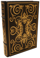
Zustand: Near Fine
ZVAB ist ein Internet-Marktplatz f�r neue, gebrauchte, antiquarische und vergriffene B�cher. Bei uns finden Sie Tausende professioneller Buchh�ndler weltweit und Millionen B�cher. Einkaufen beim ZVAB ist einfach und zu 100% sicher — Suchen Sie nach Ihrem Buch, erwerben Sie es �ber unsere sichere Kaufabwicklung und erhalten Sie Ihr Buch direkt vom H�ndler.
Millionen neuer und gebrauchter B�cher bei tausenden Anbietern
Antiquarische B�cher
Von seltenen Erstausgaben bis hin zu begehrten signierten Ausgaben – beim ZVAB finden Sie eine gro�e Anzahl seltener, wertvoller B�cher und Sammlerst�cke.
Erstausgaben
Erstausgaben sind besondere B�cher, die den ersten Abdruck des Textes in seiner urspr�nglichen Form darstellen. Hier finden sie Erstausgaben von damals bis heute.
Gebrauchte B�cher

Ob Bestseller oder Klassiker, das ZVAB bietet Ihnen eine breite Auswahl an gebrauchten B�chern: St�bern Sie in unseren Rubriken und entdecken Sie ein Buch-Schn�ppchen.