

Gesamtpreis (1 Artikel Artikel):
Versandziel:

mount page (51 Ergebnisse)
Direkt zu den wichtigsten Suchergebnissen
Suchfilter
Produktart
- Alle Product Types
- Bücher (17)
- Magazine & Zeitschriften (Keine weiteren Ergebnisse entsprechen dieser Verfeinerung)
- Comics (Keine weiteren Ergebnisse entsprechen dieser Verfeinerung)
- Noten (Keine weiteren Ergebnisse entsprechen dieser Verfeinerung)
- Kunst, Grafik & Poster (14)
- Fotografien (Keine weiteren Ergebnisse entsprechen dieser Verfeinerung)
- Karten (20)
- Manuskripte & Papierantiquitäten (Keine weiteren Ergebnisse entsprechen dieser Verfeinerung)
Zustand Mehr dazu
- Neu (Keine weiteren Ergebnisse entsprechen dieser Verfeinerung)
- Wie Neu, Sehr Gut oder Gut Bis Sehr Gut (Keine weiteren Ergebnisse entsprechen dieser Verfeinerung)
- Gut oder Befriedigend (22)
- Ausreichend oder Schlecht (1)
- Wie beschrieben (28)
Einband
Weitere Eigenschaften
- Erstausgabe (6)
- Signiert (Keine weiteren Ergebnisse entsprechen dieser Verfeinerung)
- Schutzumschlag (Keine weiteren Ergebnisse entsprechen dieser Verfeinerung)
- Angebotsfoto (49)
Sprache (2)
Gratisversand
Land des Verkäufers
Verkäuferbewertung
-
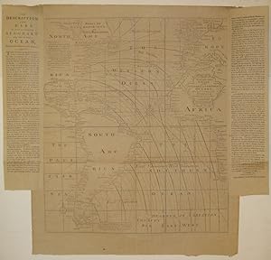
A New and Correct Chart of the Western and Southern Oceans Showing the Variations of the Compass.
Sprache: Englisch
Verlag: Mount & Davidson, Tower-Hill, London, 1794
Anbieter: Argosy Book Store, ABAA, ILAB, New York, NY, USA
Verkäuferbewertung 5 von 5 Sternen

unbound. Zustand: very good(+). Map. Uncolored engraving. Image measures 22.75" x 19.5", page including text measures 26.5" x 27 7/8". Beautiful and rare chart of the Atlantic including South America and parts of North America, Europe and Africa. Features lines of magnetic variation, or how much the compass deviates from true north. As explained in the two columns of pasted text, these observations are based upon the work of Dr. Edmond Halley in 1700 with additions in 1744. Other elements include two compass roses, extensive place names, and a note and depiction of fabled sea birds off the eastern coast of South America. The map was originally published by William Mount, John Mount and Thomas Page in "The English Pilot. The Fourth Book" circa 1750. This edition was reissued by William Mount II and James Davidson. Light offsetting. Expert repair to split along original centerfold. The "English Pilot" was a sea-chart atlas published in several editions from 1671 to 1803. The Mount family was active in publishing in various manifestations for many generations from the 1650s to 1800.
-

A Chart of South America from the River Real to Cape Horn
Verlag: London, 1702
Anbieter: Clive A. Burden Ltd., Chalfont St. Giles, BUCKS, Vereinigtes Königreich
Verkäuferbewertung 5 von 5 Sternen
Karte Erstausgabe
EUR 447,98
EUR 25,69 Versand
Versand von Vereinigtes Königreich nach USAAnzahl: 1 verfügbar
In den WarenkorbNo binding. Zustand: Fair. 455 x 575 mm., with recent outline and wash colour, with extended margins and wormhole repair lower centrefold, otherwise in good condition. A large-scale sea chart of the southern portion of South America below 15 degrees south latitude. This records San Salvador on the Brazilian coast and Lima on the west coast. It extends southwards to record Tierra del Fuego. The only internal detail delineated is the region from Lake Titicaca to the silver mountain of Potosi. Richard Mount (1654-1722) was apprenticed to William Fisher and married his daughter Sarah in 1682. Two years later Fisher and Mount formed a partnership. Their early sea atlas publications like their competitors were similarly entitled and included the 'Atlas Maritimus'. Mount's own apprentice Thomas Page (fl.1700-d.1733) joined him in 1698. One of their earliest publications is the 'Atlas Maritimus Novus' in 1702 published in a further edition in 1708. Only two examples of the first edition can be traced: the Library of Congress and the National Maritime Museum, Greenwich. That first edition contained this new chart. It has not been identified in any edition of the Fourth Part of the English Pilot which was devoted to America making this an extremely rare chart. Richard Mount was born in 1654 and died 29 June 1722 after being kicked in the leg by a cart horse on London Bridge. The firm of Mount and Page continued for over a century publishing sea charts. The British Prime Minister David Cameron is a direct descendant of the Mount family. Provenance: Jonathan Potter 2000; Juan and Peggy Rada Collection. Sanderson NMM (1971) 403 no. 33; Worms & Baynton-Williams (2011).
-
A large chart of Port Maon on the Island Minorca / Barcelona by John Gaudy / The Harbour of Malta [carta marina de Mahon, Menorca, de Barcelona y de Malta]
Verlag: London, 1716
Anbieter: Bolivar Old Prints Anticuario, Barcelona, B, Spanien
Verkäuferbewertung 5 von 5 Sternen
Karte
Zustand: Bueno. Rara carta marina que presenta en una sola hoja tres detalladas cartas portuarias: el gran plano del puerto de Mahón en la isla de Menorca (Baleares) como título principal, acompañado de Barcelona by John Gaudy y The Harbour of Malta. Cada una muestra con precisión los accesos marítimos, sondas, anclajes y defensas costeras de estos estratégicos puertos mediterráneos.Publicada en The English Pilot. Part III (Mediterranean, 1750), forma parte de la célebre serie de derroteros náuticos británicos iniciada en 1716, esencial para la navegación inglesa en el Mediterráneo durante el siglo XVIII. Su composición triple y el refinado grabado en cobre la convierten en una pieza elegante y decorativa.
-
The English pilot. The fourth book. Describing The West-Indian navigation, from Hudson's Bay to the River Amazones. Particularly delineating The Coasts, Capes, Headlands, Rivers, Bays, Roads, Havens, Harbours, Streights, Rocks, Sands, Shoals, Banks, Depths of Water, and Anchorage, with all the Islands therein; as Jamaica, Cuba, Hispaniola, Barbadoes, Antiqua, Bermudas, Porto Rico, and the rest of the Caribbee and Bahama Islands. Also A New Description of Newfoundland, New England, New York, East and West New Jersey, Dellawar Bay, Virginia, Maryland, Carolina, &c. .
Verlag: J. Mount, T. Page, W. Mount and T. Page, London, 1780
Erstausgabe
Hardcover. Zustand: Good. A SHIPBOARD COPY OF THE ENGLISH PILOT USED BY AMERICAN CAPTAINS IN THE EARLY REPUBLIC -- FROM THE LIBRARY OF JOHN GOLDEN. London: J. Mount, T. Page, W. Mount and T. Page, 1780. Thirty-third edition (Verner). Folio (18 ¾" x 12 5/16", 477mm x 312mm). [Full collation available.] With 25 engraved charts, of which 8 are double, 12 folding and 4 integral with the text; and many woodcut charts and coastal profiles integral with the text. Bound in contemporary speckled sheep (re-backed) with a blind roll border. On the spine, five raised bands. Title green to red sheep in the second panel. All edges of the text-block sprinkled brown. Re-backed and re-cornered. A large (9 3/4", 250mm diameter) scorch-ring to the front board with soiling generally. Joints strengthened with Japanese paper, along with some similar repairs to the edges of a handful of leaves. Internally tanned and offset, with a little foxing and soiling. A few splits to the mapsheets, two with repairs. Large filled losses to the first and rear free end-papers. Ink ownership inscription of "John Tremells his Book Dated at Sea 1791/ Jno Tremells Cap.t Caleb Hathaway Master of the Brig Nancy" as well as verse, sums, lists, pen trials etc. to the rear binder's blank and end-papers (see below). Presented with two manuscript fragments (one a receipt from Tremells). Books of coastal charts and profiles had been published by the Dutch since the XVIc. Lucas Janszoon Waghenaer was the pioneer of the genre, such that "Waggoner" became the English term for coastal atlases, an early proprietary eponym. The English, great XVIIc enemies of the Dutch, began to catch up with John Seller's English Pilot series, beginning in 1671. Seller was named in that year hydrographer to Charles II, and began in earnest to chart the coasts of Britain (the first book), the Continent (the second), the Orient (third), America (fourth, first published 1689) and Africa (fifth). Cumming in his British Maps of Colonial America calls it "the first significant collection of charts exclusively of the American coasts to be published in England. . . The English Pilot: The Fourth Book must have been a godsend. . . to the navigator of American waters in that period, it was his Bible. Whatever its shortcomings, there was really no substitute, no real competitor, for over sixty years" (p. 39). Coolie Verner published "A carto-bibliographical study of The English Pilot. The Fourth Book" (1960), in which he traced 37 editions -- modern bibliographers might call some of them issues -- of a shifting and growing work that was published for over a century (the final edition was in 1794). From the 18 charts of the first edition the present work has grown to 25. Bibliographers are keen to assert the rarity of the work, though that is not entirely borne out by the market. That said, of this 1780 edition, there are just 9 examples in institutional collections per OCLC. What distinguishes the present volume is the rich set of annotations by an early owner: John Tremells, an American sailor active in the 1790's and 1800's, who received and doubtless used the volume while at sea. The ownership inscription may indicate that it was given to Tremells by Captain Caleb Hathaway, master of the brig Nancy in 1795. By 1798 Tremells was commanding the schooner Swift as a merchantman in the "Quasi-War" between the U.S. and France, principally over Caribbean maritime rights, which was a turning-point in the buildup of the U.S. Navy. Indeed, it seems that Hathaway -- and perhaps Tremells as well -- was in Philadelphia; several of their circle corresponded with Alexander Hamilton and Thomas Jefferson. Arader has acquired the present volume twice: first at Swann (6 December 2007, lot 20) and again at the Sotheby's New York sale of John Golden (22 November 2022, lot 39); Golden purchased the book from Arader in October 2010. Verner, A carto-bibliographical study of The English Pilot. The Fourth Book 33.
-

The English Pilot: The Fourth Book, describing the West-India Navigation, from Hudson's-Bay to the River Amazones. The whole being much enlarged and corrected, with the additions of several new charts and descriptions. By the information of diverse able navigators of our own and other nations.
Verlag: Mount and Page, 1761
Anbieter: Lule A Vavra Rare Maps and Books, Chester, VA, USA
Verkäuferbewertung 4 von 5 Sternen

Hardcover. Zustand: Very Good. No Jacket. "MOUNT & PAGE. THE ENGLISH PILOT. THE FOURTH BOOK. 1761. ----TITLE: "The English Pilot: The Fourth Book, describing the West-India Navigation, from Hudson's-Bay to the River Amazones.. ----PUBLCATION DETAILS: Imprint: "London Printed for W. and J. Mount, T. Page and Son, on Tower-Hill, M.DCC.LXI [i.e., 1761]. Folio, 12 ½"w x 19"h. Early calf is scratched and stained. No end papers. 66 pages of text, maps not numbered. 26 engraved maps (4 single-page and 22 double-page or larger) plus 4 engraved maps in the text. A few maps with extraneous folds. Most are very good to excellent. The names of William Mount (1688-1769) and Thomas Page (1704-1762) appear on most maps. The English Pilot: The Fourth Book was published first in 1689 and last in 1794. ----CHARTS: Charts in this 1761 edition in the sequence bound, as follows: [1]A New and Correct Chart of the Western and Southern Oceans Shewing the Variations of the Compass. [2] A New and Correct Chart of the North Part of America from New Found Land to Hudson's Bay. [3] A New and Generall Chart of The West Indies. [4] A General Chart of the Western Ocean [5] A Chart of.the Sea Coast of New Foundland / New Scotland / New England / New Jersey with Virginia and Maryland. (Plate II, State 1.) [6] The Harbour of Casco Bay and Islands Adjacent By Capt. Cyprian Southicke." [7] A New and Correct Chart of the Coast of New Foundland from Cape Raze to Cape Bonavista. [8] A Chart of Part of the Sea Coast of New Foundland from the Bay of Bulls to Little Placentia exactly and Carefully lay'd down by Iohn Gaudy. Engraved by S. Parker. [9] Harbor Grace. Single page. [10] Bay Bulls. Single page. [11] Catalina Harbor. Single page. [12] Port Bonavista. Single page. Text. Island of St. Peters. In text on page 18. ]13] A Correct Map of the Coast of New England." [14] A Draught of New York from the Hook to New York Town by Mark Tiddeman. Plate I, State 2; [15]Virginia, Maryland, Pennsilvania, East & West New Jarsey (Plate II, State 1) [16]A Draught of Virginia from the Capes to York in York River by Mark Tiddeman. Verner Plate I, State 2. There is a new cartouche enclosed in a shell and scroll rather than the simple line drawing. Stephenson & McKee, 104. Verner, p. [57]. Wooldridge, illustrating this Plate I, State 2. Text. Barbados.In text on page 26. [17] A New Mapp of the Island of St. Christophers.with insets: A New Map of the Island Guardalupa" and A new Map of the Island Martineca. Text. A Large Draft of the Island Antigua. In text on p. 30. [18] A Large Draft of South Carolina from Cape Roman to Port Royall. [19] A Correct Chart of the Caribee Islands" [20] A Correct Chart of Hispaniola with the Windward Passage by C. Price. [21] A New and Correct Draught of the Bay of Matanzas. On the North side of ye Island Cubaby Robt. Pearson. Single page. [22]The Island of Jamaica. With inset: A Draft of the Harbour of Port Royal. [23] A New Chart of the Bahama Islands and the Windward Passage. Text. Bermuda. In text on p. 50. [24] A Draught of the Coast of Guyana, from the Entrance of the river Orinoco. to the Entrance of the River Amazones. With insets The River Oronoque and The River of Surinam. [25] A New and Correct Chart of the Trading Part of the West Indies, [26] An Exact Draught of the Gulf of Darien & the Coast to Porto Bello with Panama in the South Sea & the Scotch Settlement in Calledonia. Inset: The Scotch Settlement in Calledonia. ----BIBLIOGRAPHY: National Maritime Museum, Atlases and Geography, Vol. 3, Part 1, pages 488- 490. Lists contents of several editions, but not this edition; Stephenson & Mckee, Virginia in Maps, 104; Tooley, Maps and Mapmakers, p. 61; Verner, A Carto-Bibliographical Study of the English Pilot: The Fourth Book; Wooldridge, Mapping Virginia p. 98 and pl. 94. P0058".
-
[The English Pilot Parts I and III] The English Pilot for the Southern Navigation: Describing the Sea-Coasts, Capes, Headlands, Bays, Roads, Harbours, Rivers and Ports: together with the Soundings, Sands, Rocks and Dangers on the Coast of England, Scotland, Ireland, Holland, Flanders, Spain, Portugal, to the Streight's-Mouth; with the Coasts of Barbary, and off to the Canary, Madeira, Cape de Verde and Western Islands Shewing the Courses and Distances from on Place to another; The Setting of the Tides and Currents; the Ebbing and Flowing of the Sea, &c. The English Pilot. Part III. Describing The Sea-Coasts, Capes, Head-Lands, Bays, Roads, Harbours, Rivers and Ports; Together with the Soundings, Sands, Rocks and Dangers in the Whole Mediter
Verlag: J. Mount, and T. Page, London, 1771
Anbieter: Argosy Book Store, ABAA, ILAB, New York, NY, USA
Verkäuferbewertung 5 von 5 Sternen
hardcover. Zustand: very good. Folio atlas. Two parts (I and III) bound in one volume, London: 1771. Part I: 46 pp of text; 22 double page and folding maps plus 2 small maps and many additional charts and views. Ink inscription on title page reads "1774 John Hamilton Ought This Book-Bought of James Alex.(?) Stewart". Stamped name in margin of one page of text. Part III: 43 pp of text; 17 double page or folding maps, 34 half page maps and numerous topographical and panoramic views. Ink inscription "John Hamilton" on title page. Stamped name on title page and two maps. Numerous woodcut elevations and additional engraved maps throughout both volumes. Rebound in blue bukram with gilt title stamped on spine. Stamp from G.H. Crawford Co. Bookbinders, Dec. 1955 on inside back free fly page. Light scattered foxing and a few stains throughout with more toning in the final 8 pages. Small chip to title page and one map. Small wormholes to a few maps. In general, maps are crisp and clean. Beautiful composite atlas with a series of stunning maps and charts and explicit sailing directions and notations. Part I has charts of the River Thames, Newcastle trade routes, the coastlines and various ports of England, Scotland, Ireland, Flanders and the Netherlands, France, Portugal, Spain, the Strait of Gibraltar, the Canary Islands and the Cape Verde Islands. Part III has maps and charts of the Mediterranean from the Strait of Gibraltar to the Levant including the Balearic Islands, southern France, the Barbary Coast, Corsica, Sardinia, Sicily, Malta, Venice and Greece. The "English Pilot" was a sea-chart atlas published in several editions from 1671 to 1803. The Mount family was active in publishing in various manifestations for many generations from the 1650s to 1800.
-

A large Draft of the Island of Antegua
Verlag: English Pilot, London, 1740 (circa), 1740
Anbieter: Pennymead Books PBFA, Knaresborough, Vereinigtes Königreich
Verbandsmitglied: PBFA
Verkäuferbewertung 5 von 5 Sternen
EUR 119,34
EUR 17,40 Versand
Versand von Vereinigtes Königreich nach USAAnzahl: 1 verfügbar
In den WarenkorbEngraved chart showing estates and soundings with compass rose. Page 50 of 'The English Pilot.' Clean. 16 x 11in Tooley 3.
-

A Chart of The Islands of Cape Verd
Verlag: W & J Mount and T. Page at the Postern on Tower Hill, London, 1729
Anbieter: Clive A. Burden Ltd., Chalfont St. Giles, BUCKS, Vereinigtes Königreich
Verkäuferbewertung 5 von 5 Sternen
Karte
EUR 232,95
EUR 25,69 Versand
Versand von Vereinigtes Königreich nach USAAnzahl: 1 verfügbar
In den WarenkorbNo binding. 445 x 545 mm., in recent outline colour in good condition. A sea chart of the Cape Verde Islands first published by William Mount and Thomas Page from at least 1729 in the 'English Pilot First Part, Southern Navigation'. It's earlier issue was actually by John Seller. This handsome chart illustrates an important location to the Atlantic trade routes. The chart is embellished with a decorative title cartouche, large central compass rose and rhumb lines. Shirley (BL Atlases) M.M&P-1b no. 24.
-

A draught of the west end of the island of Porto Rico and the island of Zachee.
Verlag: London, 1767, 1767
Anbieter: Pennymead Books PBFA, Knaresborough, Vereinigtes Königreich
Verbandsmitglied: PBFA
Verkäuferbewertung 5 von 5 Sternen
EUR 258,57
EUR 17,40 Versand
Versand von Vereinigtes Königreich nach USAAnzahl: 1 verfügbar
In den WarenkorbHand coloured chart. Extensively repaired on reverse. 24 x 18" From the English Pilot.
-

The Sea Coast of Languedoc Provence and Part of Italy, from Cape Dragon to Cape Delle Melle
Verlag: W & J Mount and T. Page at the Postern on Tower Hill, London, 1727
Anbieter: Clive A. Burden Ltd., Chalfont St. Giles, BUCKS, Vereinigtes Königreich
Verkäuferbewertung 5 von 5 Sternen
Karte
EUR 328,52
EUR 25,69 Versand
Versand von Vereinigtes Königreich nach USAAnzahl: 1 verfügbar
In den WarenkorbNo binding. 410 x 520 mm., with a couple of small marks on the right side, otherwise okay. This very rare chart is quite probably the work of the engraver Samuel Parker. It depicts southern France and includes part of Spain and Italy including San Remo. It displays an inset of the Bay of Toulon and appears in Mount & Page's 'English Pilot Part Three' covering the Mediterranean Sea in 1747. Shirley 'Atlases in the BL' M.M&P 3b no. 14.
-

The Coast of Denmarck and Sweden from Falsterbon to Schankenes & ye Coast of Pomeren from ye Island of Rugen to Rygshead
Verlag: W & J Mount and T. Page at the Postern on Tower Hill, London, 1747
Anbieter: Clive A. Burden Ltd., Chalfont St. Giles, BUCKS, Vereinigtes Königreich
Verkäuferbewertung 5 von 5 Sternen
Karte
EUR 328,52
EUR 25,69 Versand
Versand von Vereinigtes Königreich nach USAAnzahl: 1 verfügbar
In den WarenkorbNo binding. Zustand: Good. 420 x 520 mm., with recent wash colour in good condition. This rare English sea chart was published in the 'English Pilot First Book' by Mount and Page. It illustrates the Strait between Rugen in Germany and the southern tip of Sweden with some of the islands between. Shirley 'Atlases in the BL' M.M&P 2a no. 27.
-

The Sea Coast of Languedoc Provence and Part of Italy, from Cape Dragon to Cape Delle Melle.
Verlag: London, 1735
Anbieter: Clive A. Burden Ltd., Chalfont St. Giles, BUCKS, Vereinigtes Königreich
Verkäuferbewertung 5 von 5 Sternen
Karte
EUR 388,25
EUR 25,69 Versand
Versand von Vereinigtes Königreich nach USAAnzahl: 1 verfügbar
In den WarenkorbNo binding. 410 x 520 mm., with recent outline colour, lower centrefold split repaired, just affecting the image, otherwise in good condition. A fine uncommon sea chart of the Mediterranean waters of southern France. They extend from the Spanish border to San Remo in Italy. An inset features the Bay of Toulon. Shirley BL M.M&P-3b 14.
-

A Chart of the Sea Coasts of Algrave and Andalusia between Cape St. Vincent and the Strait of Gibralter and C. Spartel
Verlag: London, 1730
Anbieter: Clive A. Burden Ltd., Chalfont St. Giles, BUCKS, Vereinigtes Königreich
Verkäuferbewertung 5 von 5 Sternen
Karte
EUR 418,11
EUR 25,69 Versand
Versand von Vereinigtes Königreich nach USAAnzahl: 1 verfügbar
In den WarenkorbNo binding. 430 x 520 mm., modern outline colour, a light fox mark in the sea otherwise in very good condition. A fine early chart depicting the south west coast of the Iberian peninsula. It extends from Cape St. Vincent in Portugal along the Algarve region to Spain taking in Cadiz and Cape Trafalger. A large scale inset depicts the Bay of Cadiz and details the town. It appeared in the 'English Pilot Southern Navigation'. The title is set within a hung drape below the scale of Leagues. Shirley BL M.M&P-1a 26.
-

A New Chart of the Sea Coast of Scotland with the Islands thereof
Verlag: W & J Mount and T. Page at the Postern on Tower Hill, London, 1715
Anbieter: Clive A. Burden Ltd., Chalfont St. Giles, BUCKS, Vereinigtes Königreich
Verkäuferbewertung 5 von 5 Sternen
Karte
EUR 418,11
EUR 25,69 Versand
Versand von Vereinigtes Königreich nach USAAnzahl: 1 verfügbar
In den WarenkorbNo binding. 470 x 530 mm., with a double fold as issued in the atlas, upper corner repairs and margins of second folds all superbly restored, otherwise in excellent condition. A rare sea chart of Scotland first published by Mount and Page in the 'English Pilot First Part, Southern Navigation' in 1715. It extends to the north to include the Outer Hebrides, the Orkney Islands and the Shetland Islands. An inset features 'A Plan of Holy Island and the Staples'. All of the major ports, harbours and castles are featured along the coasts, with as might be expected no inland details given. Soundings are shown along the east coast in the Firth of Forth north to Dundee along with a few others. The title helps to fill the blank area of the mainland. A later second state exists with a new title cartouche in the sea upper right. Moir (1983) II p. 12; NMM 423 no. 89; Shirley 'Atlases in the BL' M.M&P 1b no. 3.
-
![Bild des Verkäufers für A Description of the Coast of Spain, 11 - Altier Bay [Bahía de Altea] zum Verkauf von Frame](https://pictures.abebooks.com/inventory/md/md32134217274.jpg)
A Description of the Coast of Spain, 11 - Altier Bay [Bahía de Altea]
Verlag: Londres, 1736
Kunst / Grafik / Poster
Zustand: ACEPTABLE. [Una] Carta marina representando las zonas portuarias de Altea, en el Levante,obra deWilliam yJohn Mount, and Thomas Page. En los mapas de esta obra, los contornos costeros están detallados con indicaciones de bahías, cabos y estuarios, sin apenas representación de elevaciones terrestres. Los topónimos están escritos en inglés, lo que sugiere su creación para un público anglófono, probablemente británico. Título completo: "A large chart of Port Maon on the Island Minorca on the Mediterranean. The English pilot Part III [.] Mediterranean. M, DCC,L (1750). (to accompany) The English pilot for the Southern navigation [.] London : Printed for J. Mount and T. Page, on Tower Hill. M,DCC,LII (1752).". El "English Pilot"fue un atlas de cartas náuticas publicado en varias ediciones entre 1671 y 1803. La edición de 1752 fue impresa en Londres por John Mount y Thomas Page. ["By John Gaudy."] . Formato (cm): 25 aprox.x15.
-
![Bild des Verkäufers für Almarie Bay [Bahía de Almería] zum Verkauf von Frame](https://pictures.abebooks.com/inventory/md/md32134210619.jpg)
Zustand: ACEPTABLE. [Una] Carta marina representando las zona de la bahía de Almería, en Andalucía,obra deWilliam yJohn Mount, and Thomas Page. En los mapas de esta obra, los contornos costeros están detallados con indicaciones de bahías, cabos y estuarios, sin apenas representación de elevaciones terrestres. Los topónimos están escritos en inglés, lo que sugiere su creación para un público anglófono, probablemente británico. Título completo: "A large chart of Port Maon on the Island Minorca on the Mediterranean. The English pilot Part III [.] Mediterranean. M, DCC,L (1750). (to accompany) The English pilot for the Southern navigation [.] London : Printed for J. Mount and T. Page, on Tower Hill. M,DCC,LII (1752).". El "English Pilot"fue un atlas de cartas náuticas publicado en varias ediciones entre 1671 y 1803. La edición de 1752 fue impresa en Londres por John Mount y Thomas Page. ["By John Gaudy."] . Formato (cm): 25 aprox.x20.
-
![Bild des Verkäufers für Gibralter Bay [Bahía de Gibraltar] zum Verkauf von Frame](https://pictures.abebooks.com/inventory/md/md32134204850.jpg)
Zustand: ACEPTABLE. [Una] Carta marina representando las zona de la bahía de Gibraltar,obra deWilliam yJohn Mount, and Thomas Page. En los mapas de esta obra, los contornos costeros están detallados con indicaciones de bahías, cabos y estuarios, sin apenas representación de elevaciones terrestres. Los topónimos están escritos en inglés, lo que sugiere su creación para un público anglófono, probablemente británico. Título completo: "A large chart of Port Maon on the Island Minorca on the Mediterranean. The English pilot Part III [.] Mediterranean. M, DCC,L (1750). (to accompany) The English pilot for the Southern navigation [.] London : Printed for J. Mount and T. Page, on Tower Hill. M,DCC,LII (1752).". El "English Pilot"fue un atlas de cartas náuticas publicado en varias ediciones entre 1671 y 1803. La edición de 1752 fue impresa en Londres por John Mount y Thomas Page. ["By John Gaudy."] . Formato (cm): 25 aprox.x20.
-

The Harbour of Corke
Verlag: Richard Mount and Thomas Page in Postern-Row on Tower Hill, London, 1701
Anbieter: Clive A. Burden Ltd., Chalfont St. Giles, BUCKS, Vereinigtes Königreich
Verkäuferbewertung 5 von 5 Sternen
Karte
EUR 447,98
EUR 25,69 Versand
Versand von Vereinigtes Königreich nach USAAnzahl: 1 verfügbar
In den WarenkorbNo binding. Zustand: Very Good. 435 x 520 mm., in recent wash colour and good condition. This is the much rarer and earlier of two charts of the Harbour of Cork published by the firm Mount and Page. It was replaced at the latest by another in 1729. This particular sea chart was first published by William Mount and Thomas Page from at least 1701 in the 'English Pilot First Part, Southern Navigation'. It focuses entirely on the city of Cork and its approaches. There is unusually for a sea chart, extensive topographical detail including numerous roads and outlying villages. The main road (E30) from Cork to 'Midleton' is clearly depicted. There are extensive soundings in many harbours and inlets. Sanderson (1971) 423 no. 76;Shirley (2004) M.M&P 1a no. 18.
-
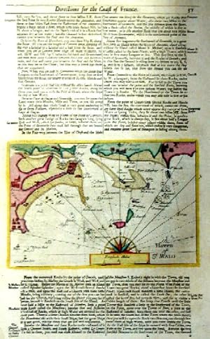
The haven of St. Malo
Verlag: Artist: Mount & Page ca :, 1750
Anbieter: Antique Sommer& Sapunaru KG, München, Deutschland
Verkäuferbewertung 3 von 5 Sternen

Technic: Copper print, colorit: original colored, condition: Perfect condition, size (in cm): 39,5 x 23 cm, Map showing the town and bay of St Malo with the offshore islands, a half-compass rose and a distance indicator. Text on the reverse, English edition.
-

A Chart of the Sea Coasts of Algarve and Andalusia Between Cape St. Vincent and Strait of Gibralter and C. Spartel
Verlag: Richard Mount and Thomas Page in Postern-Row on Tower Hill, London, 1701
Anbieter: Clive A. Burden Ltd., Chalfont St. Giles, BUCKS, Vereinigtes Königreich
Verkäuferbewertung 5 von 5 Sternen
Karte
EUR 537,57
EUR 25,69 Versand
Versand von Vereinigtes Königreich nach USAAnzahl: 1 verfügbar
In den WarenkorbNo binding. Zustand: Good. 440 x 525 mm., in fine recent wash colour, small area of loss to right margin, otherwise in good condition. The first state of this sea chart of the Algarve in south Portugal and a portion of southern Spain. It was published by Richard Mount whose imprint appears alone in the title. A later state would bear the imprint of William Mount and Thomas Page. It was published in the 'English Pilot First Part, Southern Navigation'. Two compass roses adorning the map illustrate the maps orientation slightly with north to the left of the top. The chart extends from Cape St. Vincent in Portugal to the Straights of Gibraltar. The main cities of Faro and Cadiz are both clearly identified as are the numerous salt pans in the region. Not in Conde (2003); Sanderson (1971) NMM 423 no. 81; Shirley (2004) M.M&P 1a no. 26.
-

A Chart of the Caribe Islands.
Verlag: London, [Mount & Page., c.1755.]. 440 x 535mm (17¼ x 21 inches)., 1755
Anbieter: Tooley, Adams & Co., Wallingford, OXON, Vereinigtes Königreich
Verkäuferbewertung 3 von 5 Sternen
Erstausgabe
EUR 537,57
EUR 43,09 Versand
Versand von Vereinigtes Königreich nach USAAnzahl: 1 verfügbar
In den WarenkorbUncoloured; expertly restored and backed with archivist tissue, with some loss of printed area, now reinstated in manuscript, trimmed close along the bottom edge close to printed line border, slightly soiled and water stained, now presentable and priced accordingly. A chart of the Caribbean Islands used by English navigators during the latter part of the 17th century and the first half of the 18th century. It was published in The English Pilot, Book IV, the first English, navigational atlas specifically devoted to American waters. This chart appeared in the first edition of this atlas in 1689 and in later editions through 1749. North is to the right on the chart, which provides the locations of anchorages and indicates shoals and wrecks. Shows the islands from Porto Rico to Trinidad. The chart has undergone some expert restoration and this is reflected in the price.
-

Zustand: ACEPTABLE. [Una] Carta marina representando la costa nortede África, especialmente la zona de la actual Argelia,obra deWilliam yJohn Mount, and Thomas Page. Está orientado a los navegantes, con líneas de rumbo radiales que convergen en puntos específicos (rosas de los vientos), un recurso típico para la navegación marítima. El grabado es meticuloso y combina la cartografía con la estética ornamental: el título está enmarcado en una cartela barroca decorativa, destacando el propósito artístico y funcional. Los contornos costeros están detallados con indicaciones de bahías, cabos y estuarios, sin representación de elevaciones terrestres. Los topónimos están escritos en inglés, lo que sugiere su creación para un público anglófono, probablemente británico. Título completo:"The Sea Coast of BARBARY From Cape de Tenes to Cape de Rofa". Formato (cm): 54x44.
-
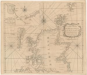
A new Chart of the sea Coast of Scotland with the Islands thereof.
Verlag: [ca. 1751], 1751
Anbieter: Maggs Bros. Ltd ABA, ILAB, PBFA, London, Vereinigtes Königreich
Verbandsmitglied: ABA ILAB PBFA
Verkäuferbewertung 5 von 5 Sternen
EUR 564,46
EUR 31,31 Versand
Versand von Vereinigtes Königreich nach USAAnzahl: 1 verfügbar
In den WarenkorbDouble-page engraved chart, 490 by 570 mm. A good example. London : William & John Mount & Thomas Page (II), A mid century version of this chart. The inset depicts Holy Island and the Staples.
-

Barcelona ; The Harbour of Malta ; A large Chart of Port Maon on the Island Minorca on the Mediterranean
Verlag: Londres, 1736
Kunst / Grafik / Poster
Zustand: ACEPTABLE. [Una] Carta marina representando las zonas portuarias de Barcelona, Malta y Mahon,obra deWilliam yJohn Mount, and Thomas Page. Las tres zonas están separadas por una filigrana vegetal. Los contornos costeros están detallados con indicaciones de bahías, cabos y estuarios, sin apenas representación de elevaciones terrestres. Los topónimos están escritos en inglés, lo que sugiere su creación para un público anglófono, probablemente británico. Título completo: "A large chart of Port Maon on the Island Minorca on the Mediterranean. The English pilot Part III [.] Mediterranean. M, DCC,L (1750). (to accompany) The English pilot for the Southern navigation [.] London : Printed for J. Mount and T. Page, on Tower Hill. M,DCC,LII (1752).". El "English Pilot"fue un atlas de cartas náuticas publicado en varias ediciones entre 1671 y 1803. La edición de 1752 fue impresa en Londres por John Mount y Thomas Page. ["By John Gaudy."] . Formato (cm): 44x57.
-
![Bild des Verkäufers für A Chart of the Sea Coast of Spain [Desde el Estrecho de Gibraltar hasta el Cabo de Gata] zum Verkauf von Frame](https://pictures.abebooks.com/inventory/md/md32082545365.jpg)
A Chart of the Sea Coast of Spain [Desde el Estrecho de Gibraltar hasta el Cabo de Gata]
Verlag: Londres, 1736
Kunst / Grafik / Poster
Zustand: ACEPTABLE. [Una] Carta marina representando la costa sureste de Estaña, y noroeste de África,obra deWilliam yJohn Mount, and Thomas Page. Está orientado a los navegantes, con líneas de rumbo radiales que convergen en puntos específicos (rosas de los vientos), un recurso típico para la navegación marítima. El grabado es meticuloso y combina la cartografía con la estética ornamental: el título está enmarcado en una cartela barroca decorativa, destacando el propósito artístico y funcional. Los contornos costeros están detallados con indicaciones de bahías, cabos y estuarios, sin representación de elevaciones terrestres. Los topónimos están escritos en inglés, lo que sugiere su creación para un público anglófono, probablemente británico. Título completo: "A Chart of the Sea Coast of SPAIN From the Straits mouth to C de Gat And of the Sea Coast of BARBARY From the Straits mouth to C de Hone". Formato (cm): 54x44.
-
![Bild des Verkäufers für A Chart of the Straits of Gibralter [Estrecho de Gibraltar] zum Verkauf von Frame](https://pictures.abebooks.com/inventory/md/md32082546110.jpg)
A Chart of the Straits of Gibralter [Estrecho de Gibraltar]
Verlag: Londres, 1736
Kunst / Grafik / Poster
Zustand: ACEPTABLE. [Una] Carta marina representando con gran detalle el Estrecho de Gibraltar,obra deWilliam yJohn Mount, and Thomas Page. Está orientado a los navegantes, con líneas de rumbo radiales que convergen en puntos específicos (rosas de los vientos), un recurso típico para la navegación marítima. El grabado es meticuloso y combina la cartografía con la estética ornamental: el título está enmarcado en una cartela barroca decorativa, destacando el propósito artístico y funcional. Los contornos costeros están detallados con indicaciones de bahías, cabos y estuarios, sin representación de elevaciones terrestres. Los topónimos están escritos en inglés, lo que sugiere su creación para un público anglófono, probablemente británico. Formato (cm): 54x44.
-
![Bild des Verkäufers für A Chart of the Sea Coast of Spain [Desde el Cabo de Gata hasta Javea - Murcia] zum Verkauf von Frame](https://pictures.abebooks.com/inventory/md/md32082546109.jpg)
A Chart of the Sea Coast of Spain [Desde el Cabo de Gata hasta Javea - Murcia]
Verlag: Londres, 1736
Kunst / Grafik / Poster
Zustand: ACEPTABLE. [Una] Carta marina representando la costa sureste de Estaña, y noroeste de África, especialmente la zona de la actual Murcia,obra deWilliam yJohn Mount, and Thomas Page. Está orientado a los navegantes, con líneas de rumbo radiales que convergen en puntos específicos (rosas de los vientos), un recurso típico para la navegación marítima. El grabado es meticuloso y combina la cartografía con la estética ornamental: el título está enmarcado en una cartela barroca decorativa, destacando el propósito artístico y funcional. Los contornos costeros están detallados con indicaciones de bahías, cabos y estuarios, sin representación de elevaciones terrestres. Los topónimos están escritos en inglés, lo que sugiere su creación para un público anglófono, probablemente británico. Título completo:"A Chart of the Sea-Coast of SPAIN From Cape de Gata to Cape S. Martin. And of the Sea-Coast of BARBARY From Cape de Hone to Cape de Tenes". Formato (cm): 54x44.
-

A Chart of the Sea Coasts of Barbaria with the Western, Canaria, & Cape de Verd, Isles
Verlag: Londres, 1736
Kunst / Grafik / Poster
Zustand: ACEPTABLE. [Una] Carta marina representando la costa noroeste de África y las Islas Canarias, obra deWilliam yJohn Mount, and Thomas Page. Está orientado a los navegantes, con líneas de rumbo radiales que convergen en puntos específicos (rosas de los vientos), un recurso típico para la navegación marítima. El grabado es meticuloso y combina la cartografía con la estética ornamental: el título está enmarcado en una cartela barroca decorativa, destacando el propósito artístico y funcional. Los contornos costeros están detallados con indicaciones de bahías, cabos y estuarios, sin representación de elevaciones terrestres. Los topónimos están escritos en inglés, lo que sugiere su creación para un público anglófono, probablemente británico. Inserta detalle de Madeira y de Tenerife El título completo ha sido eliminado de la orla. Formato (cm): 54x44.
-

A Chart of the Sea Coasts of Algarve and Andalusia (London)
Verlag: Londres, 1736
Kunst / Grafik / Poster
Zustand: ACEPTABLE. [Una] Carta marina representando las costa del norte de España de Vizcaya y Galicia, obra deWilliam yJohn Mount, and Thomas Page. Está orientado a los navegantes, con líneas de rumbo radiales que convergen en puntos específicos (rosas de los vientos), un recurso típico para la navegación marítima. El grabado es meticuloso y combina la cartografía con la estética ornamental: el título está enmarcado en una cartela barroca decorativa, destacando el propósito artístico y funcional. Los contornos costeros están detallados con indicaciones de bahías, cabos y estuarios, sin representación de elevaciones terrestres. Los topónimos están escritos en inglés, lo que sugiere su creación para un público anglófono, probablemente británico. Inserta detalle de la bahía de Cádiz, Título completo: "A Chart of the Sea Coasts of Algrave and Andalusia Between cape St. Vincent and the Strait of Gibralter and C. Spartel Sold by W. Mount & T. Page at the Postern on Great Tower Hill London.". Formato (cm): 54x44.
-

A Chart of the Sea of the Coasts Biscay and Gallicia Betwen Cape Machichaca and Cape de Pinas and from Cape de Pinas to Cape de Finisterre (London)
Verlag: Londres, 1736
Kunst / Grafik / Poster
Zustand: ACEPTABLE. [Una] Carta marina representando las costa del norte de España de Vizcaya y Galicia, obra deWilliam yJohn Mount, and Thomas Page. Está orientado a los navegantes, con líneas de rumbo radiales que convergen en puntos específicos (rosas de los vientos), un recurso típico para la navegación marítima. El mapa utiliza un diseño en dos secciones horizontales, dividiendo el territorio costero para ofrecer mayor detalle, abarcando desde el cabo Machichaco hasta el cabo de Finisterre. El grabado es meticuloso y combina la cartografía con la estética ornamental: el título está enmarcado en una cartela barroca decorativa, destacando el propósito artístico y funcional. Los contornos costeros están detallados con indicaciones de bahías, cabos y estuarios, sin representación de elevaciones terrestres. Los topónimos están escritos en inglés, lo que sugiere su creación para un público anglófono, probablemente británico. Incluye: Galicia, Asturias y País Vasco (Bilbao, Castro, Laredo, Llanes, Avilés, Luarca, Castropol, Rivadeo, Estaca de Vares, cabo Ortegal, Ferrol, Coruña, Camariñas, etc.). Título completo: "A Chart of the Sea Coasts Biscay and Gallicia between Cape Machichaco and Cape St. Pinas, and from Cape de Pinas to Cape de Finisterre. Sold by R. Mount at the Postern on Great Tower Hill, London.". (c.131) Formato (cm): 54x44.

![Bild des Verkäufers für A large chart of Port Maon on the Island Minorca / Barcelona by John Gaudy / The Harbour of Malta [carta marina de Mahon, Menorca, de Barcelona y de Malta] zum Verkauf von Bolivar Old Prints Anticuario](https://pictures.abebooks.com/inventory/md/md32361011220.jpg)


![Bild des Verkäufers für [The English Pilot Parts I and III] The English Pilot for the Southern Navigation: Describing the Sea-Coasts, Capes, Headlands, Bays, Roads, Harbours, Rivers and Ports: together with the Soundings, Sands, Rocks and Dangers on the Coast of England, Scotland, Ireland, Holland, Flanders, Spain, Portugal, to the Streight's-Mouth; with the Coasts of Barbary, and off to the Canary, Madeira, Cape de Verde and Western Islands Shewing the Courses and Distances from on Place to another; The Setting of the Tides and Currents; the Ebbing and Flowing of the Sea, &c. The English Pilot. Part III. Describing The Sea-Coasts, Capes, Head-Lands, Bays, Roads, Harbours, Rivers and Ports; Together with the Soundings, Sands, Rocks and Dangers in the Whole Mediter zum Verkauf von Argosy Book Store, ABAA, ILAB](https://pictures.abebooks.com/inventory/md/md3716837647.jpg)
