Underground map number (4 Ergebnisse)
 Weitere Bilder
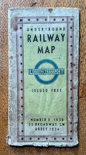
Verlag: Geographica Limited, London 1938
- Softcover
- Karte
Anbieter: Garden City Books, Herts, Vereinigtes KönigreichGarden City Books
Verkäufer/-in kontaktierenVerkäufer/-in mit 5 SternenZustand: Gebraucht - Befriedigend
EUR 47,55
EUR 23,08 VersandVersand von Vereinigtes Königreich nach USAAnzahl: 1 verfügbar
In den WarenkorbSoft cover. Zustand: Good. vintage fold out paper map that shows the Underground in diagramatic form just prior to WW2. Lines shown are the Metropolitan & District, Picadilly, Bakerloo, Northern and Central. Catchment are covered includes Staines to the West, Hight Barnet to the North , Upney to the East and Mordon to the South.… Rear shows blow up to central brown area, also map of theatres and cinemas.Condition: has a few large tears but not taped . Top margin has small stains but does not impinge on map. Would still look fantastic as a wall hanging.
 Weitere Bilder
Verlag: London Transport, London 1937
Anbieter: Antipodean Books, Maps & Prints, ABAA, Garrison, USAAntipodean Books, Maps & Prints, ABAA
Verkäufer/-in kontaktierenVerkäufer/-in mit 3 SternenZustand: Gebraucht - Gut
EUR 54,13
EUR 8,62 VersandVersand innerhalb von USAAnzahl: 1 verfügbar
In den WarenkorbZustand: Very good condition. Scarce folding color original London Underground map, which includes 2 other maps of important London sites. With the three cover panels offering information on fares, and listing dominion offices and consulates, with the the flip side with a map showing theatres and cinemas in relation to the under…ground lines, in red and blue stars, and lists of art galleries, museums, public halls, and churches and cathedrals. The Tube map extends from Cockfosters in the north, to Morden in the south; Becontree in the east and Uxbridge in the west. Authorized extensions are shown in dotted red lines. Unfolds to 18 x 24"; 3 x 6" folded. Very good + condition, very clean, with the colors on maps bright and fresh.
 Weitere Bilder
Verlag: London Transport, 1939. 1939
- Karte
Anbieter: Michael S. Kemp, Bookseller, Sheerness, Vereinigtes KönigreichMichael S. Kemp, Bookseller
Verkäufer/-in kontaktierenVerkäufer/-in mit 4 SternenZustand: Gebraucht
EUR 46,60
EUR 46,17 VersandVersand von Vereinigtes Königreich nach USAAnzahl: 1 verfügbar
In den Warenkorb450 x 605 mm. colour printed map with detailed map of the central area and keys to verso. Folded to pocket size with a some splitting to the folds as usual, and slight soiling to the outer panels.

Verlag: LondonGeographia Ltd . 1939
- Karte
Anbieter: Robert Frew Ltd. ABA ILAB, London, Vereinigtes KönigreichRobert Frew Ltd. ABA ILAB
Verkäufer/-in kontaktierenVerkäufer/-in mit 5 SternenZustand: Gebraucht
EUR 118,88
EUR 11,54 VersandVersand von Vereinigtes Königreich nach USAAnzahl: 1 verfügbar
In den WarenkorbOriginal colour-printed plan of the London Underground (overall size: 60.5 x 44.5 cm) with multiple folds reducing to a single pamphlet as issued. The map has a coloured background with the underground lines imposed over a street plan of central London and adjacent suburbs. Underground stations are denoted by circles and interch…ange stations are denoted by a diamond. Public parks are highlighted in green, and in the lower right corner there is a table showing the colour-coded key to the underground lines, along with a dotted-line for lines (Central, Bakerloo, Northern) listed for further construction in the future. The map runs from Uxbridge in the west, to Cockfosters and High Barnett in the north, to Morden in the south, and Barking in the east. On the reverse is a small plan showing centrally located cinemas and theatres, plus a larger plan showing central London overlaid with underground lines and symbols depicting art galleries, public buildings of note, cathedrals and churches. Complete with an explanation table. Lists accompany the plan for easy reference, including 'Future Extensions' to the Underground. In very good condition.


