
Gesamtpreis (1 Artikel Artikel):
Versandziel:

yamada tetsuya (11 Ergebnisse)
Direkt zu den wichtigsten Suchergebnissen
Suchfilter
Produktart
- Alle Product Types
- Bücher (11)
- Magazine & Zeitschriften (Keine weiteren Ergebnisse entsprechen dieser Verfeinerung)
- Comics (Keine weiteren Ergebnisse entsprechen dieser Verfeinerung)
- Noten (Keine weiteren Ergebnisse entsprechen dieser Verfeinerung)
- Kunst, Grafik & Poster (Keine weiteren Ergebnisse entsprechen dieser Verfeinerung)
- Fotografien (Keine weiteren Ergebnisse entsprechen dieser Verfeinerung)
- Karten (Keine weiteren Ergebnisse entsprechen dieser Verfeinerung)
- Manuskripte & Papierantiquitäten (Keine weiteren Ergebnisse entsprechen dieser Verfeinerung)
Zustand Mehr dazu
- Neu (2)
- Wie Neu, Sehr Gut oder Gut Bis Sehr Gut (3)
- Gut oder Befriedigend (1)
- Ausreichend oder Schlecht (Keine weiteren Ergebnisse entsprechen dieser Verfeinerung)
- Wie beschrieben (5)
Einband
Weitere Eigenschaften
- Erstausgabe (2)
- Signiert (Keine weiteren Ergebnisse entsprechen dieser Verfeinerung)
- Schutzumschlag (Keine weiteren Ergebnisse entsprechen dieser Verfeinerung)
- Angebotsfoto (6)
Sprache (3)
Gratisversand
- Kostenloser Versand nach USA (Keine weiteren Ergebnisse entsprechen dieser Verfeinerung)
Land des Verkäufers
Verkäuferbewertung
-
Tetsuya Yamada: Morice
Sprache: Englisch
Verlag: Francis M. Naumann Fine Art, NY, 2007
Anbieter: The Wild Muse, Granville, NY, USA
Verkäuferbewertung 5 von 5 Sternen

Erstausgabe
Soft cover. Zustand: Near Fine. 1st. Softcover exhibition catalog. Published NY: Francis M. Naumann Fine Art, 2007. Small 4to. wrappers, 7 3/4" x 10", unpaginated, illustrated with full page color plates. Minor rub at the spine. Fine.
-
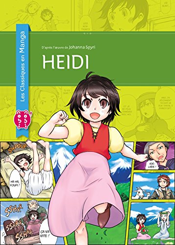
Heidi
Anbieter: Revaluation Books, Exeter, Vereinigtes Königreich
Verkäuferbewertung 5 von 5 Sternen
EUR 14,56
EUR 11,57 Versand
Versand von Vereinigtes Königreich nach USAAnzahl: 1 verfügbar
In den WarenkorbPaperback. Zustand: Brand New. Yamada, Gyugo (illustrator). French language. 7.09x5.12x0.79 inches. In Stock.
-

Tetsuya Yamada Morice
Verlag: Francis M. Naumann Fine Art, New York, 2007
Anbieter: Colin Martin Books, Near Hull, EY, Vereinigtes Königreich
Verkäuferbewertung 5 von 5 Sternen
EUR 4,77
EUR 23,14 Versand
Versand von Vereinigtes Königreich nach USAAnzahl: 1 verfügbar
In den WarenkorbPaperback. Zustand: Fine. Unpaginated, approx 28 pages, illustrated with 23 large colour plates. Unused, a Fine copy.
-

Tetsuya Yamada : Morice 16 Mar - 27 Apr 2007
Verlag: New York : Francis M. Naumann., 2007
Anbieter: Wittenborn Art Books, San Francisco, CA, USA
Verkäuferbewertung 5 von 5 Sternen
Zustand: Good. 4to. [28 pp.] Soft cover. Light signs of shelf wear. Minor distress along spine. Light creasing on edges. Mostly color plates. Very Good.Provenance: From the collection of the Peter Norton Family Foundation, Santa Monica, Ca. In 2003, Norton, the founder of Norton Utilities, became the chairman of the board of the MoMA PS1.
-

The Human Embryo
Anbieter: Ria Christie Collections, Uxbridge, Vereinigtes Königreich
Verkäuferbewertung 5 von 5 Sternen
EUR 132,67
EUR 13,86 Versand
Versand von Vereinigtes Königreich nach USAAnzahl: Mehr als 20 verfügbar
In den WarenkorbZustand: New. In.
-
Series 'Progress of Theoretical Physics, Number 99, 1989'; Supplement: COMPLEX DYNAMICS IN NONLINEAR SYSTEMS. - In Commemoration of the Retirement of Professor Hazime Mori from Kyushu University: 'STATISTICAL MECHANICS OF DYNAMICAL SYSTEMS'(Mori et al.); 'GLOBAL BIFURCATIONS . . .'(Yoshida et al.); 'THERMODYNAMICS . . .'(Fujisaka et al.); 'NONEQUILIBRIUM ASPECTS . . .'(Rikvold); '. . . LORENZ SYSTEM'(Shimada et al.); '. . . INTERMITTENCY . . .'(Yamada et al.); '. . . SPECTRAL ANALYSIS . . .'(Antoranz); 'NON-STATIONARY CHAOS . . .'(Aizawa); 'LARGE DEVIATION . . .'(Oono); '. . . SELF-ORGANIZATION AND -RELAXATION PROCESS IN PLASMA'(Horiuchi et al.); '. . . TWO-DIMENSIONAL HAMILTOPNIAN SYSTEMS'(Ichikawa et al.); 'MAGNETOHYDRODYNAMIC CELLULAR AUTOMATA'(Hatori); '. . . EVOLUTION EQUATIONS IN EXTENDED SYSTEMS'(Kuramoto); '. . . SPATIOTEMPORAL CHAOS'(Kaneko); 'PHASE TRANSITION IN A CLASS OF LARGE POPULATIONS OF COUPLED OSCILLATORS'(Daido); 'MAXWELL-BLOCH TURBULENCE'(Ikeda et al.); 'QUANTUM LAN
Verlag: Japan, 1989., 1989
Anbieter: C O - L I B R I , Bremen - Berlin ; Deutschland / Germany ., Berlin, Deutschland
Verkäuferbewertung 5 von 5 Sternen
Erstausgabe
iv, 501 pages; with many graphic illustrations. - Publisher's gilt-titled turquois cloth binding; 4to.(ca. 26 x 19 x 2 cm; ca. 1 kg.). *** FIRST EDITION, LARGESIZE CLOTHBOUND ORIGINAL. - Best condition.
-
Zustand: Sehr gut. Yamada, Gyugo (illustrator). Zustand: Sehr gut | Sprache: Französisch | Produktart: Bücher | Keine Beschreibung verfügbar.
-
?????????. 2. [Bankoku chishiryaku ansha yakuzu. 2]. [Concise International Geographical Maps. Volume 2].
Verlag: ????. [Okayasu Keisuke]. Meiji 11 [1878]., ??. [Tokyo]., 1878
Anbieter: Asia Bookroom ANZAAB/ILAB, Canberra, ACT, Australien
Verkäuferbewertung 5 von 5 Sternen
Colour folding copper engraved map with printed colour, 36 x 35cm, folded 15.2 x 10.2cm, paper title label upper cover, very good copy. This 1878 map of Africa was based on Mitchell's New School Atlas and Cornell's High School Atlas. These atlases were held by Gifu Teachers' College. Most of the names of the African countries and European colonies are written in Kanji characters instead of katakana.
-
?????????.?. [Bankoku chishiryaku ansha yakuzu. 4]. [Concise International Geographical Maps. Volume 4. North & Central America].
Verlag: ????. [Okayasu Keisuke]. Meiji 11 [1878]., ??. [Tokyo]., 1878
Anbieter: Asia Bookroom ANZAAB/ILAB, Canberra, ACT, Australien
Verkäuferbewertung 5 von 5 Sternen
Attractive hand coloured folding map of North America, 36 x 35cm, folded 15.2 x 10.2cm, paper title label upper cover. This 1878 map of North and Central America was based on Mitchell's New School Atlas and Cornell's High School Atlas. These atlases were held by Gifu Teachers' College. The US state borders are drawn and each state is coloured in different shades, including Alaska. A few states in Canada are identified. All the state names are written in Kanji characters instead of katakana. To the south, Central America as far as Panama appears in the map.
-
?????????. ?. [Bankoku chishiryaku ansha yakuzu. 6]. [Concise International Geographical Maps. Volume 6 Australia and Insular Southeast Asia].
Verlag: ????. [Okayasu Keisuke]. Meiji 11 [1878]., ??. [Tokyo]., 1878
Anbieter: Asia Bookroom ANZAAB/ILAB, Canberra, ACT, Australien
Verkäuferbewertung 5 von 5 Sternen
Colour folding copper plate engraved map showing Australia and the islands of Southeast Asia, 36 x 35cm, folded 15.2 x 10.2cm, title label on upper cover. Very good copy. This Japanese 1878 map of Australia, New Zealand, Borneo, New Guinea and the Philippines was based on two atlases held in the Gifu Teachers' College - Mitchell's New School Atlas and Cornell's High School Atlas. Shapes of Sumatra and Java are not accurate here. Australia is divided into different colonies and coloured accordingly. The majority of what is the Northern Territory today is coloured in blue and titled Alexandra Land, a smaller pink section above Alexandra Land is labelled "Northern State".
-
[MAPS] ????????? (?????????)(?????????) [Bankoku Chishiryaku Ansha Yakuzu]
Anbieter: Douglas Stewart Fine Books, Armadale, VIC, Australien
Verkäuferbewertung 4 von 5 Sternen

Complete set of 6 copperplate engraved maps with hand colouring. Maps 1-4 published by ???? (Okayasu Keisuke) [1878] (Meiji 11); Maps 5 & 6 published by ????? (Kuwabara Inosuke) [1880] (Meiji 13). 1.Asia, the Middle East, and Russia east of the Urals (340 x 400 mm); 2. Africa (310 x 260 mm); 3.Europe, with Russia west of the Urals (340 x 390 mm); 4.North America, Central America, and the Caribbean (370 x 340 mm); 5. South America (350 x 280 mm); 6.Australia, New Zealand, and the island nations of Southeast Asia (310 x 330 mm);each map folding to 150 x 100 mm, and with its original yellow covers with title slip; the 6 maps in very good condition, with an early owner's occasional brushed red and black script next to some of the place names; the folded maps are housed in the original paper case, 155 x 110 mm, as issued. These Meiji era maps would have been largely based on contemporary western sources, the influences of which are evident in the use of latitude and longitude, as well as in some of the place names (for example, China is labeled Shina [??] instead of by the dynastic name as had been Japanese cartographic practice).All six maps are reasonably accurate for each region, down to the major mountains and rivers. The map of Australia shows each colony in a different colour; a large part of the northern portion of South Australia is in a different colour and labeled Alexandra Land, whilethe top end is separately delineated asArnhem Land. The map of America also shows each state in a different colour. Complete sets are held in the National Diet Library of Japan and the National Library of Australia.


![Bild des Verkäufers für ?????????. 2. [Bankoku chishiryaku ansha yakuzu. 2]. [Concise International Geographical Maps. Volume 2]. zum Verkauf von Asia Bookroom ANZAAB/ILAB](https://pictures.abebooks.com/inventory/md/md31958308826.jpg)
![Bild des Verkäufers für ?????????.?. [Bankoku chishiryaku ansha yakuzu. 4]. [Concise International Geographical Maps. Volume 4. North & Central America]. zum Verkauf von Asia Bookroom ANZAAB/ILAB](https://pictures.abebooks.com/inventory/md/md31930366476.jpg)
![Bild des Verkäufers für ?????????. ?. [Bankoku chishiryaku ansha yakuzu. 6]. [Concise International Geographical Maps. Volume 6 Australia and Insular Southeast Asia]. zum Verkauf von Asia Bookroom ANZAAB/ILAB](https://pictures.abebooks.com/inventory/md/md31930374012.jpg)
![Bild des Verkäufers für [MAPS] ????????? (?????????)(?????????) [Bankoku Chishiryaku Ansha Yakuzu] zum Verkauf von Douglas Stewart Fine Books](https://pictures.abebooks.com/inventory/md/md30086830405.jpg)