
Gesamtpreis (1 Artikel Artikel):
Versandziel:

wisdom joseph (12 Ergebnisse)
Direkt zu den wichtigsten Suchergebnissen
Suchfilter
Produktart
- Alle Product Types
- Bücher (12)
- Magazine & Zeitschriften (Keine weiteren Ergebnisse entsprechen dieser Verfeinerung)
- Comics (Keine weiteren Ergebnisse entsprechen dieser Verfeinerung)
- Noten (Keine weiteren Ergebnisse entsprechen dieser Verfeinerung)
- Kunst, Grafik & Poster (Keine weiteren Ergebnisse entsprechen dieser Verfeinerung)
- Fotografien (Keine weiteren Ergebnisse entsprechen dieser Verfeinerung)
- Karten (Keine weiteren Ergebnisse entsprechen dieser Verfeinerung)
- Manuskripte & Papierantiquitäten (Keine weiteren Ergebnisse entsprechen dieser Verfeinerung)
Zustand Mehr dazu
- Neu (4)
- Wie Neu, Sehr Gut oder Gut Bis Sehr Gut (4)
- Gut oder Befriedigend (2)
- Ausreichend oder Schlecht (Keine weiteren Ergebnisse entsprechen dieser Verfeinerung)
- Wie beschrieben (2)
Einband
Weitere Eigenschaften
- Erstausgabe (2)
- Signiert (Keine weiteren Ergebnisse entsprechen dieser Verfeinerung)
- Schutzumschlag (4)
- Angebotsfoto (9)
Sprache (2)
Gratisversand
Land des Verkäufers
Verkäuferbewertung
-

Buch der Symbolik
Anbieter: PBShop.store UK, Fairford, GLOS, Vereinigtes Königreich
Verkäuferbewertung 5 von 5 Sternen

EUR 27,46
EUR 4,88 Versand
Versand von Vereinigtes Königreich nach USAAnzahl: Mehr als 20 verfügbar
In den WarenkorbPAP. Zustand: New. New Book. Shipped from UK. Established seller since 2000.
-

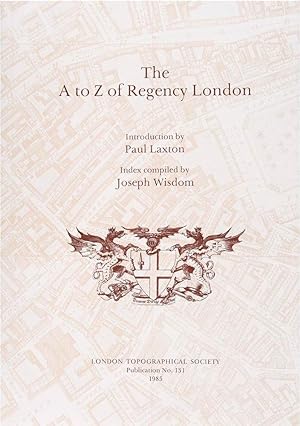
The A to Z of Regency London (London Topographical Society Publication No. 131)
Sprache: Englisch
Verlag: London Topographical Society, 1985
ISBN 10: 0902087193 ISBN 13: 9780902087194
Anbieter: WeBuyBooks, Rossendale, LANCS, Vereinigtes Königreich
Verkäuferbewertung 5 von 5 Sternen
EUR 38,81
EUR 10,18 Versand
Versand von Vereinigtes Königreich nach USAAnzahl: 1 verfügbar
In den WarenkorbZustand: Very Good. Most items will be dispatched the same or the next working day. A copy that has been read, but is in excellent condition. Pages are intact and not marred by notes or highlighting. The spine remains undamaged.
-

To Hell and Back: A True Account of Demonic Possession and Deliverance
Anbieter: Kennys Bookstore, Olney, MD, USA
Verkäuferbewertung 5 von 5 Sternen
Zustand: New. 2022. hardcover. . . . . . Books ship from the US and Ireland.
-
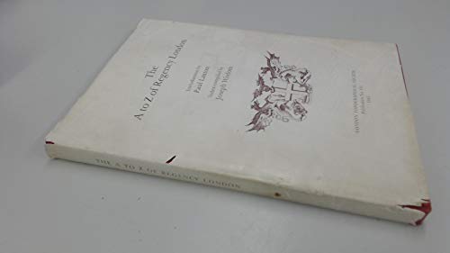
The A to Z of Regency London
Anbieter: Optimon Books, Gravesend, KENT, Vereinigtes Königreich
Verkäuferbewertung 5 von 5 Sternen
EUR 43,49
EUR 21,12 Versand
Versand von Vereinigtes Königreich nach USAAnzahl: 1 verfügbar
In den WarenkorbPaperback. Zustand: Good. The A to Z of Regency London presents the London of Charles Lamb, Thomas Lawrence, Edmund Kean, Beau Brummell, and the Prince Regent in astonishing detail. It should prove an indispensable reference tool for historians, geographers, and genealogists.
-
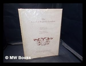
The A to Z of Regency London / introduction by Paul Laxton ; index compiled by Joseph Wisdom
Sprache: Englisch
Verlag: Lympne Castle, Kent : H. Margary in association with Guildhall Library, London, 1985
ISBN 10: 0902087193 ISBN 13: 9780902087194
Facsimile Edition. Fine cloth copy in a near fine, very slightly edge-nicked and dust-dulled dust wrapper, now mylar-sleeved. Remains particularly and surprisingly well-preserved; tight, bright, clean and sharp-cornered. Series; Reproductions of historic maps of London ; 4 C. Publication / London Topographical Society ; no. 131. Physical description; 1 atlas (xiv, 116 pages) : chiefly maps ; 31 cm. Notes; Reduced reprint. Originally published: Plan of the cities of London and Westminster, with the borough of Southwark. 3rd ed. London : R. Horwood, 1813. With additional information. Includes bibliographical references. Subjects; Horwood, Richard. Plan of the cities of London and Westminster, with the borough of Southwark. 19th century. Early maps ; Facsimiles. Regency England London ; Maps. Cartography England London History. Fire risk assessment England London ; Maps. Views ; Facsimiles. Cities history. Cartography. Early maps. Fire risk assessment. Regency. Views. Early maps ; Facsimiles. Regency England London ; Maps. Cartography England London History. Fire insurance England London ; Maps. Views ; Facsimiles. London - Atlases. London - History. Fire insurance England London ; Maps. Cities history. Topography. Maps. London Maps. Cartography England London History. Early maps Facsimiles. Regency England London ; Maps. Cartography England London History. Fire insurance England London ; Maps. Views ; Facsimiles. Cartography London History. Early maps ; Facsimiles. London (England) ; Maps. Southwark (London, England) ; Maps. Westminster (London, England) ; Maps. England London. England London Southwark. England London Westminster. London - ; Maps (1799-1819). London. History of cartography. ; [Literature] 1985. London (England) Description Maps To 1880. Great Britain History 19th century ; Maps. London (England) ; Maps. London ; Maps. London ; Maps ; Facsimiles. London (England) ; Maps. Southwark (London, England) ; Maps. Westminster (London, England) ; Maps. London (England) ; Maps. Cartography England London History. Early maps Facsimiles. Insurance, Fire England London Maps. London (England) Maps. Maps, Early Facsimiles. Regency England London Maps. Southwark (London, England) Maps. Views Facsimiles. Westminster (London, England) Maps. London (1792-1813) Maps Facsimiles Collections. London (1792-1813) Maps Collections. Genres; Atlases (Geographic). Atlases. cartographic image. Facsimiles. History. Manuscripts. Manuscripts. Maps and plans. Maps. 3 Kg.
-

EUR 38,09
EUR 48,99 Versand
Versand von Deutschland nach USAAnzahl: Mehr als 20 verfügbar
In den WarenkorbZustand: New.
-

A Gay Musical Show: Souvenir Theatre Programme Performed at Prince of Wales Theatre, Coventry Street, London
Verlag: Performance Programme circa . 1955., 1955
Anbieter: Little Stour Books PBFA Member, Canterbury, Vereinigtes Königreich
Verbandsmitglied: PBFA
Verkäuferbewertung 5 von 5 Sternen
EUR 9,67
EUR 35,20 Versand
Versand von Vereinigtes Königreich nach USAAnzahl: 1 verfügbar
In den WarenkorbZustand: Fine. Original stapled illustrated souvenir theatre programme 8˝'' x 5˝''. Contains 12 printed pages of text, advertisements and photographs of the characters from the show. In Fine condition. Member of the P.B.F.A. THEATRE PROGRAMMES.
-
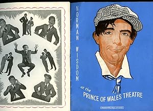
A Gay Musical Show: Souvenir Theatre Programme Performed at Prince of Wales Theatre, Coventry Street, London
Verlag: Performance Programme circa . 1955., 1955
Anbieter: Little Stour Books PBFA Member, Canterbury, Vereinigtes Königreich
Verbandsmitglied: PBFA
Verkäuferbewertung 5 von 5 Sternen
EUR 9,67
EUR 35,20 Versand
Versand von Vereinigtes Königreich nach USAAnzahl: 1 verfügbar
In den WarenkorbZustand: Fine. Original stapled illustrated souvenir theatre programme 8˝'' x 5˝''. Contains 12 printed pages of text, advertisements and photographs of the characters from the show. In Fine condition. Member of the P.B.F.A. THEATRE PROGRAMMES.
-
The A to Z of Regency London
Sprache: Englisch
Verlag: London : Harry Margary, Lympne Castle, Kent, in association with Guildhall Library, London, 1985
ISBN 10: 0902087193 ISBN 13: 9780902087194
Anbieter: Joseph Burridge Books, Dagenham, Vereinigtes Königreich
Verkäuferbewertung 5 von 5 Sternen
Erstausgabe
EUR 96,67
EUR 31,68 Versand
Versand von Vereinigtes Königreich nach USAAnzahl: 1 verfügbar
In den WarenkorbHardcover. Zustand: New. Zustand des Schutzumschlags: New. 1st Edition. 1 atlas (xiv, 116 pages) : chiefly maps ; 31 cm. The 40 sheets of the 1813 Edition of Richard Horwood's "Plan of the Cities of London and Westminster and the Borough of Southwark, including their adjacent Suburbs" are reduced in scale to 12″ to 1 mile and are each presented as a two-page spread, with an introduction by Paul Laxton and an Index covering some 6,500 place names recorded on the map.
-

The A to Z of Regency London
Sprache: Englisch
Verlag: Harry Margary / Guildhall Library, Lympne Castle, 1985
ISBN 10: 090354136X ISBN 13: 9780903541367
Anbieter: Object Relations IOBA PBFA, London, Vereinigtes Königreich
Verkäuferbewertung 5 von 5 Sternen
Erstausgabe
EUR 145,00
EUR 11,73 Versand
Versand von Vereinigtes Königreich nach USAAnzahl: 1 verfügbar
In den WarenkorbHardcover. Zustand: Near Fine. Zustand des Schutzumschlags: Very Good. 1st Edition. 1st printing (1985). 116pp. NEAR FINE book; in VG dust jacket, small chip to front bottom corner, tiny nick to head of spine, now preserved in archival jacket protector.
-

The A to Z of Regency London
Anbieter: Douglas Stewart Fine Books, Armadale, VIC, Australien
Verkäuferbewertung 4 von 5 Sternen

Introduction by Paul Laxton. London : London Topographical Society, 1985. Publication No. 131. Folio, boards in dustjacket, pp. xvi; 116, with detailed maps of Georgian London.