

Gesamtpreis (1 Artikel Artikel):
Versandziel:

willis james a c (5 Ergebnisse)
Direkt zu den wichtigsten Suchergebnissen
Suchfilter
Produktart
- Alle Product Types
- Bücher (4)
- Magazine & Zeitschriften (Keine weiteren Ergebnisse entsprechen dieser Verfeinerung)
- Comics (Keine weiteren Ergebnisse entsprechen dieser Verfeinerung)
- Noten (Keine weiteren Ergebnisse entsprechen dieser Verfeinerung)
- Kunst, Grafik & Poster (Keine weiteren Ergebnisse entsprechen dieser Verfeinerung)
- Fotografien (Keine weiteren Ergebnisse entsprechen dieser Verfeinerung)
- Karten (1)
- Manuskripte & Papierantiquitäten (Keine weiteren Ergebnisse entsprechen dieser Verfeinerung)
Zustand Mehr dazu
- Neu (Keine weiteren Ergebnisse entsprechen dieser Verfeinerung)
- Wie Neu, Sehr Gut oder Gut Bis Sehr Gut (1)
- Gut oder Befriedigend (1)
- Ausreichend oder Schlecht (Keine weiteren Ergebnisse entsprechen dieser Verfeinerung)
- Wie beschrieben (3)
Einband
Weitere Eigenschaften
- Erstausgabe (2)
- Signiert (Keine weiteren Ergebnisse entsprechen dieser Verfeinerung)
- Schutzumschlag (1)
- Angebotsfoto (2)
Sprache (1)
Gratisversand
- Kostenloser Versand nach USA (Keine weiteren Ergebnisse entsprechen dieser Verfeinerung)
Land des Verkäufers
Verkäuferbewertung
-

Hydrocarbon Generation and Migration Routes in the East Texas Basin (Abstract; p. 675) AND Computer Modeling of Hydrocarbon Migration Pathways and Fluid Flow Histories from Carbon Isotope Anomalies in Gulf Coast Exploration Wells (pp. 690-701) AND Behavior of Inorganic Consitutents During Early Diagenesis of Peats (pp. 690-702) AND Predicting Fracture Connectivity and Intensity within the Austin Chalk from Outcrop Fracture Maps and Scanline Data (pp. 702-718). (FROM: Transactions, Gulf Coast Association of Geological Societies, Vol. XLI, 1991)
Verlag: Gulf Coast Association of Geological Societies., 1991
Anbieter: Eryops Books, Stephenville, TX, USA
Verkäuferbewertung 5 von 5 Sternen

No Binding. Zustand: Very Good. ORIGINAL 1991 Articles, disbound from GCAGS Transactions volume; no covers; in very good condition. Journal.
-
THE COMPLETE SCIENCE FICTION OF WILLIAM TENN: IMMODEST PROPOSALS AND HERE COMES CIVILIZATIONS [TWO VOLUMES]
Verlag: The NESFA Press, Framingham, 2001
Anbieter: Second Story Books, ABAA, Rockville, MD, USA
Verkäuferbewertung 4 von 5 Sternen

Erstausgabe
Hardcover. Zustand des Schutzumschlags: dj. First Edition. Thick Octavo, two volumes. In Very Good minus condition with Very Good minus dust jackets. Dust jackets protected with mylar coverings. Spines black with orange and purple lettering. Exteriors have slight wear including minor edge wear. Boards have slight wear including minimal sunning with cocking to the spines. Text blocks have slight wear including faint age toning and minor soiling to the edges and minor sparse soiling to few pages. First edition. CONTENTS: Vol. One "Immodest Proposals" ISBN 1886778191, vii, 618 pages -- Vol. Two "Here Comes Civilization" ISBN 1886778280, v, 545 pages. NOTE: Shelved in Locked Annex, Column AA. Oversized book(s). Additional postage necessary for international/expedited orders. Economy International shipping unavailable due to size/weight restrictions. For international/expedited customers, please inquire for rates. 1411208. FP New Rockville Stock.
-
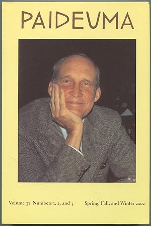
Paideuma Volume 31, Numbers 1, 2, & 3, Spring, Fall & Winter 2002
Verlag: University of Maine, Orono, Maine, 2002
Anbieter: Between the Covers-Rare Books, Inc. ABAA, Gloucester City, NJ, USA
Verbandsmitglied: ABAA ESA ILAB IOBA
Verkäuferbewertung 5 von 5 Sternen
Erstausgabe
Softcover. Zustand: Near Fine. Magazine. Illustrated from black and white photographs. Pictorial wrappers. 398pp. Light foxing on page edges, else fine. Paper tipped in "In Memoriam [sic] Carroll F. Terrell, February 21, 1917 - November 29, 2003, Founding Editor of *Paideuma*, Founding Director of the National Poetry Foundation"; Hugh Kenner, January 7, 1923 - November 24, 2003, Senior Editor of *Paideuma*, Lifelong Friend and Supporter of NPF." This special volume is dedicated to James Laughlin, 1914 - 1997, & Guest-Edited by Emily Mitchell Wallace. Contributions by Rodney Grove Dennis, Tom Vitale, James Atlas, Joel Conarroe, Anne Conover, William Eric Williams, Hught Witemeyer, Hayden Carruth, Penelope Laurans Fitzgerald, Samuel A. Streit, Emily Mitchell Wallace, Terry Halladay, Leslie A. Morris, Patricia C. Willis, John A. Harrison, Ezra Pound, Zhaoming Qian, Richard Taylor, Demetres Tryphonopoulos, William McNaughton, Patrizia De Rachewiltz, and fourteen poems by James Laughlin.
-
Map of Port Jackson, and City of Sydney, shewing the Adjacent Municipalities. N.S.W. 1868. Respectfully Dedicated to W.R. Davidson, Esq. Surveyor General of New South wales by his Obiedient servert James A.C. Willis.
Verlag: James A.C. Willis,
Anbieter: Daniel Crouch Rare Books Ltd, London, Vereinigtes Königreich
Verbandsmitglied: ABA ILAB PBFA
Verkäuferbewertung 5 von 5 Sternen
Karte
EUR 2.981,83
EUR 23,16 Versand
Versand von Vereinigtes Königreich nach USAAnzahl: 1 verfügbar
In den WarenkorbSydney's CBD Revised. Folding lithrographed map, with contemporary hand-colour in outline. First published in 1865. Available coloured and uncoloured, in loose sheets, "Book Form", and also available on rollers and varnished, for the office. A very detailed map, centred on Sydney's central business district and extending as far as ten miles in three directions: as far north as Curl Curl Head, as far south as northern Botany Bay, and as far west as Ashfield. Willis, who has compiled the map from his own surveys, and others at the New South Wales Surveyor General's Office, names all streets, important buildings: Government House, Customs House, Exchange, St. Andrew's Cathedral, St. Mary's Cathedral, Fort Phillip, the Land & Surveyor General's Office, Prince of Wales Theatre, Royal Hotel, N.S.W. Bank, General Post Office, The Markets and the Australian Museum; neighbourhoods and land reserves. The mapmaker James A.C. Willis (fl 1848-1896), painter, draftsman and surveyor, arrived in Sydney, from Devon, in the late 1840s. By 1848, he was apprenticed to Conrad Martens, then and now, one of the colony's talented artists. In 1853, he had become a surveyor and draftsman for the Surveyor General's Office of New South Wales. This is his earliest published map: others being: 'The County of Bathurst', 1869; 'The Harbour of Port Jackson, New South Wales', c1870; a 'Map of New South Wales', 1871; and the 'Cereal Map of New South Wales', 1871. He is probably best known for his panoramic view 'The Harbour of Port Jackson & city of Sydney drawn from nature', 1870. He was a founding member of the NSW Academy of Art, and in 1871 was elected one of its directors.
-

Map of Port Jackson, and City of Sydney, shewing the Adjacent Municipalities. N.S.W. 1867
Verlag: James A.C. Willis,, Sydney,, 1867
Anbieter: Daniel Crouch Rare Books Ltd, London, Vereinigtes Königreich
Verbandsmitglied: ABA ILAB PBFA
Verkäuferbewertung 5 von 5 Sternen
EUR 9.541,85
EUR 23,16 Versand
Versand von Vereinigtes Königreich nach USAAnzahl: 1 verfügbar
In den WarenkorbSydney's CBD Folding chromolithrographed map, dissected and laid down on linen in 20 sections, with contemporary hand-colour in outline, folding into publisher's maroon cloth, gilt, covers (rebacked preserving the original spine). Second state, updated, with the addition of Ferry routes, and other details. First published in 1865. Available coloured and uncoloured, in loose sheets, 'Book Form' [as here], and also available on rollers and varnished, for the office. A very detailed map, centred on Sydney's central business district and extending as far as ten miles in three directions: as far north as Curl Curl Head, as far south as northern Botany Bay, and as far west as Ashfield. Willis, who has compiled the map from his own surveys, and others at the New South Wales Surveyor General's Office, names all streets, important buildings: Government House, Customs House, Exchange, St. Andrew's Cathedral, St. Mary's Cathedral, Fort Phillip, the Land & Surveyor General's Office, Prince of Wales Theatre, Royal Hotel, N.S.W. Bank, General Post Office, The Markets and the Australian Museum; neighbourhoods and land reserves. Including 'Opinions of the Press' on the front paste-down: "A very useful map? it shows at a glance the entire harbor from the Heads to Hunter's Hill on the Parramatta River, the whole of Middle Harbour, Lane Cover River, and the bays to the southward as far as Five Dock and Figtree Bay. It also illustrates the position of the city with regard to the port, and the various suburbs so clearly, that by its aid a stranger could readily find his way from one place to another, without enquiry" - Sydney Morning Herald. Willis (fl 1848-1896), painter, draftsman and surveyor, arrived in Sydney, from Devon, in the late 1840s. By 1848, he was apprenticed to Conrad Martens, then and now, one of the colony's talented artists. In 1853, he had become a surveyor and draftsman for the Surveyor General's Office of New South Wales. This is his earliest published map: others being: 'The County of Bathurst', 1869; 'The Harbour of Port Jackson, New South Wales', c1870; a 'Map of New South Wales', 1871; and the 'Cereal Map of New South Wales', 1871. He is probably best known for his panoramic view 'The Harbour of Port Jackson & city of Sydney drawn from nature?', 1870. He was a founding member of the NSW Academy of Art, and in 1871 was elected one of its directors. Rare: only four institutional examples of this state are recorded, all in Australian institutions. Provenance: 1. With the ink stamp of Berkelouw Booksellers, Sydney, on the front paste-down; 2. From the library of Geoffrey Chapman Ingleton (1908-1998), writer, illustrator, and renowned collector of maps and charts of Australia, with his library mark (no. 10392) on verso. Having served in the Royal Australian Navy from 1922-1936, Ingleton worked as a draftsman for the Australian Hydrographic Office, from 1940-1973. His collection was sold at auction in 1991 and 1992. Tooley, Printed Maps of New South Wales', no 148; NLA Map F 109.


