
Gesamtpreis (1 Artikel Artikel):
Versandziel:

william overstreet (23 Ergebnisse)
Direkt zu den wichtigsten Suchergebnissen
Suchfilter
Produktart
- Alle Product Types
- Bücher (21)
- Magazine & Zeitschriften (Keine weiteren Ergebnisse entsprechen dieser Verfeinerung)
- Comics (Keine weiteren Ergebnisse entsprechen dieser Verfeinerung)
- Noten (1)
- Kunst, Grafik & Poster (Keine weiteren Ergebnisse entsprechen dieser Verfeinerung)
- Fotografien (Keine weiteren Ergebnisse entsprechen dieser Verfeinerung)
- Karten (1)
- Manuskripte & Papierantiquitäten (Keine weiteren Ergebnisse entsprechen dieser Verfeinerung)
Zustand Mehr dazu
- Neu (4)
- Wie Neu, Sehr Gut oder Gut Bis Sehr Gut (3)
- Gut oder Befriedigend (11)
- Ausreichend oder Schlecht (Keine weiteren Ergebnisse entsprechen dieser Verfeinerung)
- Wie beschrieben (5)
Einband
Weitere Eigenschaften
- Erstausgabe (8)
- Signiert (Keine weiteren Ergebnisse entsprechen dieser Verfeinerung)
- Schutzumschlag (2)
- Angebotsfoto (13)
Sprache (2)
Gratisversand
Land des Verkäufers
Verkäuferbewertung
-

Early American Toys & Games
Sprache: Englisch
Verlag: Western Reflections Pub Co, 2002
ISBN 10: 1890437700 ISBN 13: 9781890437701
Anbieter: ThriftBooks-Dallas, Dallas, TX, USA
Verkäuferbewertung 5 von 5 Sternen

Paperback. Zustand: Good. No Jacket. Former library book; Pages can have notes/highlighting. Spine may show signs of wear. ~ ThriftBooks: Read More, Spend Less.
-
Early American Toys & Games
Sprache: Englisch
Verlag: Western Reflections Pub Co, 2002
ISBN 10: 1890437700 ISBN 13: 9781890437701
Anbieter: ThriftBooks-Atlanta, AUSTELL, GA, USA
Verkäuferbewertung 5 von 5 Sternen
Paperback. Zustand: Very Good. No Jacket. May have limited writing in cover pages. Pages are unmarked. ~ ThriftBooks: Read More, Spend Less.
-

Contributions to the Prehistory of Saudi Arabia : I
Anbieter: N. Fagin Books, Chicago, IL, USA
Verkäuferbewertung 5 von 5 Sternen
Soft cover. Zustand: Very Good. 1973. Journals, Classical studies, Middle East. Field Research Projects. Very good wrappers/paper 11p. Plus 99 figures 5/23.
-

Fluvial Monazite Deposits in the Southeastern United States; Geological Survey Professional Paper 568, Text and Plates
Verlag: United States Government Printing Office, Washington, 1968
Zustand: very good. from the title page, "Occurrences of detrital monazite in the western Piedmont of Virginia, North Carolina, South Carolina, and Georgia, and methods used to appraise them." DX4. Hardcase, 11.5" x 9" 9 foldout maps inside pocket, Text softcover, 85 pages, illustrated, inside front pocket.
-

Why We Walked Away: Twelve Former Catholic Priests Tell Their Stories
Anbieter: Ria Christie Collections, Uxbridge, Vereinigtes Königreich
Verkäuferbewertung 5 von 5 Sternen
EUR 16,28
EUR 13,86 Versand
Versand von Vereinigtes Königreich nach USAAnzahl: Mehr als 20 verfügbar
In den WarenkorbZustand: New. In.
-
Why We Walked Away: Twelve Former Catholic Priests Tell Their Stories
Anbieter: Revaluation Books, Exeter, Vereinigtes Königreich
Verkäuferbewertung 5 von 5 Sternen
EUR 22,42
EUR 11,57 Versand
Versand von Vereinigtes Königreich nach USAAnzahl: 2 verfügbar
In den WarenkorbPaperback. Zustand: Brand New. 270 pages. 8.94x5.98x0.71 inches. In Stock.
-
Effects of space shuttle exhaust plumes on gills of some estuarine fishes : a light and electron microscopic study
Verlag: 1984, 1984
Anbieter: Sylvain Paré, Montolieu, Frankreich
Verkäuferbewertung 5 von 5 Sternen
Gulf Research Reports, Vol. 7, No. 4, 1984, 14 pages agrafées de 21,50x28 cm Bon état - Pour les envois hors de France, la tafication «livre & brochure» pour les frais de port a disparue.Les frais de port annoncés correspondent ŕ une moyenne. Ils seront calculés au plus juste en fonction du poids de votre article.
-

Halley's Gathering
Anbieter: Ria Christie Collections, Uxbridge, Vereinigtes Königreich
Verkäuferbewertung 5 von 5 Sternen
EUR 28,08
EUR 13,86 Versand
Versand von Vereinigtes Königreich nach USAAnzahl: Mehr als 20 verfügbar
In den WarenkorbZustand: New. In.
-

Political Handbook of the World: 1980
Verlag: McGraw-Hill Book Company, New York, 1980
Anbieter: Between the Covers-Rare Books, Inc. ABAA, Gloucester City, NJ, USA
Verbandsmitglied: ABAA ESA ILAB IOBA
Verkäuferbewertung 5 von 5 Sternen
Erstausgabe
Hardcover. Zustand: Fine. Zustand des Schutzumschlags: Fine. Quarto. 657pp. Fine, dustwrapper has a small tear at bottom, taped over, else fine.
-
![Bild des Verkäufers für The Comic Book Price Guide 1980-1981 ; Books from 1900-Present Included; Catalogue & Evaluation Guide-Illustrated.[A Chronology of the Development of the American Comic Book; The Origin of Marvel Comics; Understanding the Classics] zum Verkauf von Joseph Valles - Books](https://pictures.abebooks.com/inventory/md/md80915276.jpg)
The Comic Book Price Guide 1980-1981 ; Books from 1900-Present Included; Catalogue & Evaluation Guide-Illustrated.[A Chronology of the Development of the American Comic Book; The Origin of Marvel Comics; Understanding the Classics]
Verlag: Cleveland, TN : Robert M. Overstreet, 1980., 1980
Anbieter: Joseph Valles - Books, Stockbridge, GA, USA
Verkäuferbewertung 5 von 5 Sternen
Hardcover. Zustand: Fine. 10th edition ; pictorial thick wrappers ; [c40]+73+345+[62] pp. ; OCLC: 6392063 ; ISBN: 9780375722394 (pbk.); 0375722394 (pbk.) ; several pages of color plates featuring covers of comic books ; minutiae of comic collecting, with a few interesting ar ticles, especially concerning the origins of Marvel Comics, and an overview of Classics Illustrated Comics ; tight, clean, covers shiny ; FINE. Book.
-

EUR 20,95
EUR 48,99 Versand
Versand von Deutschland nach USAAnzahl: Mehr als 20 verfügbar
In den WarenkorbZustand: New.
-

Political Handbook of the World 2008.
Anbieter: Universitätsbuchhandlung Herta Hold GmbH, Berlin, Deutschland
Verbandsmitglied: GIAQ ILAB VDA
Verkäuferbewertung 4 von 5 Sternen

Erstausgabe
1st ed. 22 x 29 cm. 1665 pages. Hardcover. Versand aus Deutschland / We dispatch from Germany via Air Mail. Einband bestoßen, daher Mängelexemplar gestempelt, sonst sehr guter Zustand. Imperfect copy due to slightly bumped cover, apart from this in very good condition. Stamped. Sprache: Englisch.
-

Political Handbook of the World 2000-2002
Anbieter: Better World Books: West, Reno, NV, USA
Verkäuferbewertung 5 von 5 Sternen
Zustand: Very Good. Former library copy. Pages intact with possible writing/highlighting. Binding strong with minor wear. Dust jackets/supplements may not be included. Includes library markings. Stock photo provided. Product includes identifying sticker. Better World Books: Buy Books. Do Good.
-
Tertiary laterite of the As Sarat Mountains Asir province Kingdom of Saudi Arabia. Mineral resources bulletin 21.
Verlag: Jiddah : Directorate General of Mineral Resources, 1977
Anbieter: Wissenschaftliches Antiquariat Köln Dr. Sebastian Peters UG, Köln, Deutschland
Verkäuferbewertung 5 von 5 Sternen
Zustand: sehr gut. IV, 30 S., Beilage, 30 cm. Sprache: Englisch.
-
Miscellaneous Investigations Series Map I-1143-B: Geologic Map of Yemen Arab Republic (San'a')
Sprache: Englisch
Verlag: US Geological Survey (USGS), Washington DC, 1978
Anbieter: Dendera, London, Vereinigtes Königreich
Verkäuferbewertung 5 von 5 Sternen
Karte Erstausgabe
EUR 417,21
EUR 28,93 Versand
Versand von Vereinigtes Königreich nach USAAnzahl: 1 verfügbar
In den WarenkorbSoft cover. Zustand: Very Good. Zustand des Schutzumschlags: Good. 1st Edition. Colour printed map prepared from NASA Land Satellite (Landsat) imagery with geologic overlay, 1/500K, 107x134cm, English and Arabic text, folded in its original buff printed envelope 24x30cm. Map near fine with some crinkling. Envelope good, creased with short closed tears, and the name of the previous owner, British Arabist and diplomat C.S.M. (Craig) Shelton, handwritten to the front. This covers the Red Sea and Gulf of Aden coasts up to Wadi Najran (N) and the Rub al Khali (NE) in the interior, with the partially defined borders drawn in for PDR or South Yemen (named here as Yemen (Aden)) and Saudi Arabia. There are labels for major settlements, Wadis, and Jabals, with routes drawn in. There is a Geological Explanation, and a list of references. An Index Map shows the location and dates of Landsat images used in its compilation, all taken during 1972-73. The geologic interpretation was field checked in June and July 1975, and February 1976. This and the corresponding Geographic Map (I-1143-A) were prepared to support USAID's development project planning and implementation. The work was done in cooperation with Yemeni authorities including the Central Planning and Organisation, the Ministries of Economy and Agriculture, and the Mineral Petroleum Authority. Their publication dates around the time of the build-up in hostilities that led to the Second Yemenite War.
-
[2 related reports] (1) Technical Letter Number 58: Progress Report on Analyses of Pyritic Core from Diamond Drill Holes under Gossan at Wadi Wassat, Saudi Arabia / (2) Technical Letter Number 63: Progress Report II. Assays and Analyses of Pyritic Core from Wadi Wassat Gossan, Saudi Arabia
Sprache: Englisch
Verlag: United States Geological Survey (USGS), Jiddah [Jeddah], 1966
Anbieter: Dendera, London, Vereinigtes Königreich
Verkäuferbewertung 5 von 5 Sternen
Erstausgabe
EUR 417,21
EUR 28,93 Versand
Versand von Vereinigtes Königreich nach USAAnzahl: 1 verfügbar
In den WarenkorbSoft cover. Zustand: Good. 1st Edition. Two related reports in original staple-bound brown printed wraps 22x28cm. TL 58: (1), 17; TL63: (1), 8pp, both opening with a covering letter from Glen Brown to Fadil Kabbani, Deputy Minister for Mineral Resources. Wraps good, foxed and faintly damp stained, short closed tears, staples rusting. Interiors near fine with red ms ticks by the edge of the table on p6 in TL53, and some ink offsetting to the blank versos (not affecting text). These reports are a very early "preliminary" product of the monumental USGS-Aramco mapping project (1956-63), which, among other things, produced 21 Geological maps covering the whole of Saudi Arabia in a series of Quadrangles numbered I-200A to I-220A. They were prepared under the follow-up Saudi Arabian Mineral Exploration Project launched in 1963, which Brown coordinated from Jeddah. The team was made up of staff from USGS and the Directorate General for Mineral Resources. Their first analysis done during 22 March and 9 May was issued on 15 May 1966, based on 31 samples collected from Wadi Wassat in the Asir area (Map I-217A Asir Quadrangle). They found potential sources for pyrite meriting further exploration. Progress Report II issued on 8 June, presents findings with respect to silver and gold deposits. Among the main references are Overstreet's own Technical Letters 23 and 40. Very rare. Brown's covering letter states 10 copies of each were sent to Kabbani. Additional copies would have been circulated within USGS and probably Aramco. Worldcat records other letters in the series, but not this one. USGS reissued them in 1967 as Open-File Reports 67-174 and 67-175 (USGS website).
-
Technical Letter Number 84: Results of a Trip, October 25-29, 1966, to the Bi'r El Adhbat Area and the Esh Qay'ib (Esh Sha'ib) Mine, Eastern Asir, Saudi Arabia, including Assays of Material from Ancient Mines in the Eastern Asir
Sprache: Englisch
Verlag: United States Geological Survey (USGS), Jiddah [Jeddah], 1966
Anbieter: Dendera, London, Vereinigtes Königreich
Verkäuferbewertung 5 von 5 Sternen
Erstausgabe
EUR 417,21
EUR 28,93 Versand
Versand von Vereinigtes Königreich nach USAAnzahl: 1 verfügbar
In den WarenkorbSoft cover. Zustand: Good. 1st Edition. Original staple-bound green printed wraps 22x28cm. (2)pp prelims including covering letter from Glen Brown to Fadil Kabbani, Deputy Minister for Mineral Resources, 20pp report printed to the rectos only. Wraps good, foxed, lightly damp stained, with lower wrap coming away from staples. Interiors very good with ink offsetting to several of the blank versos (not affecting text). This report is a very early "preliminary" product of the monumental USGS-Aramco mapping project (1956-63), which, among other things, produced 21 Geological maps covering the whole of Saudi Arabia in a series of Quadrangles numbered I-200A to I-220A. It was prepared under the follow-up Saudi Arabian Mineral Exploration Project launched in 1963, which Brown coordinated from Jeddah. The team was made up of staff from USGS and the Directorate General for Mineral Resources, accompanied by a driller. Fieldwork was conducted in October 1966 at the ancient mines of En Nugger, Wadi Al Mushel, and Esh Sha'ib in eastern Asir (area covered by Map I-217A), to plan geophysical surveys and locate diamond drill holes. Local residents reported the existence of several other ancient mines close to En Nugger. It also recommended further research to the west of Abha. Very rare. Brown's covering letter states 20 copies were sent to Kabbani. Additional copies would have been circulated within USGS and probably Aramco. Worldcat locates two at the South Dakota School of Mines & Technology, and Colorado School of Mines (OCLC 182522754). USGS reissued it in 1969 as Open-File Report 69-189 (USGS website).
-
Technical Letter Number 39: Mineral Exploration between Bi'r Idimah and Wadi Haraman, Asir Quadrangle, Saudi Arabia
Sprache: Englisch
Verlag: United States Geological Survey (USGS), Jiddah [Jeddah], 1966
Anbieter: Dendera, London, Vereinigtes Königreich
Verkäuferbewertung 5 von 5 Sternen
Erstausgabe
EUR 417,21
EUR 28,93 Versand
Versand von Vereinigtes Königreich nach USAAnzahl: 1 verfügbar
In den WarenkorbSoft cover. Zustand: Good. 1st Edition. Original staple-bound green printed wraps 22x28cm. (1)pp covering letter from Glen Brown to Fadil Kabbani, Deputy Minister for Mineral Resources; 70pp Overstreet's report printed to the rectos only. Wraps good, foxed, torn to the upper staple at the front, staples rusted. Interiors very good with ink offsetting to several of the blank versos (not affecting text). This report is a very early "preliminary" product of the monumental USGS-Aramco mapping project (1956-63), which, among other things, produced 21 Geological maps covering the whole of Saudi Arabia in a series of Quadrangles numbered I-200A to I-220A. It was prepared under the follow-up Saudi Arabian Mineral Exploration Project launched in 1963, which Brown coordinated from Jeddah. Overstreet conducted his fieldwork during 8 May to 27 June 1965 using Map I-217A (Asir Quadrangle). This continued his expedition made the previous year between Khamis Mushayt and Bi'r Idimah (described in Technical Letter No. 23). He travelled 5300km accompanied by the local guide Maeith and driver Homud Saud in two 3/4 ton 4x4 Ford pickups provided by the Directorate General for Mineral Resources, with aircraft dispatched for 4 scheduled rendezvous. He took 490 samples of wadi sand, about the same number of magnetite, and 41 other materials. He identified possibilities for marble and asbestos, and suggested an ancient mine, the Ishaaib, may contain copper (pp4-5). He prepared the report on 5 July 1965, and it was issued on 15 January 1966. Very rare. Brown's covering letter states 10 copies were sent to Kabbani. Additional copies would have been circulated within USGS and probably Aramco. Worldcat records other letters in the series, but not this one. USGS reissued it in 1968 as Open-File Report 68-207 (USGS website).
-
Technical Letter Number 40: Preliminary Results of a Trip, October 30 - December 21, 1965, to the Area between Sha'ya and Jabal Bani Bisqan, Saudi Arabia, together with a Synopsis of Mineral Reconnaissance in the Asir Quadrangle
Sprache: Englisch
Verlag: United States Geological Survey (USGS), Jiddah [Jeddah], 1966
Anbieter: Dendera, London, Vereinigtes Königreich
Verkäuferbewertung 5 von 5 Sternen
Erstausgabe
EUR 417,21
EUR 28,93 Versand
Versand von Vereinigtes Königreich nach USAAnzahl: 1 verfügbar
In den WarenkorbSoft cover. Zustand: Good. 1st Edition. Original staple-bound brown printed wraps 22x28cm. (1)pp covering letter from Glen Brown to Fadil Kabbani, Deputy Minister for Mineral Resources; 48pp Overstreet's report printed to the rectos only. Wraps good, foxed, torn to the upper staple at the back, staples rusting. Interiors very good with ink offsetting to several of the blank versos (not affecting text). This report is a very early "preliminary" product of the monumental USGS-Aramco mapping project (1956-63), which, among other things, produced 21 Geological maps covering the whole of Saudi Arabia in a series of Quadrangles numbered I-200A to I-220A. It was prepared under the follow-up Saudi Arabian Mineral Exploration Project launched in 1963, which Brown coordinated from Jeddah. Overstreet conducted his fieldwork during 30 October to 21 December 1965 using Map I-217A (Asir Quadrangle), and referencing his earlier studies in the area (Technical Letters 23 and 39). He travelled 6574km accompanied by the local guide Homud El Shebany, and drivers Homud Saud and Khalif Ali in a Power Wagon, a 3/4 ton Ford 4x4, and Land Rover 4x4 provided by the Directorate General for Mineral Resources. There were 2 rendezvous by Ministry aircraft, and 14 camps were set. He took 800 samples. Other than the Al Lugatah gold mine (known to the Directorate by the work of DF Shaffner in 1957) no other exploitable occurences were found. He prepared the report on 11 January 1966, and it was issued on 16 January. Very rare. Brown's covering letter states 10 copies were sent to Kabbani. Additional copies would have been circulated within USGS and probably Aramco. Worldcat locates two at the South Dakota School of Mines & Technology, and Colorado School of Mines (OCLC 180153061). USGS reissued it in 1968 as Open-File Report 68-209 (USGS website).
-
Technical Letter Number 23: Mineral Investigations between Khamis Mushayt and Bi'r Idimah, Saudi Arabia
Sprache: Englisch
Verlag: United States Geological Survey (USGS), Jiddah [Jeddah], 1965
Anbieter: Dendera, London, Vereinigtes Königreich
Verkäuferbewertung 5 von 5 Sternen
Erstausgabe
EUR 417,21
EUR 28,93 Versand
Versand von Vereinigtes Königreich nach USAAnzahl: 1 verfügbar
In den WarenkorbSoft cover. Zustand: Good. 1st Edition. Original staple-bound green printed yapp wraps 22x28cm. (1)pp covering letter from Glen Brown to Fadil Kabbani, Deputy Minister for Mineral Resources; 15pp Overstreet's report printed to the rectos only. Wraps good, tanned towards the edges with a couple of short closed tears, staples rusted. Interiors very good with ink offsetting to the lower part of p1 (text still legible) and to the blank versos. This report is a very early "preliminary" product of the monumental USGS-Aramco mapping project (1956-63), which, among other things, produced 21 Geological maps covering the whole of Saudi Arabia in a series of Quadrangles numbered I-200A to I-220A. It was prepared under the follow-up Saudi Arabian Mineral Exploration Project launched in 1963, which Brown coordinated from Jeddah. Overstreet conducted his fieldwork during 24 September to 20 November 1964 using Maps I-212A (Southern Tuwayq Quadrangle) and I-217A (Asir Quadrangle): "Total distance travelled was 6264km. Sixteen camps were set, and 483 samples of various geologic materials, principally wadi sands, laterite, and gossan were taken" (p1). He prepared the report on 28 November 1964, and it was issued on 5 September 1965. Very rare. Brown's covering letter states 10 copies were sent to Kabbani. Additional copies would have been circulated within USGS and probably Aramco. Worldcat locates two at the South Dakota School of Mines & Technology, and Colorado School of Mines (OCLC 173974083). USGS reissued it in 1968 as Open-File Report 68-208 (USGS website).
-
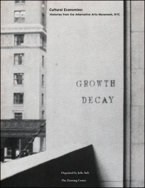
Cultural Economies : Histories from the Alternative Arts Movement, NYC
Verlag: The Drawing Center / Real Life Magazine New York / Valencia, New York / California, 1996
Anbieter: Specific Object / David Platzker, New York, NY, USA
Verkäuferbewertung 5 von 5 Sternen
72 pp.; 28 x 21.5 cm.; glue bound; black-and-white; edition size unknown; unsigned and unnumbered; offset-printed Exhibition catalogue published in conjunction with show held at The Drawing Center, New York, February 24 - April 6, 1996. Texts by exhibition organizer and artist Julie Ault and artist and writer Thomas Lawson. Includes press clippings of various news articles on alternative exhibition venues in New York from the late 1960's to the late 1990's by Margrit Pittman, Grace Glueck, John Dowell, Sam Gilliam, Joe Overstreet, Melvin Edwards, Richard Hunt, William T. Williams, Marcia Tucker, Eileen Blair, Lehman Weichselbaum, John Russell, Ricahrd Goldstein, Alison Mitchell, John Perreault, Robert D. McFadden, Lawrence Alloway, Robert Pear, Ann Meyerson, George Sternlieb, Craig Owens, Roberta Smith, Allan Schwartzman, David Deitcher, Kay Larson, Herbert Muschamp and additional unknown authors. Very Good. Light dusting of covers with 3.8 cm. and 2.8 cm. of yellow soiling to recto. Contents clean and unmarked.
-

There'll Be Some Changes Made D flat major
Verlag: Kendor Music, Inc.
ISBN 13: 0822795001167
Anbieter: CONTINUO Noten-Buch-Versand, Spabrücken, Deutschland
Verkäuferbewertung 3 von 5 Sternen

Noten
Zustand: 1. Medium Swing. Big Band und Gesang. Partitur und Stimmen .
-
The Geologic Occurrence of Monazite.
Anbieter: Antiquariat Bernard Richter, Baden-Baden, Deutschland
Verkäuferbewertung 2 von 5 Sternen

A review of the distribution of monazite and the of geologic controlsaffecting the amount of thorium in monazite. (= Geological Survey Professional Paper, 530) VIII, 327 pp, 2 folded maps in back pocket. 4to. Orig. wrappers. Washington D. C., United States Government Printing Office 1967.


![Bild des Verkäufers für [2 related reports] (1) Technical Letter Number 58: Progress Report on Analyses of Pyritic Core from Diamond Drill Holes under Gossan at Wadi Wassat, Saudi Arabia / (2) Technical Letter Number 63: Progress Report II. Assays and Analyses of Pyritic Core from Wadi Wassat Gossan, Saudi Arabia zum Verkauf von Dendera](https://pictures.abebooks.com/inventory/md/md32011933850.jpg)


