Tyson phillip thomas (5 Ergebnisse)

- Softcover
Anbieter: moluna, Greven, Deutschlandmoluna
Verkäufer/-in kontaktierenVerkäufer/-in mit 5 SternenZustand: Neu
EUR 26,25
EUR 48,99 VersandVersand von Deutschland nach USAAnzahl: Mehr als 20 verfügbar
Kartoniert / Broschiert. Zustand: New.

- Softcover
Anbieter: AHA-BUCH GmbH, Einbeck, DeutschlandAHA-BUCH GmbH
Verkäufer/-in kontaktierenVerkäufer/-in mit 5 SternenZustand: Neu
EUR 31,37
EUR 61,25 VersandVersand von Deutschland nach USAAnzahl: 2 verfügbar
Taschenbuch. Zustand: Neu. Neuware - This work has been selected by scholars as being culturally important, and is part of the knowledge base of civilization as we know it. This work was reproduced from the original artifact, and remains as true to the original work as possible. Therefore, you will see the original copyright ref…erences, library stamps (as most of these works have been housed in our most important libraries around the world), and other notations in the work.

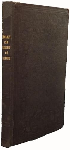
Verlag: WM. Minifie & Co., Baltimore, 1851
- Hardcover
- Erstausgabe
Anbieter: Arader Galleries - AraderNYC, New York, NY, USAArader Galleries - AraderNYC
Verkäufer/-in kontaktierenVerkäufer/-in mit 5 SternenZustand: Gebraucht
EUR 4.523,09
Versand nach gratisVersand innerhalb von USAAnzahl: 1 verfügbar
Hardcover. 1st Edition. Two parts in one volume. 8vo., (9 x 5 4/8 inches). 12 fine folding lithographic maps (one or two spots, some light browning). Original black cloth (a bit scuffed at the head and foot of the spine). Provenance: Author's penciled presentation inscription to "Col. J. J. Abert with the compliments of Philip J…. Tyson" on the recto of the first blank; signed by Abert (1788-1863), on the front paste-down. Second and best edition, one of 1000 copies for the author's own use, with added 34-page introduction ("Geology and Industrial Resources of California"), errata, index, and table of contents, otherwise the maps and sheets are the same as the first edition (31st Congress, 1st Session, Senate Executive Document 47, 1850). "Philip Tyson based this memoir on his personal observations of California during the summer and early fall of 1849. Tyson dated the report February 20, 1850. Wheat noted that this was "probably the earliest work of a true scientific research to emerge from the Gold Rush." Tyson, in his report, described his visits to the "canvass" city of Sacramento, Mormon Island, Coloma, Jackson and Sutter's Creek, and the general region of the Cosumnes and Mokelumne rivers. He was probably one of the first to realize that the Argonauts could have made more money by staying at home, and criticized newspaper reports as exaggerated" (Kurutz). The Senate ordered 5,000 copies printed, of which 1,000 were for Tyson's use. Tyson proceeded to add a new title page, an errata page, and an extensive introduction dated Baltimore, November 10, 1850. Tyson also renumbered the government-printed text portions in brackets. The purpose of this separate edition, as stated in the introduction (p. xvi), "is to call attention to some of the views expressed in the Report, to point out confirmations thereof by subsequent events, and to notice a few of the erroneous impressions that have been formed by newspaper writers and others in reference to California." Abert, an outstanding army officer, served in various capacities in the Topographical Bureau and War Department. From 1834 to 1861 as chief of the bureau he was responsible for initiating and guiding the topographical surveys of the American West, and the work of the topographical engineers. Thus Abert had an inescapable impact upon the frontier and the nation's evershifting borders, from east of the great rivers to the Pacific coast, and from border to border (Thrapp). Cowan I, p. 235; Cowan II, p. 648; Howes T455; Kurutz, The California Gold Rush 643b; Sabin 97652; Wheat, Books of the California Gold Rush 212n: "Its author was a gifted scientist whose pioneering effort was of considerable value." Purchased at Dorothy Sloan, 16th February 2006, lot 145.
Verlag: c.1850, Baltimore, 1850
- Karte
Anbieter: Alexandre Antique Prints, Maps & Books, Toronto, ON, KanadaAlexandre Antique Prints, Maps & Books
Verkäufer/-in kontaktierenVerkäufer/-in mit 4 SternenZustand: Gebraucht
EUR 520,16
EUR 5,27 VersandVersand von Kanada nach USAAnzahl: 1 verfügbar
This California Gold Rush map traces Tyson's voyage from San Francisco to the Yuba diggings, then south to Salt Lake, through the gold region to the Calaveras River, and west Livernore?s Ranch and Martinez. The map shows encampments (and when they occurred), geological features, and mining expeditions. According to Wheat, Tyson'…s work was "probably the earliest work of a true scientific research to emerge from the Gold Rush." , Size : 300x382 (mm), 11.81x15.04 (Inches), Hand Colored, 0 Very Good, laid on acid free tissue paper for long term preservation. Upper left part of the map is expertly restored.
 Weitere Bilder
Verlag: Baltimore: Wm. Minifie & Co., 1851., 1851
- Erstausgabe
Anbieter: Arader Galleries - AraderNYC, New York, NY, USAArader Galleries - AraderNYC
Verkäufer/-in kontaktierenVerkäufer/-in mit 5 SternenZustand: Gebraucht
EUR 4.070,78
Versand nach gratisVersand innerhalb von USAAnzahl: 1 verfügbar
1st Edition. 8vo., (9 1/8 x 5 7/8 inches). Fine folding frontispiece map of "The Sacramento Valley from the American River to Butte Creek" (a few professionally repaired tears, edges browned), fine folding lithographed "Sketch of the Route of Capt. Warner's Exploring Party in the Sacramento Valley and Sierra Nevada," 10 fine fol…ding lithographed geological sections, including "Geological Reconnoissances in California" and "Survey of Public Lands in the Gold Region." Provenance: Presentation inscription "Dr. J. I. Cohen with the respects of his friend P. T. Tyson" to front free endpaper, ownership inscription to front pastedown "Joshua I. Cohen." Alta California Books, October 1971. From the important cartographical library of Warren Heckrotte, his sale, Rare Cartography, Exploration and Voyages, Part II, December 3, 2015, Lot 74. First edition thus. PRESENTATION COPY. Important work containing three significant maps of the Gold Region, first published the preceding year as a Senate document, although this is an expanded version. Tyson was in California in the summer and early fall of 1849, part of the flurry of surveying activity between the Mexican War and the Boundary Survey. Wheat notes that the work was "probably the earliest work of true scientific research to emerge from the Gold Rush." Other geological sections include: "Geological Section from Bodega Bay to the Sierra Nevada"; "Geological Section from San Francisco to the Sierra Nevada"; "Geological Sections in the Gold Region of the Sierra Nevada"; "Geological Section in the Gold Region from the Yuba to Coloma"; "Geological Section in the Gold Region from the Cosumes to the Calaveras"; "Section of a Valley"; "Geological Section at Bodega Point"; "Natural Cross Section in Veins of Gold Bearing Quartz"; and "Sketch of the Route of Capt. Warner's Exploring Party in the Sacramento Valley and Sierra Nevada." Howes T-455. Wheat Gold Region 149 for Derby map; 179 for Geological Reconnaissance map; 182 for Williamson map.


