Gesamtpreis (1 Artikel Artikel):
Versandziel:

tourist map (64 Ergebnisse)
Direkt zu den wichtigsten Suchergebnissen
Suchfilter
Produktart
- Alle Product Types
- Bücher (17)
- Magazine & Zeitschriften (Keine weiteren Ergebnisse entsprechen dieser Verfeinerung)
- Comics (Keine weiteren Ergebnisse entsprechen dieser Verfeinerung)
- Noten (Keine weiteren Ergebnisse entsprechen dieser Verfeinerung)
- Kunst, Grafik & Poster (Keine weiteren Ergebnisse entsprechen dieser Verfeinerung)
- Fotografien (Keine weiteren Ergebnisse entsprechen dieser Verfeinerung)
- Karten (47)
- Manuskripte & Papierantiquitäten (Keine weiteren Ergebnisse entsprechen dieser Verfeinerung)
Zustand Mehr dazu
- Neu (Keine weiteren Ergebnisse entsprechen dieser Verfeinerung)
- Wie Neu, Sehr Gut oder Gut Bis Sehr Gut (1)
- Gut oder Befriedigend (4)
- Ausreichend oder Schlecht (Keine weiteren Ergebnisse entsprechen dieser Verfeinerung)
- Wie beschrieben (59)
Einband
Weitere Eigenschaften
- Erstausgabe (Keine weiteren Ergebnisse entsprechen dieser Verfeinerung)
- Signiert (1)
- Schutzumschlag (Keine weiteren Ergebnisse entsprechen dieser Verfeinerung)
- Angebotsfoto (62)
Sprache (1)
Gratisversand
- Kostenloser Versand nach USA (Keine weiteren Ergebnisse entsprechen dieser Verfeinerung)
Land des Verkäufers
Verkäuferbewertung
-

Lugano and Surroundings: 100 Suggestions for Excursions with Excursion-map scale 1: 60.000, Map of the 3 Lakes and Town Plan
Verlag: S.A Arti Grafiche Gia' Velladini & Co/ Official Tourist Office, Lugano, Switzerland, 1956
Anbieter: Ryde Bookshop Ltd, Isle of Wight, Vereinigtes Königreich
Verkäuferbewertung 5 von 5 Sternen

EUR 4,77
EUR 23,11 Versand
Versand von Vereinigtes Königreich nach USAAnzahl: 1 verfügbar
In den WarenkorbSoft cover. Zustand: Good. Edition illustrated with numerous b/w photographs and fold out map situated in back cover sleeve (illustrator). Illustrated guide. English language edition. Tightly bound with some cover edge wear and handling marks. Neatlyinscribed in ink on top left right hand side corner by previous owner.
-
Bergamo Step by Step: A New Practical and Comprehensive Guide of the Town: Grafica E.Arte Bergamo
Verlag: Grafica E Arte, Bergamo, Italy, 1986
Anbieter: Ryde Bookshop Ltd, Isle of Wight, Vereinigtes Königreich
Verkäuferbewertung 5 von 5 Sternen
EUR 5,96
EUR 23,11 Versand
Versand von Vereinigtes Königreich nach USAAnzahl: 1 verfügbar
In den WarenkorbSoft cover. Zustand: Good. 80 colour and 63 black and white photographs of local sites and a tourist map laid in. (illustrator). Revised Edition. Third revised and expanded edition. Firmly bound and clean with the name of the previous owner written on the title page.
-
![Bild des Verkäufers für The Stone Forest. ?????. [Shi lin dao you tu]. zum Verkauf von Asia Bookroom ANZAAB/ILAB](https://pictures.abebooks.com/inventory/md/md32402685186.jpg)
The Stone Forest. ?????. [Shi lin dao you tu].
Verlag: China International Travel Service. (Circa1980)., Shilin., 1980
Anbieter: Asia Bookroom ANZAAB/ILAB, Canberra, ACT, Australien
Verkäuferbewertung 5 von 5 Sternen
Trifold brochure, colour map and photographic illustrations. 16.5 x 12cm. A very good copy.
-
Bali and Denpasar. Map.
Verlag: (Circa1975)., 1975
Anbieter: Asia Bookroom ANZAAB/ILAB, Canberra, ACT, Australien
Verkäuferbewertung 5 von 5 Sternen
A compact folding colour map in wrappers, 23.5 x 10cm, map unfolded 23.5 x 30cm. Some light pencilling, a good copy.
-
?????. [Hangzhou you lan tu]. [Tourist Map of Hangzhou].
Verlag: ???????.[Zhejiang renmin chu ban she]., ??.[Hangzhou]., 1962
Anbieter: Asia Bookroom ANZAAB/ILAB, Canberra, ACT, Australien
Verkäuferbewertung 5 von 5 Sternen
2nd Edition, 3rd Printing. Folding colour tourist brochure for Hangzhou. One side shows large map of Hangzhou, the other 5 more detailed maps, chops and previous owner's annotations upper cover, small hole at one fold, some light wear and browning, good. Text in both traditional and simplified Chinese. Sheet size 53.9 x 38.3cm, folded size 13.5 x 19.2cm. One side includes a legend, an inset showing tourist spots surrounding Hangzhou, a table shows lists of Hangzhou's hospitality industry (e.g. hotels, cinemas, swimming pools, restaurants, department stores, etc.). The other side includes five individual tourist maps: Viewing Fish at Flower Pond [????], Lingyin Temple [??], Hangzhou Bus Map [????????], Lonely Mountain [??], Dreaming of the Tiger Spring [??].
-
Map of Japan.
Verlag: Japan Tourist Association. (Circa1970)., Tokyo., 1970
Anbieter: Asia Bookroom ANZAAB/ILAB, Canberra, ACT, Australien
Verkäuferbewertung 5 von 5 Sternen
Colour map of Japan, with inset maps of Hokkaido and Asia at-large, with a tourist guide on reverse. 29 x 41.5cm, folding into 6 panels. Extremities little browned, though overall in very good condition.
-
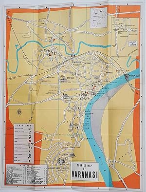
Tourist Map of Varanasi.
Verlag: (Circa1960)., 1960
Anbieter: Asia Bookroom ANZAAB/ILAB, Canberra, ACT, Australien
Verkäuferbewertung 5 von 5 Sternen
Folding colour tourist map of Varanasi in Uttar Pradesh province, two inset maps, of India and a gude map of Sarnath, legend and key, select Ghats shown, railways, "western style" and "Indian style" hotels marked, in very good condition. 42.9 x 33.1 cm.
-

Map of Kyoto.
Verlag: (Circa1978)., [Kyoto]., 1978
Anbieter: Asia Bookroom ANZAAB/ILAB, Canberra, ACT, Australien
Verkäuferbewertung 5 von 5 Sternen
Colour map of Kyoto, with inset maps of Sanjo and Shijo, Okazaki, and the vinicity of Kyoto Station. On reverse is a transportation guide to the city, alongside a map of the bus network. 70.5 x 36cm, tightly folding into 16 panels. Margins and fold points trifle worn, though overall in very good condition. A convenient map of Kyoto, aimed at English-speaking tourists. Rail and cable car links are clearly laid out, and places of interest are labelled, with particular attention devoted to the city's numerous temples.
-
Pakistan Tourist Map.
Verlag: Department of Tourism, Government of Pakistan., Karachi., 1965
Anbieter: Asia Bookroom ANZAAB/ILAB, Canberra, ACT, Australien
Verkäuferbewertung 5 von 5 Sternen
Accordion fold map with profuse colour illustrations. 48 x 66.5cm, folded 24 x 11.3cm. Light creases at margins, little chipped in one corner, overall a very good copy.
-
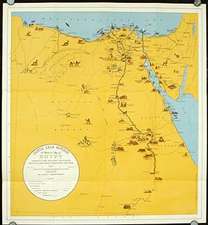
Welcome to Egypt U. A. R.
Verlag: State Tourist Administration; Institut Graphique Egyptien., Cairo., 1959
Anbieter: Asia Bookroom ANZAAB/ILAB, Canberra, ACT, Australien
Verkäuferbewertung 5 von 5 Sternen
Folding pictorial colour map, 47.5 x 43.8 cms; 51.7 x 47.7 cms (sheet) folding into plain title wrappers 21 x 12 text in panels on verso, in very good, bright condition. Brightly coloured tourist map of Egypt and the Middle East, with pictographs of various tombs, temples, oases, and wildlife, roads and railways. Information for the tourist about Egypt and Syria including a brief history, hotels, transport, health and currency are printed on the verso.
-
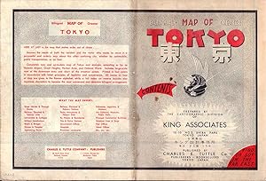
Bilingual Map of Greater Tokyo.
Verlag: Charles E. Tuttle Company., Tokyo., 1954
Anbieter: Asia Bookroom ANZAAB/ILAB, Canberra, ACT, Australien
Verkäuferbewertung 5 von 5 Sternen
Printed four colour map, 92 x 71cm; 102.5 x 74.5cm (sheet), folding into pictorial wrappers, 25.6 x 19 cms, inset map of the Marounouchi District and on the verso an extensive grid reference in English and Japanese and, over four panels, a map of the streetcar, railway and subway system, scant spotting to cover, two small fold splits (without loss) and toning most evident at the folds, in very good condition. Comprehensive 1950s map of Tokyo by US publisher Charles E. Tuttle "Here at last is the map that makes order out of chaos.extending as far as Haneda Airport, Grant Hights, Harbor Area, and Nakano Ward" (blurb).
-

Tourist's Egyptian Companion 1955-1956 (Fourth English Edition) L'indicateur touristique d'Egypte
Verlag: Published by A. Karama & Co., 13 Abdel Khalek Saroit Street, Cairo, Egypt | Printed by S. O. P. Press, Cairo, Egypt Fourth English Edition | 1956. 1955 | 1956., 1955
Anbieter: Little Stour Books PBFA Member, Canterbury, Vereinigtes Königreich
Verbandsmitglied: PBFA
Verkäuferbewertung 5 von 5 Sternen
EUR 47,71
EUR 34,74 Versand
Versand von Vereinigtes Königreich nach USAAnzahl: 1 verfügbar
In den WarenkorbFourth English edition in publisher's original colour illustrated card wrap covers (soft back). 8vo. 6½'' x 5''. Contains 219 pp + 4 pp advertisements with monochrome illustrations and photographs throughout, 2 folding colour street maps. Small repaired tear to the front fore edge, else in Very Good condition, no dust wrapper as issued. Member of the P.B.F.A. NORTH AFRICA [Egypt].
-
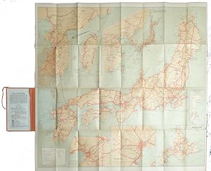
Travelers' Map of Japan, Chosen (Korea), Taiwan (Formosa), with Brief Descriptions of the Principal Tourist Points in Japan. 1927.
Verlag: Japanese Government Railways. (Circa1927)., [Tokyo]., 1927
Anbieter: Asia Bookroom ANZAAB/ILAB, Canberra, ACT, Australien
Verkäuferbewertung 5 von 5 Sternen
Large folding colour map, 78.5 x 80 cm, of Japan and Korea, 6 inset maps one of which shows Taiwan, scale 1:1,640,000 for Hondo, Shikoku and Kyushu, 1:2340,000 for Chosen; tipped into the original orange cloth covered case with orange ties, text in 31 panels on the verso (one a little age-toned), a few very small fold splits without loss, a very good copy. Attractive tourist map for the English-speaking traveller, issued by the Japanese Government Railways with extensive notes for tours and points of interest on the verso, short descriptions of cities and sites to visit, principal theatres, with suggestions for cafes, restaurants and department stores.
-
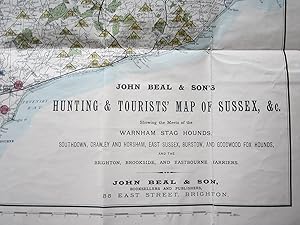
John Beal & Son's Hunting & Tourist Map of Sussex, &c, showing the Meets of the Warnham Stag Hounds, Southdown, Crawley and Horsham, East Sussex, Burstow, and Goodwood Fox Hounds, and the Brighton, Brookside, and Eastbourne Harriers.
Verlag: John Beal & Son, Brighton, 1875
Anbieter: Angelika C. J. Friebe Ltd. - MapWoman, Dorking, Vereinigtes Königreich
Verkäuferbewertung 4 von 5 Sternen

Karte
EUR 351,86
EUR 23,16 Versand
Versand von Vereinigtes Königreich nach USAAnzahl: 1 verfügbar
In den WarenkorbSoft cover. Zustand: Very Good. colourprinted folding map; overall 48 x 89 cm, folds as issued; on linen; some damage in crossfolds; occassionally paper lifted off the folds; small faint stain in lower part of the map; o verso, cloth discolured; o/w vg cond. green cloth cover; overall 19,5 x 11 cm; some wear and tear; o/w vg cond. 10pp booklet attached to cover; some discolouration; o/w vg cond.- A very attractive map of Sussex with parts of Surrey, Hampshire and Kent, outlining the various meets. The booklet contains detailed references to the meets with information about their meets.
-
Map of Japan Shewing Connections Chosen Manchuria North-China.
Verlag: Thomas Cook and Son; Box of Curios Press [circa1914]., Yokohama., 1914
Anbieter: Asia Bookroom ANZAAB/ILAB, Canberra, ACT, Australien
Verkäuferbewertung 5 von 5 Sternen
Folding coloured map of Japan showing steamship and railway routes picked out in red, 28.5 x 336.2cms, large inset map shows Japan's connections with Korea, Manchuria and North China; tipped into the original blue card title-wrappers, small professionally sealed tear to a lower margin (no loss), early owner's neat inked tracing to a few railway routes, and, a note to the front cover "Ymato - Kobe - left side of Torr Rd." tracing; but overall an excellent copy of a scarce item of Thomas Cook ephemera. Very scarce early 20th Century map of Japan for English speaking tourists. We can find no copies listed on WorldCat. Although the wrappers bear the Thomas Cook logo used in the late 19th Century, the map carries the updated logo (adding the ribbon "Australasia") in use from 1914 until the late 1920s.
-
EUROREGION Pro Europa Viadrina. Mapa Turystyczna. Touristische Karte . Tourist Map 1 : 150 000
ISBN 10: 8392704193 ISBN 13: 9788392704195
Anbieter: Bildungsbuch, Flensburg, Deutschland
Verkäuferbewertung 5 von 5 Sternen
Karte
Kein Einband. Zustand: Sehr gut. Super Landkarte der Region von Berlin über Frankfurt/Oder und Slubice bis nach Gorzow Wlkp (ehem. Landsberg) mit Reisehinweisen auf deutsch, englisch (in English) und polnisch (polski). Mit eingezeichneten Fernradwanderwegen, ungefähr Stand 2009/2010, unbenutzt, sofort lieferbar. Mittlere Oder MOL LOS FFO ASL mit Eisenhüttenstadt Land Brandenburg Dörfer und Städte, deckt u.a. den Bereich des ehem. Bezirks Frankfurt/Oder ab. Links und rechts der Staatsgrenze an der Oder.
-
Intourist Map of the Soviet Union
Verlag: Intourist Inc., (New York), 1939
Anbieter: Antipodean Books, Maps & Prints, ABAA, Garrison, NY, USA
Verbandsmitglied: ABAA ANZAAB ESA ILAB
Verkäuferbewertung 3 von 5 Sternen

A large pictorial map of the Soviet Union and Europe, with two inset maps "To the Far East via the Trans-Siberian Railroad" and "Europe - Iran via the U.S.S.R. 4 1/2 days", along with 9 b&w images of life in the USSR. The USSR is outlined in a dark brown/black border, and with a comparable land mass to all of Europe, is suggestive of their power. Text "Intourist suggested itineraries for 1939" lists 25 tours. Printed in color, with the address Intourist, Inc. 545 Fifth Avenue, New York City. Map 24 x 17 1/2", folded 4 x 8 7/8". Two very short separations in a fold line, overall very good condition.
-

Kuala Lumpur Tourist Map. ZOOM with Supershell.
Verlag: Kuala Lumpur Tourist Association., Kuala Lumpur., 1970
Anbieter: Asia Bookroom ANZAAB/ILAB, Canberra, ACT, Australien
Verkäuferbewertung 5 von 5 Sternen
Colour map of Kuala Lumpur. 53.5 x 39cm, folding into 12 panels. Extremities trifle worn, though overall in very good condition. An advertisement for Royal Dutch Shell, crossed with a tourist map and directory to Kuala Lumpur. The map shows the city's streets, principal attractions, and the locations of Shell petrol stations. On the reverse is a directory of tourist-relevant companies.
-
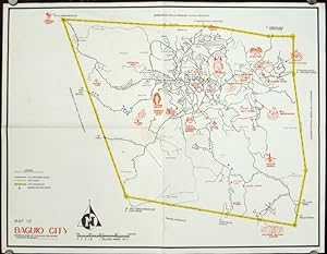
Map of Baguio City Showing Some of Its Major and Minor Tourists Interests.
Verlag: circa1960., 1960
Anbieter: Asia Bookroom ANZAAB/ILAB, Canberra, ACT, Australien
Verkäuferbewertung 5 von 5 Sternen
Printed pictorial map 44.8 x 58 cms, 46.7 x 60.3 cms (sheet), original folds (a little wear), but in very good condition. Attractive 1960s tourist map of Baguio city when it was the "Summer Capital" of the Philippines. Tourist attractions are shown pictorially in red, blue triangles denote wood carving shops, the city boundaries outlined in yellow, sealed and unsealed roads are also shown.
-

Official All-Year Club Sight-Seeing Map Southern California.
Erscheinungsdatum: 1953
Anbieter: Geographicus Rare Antique Maps, Brooklyn, NY, USA
Verbandsmitglied: ABAA ESA ILAB
Verkäuferbewertung 3 von 5 Sternen
Karte
Good. Exhibits light wear along original fold lines. Unrepaired fold separations and slight loss at a few fold intersections because both recto and verso have visual merit. Text and map of Los Angeles County on verso. Size 27.5 x 22.5 Inches. This is a 1953 All-Year Club of Southern California pictorial tourist map. Coverage extends from Topaz Lake south to the U.S. - Mexico border and from the Pacific Ocean to the California - Nevada border. Pictorial vignettes add charm. Tourists are illustrated sunbathing, fishing, surfing, hiking, and rock climbing, while a rancher, a covered wagon, and a miner reference the region's history. Grapes, oranges, giant sequoias, and cacti highlight the breadth of California's flora. Block texts introduce the region's eight counties, recount history, and highlight places of interest. A yellow box in the upper right includes the All-year Club's pitch that weather in southern California is ideal year-round. The All-Year Club of Southern California By the 1910s, Southern California was already a winter destination, a haven for easterners keen to escape New England winters. By the early 1920s, businessmen realized tourism need not be seasonal; Southern California's 'amazing' weather could draw visitors year-round. In 1921, a group of nineteen Southern California businessmen, led by Harry Chandler (publisher of the Los Angeles Times ), created the All-Year Club of Southern California as a spin-off of the Los Angeles Chamber of Commerce. The club lobbied the county Board of Supervisors for funding to sell southern California as a summer resort. The push began in Texas, Arizona, and Oklahoma, where residents would see L.A.'s ninety degrees days with low humidity as relief from the sweltering Midwestern summer. That year, a single large resort reported a daily increase of 100 visitors. Likewise, the Santa Fe, Southern Pacific, and Union Pacific railroads reported record ticket sales during the summer of 1921. These early successes were proof of concept for the All-Year Club, and so it expanded promotion. Numbers continued to rise, as did the Club's budget, and by 1926 the All-Year Club was spending $450,000 on advertising and promotional material. However, not everything was positive. Even though SoCal was booming, ads only wanted tourists, not job-seekers. The ads stated categorically that tourists were welcome, but job-seekers were not, since they would not be able to find work. Nonetheless, the hopeful unemployed came, leading to an ongoing population boom. The All-Year Club of Southern California operated under that name until 1968, when it became the Greater Los Angeles Visitors and Convention Bureau, which later merged with the Southern California Visitors Council. Until 2012, the organization had been known as LA Inc., and today it is the Los Angeles Tourism and Convention Board. Publication History and Census This map was created for and published by the All-Year Club of Southern California in 1953. This map is well represented in institutional collections. References: OCLC 150565292.
-

Sumatra (W. Coast)
Erscheinungsdatum: 1920
Anbieter: Geographicus Rare Antique Maps, Brooklyn, NY, USA
Verbandsmitglied: ABAA ESA ILAB
Verkäuferbewertung 3 von 5 Sternen
Karte
Very good. Light wear along original fold lines. Verso repairs to fold separations. Blank on verso. Size 16.5 x 11.75 Inches. This is a 1920 Dutch East Indies Official Tourist Bureau map of the Padang Highlands in Sumatra. The map depicts the region from the Indian Ocean and the Lake of Manindjau to Sawah Loento and from Soeliki to Boengoes Bay. Numerous cities, towns, and villages are labeled throughout the region. Three different grades of road are illustrated: a high road, a cart road, and a horse path. Railways are also included. Padang itself if situated near the center of the bottom border, very close to the map's key. Rivers, lakes, and mountain peaks are also noted, and the elevation of most of the mountain peaks are given in meters. This map was created for the Dutch East Indies Official Tourist Bureau and published in 1920.
-

Fun Map of Nevada City California.
Erscheinungsdatum: 1950
Anbieter: Geographicus Rare Antique Maps, Brooklyn, NY, USA
Verbandsmitglied: ABAA ESA ILAB
Verkäuferbewertung 3 von 5 Sternen
Karte
Good. Light soiling. Light wear along original fold lines. Closed edge tear professionally repaired on verso. Crease to upper right corner. Size 17.25 x 22 Inches. This is a c. 1950 George Mathis pictorial map of Nevada City, California. Formerly a Gold Rush boom town, the Nevada City of today is a magnet for outdoor enthusiasts. A Closer Look The map is centered on Nevada City. The region's outdoor recreation camps are prominently labeled, including two Girl Scout camps. Rivers, lakes, and creeks appear a bright blue, underscoring the abundant fishing opportunities. Lake Tahoe appears in the upper right corner. Fishermen appear alongside hunters (one of whom is being chased by a bear), golfers, and vacationers. References to the area's mining past appear in the form of a mining cart and prospector along the bottom edge, several abandoned mining shafts, and a runaway stagecoach on the right. Advertisements for local businesses frame the map on the left side and bottom. Publication History and Census This map was drawn by George Mathis and published by the Nevada City Chamber of Commerce c. 1950. It is dated based on Mathis's signature along the right border, which states that he lives in Nevada City. Mathis did not move to Nevada City until 1948, making 1950 the earliest likely publication date. We note a single example cataloged in OCLC, located at the California Historical Society. Scarce to the market. References: OCLC 1009086589.
-
Lebanon Touristic Map.
Erscheinungsdatum: 1950
Anbieter: Geographicus Rare Antique Maps, Brooklyn, NY, USA
Verbandsmitglied: ABAA ESA ILAB
Verkäuferbewertung 3 von 5 Sternen
Karte
Good. Verso repair to fold separation. Exhibits wear along original fold lines and slight loss at original fold intersections. Text and printed images on verso. Size 18 x 23 Inches. This is a very scarce c. 1950 tourist guide and map of Lebanon evoking a halcyon era before the outbreak of the Lebanese Civil War of 1958 and the subsequent Lebanese Civil War (1975 - 1990). The color-printed folding brochure is filled with scenic photographs of the country, with the interior dominated by an attractive pictorial map. Although the map is not dated, the cover (depicting a stylish, European trekking couple enjoying a vista overlooking a winding coastal road) bears the signature 'B.N. 50.,' suggesting a terminus post quem of 1950. The Map Color and shading indicate topography and agricultural viability, evoking Lebanon's mountain ranges and the key agricultural area of the Beqaa Valley. A lovely compass rose embellished with the Zodiac adorns the upper left and old-fashioned sailing ships are depicted off the coast. Orange lines trace Lebanon's road network. The black line along the coast highlights a Lebanese railway, while other inland routes follow the tracks of the Beirut-Damascus and the Rayak-Homs lines. Publication History and Census The map was printed by the Catholic Press on behalf of the Tourist Bureau of the Lebanese Government. No individual author or artist is credited. We see no examples listed in institutional collections and find no instances of the map in dealers' catalogues or auction records.
-
G. Woolworth Colton's Railroad, Township and Distance Map of New England with adjacent portions of New York, Canada and New Brunswick.
Erscheinungsdatum: 1862
Anbieter: Geographicus Rare Antique Maps, Brooklyn, NY, USA
Verbandsmitglied: ABAA ESA ILAB
Verkäuferbewertung 4 von 5 Sternen
Karte
Very good. Exhibits wear along original fold lines. Laid down on archival tissue. Exhibits minor loss at a handful of fold intersections. Accompanies original gilt-stamped linen binder. Size 38.5 x 28 Inches. This is an 1862 George Woolworth and Charles B. Colton railroad pocket map of New England - illustrating a period of brisk industrialization, railroad construction, and democratization of travel. A Closer Look The map details the expanding New England railroad network extending from Maine and Quebec to Long Island. Towns and villages along the railroad lines are identified, with mileage provided. An inset in the lower right focuses on the busy eastern Massachusetts corridor between Boston and Worcester. A table above the inset contains distances by rail from nearly 200 towns to New York, Hartford, Providence, Boston, Montpelier, Concord, and Augusta. Railroads of New England In 1862, New England railroads were experiencing rapid growth and played a vital role in the region's economy and transportation network. The rail lines connected major cities such as Boston, Providence, and Hartford, and extended into rural areas, facilitating the movement of goods, people, and raw materials, particularly during the ongoing Civil War. Railroads like the Boston and Maine, the New York, New Haven, and Hartford Railroad, and the Vermont Central were instrumental in transporting manufactured goods, agricultural products, and coal, which was crucial for the industrial operations in New England's factories and mills. Despite the challenging terrain, including mountains and rivers, the development of extensive rail infrastructure helped knit together the region's economy, supported the Union war effort, and laid the foundation for future industrial expansion. Publication History and Census This map was created by George Woolworth and Charles B. Colton. It bears a copyright of 1861, but is also dated in the title to 1862, this example representing the second edition. Multiple subsequent editions followed to about 1886. While published in quantity, early editions are scarce to the market. We do not see an OCLC reference for the 1861 edition, as here.
-

Karnten Austria.
Erscheinungsdatum: 1953
Anbieter: Geographicus Rare Antique Maps, Brooklyn, NY, USA
Verbandsmitglied: ABAA ESA ILAB
Verkäuferbewertung 3 von 5 Sternen
Karte
Very good. Light wear along original fold lines. Printed photographs on verso. Size 16.25 x 23.5 Inches. This is a c. 1953 Heinz Ebner pictorial map of Kärnten (Carinthia), Austria. Pictorial vignettes illustrate cities and towns throughout Kärnten, the southernmost state in Austria bordering modern-day Slovenia and Italy. Tourists appear skiing and sunbathing, while locals are depicted dancing and painting. Beautiful illustrations highlight churches, fortresses, and other buildings in the state. German and English text promote Kärnten / Carinthia as a tourist destination and laud its mountains, lakes, majestic scenery, and health spas. Printed photographs on both the recto and verso provide potential tourists with stunning views of both scenery and architecture. Publication History and Census This map was drawn by Heinz Ebner and published by the State Tourist Office for Kärnten c. 1953. This is the only known cataloged example.
-

Pleasure Map of St. Petersburg Florida.
Erscheinungsdatum: 1953
Anbieter: Geographicus Rare Antique Maps, Brooklyn, NY, USA
Verbandsmitglied: ABAA ESA ILAB
Verkäuferbewertung 3 von 5 Sternen
Karte
Very good. Exhibits light wear along original fold lines. Text and map of downtown St. Petersburg on verso. Size 17.75 x 12 Inches. This is a 1953 Thomas Griffith and Robert McCarthy tourist map of St. Petersburg, Florida. Depicting the entirety of St. Petersburg, the map highlights the main thoroughfares and many points of interest around the city. Among these are the botanical garden, Lakewood Country Club, and the Florida Wild Animal and Reptile Ranch. According to the text along the bottom, studying this piece makes getting around St. Petersburg 'easy'. Verso Content On the verso, a detailed map of downtown St. Petersburg covers from 13th Street N. to Tampa Bay and from 22nd Avenue N. to Newton Avenue. Forty-nine locations are numerically identified and correspond with an index along the bottom border. The Mound Park Hospital, St. Anthony's Hospital, Mirror Lake, Crescent Lake, and Albert Whitted Municipal Airport are labeled directly. Publication History and Census This map was created by Griffith-McCarthy Inc. in 1953. Three examples are cataloged in OCLC and are part of the collections at Syracuse University, Ball State University, and Pennsylvania State University. A fourth example is part of the Touchton Map Collection at the Tampa Bay History Center. References: Tampa Bay History Center, Touchton Map Library, #2018.136.005. OCLC 59281415, 1021049453.
-

St. Petersburg, Florida. / St. Petersburg Florida Pleasure Map.
Erscheinungsdatum: 1947
Anbieter: Geographicus Rare Antique Maps, Brooklyn, NY, USA
Verbandsmitglied: ABAA ESA ILAB
Verkäuferbewertung 4 von 5 Sternen
Karte
Very good. Light wear along original fold lines. Map of downtown St. Petersburg on verso. Size 17.5 x 11.75 Inches. This is a 1947 Griffith Advertising Agency pictorial tourist map of St. Petersburg, Florida. The 'pleasure map', a unique Florida genre, was produced to promote the region as an escape from winter. A Closer Look Coverage embraces St. Petersburg and its immediate environs, including Long Key and part of Pine Key. Labeled locations throughout include mini-illustrations, such as several schools, hospitals, and golf courses, along with the Florida Military Academy and the Sky Harbor Airport. Other illustrations of sunbathers frolicing on the beach, fishing, and boating complete the image of a 'pleasure map'. Verso Content A map of downtown St. Petersburg occupies half the verso. Street, lakes, parks, railroad stations, and the spring training grounds of the New York Yankees are labeled. Forty-six locations are numerically identified and correspond with an index along the bottom border. Publication History and Census This map was created and published by the Griffith Advertising Agency in 1947. We note at least two previous editions of a 'Pleasure Map of St. Petersburg' published by the Griffith Advertising Agency, c. 1937. The 1937 map is significantly different, making it difficult to refer to it as an edition of the same map (c.f. Geographicus: PleasureMapStPetersburg-griffith-1937). The Griffith Advertising Agency published at least two subsequent editions: one in 1948 and the other in 1950. Both the 1948 and 1950 editions are nearly identical, except the stippling along the coastline to illustrate shallow water is changed in each edition, progressively making the text more legible. This is the only confirmed example of the 1947 edition.
-

Pleasure Map of St. Petersburg Florida.
Erscheinungsdatum: 1937
Anbieter: Geographicus Rare Antique Maps, Brooklyn, NY, USA
Verbandsmitglied: ABAA ESA ILAB
Verkäuferbewertung 3 von 5 Sternen
Karte
Very good. Light wear long original fold lines. Very minimal loss at two fold intersections. Chip to bottom edge. Size 18 x 16 Inches. This is a c. 1937 Griffith Advertising Agency pictorial tourist map of St. Petersburg, Florida. A Closer Look Pictorial vignettes highlight the city's golf courses, beaches, and tropical flora. Fishing and sailing boats ply the waters of Tampa Bay, Boca Ciega Bay, and the Gulf of Mexico. Illustrations of fish and seabirds add charm, while airplanes reinforce the modern era of 'easy' transportation and travel. Printed photographs frame the map on three sides, promoting St. Petersburg as a vacation destination. A map of downtown St. Petersburg occupies half the verso. Publication History and Census This map was created and published by the Griffith Advertising Agency for the St. Petersburg Chamber of Commerce c. 1937. There are two states. The difference between states lies in the photographs in the upper-right and upper-left corners. Unfortunately, as neither state is dated, it is impossible to tell which has primacy. We have previously offered the other state (see PleasureMapStPetersburg-griffith-1937). We note a single cataloged example, at the Miami-Dade Public Library.
-

Visit Florida State Parks and Historic Memorials.
Erscheinungsdatum: 1970
Anbieter: Geographicus Rare Antique Maps, Brooklyn, NY, USA
Verbandsmitglied: ABAA ESA ILAB
Verkäuferbewertung 4 von 5 Sternen
Karte
Very good. Verso repair to a fold separation. Text on verso. Size 18 x 16 Inches. This is a c. 1970 pictorial tourist map of Florida. Ringed by photographs of Florida attractions and activities, the map depicts the state from Alabama to the Atlantic Ocean and from Georgia and Alabama to Key West. Pictorial vignettes highlight state parks and historic memorials throughout the state, including the Florida Caverns, Manatee Springs, Turtle Mound, and Collier Seminole. A key to the left of Key West notes that four different symbols are used when marking sites around the state: circles mark parks that are in operation, squares mark partially developed parks, and triangles note undeveloped parks. Diamonds denote historic landmarks. Publication History This map was published by the Florida Board of Parks and Historic Memorials c. 1970.
-

Visit Florida State Parks and Historic Memorials. Florida's State Parks Invite You.
Erscheinungsdatum: 1960
Anbieter: Geographicus Rare Antique Maps, Brooklyn, NY, USA
Verbandsmitglied: ABAA ESA ILAB
Verkäuferbewertung 4 von 5 Sternen
Karte
Very good. Light wear along original fold lines. Text on verso. Size 18 x 16 Inches. This is a c. 1960 pictorial tourist map of Florida. Ringed by photographs of Florida attractions and activities, the map depicts the state from Alabama to the Atlantic Ocean and from Georgia and Alabama to Key West. Pictorial vignettes highlight state parks and historic memorials throughout the state, including the Florida Caverns, Manatee Springs, Turtle Mound, and Collier Seminole. A legend to the left of Key West notes that four different symbols are used when marking sites around the state: circles mark parks that are in operation, squares mark partially developed parks, and triangles note undeveloped parks. Diamonds denote historic landmarks. The Florida Board of Parks and Historic Memorials The Florida Board of Parks and Historic Monuments was created in 1949 and was charged with 'preserving historical sites and memorials, presenting interpretations to the public and contribut[ing] materially to the development of a strong mental, moral and physical fiber in the people'. In 1969, the Florida Board of Parks and Historic Monuments merged with the Outdoor Recreational Development Council and formed the Division of Recreation and Parks which was part of the Department of Natural Resources. Publication History This map was published by the Florida Board of Parks and Historic Memorials c. 1960. Not in the OCLC, but we note an example at the Touchton Map Library at the Tampa Bay History Center. References: Tampa Bay History Center, Touchton Map Library 2019.132.001.


![Bild des Verkäufers für ?????. [Hangzhou you lan tu]. [Tourist Map of Hangzhou]. zum Verkauf von Asia Bookroom ANZAAB/ILAB](https://pictures.abebooks.com/inventory/md/md22891403587.jpg)