Sidney hall (173 Ergebnisse)
- Softcover
Anbieter: BooksRun, Philadelphia, PA, USABooksRun
Verkäufer/-in kontaktierenVerkäufer/-in mit 5 SternenZustand: Gebraucht - Ausreichend
EUR 4,78
Versand nach gratisVersand innerhalb von USAAnzahl: 1 verfügbar
Paperback. Zustand: Fair. The item might be beaten up but readable. May contain markings or highlighting, as well as stains, bent corners, or any other major defect, but the text is not obscured in any way.

- Softcover
Anbieter: World of Books (was SecondSale), Montgomery, IL, USAWorld of Books (was SecondSale)
Verkäufer/-in kontaktierenVerkäufer/-in mit 5 SternenZustand: Gebraucht - Befriedigend
EUR 5,40
Versand nach gratisVersand innerhalb von USAAnzahl: 1 verfügbar
Zustand: Good. Item in good condition. Textbooks may not include supplemental items i.e. CDs, access codes etc.
- Softcover
Anbieter: ThriftBooks-Dallas, Dallas, TX, USAThriftBooks-Dallas
Verkäufer/-in kontaktierenVerkäufer/-in mit 5 SternenZustand: Gebraucht - Gut
EUR 6,02
Versand nach gratisVersand innerhalb von USAAnzahl: 1 verfügbar
Paperback. Zustand: Very Good. No Jacket. May have limited writing in cover pages. Pages are unmarked. ~ ThriftBooks: Read More, Spend Less.
- Softcover
Anbieter: ThriftBooks-Dallas, Dallas, TX, USAThriftBooks-Dallas
Verkäufer/-in kontaktierenVerkäufer/-in mit 5 SternenZustand: Gebraucht - Gut
EUR 6,10
Versand nach gratisVersand innerhalb von USAAnzahl: 1 verfügbar
Paperback. Zustand: Very Good. No Jacket. May have limited writing in cover pages. Pages are unmarked. ~ ThriftBooks: Read More, Spend Less.
- Hardcover
- Erstausgabe
Anbieter: BooksRun, Philadelphia, PA, USABooksRun
Verkäufer/-in kontaktierenVerkäufer/-in mit 5 SternenZustand: Gebraucht - Gut
EUR 6,55
Versand nach gratisVersand innerhalb von USAAnzahl: 1 verfügbar
Hardcover. Zustand: Very Good. First Edition. With dust jacket. It's a well-cared-for item that has seen limited use. The item may show minor signs of wear. All the text is legible, with all pages included. It may have slight markings and/or highlighting.
- Hardcover
Anbieter: ThriftBooks-Atlanta, AUSTELL, GA, USAThriftBooks-Atlanta
Verkäufer/-in kontaktierenVerkäufer/-in mit 5 SternenZustand: Gebraucht - Befriedigend
EUR 8,53
Versand nach gratisVersand innerhalb von USAAnzahl: 1 verfügbar
Hardcover. Zustand: Good. No Jacket. Pages can have notes/highlighting. Spine may show signs of wear. ~ ThriftBooks: Read More, Spend Less.
- Softcover
Anbieter: Henry Hollander, Bookseller, Los Angeles, CA, USAHenry Hollander, Bookseller
Verkäufer/-in kontaktierenVerkäufer/-in mit 4 SternenZustand: Gebraucht - Gut
EUR 4,47
EUR 6,13 VersandVersand innerhalb von USAAnzahl: 1 verfügbar
Softbound. Zustand: Very Good. Small octavo, glossy paper covers, xvi, 192 pp., notes, bibliography, index.

- Softcover
- Signiert
Anbieter: A Squared Books (Don Dewhirst), South Lyon, MI, USAA Squared Books (Don Dewhirst)
Verkäufer/-in kontaktierenVerkäufer/-in mit 5 SternenZustand: Gebraucht - Gut
EUR 9,02
EUR 5,69 VersandVersand innerhalb von USAAnzahl: 1 verfügbar
paperback. Zustand: Very Good. Brookline, 1994; signed by author on title page; illustrated paper covers; mild corner wear; 8vo, 7 3/4" to 9 3/4" tall; interior is clean and unmarked; 50 pages. Signed by Author.
- Hardcover
Anbieter: Roundabout Books, Greenfield, MA, USARoundabout Books
Verkäufer/-in kontaktierenVerkäufer/-in mit 4 SternenVerbandsmitglied: SNEAB
Zustand: Gebraucht - Gut bis sehr gut
EUR 15,17
Versand nach gratisVersand innerhalb von USAAnzahl: 1 verfügbar
hardcover. Zustand: Near Fine. Excellent, unmarked copy with little wear and tight binding. We ship in recyclable American-made mailers. 100% money-back guarantee on all orders.

- Hardcover
Anbieter: Majestic Books, Hounslow, Vereinigtes KönigreichMajestic Books
Verkäufer/-in kontaktierenVerkäufer/-in mit 4 SternenZustand: Neu
EUR 15,76
EUR 7,63 VersandVersand von Vereinigtes Königreich nach USAAnzahl: 4 verfügbar
Zustand: New. pp. 203.

Verlag: Scholastic, Incorporated, 2018
Anbieter: Better World Books, Mishawaka, IN, USABetter World Books
Verkäufer/-in kontaktierenVerkäufer/-in mit 5 SternenZustand: Gebraucht - Befriedigend
EUR 10,78
Versand nach gratisVersand innerhalb von USAAnzahl: 1 verfügbar
Zustand: Good. Pages intact with minimal writing/highlighting. The binding may be loose and creased. Dust jackets/supplements are not included. Stock photo provided. Product includes identifying sticker. Better World Books: Buy Books. Do Good.

- Softcover
Anbieter: ThriftBooks-Atlanta, AUSTELL, GA, USAThriftBooks-Atlanta
Verkäufer/-in kontaktierenVerkäufer/-in mit 5 SternenZustand: Gebraucht - Befriedigend
EUR 25,93
Versand nach gratisVersand innerhalb von USAAnzahl: 1 verfügbar
Paperback. Zustand: Good. No Jacket. Pages can have notes/highlighting. Spine may show signs of wear. ~ ThriftBooks: Read More, Spend Less.

Verlag: Berkeley, 1908
- Hardcover
Anbieter: Books From California, Simi Valley, CA, USABooks From California
Verkäufer/-in kontaktierenVerkäufer/-in mit 4 SternenZustand: Gebraucht - Befriedigend
EUR 13,53
EUR 4,37 VersandVersand innerhalb von USAAnzahl: 1 verfügbar
hardcover. Zustand: Good. Ex-library copy with usual markings. Cover and edges shows shelf wear. Pages are clean and intact.

- Softcover
Anbieter: PBShop.store US, Wood Dale, IL, USAPBShop.store US
Verkäufer/-in kontaktierenVerkäufer/-in mit 5 SternenZustand: Neu
EUR 28,84
Versand nach gratisVersand innerhalb von USAAnzahl: 15 verfügbar
PAP. Zustand: New. New Book. Shipped from UK. Established seller since 2000.
- Softcover
Anbieter: PBShop.store UK, Fairford, GLOS, Vereinigtes KönigreichPBShop.store UK
Verkäufer/-in kontaktierenVerkäufer/-in mit 5 SternenZustand: Neu
EUR 27,30
EUR 4,88 VersandVersand von Vereinigtes Königreich nach USAAnzahl: 15 verfügbar
PAP. Zustand: New. New Book. Shipped from UK. Established seller since 2000.
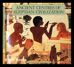
Ancient centres of Egyptian civilization / editors, H. S. Smith [and] Rosalind M. Hall
Smith, H. S. (Harry Sidney) [editor]. Hall, Rosalind M. [editor]
Verlag: London : Egyptian Education Bureau, 1983
- Softcover
Anbieter: MW Books, New York, NY, USAMW Books
Verkäufer/-in kontaktierenVerkäufer/-in mit 5 SternenZustand: Gebraucht
EUR 20,81
Versand nach gratisVersand innerhalb von USAAnzahl: 1 verfügbar
Early Edition. Near fine paperback copy; edges very slightly dust-dulled. Remains particularly well-preserved overall; tight, bright, clean and especially sharp-cornered. Physical description; 100 pages : illustrations (some colour) ; 20 x 21 cm. Subjects; Historic sites Egypt. Egypt Civilization 332 B.C.-638 A.D. Egypt Antiquit…ies. Egypt Description and travel. 3 Kg.

Autocracy and Insurgency in Organized Labor
Hall, Burton H. (Editor); New Politics Magazine; Barnes, Fred; Cole, John; Denby, Charles; Feldman, Clarice R.; Ferrara, Fred; Hill, Herbert; Jacobson, Julius; Langley, David; Lens, Sidney; Morrissey, James; Prickett, James; Shanker, Albert; Tyler, Gus; Spira, Henry; Weir, Stanley; Youngdahl, James; Zeluck, Steve
Sprache: Englisch
Verlag: Transaction Books (E.P. Dutton and Company), New Brunswick, NJ, 1972
- Softcover
Anbieter: Second Edition Books, Butte, MT, USASecond Edition Books
Verkäufer/-in kontaktierenVerkäufer/-in mit 5 SternenZustand: Gebraucht - Gut
EUR 27,07
EUR 4,82 VersandVersand innerhalb von USAAnzahl: 1 verfügbar
Soft cover. Zustand: Very Good -. Binding tight; interior clean; previous owner name on first title page. Black and white wraps with minor shelf wear; light creasing upper front. A collection of essays providing voice to insurgent members of unions, describing their efforts to achieve membership participation and control of thei…r unions. 348pp.

- Softcover
Anbieter: Ria Christie Collections, Uxbridge, Vereinigtes KönigreichRia Christie Collections
Verkäufer/-in kontaktierenVerkäufer/-in mit 5 SternenZustand: Neu
EUR 18,03
EUR 14,07 VersandVersand von Vereinigtes Königreich nach USAAnzahl: Mehr als 20 verfügbar
Zustand: New. In.

- Softcover
Anbieter: Ria Christie Collections, Uxbridge, Vereinigtes KönigreichRia Christie Collections
Verkäufer/-in kontaktierenVerkäufer/-in mit 5 SternenZustand: Neu
EUR 19,08
EUR 14,07 VersandVersand von Vereinigtes Königreich nach USAAnzahl: Mehr als 20 verfügbar
Zustand: New. In.

- Hardcover
Anbieter: PBShop.store US, Wood Dale, IL, USAPBShop.store US
Verkäufer/-in kontaktierenVerkäufer/-in mit 5 SternenZustand: Neu
EUR 38,74
Versand nach gratisVersand innerhalb von USAAnzahl: 15 verfügbar
HRD. Zustand: New. New Book. Shipped from UK. Established seller since 2000.
- Hardcover
Anbieter: PBShop.store UK, Fairford, GLOS, Vereinigtes KönigreichPBShop.store UK
Verkäufer/-in kontaktierenVerkäufer/-in mit 5 SternenZustand: Neu
EUR 35,76
EUR 5,89 VersandVersand von Vereinigtes Königreich nach USAAnzahl: 15 verfügbar
HRD. Zustand: New. New Book. Shipped from UK. Established seller since 2000.
Verlag: Roehr, Berlin, 1920
- Softcover
Anbieter: Malota, Klosterneuburg, ÖsterreichMalota
Verkäufer/-in kontaktierenVerkäufer/-in mit 5 SternenZustand: Gebraucht - Befriedigend
EUR 8,00
EUR 19,00 VersandVersand von Österreich nach USAAnzahl: 1 verfügbar
Soft Cover. Zustand: Good. Erschienen ca. 1920. Orig.-Brosch., 12x18, S 32. Guter Zustand.

- Softcover
Anbieter: Ria Christie Collections, Uxbridge, Vereinigtes KönigreichRia Christie Collections
Verkäufer/-in kontaktierenVerkäufer/-in mit 5 SternenZustand: Neu
EUR 32,76
EUR 14,07 VersandVersand von Vereinigtes Königreich nach USAAnzahl: Mehr als 20 verfügbar
Zustand: New. In.

- Hardcover
Anbieter: Ria Christie Collections, Uxbridge, Vereinigtes KönigreichRia Christie Collections
Verkäufer/-in kontaktierenVerkäufer/-in mit 5 SternenZustand: Neu
EUR 32,76
EUR 14,07 VersandVersand von Vereinigtes Königreich nach USAAnzahl: Mehr als 20 verfügbar
Zustand: New. In.

- Hardcover
Anbieter: Ria Christie Collections, Uxbridge, Vereinigtes KönigreichRia Christie Collections
Verkäufer/-in kontaktierenVerkäufer/-in mit 5 SternenZustand: Neu
EUR 33,85
EUR 14,07 VersandVersand von Vereinigtes Königreich nach USAAnzahl: Mehr als 20 verfügbar
Zustand: New. In.

Sprache: Englisch
Verlag: London ca. 1820., 1820
- Karte
Anbieter: Antiquariat Steffen Völkel GmbH, Seubersdorf, DeutschlandAntiquariat Steffen Völkel GmbH
Verkäufer/-in kontaktierenVerkäufer/-in mit 5 SternenZustand: Gebraucht
EUR 9,99
EUR 30,00 VersandVersand von Deutschland nach USAAnzahl: 1 verfügbar
AltkolorierteKupferstich-Karte von ca. 1820. -- Blattmasse ca.27 x21 cm. -- gut erhalten. || Old colored engraved map from c. 1820. -- in good condition. | Dies ist ein Original! - Kein Nachdruck! - Keine Kopie! -- This is an original! No copy! - No reprint! // Wir, das Antiquariat Steffen Völkel, kaufen und verkaufen alte Büche…r, Handschriften, Zeichnungen, Autographen, Grafiken und Fotografien. Wir sind stets am Ankauf von kompletten Bibliotheken, Sammlungen und Nachlässen interessiert. Sprache: Englisch Gewicht in Gramm: 10.
Verlag: Hopwood and Crew, London. 1896., 1896
- Softcover
Anbieter: Loïc Simon, Blaison-Saint Sulpice, FR, FrankreichLoïc Simon
Verkäufer/-in kontaktierenVerkäufer/-in mit 5 SternenZustand: Gebraucht
EUR 16,00
EUR 19,00 VersandVersand von Frankreich nach USAAnzahl: 1 verfügbar
Libreto by Owen Hall. Lyrics by Harry Greenbank. Music by Sidney Jones. Broché. 206 pages. 22x28cm. Manques à la couverture.

- Hardcover
Anbieter: Ria Christie Collections, Uxbridge, Vereinigtes KönigreichRia Christie Collections
Verkäufer/-in kontaktierenVerkäufer/-in mit 5 SternenZustand: Neu
EUR 41,43
EUR 14,07 VersandVersand von Vereinigtes Königreich nach USAAnzahl: Mehr als 20 verfügbar
Zustand: New. In.

Sprache: Englisch
Verlag: Rowman & Littlefield Publishers, Incorporated, 2015
- Softcover
Anbieter: Majestic Books, Hounslow, Vereinigtes KönigreichMajestic Books
Verkäufer/-in kontaktierenVerkäufer/-in mit 4 SternenZustand: Neu
EUR 51,39
EUR 7,63 VersandVersand von Vereinigtes Königreich nach USAAnzahl: 3 verfügbar
Zustand: New. pp. 166.


