Sidney edwards morse (35 Ergebnisse)
- Softcover
Anbieter: Ria Christie Collections, Uxbridge, Vereinigtes KönigreichRia Christie Collections
Verkäufer/-in kontaktierenVerkäufer/-in mit 5 SternenZustand: Neu
EUR 15,78
EUR 14,02 VersandVersand von Vereinigtes Königreich nach USAAnzahl: Mehr als 20 verfügbar
Zustand: New. In.
- Softcover
Anbieter: Ria Christie Collections, Uxbridge, Vereinigtes KönigreichRia Christie Collections
Verkäufer/-in kontaktierenVerkäufer/-in mit 5 SternenZustand: Neu
EUR 19,05
EUR 14,02 VersandVersand von Vereinigtes Königreich nach USAAnzahl: Mehr als 20 verfügbar
Zustand: New. In.
- Softcover
Anbieter: Ria Christie Collections, Uxbridge, Vereinigtes KönigreichRia Christie Collections
Verkäufer/-in kontaktierenVerkäufer/-in mit 5 SternenZustand: Neu
EUR 19,05
EUR 14,02 VersandVersand von Vereinigtes Königreich nach USAAnzahl: Mehr als 20 verfügbar
Zustand: New. In.
- Hardcover
Anbieter: Ria Christie Collections, Uxbridge, Vereinigtes KönigreichRia Christie Collections
Verkäufer/-in kontaktierenVerkäufer/-in mit 5 SternenZustand: Neu
EUR 28,75
EUR 14,02 VersandVersand von Vereinigtes Königreich nach USAAnzahl: Mehr als 20 verfügbar
Zustand: New. In.

- Softcover
Anbieter: Ria Christie Collections, Uxbridge, Vereinigtes KönigreichRia Christie Collections
Verkäufer/-in kontaktierenVerkäufer/-in mit 5 SternenZustand: Neu
EUR 33,75
EUR 14,02 VersandVersand von Vereinigtes Königreich nach USAAnzahl: Mehr als 20 verfügbar
Zustand: New. In.

Verlag: Richardson & Lord / E. & E. Hosford, Boston & Albany, 1822
- Hardcover
Anbieter: Thomas J. Joyce And Company, Chicago, IL, USAThomas J. Joyce And Company
Verkäufer/-in kontaktierenVerkäufer/-in mit 2 SternenZustand: Gebraucht - Befriedigend
EUR 27,01
EUR 6,12 VersandVersand innerhalb von USAAnzahl: 1 verfügbar
Hardcover. Zustand: Good. 23rd Edition. 16mo, 278, [ii], 100 pages; ex Mary Sherman, ex Lucy, full calf, heel of spine chipped, tidal stains. Note: this does not have the Atlas volume to accompany it. " The 22nd edition . was prepared for the press with much care, re=written on an improved plan, and accompanied with a new Atlas…adapted to the work. Few alterations have been found necessary to the present edition. The principal improvement is the addition of a System of Ancient Geography, accompanied with an Ancient Atlas of five maps - page v".
- Softcover
Anbieter: Ria Christie Collections, Uxbridge, Vereinigtes KönigreichRia Christie Collections
Verkäufer/-in kontaktierenVerkäufer/-in mit 5 SternenZustand: Neu
EUR 46,65
EUR 14,02 VersandVersand von Vereinigtes Königreich nach USAAnzahl: Mehr als 20 verfügbar
Zustand: New. In.

- Softcover
Anbieter: moluna, Greven, Deutschlandmoluna
Verkäufer/-in kontaktierenVerkäufer/-in mit 5 SternenZustand: Neu
EUR 25,63
EUR 48,99 VersandVersand von Deutschland nach USAAnzahl: Mehr als 20 verfügbar
Zustand: New.

- Softcover
Anbieter: moluna, Greven, Deutschlandmoluna
Verkäufer/-in kontaktierenVerkäufer/-in mit 5 SternenZustand: Neu
EUR 25,63
EUR 48,99 VersandVersand von Deutschland nach USAAnzahl: Mehr als 20 verfügbar
Zustand: New.

- Softcover
Anbieter: AHA-BUCH GmbH, Einbeck, DeutschlandAHA-BUCH GmbH
Verkäufer/-in kontaktierenVerkäufer/-in mit 5 SternenZustand: Neu
EUR 20,08
EUR 60,30 VersandVersand von Deutschland nach USAAnzahl: 2 verfügbar
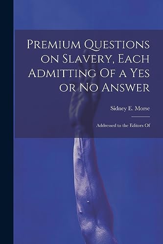
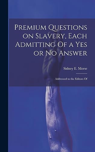
Taschenbuch. Zustand: Neu. Neuware - This powerful collection of questions addresses the issue of slavery head-on, offering a unique and thought-provoking perspective on a dark period in American history. It is essential reading for anyone interested in understanding the issues that have shaped our nation.This work has been sele…cted by scholars as being culturally important, and is part of the knowledge base of civilization as we know it.This work is in the 'public domain in the United States of America, and possibly other nations. Within the United States, you may freely copy and distribute this work, as no entity (individual or corporate) has a copyright on the body of the work.Scholars believe, and we concur, that this work is important enough to be preserved, reproduced, and made generally available to the public. We appreciate your support of the preservation process, and thank you for being an important part of keeping this knowledge alive and relevant.

- Hardcover
Anbieter: moluna, Greven, Deutschlandmoluna
Verkäufer/-in kontaktierenVerkäufer/-in mit 5 SternenZustand: Neu
EUR 33,31
EUR 48,99 VersandVersand von Deutschland nach USAAnzahl: Mehr als 20 verfügbar
Zustand: New.

- Hardcover
Anbieter: moluna, Greven, Deutschlandmoluna
Verkäufer/-in kontaktierenVerkäufer/-in mit 5 SternenZustand: Neu
EUR 33,31
EUR 48,99 VersandVersand von Deutschland nach USAAnzahl: Mehr als 20 verfügbar
Gebunden. Zustand: New.

- Softcover
Anbieter: moluna, Greven, Deutschlandmoluna
Verkäufer/-in kontaktierenVerkäufer/-in mit 5 SternenZustand: Neu
EUR 39,46
EUR 48,99 VersandVersand von Deutschland nach USAAnzahl: Mehr als 20 verfügbar
Zustand: New. KlappentextbTitle:/b A new system of Modern Geography, or a view of the present state of the world. With an appendix . Accompanied with an atlas.br/br/bPublisher:/b British Library, Historical Print Editionsbr/br/The British Library is.

- Softcover
Anbieter: AHA-BUCH GmbH, Einbeck, DeutschlandAHA-BUCH GmbH
Verkäufer/-in kontaktierenVerkäufer/-in mit 5 SternenZustand: Neu
EUR 28,86
EUR 60,93 VersandVersand von Deutschland nach USAAnzahl: 2 verfügbar
Taschenbuch. Zustand: Neu. Neuware - This work has been selected by scholars as being culturally important and is part of the knowledge base of civilization as we know it.

Sprache: Englisch
Verlag: British Library, Historical Print Editions Mär 2011, 2011
- Softcover
Anbieter: AHA-BUCH GmbH, Einbeck, DeutschlandAHA-BUCH GmbH
Verkäufer/-in kontaktierenVerkäufer/-in mit 5 SternenZustand: Neu
EUR 30,27
EUR 60,84 VersandVersand von Deutschland nach USAAnzahl: 2 verfügbar
Taschenbuch. Zustand: Neu. Neuware.

- Hardcover
Anbieter: moluna, Greven, Deutschlandmoluna
Verkäufer/-in kontaktierenVerkäufer/-in mit 5 SternenZustand: Neu
EUR 42,12
EUR 48,99 VersandVersand von Deutschland nach USAAnzahl: Mehr als 20 verfügbar
Gebunden. Zustand: New.

- Hardcover
Anbieter: moluna, Greven, Deutschlandmoluna
Verkäufer/-in kontaktierenVerkäufer/-in mit 5 SternenZustand: Neu
EUR 42,12
EUR 48,99 VersandVersand von Deutschland nach USAAnzahl: Mehr als 20 verfügbar
Gebunden. Zustand: New. KlappentextThis work has been selected by scholars as being culturally important, and is part of the knowledge base of civilization as we know it. This work was reproduced from the original artifact, and remains as true to the original w.

Sprache: Englisch
Verlag: British Library, Historical Print Editions Mär 2011, 2011
- Softcover
Anbieter: AHA-BUCH GmbH, Einbeck, DeutschlandAHA-BUCH GmbH
Verkäufer/-in kontaktierenVerkäufer/-in mit 5 SternenZustand: Neu
EUR 30,27
EUR 60,86 VersandVersand von Deutschland nach USAAnzahl: 2 verfügbar
Taschenbuch. Zustand: Neu. Neuware.

- Hardcover
Anbieter: AHA-BUCH GmbH, Einbeck, DeutschlandAHA-BUCH GmbH
Verkäufer/-in kontaktierenVerkäufer/-in mit 5 SternenZustand: Neu
EUR 36,43
EUR 61,14 VersandVersand von Deutschland nach USAAnzahl: 2 verfügbar
Buch. Zustand: Neu. Neuware - This powerful collection of questions addresses the issue of slavery head-on, offering a unique and thought-provoking perspective on a dark period in American history. It is essential reading for anyone interested in understanding the issues that have shaped our nation.This work has been selected by… scholars as being culturally important, and is part of the knowledge base of civilization as we know it.This work is in the 'public domain in the United States of America, and possibly other nations. Within the United States, you may freely copy and distribute this work, as no entity (individual or corporate) has a copyright on the body of the work.Scholars believe, and we concur, that this work is important enough to be preserved, reproduced, and made generally available to the public. We appreciate your support of the preservation process, and thank you for being an important part of keeping this knowledge alive and relevant.

- Hardcover
Anbieter: AHA-BUCH GmbH, Einbeck, DeutschlandAHA-BUCH GmbH
Verkäufer/-in kontaktierenVerkäufer/-in mit 5 SternenZustand: Neu
EUR 41,49
EUR 61,07 VersandVersand von Deutschland nach USAAnzahl: 2 verfügbar
Buch. Zustand: Neu. Neuware.

Sprache: Englisch
Verlag: British Library, Historical Print Editions Mär 2011, 2011
- Softcover
Anbieter: AHA-BUCH GmbH, Einbeck, DeutschlandAHA-BUCH GmbH
Verkäufer/-in kontaktierenVerkäufer/-in mit 5 SternenZustand: Neu
EUR 50,71
EUR 66,08 VersandVersand von Deutschland nach USAAnzahl: 2 verfügbar
Taschenbuch. Zustand: Neu. Neuware - bTitle:/b A new system of Modern Geography, or a view of the present state of the world. With an appendix . Accompanied with an atlas.br/br/bPublisher:/b British Library, Historical Print Editionsbr/br/The British Library is the national library of the United Kingdom. It is one of the world's… largest research libraries holding over 150 million items in all known languages and formats: books, journals, newspapers, sound recordings, patents, maps, stamps, prints and much more. Its collections include around 14 million books, along with substantial additional collections of manuscripts and historical items dating back as far as 300 BC.br/br/The GEOGRAPHY & TOPOGRAPHY collection includes books from the British Library digitised by Microsoft. Offering some insights into the study and mapping of the natural world, this collection includes texts on Babylon, the geographies of China, and the medieval Islamic world. Also included are regional geographies and volumes on environmental determinism, topographical analyses of England, China, ancient Jerusalem, and significant tracts of North America. br/br/++++br/The below data was compiled from various identification fields in the bibliographic record of this title. This data is provided as an additional tool in helping to insure edition identification:br/++++br/br/b/b British Librarybr/b/b Morse, Sidney Edwards; br/b/b 1822.br/b/b 8º.br/b/b 1297.g.2.br/.

Verlag: Harper & Brothers, New York, 1843
Anbieter: Argosy Book Store, ABAA, ILAB, New York, NY, USAArgosy Book Store, ABAA, ILAB
Verkäufer/-in kontaktierenVerkäufer/-in mit 5 SternenZustand: Gebraucht - Gut
EUR 58,51
EUR 5,24 VersandVersand innerhalb von USAAnzahl: 1 verfügbar
unbound. Zustand: very good. Map. Color wax engraving (cerograph). Image measures 14.75" x 12.25". Includes approach to the St. Lawrence River, the Bay of Fundy, and Prince Edward Island. A fine example of Sidney Edwards Morse's wax engraving technique, from "The Cerographic Atlas of the United States". Some wear to right edge.…Sidney Edwards Morse (1794-1871) was an American geographer, journalist, and inventor. He shared his innovative spirit with his brother, Samuel F.B. Morse, and his father Jedidiah Morse, who published the first geography book in the United States in 1784. Morse pioneered the printing process of wax engraving, otherwise known as cerography.
Verlag: Richardson & Lord, Boston, 1824
Anbieter: Rulon-Miller Books (ABAA / ILAB), St. Paul, MN, USARulon-Miller Books (ABAA / ILAB)
Verkäufer/-in kontaktierenVerkäufer/-in mit 5 SternenZustand: Gebraucht
EUR 56,27
EUR 10,49 VersandVersand innerhalb von USAAnzahl: 1 verfügbar
Twenty-fourth edition, pp. ix, [4], 14-360; atlas not present, foxed and toned, extremities rubbed and worn with dampstaining on boards, else good in original calf-backed paper covered boards with gilt lettering on spine.

Verlag: Harper & Brothers, New York, 1842
Anbieter: Argosy Book Store, ABAA, ILAB, New York, NY, USAArgosy Book Store, ABAA, ILAB
Verkäufer/-in kontaktierenVerkäufer/-in mit 5 SternenZustand: Gebraucht - Gut
EUR 67,52
EUR 5,24 VersandVersand innerhalb von USAAnzahl: 1 verfügbar
unbound. Zustand: very good(+). Map. Color wax engraving (cerograph). Image measures 14" x 11". Great map of Vermont and New Hampshire divided into counties and townships. Denotes towns, major routes, waterways and topographical features. Light scattered foxing. A fine example of Sidney Edwards Morse's wax engraving technique, f…rom "The Cerographic Atlas of the United States".
 Weitere Bilder
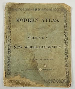
Verlag: Richardson & Lord, Boston, 1822
- Softcover
Anbieter: Resource Books, LLC, East Granby, CT, USAResource Books, LLC
Verkäufer/-in kontaktierenVerkäufer/-in mit 5 SternenVerbandsmitglied: SNEAB
Zustand: Gebraucht - Ausreichend
EUR 587,83
Versand nach gratisVersand innerhalb von USAAnzahl: 1 verfügbar
Paperback. Zustand: Fair. Boston: Richardson & Lord, 1822. Undated [1822]. Scarce. Heavily worn softcover, 11 3/8 inches tall, includes eight maps hand colored and/or in outline, including double page map of the worly by hemisphere, double page map of the United States, single page maps of British Islands, North America, South A…merica, Europe, Asia, Africa. Covers and edges tattered but no chips to maps, age-toning and dampstains throughout, front cover and first map detached, name and 1826 date handwritten on front free endpaper. . Soft Cover. Fair. 4to - over 9¾" - 12" tall.
Verlag: New York: Harper & Brothers, 1842 [but 1845]., 1845
- Hardcover
- Erstausgabe
Anbieter: Arader Galleries - AraderNYC, New York, NY, USAArader Galleries - AraderNYC
Verkäufer/-in kontaktierenVerkäufer/-in mit 5 SternenZustand: Gebraucht
EUR 5.851,36
Versand nach gratisVersand innerhalb von USAAnzahl: 1 verfügbar
Hardcover. 1st Edition. Folio (18 x 14 ½ inches). 36 colored maps depicting Canada, United States and Mexico, most of the maps depict individual states of the United States. One map depicts Mexico. (Some minor scattered foxing, front endpaper torn in the gutter). Half black roan and cloth boards gilt (extremities rubbed with som…e wear particularly to the spine.) Provenance: A.P. Schute signature on front pastedown dated 1854 (? Rev. amateur geologist fl. 1850's.) THE FIRST CEROGRAPHIC ATLAS OF THE UNITED STATES First colour-printed edition, and enlarged from the first edition published in parts between 1842-1845, without a map of Oregon, nor a separate map of Iowa, but with maps of North America, Canada east, Canada west, Nova Scotia - New Brunswick &c., West India Islands, and Wisconsin Southern Part, not found in the first edition. Son of the celebrated Jedediah Morse, Sidney "was helpful to his father in revising the famous "Geography" of the elder Morse, and in 1822 the two edited a New System of Modern Geography. He made further advances in the field of geography when, in the 1830's, he and Henry A. Munson began working on a new method of printing maps: an engraving was made on wax, and from the engraving was made a plate to be inserted with the type. Morse had written atlases previously, the first being "An Atlas of the United States" in 1823, and the new method proved very valuable in enabling him to print several more. The first production using the new method was his "Gerographic Atlas of the United States", published in 1842. He is credited with two other inventions. On October 3, 1817, he and his brother Samuel F. B. Morse (1791-1872) were granted a patent for a "flexible piston pump", and on July 17, 1866, he and his son were granted one for a "bathometer", to be used in deep-sea exploration" (Yale University Library online); Phillips, 1228.
Verlag: New York: Harper & Brothers, 1842 [but 1845]., 1845
- Hardcover
- Erstausgabe
Anbieter: Arader Galleries - AraderNYC, New York, NY, USAArader Galleries - AraderNYC
Verkäufer/-in kontaktierenVerkäufer/-in mit 5 SternenZustand: Gebraucht
EUR 6.076,41
Versand nach gratisVersand innerhalb von USAAnzahl: 1 verfügbar
Hardcover. 1st Edition. Folio (17 4/8 x 14 inches). 36 coloured wax-engraved maps (some occasionally heavy mostly marginal spotting). Modern half maroon calf over original maroon cloth boards, gilt (unevenly faded). The first Cerographic Atlas of the United States. First colour-printed edition, and enlarged from the first editio…n published in parts between 1842-1845, without a map of Oregon, nor a separate map of Iowa, but with maps of North America, Canada east, Canada west, Nova Scotia - New Brunswick &c., West India Islands, and Wisconsin Southern Part, not found in the first edition. Son of the celebrated Jedediah Morse, Sidney "was helpful to his father in revising the famous "Geography" of the elder Morse, and in 1822 the two edited a New System of Modern Geography. He made further advances in the field of geography when, in the 1830's, he and Henry A. Munson began working on a new method of printing maps: an engraving was made on wax, and from the engraving was made a plate to be inserted with the type. Morse had written atlases previously, the first being "An Atlas of the United States" in 1823, and the new method proved very valuable in enabling him to print several more. The first production using the new method was his "Gerographic Atlas of the United States", published in 1842. He is credited with two other inventions. On October 3, 1817, he and his brother Samuel F. B. Morse (1791-1872) were granted a patent for a "flexible piston pump", and on July 17, 1866, he and his son were granted one for a "bathometer", to be used in deep-sea exploration" (Yale University Library online); Phillips, 1228.

Verlag: Harper & Brothers, New York, 1842
Anbieter: Argosy Book Store, ABAA, ILAB, New York, NY, USAArgosy Book Store, ABAA, ILAB
Verkäufer/-in kontaktierenVerkäufer/-in mit 5 SternenZustand: Gebraucht
EUR 135,03
EUR 5,24 VersandVersand innerhalb von USAAnzahl: 1 verfügbar
unbound. Map. Wax engraving (cerograph) with hand coloring. Page measures 12 3/8" x 16 1/4" This detailed map of Ohio by Sidney Morse and Samuel Breese depicts the states divided into counties and townships. The map notes towns, roads, rivers, lakes, railroads, mountains, and other topography. This map was featured in Morse's No…rth American Atlas, which, when originally published in 1842, was the first atlas of the United States to feature the technique of cerography, or wax engraving, which Morse pioneered. It is from the 1845 edition of the Atlas, which was a reissue with some minor changes and the introduction of color. The map is in very good condition. Minor chips and tears to edges, not affecting the image. Sidney Edwards Morse (1794-1871) was an American geographer, journalist, and inventor. He shared his innovative spirit with his brother, Samuel F.B. Morse, and his father Jedidiah Morse, who published the first geography book in the United States in 1784. Morse pioneered the printing process of wax engraving, otherwise known as cerography. This map is a fine example of Morse's innovative cerographic technique.

Verlag: Harper & Brothers, New York, 1842
Anbieter: Argosy Book Store, ABAA, ILAB, New York, NY, USAArgosy Book Store, ABAA, ILAB
Verkäufer/-in kontaktierenVerkäufer/-in mit 5 SternenZustand: Gebraucht - Gut
EUR 135,03
EUR 5,24 VersandVersand innerhalb von USAAnzahl: 1 verfügbar
unbound. Zustand: very good. Map. Color wax engraving (cerograph). Image measures 12" x 14.75". Great map of Massachusetts and Rhode Island divided into counties and townships showing towns, major routes, waterways and railroads. A fine example of Sidney Edwards Morse's wax engraving technique, from "The Cerographic Atlas of the… United States". Minor toning and scattered foxing to margins. A few scattered tears.

Verlag: Harper & Brothers, New York, 1842
Anbieter: Argosy Book Store, ABAA, ILAB, New York, NY, USAArgosy Book Store, ABAA, ILAB
Verkäufer/-in kontaktierenVerkäufer/-in mit 5 SternenZustand: Gebraucht
EUR 157,54
EUR 5,24 VersandVersand innerhalb von USAAnzahl: 1 verfügbar
unbound. Map. Wax engraving (cerograph) with hand coloring. Page measures 11" x 14" This detailed map of Maryland and Delaware by Sidney Morse and Samuel Breese depicts the states divided into counties and townships. The map notes towns, roads, rivers, lakes, railroads, mountains, and other topography. Features an inset of Distr…ict of Columbia, and an elevation view of the Chesapeake and Ohio Canal, and the Baltimore and Ohio Railroad. New York Public Library Map Room stamp on verso. This map was featured in Morse's North American Atlas, which, when originally published in 1842, was the first atlas of the United States to feature the technique of cerography, or wax engraving, which Morse pioneered. It is from the 1845 edition of the Atlas, which was a reissue with some minor changes and the introduction of color. The map is in good condition, with some edge wear, including some chipping to corners, not affecting the image. Minor toning. Sidney Edwards Morse (1794-1871) was an American geographer, journalist, and inventor. He shared his innovative spirit with his brother, Samuel F.B. Morse, and his father Jedidiah Morse, who published the first geography book in the United States in 1784. Morse pioneered the printing process of wax engraving, otherwise known as cerography. This map is a fine example of Morse's innovative cerographic technique.


