
Gesamtpreis (1 Artikel Artikel):
Versandziel:

saigon (31 Ergebnisse)
Direkt zu den wichtigsten Suchergebnissen
Suchfilter
Produktart
- Alle Product Types
- Bücher (18)
- Magazine & Zeitschriften (Keine weiteren Ergebnisse entsprechen dieser Verfeinerung)
- Comics (Keine weiteren Ergebnisse entsprechen dieser Verfeinerung)
- Noten (Keine weiteren Ergebnisse entsprechen dieser Verfeinerung)
- Kunst, Grafik & Poster (Keine weiteren Ergebnisse entsprechen dieser Verfeinerung)
- Fotografien (Keine weiteren Ergebnisse entsprechen dieser Verfeinerung)
- Karten (11)
- Manuskripte & Papierantiquitäten (2)
Zustand Mehr dazu
- Neu (1)
- Wie Neu, Sehr Gut oder Gut Bis Sehr Gut (5)
- Gut oder Befriedigend (7)
- Ausreichend oder Schlecht (Keine weiteren Ergebnisse entsprechen dieser Verfeinerung)
- Wie beschrieben (18)
Einband
Weitere Eigenschaften
- Erstausgabe (4)
- Signiert (1)
- Schutzumschlag (Keine weiteren Ergebnisse entsprechen dieser Verfeinerung)
- Angebotsfoto (25)
Sprache (4)
Gratisversand
- Kostenloser Versand nach USA (Keine weiteren Ergebnisse entsprechen dieser Verfeinerung)
Land des Verkäufers
Verkäuferbewertung
-

CANADIAN FLEETS. Along the Seaway
Sprache: Englisch
Verlag: Partners Publishers Group, 1989
ISBN 10: 0919549195 ISBN 13: 9780919549197
Erstausgabe
Softcover. Zustand: Very Good+. First Edition. A crisp, clean, tightly bound softcover copy appearing lightly read, presenting light shelf wear. ; 116 pages.
-

Bonsoir Maitresse: A Novel
Verlag: Pavilion Publications, 1963
Anbieter: World of Rare Books, Goring-by-Sea, SXW, Vereinigtes Königreich
Verkäuferbewertung 5 von 5 Sternen

EUR 13,52
EUR 5,58 Versand
Versand von Vereinigtes Königreich nach USAAnzahl: 1 verfügbar
In den WarenkorbZustand: Good. 1963. No edition remarks. 128 pages. Paperback book with pictorial cover. Clean pages with mild tanning and foxing throughout. Tightly bound with faint thumb-marking throughout. Paper stuck to first page with pen inscription present. Paper cover has mild edge wear with mild corner curling. Heavy tanning to spine and edges. Heavy scratching and marking to covers. Mild water stains and droplets to covers.
-

BONSOIR MAITRESSE
Sprache: Englisch
Verlag: PAVILION, LONDON, GREAT BRITAIN, 1963
Anbieter: Happyfish Books, Meopham, KENT, Vereinigtes Königreich
Verkäuferbewertung 4 von 5 Sternen

EUR 23,84
EUR 23,15 Versand
Versand von Vereinigtes Königreich nach USAAnzahl: 1 verfügbar
In den WarenkorbSoft cover. Zustand: Good. No Jacket. * PUBLISHER : PAVILION * YEAR : 1963 * ISBN : N/A * No OF PAGES : 128 * CONDITION : USED - GOOD * OTHER: THE COVER IS HEAVILY RUBBED WITH BUMPING AND TANNING ALONG THE EDGES AND CORNERS WITH SMALL STAINS IN PLACES. THE SPINE IS WORN AND CREASED WITH HEAVY TANNING. THE SPINE IS BUMPED AT BOTH ENDS. THE BINDING IS FIRM. THE PAGES ARE LIGHTLY TANNED, HOWEVER THE PAGES REMAIN CLEAR AND CRISP. PAGES GENERALLY APPEAR CLEAN AND CREASE FREE. ALL IN ALL A NICE EXAMPLE OF THIS BOOK.
-
![Bild des Verkäufers für [Punk Flyer]: Speak No Evil Saturday Nights! zum Verkauf von Between the Covers-Rare Books, Inc. ABAA](https://pictures.abebooks.com/inventory/md/md10230984084.jpg)
[Punk Flyer]: Speak No Evil Saturday Nights!
Verlag: Los Angeles, California, 1980
Anbieter: Between the Covers-Rare Books, Inc. ABAA, Gloucester City, NJ, USA
Verbandsmitglied: ABAA ESA ILAB IOBA
Verkäuferbewertung 5 von 5 Sternen
Unbound. Zustand: Near Fine. Photomechanically reproduced flyer on 4.25" x 5.5" cream paper. Some creasing else near fine. An original handbill flyer promoting Saturday nights at Speak No Evil featuring Wolfsbane, Celebrity Skin, My Life with the Thrill Kill Kult, Lypsinka.
-

Saďgon en révolution.
Verlag: 1955., 1955
Anbieter: Loďc Simon, Blaison-Saint Sulpice, FR, Frankreich
Verkäuferbewertung 4 von 5 Sternen
Reportage de 8 pages dans Paris-Match. Numéro complet.
-

EUR 19,26
EUR 48,99 Versand
Versand von Deutschland nach USAAnzahl: Mehr als 20 verfügbar
In den WarenkorbZustand: New. KlappentextrnrnUnlike some other reproductions of classic texts (1) We have not used OCR(Optical Character Recognition), as this leads to bad quality books with introduced typos. (2) In books where there are images such as portraits, maps, sketc.
-
BONSOIR MAITRESSE: A NOVEL.
Verlag: Pavilion Publications,, London,, 1963
Anbieter: Burwood Books, Wickham Market, Vereinigtes Königreich
Verbandsmitglied: PBFA
Verkäuferbewertung 5 von 5 Sternen
Erstausgabe
EUR 26,23
EUR 26,05 Versand
Versand von Vereinigtes Königreich nach USAAnzahl: 1 verfügbar
In den WarenkorbHardcover. Zustand: Very Good. First Edition. Wraps. 8vo. pp 128. Parody of Francoise Saigon. Light wear otherwise very good. A few slight marks abd slight tanning to covers. Lacks fep.
-

Lizard
Anbieter: Versandantiquariat Felix Mücke, Grasellenbach - Hammelbach, Deutschland
Verkäuferbewertung 5 von 5 Sternen
Audio CD. Zustand: Befriedigend. HĂlle mit Gebrauchsspuren, Artikel stammt aus Nichtraucherhaushalt! NB1-1257 Sprache: Englisch Gewicht in Gramm: 104.
-
THERE IS NO BUISNESS.LIKE SHOW BUISNESS
Sprache: Englisch
Verlag: Delta Music, 1997
Anbieter: ABC Versand e.K., Aarbergen, Deutschland
Verkäuferbewertung 5 von 5 Sternen
Audio CD. Zustand: Sehr gut. Hülle mit kleinen Gebrauchspuren , CD wie neu OM103F9 Sprache: Englisch Gewicht in Gramm: 505.
-

Aghata
Verlag: Madrid/Fareso, 1981
ISBN 10: 8487198198 ISBN 13: 9788487198199
Anbieter: La Librería, Iberoamerikan. Buchhandlung, Bonn, NRW, Deutschland
Verkäuferbewertung 4 von 5 Sternen
Zustand: Wie neu. 76p. Sprache: Spanisch, USADO / GEBRAUCHT / USED. Una joven y un joven se encuentran en una villa junto al mar. Aquí una vez tuvieron pasé a las vacaciones de la infancia sin preocupaciones. Callan. No se miran el uno al otro. ella es ven a decirle adiós para siempre. El hombre es su hermano y el es de ella Amante. Surge un diálogo que está moldeado por la voluntad de volverse extrańos el uno para el otro. Te está intentando a ti mismo liberarse del "terrible poder" de este amor y al mismo tiempo conservar algo de él. ** 10% DESCUENTO/RABATT/DISCOUNT PRIMAVERA * excl. New German Books * * * * 6,30 (original price 7,00) **.
-
The Viatnamese Music. Special Edition.
Sprache: Englisch
Verlag: Review Horizons
Anbieter: Musikantiquariat Bernd Katzbichler, Haarbach, D, Deutschland
Verkäuferbewertung 4 von 5 Sternen
23 S. mit zahlr. Abb. Originalkarton. Gut erhalten.
-

Musée Blanchard de la Brosse : catalogue général des collections : comprenant des notices descriptives et explicatives, accompagnées de 31 illustrations : Tome I. Arts de le famille indienne
Sprache: Französisch
Verlag: Imprimerie d'Extręme-Orient, Hanoi, 1937
Anbieter: Joseph Burridge Books, Dagenham, Vereinigtes Königreich
Verkäuferbewertung 5 von 5 Sternen
Erstausgabe
EUR 65,59
EUR 26,63 Versand
Versand von Vereinigtes Königreich nach USAAnzahl: 1 verfügbar
In den WarenkorbSoft cover. Zustand: Very Good. 1st Edition. ix + 190 pages + XXXI plates : 22 cm. Volume 1 (of 2) only.
-
The Postwar Development of the Republic of Vietnam: Policies and Programs.
Verlag: Praeger, 1970., 1970
Anbieter: The Book Firm, Subiaco, WA, Australien
Verkäuferbewertung 2 von 5 Sternen

Hardcover. Ex-library, some light marks to bottom edge of front cover, o/wise good (no markings to text). No dj. 552pp. 11445.
-
N° 55, 2° semestre 1908
Verlag: F. H. Schneider, 1908
Anbieter: Librairie de l'Avenue - Henri Veyrier, Saint-Ouen, FR, Frankreich
Verkäuferbewertung 4 von 5 Sternen
Couverture souple. Zustand: Bon état. In-8 broché, 110 pp. Couverture fanée, premier plat détaché. Notamment : Durrwell (George) La famille Annamite et le Culte des Ancętres ; Monographie du centre administratif de Dong-Trieu (M. Petillot) in-8°.
-
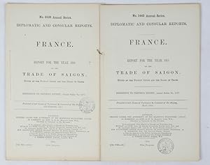
Trade of Saigon.
Verlag: His Majesty's Stationery Office., London., 1913
Anbieter: Asia Bookroom ANZAAB/ILAB, Canberra, ACT, Australien
Verkäuferbewertung 5 von 5 Sternen
Parliamentary Report (House of Commons Command Paper), 34 x 21.5 cm, 16pp., folding map, original plain title wrappers, stamp of the Bibiothčque du Palais de la Paix with their shelf stamp on the title page, in very good condition. Report for Saigon for 1912 by the British Consul Thomas Carlisle. He notes the disproportionate advantage given to French imports because of the tariff advantage as against broader European (British) market share.
-
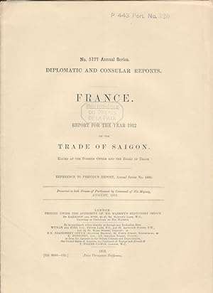
Trade of Saigon.
Verlag: His Majesty's Stationery Office., London., 1915
Anbieter: Asia Bookroom ANZAAB/ILAB, Canberra, ACT, Australien
Verkäuferbewertung 5 von 5 Sternen
Two reports, for 1913 and 1914. In original wrappers, each with full page black and white maps. Good copies. Report for the Year 1913 on the Trade of Saigon. No. 5442. Diplomatic and Consular Reports. France. Full page black and white map, 17pp. No. 5442 Annual Series. Report for the Year 1914 on the Trade of Saigon. No. 5538. Diplomatic and Consular Reports. France. Full page black and white map, 18pp. No. 5538 Annual Series.
-
Trade of Saigon.
Verlag: Her Majesty's Stationery Office. 1888-9, 1895-9, 1913,1915., London., 1888
Anbieter: Asia Bookroom ANZAAB/ILAB, Canberra, ACT, Australien
Verkäuferbewertung 5 von 5 Sternen
Ten Parliamentary Reports (House of Commons Command Papers), 31.8 x 20.5 cm, together 215 pp., three black and white maps of Saigon (one folding) in the reports for 1912, 1913 and 1914, original stab-sewn title wrappers, top edge gilt, previous owner's added manuscript pagination to the top right of each Report, in manuscript for the first seven and ink-stamped in the final three, in very good condition. Wide-ranging group of Reports for Saigon in the French Colonial Period from 1888 to the first year of World War One. The first seven 19th Century Reports also include Indo-China, with coverage of the ongoing "pacification" of Tonkin, lengthy notes on French tariffs (from the British Consul's point of view) and the challenging terrain impeding the conduct of trade in Laos. The Report for 1887 includes a report on casualties from the loss of steamers of the Messageries Maritimes: four British steamers and one German.
-
National Catalog of Psyops Matrials: Vietnam
Erscheinungsdatum: 1969
Anbieter: Transmutation Publishing, Corning, CA, USA
Verkäuferbewertung 4 von 5 Sternen
Softcover. Zustand: Fine. Zustand des Schutzumschlags: No Dust Jacket. 1969 Softcover Fine/No Dust Jacket Joint United States Public Affairs Office, Pub, Saigon, Vietnam, 1969, fine condition, spiral-bound; profusely illustrated; un-paginated; Psyops, Military History.
-

PHAN NGOC DANH (Daten unbekannt) Professor Dr. für Philosophie am Lycée Petrus Ky in Saigon
Anbieter: Herbst-Auktionen, Detmold, Deutschland
Verkäuferbewertung 3 von 5 Sternen

Manuskript / Papierantiquität Signiert
E.Albumblatt (1 S. kl. 8 to), in Kuli eigenhändig signiert mit E.ZITAT, Ort, Datum, Unterschrift und voller Adresse Saigon, den 10.10.1971 Die Liebe in den Augen Das Herz in der Hand Reist Prof. Italiaander durch die verdorbene Welt. Begegnet er bald dem Frieden? Oder hat der Frieden schon sein Ende? PHAN NGOC DANH, Professor der Philosophie am Lycée Petrus Ky in Saigon. (englisch : Love in his eyes, Heart in his hand, Professor Italiaander travels through the corrupted world. Will he soon meet peace? Or has peace already met its end?) (autograph album page signed in person by korean author. PROVENIENZ : aus Reisealbum / from autograph album of world traveller ROLF ITALIAANDER (1913-91, Professor Dr., deutscher Schriftsteller und Völkerkundler / german writer and folklorist ).
-

Batiments Civils Projet de Ville de 500,000 Ames Saîgon.
Erscheinungsdatum: 1862
Anbieter: Geographicus Rare Antique Maps, Brooklyn, NY, USA
Verbandsmitglied: ABAA ESA ILAB
Verkäuferbewertung 4 von 5 Sternen
Karte
Good. Manuscript and wash. Laid down on archival paper. Some wear on old fold lines. Soiling. Size 26.5 x 30.75 Inches. This is Lucien Florent Paul Coffyn's 1862 manuscript masterplan of Saigon - the first and most significant map of Saigon (Ho Chi Minh City). Coffyn was the French military engineer tasked with transforming a war-torn fort into a model colonial capital. Following the 1861 French occupation of Saigon, authorities resolved to build a new city on the wartorn site at a monumental scale, reflecting boundless imperial ambition. Coffyn, driven by an unwavering belief in the colony's promise, envisioned a grand, European-style metropolis designed to accommodate half a million residents across 25 square kilometers. The present map - exquisitely drafted and signed by both Coffyn and Vice Admiral Louis Bonard, Governor of Cochinchina - is the likely original manuscript submitted for formal approval. Over the subseqeunt decades, Coffyn's street layout and placement of major sites were implemented with fidelity, though not comprehensively, marking this as the foundational document of colonial Saigon. It stands as a unique testament to French imperial planning and an unparalleled artifact of Asian colonial urbanism. A Closer Look The map is meticulously executed in grisaille pen and wash. It presents an ambitious polygonal city extending west from the Saigon River (Sông Sŕi Gňn) and exhibiting symmetry and perfection seemingly at odds with the swampy malarial terrain of the Mekong Delta. Coverage extends south to the Arroyo Chinois (Tŕu H?) and north to the Arroyo de l'Avalanche (Th? Nghč), bother pre-existing rivers. The terrain was to be drained by a series of canals, including a belt canal ( canal de ceinture ), which would also serve a defensive function, and an expansive network of internal canals. The streets are laid out on a grid of 45° orthogonals radiating from a semicircular plaza on the waterfront. Streets throughout are numbered, with the sole exception being the proposed main street, Rue Impériale (now Hai Bŕ Tr?ng Street), which runs northeast from the rondpointe . To the north of Rue Impériale is the Gouvernement et Administration Supérieure in the form of a large fort - the site of Saigon's existing La Citadelle du Phe?nix. To the Rue Impérial, he planned the city's commercial and industrial district, comprising some 2,300 hectares. The remainder was intended for residential development, including a large public park and water basin. Across the river to the east and south are proposed residential suburbs. The legend at lower right identifies 30 key locations: Gouvernement et Administration Sup.re - Supreme Government and Administration Office, located within La citadelle du Phénix. Caserne des Troupes Indigčnes - Barracks for Indigenous Troops. Caserne de Cavalerie - Barracks for Cavalry. Caserne d'Infanterie de Marine - Barracks for the Marines. Champ des Manuvres - Field for Military Manoeuvres. Cimetičre - Cemetery. Prisons - Prisons. Hôpital - Hospital. Arsenal - Arsenal. Caserne du Génie - Barracks for the Engineering Corps. Magasine aux Vivres et Magasin Général - Food Storage Magazine and General Magazine. Construction Navales - Naval Construction Grounds. Dépôt de Charbons - Coal Depot. Gouvernement Provisoire (Doit devenir Place Pbl.) - Provisional Government Office (will become the Place Publique). Messagerie Impériales - Imperial Post and Telegraph Office. Direction du Port de Commerce - Commercial Harbour Master's Office. Direction du Port Militaire - Military Port HQ. Terrains occupés provisoirement - Land temporarily occupied by Spanish Troops, Marine Artillery, Military Engineering, Hospital, Coolie's Depot, Hydrographic Office. Terrains occupés provisoirement par Magasin Général - Land temporarily occupied by the General Magazine. Terrains occupés provisoirement par Les Subsistances - Land temporarily occupied by the Military Storehouse. Terrains occupés provi.
-

Mu'o'i Dieu Chanh-Sach Cu The Doi Vo'i Si Quan, Binh Linh, Canh Sat Va Nhan Vien Nguy Quyen / The 10 Commandments Of The Practical Administrative Policy For Officers, Gi, Policemen And Employees Of The Rebel Authorities(Original Insurgent Vietnamese Propaganda Flyer With English Translation)
Sprache: Vietnamesisch
Verlag: Committee Of Revolutionary Of Army And People At Saigon-Cholon-Gia Dinh Areas [Viet Cong, Circa 1968], 1968
Anbieter: Arroyo Seco Books, Pasadena, Member IOBA, Pasadena, CA, USA
Verbandsmitglied: IOBA
Verkäuferbewertung 4 von 5 Sternen
Manuskript / Papierantiquität Erstausgabe
No Binding. Zustand: Good. 1st Edition. Rebel Administrative Flyer, Single Sheet Printed On Two Sides, With Usa Government Typed Translation Attached.
-
![Bild des Verkäufers für Ba?n Do? Chi Dan Tinh Ly Bac Lieu. / [Map Of People's Villages, Bac Lieu Province]. zum Verkauf von Geographicus Rare Antique Maps](https://pictures.abebooks.com/inventory/md/md32068505765.jpg)
Ba?n Do? Chi Dan Tinh Ly Bac Lieu. / [Map Of People's Villages, Bac Lieu Province].
Erscheinungsdatum: 1960
Anbieter: Geographicus Rare Antique Maps, Brooklyn, NY, USA
Verbandsmitglied: ABAA ESA ILAB
Verkäuferbewertung 3 von 5 Sternen
Karte
Good. Closed margin tears professionally repaired on verso. Verso repair to centerfold separation. Blank on verso. Size 12.25 x 17.5 Inches. This is a c. 1960 Saigon Moi Newspaper city map or plan of B?c Lięu, Vietnam, the capital of B?c Lięu Province. The B?c Lięu River flows through town, and city streets are illustrated and labeled along both banks. Fourteen locations within the city are numerically identified and correspond with a key situated in the lower left corner, including the cemetery, two temples, the football field, and the hospital. During the French colonial period, B?c Lięu was a prosperous town, with many wealthy farmers and other successful inhabitants. However, during the years of the Vietnam War, people began leaving B?c Lięu, and the city slowly shrank, and even today is still trying to recover from the hardships suffered during the war years. Publication History and Census This map was created and published by the Saigon Moi Newspaper c. 1960.
-
Plan Saigon-Cholon / [Saigon-Cholon Map].
Erscheinungsdatum: 1956
Anbieter: Geographicus Rare Antique Maps, Brooklyn, NY, USA
Verbandsmitglied: ABAA ESA ILAB
Verkäuferbewertung 4 von 5 Sternen
Karte
Very good. Previous repair evident at bottom-left margin. Size 14 x 20.75 Inches. This is a c. 1956 map of Saigon published by the city's Chamber of Commerce and the Mutual Association of Commercial and Industrial Employees of South Vietnam. It primarily shows the city's two main centers of Cholon and Saigon soon after Vietnamese independence. Colonial Saigon This map faces towards the northwest and clearly represents the geography of Saigon, situated on the Saigon River and its tributaries with two historical urban centers at Cholon towards bottom-left and old Saigon towards right-center. Cholon was historically inhabited by overseas Chinese and was the largest concentration of the Hoa (Chinese) ethnic minority in Vietnam. Although they were important for commerce with the outside world, the Chinese population was often looked at with suspicion and even hatred by local rulers. As a threatened minority, the Hoa cooperated with outside forces, namely the French and Americans, as a means of protection, which caused them to be targeted again once Vietnam was reunified in 1975. As for Saigon, the pre-existing city dates back centuries but grew significantly under the Nguyen lords in the 18th century. It was renovated by the French starting in the 1860s to craft it into a colonial city, with a set of new structures including an opera house, a cathedral, and a palace (all near center-right), initially built for the King of Cambodia but later to become the home of Saigon's colonial governors and South Vietnam's presidents (it was damaged in an assassination attempt against Ngo Dinh Diem in the 1960s and rebuilt as 'Independence Hall'). The colonial-style building of the Chamber of Commerce, indicated with a long, thin arrow stretching from top-right, is now the H? Chí Minh City Stock Exchange. Also worth noting are the three large park areas in green on the map: the Hippodrome (at left, later the Phú Th? Horse Racing Ground), Tao Dan Park (right-center), and the Saigon Zoo and Botanical Gardens (at right). Though there is no legend, the map shows streetcar and rail lines running through and beyond the city. The verso (back) includes advertisements for French businesses in Saigon, presumably members of the Chamber of Commerce. Wider Context Although undated, this map dates from just after Vietnamese independence and the division of Vietnam according to the 1954 Geneva Accords. French influence was greatly diminished because of independence, but individual French nationals and businesses continued. Some one-fifth of the European population (including British, Dutch, and others aside from French) were mixed-race 'Eurasians' who often could attain a degree of the social and legal rights as Europeans but still faced discrimination from the white population. This era of collapsing French colonialism in Vietnam, replaced soon afterwards by increasing American intervention, has been captured in works of literature and film like Graham Greene's The Quiet American and the 1992 French film Indochine . Publication History and Census This map was published by the Chambre de Commerce and the Association Mutuelle des Employés de Commerce et d'Industrie du Sud-Vietnam. At bottom-right is the text 'I.F.O.M. Saigon' but whether this was a publisher, or some other organization is unclear. The date is difficult to know with certainty, but the reference to South Vietnam in the second organization's title indicates that it is from after 1954. Given the rapid decrease in French influence after 1954, it likely dates from soon after that date. The map has not been found by us in any institution's holdings and has no known history on the market.
-
![Bild des Verkäufers für Hoa Do? Saigon Va Vung Phu Cun. / [Map of Saigon and its Suburbs.] zum Verkauf von Geographicus Rare Antique Maps](https://pictures.abebooks.com/inventory/md/md32068511394.jpg)
Hoa Do? Saigon Va Vung Phu Cun. / [Map of Saigon and its Suburbs.]
Erscheinungsdatum: 1968
Anbieter: Geographicus Rare Antique Maps, Brooklyn, NY, USA
Verbandsmitglied: ABAA ESA ILAB
Verkäuferbewertung 3 von 5 Sternen
Karte
Good. Verso repair and reinforcement to old fold lines. A few minor margin tears reinforced on verso. Light infill and soiling. Size 23.75 x 18 Inches. This is a rare 1968 map of Saigon and its suburbs, issued in Saigon at the height of the Tet Offensive, when the city was under siege by Viet Cong and North Vietnamese forces. Saigon c. 1968 This map is a clear representation of the geography of Saigon, situated on the Saigon River and its tributaries with two historical urban centers at Cholon towards bottom-left and old Saigon towards right-center. Cholon was historically inhabited by overseas Chinese and was the largest concentration of the Hoa (Chinese) ethnic minority in Vietnam. Although they were important for commerce with the outside world, the Chinese population was often looked at with suspicion and even hatred by local rulers. As a threatened minority, the Hoa cooperated with outside forces, namely the French and Americans, as a means of protection, which caused them to be targeted again once Vietnam was reunified in 1975. As for Saigon, the pre-existing city dates back centuries but grew significantly under the Nguyen lords in the 18th century. It was renovated by the French starting in the 1860s to craft it into an ideal colonial city, with a set of new structures including an opera house, a cathedral, and a palace, initially built for the King of Cambodia but later to become the home of Saigon's colonial governors (it was damaged in an assassination attempt against Ngo Dinh Diem in the 1960s and rebuilt as 'Independence Hall'). Also worth noting are the three large park areas shaded green: from left-to-right the Phú Th? Horse Racing Ground, Tao Dan Park, and the Saigon Zoo and Botanical Gardens. Finally, the Tân S?n Nh?t Airfield (now Tân S?n Nh?t International Airport) is very prominent towards top-center. Wider Context This map was published in 1968, the same year as the surprise Tet Offensive by Viet Cong and North Vietnamese forces. The offensive targeted Saigon with the intention of weakening the South Vietnamese government and launching guerrilla attacks on symbolically important sites rather than capture the city. Running battles in the streets raged from the end of January through early February, with major battles at the Airfield (at that point primarily operating as an air base for the U.S. and South Vietnamese forces), the Horse Racing Ground, and Cholon District, where many civilians were killed in the fighting and in U.S. airstrikes. In late April and May, a second attack by Viet Cong and North Vietnamese forces was launched on Saigon, especially the western and southern parts of the city. Again, the attacks were repulsed with the attackers suffering heavy losses. In the end, although Saigon remained in South Vietnamese government hands, the ability of Communist forces to launch so many attacks on and inside the capital dealt a serious psychological blow, and Communist forces continued to control much of the surrounding countryside. Cholon and some other areas were badly damaged in the fighting and refugees had to be housed on the Racing Grounds. For the U.S. side, the high number of casualties caused by the Tet Offensive turned public opinion against the war and motivated a policy of 'Vietnamization' under the new Nixon Administration in 1969, the beginnings of U.S. withdrawal. The Tet Offensive January 30, 1968 marked the beginning of the Tet Offensive (January 30, 1968 - September 23, 1968), one of the largest North Vietnamese / Vietcong offensives of the Vietnam War. The Tet Offensive comprised of coordinated surprise attacks targeting both military and civilians. All told, the North Vietnamese struck more than 100 towns and cities, including Saigon, the capital of South Vietnam, and 36 of 44 provincial capitals. U.S. forces were caught unprepared and by the second week of February had suffered over 9000 casualties. Publication History and Census This map was published by the Southeast Asia Pr.
-
Ban Do Do Thanh Saigon. [Map of the City of Saigon].
Erscheinungsdatum: 1966
Anbieter: Geographicus Rare Antique Maps, Brooklyn, NY, USA
Verbandsmitglied: ABAA ESA ILAB
Verkäuferbewertung 4 von 5 Sternen
Karte
Very good. Exhibits light wear along original fold lines. Text on verso. Accompanied by original binder. Size 19 x 25 Inches. This is a 1966 Pham Thang city map or plan of Saigon, South Vietnam. The map depicts the city from the border between Saigon and An Lac to Gia ??nh Province and from Běnh Hňa to Běnh H?ng. Streets throughout are labeled in Vietnamese, along with parks and rivers, including the Saigon. The city's eight qu?n , or counties, are numerically identified and shaded different colors to allow for easy differentiation. Villages around the city are identified. An index of streets and other locations across the city is situated along the bottom border and provides the grid location where each place is located. Publication History This map was created by Ph?m Th?ng and published by Khai Tr?.
-
![Bild des Verkäufers für Ban Do Chi Dan Saigon - Cholon. [Map of Saigon - Cholon]. zum Verkauf von Geographicus Rare Antique Maps](https://pictures.abebooks.com/inventory/md/md32068516120.jpg)
Ban Do Chi Dan Saigon - Cholon. [Map of Saigon - Cholon].
Erscheinungsdatum: 1960
Anbieter: Geographicus Rare Antique Maps, Brooklyn, NY, USA
Verbandsmitglied: ABAA ESA ILAB
Verkäuferbewertung 3 von 5 Sternen
Karte
Very good. Even overall toning. Light wear along original fold lines. Area of infill along bottom border. Blank on verso. Size 19 x 24.25 Inches. This is a c. 1960 Saigon Moi Newspaper city map or plan of Saigon, South Vietnam. The map depicts the city center, roughly District 1 of today's Ho Chi Minh City. Streets throughout the district are labeled. Forty-four locations are numerically identified and correspond with an index situated in the lower right corner. Street signs are illustrated along the left and right borders and captions provide instruction as to what each sign means. Photographs of sites all across the city are situated along the top and bottom borders. Some of the photographed sites include a post office, City Hall, Le Loi Boulevard, and Saigon Market. An alphabetical street index is situated along the bottom border. Publication History This map was created and published by Saigon Moi Newspaper, one of several daily newspapers published in Saigon, c. 1960.
-

Carte Particuliere de la Cote de Cochinchine Depuis le Cap Saint Jacques jusqu'an Faux Cap Varelle.
Erscheinungsdatum: 1830
Anbieter: Geographicus Rare Antique Maps, Brooklyn, NY, USA
Verbandsmitglied: ABAA ESA ILAB
Verkäuferbewertung 3 von 5 Sternen
Karte
Very good. Original platemark visible. Minor spotting at places. Size 18 x 24 Inches. This is an impressive c.1830 example of the French Depot-General de la Marine nautical chart or maritime map of the coast of Vietnam. It covers from Saigon (modern day Ho Chi Minh City) northward as far as Cam Ranh. Offers extraordinary detail both inland and at sea, noting rivers, elevations near the coast. Saigon city is identified. In the harbor there are countless depth soundings and other information important to the mariner. Issued by the Depot de Marine as chart no. 294.
-

Environs de la Place de Saigon.
Erscheinungsdatum: 1904
Anbieter: Geographicus Rare Antique Maps, Brooklyn, NY, USA
Verbandsmitglied: ABAA ESA ILAB
Verkäuferbewertung 4 von 5 Sternen
Karte
Good. Even overall toning. Some wear on original fold lines. Manuscript original color. Old heliotype printing naturally faded, with some manuscript overwriting. Size 26 x 33.5 Inches. An exceptional, highly detailed combination ferro-gallic and manuscript map of Saigon (Ho Chi Minh City), Vietnam, prepared in 1904 for Lieutenant Chantereau, an officer serving with the Artillerie Coloniale. The map captures Saigon at its peak as a colonial capital. A Closer Look The map is centered on the center of Saigon City, roughly corresponding to the modern District 1, west of the Song Sai Gon River between the Nhięu L?c River and the B?n Nghé River. It extends significantly into the surrounding regions, then dotted by small villages, pagodas, and markets, all of which are now part of metropolitan Ho Chi Minh City. The focus appears to be the network of roadways, railroads, tramways, and river connections between the trading center of Cholon (Ch? L?n), then a separate city, and Saigon. Most of the text is either French or transliterated Vietnamese. City, town, village, and canton boundaries are delineated using various dotted lines referenced via a legend in the lower right. Pagodas are marked with a 'P'. A Unique Military Map This is a unique piece. Ferro-gallic printing is a heliographic process (laying the original on light-sensitive paper and placing it under a strong light to transfer the image), suitable for field duplication of documents only in extremely small quantities (usually less than ten), underscoring the rarity of this map. Although the typography suggests it was heliotyped from a printed map, the present map has been extensively embellished by manuscript work in red and black ink, defining major roads, which often amounted to causeways in this swampy terrain. The map is clearly described as derived from a military survey completed by the French colonial army's Service Topographique during the campaigns of 1899 - 1900, with subsequent regularly filed updates. The updates may relate to the 1904 survey of Captains Sherdiin Benoît and Gros. French Cochinchina French forces captured Saigon for Emperor Napoleon III in 1859, and the territory was formally ceded to France in 1862 by the Vietnamese Emperor T? ??c (Tu Duc; 1829 - 1883). In the same year, Saigon was made capital of French Cochinchina, or South Vietnam, a large colony central to French colonial ambitions in Asia. In 1887, it became the capital of the greater Union of French Indochina. Unlike most French colonial cities, Saigon was French administered both de jure and de facto . The French lavished wealth on their new city. As the capital of Cochinchina, Saigon was transformed into a major port city and a metropolitan center, with beautiful villas, imposing public buildings, railroad infrastructure, and well-paved, tree-lined boulevards. By the late 19th century, Saigon was the principal port for rice and other goods from the Mekong Delta. Writing on a 1904 trip to Saigon, the anonymous Frenchwoman C. Vray, described the city Saďgon is the Paris of Cochinchina, it's the city of luxury and temptation, and how many, failing to resist, have foundered miserably in a whirlwind of pleasure? One spends too much money, one spreads one's wealth here. It's all about who spends the most and the best in this high society life where everything can be procured at a price. In 1902, the capital of the Indochinese Union was moved to Hanoi, but Saigon continued as the capital of Cochinchina, and as a center of trade, culture, and colonial life. Ferro-Gallic Print Ferro-Gallic printing, also called 'Iron Gall Print', is a photo-reproductive process developed in 1859 by Alphonse Louis Poitevin. The process became popular in the late 1880s when it was introduced commercially, particularly as it could be used to make fast copies of tracings and allowed for corrections to be made during the printing process. Moreover, copies could be made directly from originals without an intermediary.
-
Carte de la Riviere de Saigon (Cochinchine). / Plan du Band de Corail (Riviere de Saigon). / Plan de al Riviere de Woosung Leve en 1842 Par les Capitaines H. Kellet and R. Collinson, de la Marine Anglaise.
Erscheinungsdatum: 1850
Anbieter: Geographicus Rare Antique Maps, Brooklyn, NY, USA
Verbandsmitglied: ABAA ESA ILAB
Verkäuferbewertung 4 von 5 Sternen
Karte
Good. Partial centerfold split. Some ink burn through. Even toning. Edge wear. Size 24.5 x 37.5 Inches. This is a remarkable set of back-to-back maps - both are significant in different ways. The most interesting is a finely-executed c. 1860 manuscript chart detailing river approaches to Saigon (Ho Chi Min City). On the verso (or recto, depending) is an 1850 printed nautical chart of the approaches to Shanghai based on the cartography of the First Opium War (1839 - 1842). Both maps are significant, with the manuscript taking primacy as, in all likelihood, it is the first modern hydrographic survey of the Song Sai Gon Estuary. Manuscript Map of Saigon This spectacular manuscript map details the complex network of waterways between the China Sea and Saigon. It is likely the earliest hydrographic survey of these waters. It emerged from French efforts to seize and develop Saigon as a major port in the early 1860s. Soundings in meters elucidate the most important channels, with further identification of fortifications, villages, notable trees, and more. It highlights a large coral reef, Banc de Corail, at center, with the same treated with great care in a large detail map at right. This coral bank, situated centrally on one of the main navigable channels to and from Saigon, was a significant danger coming to and from the city. It remains a threat to navigation to this day. The manuscript is undated, but it almost certainly hails from the French seizure of Saigon around 1859-60. We have identified a similar printed nautical chart published around 1863 by Léo de Lespčs, which is based upon this manuscript - with several updates. The coverage is identical, although the later printed chart has been revised more detail than is present here. Both charts feature a larger scale map of the dangerous 'Banc de Corail'. Both manuscript maps (Saigon and Banc de Corail) bear the signature of A. Deschamps. We have unfortunately been unable to learn more of this elusive cartographer. The Map of Shanghai The printed Shanghai map / nautical chart is itself quite rare. Although published by the French Dépňt Général de la Marine in 1850, it represents British surveys made during Shanghai's occupation in the First Opium War (1839 - 1842) by commanders Henry Kellett (1806 - 1875) and Richard Collinson (1811 - 1883). A Closer Look at Shanghai On a scale of 1:28610, coverage embraces from the confluence of the Yangtze and Huangpu (Woosong) Rivers, south along the Huangpu as far as the old city of Shanghai (Shang-Hae). Soundings along the Huangpu are numerous, but there is otherwise very little inland detail. Around the somewhat circular walled city, the map notes some port development, as well as development along nearby roads. However, the map generally predates the rapid development of Shanghai during the Treaty Port Era. Further north, the map recognizes several forts protecting the river, including the walled city of Paou-Shan and the fishing port of Woosung. Publication History and Census We are aware of no other examples of either the manuscript maps of Saigon, or the printed nautical chart. We have noted that the original manuscript draught for the Shanghai map survives at the Bibliothčque nationale de France but note no other known printed examples. Conversely, we are aware of a related printed map of the Song Sai Gon Estuary, but as a manuscript piece, it is unique. References: cf. (Shanghai) Bibliothčque nationale de France, département Cartes et plans, GE SH 19 PF 179 DIV 18 P 21. cf. (Saigon) Bibliothčque nationale de France, département Cartes et plans, GE B-902.
-
Do - Thanh Saigon. / Citadel of Saigon. / Ban do d?ong sa Viet Nam. / Road Map of Vietnam.
Erscheinungsdatum: 1968
Anbieter: Geographicus Rare Antique Maps, Brooklyn, NY, USA
Verbandsmitglied: ABAA ESA ILAB
Verkäuferbewertung 4 von 5 Sternen
Karte
Good. Exhibits wear, toning, and light soiling along original fold lines. Light dampstainging. Areas of infill along original fold lines. Road map of South Vietnam on verso. Size 24.5 x 37.5 Inches. This is a 1968 Vietnam War Era Esso city plan or map of Saigon, Vietnam. The map was issued to promote Esso gas with Esso symbols marking stations throughout. Streets are labeled in Vietnamese and an alphabetic street index appears outside the left and right borders. 147 locations are numerically identified and correspond with an index below the bottom border. A road map of South Vietnam occupies the verso. Tere are inset maps of Hu?, ?ă N?ng, Nha Trang, ?ŕl?t, C?n Th?, and Phú Qu?c. The Vietnam War The Vietnam War, known in Vietnam as the Resistance War Against America or simply the American War, raged between November 1, 1955, and April 30, 1975, when Saigon fell to the North Vietnamese. A complicated conflict with an even more complicated history and legacy, the Vietnam War pitted the North Vietnamese, led by Ho Chi Minh, against the South Vietnamese. The South Vietnamese were supported by the United States, while the Soviet Union and China supported the North Vietnamese. American anti-communist dogma and fear that 'if one country fell to Communism, then more would fall' drove participation in the far-off civil war. As the conflict grew, American involvement became increasingly overt. Finally, in 1964, American ground troops were sent into combat. In 1968, U.S. troop strength in Vietnam reached its maximum at 549,500 soldiers. The same year saw the Tet Offensive, the most successful North Vietnamese campaign against American forces, and a waning of American home front support. U.S. forces withdrew in January 1973, and Saigon fell to the North Vietnamese on April 30, 1975. Publication History and Census This map was created for and published by the Esso Company in 1968. We note five examples cataloged in OCLC which are part of the collections at Harvard University, Pennsylvania State University, the University of Miami, the University of Kansas, and the University of Hawaii at Manoa. References: OCLC 52891534.


![Bild des Verkäufers für Plan Saigon-Cholon / [Saigon-Cholon Map]. zum Verkauf von Geographicus Rare Antique Maps](https://pictures.abebooks.com/inventory/md/md32068511399.jpg)
![Bild des Verkäufers für Ban Do Do Thanh Saigon. [Map of the City of Saigon]. zum Verkauf von Geographicus Rare Antique Maps](https://pictures.abebooks.com/inventory/md/md32068510397.jpg)

