Gesamtpreis (1 Artikel Artikel):
Versandziel:

rymill john stephenson (5 Ergebnisse)
Direkt zu den wichtigsten Suchergebnissen
Suchfilter
Produktart
- Alle Product Types
- Bücher (5)
- Magazine & Zeitschriften (Keine weiteren Ergebnisse entsprechen dieser Verfeinerung)
- Comics (Keine weiteren Ergebnisse entsprechen dieser Verfeinerung)
- Noten (Keine weiteren Ergebnisse entsprechen dieser Verfeinerung)
- Kunst, Grafik & Poster (Keine weiteren Ergebnisse entsprechen dieser Verfeinerung)
- Fotografien (Keine weiteren Ergebnisse entsprechen dieser Verfeinerung)
- Karten (Keine weiteren Ergebnisse entsprechen dieser Verfeinerung)
- Manuskripte & Papierantiquitäten (Keine weiteren Ergebnisse entsprechen dieser Verfeinerung)
Zustand Mehr dazu
- Neu (Keine weiteren Ergebnisse entsprechen dieser Verfeinerung)
- Wie Neu, Sehr Gut oder Gut Bis Sehr Gut (Keine weiteren Ergebnisse entsprechen dieser Verfeinerung)
- Gut oder Befriedigend (5)
- Ausreichend oder Schlecht (Keine weiteren Ergebnisse entsprechen dieser Verfeinerung)
- Wie beschrieben (Keine weiteren Ergebnisse entsprechen dieser Verfeinerung)
Einband
- alle Einbände
- Hardcover (5)
- Softcover (Keine weiteren Ergebnisse entsprechen dieser Verfeinerung)
Weitere Eigenschaften
- Erstausgabe (4)
- Signiert (Keine weiteren Ergebnisse entsprechen dieser Verfeinerung)
- Schutzumschlag (1)
- Angebotsfoto (4)
Sprache (2)
Preis
- Beliebiger Preis
- Weniger als EUR 20 (Keine weiteren Ergebnisse entsprechen dieser Verfeinerung)
- EUR 20 bis EUR 40
- Mehr als EUR 40
Gratisversand
- Kostenloser Versand nach USA (Keine weiteren Ergebnisse entsprechen dieser Verfeinerung)
Land des Verkäufers
Verkäuferbewertung
-
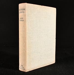
Southern Lights: The Official Account of the British Graham Land Expedition, 1934-1937
Sprache: Englisch
Verlag: The Travel Book Club, London, UK, 1939
Anbieter: All Lost Books, Wollaston, Vereinigtes Königreich
Verkäuferbewertung 5 von 5 Sternen

Erstausgabe
EUR 29,78
EUR 23,36 Versand
Versand von Vereinigtes Königreich nach USAAnzahl: 1 verfügbar
In den WarenkorbHardcover. Zustand: Very Good. Zustand des Schutzumschlags: No Dust Jacket. 1st Edition. Includes 34*b/w photographs and 1*folded map. xii, 330pp. Green cloth boards. Light sunning to spine cloth.
-
Southern Lights: The Official Account of the British Graham Land Expedition
Verlag: The Travel Book Club, London, 1939
Anbieter: Rooke Books PBFA, Bath, Vereinigtes Königreich
Verbandsmitglied: PBFA
Verkäuferbewertung 5 von 5 Sternen
EUR 44,07
EUR 23,12 Versand
Versand von Vereinigtes Königreich nach USAAnzahl: 1 verfügbar
In den WarenkorbCloth. Zustand: Very Good Indeed. None (illustrator). An early edition of John Rymill's account of the British Graham Land Expedition, illustrated with a folding map and plates. The British Graham Land Expedition took place to Antarctica between 1934 and 1937; led by Rymill, they successfully determined that Graham Land was a peninsula, as well as enjoying great success in scientific exploits. All members of the landing party were rewarded with a Polar Medal.Written by expedition leader John Rymill, who was honoured with the rare accolade of the second clasp to his Polar Medal.The Travel Book Club edition of this work, which first appeared the year prior.Illustrated with thirty plates and a folding map, all bound to the rear, as well as in-text maps.Containing the ownership inscription of R. K. M. Parry. In the publisher's original full buckram binding. Externally very smart, with just slight occasional discolouration to the cloth. Prior owner's inscription to the front endpaper. Internally, firmly bound. Pages are bright and clean, bar the odd spot to the foredge. Very Good Indeed. book.
-

SOUTHERN LIGHTS the Official Account
Verlag: Chatto and Windus, London, 1938
Anbieter: J. Wyatt Books, Ottawa, ON, Kanada
Verkäuferbewertung 5 von 5 Sternen
Erstausgabe
Hardcover. Zustand: Very Good+. No Jacket. First U.K. Edition. Hardcover; 4to; 296 pages. First U.K. edition. Green cloth hardcovers, with gilt lettering on brown cloth label on spine. Boards a little dusty, lightly scuffed. Tops cut, dyed light green. Other edges deckled. Bright and clean pages, with many sepia-tone plates throughout. Large colour folding map, pasted in rear, in excellent condition. No dj. VG+/--. Book.
-
![Bild des Verkäufers für Southern Lights; The Official Account of the British Land Expedition 1934-1937 [1] zum Verkauf von Little Stour Books PBFA Member](https://pictures.abebooks.com/inventory/md/md764142598.jpg)
Southern Lights; The Official Account of the British Land Expedition 1934-1937 [1]
Verlag: Published by Chatto & Windus Ltd, 42 William IV Street, London First Edition . London 1938., 1938
Anbieter: Little Stour Books PBFA Member, Canterbury, Vereinigtes Königreich
Verbandsmitglied: PBFA
Verkäuferbewertung 5 von 5 Sternen
Erstausgabe
EUR 160,80
EUR 34,69 Versand
Versand von Vereinigtes Königreich nach USAAnzahl: 1 verfügbar
In den WarenkorbFirst edition hard back binding in publisher's original apple green cloth covers, gilt lettering to the spine, lower page edges untrimmed. Quarto 10'' x 8'' xvi, 296 [pp]. Three fold-out colour maps, sepia photographic illustrations throughout. Free front end paper has been clipped vertically from corner to corner, light foxing to the closed page edges and front end papers, spine very slightly age darkened, binding firm, sound and square and in Very Good condition, no dust wrapper. Member of the P.B.F.A. POLAR [Antarctic].
-
Southern Lights. The Official Account of the British Graham Land Expedition, 1934-1937. With Two Chapters by A. Stephenson and an Historical Introduction by Hugh Robert Mill
Verlag: Chatto and Windus, London, 1938
Anbieter: Michael Treloar Booksellers ANZAAB/ILAB, Adelaide, SA, Australien
Verkäuferbewertung 5 von 5 Sternen
Erstausgabe
Hardcover. Zustand: Very Good. Dust Jacket Included. First Edition. London, Chatto and Windus, 1938 (first edition). Quarto, xvi, 296 pages with several maps and illustrations plus 81 pages of plates and 4 colour maps (3 folding). Green cloth with a contrasting gilt-lettered cloth label on the spine; top edge dyed green, bottom edge uncut; endpapers a little tanned, with early ownership details on the front free endpaper; an excellent copy with the very good unclipped dustwrapper (unevenly sunned, with a crease across the front panel and some loss along the top edge, affecting a few letters of the first word in the title on the spine and front cover). John Riddoch Rymill (1905-1968), polar explorer and farmer, was the leader of the expedition; he was born in Penola, South Australia, a grandson of the pioneer John Riddoch. 'Rymill's party proved that Graham Land was part of a continental extension (now the Antarctic Peninsula). They discovered a southern, permanently frozen channel, later named King George VI Sound, islanding Alexander I Land (now Alexander Island) and extending to the Bellingshausen Sea. The B.G.L.E. logistics were innovative in Antarctica. Outstanding sledging with dogs, especially over sea ice, was backed by air support and depot laying; the use of a motor launch probing ahead to plot a route for "Penola" through uncharted, rock-strewn waters, was original and successful. The "Penola" covered 26,896 miles (43,283 km) mostly under sail' ('Australian Dictionary of Biography').