Rush gold (42 Ergebnisse)

- Softcover
Anbieter: Revaluation Books, Exeter, Vereinigtes KönigreichRevaluation Books
Verkäufer/-in kontaktierenVerkäufer/-in mit 5 SternenZustand: Neu
EUR 12,12
EUR 14,67 VersandVersand von Vereinigtes Königreich nach USAAnzahl: 1 verfügbar
Paperback. Zustand: Brand New. 100 pages. 9.00x6.00x0.23 inches. In Stock.

- Softcover
Anbieter: Revaluation Books, Exeter, Vereinigtes KönigreichRevaluation Books
Verkäufer/-in kontaktierenVerkäufer/-in mit 5 SternenZustand: Neu
EUR 12,32
EUR 14,67 VersandVersand von Vereinigtes Königreich nach USAAnzahl: 1 verfügbar
Paperback. Zustand: Brand New. 100 pages. 9.00x6.00x0.23 inches. In Stock.

Verlag: Tombstone Nugget Publishing Co n.y., Tucson
- Softcover
Anbieter: Main Street Fine Books & Mss, ABAA, Galena, IL, USAMain Street Fine Books & Mss, ABAA
Verkäufer/-in kontaktierenVerkäufer/-in mit 5 SternenZustand: Gebraucht
EUR 18,07
EUR 5,26 VersandVersand innerhalb von USAAnzahl: 1 verfügbar
In den WarenkorbPaperback. 8vo. Stiff yellow pictorial wrappers. 95pp. Illustrations, maps, line drawings. Near fine. Undated (circa 1970?) facsimile reprint of the Chicago Record Co.'s original 1897 edition of this well-known Klondike Gold Rush how-to. Superb copy.
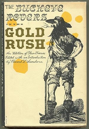
The Buckeye Rovers in the Gold Rush; An Edition of Two Diaries
[Gold Rush]; [Western Americana]; [Mining]; Howard L. Scamehorn, [Ed.]
Verlag: Ohio University Press, Athens, Ohio, 1965
- Hardcover
- Erstausgabe
Anbieter: Evening Star Books, ABAA/ILAB, Madison, WI, USAEvening Star Books, ABAA/ILAB
Verkäufer/-in kontaktierenVerkäufer/-in mit 5 SternenZustand: Gebraucht
EUR 29,81
EUR 5,70 VersandVersand innerhalb von USAAnzahl: 1 verfügbar
In den WarenkorbHardcover. Zustand: Very near Fine. Near Fine. First edition. 8vo. [12], xiiixxiv, [3], 4-195, [5] pp. Brown cloth with decorations in black and gold on the front board, gold lettering on the spine; green topstain. Gold endpapers and pastedowns. Price of $5.00 on the front flap of the dust jacket. Illustrated with a plate, a dra…wing on the title page, and a double-page map. Edited with an introduction by Howard L. Scamehorn. A few hints of edge wear and rubbing to the jacket.
Verlag: Tolra, Paris, 1898. 159 pp. Text in French., 1898
Anbieter: Antiquariaat Hortus Conclusus, Bergambacht, NiederlandeAntiquariaat Hortus Conclusus
Verkäufer/-in kontaktierenVerkäufer/-in mit 5 SternenZustand: Gebraucht
EUR 15,00
EUR 14,50 VersandVersand von Niederlande nach USAAnzahl: 1 verfügbar
In den WarenkorbFraaie halfleren band met titel en decoratie in goud op rug. Iets geschaafd maar een (zeer) goed exemplaar. Please see description or ask for photos.

- Softcover
Anbieter: moluna, Greven, Deutschlandmoluna
Verkäufer/-in kontaktierenVerkäufer/-in mit 5 SternenZustand: Neu
EUR 36,84
EUR 48,99 VersandVersand von Deutschland nach USAAnzahl: Mehr als 20 verfügbar
Zustand: New. KlappentextrnrnThis scarce antiquarian book is a facsimile reprint of the original. Due to its age, it may contain imperfections such as marks, notations, marginalia and flawed pages. Because we believe this work is culturally important, we have.
Verlag: Lille, L. Lefort, 1851. Met fraaie litho voorin van goudzoekers, 1851
Anbieter: Antiquariaat Hortus Conclusus, Bergambacht, NiederlandeAntiquariaat Hortus Conclusus
Verkäufer/-in kontaktierenVerkäufer/-in mit 5 SternenZustand: Gebraucht
EUR 25,00
EUR 14,50 VersandVersand von Niederlande nach USAAnzahl: 1 verfügbar
In den WarenkorbOriginele decoratieve kartonnen band ("reliure romantique") , rug en hoeken helaas flink gesleten. Please see description or ask for photos.

- Hardcover
Anbieter: Ken Sanders Rare Books, ABAA, Salt Lake City, UT, USAKen Sanders Rare Books, ABAA
Verkäufer/-in kontaktierenVerkäufer/-in mit 5 SternenZustand: Gebraucht - Sehr gut
EUR 90,33
EUR 6,58 VersandVersand innerhalb von USAAnzahl: 1 verfügbar
Hardcover. Zustand: Fine. Zustand des Schutzumschlags: Near Fine. 229pp. Quarto [28.5 cm] Navy blue cloth over boards. In the dust jacket, with negligible surface wear. First published in London in 1856, this edition is the illustrated 2003 edition. Limited second edition with an Introduction by Mallard R. Huntley. Various (illu…strator).

- Softcover
Anbieter: AHA-BUCH GmbH, Einbeck, DeutschlandAHA-BUCH GmbH
Verkäufer/-in kontaktierenVerkäufer/-in mit 5 SternenZustand: Neu
EUR 46,55
EUR 62,45 VersandVersand von Deutschland nach USAAnzahl: 1 verfügbar
Taschenbuch. Zustand: Neu. Neuware - This scarce antiquarian book is a facsimile reprint of the original. Due to its age, it may contain imperfections such as marks, notations, marginalia and flawed pages. Because we believe this work is culturally important, we have made it available as part of our commitment for protecting, pr…eserving, and promoting the world's literature in affordable, high quality, modern editions that are true to the original work.

Sprache: Englisch
Verlag: Weaverville, [CA], 1859
Anbieter: Kaaterskill Books, ABAA/ILAB, East Jewett, NY, USAKaaterskill Books, ABAA/ILAB
Verkäufer/-in kontaktierenVerkäufer/-in mit 5 SternenZustand: Gebraucht
EUR 67,75
EUR 6,14 VersandVersand innerhalb von USAAnzahl: 1 verfügbar
In den Warenkorb[1] pp. Bifolium. 5 x 8 inches. March 24th, 1859. Gold Rush era letter from John Hobart to Trinity County Clerk, J.A.Watson, resigning from his post in Weaverville, California . "I will be obliged to you to tender in my resignation as Road overseer for Rattlesnake Creek Road District to the Board of Supervisors when next they me…et as I am doubtfull that circumstance will keep me in that section of the County throughout the summer." Weaverville, California, founded in 1850, was a Gold Rush town and once had a population of nearly 2500 Chinese goldminers. In 1855 the Weaverville Trinity Times called attention " the large and rapidly increasing number of Chinese among us.crowding themselves into every vacant spot they can find." Very good, minor creasing along edges and folds, minor soiling, contents clean.

Verlag: Tuttle, Morehouse & Taylor, New Haven, 1878
- Hardcover
- Erstausgabe
Anbieter: Resource Books, LLC, East Granby, CT, USAResource Books, LLC
Verkäufer/-in kontaktierenVerkäufer/-in mit 5 SternenVerbandsmitglied: SNEAB
Zustand: Gebraucht - Befriedigend
EUR 120,13
Versand nach gratisVersand innerhalb von USAAnzahl: 1 verfügbar
In den WarenkorbHardcover. Zustand: Good. First Edition. New Haven: Tuttle, Morehouse & Taylor, 1878. First edition [1878]. Lightly worn. Charmingly written reminiscences of adventures of a young man from New Haven, including during the California Gold Rush and his experiences with salt water fishing. Sections include: A Dish of Chowder; A Voya…ge up the Mediterranean; California in 1849; Sam Patch's Last Leap (Genesee Falls in 1825); Respect to Aged Fisherman; The Serpent of the Sea; Short Beach; and "Throw a Rope". Rust colored cloth lettered and with a ship motif in gilt, 127 pages plus an advertisemen for Forest and Stream, Rod and Gun weekly magazine at the front. Some external wear, mainly rubbing to the corners and spine ends, some light external soil, front hinge very lightly internally cracked, text block sound, blank page before title page starting to tear from the bottom inner margin up, pages clean with a bit of age-toning and a few spots in the upper margin of a few, names on front pastedown and at the head of the advertisement, which also has a small chip. Howes H-666. First Edition. Hard Cover. Good. 12mo - over 6¾" - 7¾" tall.
Verlag: The Grabhorn Press in arrangement with the Society of California Pioneers, San Francisco, 1939
- Hardcover
- Erstausgabe
Anbieter: The Old Mill Bookshop, HACKETTSTOWN, NJ, USAThe Old Mill Bookshop
Verkäufer/-in kontaktierenVerkäufer/-in mit 2 SternenZustand: Gebraucht
EUR 135,50
EUR 10,52 VersandVersand innerhalb von USAAnzahl: 1 verfügbar
In den Warenkorb1st Edition. First edition. One of 950 copies printed. Colored frontispiece, facsimile of a page of the manuscript, map. 1 vols. 4to. Includes an index to the "Persons at the Fort". Howes S1155. Howes S1155 Original linen-backed decorated boards, printed paper label. Some discoloration of spine, Bookplate of Alistair Cooke Color…ed frontispiece, facsimile of a page of the manuscript, map. 1 vols. 4to First edition. One of 950 copies printed.
Verlag: Melbourne: John Ferres, Government Printer, 1860., 1860
- Hardcover
Anbieter: Arader Galleries - AraderNYC, New York, NY, USAArader Galleries - AraderNYC
Verkäufer/-in kontaktierenVerkäufer/-in mit 5 SternenZustand: Gebraucht
EUR 180,67
Versand nach gratisVersand innerhalb von USAAnzahl: 1 verfügbar
In den WarenkorbHardcover. Folio (13 x 8 inches). Printed on blue paper. Modern brown leatherette, gilt. A detailed set of accounts showing the total amount of export duty on gold - 1,500,000 pounds; and the total expenditure for managing the gold fields - 460,000 pounds - broken down in the minutest detail.
Verlag: Melbourne: John Ferres, Government Printer, 1860., 1860
- Hardcover
Anbieter: Arader Galleries - AraderNYC, New York, NY, USAArader Galleries - AraderNYC
Verkäufer/-in kontaktierenVerkäufer/-in mit 5 SternenZustand: Gebraucht
EUR 180,67
Versand nach gratisVersand innerhalb von USAAnzahl: 1 verfügbar
In den WarenkorbHardcover. Folio (13 1/8 x 8 inches). Printed on blue paper. Modern brown leatherette, gilt. "It appears that a certain lead known as Contest Lead at Smythe's Creek was discovered in November, 1857, and that a 'prospecting claim' was awarded to the discoverers.", who then abandoned the claims, which were taken up by newcomers. T…his document seeks to unravel the complicated and conflicting claims at the Contest Lead and thereby set a precedent in similar circumstances.
Verlag: Melbourne: John Ferres, 1859., 1859
- Hardcover
Anbieter: Arader Galleries - AraderNYC, New York, NY, USAArader Galleries - AraderNYC
Verkäufer/-in kontaktierenVerkäufer/-in mit 5 SternenZustand: Gebraucht
EUR 271,00
Versand nach gratisVersand innerhalb von USAAnzahl: 1 verfügbar
In den WarenkorbHardcover. Folio (13 1/8 x 8 inches. Printed on blue paper. Modern brown leatherette, gilt. Since gold had been discovered in Ballarat in 1851 a substantial community had developed, which now needed infrastructure. Of great concern was the maintenance of a clean water supply: "there is a considerable quantity of water collected…in a natural reservoir, known as the Wendouree or Yuille's swamp, . the storage of water therein might be readily increased at a small cost." (page [i]). However at the time of the report a by-law existed entitling only the residents of Ballaarat East to the water. The report concluded that this should be changed to allow all residents of Ballaarat access to the water from the swamp.
Verlag: Melbourne: John Ferres, October 1853., 1853
- Hardcover
Anbieter: Arader Galleries - AraderNYC, New York, NY, USAArader Galleries - AraderNYC
Verkäufer/-in kontaktierenVerkäufer/-in mit 5 SternenZustand: Gebraucht
EUR 271,00
Versand nach gratisVersand innerhalb von USAAnzahl: 1 verfügbar
In den WarenkorbHardcover. Folio (13 x 8 inches). Printed on blue paper. Modern brown leatherette, gilt. Including detailed inventory of the stores and provisions at the gold diggings in Beechworth, Sandhurst, Upper Loddon District (Castelmaine is recorded as having 2 Union Jacks), Heathcote, and Ballaarat.
Verlag: Melbourne: John Ferres, at the Government Printing Office, January 1853., 1853
- Hardcover
Anbieter: Arader Galleries - AraderNYC, New York, NY, USAArader Galleries - AraderNYC
Verkäufer/-in kontaktierenVerkäufer/-in mit 5 SternenZustand: Gebraucht
EUR 271,00
Versand nach gratisVersand innerhalb von USAAnzahl: 1 verfügbar
In den WarenkorbHardcover. Folio (13 2/8 x 8 inches). Printed on blue paper. Modern brown leatherette, gilt. A far-reaching, although incomplete, report of the select committee in to the management of the gold fields, which examined everything from the number of officers required to maintain order at the diggings to the preservation of fresh wa…ter holes, the regulation of butchers and other 'hawkers', and 'sly grog-selling'.
Verlag: Melbourne: John Ferres, at the Government Printing Office, 1852., 1852
- Hardcover
Anbieter: Arader Galleries - AraderNYC, New York, NY, USAArader Galleries - AraderNYC
Verkäufer/-in kontaktierenVerkäufer/-in mit 5 SternenZustand: Gebraucht
EUR 271,00
Versand nach gratisVersand innerhalb von USAAnzahl: 1 verfügbar
In den WarenkorbHardcover. Folio (13 x 8 inches. Printed on blue paper. Modern brown leatherette, gilt. Detailed Returns (accounts) of the individual gold fields in Victoria, which had by this time been whittled down to Mount Alexander, and Ballaarat. Included are: a break down by month from November 1851 of the number of licenses to dig for go…ld issued, showing a rise from about 8,000 to 24,500 in June of 1852; a list of the Gold Commissioners by name, gold field, salary etc; the number of police and soldiers employed to maintain order in the fields; the cost of the gold escort; the incidental costs to the public service of the gold crisis; the amount of gold escorted to the treasuries in Melbourne and Adelaide between November 1851 and June 1852, which was valued at nearly 3,000,000 pounds; and a comprehensive list of the gold exported from the colony, on which ship and where to, most of it going to London; although amazingly no gold is recorded as having been lost in transport, there is a record of the number of assaults and robberies carried out with a direct connection to the gold crisis.
Verlag: Melbourne: John Ferres, Government Printer, March 1856., 1856
- Hardcover
Anbieter: Arader Galleries - AraderNYC, New York, NY, USAArader Galleries - AraderNYC
Verkäufer/-in kontaktierenVerkäufer/-in mit 5 SternenZustand: Gebraucht
EUR 542,00
Versand nach gratisVersand innerhalb von USAAnzahl: 1 verfügbar
In den WarenkorbHardcover. Broadsheet (12 2/8 x 8 inches). Printed on blue paper. Modern brown leatherette, gilt. An extensive report recommending the institution of a Mining Board that would be in charge of carrying out extensive geological surveys throughout Victoria to distinguish between auriferous and agricultural land. This survey would b…ecome the basis for an ordnance map of the county, and provide initial information to plan a railroad, reservoirs, etc: "America, which has credit for being the most economical Government in the civilised world, has expended very large sums of money in making topographical, geological, and natural history surveys on the most comprehensive scale, and which surveys are superior to those elaborated by any Government of Europe, and results of great practical value have in all places followed from such proceedings" (page iii-iv). The Committee also reports on the mining equipment and methods currently in use and decides that it is very unsatisfactory, and in need of organisation: "there are 100,000 miners either engaged in actual mining, or rushing about from place to place in search of new gold fields."(page v). A supplement to the report provided by mining expert, Jacob Braché (1827-1905) estimates the auriferous lands of the Colony to be 20,000 square miles, including 200 square miles of quartz reefs; that there are 20,650 millions of tons of quartz, which would take 100,000 miners 300 years to work up. Estimating its value as low as 1 pound per ton, it would give the enormous yield of 62 millions sterling per annum, allowing 10,000 companies of 10 men each to quarry and crush 24 tons per day. it gives the grand total of the estimated auriferous wealth of the Colony of Victoria of 26,783 millions sterling!" (page v). On the strength of his enthusiasm alone Brache was commissioned to conduct the report into the mining methods employed - a task he was signally unsuited for.
 Weitere Bilder
Verlag: James French and Company, Boston, 1857
- Hardcover
- Erstausgabe
Anbieter: The First Edition Rare Books, LLC, Cincinnati, OH, USAThe First Edition Rare Books, LLC
Verkäufer/-in kontaktierenVerkäufer/-in mit 5 SternenZustand: Gebraucht - Gut
EUR 767,83
EUR 5,26 VersandVersand innerhalb von USAAnzahl: 1 verfügbar
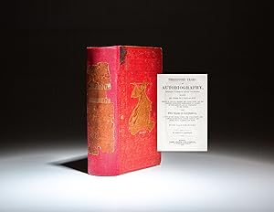
In den WarenkorbCloth. Zustand: Very good. First Edition. Octavo, vi, [4], [11]-504pp. Publisher's red cloth, title in gilt, illustration of Saladin in gilt on cover. Original cloth laid down and reinforced at spine. Includes frontispiece and 13 full-page illustrations of naval life. Even toning throughout, a few scholarly notes in pencil. Prev…ious ownership inscriptions on the front endpapers and verso of frontispiece. (Sabin 32457) (Howes H576) (Howell, California 50: 524) (Wheat, Books of the California Gold Rush 102.) A scarce first edition, with only a handful of known copies appearing on the retail market. Samuel Holbrook arrived in California in 1850, after a difficult journey over the Isthmus of Panama. His descriptions of early California detail the "worst and unromantic side of life in the state [but] are nevertheless interesting." He wrote that "San Francisco was filled with gamblers, rogues of every species, cut throats, highway robbers, Sydney convicts, villainous commission merchants and bankers, fraudulent auctioneers, hypocrites, apologies for courts, and some of the most miserable and contemptible pettifoggers that could be scraped together from every section of the country.". First edition of Threescore Years: An Autobiography, an early history of the Gold Rush era in California, by Samuel F. Holbrook. (illustrator).
Verlag: Melbourne: John Ferres, 1859., 1859
- Hardcover
Anbieter: Arader Galleries - AraderNYC, New York, NY, USAArader Galleries - AraderNYC
Verkäufer/-in kontaktierenVerkäufer/-in mit 5 SternenZustand: Gebraucht
EUR 1.084,00
Versand nach gratisVersand innerhalb von USAAnzahl: 1 verfügbar
In den WarenkorbHardcover. Folio (13 1/8 x 8 inches). Printed on blue paper. Folding lithographed map of the Parish of Narree Worran. Modern brown leatherette, gilt. The accompanying "sketch of the ranges of hills and streams contiguous to these gold workings, and also of the track leading thereunto, has been only very cursorily made with the a…id of compass-bearings and rough estimation of distances; and even to procure this very ride and imperfect delineation of these topographical features, I found it necessary to force a passage through such dense tangled scrub that I was occasionally compelled to crawl on my hands and knees to advance at all" (page [i]). The reason for the map's sketchiness is explained by the "unexampled stupidity" of the men that Clement Hodgkinson sent before him, in getting lost. However Hodgkinson was able to provide a detailed report of the area and the diggings. He noted that the profitable land was limited in area and that only about 200 miners were working it. By 1860 these fields were largely depleted.
Verlag: Melbourne: John Ferres, at the Government Printing Office, September 1852, 1852
- Hardcover
Anbieter: Arader Galleries - AraderNYC, New York, NY, USAArader Galleries - AraderNYC
Verkäufer/-in kontaktierenVerkäufer/-in mit 5 SternenZustand: Gebraucht
EUR 813,00
Versand nach gratisVersand innerhalb von USAAnzahl: 1 verfügbar
In den WarenkorbHardcover. Folio (13 x 8 inches). Printed on blue paper. Modern brown leatherette, gilt. "It is quite impossible for me to describe to your Lordship the effect which these discoveries have had upon the whole community" (Lieut-Governor La Trobe to Earl Grey) An important collection of papers detailing the discovery of gold in Vic…toria. Throughout the year La Trobe gives a very detailed and increasingly desperate account of the discoveries made at Anderson's Creek, Clunes, Buninyong and Ballaarat [sic]. He not only gives a vivid account of how the gold was found, but also an analysis of the geology of the areas, soil, clay and ore type. His main and growing concern, however is the detrimental effect of the gold discoveries on the community as a whole: "Within the last three weeks the towns of Melbourne and Geelong, with their large suburbs, have been, in appearance, almost emptied of many classes of their mail inhabitants; the streets which, for a week or ten days, were crowded by drays loading with the outfit for the workings, are now seemingly deserted.Not only have the idlers, day labourers, shopmen, artisans, and mechanics of every description thrown up their employments, and in most cases, leaving their employers and their wives and families to take care of themselves, run off to the workings, but responsible tradesmen, farmers, clerks of every grade, and not a few of the superior classes have followed" (page 5-6). In the face of a complete breakdown in society, La Trobe took a number of extraordinary measures: he authorised an immediate pay rise to all clerks, turnkeys, constabulary and mounted police, as well as to messengers and surveyors; the cost of a prospector's license was increased, although La Trobe would have preferred a tax to be paid on the gold found; he seconded the help of subordinate officers from his neighbouring colonies; and begged the Imperial Government for guidance, and help in the form of men to police the diggings, and to guard the ports. After the initial fever, or "Gold Crsis" as La Trobe refers to it, many of the original absconders returned to their more mundane and less lucrative lives, having discovered what punishing and often disappointing work digging for gold actually was, but the colony's problems were ongoing.
Verlag: Melbourne: John Ferres, Government Printer, September 1853., 1853
- Hardcover
Anbieter: Arader Galleries - AraderNYC, New York, NY, USAArader Galleries - AraderNYC
Verkäufer/-in kontaktierenVerkäufer/-in mit 5 SternenZustand: Gebraucht
EUR 722,67
Versand nach gratisVersand innerhalb von USAAnzahl: 1 verfügbar
In den WarenkorbHardcover. Folio (13 x 8 inches). Printed on blue paper. Modern brown leatherette, gilt. An important report listing the number of prospecting licenses sold, an increasingly long list of Officers employed to maintain order in the gold fields, but also the long awaited "Regulations and Instructions for the Gold Fields. 1852". Whi…le the report outlines the duties of the Chief Commissioner, his subordinates etc., it also records the duties of the "Escort for the Gold": "Most particular instructions must be given to the Officer in charge of the Escort, that he never loses sight of the treasure; that the men are not allowed, under any pretext, to leave the immediate proximity of the horses or cart bearing it; and that at night it is deposited in the room where the Officer himself is; and that a sufficient guard is kept constantly over it. At night, also, the whole of the Escort should rest in the immediate vicinity of the room where the gold is; and on reaching Melbourne, it is to be immediately handed over to the Colonial Treasurer; for which purpose the Escort should not reach Melbourne later than 2pm on the day fixed for arrival" (page 15).
Verlag: Melbourne: John Ferres, 1859., 1859
- Hardcover
Anbieter: Arader Galleries - AraderNYC, New York, NY, USAArader Galleries - AraderNYC
Verkäufer/-in kontaktierenVerkäufer/-in mit 5 SternenZustand: Gebraucht
EUR 1.084,00
Versand nach gratisVersand innerhalb von USAAnzahl: 1 verfügbar
In den WarenkorbHardcover. Folio (13 1/8 x 8 inches). Printed on blue paper. FINE FOLDING CHROMOLITHOGRAPHED MAP WITH ORIGINAL HAND COLOUR OF THE VALLEY OF BENDIGO, folding leaf of profiles of slag heaps, full-page profiles of Bendigo Creek, Reservoir near Irish Town Bridge, Golden Square Bridge, and 2 of sluice gates. Modern brown leatherette,… gilt. An extensive report, illustrated with a very fine map of Bendigo, investigating how best to carry off sludge from the puddling mills at Sandhurst, without interfering with the drainage of the town and the roads in the neighbourhood. "Throughout the gold field the injurious consequences o the choking up of the natural drainage channel, and the want of a proper system for carrying off the sludge from the puddling mills, is everywhere apparent. Even in the gullies where the ground lies relatively higher, large areas may be seen of partially worked ground which have been overflowed by the sludge and rendered almost worthless. On the flats and low levels the damage is even more extensive; in many places, and particularly at the junction of large gullies where the sludge has found no outlet, and has consequently spread to vast mud estuaries, it has covered many acres of valuable auriferous land, filling up the water-dams, and rendering useless the machines erected in these localities; in some instances it has risen to so great a height that the machines themselves have been totally submerged. This is the case particularly at the junction of Long ad Ironbark gullies with the Bendigo Flat, where the sludge has attained a height of twelve feet above the level of the old workings" (page 3-4). Alluvial gold was first discovered in the creek at Bendigo in 1851, but was soon depleted and a system of puddling the topsoil down to the bedrock was developed to get at the gold trapped within it By 1853 By1853, the alluvial gold was "increasingly hard to find and some miners turned to crushing the quartz reefs which were standing above the surface, first using hand methods and then crushing machines. The miners followed the quartz reefs below the surface, until, in the 1890s, a few shafts were nearly 1,500 metres deep. Booms in quartz mining occurred in 1859 and 1871; gold production declined gradually as the mines were deepened but there was a revival during the 1890s depression and, in the early 1900s, production was maintained with the cyanide treatment of gold left in the earlier tailings" (Bendigo Historical Society online).
Verlag: Melbourne: John Ferres, at the Government Printing Office, 1851., 1851
- Hardcover
Anbieter: Arader Galleries - AraderNYC, New York, NY, USAArader Galleries - AraderNYC
Verkäufer/-in kontaktierenVerkäufer/-in mit 5 SternenZustand: Gebraucht
EUR 1.264,66
Versand nach gratisVersand innerhalb von USAAnzahl: 1 verfügbar
In den WarenkorbHardcover. Folio (13 x 8 inches). Printed on grey paper. Modern brown leatherette, gilt. GOLD IS DISCOVERED IN VICTORIA "Whereas, by Law, all Mines of Gold and all Gold in its natural place of deposit within the Colony of Victoria, whether on the lands of the Queen or of any of Her Majesty's subjects, belong to the Crown. And wh…ereas information has been received by the Government that Gold exists upon and in the soil of the Colony, and that certain persons have commenced, or are about to commence, searching and digging for the same for their own use, without leave or other authority from Her Majesty: Now I, Charles Joseph LaTrobe, Esquire, the Lieutenant Governor aforesaid, on behalf of Her Majesty, do hereby publicly notify and declare that all persons who shall take from any lands with the said Colony, and Gold, Metal, or Ore containing Gold, . will be prosecuted both criminally and civilly as the Law allows." (page 10). The above notice was issued on the 15th of August in 1851, little more than a month after gold had been discovered in Victoria. The discovery sparked a rush similar to that in California, the population quadrupled in the next 3 years, and Britain had enough wealth to pay off her foreign debts and fund an industrial revolution. This is an important collection of 11 Returns and Memos detailing the history of the discovery of gold in Victoria, including documents that record the dates and locations of the finds, the number of licenses issued, the quantity and value of the finds. There are also documents recording the incidental consequences of the finds, including the number of immigrants to Victoria drawn there by the gold, the number of extra Government Commissioners and Police required to maintain order, and details of the gold escort system that took the gold from the fields to the treasury in Melbourne.
Verlag: Melbourne: John Ferres, Government Printer, 1878., 1878
Anbieter: Arader Galleries - AraderNYC, New York, NY, USAArader Galleries - AraderNYC
Verkäufer/-in kontaktierenVerkäufer/-in mit 5 SternenZustand: Gebraucht
EUR 338,75
Versand nach gratisVersand innerhalb von USAAnzahl: 1 verfügbar
In den WarenkorbFolio (13 2/8 x 8 inches). Modern brown leatherette. "The mining industry during the past year has not been so prosperous as usual. Scarcity of water, through long continued drought, has militated greatly against alluvial mining operations. The return of gold also from quartz mining shows a decrease as compared with preceding ye…ars, but there does not appear to be any ground to fear that this branch of mining is on the wane, for veins are being steadily worked at increasing depths; and, as regards alluvial mining, it is hoped, with a better supply of water, there will, during the next year, be an increased yield of gold" (W. Collard Smith, Minister of Mines). The amount of gold 'raised' out of the ground between 1872 and 1877 diminished by about 40%. Gold mining in Victoria declined steadily throughout the 19th-century, but the ban on exporting gold in 1915, and the abolition of the gold standard throughout the empire meant that the early 20th-century saw the complete collapse of many Victorian mining towns.
Verlag: Melbourne: John Ferres, Government Printer, 1861., 1861
Anbieter: Arader Galleries - AraderNYC, New York, NY, USAArader Galleries - AraderNYC
Verkäufer/-in kontaktierenVerkäufer/-in mit 5 SternenZustand: Gebraucht
EUR 406,50
Versand nach gratisVersand innerhalb von USAAnzahl: 1 verfügbar
In den WarenkorbFolio (13 x 8 inches). Printed on blue paper. Modern brown leatherette. A report outlining the expenditure of an agreed 30,000 pound budget for prospecting for New Gold Fields in Victoria, particularly in the district of Gipps Land and the Great Dividing Range; the Basin of the River Yarra; the country north and north-east of Ko…rong; the sources of the Mitta-Mitta, Little River, Sandy Creek, and the sources of the creeks north and east of the Benambra Mountains, in the mining district of Beechworth. The report includes appendices which list the leaders of the prospecting teams at all these sites, with details of their place of birth and previous occupations. Not surprisingly only one was born 'locally', in Tasmania.
Verlag: Melbourne: John Ferres, Government Printer, 1867., 1867
Anbieter: Arader Galleries - AraderNYC, New York, NY, USAArader Galleries - AraderNYC
Verkäufer/-in kontaktierenVerkäufer/-in mit 5 SternenZustand: Gebraucht
EUR 496,83
Versand nach gratisVersand innerhalb von USAAnzahl: 1 verfügbar
In den WarenkorbFolio (13 2/8 x 8 inches). Modern brown leatherette. An extensive report into the claims made by mining companies to prospect for gold on land previously 'reserved' for some other use near Ballaraat. "In cases where it is necessary to authorise mining operations under lands which have been for a long period dedicated to public u…ses, and where the contingent rights of the neighbouring claimholders are not involved, we are of opinion that it would be convenient and more satisfactory to demise the reserved lands than to authorise holders of miners' rights to occupy them under the 15th section of the "Mining Stature" 1865". In order to prevent future violations it is recommended that the Mining department be sent any reports showing land that has been preserved for public use in mining fields. The lands include the Cricket Reserve (permission refused); the Public Park (permission granted); Miners' Racecourse Reserve (judgment withheld); Benevolent Asylum Reserve (permission refused); Botanical Gardens Reserve (applicant failed to appear); Survey Paddock Reserve (applicants withdrew); Corporation Reserve (applicant failed to appear); Cattle Yards Reserve (permission refused); Prince of Wales Park (permission granted); and Lake Wendouree (already being mined by another party).
Verlag: Melbourne: Rob[er]t S. Brain, Government Printer, 1894., 1894
Anbieter: Arader Galleries - AraderNYC, New York, NY, USAArader Galleries - AraderNYC
Verkäufer/-in kontaktierenVerkäufer/-in mit 5 SternenZustand: Gebraucht
EUR 587,17
Versand nach gratisVersand innerhalb von USAAnzahl: 1 verfügbar
In den WarenkorbFolio (12 6/8 x 8 inches). (Some spotting and browning, early repair to verso of last leaf). Modern brown leatherette, original blue front wrapper laid down on heavier stock at beginning. A report into a number of gold fields that were once highly productive "but which have been long neglected and in some instances almost forgot…ten". They include the Pyranees District, Inglewood Reefs, Kingower Eistrict, Wood's Point Reefs, Matlock Reefs, Big River and Raspberry Creek Mines, Big River Reefs, Alexandra Reefs, and Yarra Gold-fields. The causes of the 'decadence of mining', according to Walker's report, are not so closely associated to a diminution of gold, but to mismanagement, lack of enthusiasm for the job on the part of the younger generations, inefficiency of equipment: "in numberless places throughout the colony, Bendigo, Stawell, or Ballarat, skill, backed by comparatively small capital, would, I am convinced, in a short time lay bare some very prolific sources of tat mineral wealth on which our national prosperity was founded. the fact that the mining industry has not flourished all over the colony is due mainly to the incompetence and carelessness of the people interested" (Introduction).
 Weitere Bilder
Verlag: J. Steele, Lodi, Wisconsin, 1901
- Erstausgabe
Anbieter: Phillip J. Pirages Rare Books (ABAA), McMinnville, OR, USAPhillip J. Pirages Rare Books (ABAA)
Verkäufer/-in kontaktierenVerkäufer/-in mit 3 SternenZustand: Gebraucht
EUR 5.167,06
EUR 8,77 VersandVersand innerhalb von USAAnzahl: 1 verfügbar
In den WarenkorbFIRST EDITION. 232 x 155 mm. (9 1/8 x 6"). 81 pp. Original green (faded to brown) printed paper wrappers. Housed in a fine modern caramel-colored morocco clamshell box with gilt lettering on spine. Inside front wrapper with ink signature of M. R. Skinner; occasional pencil underlining in the text. Howes S-924; Graff 3964; Street…er 3027; Wagner-Camp 244 (note). Top inch of spine chipped away, a little fraying to edges, first three leaves with overall browning, minor corner creases, but QUITE AN EXCELLENT COPY of a very fragile item, clean and fresh internally, with the insubstantial binding entirely intact (against all odds). Based on the author's diaries written between September 1850 and July 1853, this work, as the introduction tells us, lays out events "just as they happened," being "ludicrous, solemn, serious, tragic, inexpressibly sad, but always interesting." Kurutz calls the book a "detailed and important account of mining life" and notes that Steele "provided important information on mining techniques and laws while laboring in the Coloma District and on the Yuba and Feather rivers." This account includes some fascinating stories about the many hardships and dangers experienced by the author and his associates, including nearly constant fatigue and hunger, dreadful weather conditions, and dicey encounters with desperados, dishonest miners, and disgruntled frontier men of commerce. John Steele (1832-1905) was only 18 years old when he left his home in Wisconsin for the gold fields of California. After three and a half years of adventuring, he returned to the Midwest, where he pursued a career in teaching. Steele also volunteered for the Union army during the Civil War, and spent the last 30 years of his life as a minister in the Methodist Episcopal Church. The present work was privately printed by the author in a small number of copies and is, as expected, quite rare on the market now. Besides the present one, RBH lists just two other copies sold since 1981 (and as of this writing, no other dealer seems to be offering one). Furthermore, our copy is a remarkably well-preserved survival, with its delicate wrappers and text in condition as attractive as one could hope to find.


