Philip d burden (11 Ergebnisse)

- Hardcover
Anbieter: Mooney's bookstore, Den Helder, NiederlandeMooney's bookstore
Verkäufer/-in kontaktierenVerkäufer/-in mit 4 SternenZustand: Gebraucht - Gut
EUR 481,38
EUR 14,95 VersandVersand von Niederlande nach USAAnzahl: 1 verfügbar
Zustand: Very good.
Verlag: Rickmansworth, Raleigh Publ, ., 1996
- Hardcover
Anbieter: Bibliographica Christian Höflich, Hamburg, HH, DeutschlandBibliographica Christian Höflich
Verkäufer/-in kontaktierenVerkäufer/-in mit 5 SternenZustand: Gebraucht
EUR 150,00
EUR 25,00 VersandVersand von Deutschland nach USAAnzahl: 1 verfügbar
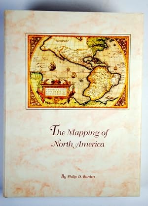
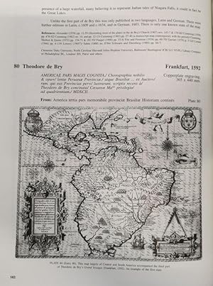
Mit 429 tlw. ganzseit. Abbildungen (davon 11 farb.). XXXIV, 568 S. Orig.-Leinen mit Schutzumschlag. 36 : 26,5 cm. * Wichtiges Standardwerk zur Kartographie von Nordamerika, beschreibt und kommentiert detailliert 410 Karten. Mit Vorwort von Tony Campbell sowie Glossar, Kartobibliographie, Bibliographie und Index. - Sehr gut erhal…ten.

Verlag: Raleigh Publications, 1996
- Hardcover
- Karte
Anbieter: Forest Books, ABA-ILAB, Grantham, LINCS, Vereinigtes KönigreichForest Books, ABA-ILAB
Verkäufer/-in kontaktierenVerkäufer/-in mit 5 SternenZustand: Gebraucht
EUR 180,36
EUR 29,18 VersandVersand von Vereinigtes Königreich nach USAAnzahl: 1 verfügbar
Large 4to, 608pp., 420 illustrs., (some coloured), orig. cloth, d.w. Every one of the 410 maps mentioned is illustrated, full cartographical and bibliographical details are given, together with their locations.
Verlag: Raleigh Publications, 2007
- Hardcover
- Karte
Anbieter: Forest Books, ABA-ILAB, Grantham, LINCS, Vereinigtes KönigreichForest Books, ABA-ILAB
Verkäufer/-in kontaktierenVerkäufer/-in mit 5 SternenZustand: Gebraucht
EUR 228,45
EUR 29,18 VersandVersand von Vereinigtes Königreich nach USAAnzahl: 1 verfügbar
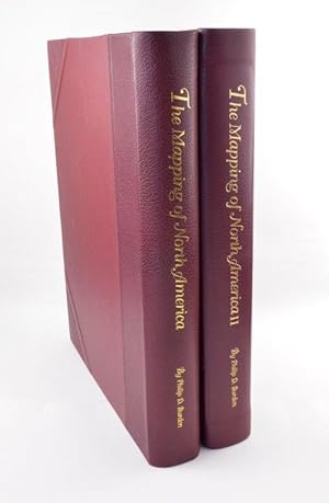
Large 4to, 540pp., 392 illustrs., (12 coloured), orig. cloth, d.w. Continues on from the first volume in documenting the printed cartographic record of the discovery of the continent from 1670 to 1700.
Verlag: Raleigh Publications, 2007
- Hardcover
- Karte
Anbieter: Forest Books, ABA-ILAB, Grantham, LINCS, Vereinigtes KönigreichForest Books, ABA-ILAB
Verkäufer/-in kontaktierenVerkäufer/-in mit 5 SternenZustand: Gebraucht
EUR 228,45
EUR 29,18 VersandVersand von Vereinigtes Königreich nach USAAnzahl: 1 verfügbar
Large 4to, 540pp., 392 illustrs., (12 coloured), orig. cloth, d.w. Continues on from the first volume in documenting the printed cartographic record of the discovery of the continent from 1670 to 1700.
Verlag: Raleigh Publications, Rickmansworth, UK, 2007
- Hardcover
Anbieter: Alexandre Antique Prints, Maps & Books, Toronto, ON, KanadaAlexandre Antique Prints, Maps & Books
Verkäufer/-in kontaktierenVerkäufer/-in mit 4 SternenZustand: Gebraucht
EUR 337,65
EUR 5,24 VersandVersand von Kanada nach USAAnzahl: 1 verfügbar
Cloth boards with dust-jacket., Size : Folio, Profusely illustrated with black and white maps and charts., Volume : Vol 2 of 2, 540 pp. Book and dust-jacket in excellent condition.
Verlag: Raleigh Publications, 1996
Anbieter: Argosy Book Store, ABAA, ILAB, New York, NY, USAArgosy Book Store, ABAA, ILAB
Verkäufer/-in kontaktierenVerkäufer/-in mit 5 SternenZustand: Gebraucht
EUR 180,08
EUR 5,24 VersandVersand innerhalb von USAAnzahl: 1 verfügbar
420 illustrations, 10 in color. 568pp., Large 4to, cloth boards, d.w. Raleigh Publications, 1996. Very good. Signed. The Mapping of North America documents the printed cartographic record of the discovery of the continent from 1511 - 1670. Comprehensive, a must have for anyone interesting in mapping.

Verlag: Raleigh Publications,, Rickmansworth, Herts,, 1996
Anbieter: Daniel Crouch Rare Books Ltd, London, Vereinigtes KönigreichDaniel Crouch Rare Books Ltd
Verkäufer/-in kontaktierenVerkäufer/-in mit 4 SternenZustand: Gebraucht
EUR 300,59
EUR 23,35 VersandVersand von Vereinigtes Königreich nach USAAnzahl: 1 verfügbar
The book documents the printed cartographic record of the discovery of the continent in 1492 to 1670 Hardcover, inscribed by author, 568 pages, no dust jacket, edition 64/100. The book documents the printed cartographic record of the discovery of the continent in 1492 to 1670.
Verlag: Rickmansworth, Raleigh., 1996
Anbieter: Antiquariat Bücheretage, Bonn, DeutschlandAntiquariat Bücheretage
Verkäufer/-in kontaktierenVerkäufer/-in mit 5 SternenVerbandsmitglied: GIAQ
Zustand: Gebraucht
EUR 500,00
EUR 35,00 VersandVersand von Deutschland nach USAAnzahl: 1 verfügbar
Folio. XXXIV, 586 S. mit 429 Abb davon 11 in Farbe. Old. mit Leinenschuber. Number 14 of 25 copies in full leather signed by the author. Very good condition. Es erschien noch ein Fortsetzungsband, der den Zeitraum bis 1700 umfaßt.
Verlag: Raleigh Publications. -2007, 1996
- Signiert
- Karte
Anbieter: Forest Books, ABA-ILAB, Grantham, LINCS, Vereinigtes KönigreichForest Books, ABA-ILAB
Verkäufer/-in kontaktierenVerkäufer/-in mit 5 SternenZustand: Gebraucht
EUR 529,05
EUR 29,18 VersandVersand von Vereinigtes Königreich nach USAAnzahl: 1 verfügbar
2 Vols., large 4to, 540; 608pp., ONE OF 100 NUMBERED COPIES SIGNED BY THE AUTHOR BOUND IN RED HALF MOROCCO, 812 illustrs., (some coloured), a very nice set.
Anbieter: Manuela-Charlott Tepper, Schulendorf Scharbeutz, DeutschlandManuela-Charlott Tepper
Verkäufer/-in kontaktierenVerkäufer/-in mit 2 SternenZustand: Gebraucht
EUR 120,00
EUR 35,00 VersandVersand von Deutschland nach USAAnzahl: 1 verfügbar
Raleigh Publications, Rickmansworth 1996. KL.-Folio. XXXIV, 568 Seiten. OLeinwand mit OUmschlag. Beschreibt und kommentiert 410 Karten , alle abgebildet.


