Gesamtpreis (1 Artikel Artikel):
Versandziel:

pacific ocean (32 Ergebnisse)
Direkt zu den wichtigsten Suchergebnissen
Suchfilter
Produktart
- Alle Product Types
- Bücher (19)
- Magazine & Zeitschriften (Keine weiteren Ergebnisse entsprechen dieser Verfeinerung)
- Comics (Keine weiteren Ergebnisse entsprechen dieser Verfeinerung)
- Noten (Keine weiteren Ergebnisse entsprechen dieser Verfeinerung)
- Kunst, Grafik & Poster (Keine weiteren Ergebnisse entsprechen dieser Verfeinerung)
- Fotografien (Keine weiteren Ergebnisse entsprechen dieser Verfeinerung)
- Karten (13)
- Manuskripte & Papierantiquitäten (Keine weiteren Ergebnisse entsprechen dieser Verfeinerung)
Zustand Mehr dazu
Einband
Weitere Eigenschaften
Sprache (3)
Gratisversand
- Kostenloser Versand nach USA (Keine weiteren Ergebnisse entsprechen dieser Verfeinerung)
Land des Verkäufers
Verkäuferbewertung
-

Pacific Ocean: Ferdinand Magellan Santa Cruz Island (The photo book of Ocean Series)
Anbieter: Revaluation Books, Exeter, Vereinigtes Königreich
Verkäuferbewertung 5 von 5 Sternen

EUR 29,77
EUR 14,45 Versand
Versand von Vereinigtes Königreich nach USAAnzahl: 1 verfügbar
In den WarenkorbPaperback. Zustand: Brand New. 107 pages. 9.00x6.00x0.26 inches. In Stock.
-

Elements of a Science Plan for the North Pacific Research Board
Anbieter: Orbiting Books, Hereford, Vereinigtes Königreich
Verkäuferbewertung 5 von 5 Sternen
EUR 43,77
EUR 13,87 Versand
Versand von Vereinigtes Königreich nach USAAnzahl: 1 verfügbar
In den Warenkorbpaperback. Zustand: Very Good. Bumped edges. Scratches to the cover. Marks to the edges of the pages. Appears unread, may have minor damage from transit/storage. Next day dispatch from the UK (Mon-Fri). Please contact us with any queries.
-

EUR 23,43
EUR 48,99 Versand
Versand von Deutschland nach USAAnzahl: Mehr als 20 verfügbar
In den WarenkorbZustand: New. KlappentextLooks at combat propaganda geared toward the goal of taking of prisoners. Discusses assault propaganda, propaganda directed to by-passed and isolated garrisons, themes and appeals to be used in propaganda, and the proper disse.
-

EUR 23,43
EUR 48,99 Versand
Versand von Deutschland nach USAAnzahl: Mehr als 20 verfügbar
In den WarenkorbZustand: New. KlappentextDuring WW II the Command and General Staff Colleges primary mission was to train large numbers of captains and majors to be staff officers in battalions, brigades, divisions, and corps. To that end, the Army provided copies of.
-

EUR 26,08
EUR 48,99 Versand
Versand von Deutschland nach USAAnzahl: Mehr als 20 verfügbar
In den WarenkorbZustand: New. KlappentextConsists of the most comprehensive set of field fortification layouts and specifications that had been obtained. Contains translations of these captured plans. Special translation number 58.
-

EUR 25,19
EUR 48,99 Versand
Versand von Deutschland nach USAAnzahl: Mehr als 20 verfügbar
In den WarenkorbZustand: New. KlappentextConsists of the most comprehensive set of field fortification layouts and specifications that had been obtained. Contains translations of these captured plans. Special translation number 58.
-
![Bild des Verkäufers für Selkirk's Island [Signed] zum Verkauf von Little Stour Books PBFA Member](https://pictures.abebooks.com/inventory/md/md30972517858.jpg)
Selkirk's Island [Signed]
Verlag: Published by George Weidenfeld & Nicolson Ltd., The Orion Publishing Group, 5 Upper St. Martin's Lane, London First Edition . 2001., 2001
Anbieter: Little Stour Books PBFA Member, Canterbury, Vereinigtes Königreich
Verbandsmitglied: PBFA
Verkäuferbewertung 5 von 5 Sternen
Erstausgabe Signiert
EUR 17,85
EUR 34,67 Versand
Versand von Vereinigtes Königreich nach USAAnzahl: 1 verfügbar
In den WarenkorbFirst edition hard back binding in publisher's original burgundy red boards, Venetian red end papers. 8vo. 9'' x 6''. His story of survival was widely publicised after his return to England, becoming a source of inspiration for writer Daniel Defoe's fictional character Robinson Crusoe. Contains 246 pp with colour photographs, monochrome illustrations and maps throughout. Fine condition book in Fine condition dust wrapper, not price clipped. SIGNED by the author to the title page 'Diana Souhami'. Dust wrapper supplied in archive acetate film protection. Member of the P.B.F.A. ISBN 0297643851 DEFOE, Daniel (c. 1660-1731).
-

Pacific Ocean - Very Detailed , Especially Showing Many Islands - An Original Antique Map.
Sprache: Englisch
Verlag: Fullarton, 1830
Anbieter: K Books Ltd ABA ILAB, York, YORKS, Vereinigtes Königreich
Verbandsmitglied: ABA ILAB PBFA
Verkäuferbewertung 5 von 5 Sternen
EUR 47,61
EUR 22,53 Versand
Versand von Vereinigtes Königreich nach USAAnzahl: 1 verfügbar
In den WarenkorbNo Binding. Zustand: Very Good. A splendid original antique delicately (but not contemporary) hand-coloured map. Mounted (matted) and ready to fame. Mount size approx. 11 x 9 inches, 28 x 23 cms. Excellent condition. c. 1830.
-

Land Plants Collected by the Velero III, Allan Hancock Pacific Expeditions (Plates 1-15, Maps 1-3)
Verlag: The University of Southern California Press, Los Angeles, 1949
Anbieter: Ken Sanders Rare Books, ABAA, Salt Lake City, UT, USA
Verbandsmitglied: ABAA ILAB IOBA RMABA
Verkäuferbewertung 5 von 5 Sternen
Paperback. Zustand: Good. 245pp. Octavo [23.5 cm] Gray printed wraps. Several small chipped losses to the surface of the spine and to the bottom fore-edge corner of the front wrap. Wraps mildly toned at the edges. Text block cracked at p. 204. Notation in pen on first page. Allan Hancock Pacific Expeditions Volume 13, Number 2. The 1,000-ton vessel Velero III, a floating research lab funded by Los Angeles oil millionaire Angeleno George Allan Hancock (1875-1965), enriched early ocean research tremendously. Hancock acted as captain aboard the research vessel, and the Velero III would undertake yearly months-long scientific expeditions throughout the Pacific Ocean with scientists, geologists, paleontologists and marine biologists from university institutions, the Smithsonian, the Steinhart Aquarium, the San Diego Zoo, and the Bureau of Fisheries.
-
The Pacific Ocean - Mexico to Australia, with Sandwich, Marchall, Ladrone , Fidji, New Hebrides, Salomon , Gilbert Islands Etc - an Antique Map
Sprache: Englisch
Anbieter: K Books Ltd ABA ILAB, York, YORKS, Vereinigtes Königreich
Verbandsmitglied: ABA ILAB PBFA
Verkäuferbewertung 5 von 5 Sternen
EUR 53,56
EUR 22,53 Versand
Versand von Vereinigtes Königreich nach USAAnzahl: 1 verfügbar
In den WarenkorbNo Binding. Zustand: Very Good. Engraved By Walker (illustrator). A fine antique map in very good condition - printed in circa 1844. Mounted (matted) and ready to frame. Engraved size approx 16 x 13 Ins, 41 x 33 Cms. Mounted size approx 19 x 16 in, 49 x 41cm. Coloured in outline, hand colouring contemporary. A fine engraved map of The Pacific Ocean - Mexico to Australia, with Sandwich, Marchall, Ladrone , Fidji, New Hebrides, Salomon , Gilbert Islands Etc.
-
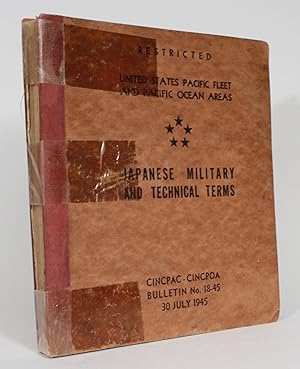
CINCPAC-CINCPOA Bulletin No. 18-45: "Restrited." Japanese Military and Technical Terms
Verlag: CINCPAC-CINCPOA, United States, 1945
Anbieter: Minotavros Books, ABAC ILAB, Whitby, ON, Kanada
Verkäuferbewertung 5 von 5 Sternen
Soft cover. Zustand: Good. 8vo. With Kanji translations. Quarter red cloth, russet stiff card boards, duotang binding. x, 360 pp. Spine reinforced with packing tape, . Damp staining to interior. The distribution list at rear indicates that 462 copies went to the Army, 243 copies went to the Navy, and 250 copies to the Marines.
-
Collection of 44 reprints on fishes from the Pacific Ocean published in the Proceedings of the U.S
Anbieter: Backhuys Biological Books, Kerkwerve, Niederlande
Verkäuferbewertung 5 von 5 Sternen
National Museum 0.0.
-
Handbook of Japanese Administrative Districts
Verlag: U.S. Pacific Fleet, n.p., 1945
Anbieter: Ground Zero Books, Ltd., Silver Spring, MD, USA
Verkäuferbewertung 4 von 5 Sternen

Zustand: fair. 423, wraps, text in Japanese (only the introduction and index have been translated), covers worn and soiled. This handbook was originally published in 1901 by the Keigansha Governmental Research Bureau, with corrections including No. 94 to 1943. The U.S. Pacific Fleet reproduced this book because it was the latest material at hand on the political organization of Japan. The handbook was marked "Restricted, " but that classification was crossed out by hand on the cover and changed to "Unclassified--1945-6. ".
-
Journal of a Cruise Made to the Pacific Ocean; In the United States Frigate Essex, in the Years 1812, 1813, and 1814
Verlag: Wiley & Halsted, New York, 1822
Anbieter: The First Edition Rare Books, LLC, Cincinnati, OH, USA
Verbandsmitglied: ABAA ILAB IOBA MWABA
Verkäuferbewertung 5 von 5 Sternen
Full leather. Zustand: Near fine. Second edition of the Journal of a Cruise Made to the Pacific Ocean by Captain David Porter, U.S.N., published in 1822. (illustrator). Second Edition. Octavo, [two volumes], lxxvi, 246pp; 256pp. Page 175 of Volume II misnumbered as 157. Bound in full sheepskin, rebacked. Spine decorated with gilt compartments, title in gilt on red and green morocco labels. Solid text blocks, foxing throughout, primarily reserved to endpapers. Contains seven plates between the two volumes: a frontispiece and one plate in Volume I and five plates in Volume II. Two near fine fold-out pieces in Volume I: one table of daily coordinates placing the location of the Essex and one map of the Galapagos Islands. (Hill, 239) (Howes P484) A clean, well-presenting example. Hill considers this second edition to be "the best edition and only complete edition," including Porter's Preface defending the first edition of the journal, numerous fold out maps, and the full narrative of Porter's experience throughout the War of 1812. This journal also served as a source piece for Herman Melville's Typee (1846).
-
Rovings in the Pacific, from 1837 to 1849; with a Glance at California, by a Merchant long resident at Tahiti.
Verlag: Longman, Brown, Green, and Longmans, London., 1851
Anbieter: Peter Ellis, Bookseller, ABA, ILAB, London, Vereinigtes Königreich
Verkäuferbewertung 5 von 5 Sternen
Erstausgabe
EUR 1.368,83
EUR 17,33 Versand
Versand von Vereinigtes Königreich nach USAAnzahl: 1 verfügbar
In den WarenkorbFirst edition. Octavo. Two volumes in one: pp xii, 352; xii, 371. Four chromolithograph plates. Original blue cloth decorated in blind, lettered in gilt.On the front free endpaper are two 19th century inscriptions, one of which has been crossed through. Some foxing here and there. Head and tail of spine a bit scuffed. Some wear to edges. Very good. Very scarce in the intact publishers' binding.
-
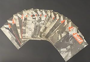
Brief - Volume 2, No.s 6, 10-15, 27-32, 34, 36, 37, 39
Verlag: Information and Education Division of AAFPOA January- August 1945, San Francisco, 1945
Anbieter: William Chrisant & Sons, ABAA, ILAB. IOBA, ABA, Ephemera Society, Fort Lauderdale, FL, USA
Verbandsmitglied: ABAA ESA ILAB
Verkäuferbewertung 5 von 5 Sternen
Erstausgabe
Zustand: Very Good. First Edition. Set of 17 issues of Brief all from 1945. Each issue includes a full page photo of a pin-up girl on the back cover. Models include: Marguerite Chapman, Virginia de Luce, Lana Turner, Belita, Dorothy Morris, Ava Gardner and many others. In addition to being a news and information publication, Brief also strives to acquaint the men with the accomplishments of the personnel of AAFPOA. Creasing and occasional fold lines down middle, a few have some water staining to back wrap (see images). 18 pp. 9 x 12 inches. Complete list of issue dates: 9 Jan, 6 Feb, 13 Feb, 20 Feb, 27 Feb, 6 March, 13 March, 5 June, 12 June, 19 June, 26 June, 3 July, 10 July, 24 July, 7 Aug, 14 Aug, 28 Aug.
-

Superpower in the Pacific.
Erscheinungsdatum: 1944
Anbieter: Geographicus Rare Antique Maps, Brooklyn, NY, USA
Verbandsmitglied: ABAA ESA ILAB
Verkäuferbewertung 3 von 5 Sternen

Karte
Average. Wear along original fold lines. Verso repairs to fold separations and at fold intersections. Closed tear extending 1.5 inches into printed area from left margin professionally repaired on verso. Closed tear extending 2.25 inches into printed area from right margin professionally repaired on verso. Slight loss at fold intersections and along fold lines. Has old institutional collection stamp on verso. We have contacted the institution to verify that this item was legally deaccessioned. Size 32.75 x 36 Inches. This is a 1944 Robert M. Chapin Jr. map of the then-current situation in the Pacific Theater during World War II (1939 - 1945). It illustrates the 'leapfrogging' tactic by which U.S. Forces crossed the vast Pacific to get within striking distance of Imperial Japan. A Closer Look The map depicts from Burma and China to the Gilbert Islands and from Japan to northern Australia. Individual islands and archipelagos are labeled throughout. In the Central and Northern Pacific, the Gilbert Islands, Marshall Islands, and Marianas Islands are identified, as are individual islands (such as Saipan, Tinian, and Guam in the Marianas) and atolls including Kwajalein in the Marshalls, and Tarawa and Makin in the Gilberts. In the Southwest Pacific, larger individual islands are predominantly those identified, for example New Guinea, Celebes, Timor, Borneo, Java, and Sumatra. The Philippine Islands are labeled separately, as are the islands of Mindanao and Luzon, which are within the Philippine Archipelago. Cities, among them Hong Kong, Shanghai, Saigon, Singapore, Manila, Batavia, and Surabaya are labeled. Detailing the War By late April 1944, when this map was published, the United States had been fighting the Japanese in the Pacific since the attack on Pearl Harbor nearly two and a half years earlier. After a major campaign on Guadalcanal (in the Solomon Islands), the Pacific Theater was divided between General Douglas MacArthur, who commanded forces in the Southwest Pacific, and Admiral Chester Nimitz, who was in command of the Navy's charge across the Central and Northern Pacific. Here, both Nimitz and MacArthur are referenced by name, indicating where their respective forces were located. The third Allied commander identified here is Claire Chennault, who became famous for commanding the American Volunteer Group known as 'The Flying Tigers'. By 1944, Chennault had rejoined the U.S. Army Air Corps and was commanding the 14th U.S. Army Air Force. Chapin also highlights Japanese bases, identifying them with a silhouette of a battleship in front of an illustration of the Japanese Rising Sun, the Japanese insignia widely-used during World War II. Fighting in the Pacific After realizing the vast distances Allied forces would have to cover in order to reach Japan, the Allies adopted a policy of 'leapfrogging' across the Pacific. Here, Tarawa, Makin, Majuro, Kwajalein, and Eniwetok are colored red, because these were islands that the U.S. Army and U.S. Marine Corps invaded amphibiously. The fighting for these islands was fierce and bloody and set the tone for the rest of the Pacific War. Chapin illustrates the 'leapfrogging' concept by using starbursts, probably meant to symbolize bomb explosions, on islands where Japanese troops were garrisoned, such as Truk and Rabaul, that Allied forces bypassed. Less than two months after this map was published, the Allies launched invasions of Saipan, Tinian, and Guam. By capturing these islands, American bombers were within range of the Japanese Home Islands and began an organized bombing campaigns. Allied forces would also land in the Philippines by the end of the year. Publication History and Census This map was drawn by Robert M. Chapin Jr. to accompany an article in TIME Magazine that appeared in the April 24, 1944 issue. TIME subsequently published this edition of the map separately. The OCLC records two examples as being part of institutional collections at Franklin and Marshall College in.
-

Carte des Déclinaisons et Inclinaisons de l'Aiguille Aimantée, Rédigée d'aprčs la Table des Observations Magnétiques faites par les Voyageurs depuis l'Année 1775
Verlag: F. Dufart, [Paris, 1790
Anbieter: Michael Treloar Booksellers ANZAAB/ILAB, Adelaide, SA, Australien
Verkäuferbewertung 5 von 5 Sternen
Karte
Zustand: Very Good. [Paris, F. Dufart? circa 1790]. A hand-coloured engraved map (printed surface 378× 415 mm, sheet size approximately 420 × 540 mm). 'Gravée par Tardieu l'Ainé . Dessiné par Poirson . Ecrit par Beaublé'. Original folds, as issued; some minor uneven tanning; in very good condition. An uncommon chart of the Pacific Ocean and Australia showing magnetic variation and dip, drawing on observations made in the course of Pacific voyages after 1775, most notably Cook's third voyage. It is most likely from a duodecimo edition of Buffon's 'Histoire naturelle générale et particuličre' around the end of the eighteenth century ('PL. III. Tome XVI' and 'Page 58' are printed in the top margin). It is based on a larger chart in four sheets (attributed to Jean-Charles de Borda). The engraver Tardieu is one of half a dozen members of the family working as engravers at the period, one of whom (P.A.F. Tardieu) would engrave the charts published in the official account of the Baudin voyage.
-

Pacific Ocean. Compiled and drawn in the Cartographic Section of the National Geographic Society for the National Geographic Magazine.
Anbieter: Gert Jan Bestebreurtje Rare Books (ILAB), Vianen, Niederlande
Verkäuferbewertung 5 von 5 Sternen
Washington, The Nationa Geographic Society, 1936. Coloured map of the Pacific, surrounded by inset maps. Ca. 76 x 95 cm.
-

Wake Island North Pacific Ocean.
Erscheinungsdatum: 1956
Anbieter: Geographicus Rare Antique Maps, Brooklyn, NY, USA
Verbandsmitglied: ABAA ESA ILAB
Verkäuferbewertung 4 von 5 Sternen
Karte
Very good. Minor wear and toning along original fold lines. Minor spotting. Size 22 x 29 Inches. This is a fine 1957 U.S. Air Force aeronautical chart or map of Wake Island in the Northern Pacific Ocean. It covers the coral atoll just north of Marshall Islands and the waters surrounding it. The Wake atoll is an unorganized, unincorporated territory of the United States managed by the United States Air Force. Verso of this chart features legends and a world aeronautical chart index. This chart was published by the USAF Aeronautical Chart and Information Service, Washington 25, D.C., and was issued as chart no. 627. First issued in 1949, this is the third edition revised to Aug 1956.
-

Chart of the Pacific Ocean.
Erscheinungsdatum: 1831
Anbieter: Geographicus Rare Antique Maps, Brooklyn, NY, USA
Verbandsmitglied: ABAA ESA ILAB
Verkäuferbewertung 3 von 5 Sternen
Karte
Very good. Light wear along original centerfold. Size 13.75 x 16.5 Inches. This is an 1831 Henry Teesdale map of the Pacific Ocean, with coverage extending from Asia to the Americas. Islands dot the map, including the Sandwich Islands and 'Owhyhee', the Society Islands, and the Friendly Islands. Unusual names and spellings populate the Pacific Northwest, including, from north to south, 'Alashka', New Norfolk, New Cornwall, New Hanover, and New Georgia. Intriguing regional names appear in Australia as well, such as 'Lions Land', 'Edels Land', 'Nuyts Land', and 'Endrachts Land'. Publication History and Census This map was drawn and engraved by John Crane Dower and published by Henry Teesdale in the 1831 edition of his A New General Atlas of the World . The separate map is not cataloged in OCLC. We note three examples of the atlas cataloged in OCLC: The British Library, the University of London, and the Thomas Fisher Rare Book Library in Toronto, Ontario, Canada.
-

Oceanie.
Erscheinungsdatum: 1874
Anbieter: Geographicus Rare Antique Maps, Brooklyn, NY, USA
Verbandsmitglied: ABAA ESA ILAB
Verkäuferbewertung 4 von 5 Sternen
Karte
Very good. Minor wear along original centerfold. Original platemark visible. Minor spotting. Size 14.5 x 17.5 Inches. This is a fine 1874 map of the Pacific Ocean, including Australia, Polynesia, Melanesia and Malaysia by Ambroise Tardieu. It covers the region in considerable detail with parts of North America and Asia included. Extends as far north as Japan and south to include Auckland Island and New Zealand. This map depicts the continent of Australia with good detail along the coast with a largely unexplored interior. This map also identifies various cities, towns, rivers and an assortment of additional topographical details. This map was prepared by Ambroise Tardieu as plate no. 25 and issued in his 1874 edition of Atlas Universel de Geographie Ancienne et Moderne . References: Rumsey 4697.031 (1863 edition).
-

The Pacific Ocean including Oceanica with its several Divisions, Islands, Groups etc.
Erscheinungsdatum: 1850
Anbieter: Geographicus Rare Antique Maps, Brooklyn, NY, USA
Verbandsmitglied: ABAA ESA ILAB
Verkäuferbewertung 4 von 5 Sternen
Karte
Very good. Overall age toning. Minor spotting at places. Top margin cut off. Size 13 x 16 Inches. This is a fine example of Thomas Cowperthwait and S. A. Mitchell's 1854 map of the Pacific, Polynesia, and Australia. Centered on the Sandwich or Hawaiian Islands, this map covers the entirety of the pacific Basin from the Aleutian Islands to New eland and the Straits of Magellan, and from Sumatra to the coasts of America. Mitchell identifies many of the Polynesian, Micronesian, and Melanesian Islands as well as, Japan, Korea, and Alaska. Noteworthy remarks on the lands and peoples of Oceania appear in the lower right quadrant under the title. In the lower left quadrant part of the Antarctica is detailed along with the track of the 1840 U.S. Exploring Expedition in this region. The whole is engraved in Mitchell's distinctive style with green border work and vivid pastels. Political and topographical features are noted and color coded with elevation rendered by hachure. This map was prepared by S. A. Mitchell for publication as plate no. 73 by the Philadelphia firm of Thomas Cowperthwait and Co. in the 1854 edition of Mitchell's New General Atlas . Dated and copyrighted, 'Entered according to act of Congress in the year 1850 by Thomas Cowperthwait and Co. in the Clerk's office of the Eastern District of Pennsylvania. References: Rumsey 0537.071 (1846 edition). Phillips (Atlases) 814.
-

Oceana or Pacific Ocea.
Erscheinungsdatum: 1849
Anbieter: Geographicus Rare Antique Maps, Brooklyn, NY, USA
Verbandsmitglied: ABAA ESA ILAB
Verkäuferbewertung 4 von 5 Sternen
Karte
Very good. Minor foxing and overall toning. Minor edge wear. Size 13 x 16 Inches. This is a fine example of S. A. Mitchell's 1849 map of the Pacific, Polynesia, and Australia. Centered on the Sandwich or Hawaiian Islands, this map covers the entirety of the pacific Basin from the Aleutian Islands to New eland and the Straits of Magellan, and from Sumatra to the coasts of America. Mitchell identifies many of the Polynesian, Micronesian, and Melanesian Islands as well as, Japan, Korea, and Alaska. Noteworthy remarks on the lands and peoples of Oceania appear in the lower right quadrant under the title. In the lower left quadrant part of the Antarctica is detailed along with the track of the 1840 U.S. Exploring Expedition in this region. Political and topographical features are noted and color coded with elevation rendered by hachure. The whole is engraved and colored in Mitchell's distinctive style with green border work and vivid pastels. Mitchell published this chart in his atlas from 1846 to the late 1850s before discontinuing the series and selling his map plates to DeSilver. This map was issued in the 1849 edition of the New Universal Atlas . It was the last edition of that atlas to be published by Mitchell prior to selling the plates and rights to the atlas to Thomas Cowperthwait in 1850. References: Rumsey 0545.075.
-

Pacific Ocean.
Erscheinungsdatum: 1842
Anbieter: Geographicus Rare Antique Maps, Brooklyn, NY, USA
Verbandsmitglied: ABAA ESA ILAB
Verkäuferbewertung 3 von 5 Sternen
Karte
Good. Light foxing. Some offsetting present. Size 11.5 x 14.25 Inches. A beautiful 1842 map of the Pacific Ocean, Australia, and Polynesia by the important American mapmaker T. G. Bradford. Centered on the Sandwich or Hawaiian Islands, it depicts the entirety of the Pacific Basin along with portions of the surrounding continents. A Closer Look The map covers from the Bering Strait south as far as Cape Horn and from modern day Vietnam east as far as the Gulf of Mexico. Although the interiors of the continents remain blank, the coastlines are relatively accurate. Borneo is misshapen, though improved considerably from Bradford's 1835 map of the same (previously sold by us), as are the Philippine Islands (see Publication History and Census below). The islands of Polynesia, Melanesia, and Micronesia are noted in remarkable detail, often with names no longer in use and whose origin is mysterious. Some of them appear to be phantom islands. In North America, curious landward features such as the placement of San Francisco and 'Ft. McHenry' reveal the minimal level of geographical knowledge of the continent's western half at the time. Publication History and Census This map was prepared by Thomas Bradford and engraved by George Washington Boynton. It appeared in the 1842 edition of Samuel Goodrich's reprint of Bradford's Universal Illustrated Atlas . Though dated 1841, the page number at top-left and text offsetting from an opposite page distinguish it from the 1841 state of the map (held by the David Rumsey Historical Map Collection). The present state is quite rare, having no known history in institutional collections or on the market, though that is likely because extant examples are understandably yet incorrectly dated to 1841. References: Rumsey 4453.049 (1841 edition), OCLC 957467845 (1841 edition).
-

Chart Showing the Locations of the Dredgings in Less Than 100 Fathoms Made by the U.S. Fish Commission Steamship Albatross in the Atlantic and Pacific Oceans from 1883 to 1900.
Erscheinungsdatum: 1900
Anbieter: Geographicus Rare Antique Maps, Brooklyn, NY, USA
Verbandsmitglied: ABAA ESA ILAB
Verkäuferbewertung 3 von 5 Sternen
Karte Signiert
Very good. Exhibits light wear along original fold lines. Left side remargined. Size 19.75 x 24.25 Inches. This is a 1900 C. H. Townsend and U.S. Fish Commission map of Atlantic and Pacific Ocean floor samplings less than 100 fathoms. Red numbers identify these dredging locations and can be correlated with detailed data in USS Albatross archives. Stretching from Japan to the Azores and from the Bering Sea to Cape Horn, dredgings marked were collected by the Albatross between 1883 and 1900. Unlike other maps in this series, dredging locations are marked in red but in many places dredging data is grouped geographically. Each grouping is labeled, including 'Bering Sea', 'Off Cal.', 'Off Washington' 'Off Col[ombia], and G. of Mex. And Vicinity. The USS Albatross This USS Albatross , also known as the USFC Albatross in scientific papers, was the first specifically built marine research vessel. Albatross operated in the Atlantic between December 1882 and November 1887, when she began her voyage to the Pacific Ocean. She arrived at the Straits of Magellan on January 23, 1888, and then continued up the coast of South America, stopping in the Galapagos briefly in April 1888. She operated along the U.S. Pacific coast and as far north as the Bering Sea and as far south as Panama between 1888 and 1898, when she was converted into an auxiliary cruiser for service during the Spanish-American War. After this work was finished, she sailed for Mexico, but did not see combat before peace treaties were signed. She immediately underwent conversion back to being a research vessel. After the retrofit, Albatross left San Francisco on August 23, 1899 and spent the next few months in the Central and South Pacific, before arriving in Yokohama, Japan, on March 4, 1900. Albatross continued her research work until she was transferred to the Navy on May 2, 1917, for service during World War I. She served with the American Patrol Detachment as a gunboat and protected tankers transporting oil and petroleum in the Caribbean and the Gulf of Mexico. After World War I, Albatross returned to research work, until she was decommissioned on October 29, 1921. She was sold to Thomas Butler and Company of Boston in June 1924, without her library, equipment, or instruments. Butler converted her into a school ship, then refitted her as a training ship for 'nautical students and cadets'. She left for Europe with 119 students on board on July 12, 1927. However, the students filtered off the ship at a succession of ports and by the time the Albatross reached Hamburg the crew demanded that she be auctioned off to satisfy their salaries. The paper trail goes cold in 1928 and her ultimate fate is unknown. Publication History and Census This map was created under the supervision of Charles Haskins Townsend for the U.S. Fish Commission. It was published in the 1900 U.S. Fish Commission report to Congress and printed by the Norris Peters Company. An example of the separate map is cataloged in OCLC and is part of the collection at the New York Botanical Garden. The report in which it was printed are cataloged in OCLC.
-

Chart Showing the Positions of the Dredgings Deeper than 100 Fathoms Made by the U.S. Fish Commission Steamship Albatross in the Pacific Ocean and Bering Sea from 1888 to 1900.
Erscheinungsdatum: 1900
Anbieter: Geographicus Rare Antique Maps, Brooklyn, NY, USA
Verbandsmitglied: ABAA ESA ILAB
Verkäuferbewertung 3 von 5 Sternen
Karte Signiert
Very good. Exhibits light wear along original fold lines. Size 21 x 33.25 Inches. This is a 1900 C. H. Townsend and U.S. Fish Commission map of Pacific Ocean floor samplings deeper than 100 fathoms. Red numbers identify these dredging locations and can be correlated with detailed data in USS Albatross archives. Stretching from Japan to North and South America and from the Bering Sea to Australia, Micronesia, and Polynesia, dredgings marked were collected by the Albatross between 1888 and 1900. The USS Albatross This USS Albatross , also known as the USFC Albatross in scientific papers, was the first specifically built marine research vessel. Albatross operated in the Atlantic between December 1882 and November 1887, when she began her voyage to the Pacific Ocean. She arrived at the Straits of Magellan on January 23, 1888, and then continued up the coast of South America, stopping in the Galapagos briefly in April 1888. She operated along the U.S. Pacific coast and as far north as the Bering Sea and as far south as Panama between 1888 and 1898, when she was converted into an auxiliary cruiser for service during the Spanish-American War. After this work was finished, she sailed for Mexico, but did not see combat before peace treaties were signed. She immediately underwent conversion back to being a research vessel. After the retrofit, Albatross left San Francisco on August 23, 1899 and spent the next few months in the Central and South Pacific, before arriving in Yokohama, Japan, on March 4, 1900. Albatross continued her research work until she was transferred to the Navy on May 2, 1917, for service during World War I. She served with the American Patrol Detachment as a gunboat and protected tankers transporting oil and petroleum in the Caribbean and the Gulf of Mexico. After World War I, Albatross returned to research work, until she was decommissioned on October 29, 1921. She was sold to Thomas Butler and Company of Boston in June 1924, without her library, equipment, or instruments. Butler converted her into a school ship, then refitted her as a training ship for 'nautical students and cadets'. She left for Europe with 119 students on board on July 12, 1927. However, the students filtered off the ship at a succession of ports and by the time the Albatross reached Hamburg the crew demanded that she be auctioned off to satisfy their salaries. The paper trail goes cold in 1928 and her ultimate fate is unknown. Publication History and Census This map was created under the supervision of Charles Haskins Townsend for the U.S. Fish Commission. It was published in the 1900 U.S. Fish Commission report to Congress and printed by the Norris Peters Company. Neither the separate map nor the report in which it was printed are cataloged in OCLC.
-

Maris Pacifici (quod vulgo Mar del Zur).
Erscheinungsdatum: 1589
Anbieter: Geographicus Rare Antique Maps, Brooklyn, NY, USA
Verbandsmitglied: ABAA ESA ILAB
Verkäuferbewertung 4 von 5 Sternen
Karte
Excellent. Some marginal staining well away from printed image. Superb original color, generous margins and a bold strike. Size 13.5 x 19.5 Inches. This is Abraham Ortelius' 1589 map of the Pacific; here is the best example to appear on the market in recent years, with a strong strike and fine original color. Abraham Ortelius' map is as important as it is beautiful - Burden hailed it as ' one of the most important maps that appeared in the Ortelius atlases ' and ' one of Ortelius' most desirable maps '. The map is not only the first to focus on the Pacific Ocean, but it is also the first acquirable map to separately identify North and South America. A Closer Look Ortelius' map was the first to place the Pacific Ocean at its center; thus, its scope is unique. The map reaches from 60° north to a little further than 60° south; it ranges from the Philippines and China at its western extent to just beyond the Strait of Magellan. The map is among Ortelius' finest compositions, matchless in its balance and artistry. It sports two elegant strapwork cartouches, and its stippled oceans are sailed by three ships. One of these, particularly grand, represents Magellan's flagship Victoria . This last is accompanied by a valedictory verse dedicated to the ship, ' I deserved to be named Victoria: Sails were my wings; my prize was glory; my war was with the sea. ' China, Japan and the 'Isla de Plata' The northwest corner of the map is taken up with China; the Great Wall appears; the Korean peninsula does not. Japan appeared in no fewer than five configurations in the pages of Ortelius' atlas over the long course of its publication. The 'turtle' shape of Japan on the present map was unique among these, having been drawn from the manuscript charts (c. 1568 - 1580) of Portuguese cartographer Fernăo Vaz Dourado. This delineation of Japan was thus one of the first to be based on a firsthand European report. Another first is the appearance of the Isla de Plata [Island of Silver] to the north of Japan. As early as 1584, the Spanish captain Francisco Gali reported that Chinese harbor pilots claimed the islands north of Japan abounded in precious metals. Ortelius' recording of the Isla de Plata is thus based on one of the few fresh reports of these distant lands to reach Europe. Philippine and East Indian Cartography After having neglected the Philippines on his earlier maps (following Mercator), Ortelius began to name the archipelago on 1587 and later states of his maps of the World and China. This map follows suit, improving on Ortelius' 1570 map of the East Indies. Ortelius also includes the Moluccas (Spice Islands) and a massive insular New Guinea. This is also one of the first maps to indicate any of the islands of Micronesia. The West Coast of the Americas Ortelius' map represents a high watermark in the mapping of the American West Coast before the geographic world plunged into the folly of California-as-an-island. Compared with Ortelius' other maps and those of his contemporaries, the mapping here is unique. Wagner described this map's configuration as 'a distinct departure; being unlike any other map . published before 1589.' It is unclear whether this is due to records of an unknown voyage or is a reinterpretation of existing works. While the American interior is given scant detail - the focus is here on the ocean, after all - there is a reference to the mythical land of Quivira, one of the golden lands sought in America by the Conquistadors Coronado and de Soto. Other broad regions - California, New Spain, Peru, Chile, and Patagonia - are named. The Speculative Southern Continent The southern extreme of the map is dominated by an enormous continent identified as Terra Australis Sive Magellanica, Nondum Detecta [The Southern Land or Magellanica Not Yet Discovered]. This massive continent was postulated in antiquity by no less than Plato, who belied it must exist to counterbalance the weight of Europe and Asia, and modern geographers - Merc.
-
Carte Generale de l'Oceanie. General Map of Oceania Showing British Possessions. Mapa General de Oceania. Carta General dell Oceania.
Erscheinungsdatum: 1888
Anbieter: Geographicus Rare Antique Maps, Brooklyn, NY, USA
Verbandsmitglied: ABAA ESA ILAB
Verkäuferbewertung 3 von 5 Sternen
Karte
Very good. Dissected and mounted on linen in thirty-two (32) panels. Light wear along original fold lines. Size 28.75 x 38.5 Inches. This is the 1888 Jean Dosseray map of the Pacific Ocean. Composed in French (with titles in French, English, Spanish, and Italian), islands, island chains, and seas are illustrated and identified throughout. Colors highlight colonial claims of England, France, Spain, Portugal, and the Netherlands. Insets along the bottom focus on New Caledonia and the Loyalty Islands, Nuku Hiva (the largest of the Marquesas Islands in French Polynesia), Tahiti, and part of Antarctica. Publication History and Census This map was created and published by Jean Dosseray in 1888. We note a single cataloged example in OCLC, located at the University of California Santa Barbara. References: OCLC 44143278.