Gesamtpreis (1 Artikel Artikel):
Versandziel:

owen bowen (63 Ergebnisse)
Direkt zu den wichtigsten Suchergebnissen
Suchfilter
Produktart
- Alle Product Types
- Bücher (53)
- Magazine & Zeitschriften (Keine weiteren Ergebnisse entsprechen dieser Verfeinerung)
- Comics (Keine weiteren Ergebnisse entsprechen dieser Verfeinerung)
- Noten (Keine weiteren Ergebnisse entsprechen dieser Verfeinerung)
- Kunst, Grafik & Poster (Keine weiteren Ergebnisse entsprechen dieser Verfeinerung)
- Fotografien (Keine weiteren Ergebnisse entsprechen dieser Verfeinerung)
- Karten (10)
- Manuskripte & Papierantiquitäten (Keine weiteren Ergebnisse entsprechen dieser Verfeinerung)
Zustand Mehr dazu
- Neu (Keine weiteren Ergebnisse entsprechen dieser Verfeinerung)
- Wie Neu, Sehr Gut oder Gut Bis Sehr Gut (7)
- Gut oder Befriedigend (12)
- Ausreichend oder Schlecht (Keine weiteren Ergebnisse entsprechen dieser Verfeinerung)
- Wie beschrieben (44)
Einband
Weitere Eigenschaften
Sprache (3)
Gratisversand
Land des Verkäufers
Verkäuferbewertung
-

Wheels - Life Science Library
Sprache: Englisch
Verlag: Time Inc., 1967
Anbieter: Heisenbooks, Fairless Hills, PA, USA
Verkäuferbewertung 2 von 5 Sternen

hardcover. Zustand: Very Good. US Hard Cover Very Good Edition. Book is in great condition! Little to no damage present on cover, pages, spine, or corners. Dustcover is included if applicable. An amazing buy!
-
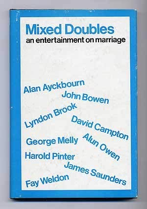
Mixed doubles: An entertainment on marriage, (Methuen's modern plays)
Anbieter: Wonder Book, Frederick, MD, USA
Verkäuferbewertung 5 von 5 Sternen

Erstausgabe
Zustand: Very Good. First edition copy. . Good dust jacket. In protective mylar cover. (Plays, Drama).
-
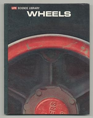
Life Science Library: Wheels
Verlag: Time-Life Books, New York, 1972
Anbieter: Between the Covers-Rare Books, Inc. ABAA, Gloucester City, NJ, USA
Verbandsmitglied: ABAA ESA ILAB IOBA
Verkäuferbewertung 5 von 5 Sternen
Hardcover. Zustand: Fine. Later printing. 200pp. Illustrated. Fine. A history of wheels, and a survey of its progress from oxcarts to trains to trucks; also covering auto bridges, parking, and more.
-
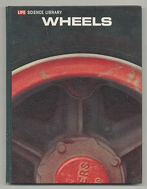
Life Science Library: Wheels
Verlag: Time-Life Books, New York, 1968
Anbieter: Between the Covers-Rare Books, Inc. ABAA, Gloucester City, NJ, USA
Verbandsmitglied: ABAA ESA ILAB IOBA
Verkäuferbewertung 5 von 5 Sternen
Hardcover. Zustand: Fine. Later printing. 200pp. Illustrated. Fine. A history of wheels, and a survey of its progress from oxcarts to trains to trucks; also covering auto bridges, parking, and more.
-

Autos und Eisenbahnen.
Sprache: Deutsch
Verlag: Reinbek bei Hamburg Rowohlt Taschenbuch Verlag, 1971
ISBN 10: 3499180200 ISBN 13: 9783499180200
190 S., Illustr. OBrosch., Aus dem Englischen., Taschenbuch., Mit zahlr. meist farbigen Abb., Block etwas schief., Einband mit Gebrauchsspuren., Gelenke berieben., Unteres Kapital etwas lädiert., Vorsatz fehlt., [K1_Ro_Kt_3] Sprache: Deutsch 0 310 gr.
-

Autos und Eisenbahnen / aus d. Engl. übertr. von Uwe Gewecke. Dt. Taschenbuchausg.
Sprache: Deutsch
Verlag: Reinbek bei Hamburg: Rowohlt, 1971
ISBN 10: 3499180200 ISBN 13: 9783499180200
Anbieter: Antiquariat + Buchhandlung Bücher-Quell, Waldbrunn-Lahr, Deutschland
Verkäuferbewertung 3 von 5 Sternen

190 S. : zahlr. Ill., Kt. 8°. OKt. (Tb). Zustand: akzeptabel. (Rororo ; 20 : Sachbuch) (Das farbige LIFE-Bildsachbuch).
-
Räder. Wunder der Wissenschaft.,.
Verlag: Time Life, Amsterdam 1967.,, 1967
Anbieter: Antiquariat Petri, Jena, Deutschland
Verkäuferbewertung 4 von 5 Sternen

gebunden. Oln., 4°, 200s., in gutem Zustand, [LSC50,1b]. (2) Deu 700g.
-
Sonderangebot
EUR 5,55
EUR 16,50 Versand
Versand von Frankreich nach USAAnzahl: 1 verfügbar
In den WarenkorbZustand: Très bon. Ammareal reverse jusqu'à 15% du prix net de cet article à des organisations caritatives. ENGLISH DESCRIPTION Book Condition: Used, Very good. Ammareal gives back up to 15% of this item's net price to charity organizations.
-
Circa 1720 Original MAP of FLINTSHIRE from the Britannia Depicta Atlas by the Cartographers John Owen and Emanuel Bowen
Sprache: Englisch
Verlag: John Owen and Emanuel Bowen, London, 1720
Anbieter: Andrew Cox PBFA, Shropshire, Vereinigtes Königreich
Verbandsmitglied: PBFA
Verkäuferbewertung 5 von 5 Sternen
Karte
EUR 19,08
EUR 22,58 Versand
Versand von Vereinigtes Königreich nach USAAnzahl: 1 verfügbar
In den WarenkorbNo Binding. Zustand: Good. Dating to circa 1720 this is a nice hand coloured antique map of Flintshire by John Owen and Emanuel Bowen, the map comes from their Atlas Britannia Depicta, and is double sided with a road map on the reverse showing the road from Shrewsbury to Wrexham. The map measures 7.5 inches by 5.25 inches approx., noticeable browning to the reserve side else in nice condition. This is a lighter item, overseas shipping costs will be reduced accordingly at checkout.
-

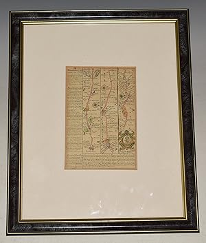
The Road From Cambridge To Coventry (Original Antique Hand Colored Map From "Britannia Depicta Or Ogilby Improv'd")
Sprache: Englisch
Verlag: T. Bowles, London (Circa 1720-1764), 1720
Anbieter: Arroyo Seco Books, Pasadena, Member IOBA, Pasadena, CA, USA
Verbandsmitglied: IOBA
Verkäuferbewertung 4 von 5 Sternen
Karte Erstausgabe
No Binding. Zustand: Fine. 1st Edition. Original Antique Map, Page 64 From Britannia Depicta, Unknown Printing Circa 1720-1764. Very Nicely Colored, Attractively Mounted And Matted And Ready For Framing.
-
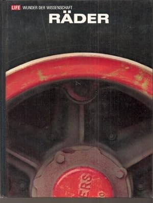
Life - Wunder der Wissenschaft. 200 S. Quart. Mit zahlr. Abbildungen. Time-Life International. Amsterdam. 1967. Guter Zustand/Good condition. Pappeinband illustriert/Hardcover. Ecken leicht betossen. Sprache: deutsch/german.
-

Miniature Original Antique engraved map: strip road map of GLOCESTERSHIRE / SOMERSETSHIRE/ WILTSHIRE: strip road map on both sides: Marlborough - Chippenham - Calne - Marshfield - Bristol - Axbridge - Huntspil. ( Gloucestershire) From: BRITANNIA DEPICTA.
Verlag: 1720, 1720
Anbieter: PROCTOR / THE ANTIQUE MAP & BOOKSHOP, DORCHESTER, Vereinigtes Königreich
Verbandsmitglied: PBFA
Verkäuferbewertung 5 von 5 Sternen
Karte
EUR 13,12
EUR 23,16 Versand
Versand von Vereinigtes Königreich nach USAAnzahl: 1 verfügbar
In den WarenkorbEngraved surface of map: ca 11 cm & 18 cm. Overall size including mount: ca. 23 cm x 31.5 cm. With later professional hand-colouring. Weak mark lower corner. Very good condition. On maps are nice finely engraved coat of arms ( Calne / Chippenham). Underneath the maps: details of the county, size, climate, industry & commerce. Well and pleasing later professional colouring ( of ONE side only). In ivory mount with one gilt line (and another mount on verso of map, but without gold line). Pages 25 & 26 from ?Britannia Depicta? - ?Emanuel Bowen was one of the most skilled and prolific engravers of 18th. century. It was an unusual feature of his ?Britannia Depicta? atlas that the maps were engraved on both sides of each page. The maps can be double glazed, thus the customer has a choice of two maps. The publisher of the Atlas was a John Owen, hence the term ?Owen and Bowen? to describe maps from the work. The appreciation rate of this series of maps over the past 20 years has been remarkable? (J.Booth: Looking at old maps).
-
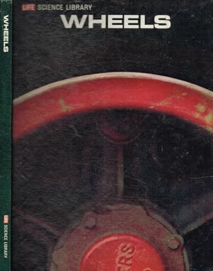
Wheels Life science library
Verlag: Time-life books, NEW YORK, 1975
ISBN 13: 2560223439196
Anbieter: Biblioteca di Babele, Tarquinia, VT, Italien
Verkäuferbewertung 5 von 5 Sternen
Zustand: BUONO USATO. INGLESE Introduzione di Harmer E.Davis, inglese, pagine ingiallite ai bordi e con sporadica fioritura, con illustrazioni a colori ed in nero nei testi, tagli ingialliti, con fioritura e qualche macchia, rilegatura editoriale cartonata, illustrata, con tracce di polvere, segni di sfregamento, usura ai bordi ed alle punte, usura anche al dorso. Numero pagine 200.
-
Attractive miniature Antique county map: NOTTINGHAMSHIRE. From: BRITANNIA DEPICTA. or ?Ogilby Improv'd?
Verlag: 1720, 1720
Anbieter: PROCTOR / THE ANTIQUE MAP & BOOKSHOP, DORCHESTER, Vereinigtes Königreich
Verbandsmitglied: PBFA
Verkäuferbewertung 5 von 5 Sternen
EUR 17,89
EUR 23,16 Versand
Versand von Vereinigtes Königreich nach USAAnzahl: 1 verfügbar
In den WarenkorbEngraved surface of map: ca 12 cm & 19 cm. Overall size including mount: ca. 24 cm x 30.5 cm. With attractive hand-colouring. A few small weak marks on lower margin ( covered by mount). Very good condition. Decorative and finely engraved cartouche above the county map. Underneath the map: details of the county, size, climate, industry & commerce.With black & white strip road map on verso of map:London - Hodsdon - Barwick. In ivory mount with gold line. Page 11 / 12from ?Britannia Depicta? - ?Emanuel Bowen was one of the most skilled and prolific engravers of 18th. century. It was an unusual feature of his ?Britannia Depicta? atlas that the maps were engraved on both sides of each page. The maps can be double glazed, thus the customer has a choice of two maps. The publisher of the Atlas was a John Owen, hence the term ?Owen and Bowen? to describe maps from the work. The appreciation rate of this series of maps over the past 20 years has been remarkable? (J.Booth: Looking at old maps).
-
Miniature county map: DENBIGHSHIRE. From: BRITANNIA DEPICTA.
Verlag: 1720, 1720
Anbieter: PROCTOR / THE ANTIQUE MAP & BOOKSHOP, DORCHESTER, Vereinigtes Königreich
Verbandsmitglied: PBFA
Verkäuferbewertung 5 von 5 Sternen
EUR 17,89
EUR 23,16 Versand
Versand von Vereinigtes Königreich nach USAAnzahl: 1 verfügbar
In den WarenkorbEngr.surface ca 12cm & 19cm. In ivory mount. Very good. Well and pleasing later professional colouring Decorative and finely engraved cartouche above the county map. Underneath the map: details of the county, size, climate, industry & commerce. With strip road map on verso of map. Engraved map page 265 of the atlas.
-
Räder
Sprache: Deutsch
Verlag: Time-Life International (Nederland) N.V., 1969
Anbieter: Antiquariat Liber Antiqua, Krems an der Donau, Österreich
Verkäuferbewertung 5 von 5 Sternen
Abbildungen, Illustrationen, 200 Seiten Großformat, Hardcover, imprägniertes Ganzleinen, abgegriffen, verschmutz, fleckig, Kanten und Ecken bestossen, schiefgelesen, Seiten gebräunt, wellig, tw. fleckig, mittlerer Zustand Sprache: Deutsch Aus der Reihe "Life - Wunder der Wissenschaft",.
-
Räder
Sprache: Deutsch
Verlag: Time-Life International (Nederland) N.V., 1969
Anbieter: Antiquariat Liber Antiqua, Krems an der Donau, Österreich
Verkäuferbewertung 5 von 5 Sternen
Abbildungen, Illustrationen, 200 Seiten Großformat, Hardcover, imprägniertes Ganzleinen, abgegriffen, verschmutz, fleckig, Kanten und Ecken bestossen, schiefgelesen, Seiten gebräunt, wellig, tw. fleckig, mittlerer Zustand Sprache: Deutsch Aus der Reihe "Life - Wunder der Wissenschaft",.
-
The Road From Nottingham To Grimsby. From: BRITANNIA DEPICTA. Or, ?Ogilby Improv'd?.
Verlag: Owen & Bowen, ca1720, 1720
Anbieter: PROCTOR / THE ANTIQUE MAP & BOOKSHOP, DORCHESTER, Vereinigtes Königreich
Verbandsmitglied: PBFA
Verkäuferbewertung 5 von 5 Sternen
EUR 26,24
EUR 23,16 Versand
Versand von Vereinigtes Königreich nach USAAnzahl: 1 verfügbar
In den WarenkorbEngraved surface of map; 18 cm & 12 cm. Overall size; 20 cm x 14 cm. (8 x 5.5 ins.) Very good condition. Some minor offsetting to rear side (208). Some minor staining and darkening to bottom corner edge. Bound edge a little rough (from original binding.) Else a very good clean and bright copy. Double sided B&W strip-road map, showing Nottingham to Newark, Lincoln on front, and Lincoln to Grimby on verso. With desscriptions of Lincoln and towns. Page 207 - 208 from ?Brittania Depicta? - ?Emanuel Bowen was one of the most skilled and prolific engravers of 18th. century. It was an unusual feature of his ?Britannia Depicta? atlas that the maps were engraved on both sides of each page. The maps can be double glazed, thus the customer has a choice of two maps. The publisher of the Atlas was a John Owen, hence the term ?Owen and Bowen? to describe maps from the work. The appreciation rate of this series of maps over the past 20 years has been remarkable? (J.Booth: Looking at old maps).
-

Couverture rigide. Zustand: bon. RO20000701: 1967. In-4. Cartonnage d'éditeurs. Bon état, Couv. convenable, Dos satisfaisant, Intérieur frais. 200 pp., photographies couleurs. . . . Classification Dewey : 625-Chemins de fer, routes, autoroutes.
-
Original engraved map: strip road map of DEVON: EXETER - LYME REGIS. From: BRITANNIA DEPICTA.
Verlag: 1720, 1720
Anbieter: PROCTOR / THE ANTIQUE MAP & BOOKSHOP, DORCHESTER, Vereinigtes Königreich
Verbandsmitglied: PBFA
Verkäuferbewertung 5 von 5 Sternen
Karte
EUR 31,01
EUR 23,16 Versand
Versand von Vereinigtes Königreich nach USAAnzahl: 1 verfügbar
In den WarenkorbEngraved map comprising pages 253 & 254 of the atlas Size of engraved surface: 13 cm x 18 cm. Overall size: 26 cm x 33 cm (including mount). Very good. Nice finely engraved coat of arms (arms of Bridport) There is text with details of the county, size, climate, industry & commerce. Well and pleasing later professional colouring. In ivory mount with one gilt.
-
Attractive miniature Antique county map: BEDFORDSHIRE. From: BRITANNIA DEPICTA. or ?Ogilby Improv'd?.
Verlag: 1720, 1720
Anbieter: PROCTOR / THE ANTIQUE MAP & BOOKSHOP, DORCHESTER, Vereinigtes Königreich
Verbandsmitglied: PBFA
Verkäuferbewertung 5 von 5 Sternen
EUR 33,40
EUR 23,16 Versand
Versand von Vereinigtes Königreich nach USAAnzahl: 1 verfügbar
In den WarenkorbEngraved surface of map: ca 12 cm & 19 cm. With attractive hand-colouring. In very good condition. Some tanning to edges. Two Small tape on top margin. Decorative and finely engraved cartouche above the county map. Underneath the map: details of the county, size, climate, industry & commerce. With black & white strip road map on verso of map: Thetford - Attleborough - Larlingford - Windham - Norwich. Page 117 / 118 from ?Britannia Depicta? - ?Emanuel Bowen was one of the most skilled and prolific engravers of 18th. century. It was an unusual feature of his ?Britannia Depicta? atlas that the maps were engraved on both sides of each page. The maps can be double glazed, thus the customer has a choice of two maps. The publisher of the Atlas was a John Owen, hence the term ?Owen and Bowen? to describe maps from the work. The appreciation rate of this series of maps over the past 20 years has been remarkable? (J.Booth: Looking at old maps).
-

Autos und Eisenbahnen
Anbieter: Antiquariat Wortschatz, Markt Hartmannsdorf, Österreich
Verkäuferbewertung 4 von 5 Sternen
Softcover/Taschenbuch. Zustand: Sehr gut. zahlreiche (illustrator). kA. Auflage. Anzahl Bände: 1 - Bd.Nr.: kA - Sprache: de - Einband: Paperback - Gewicht: 214 - Illust.: zahlreiche - Zustand: Sehr gut -.
-
Miniature Original Antique Engraved Hand-Coloured Map of Andover-Amesbury-Warminster (The Road from London to Barnstable)
Verlag: Bowen 1720, 1720
Anbieter: PROCTOR / THE ANTIQUE MAP & BOOKSHOP, DORCHESTER, Vereinigtes Königreich
Verbandsmitglied: PBFA
Verkäuferbewertung 5 von 5 Sternen
EUR 36,97
EUR 23,16 Versand
Versand von Vereinigtes Königreich nach USAAnzahl: 1 verfügbar
In den WarenkorbFramed Map. Engraved surface of map: approx 7 x 5 ins. Overall size including mount: 15.5 x 12.5 ins. In very good condition. Hand coloured. Plate number 78 is shown.
-
Attractive miniature hand coloured engraved county map: The Road From Winchester to Southampton. From: BRITANNIA DEPICTA. or ?Ogilby Improv'd.? With The Road From Winchester to Ringwood on Rear.
Verlag: 1720, 1720
Anbieter: PROCTOR / THE ANTIQUE MAP & BOOKSHOP, DORCHESTER, Vereinigtes Königreich
Verbandsmitglied: PBFA
Verkäuferbewertung 5 von 5 Sternen
EUR 36,97
EUR 23,16 Versand
Versand von Vereinigtes Königreich nach USAAnzahl: 1 verfügbar
In den WarenkorbOverall size 21cm x 14.5cm. Engraved surface approx 18cm x 11.5cm. Unframed & unmounted. Very good condition. Hand coloured. Double sided strip road map: From Alresford to Ringwood, with description of Ringwood, Rumsey, Matwood Castle and Arms of Limington. Other side shows Knaston to Pool, Pool to Christchurch & Limington, and Winchester to Southampton. With Arms of Christchurch and Deanery, and description of New Forrest, and Christchurch. Page 263 / 264 from ?Britannia Depicta? - ?Emanuel Bowen was one of the most skilled and prolific engravers of 18th. century. It was an unusual feature of his ?Britannia Depicta? atlas that the maps were engraved on both sides of each page. The maps can be double glazed, thus the customer has a choice of two maps. The publisher of the Atlas was a John Owen, hence the term ?Owen and Bowen? to describe maps from the work. The appreciation rate of this series of maps over the past 20 years has been remarkable? (J.Booth: Looking at old maps).
-

Hardcover. Zustand: Good. Zustand des Schutzumschlags: Not present. Dutch In Wheels schetsen Owen en Bowen hoe het wiel ? misschien wel de eenvoudigste uitvinding ? in werkelijkheid een revolutionaire motor is geweest voor de menselijke beschaving: van de eerste houten wielen onder ossenwagens tot moderne auto?s en spoorwegen, en van landtransport tot bruggen en infrastructuur. Ze beschrijven hoe het wiel door de eeuwen heen de manier veranderde waarop mensen zich verplaatsen, goederen vervoeren en samenlevingen inrichten. Het boek laat zien hoe technologische, economische en culturele vooruitgang onlosmakelijk verbonden is met de evolutie van het wiel ? hoe steeds verfijndere technieken, materialen en ontwerpen leidden tot sneller, efficiënter en massaler transport. Op die manier toont Wheels dat dit schijnbaar eenvoudige mechanisme van enorme invloed is geweest op de menselijke geschiedenis, en hoe het wiel de wereld letterlijk en figuurlijk in beweging zette.
-

A Map of Northamptonshire.
Verlag: London, c.1720. 185 x 115mm (7¼ x 4½ inches)., 1720
Anbieter: Tooley, Adams & Co., Wallingford, OXON, Vereinigtes Königreich
Verkäuferbewertung 4 von 5 Sternen
EUR 21,47
EUR 43,02 Versand
Versand von Vereinigtes Königreich nach USAAnzahl: 1 verfügbar
In den WarenkorbUncoloured; light age-toning to the edges of the paper, printing plate has cut into paper on the left hand margin, otherwise a fair example. From 'Britannia Depicta or Ogilby Improv'd'. The verso has the road from London to Amersham.
-

A Map of Hereford Shire.
Verlag: London, c.1720. 183 x 115mm (7¼ x 4½ inches)., 1720
Anbieter: Tooley, Adams & Co., Wallingford, OXON, Vereinigtes Königreich
Verkäuferbewertung 4 von 5 Sternen
EUR 22,66
EUR 43,02 Versand
Versand von Vereinigtes Königreich nach USAAnzahl: 1 verfügbar
In den WarenkorbUncoloured; light age-toning to the edges of the paper, otherwise good condition. The road from Bristol to Monmouth on the verso. From 'Britannia Depicta or Ogilby Improv'd'.
-

Bedford Shire.
Verlag: London, c.1720. 185 x 115mm (7¼ x 4½ inches)., 1720
Anbieter: Tooley, Adams & Co., Wallingford, OXON, Vereinigtes Königreich
Verkäuferbewertung 4 von 5 Sternen
EUR 23,85
EUR 43,02 Versand
Versand von Vereinigtes Königreich nach USAAnzahl: 1 verfügbar
In den WarenkorbUncoloured; light age-toning to the edges of the paper, otherwise a very good example. A miniature map of the county of Bedfordshire, from the 'Britannia Depicta or Ogilby Improved' by John Owen and Emanuel Bowen. The verso has the road from Thetford to Norwich.
-
Miniature Antique county map: THE SMALLER ISLANDS IN THE BRITISH OCEAN: Isle of Wight. Guernsey. Jersey. Isle of Scilly. Arne Island. Isle of Man. Alderney. Holy Island. From: BRITANNIA DEPICTA. or ?Ogilby Improv'd?.
Verlag: 1720, 1720
Anbieter: PROCTOR / THE ANTIQUE MAP & BOOKSHOP, DORCHESTER, Vereinigtes Königreich
Verbandsmitglied: PBFA
Verkäuferbewertung 5 von 5 Sternen
EUR 46,52
EUR 23,16 Versand
Versand von Vereinigtes Königreich nach USAAnzahl: 1 verfügbar
In den WarenkorbWooden frame with glass front, In ivory mount with gold line. Engraved surface of map: ca 11 cm & 18 cm. Overall size including mount: ca. 23 cm x 31.5 cm. Frame Size 37cm x 30cm With later professional hand-colouring. Very good condition. Very lightly tanned. Decorative and finely engraved cartouche above the county map. Underneath the map: details of the county, size, climate, industry & commerce. With black & white strip road map on verso of map: Shrewsbury - Welchpool (Shropshire / Montgomeryshire ). Page 127 & 128 from ?Brittania Depicta? - ?Emanuel Bowen was one of the most skilled and prolific engravers of 18th. century. It was an unusual feature of his ?Britannia Depicta? atlas that the maps were engraved on both sides of each page. The maps can be double glazed, thus the customer has a choice of two maps. The publisher of the Atlas was a John Owen, hence the term ?Owen and Bowen? to describe maps from the work. The appreciation rate of this series of maps over the past 20 years has been remarkable? (J.Booth: Looking at old maps).
-

A Map of Leicestershire.
Verlag: London, c.1720. 180 x 115mm (7 x 4½ inches)., 1720
Anbieter: Tooley, Adams & Co., Wallingford, OXON, Vereinigtes Königreich
Verkäuferbewertung 4 von 5 Sternen
EUR 28,63
EUR 43,02 Versand
Versand von Vereinigtes Königreich nach USAAnzahl: 1 verfügbar
In den WarenkorbUncoloured; light age-toning to the edges of the paper, otherwise a good example. From 'Britannia Depicta or Ogilby Improv'd'.