

Gesamtpreis (1 Artikel Artikel):
Versandziel:

moscow plan (3 Ergebnisse)
Direkt zu den wichtigsten Suchergebnissen
Suchfilter
Produktart
- Alle Product Types
- Bücher (1)
- Magazine & Zeitschriften (Keine weiteren Ergebnisse entsprechen dieser Verfeinerung)
- Comics (Keine weiteren Ergebnisse entsprechen dieser Verfeinerung)
- Noten (Keine weiteren Ergebnisse entsprechen dieser Verfeinerung)
- Kunst, Grafik & Poster (Keine weiteren Ergebnisse entsprechen dieser Verfeinerung)
- Fotografien (Keine weiteren Ergebnisse entsprechen dieser Verfeinerung)
- Karten (2)
- Manuskripte & Papierantiquitäten (Keine weiteren Ergebnisse entsprechen dieser Verfeinerung)
Zustand Mehr dazu
- Neu (Keine weiteren Ergebnisse entsprechen dieser Verfeinerung)
- Wie Neu, Sehr Gut oder Gut Bis Sehr Gut (Keine weiteren Ergebnisse entsprechen dieser Verfeinerung)
- Gut oder Befriedigend (Keine weiteren Ergebnisse entsprechen dieser Verfeinerung)
- Ausreichend oder Schlecht (Keine weiteren Ergebnisse entsprechen dieser Verfeinerung)
- Wie beschrieben (3)
Einband
- alle Einbände
- Hardcover (1)
- Softcover (Keine weiteren Ergebnisse entsprechen dieser Verfeinerung)
Weitere Eigenschaften
- Erstausgabe (Keine weiteren Ergebnisse entsprechen dieser Verfeinerung)
- Signiert (Keine weiteren Ergebnisse entsprechen dieser Verfeinerung)
- Schutzumschlag (Keine weiteren Ergebnisse entsprechen dieser Verfeinerung)
- Angebotsfoto (3)
Sprache (1)
Preis
- Beliebiger Preis
- Weniger als EUR 20 (Keine weiteren Ergebnisse entsprechen dieser Verfeinerung)
- EUR 20 bis EUR 45 (Keine weiteren Ergebnisse entsprechen dieser Verfeinerung)
- Mehr als EUR 45
Gratisversand
- Kostenloser Versand nach USA (Keine weiteren Ergebnisse entsprechen dieser Verfeinerung)
Land des Verkäufers
Verkäuferbewertung
-
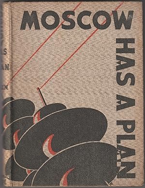
- Moscow has a Plan. A Soviet Primer. Translated from the Russian of M. Ilin. By G. S. Counts & N. P. Lodge with illustrations drawn by William Kermode.
Verlag: Jonathan Cape London, 1931
Anbieter: Antiquariat Herold, Berlin, Deutschland
Verkäuferbewertung 5 von 5 Sternen

fester Einband. . Leinen bedruckt, 218 Seiten, 8° * etwas angebräunt, ansonsten guter Zustand (K24). 530 gr.
-

Carstvajucoi grad Moskva nacalo I gorod veh Moskovech I carstvach. Urbis Moskvae.
Erscheinungsdatum: 1662
Anbieter: Geographicus Rare Antique Maps, Brooklyn, NY, USA
Verbandsmitglied: ABAA ESA ILAB
Verkäuferbewertung 4 von 5 Sternen

Karte
Very good. Even overall toning. Large margins. Blank on verso. Size 15.5 x 25 Inches. This is the 1662 Hessel Gerritsz and Willem Janszoon Blaeu city map or plan of Moscow, Russia. The map is significant as the dominant plan of Moscow in the 17th century. It is also significant for its innovative use of Cyrillic calligraphy to name both the city gates and in the map's titling - a first for non-Russian publishers. The Cyrillic calligraphy of the title is especially innovative, revealing the designer as a master of the style. A Closer Look The map is oriented west-by-south, with the Kremlin at its center. The city is displayed with its assorted walled sections, intersecting waterways, meandering streets, and distinctive buildings. Coverage embraces from the Moscow River to Zemlyanoy Gorod, which is surrounded by ramparts and a moat. This historical district in Moscow corresponds to the area between the Boulevard Ring and the Garden Ring roads in modern Moscow. A coat of arms bearing a double-headed imperial eagle, a sign of Russian rulers, is in the top left. The map features an extensive textual key on a scroll at right. The guide introduces the four-part division of the city: Kitaygorod , the inner city; Kremlenagrad , the castle; Tzargorod , the middle city; and Skorodum with Strelzka Slaboda , or outer ring. It outlines the landmarks and properties of prominent citizens, highlighting 33 features within Kitaygorod , 10 within Tzargorod , and 3 within Skorodum . Additionally, the guide names, in Latin transliteration, the ten city gates. Notably, no landmarks are designated within Kremlenagrad, as they pertain to the sibling plate. Publication History and Census It is commonly argued that this map derived from a survey ordered by Boris Fyodorovich Godunov, who ruled the Tsardom of Russia as de facto regent from c. 1585 to 1598, and then as the first non-Ririkid tsar from 1598 until 1605. The original plan is not believed to have survived. There are two states. The first state was engraved and separately published around 1613. It can be distinguished by a very simple unfinished outline of the scroll at right. The second state may have been engraved as early as the 1640s, but is not confirmed in an atlas until Willem Janszoon Blaeu's 1662 Atlas Maior . Earlier editions of partner Kremlenagrad map are known to have been published in Braun and Hogenburg's Civitates Orbis Terrarium , which does not rule out the possibility that Gerritsz's plan of Moscow was also published in Hogenburg's atlas. This present example was issued in the 1662 French edition of Blaeu's Atlas Maior . Scarce. References: OCLC 165859806.
-

Moscva.
Erscheinungsdatum: 1646
Anbieter: Geographicus Rare Antique Maps, Brooklyn, NY, USA
Verbandsmitglied: ABAA ESA ILAB
Verkäuferbewertung 4 von 5 Sternen
Karte
Very good. Extremities of margins toned, else excellent with a bold, sharp strike. Size 10.75 x 14 Inches. This is a scarce 1638 Matthais Merian city plan or map of Moscow. Apart from the Braun and Hogenberg, this is the earliest full-sheet edition of the plan, which pre-dates by more than 20 years the version included by Joan Blaeu in his Atlas Maior. Sources Though an intermediary source may have been Hessel Gerritz, the map is believed to have been ultimately derived from a Russian survey prepared at the orders of the Czar of Muscovy, Boris Godunov. Iterations of this plan first appear in the final, 1617, edition of the Braun and Hogenberg city book. A reduced version was included as an inset in Hessel Gerritz's Tabula Russiae , the plate for which would later be purchased by Blaeu for inclusion in his atlas. Although this map's information dates to the end of the 16th century, the onset of the Time of Troubles following the death of Boris Godunov would curtail much reliable contact with this part of the world, and so well into the 17th century this plan would remain the most up-to-date mapping of Moscow available. An inset of this plan would even adorn the 1676 map engraved by Francis Lamb for inclusion in the last editions of the Speed atlas. The Plan The plan is oriented to the west-north-west and shows the concentric city walls of the Kremlin, Kitai Gorod and the old city at the junction of the Moscow and Neglinnaya rivers. A legend with a letter-and-number key labels city features. In addition the map also notes the Kremlin and Kitai Gorod, the Streltsy encampment, churches, courts and other public buildings. Publication History and Census This map was executed in 1638 for inclusion in Matthias Merian's Neuwe Archontologia cosmica , a German translation of Pierre d'Avity's 1616 Les Estats, empires, et principautez du monde . We identify about ten examples of later editions of Merian's Neuwe Archontologia cosmica in institutional collections, and twelve examples of this separate map are so cataloged, in various editions. References: OCLC 5490168.

