Morgan griffith (29 Ergebnisse)
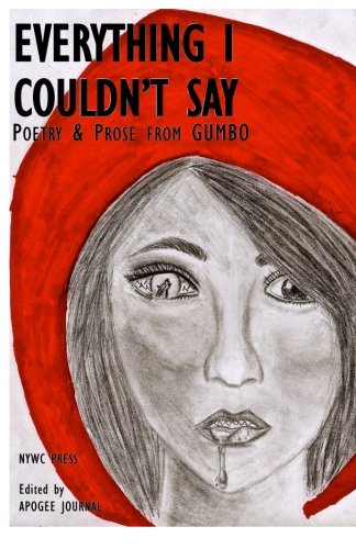
Everything I Couldn't Say: Poetry & Prose from GUMBO
Great United Minds Believing in Ourselves; Atira Barber-Ellis; Ornella Dacius; Marie Damus; Likita Griffith; Mani M.; Jeneice Marshall; Dene Morgan
- Softcover
Anbieter: ThriftBooks-Dallas, Dallas, TX, USAThriftBooks-Dallas
Verkäufer/-in kontaktierenVerkäufer/-in mit 5 SternenZustand: Gebraucht - Gut
EUR 6,53
Versand nach gratisVersand innerhalb von USAAnzahl: 1 verfügbar
Paperback. Zustand: Very Good. No Jacket. May have limited writing in cover pages. Pages are unmarked. ~ ThriftBooks: Read More, Spend Less.
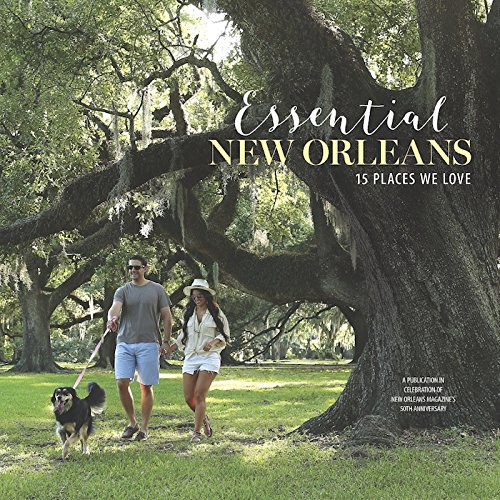
Essential New Orleans: 15 Places We Love
Don P. Elbers; Liz Monaghan; Carolyn Kolb; Tim McNally; Zachary Lazar; Grace Wilson Birch; Jesyka Bartlett; Morgan Packard Griffith; Melanie Warner Spencer; Sarah Ravits; Jyl Benson; Kim Singletary; Stephen Maloney; Mike Griffith; Dominic Massa; Errol Laborde
- Hardcover
Anbieter: ThriftBooks-Dallas, Dallas, TX, USAThriftBooks-Dallas
Verkäufer/-in kontaktierenVerkäufer/-in mit 5 SternenZustand: Gebraucht - Gut
EUR 13,36
Versand nach gratisVersand innerhalb von USAAnzahl: 1 verfügbar
Hardcover. Zustand: Very Good. No Jacket. May have limited writing in cover pages. Pages are unmarked. ~ ThriftBooks: Read More, Spend Less. Tiffani Reding Amedeo; Marianna Massey (illustrator).
Anbieter: ThriftBooks-Atlanta, AUSTELL, GA, USAThriftBooks-Atlanta
Verkäufer/-in kontaktierenVerkäufer/-in mit 5 SternenZustand: Gebraucht - Befriedigend
EUR 9,19
Versand nach gratisVersand innerhalb von USAAnzahl: 1 verfügbar
Unknown. Zustand: Good. No Jacket. Pages can have notes/highlighting. Spine may show signs of wear. ~ ThriftBooks: Read More, Spend Less.
- Softcover
Anbieter: Wonder Book, Frederick, MD, USAWonder Book
Verkäufer/-in kontaktierenVerkäufer/-in mit 5 SternenZustand: Gebraucht - Gut
EUR 18,04
Versand nach gratisVersand innerhalb von USAAnzahl: 1 verfügbar
Zustand: Very Good. Very Good condition. A copy that may have a few cosmetic defects. May also contain light spine creasing or a few markings such as an owner's name, short gifter's inscription or light stamp. Bundled media such as CDs, DVDs, floppy disks or access codes may not be included.

- Softcover
Anbieter: PBShop.store UK, Fairford, GLOS, Vereinigtes KönigreichPBShop.store UK
Verkäufer/-in kontaktierenVerkäufer/-in mit 5 SternenZustand: Neu
EUR 17,80
EUR 3,87 VersandVersand von Vereinigtes Königreich nach USAAnzahl: 15 verfügbar
PAP. Zustand: New. New Book. Shipped from UK. Established seller since 2000.

Masks
Drinkel, Dean M; Everington, James; Griffith, D T; Stokes, Chris; Proctor, Russell; Morgan, Christine; Williams, Lucas; Sloman, Phil; Rader, Kyle; Beck, Christopher
Sprache: Englisch
Verlag: CreateSpace Independent Publishing Platform, 2015
- Softcover
Anbieter: Seagull Books, Hove, Vereinigtes KönigreichSeagull Books
Verkäufer/-in kontaktierenVerkäufer/-in mit 5 SternenZustand: Gebraucht - Befriedigend
EUR 5,46
EUR 15,88 VersandVersand von Vereinigtes Königreich nach USAAnzahl: 1 verfügbar
Soft cover. Zustand: Good. Signed and dedicated by Dean M Drinkel. Has some light general reading/shelfwear - otherwise this is a clean, tight copy. Quick dispatch from the UK. Book.
- Softcover
Anbieter: Revaluation Books, Exeter, Vereinigtes KönigreichRevaluation Books
Verkäufer/-in kontaktierenVerkäufer/-in mit 5 SternenZustand: Neu
EUR 9,72
EUR 11,77 VersandVersand von Vereinigtes Königreich nach USAAnzahl: 1 verfügbar
Paperback. Zustand: Brand New. 94 pages. 8.50x5.50x0.22 inches. In Stock.
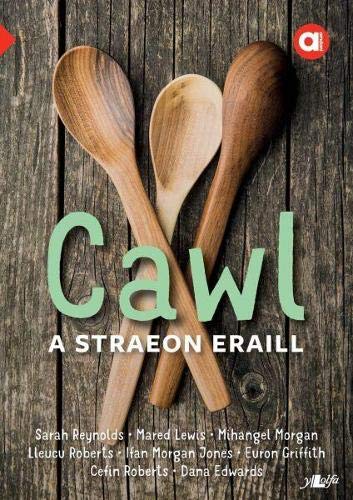
Cyfres Amdani: Cawl a Straeon Eraill
Sarah Reynolds; Mared Lewis; Mihangel Morgan; Lleucu Roberts; Ifan Morgan Jones; Euron Griffith; Cefin Roberts; Dana Edwards
- Softcover
Anbieter: PBShop.store US, Wood Dale, IL, USAPBShop.store US
Verkäufer/-in kontaktierenVerkäufer/-in mit 5 SternenZustand: Neu
EUR 13,62
Versand nach gratisVersand innerhalb von USAAnzahl: 7 verfügbar
PAP. Zustand: New. New Book. Shipped from UK. Established seller since 2000.
Cyfres Amdani: Cawl a Straeon Eraill
Sarah Reynolds; Mared Lewis; Mihangel Morgan; Lleucu Roberts; Ifan Morgan Jones; Euron Griffith; Cefin Roberts; Dana Edwards
- Softcover
Anbieter: PBShop.store UK, Fairford, GLOS, Vereinigtes KönigreichPBShop.store UK
Verkäufer/-in kontaktierenVerkäufer/-in mit 5 SternenZustand: Neu
EUR 13,32
EUR 3,87 VersandVersand von Vereinigtes Königreich nach USAAnzahl: 7 verfügbar
PAP. Zustand: New. New Book. Shipped from UK. Established seller since 2000.
- Softcover
Anbieter: Revaluation Books, Exeter, Vereinigtes KönigreichRevaluation Books
Verkäufer/-in kontaktierenVerkäufer/-in mit 5 SternenZustand: Neu
EUR 17,62
EUR 14,71 VersandVersand von Vereinigtes Königreich nach USAAnzahl: 1 verfügbar
Paperback. Zustand: Brand New. 216 pages. 9.00x6.00x0.49 inches. In Stock.
Cyfres Amdani: Cawl a Straeon Eraill
Sarah Reynolds; Mared Lewis; Mihangel Morgan; Lleucu Roberts; Ifan Morgan Jones; Euron Griffith; Cefin Roberts; Dana Edwards
- Softcover
Anbieter: Majestic Books, Hounslow, Vereinigtes KönigreichMajestic Books
Verkäufer/-in kontaktierenVerkäufer/-in mit 4 SternenZustand: Neu
EUR 13,11
EUR 7,65 VersandVersand von Vereinigtes Königreich nach USAAnzahl: 3 verfügbar
Zustand: New. pp. 110.

Verlag: Fellowship of the Thing Ltd, 2024
- Softcover
Anbieter: Books From California, Simi Valley, CA, USABooks From California
Verkäufer/-in kontaktierenVerkäufer/-in mit 4 SternenZustand: Gebraucht - Gut
EUR 21,85
EUR 4,37 VersandVersand innerhalb von USAAnzahl: 3 verfügbar
In den Warenkorbpaperback. Zustand: Very Good.

- Softcover
Anbieter: Ria Christie Collections, Uxbridge, Vereinigtes KönigreichRia Christie Collections
Verkäufer/-in kontaktierenVerkäufer/-in mit 5 SternenZustand: Neu
EUR 26,94
EUR 14,10 VersandVersand von Vereinigtes Königreich nach USAAnzahl: Mehr als 20 verfügbar
Zustand: New. In.
Verlag: Hughes a'i fab Wrecsam, 1927
Anbieter: Siop y Morfa BA, Y RHYL, Vereinigtes KönigreichSiop y Morfa BA
Verkäufer/-in kontaktierenVerkäufer/-in mit 5 SternenZustand: Gebraucht
EUR 7,27
EUR 13,88 VersandVersand von Vereinigtes Königreich nach USAAnzahl: 1 verfügbar
In den WarenkorbCyfrol o'r deuddeg teitl cyntaf mewn un rhwymiad. Copi glân.
- Softcover
Anbieter: Revaluation Books, Exeter, Vereinigtes KönigreichRevaluation Books
Verkäufer/-in kontaktierenVerkäufer/-in mit 5 SternenZustand: Neu
EUR 31,90
EUR 11,77 VersandVersand von Vereinigtes Königreich nach USAAnzahl: 2 verfügbar
Paperback. Zustand: Brand New. 164 pages. 11.00x8.50x0.35 inches. In Stock.
Cyfres Amdani: Cawl a Straeon Eraill
Sarah Reynolds; Mared Lewis; Mihangel Morgan; Lleucu Roberts; Ifan Morgan Jones; Euron Griffith; Cefin Roberts; Dana Edwards
- Softcover
Anbieter: Ria Christie Collections, Uxbridge, Vereinigtes KönigreichRia Christie Collections
Verkäufer/-in kontaktierenVerkäufer/-in mit 5 SternenZustand: Neu
EUR 12,64
EUR 14,10 VersandVersand von Vereinigtes Königreich nach USAAnzahl: 7 verfügbar
Zustand: New. In Welsh.
- Softcover
Anbieter: SZ Global, Toronto, ON, KanadaSZ Global
Verkäufer/-in kontaktierenVerkäufer/-in mit 2 SternenZustand: Gebraucht
EUR 12,79
EUR 32,60 VersandVersand von Kanada nach USAAnzahl: 1 verfügbar
Pamphlet. Zustand: Collectible-Very Good. Follows a group of hikers as they climb Mount Katahdin, highest peak in Maine, observing the flora, fauna, and sights of interest along the way.

- Softcover
Anbieter: Ria Christie Collections, Uxbridge, Vereinigtes KönigreichRia Christie Collections
Verkäufer/-in kontaktierenVerkäufer/-in mit 5 SternenZustand: Neu
EUR 34,00
EUR 14,10 VersandVersand von Vereinigtes Königreich nach USAAnzahl: Mehr als 20 verfügbar
Zustand: New. In.

- Softcover
Anbieter: moluna, Greven, Deutschlandmoluna
Verkäufer/-in kontaktierenVerkäufer/-in mit 5 SternenZustand: Neu
EUR 21,80
EUR 48,99 VersandVersand von Deutschland nach USAAnzahl: Mehr als 20 verfügbar
Zustand: New. KlappentextrnrnThis is a reproduction of the original artefact. Generally these books are created from careful scans of the original. This allows us to preserve the book accurately and present it in the way the author intended. Since the origina.
Verlag: Montgomery County Historical Society
Anbieter: Wonder Book, Frederick, MD, USAWonder Book
Verkäufer/-in kontaktierenVerkäufer/-in mit 5 SternenZustand: Gebraucht - Befriedigend
EUR 35,78
Versand nach gratisVersand innerhalb von USAAnzahl: 1 verfügbar
In den WarenkorbZustand: Good. Good condition. Staple Bound. Slightly dampstained. Writing inside. (history, maps, MD).
- Hardcover
Anbieter: SZ Global, Toronto, ON, KanadaSZ Global
Verkäufer/-in kontaktierenVerkäufer/-in mit 2 SternenZustand: Gebraucht
EUR 44,24
EUR 32,60 VersandVersand von Kanada nach USAAnzahl: 1 verfügbar
Hardcover. Zustand: Collectible-Very Good. Follows a group of canoeists as they explore and enjoy ninety-two miles of waterway along the Allagash River in northern Maine.

Verlag: Harrisburg, PA : American Rose Society, 1949., 1949
- Hardcover
Anbieter: Joseph Valles - Books, Stockbridge, GA, USAJoseph Valles - Books
Verkäufer/-in kontaktierenVerkäufer/-in mit 5 SternenZustand: Gebraucht - Befriedigend
EUR 49,62
EUR 14,85 VersandVersand innerhalb von USAAnzahl: 1 verfügbar
In den WarenkorbHardcover. Zustand: Good. Zustand des Schutzumschlags: Good. viii, 281 pp. ; metallic gold and mauve cloth in color photographic dustjacket ; dustjacket has some fading, nicks on edges ; Contents: What We Are And What We Can Do / George A. Sweetser John Horace Mcfarland, L.H.D. R. C. Allen, Robert Pyle, Louis M. Massey, Arthur F…. Truex -- Living With Roses / Mrs. P. D. Fulwood -- Pros, Cons and Nature / A. B. Albera -- Malmaison: Birthplace Of Modern Roses / Josephine Craven Chandler -- Vernal, Utah, Shows The Way / Paul Dougherly -- The Roses In Colonial Virginia / Charles A. Dawson -- Outline For Rose Culture / Mrs. R. M. Allred -- Rose Interest In Florida / Nixon Smiley -- Rose Growing In South Carolina / C. R. Raysor -- Roses In Mississippi / Thomas B. Kennedy -- 'And The Desert Shall Bloom Like A Rose" / Mrs. George Doolittle -- Roses In Adobe / Mrs. A. B. Gowens -- Cultural Practices For The Central Southwest / Lem H. Tithe -- Roses In Cold Climes / A. L. Truax -- Poor Rose Plants / Mrs. Webster Wagner -- 2,4-D Injury On Roses / Dr. P. W. Zimmerman -- Fables and Fancies In Rose Growing / Professor A. H. MacAndrews -- Abnormalities-Variety Traits Or Disease / Dr. B. W. Lyle -- Insects and Insecticides / Dr. O. S. Hensill -- The Diagnosis and Treatment Of A Rosarian / Dr. E. C. Hamblen -- Soil Nitrate Levels and The Growth Of Roses / Dr. John O. Seeley -- My Garden (A Poem) / Mabel O. Hatton -- Ground Corncobs: A Labor Saver / Morgan D. Reinbold -- Horticultural Vermiculite In Rose Culture / Arthur E. Navlet -- Long And Short Pruning / Dixon Vallance -- Prepackaging Of Roses / Professor Alex Laurie -- Row To Make Cut Roses Last / Edwin F. Steffek -- May Is The Month Of Roses / Jessie Brice -- Nicholson Bowl Award -- Plant Hunters / Dr. Wilber Stout -- Alister Clark / Harry H. Hazlewood -- My Favorite Roses / Roy Shepherd -- Jesse A. Currey-A Great American Rosarian / Quimby L. Matthews -- The Advance Guard / Margaret Snyder -- A New Basis Of Variety Classification / Ralph Moore -- The Forgotten Roses / Oliver Linton Lilley -- A New Use For An Old Plant / Stanley A. Matzke -- Understocks For Roses / George M. Taylor -- The Rose Named Liberty / Dr. James A. Gamble -- New Varieties For The Extreme North / Percy H. Wright -- Mistakes In Growing Roses / George A. Sweetser -- On Pruning Roses / Alfred Stettler -- Cold Hardiness / Griffith J. Buck -- Modern Hardy Climbers In New England / Karl P. Jones -- Roses Are Flourishing In South Africa / John E. Crewe Brown -- Hybridizing: Fascinating Year-Round Hobby / Mrs. K. Melvin Covington -- Meaning In The Rose / Morgan T. Riley -- Bibliography Of The Language Of Flowers -- Proof Of The Pudding -- New Roses Of The World -- Index -- Illustrations -- Facing -- Jesse A. Currey, First Curator O The International Rose Test Garden -- Hedge Plantings Of Rosa Multiflora -- Main (In Color) -- Tallyho (In Color) -- A New Rose In The Making -- Golden Anniversary (In Color) -- Lavender Pinocchio (In Color) -- Rose Of Freedom (In Color) -- Holiday (In Color) -- California Centennial (In Color) -- Facing Page -- Dr. J. Horace Mcfarland, President Emeritus, American Rose -- Society -- Grace Moore (In Color) -- Gardens At Malmaison -- Valiant (In Color) -- Gay Gypsy (In Color) -- Effect Of 2,4-D On Plants -- Anna Marie (In Color) -- Forty-Niner (In Color) -- Applause (In Color) ; G/G. Book.

Barr, R: FRE-WENDIGO - FANTASTIQUE & HO
Nolane, Richard D.; Barr, Robert; Griffith, George; Rousseau, Victor; Robertson, Morgan; Lignon, Yves; Quinn, Seabury; Marrama, D. O.; Fisher Jr, Philip M.; Abdullah, Achmed
Sprache: Französisch
Verlag: Amazon Digital Services LLC - KDP Print US, 2020
Serie: WENDIGO ‒ Fantastique & Horreur, Buch 1 von 7. Buch 1 von 7 - WENDIGO ‒ Fantastique & Horreur
- Softcover
Anbieter: AHA-BUCH GmbH, Einbeck, DeutschlandAHA-BUCH GmbH
Verkäufer/-in kontaktierenVerkäufer/-in mit 5 SternenZustand: Neu
EUR 23,69
EUR 61,16 VersandVersand von Deutschland nach USAAnzahl: 2 verfügbar
Taschenbuch. Zustand: Neu. Neuware.
Verlag: Historical & Genealogicial Research Center, Kuethe Library
- Hardcover
Anbieter: Wonder Book, Frederick, MD, USAWonder Book
Verkäufer/-in kontaktierenVerkäufer/-in mit 5 SternenZustand: Gebraucht - Befriedigend
EUR 80,78
Versand nach gratisVersand innerhalb von USAAnzahl: 1 verfügbar
In den WarenkorbZustand: Good. Glen Burnie, MD: Historical & Genealogicial Research Center, Kuethe Library, 1994. Reprint of 1878 publication. 4to. 54pp. Illus., maps. Good book. Owner's names embossed on front board. Gifter's inscription on front free endpage, else Fine. (Maryland, Anne Arundel County, atlas, real property, geneaology) Inquire… if you need further information.

Verlag: London (Stasny Music), 1922
- Noten
Anbieter: Antiquariat A. Suelzen - Angela Sülzen, Berlin, DeutschlandAntiquariat A. Suelzen - Angela Sülzen
Verkäufer/-in kontaktierenVerkäufer/-in mit 5 SternenZustand: Gebraucht
EUR 14,00
EUR 80,00 VersandVersand von Deutschland nach USAAnzahl: 1 verfügbar
In den Warenkorb5 Seiten. Noten für Gesang und Klavier. 31,5 x 23,5 cm, farbig illustr. Cover (Gebrauchsspuren).
- Hardcover
Anbieter: Wonder Book, Frederick, MD, USAWonder Book
Verkäufer/-in kontaktierenVerkäufer/-in mit 5 SternenZustand: Gebraucht - Ausreichend
EUR 483,25
Versand nach gratisVersand innerhalb von USAAnzahl: 1 verfügbar
In den WarenkorbZustand: Fair. Philadelphia: G.M. Hopkins, C.E., 1878. Folio. Black cloth with gilt titling to the spine, and decoratively stamped front board with gilt-stamped titling. 77pp. Color maps. Fair ex-library copy. Slated with a slightly bowed front board. Remarkably light shelfwear with just a bit of rubbing to the joints. White pap…er library call to the lower spine, bar code and library label to the opposing upper front corners, and white handwritten library notation to the lower front corner. Maryland Historical Society bookplate to the front pastedown. Library ink stamps to the title page, copyright page, last map and rear pastedown. Title page through page 31 detached and quite edge-chipped. [Baltimore, Baltimore County, Howard County, Maryland, surveys] Inquire if you need further information.
 Weitere Bilder
[Archive]: A Collection of Manuscript Estate Documents for Historic Properties in the City of Burlington, New Jersey, Signed by Notable Colonial and Post-Colonial Figures, Including Chief Justice James Kinsey, General Joseph Bloomfield, Philadelphia Lawyer Horace Binney, and Writer Mary Griffith (1794-1835)
BINNEY, Horace; Henry Baldwin, Joseph Bloomfield, William and Rachel Coxe (Smith), Mary Destouet (Maria Morgan), John B. Gibson, Mary Griffith (Corré), James Kinsey, Mary McIlvaine, William Tilghman, Thomas I. Wharton, and Others
Verlag: (Burlington, New Jersey, 1935
Anbieter: Between the Covers-Rare Books, Inc. ABAA, Gloucester City, NJ, USABetween the Covers-Rare Books, Inc. ABAA
Verkäufer/-in kontaktierenVerkäufer/-in mit 5 SternenZustand: Gebraucht - Gut
EUR 22.556,59
EUR 4,82 VersandVersand innerhalb von USAAnzahl: 1 verfügbar
In den WarenkorbZustand: Very Good. An archive of 23 documents consisting of a 1794 "Field Book" land survey (with several hand drawn maps), and 21 associated property deed indentures and agreements: most dating from 1796-1847, with a later three later from 1868, 1872, and 1935. The 1794 Field Survey has some partial splitting along the horizon…tal folds and fraying to the edges of three final fold-out leaves; two other documents (from 1809 and 1830) have some splitting along the folds; very good overall with scattered short tears at the edges. The collection documents the history of several adjoining properties located at the heart of Burlington's historic district extending from the Delaware River to St. Mary's Episcopal Church (built in 1703), and Wood Street westerly to Talbot Street. Also included is a rare engraved map (circa 1810), of 112,000 acres of wilderness lands in northwestern Pennsylvania owned by William Griffith, who was a New Jersey U.S. Circuit Judge appointed by John Adams, and the Mayor of Burlington. Much of the original Burlington City property, owned by the brothers Richard and William Smith, appears to have been inherited by William and Rachel Coxe (Smith) in the mid-1790s. Portions of the property later came into the possession of Horace Binney and other notable figures from Philadelphia and Burlington, including: Thomas Isaac Wharton (a Captain in the War of 1812 and an important legal scholar); and the writer Mary Griffith (author of *Three Hundred Years Hence*, the first known utopian novel by an American woman). The collection documents how significant portions of the property were owned or "conveyed" by women such as Rachel Coxe, (the only surviving child and heir of Richard Smith) Bloomfield's wife Mary McIlvaine, Mary Griffith, and Mary Destouet, who was compelled to sell her husband's house for one dollar to John Broomhead in 1868. The "highly respected" John Broomhead operated a tanning business on Wood Street. In addition to principal signatories like Rachel and William Coxe, Binney and Wharton (and their wives); the collection includes documents signed by several historically important figures: James Kinsey (a member of the Continental Congress and Chief Justice of the New Jersey Supreme Court), Joseph Bloomfield (a Revolutionary War hero and fourth Governor of New Jersey), U.S. Supreme Court Justice Henry Baldwin, and two successive Chief Justices of the Pennsylvania Supreme Court: William Tilghman and John Gibson. One document from 1796 is handwritten on parchment and the final document from 1935 is typed, else all of the other documents (other than the engraved map) are handwritten in ink on folio paper sheets. All but four (copied in 1832-33) are original documents signed by the principal parties and witnesses. An important collection that contains a significant amount of primary historical and biographical information about several properties in Burlington's historic district, and of the eminent owners and tenants who lived there in the years following the Revolutionary War. A detailed list of all 23 documents, together with biographical notes, is available upon request.
Verlag: Philadelphia: Clark & Tackabury, 1860., 1860
Anbieter: Arader Galleries - AraderNYC, New York, NY, USAArader Galleries - AraderNYC
Verkäufer/-in kontaktierenVerkäufer/-in mit 5 SternenZustand: Gebraucht
EUR 1.624,07
Versand nach gratisVersand innerhalb von USAAnzahl: 1 verfügbar
In den WarenkorbLarge wall map (70 x 56 inches). Mounted on linen and lightly shellacked with wooden rod and molding present (intact), original hand-coloring (grosgrain ribbon binding mission from the vertical edges). An attractive 1860 edition example of Richard Clark and Robert & George Tackabury's important wall map of Connecticut. One of th…e most highly detailed 19th century wall maps of Connecticut ever made. The map covers the entire state of Connecticut with impressive detail including topography shown by hachure, coding by county and township, notes on railroad lines, rivers, and roads, countless depth sounding all along the Long Island Sound, and multiple insets of Connecticut cities. Drawn on a scale of 1.5 miles to the inch, Clark & Tackabury's map purports to be the most complete map of Connecticut ever published, identifying 'the location of all public buildings, churches, school-houses, manufacturing establishments, and private residences.' Nine insets focus on the cities of Norwalk, New London, Bridgeport, Hartford, Norwich, Middleton, Waterbury, Norwich, Waterbury, Stamford and New Haven, where Yale College is identified. To the left of the map proper are 1850 census population statistics for both counties and cities arrayed in a table. Cartographically this map is an amalgam of older maps and new private survey work produced by G. M Hopkins and Company of Philadelphia. The countless depth soundings along the Long Island Sound are drawn from the U.S. Coast Survey's work in this region. This is one of the last great wall maps of Connecticut in the 19th century. This map was printed in Philadelphia and sold by subscription in both wall and case format from March 2, 1859. G. M. Hopkins and Co. (fl. c. 1865 - 1943) was a Philadelphia based civil engineer and surveying firm active in the middle part of the 19th century. Hopkins and Company, working with cartographic publishing figures such as Henry Francis Walling, Robert and George Tackabury, Gray, and Robert Clark, was part of the middle to late 19th century effort to create highly detailed privately published maps and atlases of American states, counties, cities, and towns. Many of these early maps, most of which focused on the Middle Atlantic and New England States, relied on original independent survey work done by figures such as Hopkins and others. The maps were then sold door to door by subscription in their focus areas. The G. M. Hopkins Company which continued to produce surveys until 1943. Richard Clark (fl. c. 1850 - 1865) was an American cartographer active in the middle part of the 19th century. Though he seems to have been based in Philadelphia, most of Clark's work was compiled in conjunction with other publishers and focused on Connecticut and Massachusetts. Clark is associated with several maps, but his most important are a wall map of Fairfield County, Connecticut, and Connecticut itself. Little is known of Clark's life. Robert M. Tackabury and George N. Tackabury (1828 - 1894) were Philadelphia based map publishers active in the middle part of the 19th century. The Tackaburys were born in New York. They published several case maps, pocket maps and atlases in conjunction with Robert Clark and Henry Francis Walling. Little else is known of this elusive duo. For more information on this map, or a warm welcome to see other books and maps of our collection at 72nd Street NYC, please contact Natalie Zadrozna.

Verlag: G.M. Hopkins,C.E., Philadelphia, 1876
Anbieter: James Cummins Bookseller, ABAA, New York, NY, USAJames Cummins Bookseller, ABAA
Verkäufer/-in kontaktierenVerkäufer/-in mit 5 SternenZustand: Gebraucht
EUR 902,26
EUR 10,51 VersandVersand innerhalb von USAAnzahl: 1 verfügbar
In den Warenkorb21 maps & Index map. 1 vols. Folio. Quarter contemporary morocco and cloth, rubbed, internally fine 21 maps & Index map. 1 vols. Folio.


