Gesamtpreis (1 Artikel Artikel):
Versandziel:

margary harry (7 Ergebnisse)
Direkt zu den wichtigsten Suchergebnissen
Suchfilter
Produktart
- Alle Product Types
- B³cher (6)
- Magazine & Zeitschriften (Keine weiteren Ergebnisse entsprechen dieser Verfeinerung)
- Comics (Keine weiteren Ergebnisse entsprechen dieser Verfeinerung)
- Noten (Keine weiteren Ergebnisse entsprechen dieser Verfeinerung)
- Kunst, Grafik & Poster (Keine weiteren Ergebnisse entsprechen dieser Verfeinerung)
- Fotografien (Keine weiteren Ergebnisse entsprechen dieser Verfeinerung)
- Karten (1)
- Manuskripte & Papierantiquitõten (Keine weiteren Ergebnisse entsprechen dieser Verfeinerung)
Zustand Mehr dazu
- Neu (Keine weiteren Ergebnisse entsprechen dieser Verfeinerung)
- Wie Neu, Sehr Gut oder Gut Bis Sehr Gut (3)
- Gut oder Befriedigend (3)
- Ausreichend oder Schlecht (Keine weiteren Ergebnisse entsprechen dieser Verfeinerung)
- Wie beschrieben (1)
Einband
Weitere Eigenschaften
- Erstausgabe (1)
- Signiert (Keine weiteren Ergebnisse entsprechen dieser Verfeinerung)
- Schutzumschlag (1)
- Angebotsfoto (3)
Sprache (2)
Preis
- Beliebiger Preis
- Weniger als EUR 20 (Keine weiteren Ergebnisse entsprechen dieser Verfeinerung)
- EUR 20 bis EUR 45
- Mehr als EUR 45
Gratisversand
Land des Verkõufers
Verkõuferbewertung
-

Salter's Families 1990
Verlag: Harry Margary & the Master and W, 1990
Anbieter: The Guru Bookshop, Hereford, Vereinigtes K÷nigreich
Verkõuferbewertung 5 von 5 Sternen

EUR 29,80
EUR 13,89 Versand
Versand von Vereinigtes K÷nigreich nach USAAnzahl: 1 verf³gbar
In den WarenkorbHardcover. Zustand: Very Good. on blue cloth with salter's crest to forntis.
-
Salter's Families 1990
Verlag: Harry Margary & the Master and W, 1990
Anbieter: The Guru Bookshop, Hereford, Vereinigtes K÷nigreich
Verkõuferbewertung 5 von 5 Sternen
EUR 38,15
EUR 13,89 Versand
Versand von Vereinigtes K÷nigreich nach USAAnzahl: 1 verf³gbar
In den WarenkorbHardcover. Zustand: Fine. on blue cloth crest to frontis.
-
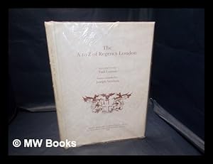
The A to Z of Regency London / introduction by Paul Laxton ; index compiled by Joseph Wisdom
Sprache: Englisch
Verlag: Lympne Castle, Kent : H. Margary in association with Guildhall Library, London, 1985
ISBN 10: 0902087193 ISBN 13: 9780902087194
Facsimile Edition. Fine cloth copy in a near fine, very slightly edge-nicked and dust-dulled dust wrapper, now mylar-sleeved. Remains particularly and surprisingly well-preserved; tight, bright, clean and sharp-cornered. Series; Reproductions of historic maps of London ; 4 C. Publication / London Topographical Society ; no. 131. Physical description; 1 atlas (xiv, 116 pages) : chiefly maps ; 31 cm. Notes; Reduced reprint. Originally published: Plan of the cities of London and Westminster, with the borough of Southwark. 3rd ed. London : R. Horwood, 1813. With additional information. Includes bibliographical references. Subjects; Horwood, Richard. Plan of the cities of London and Westminster, with the borough of Southwark. 19th century. Early maps ; Facsimiles. Regency England London ; Maps. Cartography England London History. Fire risk assessment England London ; Maps. Views ; Facsimiles. Cities history. Cartography. Early maps. Fire risk assessment. Regency. Views. Early maps ; Facsimiles. Regency England London ; Maps. Cartography England London History. Fire insurance England London ; Maps. Views ; Facsimiles. London - Atlases. London - History. Fire insurance England London ; Maps. Cities history. Topography. Maps. London Maps. Cartography England London History. Early maps Facsimiles. Regency England London ; Maps. Cartography England London History. Fire insurance England London ; Maps. Views ; Facsimiles. Cartography London History. Early maps ; Facsimiles. London (England) ; Maps. Southwark (London, England) ; Maps. Westminster (London, England) ; Maps. England London. England London Southwark. England London Westminster. London - ; Maps (1799-1819). London. History of cartography. ; [Literature] 1985. London (England) Description Maps To 1880. Great Britain History 19th century ; Maps. London (England) ; Maps. London ; Maps. London ; Maps ; Facsimiles. London (England) ; Maps. Southwark (London, England) ; Maps. Westminster (London, England) ; Maps. London (England) ; Maps. Cartography England London History. Early maps Facsimiles. Insurance, Fire England London Maps. London (England) Maps. Maps, Early Facsimiles. Regency England London Maps. Southwark (London, England) Maps. Views Facsimiles. Westminster (London, England) Maps. London (1792-1813) Maps Facsimiles Collections. London (1792-1813) Maps Collections. Genres; Atlases (Geographic). Atlases. cartographic image. Facsimiles. History. Manuscripts. Manuscripts. Maps and plans. Maps. 3 Kg.
-
Salter's Families 1990
Verlag: Harry Margary & the Master and Wardens of the Salter's Company, 1990
Anbieter: Lincolnshire Old Books, Sleaford, Lincolnshire, Vereinigtes K÷nigreich
Verkõuferbewertung 5 von 5 Sternen
Erstausgabe
EUR 42,91
EUR 37,21 Versand
Versand von Vereinigtes K÷nigreich nach USAAnzahl: 1 verf³gbar
In den WarenkorbHardcover. Zustand: Fine. 1st Edition. A SCARCE title. NO CHIPPING & NO SPLITTING to VERY CLEAN boards with livery armorial pasted on front board (as originally issued). Internally VERY CLEAN with NO INSCRIPTIONS. TIGHT textblock. NO LOOSE & NO MISSING leaves. The clear tissue dustwrapper has a number of short closed tear and associated creasing.
-
Two Hundred and Fifty Years of Map-Making in the Country of Sussex: A Collection of Reproductions of Printed Maps Published Between the Years 1575-1825
Verlag: Harry Margary, 1974
Anbieter: Chapter 1, Johannesburg, GAU, S³dafrika
Verkõuferbewertung 5 von 5 Sternen
Hardcover. Zustand: Good. No Jacket. No Edition. The boards are edge worn with knocked corners and scuffing around the edges. The printed title on the front board is rubbed and marked, but legible. The binding is mobile but secure. Foxing on the end papers. No ink inscriptions or annotations. The maps are clear and neat overall. Very tall and heavy book, extra postage required. JHK. Our orders are shipped using tracked courier delivery services.
-
An Exact Survey of the City's of London Westminster ye Borough of Southwark and the Country Near 10 Miles Round London in 16 Sheets to a Scale of 5.5 Inches to 1 Mile in 1746 PLUS Index to Rocque's Plan of London
Verlag: Harry Margary AND Phillimore & Co Ltd, Lympne Castle, Kent AND Chichester, 1971
Anbieter: Old Hall Bookshop, ABA ILAB PBFA BA, Brackley, Vereinigtes K÷nigreich
Verbandsmitglied: ABA ILAB PBFA
Verkõuferbewertung 5 von 5 Sternen
Karte
EUR 238,41
EUR 17,36 Versand
Versand von Vereinigtes K÷nigreich nach USAAnzahl: 1 verf³gbar
In den WarenkorbPebbled Red Cloth. Zustand: Fine. John Pine Bluemantle (illustrator). Facsimile. The scarce 1971 facsimile of John Rocques 1746 map 'An Exact Survey of the City's of London Westminster ye Borough of Southwark and the Country Near 10 Miles Round London in 16 Sheets to a Scale of 5.5 Inches to 1 Mile' and his 1746 'A Plan of the Cities of London and Westminster and Borough of Southwark with the Contiguous Buildings from an Actual Survey in 24 sheets to a scale of 26 inches to 1 mile', introductory notes by James Howgego, pages clean and crisp, as are endpapers and edges, pebbled red cloth with illustrated title label pasted to upper board PLUS An alphabetical index of the streets, squares, lanes, alleys &c contained in the plan of the Cities of London and Westminster and Borough of Southwark, with the contiguous buildings, (ii), xii, 46pp, 1p table of contents, illustrated with a folding plan, pages clean and crisp, likewise edges and endpapers, tan cloth, black spine lettering. Both volumes are in excellent condition and have been kept in the original large cardboard box used for delivery to the original customer, also includes two letters from the editor regarding problems with the package getting to this customer! Rocque, a French-born cartographer, created the survey over a ten-year period in collaboration with surveyor John Pine, and it remains one of the most significant cartographic records of pre-Victorian London. NB THIS IS A VERY LARGE HEAVY BOOK WHICH WILL NEED TO BE SENT BY COURIER - UK COST WILL BE BETWEEN ROUGHLY Ż12, USA ROUGHLY Ż40 AND EUROPE ROUGHLY Ż20 - PLEASE EMAIL FOR AN EXACT PRICE Size: 22.25 X 16.75 Inches. Maps.
-
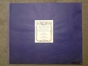
SPOILS OF WAR - PORTRAITS OF THE FRENCH AND SPANISH SHIPS TAKEN BY LORD ANSON, CAPTAIN BUCKLE, AND SIR E. HAWKE IN THE YEAR 1747.
Verlag: HOLLAND PRESS AND HARRY MARGARY, 1977
Anbieter: Bishops Green Books, Newbury, BERKS, Vereinigtes K÷nigreich
Verkõuferbewertung 4 von 5 Sternen

EUR 351,66
EUR 16,78 Versand
Versand von Vereinigtes K÷nigreich nach USAAnzahl: 1 verf³gbar
In den WarenkorbSoft cover. Zustand: Good. No Jacket. A large, softcover book, with twelve amazing reproduce prints of the original engravings, drawn by Robert Short and published by John Boydell in the years 1748 to 1751, portraits of the French and Spanish Ships taken by Lord Anson, Captain Buckle and Sir E. Hawke in the year 1747. This tremendous book is in good condition. Normal wear and marks apply, consistent with use and age. First published in 1977. Published by Holland Press, London and Harry Margary, Lympne Castle, Kent, Printed by Headley Brothers, Ashford, Kent 1977. The twelve beautiful black & white prints of captured French and Spanish ships are in really good order. Each print measures 68cms wide x 56cms high. Each ship is titled as follows: 1. "Intrepid" launched as Serieux. 2."Gloire", a French Man of War. 3. "Invincible" 4. Stern Views of "Invincible", "Ruby", "Isis" & "Dimant". 5. "Intrepid" (Serieux), & "Gloire". 6.Stern view of "Jason", Head view of "Ruby", & "Diamond". 7. Stern view of "Glorioso", Head view of "Jason" & "Gloire". 8. "Glorioso" a Spanish Man of War. 9. "Monarque" Man of War. 10. "Terrible" a Man of war. 11. Stern views of "Monarque", "Forgeaux" & "Trident". 12. Stern views of "Terrible", "Neptune" & Severn", three Men of War ships. Historical Background: After the "Peace of Utrecht" in 1714, friction between Britain and Bourbon Family Compact nations of France and Spain continued intermittently until 1739. Britain was determined to open up Spanish America and the West Indies to trade, and Spain was equally determined to prevent this, claiming a right of search on the high seas which culminated in the War of Jenkins' Ear in 1739. This continued into the war of the Austrian Succession, when France, over-running the Austrian Netherlands, threatened an invasion of the England shore and Britain declared war in 1744. The struggle lasted with short intervals until 1815, and was the first of the great wars in modern history to be fought in all four quarters of the globe, in the Americas, Canada, the West Indies, West Africa, India and Europe. By 1747, France had captured Madras; and Britain, Louisberg, on Cape Breton Island, commanding the mouth of St. Lawrence. The spoils of war were fairly even, when two sea battles off the Bay of Biscay changed the whole course of the struggle. The importance of sea power was not realised until later on when France was unable to hold her conquests because of the lack of it, and Britain took a long time to realise the advantage of it, but eventually command of the seas, which Britain won after two naval engagements in 1747, established her as the chief colonial power in the world, and, with it, a vast extension of her raw materials, industry, commerce, and wealth. This fabulous book is wonderful reminder of what went on in that period of time on the high seas. Just a wonderful collection of naval prints.