

Gesamtpreis (1 Artikel Artikel):
Versandziel:

map cram george (3 Ergebnisse)
Direkt zu den wichtigsten Suchergebnissen
Suchfilter
Produktart
- Alle Product Types
- Bücher (2)
- Magazine & Zeitschriften (Keine weiteren Ergebnisse entsprechen dieser Verfeinerung)
- Comics (Keine weiteren Ergebnisse entsprechen dieser Verfeinerung)
- Noten (Keine weiteren Ergebnisse entsprechen dieser Verfeinerung)
- Kunst, Grafik & Poster (Keine weiteren Ergebnisse entsprechen dieser Verfeinerung)
- Fotografien (Keine weiteren Ergebnisse entsprechen dieser Verfeinerung)
- Karten (1)
- Manuskripte & Papierantiquitäten (Keine weiteren Ergebnisse entsprechen dieser Verfeinerung)
Zustand Mehr dazu
- Neu (Keine weiteren Ergebnisse entsprechen dieser Verfeinerung)
- Wie Neu, Sehr Gut oder Gut Bis Sehr Gut (1)
- Gut oder Befriedigend (Keine weiteren Ergebnisse entsprechen dieser Verfeinerung)
- Ausreichend oder Schlecht (Keine weiteren Ergebnisse entsprechen dieser Verfeinerung)
- Wie beschrieben (2)
Einband
- alle Einbände
- Hardcover (Keine weiteren Ergebnisse entsprechen dieser Verfeinerung)
- Softcover (Keine weiteren Ergebnisse entsprechen dieser Verfeinerung)
Weitere Eigenschaften
- Erstausgabe (Keine weiteren Ergebnisse entsprechen dieser Verfeinerung)
- Signiert (Keine weiteren Ergebnisse entsprechen dieser Verfeinerung)
- Schutzumschlag (Keine weiteren Ergebnisse entsprechen dieser Verfeinerung)
- Angebotsfoto (3)
Sprache (1)
Preis
- Beliebiger Preis
- Weniger als EUR 20 (Keine weiteren Ergebnisse entsprechen dieser Verfeinerung)
- EUR 20 bis EUR 45
- Mehr als EUR 45
Gratisversand
- Kostenloser Versand nach USA (Keine weiteren Ergebnisse entsprechen dieser Verfeinerung)
Land des Verkäufers
Verkäuferbewertung
-
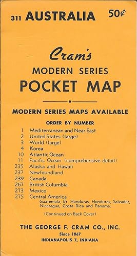
Cram's Modern Series Pocket Map #311 - Australia
Verlag: George F. Cram Co. Inc. nd, Indianapolis
Anbieter: Antipodean Books, Maps & Prints, ABAA, Garrison, NY, USA
Verbandsmitglied: ABAA ANZAAB ESA ILAB
Verkäuferbewertung 3 von 5 Sternen

Zustand: Fine. The map is tipped into its original, 8 ½" x 4 ½", yellow wrapper that lists the available Modern Series Maps offered by the Cram company on both sides. The colored map unfolds to 16" x 22". A small map on Tasmania is inserted at upper left corner. Someone has used a black marker throughout the Western Australia portion of the map to denote eucalyptus forests, savannah, desert, mallee, and mulga.
-
Africa [and] N. W. Africa, Morocco, Algeria & Tunis.
Verlag: Geo. F. Cram. (1894)., Chicago., 1894
Anbieter: Asia Bookroom ANZAAB/ILAB, Canberra, ACT, Australien
Verkäuferbewertung 5 von 5 Sternen

Chromolithographed maps, 54.3 x 34.1 cm (sheet), central fold, a few small edge tears and marginal age toning, but in very good condition. Detailed maps prepared for George F. Cram's 1894 "Standard American Atlas": one of the first American firms to publish a world atlas. Maps of Oceania and South Africa printed on the verso.
-

Oregon. Oregon and Western Colonization Company.
Erscheinungsdatum: 1911
Anbieter: Geographicus Rare Antique Maps, Brooklyn, NY, USA
Verbandsmitglied: ABAA ESA ILAB
Verkäuferbewertung 3 von 5 Sternen
Karte
Fair. Wear along original fold lines. Several areas of infill at fold intersections and along fold lines. Some soiling. Size 28 x 35.25 Inches. This is a 1911 George Cram map of Oregon published for the Oregon and Western Colonization Company (OWC). The grant lands offered for sale here were the fruit of a 'most unblushing fraud upon the government' perpetrated in the late 19th century by the Willamette Valley and Cascade Mountain Wagon Road Company. A Closer Look Coverage embraces the state of Oregon with red and green checker patterns highlighting land offered for sale by the Oregon and Western Colonization Company - a broad corridor extending from Linn County southeasterly as far as Malheur County. Green acreage is designated for logging, while red marks agricultural land. A key explaining this occupies the upper right corner. Bold black lines illustrate railroads. Cities, towns, and villages are labeled throughout, and an index of railroads and electric railroads appears above the Oregon border. The Oregon and Western Colonization Company The Oregon and Western Colonization Company (OWC) was founded in May 1910 by investors in St. Paul, Minnesota. It acquired over 800,000 acres of land in central Oregon from the defunct Willamette Valley and Cascade Mountain Wagon Road Company, which they planned to sell to settlers for between $15 and $200 an acre. The Willamette Valley and Cascade Mountain Wagon Road Company The land grants offered for sale here date to the second half of the 19th century. In 1866, the Willamette Valley and Cascade Mountain Wagon Road Company (WVCM), a well-intended group formed by Linn County farmers, ranchers, and lumbermen, constructed a rough wagon road from Lebanon to Camp Polk (Sisters) on the Deschutes River. Known as the Santiam Wagon Road, the route proved popular, and the WVCM profited handsomely from tolls and road services. When the federal government began authorizing massive land grants to road and railroad builders, the WVCM put in an application that included an exaggerated claim that the existing Santiam Wagon Road was a massive road, built in response to an 1866 congressional bill, that would eventually extend from Albany to the Snake River. The WVDM proposal leveraged kernels of truth with exaggerations, lies, misinformation, and other tricks to maximize their grant. First, they fraudulently claimed a pre-existing road between Albany and Lebanon as their work. Second, they lied about the dates, suggesting that the Santiam Wagon Road was actually built in response to the 1866 bill when it predated the bill considerably. Third, they used the lack of detailed mapping of central Oregon to introduce an erratic, unnecessarily winding route with multiple turns and switchbacks, thus maximizing the area of the grant. Finally, they bribed official agents to 'certify' the unfinished road on the state level, thus confirming the grant. Decades later, in 1880, at least three dozen homesteaders discovered that their lands had been, at least in name, appropriated by the WVCM. In the hope of annulling the grant, they sent an appeal to the Department of the Interior, arguing that the WVCM 'never built or constructed any road as the laws of this State require roads of that character.' They also argued that 'there has been no attempt to open or construct any road' between Smith's Rock and the Snake River, a distance of 300 miles. The Secretary of the Interior sent an investigator who discovered that 'from Cache Creek eastward to the State line it is very manifest that the terms of the grant have not been complied with.' The Department of the Interior nonetheless deferred a decision on the matter to Oregon's state government. Oregon investigated in 1885, and the Secretary of the Interior opened a new investigation in 1887, which concluded that the Willamette Valley road was a 'most unblushing fraud upon the government'. In 1889, the Department of the Interior took the WVCM to court. The Supreme Court ultim.

![Bild des Verkäufers für Africa [and] N. W. Africa, Morocco, Algeria & Tunis. zum Verkauf von Asia Bookroom ANZAAB/ILAB](https://pictures.abebooks.com/inventory/md/md31208508236.jpg)
