
Gesamtpreis (1 Artikel Artikel):
Versandziel:

john george bartholomew editor (2 Ergebnisse)
Direkt zu den wichtigsten Suchergebnissen
Suchfilter
Produktart
- Alle Product Types
- Bücher (2)
- Magazine & Zeitschriften (Keine weiteren Ergebnisse entsprechen dieser Verfeinerung)
- Comics (Keine weiteren Ergebnisse entsprechen dieser Verfeinerung)
- Noten (Keine weiteren Ergebnisse entsprechen dieser Verfeinerung)
- Kunst, Grafik & Poster (Keine weiteren Ergebnisse entsprechen dieser Verfeinerung)
- Fotografien (Keine weiteren Ergebnisse entsprechen dieser Verfeinerung)
- Karten (Keine weiteren Ergebnisse entsprechen dieser Verfeinerung)
- Manuskripte & Papierantiquitäten (Keine weiteren Ergebnisse entsprechen dieser Verfeinerung)
Zustand Mehr dazu
- Neu (Keine weiteren Ergebnisse entsprechen dieser Verfeinerung)
- Wie Neu, Sehr Gut oder Gut Bis Sehr Gut (Keine weiteren Ergebnisse entsprechen dieser Verfeinerung)
- Gut oder Befriedigend (Keine weiteren Ergebnisse entsprechen dieser Verfeinerung)
- Ausreichend oder Schlecht (Keine weiteren Ergebnisse entsprechen dieser Verfeinerung)
- Wie beschrieben (2)
Einband
- alle Einbände
- Hardcover (2)
- Softcover (Keine weiteren Ergebnisse entsprechen dieser Verfeinerung)
Weitere Eigenschaften
- Erstausgabe (1)
- Signiert (Keine weiteren Ergebnisse entsprechen dieser Verfeinerung)
- Schutzumschlag (Keine weiteren Ergebnisse entsprechen dieser Verfeinerung)
- Angebotsfoto (2)
Sprache (1)
Preis
- Beliebiger Preis
- Weniger als EUR 20 (Keine weiteren Ergebnisse entsprechen dieser Verfeinerung)
- EUR 20 bis EUR 45 (Keine weiteren Ergebnisse entsprechen dieser Verfeinerung)
- Mehr als EUR 45
Gratisversand
Land des Verkäufers
Verkäuferbewertung
-
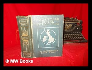
The survey gazetteer of the British Isles, topographical, statistical, and commercial : compiled from the 1901 census and the latest official returns / Ed. by J.G. Barthololmew . With appendices and special maps
Verlag: London : George Newnes, Limited, 1904
Erstausgabe
First Edition. Poor copy in the original gilt decorated pictorial cloth; wear and tear as with age. Front board starting., with the title page detached, but loosely inserted. Text remains in fine condition and without blemish. Physical description; [8], 928 pages : illustrations, 64 (i.e. 55) colour plates (including maps, plans, diagrams, charts); 27 cm. Subjects; Gazetteers. Great Britain ; Gazetteers. Ireland ; Gazetteers. Great Britain. Ireland. Genres; cartographic image. Gazetteers. Illustrated 4 Kg.
-
The XXth Century Citizen's Atlas of the World. Containing 156 pages of maps and plans with an index, a gazetteer, and geographical statistics. Edited by J.G. Bartholomew, F.R.G.S.
Verlag: George Newnes, [1902]., London:, 1902
Anbieter: Jeff Weber Rare Books, Neuchatel, NEUCH, Schweiz
Verkäuferbewertung 4 von 5 Sternen

Folio. xvi, 133, [1] pp. 156 ff. with fine color folding maps, each neatly tabbed in order to allow even/flat opening of each map. The map 'plates' are printed on the rectos only. Index. Original half maroon leather, maroon decorative cloth, simple spine rules and title in gilt; joints cracked (but holding), extremities & corners showing. Good +. PROVENANCE: P. Patton Milne, 12/12/1902; William Hutton Stewart, 2nd May, 1960. With the color folding maps in excellent condition. "Under his administration the family business became one of the top operations in its field. Bartholomew himself was not merely a specialist in production, but also a talented geographer and cartographer. It was he who introduced the use of coloured contour layer maps developed by his father . . ." The maps are here all printed in colors and the maps are all well researched and presented for this purpose. J.G. Bartholomew was a founding member of the R.S.G.S. As a holder of a royal warrant, he used the title "Cartographer to the King"; for this reason, he was sometimes known by the epithet "the Prince of Cartography". / "Bartholomew gave much thought to the perfecting of the technical processes of map-production as well as to the planning of new geographical works; and by keeping in touch with the latest progress of discovery and research he avoided the tendency of some map-makers to content themselves with following in the footsteps of their predecessors. The two great atlases of Scotland and of England and Wales, published in 1895 (second edition 1912) and 1903 respectively, are among the most important of his works, embodying an immense amount of geographical and statistical research . . . Bartholomew's work as a map-maker is distinguished both by accuracy in detail and by skill in craftsmanship; but his most important contribution to the science of cartography was his extension and improvement of the system of layer colouring for marking contours, a system by which his maps attain a high degree of delicacy and effectiveness. His skilful use of colour for other purposes, as for instance in population maps, is also noteworthy." â" DNB. PROVENANCE [2]: [1] P. Patton Milne, 12/12/1902; [2] William Hutton Stewart, 2nd May, 1960.
