
Gesamtpreis (1 Artikel Artikel):
Versandziel:

japan ukiyo e (15 Ergebnisse)
Direkt zu den wichtigsten Suchergebnissen
Suchfilter
Produktart
- Alle Product Types
- Bücher (10)
- Magazine & Zeitschriften (Keine weiteren Ergebnisse entsprechen dieser Verfeinerung)
- Comics (Keine weiteren Ergebnisse entsprechen dieser Verfeinerung)
- Noten (Keine weiteren Ergebnisse entsprechen dieser Verfeinerung)
- Kunst, Grafik & Poster (Keine weiteren Ergebnisse entsprechen dieser Verfeinerung)
- Fotografien (Keine weiteren Ergebnisse entsprechen dieser Verfeinerung)
- Karten (5)
- Manuskripte & Papierantiquitäten (Keine weiteren Ergebnisse entsprechen dieser Verfeinerung)
Zustand Mehr dazu
- Neu (Keine weiteren Ergebnisse entsprechen dieser Verfeinerung)
- Wie Neu, Sehr Gut oder Gut Bis Sehr Gut (3)
- Gut oder Befriedigend (2)
- Ausreichend oder Schlecht (Keine weiteren Ergebnisse entsprechen dieser Verfeinerung)
- Wie beschrieben (10)
Einband
Weitere Eigenschaften
Sprache (2)
Preis
- Beliebiger Preis
- Weniger als EUR 20 (Keine weiteren Ergebnisse entsprechen dieser Verfeinerung)
- EUR 20 bis EUR 45
- Mehr als EUR 45
Gratisversand
- Kostenloser Versand nach USA (Keine weiteren Ergebnisse entsprechen dieser Verfeinerung)
Land des Verkäufers
Verkäuferbewertung
-
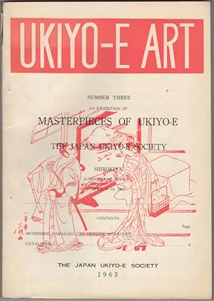
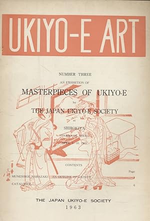
An Exhibition of Masterpieces of Ukiyo-E by the Japan Ukiyo-E Society at Shirokiya, Nihonbashi, Tokyo April 5-10, 1963. Ukiyo-E Art, Number Three. 1963
Sprache: Englisch
Verlag: Japan Ukiyo-E Society, Tokyo, 1963
Anbieter: Kaaterskill Books, ABAA/ILAB, East Jewett, NY, USA
Verbandsmitglied: ABAA ILAB IOBA
Verkäuferbewertung 5 von 5 Sternen

Erstausgabe
Illustrated paper wrappers. First edition. 30, 52, 98 pp. Illus. with 6 color plates + 321 b/w reproductions. Sm. 4to. Shigeo Miyao, ed. Errata slip tipped in. Catalogue of 321 prints in English and Japanese. 8 pages of ads. Glossary. Chip at the head of the spine else a very good copy.
-

Sharaku (Excellent Ukiyo-e Vol. 7)
Verlag: Yamada Shoin Co., 1981
Anbieter: Object Relations IOBA PBFA, London, Vereinigtes Königreich
Verkäuferbewertung 5 von 5 Sternen
Erstausgabe
EUR 23,82
EUR 11,56 Versand
Versand von Vereinigtes Königreich nach USAAnzahl: 1 verfügbar
In den WarenkorbHardcover. Zustand: Near Fine. Zustand des Schutzumschlags: Near Fine. 1st Edition. 1st ed. (1981). VG+/VG+ copy in VG slipcase, gift inscription to ffep.
-
An Exhibition of Masterpieces of Ukiyo-e. Tokyo, April 5-10, 1963.
Sprache: Englisch
Verlag: The Japan Ukiyo-e Society, 1963
Anbieter: Borkert, Schwarz und Zerfaß GbR, Berlin, Deutschland
Verkäuferbewertung 5 von 5 Sternen
Paperback. Zustand: Sehr gut. 30, 52, 98 p.: Ill. Die Seiten sind papierbedingt gebräunt, die Broschur löst sich leicht vom Buchrücken und ist ebenfalls tlw. ausgeblichen oder gebräunt. Sonst aber ein sauberes und gut erhaltenes Exemplar. Der Text ist teilweise auf Japanisch und teilweise auf Englisch geschrieben/ The pages are browned due to the paper, and the booklet is slightly detached from the spine and is also faded or browned in places. Otherwise, however, a clean and well preserved copy. The text ist written partly in japanese and partly in english. - ABOUT A CENTURY has elapsed since ukiyo-e emigrated from Japan and has become a matter of interest to the world at large. During this period many ukiyo-e prints have been sent abroad, where they have been highly appreciated and have had a remarkable influence upon some of the Western art. Many books both at home and abroad, beginning with Edmond de Goncourts Outamaro (Paris, 1891) and Kyoshin Ijimas Katsushika Hokusai Den (Tokyo, 1893), have been published about ukiyo-e: to the end that ukiyo-e has become firmly set in the vision of world art. The time seems ripe now for scholars and collectors to come together and arrive at some conclusions about the fundamental research which has been made during the past century. One of the purposes of the Japan Ukiyo-e Society is to bring together Japanese and Western scholars and facilitate the exchange of information and views between them. Upon the occasion of the societys first major exhibition of ukiyo-e masterpieces, I would like to offer some opinions and tentative conclusions in regard to the history and essence of ukiyo-e. The origin and precise meaning of the word ukiyo-e have been the subject of much research and controversy, which is probably, in the final analysis, of rather small interest and importance. The word first appeared in a literary work published in 1681, and at that time there was a definite connotation that linked the word with the gay quarter at Yoshiwara. Some critics have held that ukiyo-e, in an exact sense, must be confined within the limits of the original definition. But most of us are willing to give it a wider meaning, and it may be noted that the ukiyo-e prototypes now being discovered and studied were not so limited in subject-matter and would come within the purview of a wider definition. An admirable median definition has been given by Sir George Sansom in his Japan: A Short Cultural History (New York, rev. ed., 1943, p. 474), as follows: The culture of the townspeople was essentially the culture of a prosperous bourgeoisie devoted to amusement. Their arts centred round what was called in the current language of the day Ukiyo or the Floating World. This is the world of fugitive pleasures, of theatres and restaurants, wrestling-booths and houses of assignation, with their permanent population of actors, dancers, singers, story-tellers, jesters, courtesans, bath-girls and itinerant purveyors, among whom mingled the profligate sons of rich merchants, dissolute samurai and naughty apprentices. It is chiefly the life of these gay quarters and their denizens which is depicted in popular novels and paintings of the day, the ukiyo-soshi and the ukiyo-e, the sketch-books and the pictures of the floating world. Some sketchy outlines for a history of ukiyo-e were provided by Ota Nampo and other writers in the Ukiyo-e Ruiko, starting around 1800, but these efforts were rather desultory and were not guided by any real historical sense. Ukiyo-e scholarship in Japan cannot be said to have started until the Meiji era. For a long time this scholarship has been plagued by fables and old wives tales. Within living memory some scholars have believed that Matabei was the founder of ukiyo-e. Others have held that the Otsu-e folk paintings were direct forerunners of the ukiyo-e prints. And there are still many who believe that ukiyo-e appeared suddenly and miraculously in the 17th century, without any apparent antecedent or origin, in the person of Hishikawa Moronobu. Certain investigations are now being centered on the genre art which preceded ukiyo-e, and we are beginning to see that ukiyo-e, instead of being a neatly defined body of art extending from such-and-such a date to such-and-such a date, comprising certain works by certain artistsis, in fact, but one aspect of a much broader concept of Japanese plebian art. Probably not until we have devoted much more study to the larger concept of plebian art can we arrive at a better understanding of ukiyo-e itself. Sprache: Englisch Gewicht in Gramm: 550.
-
UKIYO-E ART. Individual Journal Numbers
Anbieter: RARE ORIENTAL BOOK CO., ABAA, ILAB, Aptos, CA, USA
Verkäuferbewertung 5 von 5 Sternen
Tokyo 1964.J.U.S. No. 7. Stiff wrs., very good, 26p., with a rticle by Suzuki Juzo:AN ANALYTICAL STUDY OF UTAMARO'S ILLU- STRATED BOOKS, 37 b.w. photos, Japanese text. This journal was under the directorship of Muneshige Nara- zaki, edited by Shigeo Miyao, international editoral staff were J. Hillier, R. Paine, H. Stern, T. Volker, Dr. S. Taka- hashi president, C. Mitchell international editorial secret- ary et al. With fine and scholarly articles by leading expo- nents on all aspects of Ukiyo-e prints & E-hon [illustrated books] of the Edo & other periods. A useful reference tool for any collector or student. Good adverts are also part of this journal giving a variety of dealers & publishers. Also has news, book reviews, timely articles and controversial subjects addressed.
-
Utamro and Hiroshige: from the Honolulu Academy of Arts, from the James Michener Collection
Verlag: Not Stated, Not Stated, 1975
Anbieter: Independent Books, Long Beach, WA, USA
Verkäuferbewertung 2 von 5 Sternen

Trade Paperback. Zustand: Very Good. unnumbered pp; TPB. In Japanese and English. For the exhibition at the Honolulu Academy of Arts from the James Michener collection. Pages: clean, bright, tight, yellow eps, frontis; a.e. lt tanned. Cover: teal/white wraps, color artwork + pink titles front/spine, color artwork back; modest edge/shelfwear, spine creased, sm ink stain spine. 150 plates, several in color.
-
Kunst Postkarte Japan // Vier schöne Kunstpostkarten mit Darstellungen von Kurtisanen aus dem Kaiserlichen Museum in Tokio (Künstler: Shigenobu Takizawa, tätig um 1730; Chikanobu Matsuno, tätig um 1720; Toshinobu Sengodo und Narishige Kwaigetsudo). Einliegend in japanisch bedrucktem Faltumschlag.
Verlag: Tokio um 1930, 1930
Anbieter: Antiquariat Thomas Mertens, Berlin, Deutschland
Verbandsmitglied: GIAQ ILAB VDA
Verkäuferbewertung 4 von 5 Sternen

Vier Blanko-Postkarten auf sehr kräftigem Papier (9 x 14,2 cm). Der dekorative Umschlag im Format 10,3 x 17,3 cm. -- Zustand: Karten leicht gebogen und etwas gebräunt; Umschlag leicht schadhaft.
-
Zustand: Used: Very Good. Couverture légčrement passée.
-
Kiyonaga's Unexhibited (Un-exhibited) Masterpieces | With English Translation
Verlag: Published by Takashi Uehara | Shumei Printing, Ltd., Tokyo 1949., 1949
Anbieter: Little Stour Books PBFA Member, Canterbury, Vereinigtes Königreich
Verbandsmitglied: PBFA
Verkäuferbewertung 5 von 5 Sternen
Erstausgabe
EUR 446,64
EUR 34,69 Versand
Versand von Vereinigtes Königreich nach USAAnzahl: 1 verfügbar
In den WarenkorbZustand: Fine. First edition hard back binding in publisher's original black silk brocade covered boards, blocked and lettered scarlet Japanese calligraphy and gold outlined image of a Japanese lady to the front, cream end sheets flecked with gold, scarlet silk head-bands. 8vo. 10'' x 7Ľ''. Deluxe edition number 1313 of 1500 Limited Edition copies published for the Murasaki Bookstore, 173 Miyamae, Meguro Ward, Tokyo, Japan. Contains vertically folding colour frontispiece on black ground, profusely illustrated with tissue-guarded multi-coloured woodblock prints, commentary and 19 pp of English explanations, catalogue raisonné, 111 pp written in Japanese + [2] blanks + 17 pp, textured Japanese papers throughout. Feint surface mark to the top corner of the rear board, else Fine condition book housed in light wooden bamboo case which has received repairs to the edges. Member of the P.B.F.A. ART & CRAFT [Japanese].
-
Images of 19th century Japan. Travel and Tourism, Creped paper books, Photograph albums.
Anbieter: Antiquariaat Wim de Goeij, Kalmthout, ANTW, Belgien
Verbandsmitglied: ILAB
Verkäuferbewertung 5 von 5 Sternen
2. Leiden, Ukiyo Books, s.d., (ca. 1985), 21 x 21, (44 pp), orig.wrapper, stapled, b/w ills, some articles + 121 items.
-
Zenith 1: 24 Masterpieces Sharaku. Shuei-Sha edition Ukiyo-e Hanga.
Verlag: Tokyo, Toppan / Shuei-Sha, 1964., 1964
Anbieter: Antiquariat Thomas Rezek, München, Deutschland
Verkäuferbewertung 5 von 5 Sternen
circa 48,5 x 35 cm. 2 ff., 20 pp., 24 prints in colour on plates with cover Original box Large collection of portraits of kabuki actors. - Fine, clean - large and heavy!.
-
![Bild des Verkäufers für [Spectacular View of the Temple, the Land, Mt. Itajiki, the Zen Chamber, the Snowy and Windy Valley in Inada Township, Kasama County, Hitachi Province]. zum Verkauf von Geographicus Rare Antique Maps](https://pictures.abebooks.com/inventory/md/md32068517266.jpg)
[Spectacular View of the Temple, the Land, Mt. Itajiki, the Zen Chamber, the Snowy and Windy Valley in Inada Township, Kasama County, Hitachi Province].
Erscheinungsdatum: 1868
Anbieter: Geographicus Rare Antique Maps, Brooklyn, NY, USA
Verbandsmitglied: ABAA ESA ILAB
Verkäuferbewertung 4 von 5 Sternen
Karte
Very good. Light wear along centerfold. Size 14.5 x 19 Inches. An intriguing c. 1868 ukiyo-e view of the township of Inada in Kasama municipality, Ibaraki Prefecture, Japan, some 50 miles north of Tokyo. It focuses on the Sainenji Temple (???), originally constructed in the 13th century. A Closer Look This view is oriented towards the north, looking over the village of Inada towards the Sainenji Temple, with the Inada River flowing in the foreground. Within the temple complex, various structures and sites are labeled, including the main hall (??) of the temple, a small structure covering a bell (??) at the right, and even a tree (???) and stone with religious significance (???). Outside of the temple, fields, a teahouse, and other hills and mountains are labeled. At left is Mt. Itajiki (in the title as ??? but on the view written using kana ?????), which also carries spiritual significance. Historically, the altar atop the mountain was a site where monks from Sainenji and other ascetics would practice Shugend? Inada Sainenji Temple The Inada Sainenji Temple is an important temple in the J?do Shinsh? school or sect of Pure Land Buddhism. It is said that Shinran (1173 - 1263), who founded the J?do Shinsh? school, wrote the draft of his magnum opus Ky?gy?shinsh? (????, 'The True Teaching, Practice, and Realization of the Pure Land Way') there in the year 1224. The phrase 'Windy and Snowy Valley' in the title is a reference to the name of the hermitage built for Shinran by the local feudal lord, Inada Kur? Yorishige (??????). The main hall contains a stepped platform, at the top of which is a statue of the Amitabha Buddha, with the lower steps including statues of other important Buddhist figures, including Shinran. Publication History and Census This view is untitled and contains no stamp indicating the artist or publication information. It likely was produced in the late Edo or early Meiji period, c. 1868. We have been unable to locate any other examples of this view in institutional collections or on the market. The meaning of the stamp at the bottom-right (????) is somewhat unclear but may mean that this is a later (19th century) representation of the temple and surroundings as they appeared in an earlier time. In any event, it is likely that the view was distributed on-site at the temple itself.
-
[Untitled] / ['View of Famous Places in the Western Inland Sea' ()].
Erscheinungsdatum: 1859
Anbieter: Geographicus Rare Antique Maps, Brooklyn, NY, USA
Verbandsmitglied: ABAA ESA ILAB
Verkäuferbewertung 4 von 5 Sternen
Karte
Very good. Small pinholes along one vertical edge of each sheet. Size 14 x 28.5 Inches. A scarce 1859 ukiyo-e triptych of the Kanmon Straits (also known as the Straits of Shimonoseki) where the islands of Honshu and Kyushu meet, produced by Sadahide, one of the most popular ukiyo-e artists of his time. A Closer Look Oriented towards the west, this view displays the area along the shores of the 600-meter wide Kanmon Straits, modern-day Kitakyushu and Shimonoseki, which at that time was a constellation of neighboring ports and villages. Many temples and shrines are noted, most of which are still extant, including the Kameyama Hachimangu (?????), the castle-like structure at right, Nakayamadera (???), and Hofukuji (???). Neighborhoods (?) and streets (?) are labeled along both sides of the Straits, as are islands (including Ganry?-jima, ???), rocks, and coastal banks. Fishing and trading boats appear in great numbers, particularly on the Shimonoseki side of the Straits. Nagato (??), on the northwest side of Honshu, is referred to in the background. Battleground for Japan's Modernization Though appearing tranquil here, this region and Japan as a whole were in the midst of a crisis brought on by the country's forcible opening to foreign trade in the preceding decade. The ruling Tokugawa Shogunate appeared incapable of responding to the crisis, providing an opportunity to provincial daimyo who had long chafed at their rule, including the powerful lords of Ch?sh? Domain in western Honshu. Although the Shogunate belatedly organized missions to study foreign technology and military science, the daimyo and samurai of Ch?sh? Domain and nearby southern domains had already begun to produce their own Western-style cannons during the 1850s, and soon afterward purchased their own foreign warships. As discontent with the Tokugawa grew, a movement to expel the 'barbarians' and 'restore' the emperor gained momentum, especially in Ch?sh? and neighboring southern domains. When Emperor K?mei issued an order to expel the barbarians in 1863, Ch?sh? Domain responded by firing on foreign warships sailing through the Straits of Shimonoseki. In the following months, American and British warships were attacked while transiting the Straits, with the British launching a successful campaign to capture Ch?sh? Domain's gun batteries. Afterward, the samurai and daimyo of Ch?sh? turned their ire more directly at the Tokugawa, launching a failed effort to seize Kyoto in August 1864 and openly rebelling against the Shogunate. Although these early efforts failed, Ch?sh? men were in the lead four years later when the Meiji Emperor was successfully 'restored' and the Tokugawa overthrown. In the decades afterward, Ch?sh? samurai, who had resisted foreign invasion, fully embraced foreign technology and influence as leaders of the Meiji government, modernizing Japan in the span of a generation. Publication History and Census This view was drawn by Sadahide and published in 1859 by Seibund? (???), an Edo-based printer of ukiyo-e works. The triptych here forms the right-hand side of a rare six-panel piece (hexaptych) titled 'View of Famous Places in the Western Inland Sea' (????????), referring to the Seto Inland Sea which lies to the east of the Straits of Shimonoseki. The left three panels of the entire work cover the southern part of the Straits, today the urban center of Kitakyushu. The work is very rare; it is only noted among the holdings of the Kitakyushu City Museum of Natural History and Human History and the Metropolitan Museum of Art in New York, both of which hold the entire hexaptych. References: Metropolitan Museum of Art Accession Number: 2007.49.296af.
-
[View of the Coast at Yokohama.]
Erscheinungsdatum: 1860
Anbieter: Geographicus Rare Antique Maps, Brooklyn, NY, USA
Verbandsmitglied: ABAA ESA ILAB
Verkäuferbewertung 4 von 5 Sternen
Karte
Very good. Light soiling. Size 30 x 14.75 Inches. A striking 1860 Hiroshige II ukiyo-e triptych of Yokohama soon after its opening as a port for foreign trade port. This is among the earliest views of the city. A Closer Look This view, oriented towards the southeast, displays the port city of Yokohama in its infancy as a global trade center. Rudimentary docks appear to the left, beyond which is the city's foreign quarter. At the center and to the right are the Japanese-occupied neighborhoods. Several features are labeled, including a forest and temple at the right, a theater (??) near the center, and a teahouse and ferry at the left in the foreground. In the background is the Miyozaki pleasure quarter (discussed below). This view is especially fascinating because it depicts Yokohama at the moment of its opening as a port for foreign trade. Although the city owed its existence to treaties signed with foreign powers, evidence of the foreign presence is very subtle, and the view remains essentially Japanese in style and theme. No foreign ships can be seen in the harbor. The clouds, cherry blossoms, and color scheme give the view an ethereal feeling. Most intriguing is the woman in the teahouse holding a telescope, curiously eyeing developments on the opposite shore, perhaps a metaphor for Japan itself. Miyozaki Miyozaki was Yokohama's red-light district, modeled on and managed by brothel-owners from Edo's infamous Yoshiwara (in fact, it is labeled here as 'Yoshiwara corridor' ???). The district had been planned during discussions around the Harris Treaty (also known as the Treaty of Amity and Commerce, 1858) and other similar treaties with foreign powers that opened Yokohama to foreign trade. Located where today's Yokohama Park sits, it was separated from Yokohama proper by a moat and wall and approached by a confined walkway ending at a bridge with a large gate, which was the only way to enter or leave the district. It was foremost among the many curiosities in Yokohama in which consumers of Yokohama-e (???) prints were interested. Foreigners were equally curious about Miyozaki, for obvious reasons, though the more genteel among them typically regarded the area with disdain, at least publicly. The teahouses and brothels in this district catered primarily to foreign (Western and Chinese) clients, in large part to avoid the potential for scandals involving foreigners and Japanese women not engaged in prostitution (as had been done for many years in the Maruyama red light district in Nagasaki). This fit with a trend throughout the Tokugawa to sequester supposedly immoral or harmful influences on society. This trend was heightened in the decades just before Japan was opened to foreign trade. While Yokohama maintained a laissez-faire ethos overall, Miyozaki was possibly the most strictly monitored and managed part of the entire city, as the Tokugawa were anxious to keep foreigners occupied and away from Japanese women not engaged in the sex trade. Certain establishments, especially the famous Gankir? (???), aimed at more esteemed and wealthy clients, who could arrange for long-term mistresses, often depicted alongside foreigners in Yokohama-e prints. As the city grew, the red-light district was relocated several times, beginning in 1867. Frequent fires and further urban sprawl led to further relocations, with its finally (in 1880) being placed in Magane, where it remained, with official sanction, until the Japanese government enacted an anti-prostitution law in 1958. Yokohama - Japan's Gateway to the Outside World This work is an early example of Yokohama-e , a ukiyo-e genre depicting foreigners and the cultural interactions between Japan and the outside world. Although Japan had reluctantly signed a 'Treaty of Peace and Amity' with the United States in 1854, opening the door for greater foreign presence and influence, the terms were quite vague. Other foreign powers piled into Japan to sign similar treaties stipulating rights for th.
-
![Bild des Verkäufers für [Map of Nagasaki in Hizen]. zum Verkauf von Geographicus Rare Antique Maps](https://pictures.abebooks.com/inventory/md/md32068507749.jpg)
[Map of Nagasaki in Hizen].
Erscheinungsdatum: 1860
Anbieter: Geographicus Rare Antique Maps, Brooklyn, NY, USA
Verbandsmitglied: ABAA ESA ILAB
Verkäuferbewertung 4 von 5 Sternen
Karte
Very good. Two sheets, joined by publisher. Small spots of soiling in margins. Folds into original covers. Size 19 x 27 Inches. A colorful c. 1860 ukiyo-e woodblock map of Nagasaki, published by Baik?d? It displays the port city in the wake of its opening to foreign trade as a treaty port, superseding its earlier role as Japan's outlet to the world via exclusive trade with Chinese and Dutch merchants. A Closer Look Oriented towards the northwest, this map covers both shores of Nagasaki Bay, recording streets, bridges, temples, shrines, agricultural fields (?), mountains, and other features. Both Japanese and foreign ships appear in the bay, some of the latter being steamships. Dejima (??), an artificial island near center, was Japan's only open port to the Western world for most of the Tokugawa period (1600 - 1868); the Dutch were granted exclusive trading rights and Dejima retains a Dutch flag atop a tall flagpole here. To the south of Dejima is the T?jinyashiki (????), a similar quarter reserved for Chinese merchants, as well as an area marked T?jinyashiki 'New Area' (Shinchi ??), which developed into Nagasaki's Chinatown. The area southwest of Dejima is where foreign warehouses were set up in the months preceding this map's publication. Foreign flags, warehouses, and even some churches can be seen here. Today, the area is home to a museum and gardens named Glover Gardens, after Thomas Blake Glover (1838 - 1912), a British merchant who played a prominent role among the foreign community in Nagasaki at the time. At the bottom and bottom-left are tables of distances between different points in Nagasaki, and between Nagasaki and major Japanese cities and ports, as well as a brief description of the port's history as an outlet for trade with Chinese and Dutch merchants. Opening the Window a Little More From the 1630s until the 1850s, the Tokugawa Shogunate pursued sakoku ('locked country') policies, restricting foreign trade to Chinese and Dutch merchants at Nagasaki. The shogunate was particularly concerned about the potential spread of Christianity, which in the 16th - 17th centuries had gained a foothold in southern Japan, where the Tokugawa were relatively weak. But after Japan's forcible opening at the hands of the Americans in the 1850s, culminating in the 1858 Treaty of Amity and Commerce (also known as the Harris Treaty), Nagasaki was one of five ports opened to foreign trade in 1859. In the following years, foreign merchants from multiple nations joined the Dutch and Japanese in Nagasaki, and the city became an even more important conduit for foreign ideas and knowledge. As the Tokugawa had feared all along, southern daimyo, especially from nearby Ch?sh? and Satsuma Domains, used these foreign connections to plot the downfall of the shogunate, which they achieved in 1868. Publication History and Census A map with this title and format was printed as early as 1802 by K?jud? (???), which is credited here. The present map was an enlarged reprint of the original by Baik?d? (???), with added features such as the foreign ships and warehouses mentioned above, which also help date it to c. 1860. A map of this title dated c. 1860 is noted among the holdings of the Library of Congress and the University of California Berkeley in the OCLC, though the example held by UC Berkeley has a slightly different format, with an additional, smaller sheet appended to those seen here, covering some of the islands southwest of Nagasaki. The University of British Columbia and Waseda University also hold examples matching the present one, which are not listed in the OCLC. References: OCLC 166424307. University of British Columbia Library, Rare Books and Special Collections. G7964.N26 P55 1800z B2. Waseda University Library Special Collections, Call No. ??08 C0347.
-
![Bild des Verkäufers für [Map of the Open Port of Yokohama]. zum Verkauf von Geographicus Rare Antique Maps](https://pictures.abebooks.com/inventory/md/md32068520929.jpg)
[Map of the Open Port of Yokohama].
Erscheinungsdatum: 1862
Anbieter: Geographicus Rare Antique Maps, Brooklyn, NY, USA
Verbandsmitglied: ABAA ESA ILAB
Verkäuferbewertung 4 von 5 Sternen
Karte Signiert
Very good. Two joined sheets, as issued by publisher. Size 18.25 x 26.5 Inches. A colorful c. 1862 ukiyo-e map of Yokohama, Japan, by Ichikawa Yoshikazu. It presents the city several years after its opening as a treaty port in 1859, when it was rapidly developing into Japan's main point of trade and cultural interaction with Western powers. A Closer Look Oriented towards the southeast, this map covers the recently-opened and bustling treaty port of Yokohama and its environs. The foreign-inhabited area of the city is shaded yellow, with additional foreign warehouses marked with the flags of various Western countries across the water near Kanagawa. Towards the right is the Japanese-inhabited part of the city, with streets and public institutions (such as a theater, ??, and a British-built horseracing track, ??) noted. Additional residences and offices, including a large government office (??), are indicated on the right. A customs station (???) stands prominently near center near the city's two main docks, roughly dividing the foreign and Japanese portions of the city. Temples, cemeteries, neighborhoods, and villages are marked with red boxes containing black text. Towards top-left is the original fishing village of Yokohama (here as ??). Near it are three cemeteries, two for 'foreigners' (that is, Westerners, ????) and one for 'Nanjing people' (????), which likely refers to any Chinese person and not only natives of the city. Although Chinese traders had been able to reside and conduct business at Nagasaki throughout the Tokugawa period, Yokohama quickly attracted a significant population of Chinese traders. The city has long been home to Japan's largest Chinatown. Miyozaki - Yokohama's Red-Light District The compound prominent towards top is Miyozaki (???), a red-light district modeled on Edo's infamous Yoshiwara. It had been arranged during discussions around the Harris Treaty (1858), which opened Yokohama to foreign trade. Miyozaki was meant to preserve the dignity of Japanese women by confining dalliances with foreigners to this single compound (fitting in with a popular approach in the late Tokugawa period for building sequestered quarters for 'immoral' activities). Separated by a wall, moat, and a single large gate, the teahouses (??) and brothels (???) in this district took on fanciful and, in some cases, suggestive names, such as the 'House of the Rock Turtle' (???, the Gankir?, known for providing long-term mistresses to wealthy clients) and 'House of Fifty Bells' (????). Yokohama - Japan's Gateway to the Outside World This map is an example of Yokohama-e (???), a genre of woodblock prints depicting foreigners and the cultural interactions between Japan and the outside world that took place in Yokohama. Japan reluctantly signed a 'Treaty of Peace and Amity' with the United States in 1854, opening the door for greater foreign presence and influence in Japan. The terms of this 1854 treaty were quite vague. A subsequent treaty, the Treaty of Amity and Commerce (also known as the Harris Treaty), was signed in 1858, opening Japanese ports to foreign trade. Other foreign powers piled into Japan to sign similar treaties stipulating rights for their nationals to trade and reside in certain Japanese ports. The most important of these 'treaty ports' were Nagasaki and Yokohama, the former having been a major port for centuries, the latter much less so. The foreign powers demanded a port near Edo (Tokyo), understanding that the capital itself was not an option. Yokohama was primarily chosen because the Shogunate opposed the most obvious choice, Kanagawa-juku, a nearby coastal station on the T?kaid? Much like Shanghai in China, Yokohama grew rapidly and became the main conduit for the exchange of people, goods, and ideas between Japan and the outside world. Artists rushed to depict the new visitors, who were regarded with both curiosity and revulsion but, in either case, were an object of keen interest throughout Japan. As the city. Signed by Author(s).


![Bild des Verkäufers für [Untitled] / ['View of Famous Places in the Western Inland Sea' ()]. zum Verkauf von Geographicus Rare Antique Maps](https://pictures.abebooks.com/inventory/md/md32074546468.jpg)
![Bild des Verkäufers für [View of the Coast at Yokohama.] zum Verkauf von Geographicus Rare Antique Maps](https://pictures.abebooks.com/inventory/md/md32068507772.jpg)