House map (30 Ergebnisse)

Anbieter: medimops, Berlin, Deutschlandmedimops
Verkäufer/-in kontaktierenVerkäufer/-in mit 5 SternenZustand: Gebraucht - Gut
EUR 6,91
EUR 10,00 VersandVersand von Deutschland nach USAAnzahl: 1 verfügbar
Zustand: very good. Gut/Very good: Buch bzw. Schutzumschlag mit wenigen Gebrauchsspuren an Einband, Schutzumschlag oder Seiten. / Describes a book or dust jacket that does show some signs of wear on either the binding, dust jacket or pages.

Anbieter: PBShop.store UK, Fairford, GLOS, Vereinigtes KönigreichPBShop.store UK
Verkäufer/-in kontaktierenVerkäufer/-in mit 5 SternenZustand: Neu
EUR 14,51
EUR 3,82 VersandVersand von Vereinigtes Königreich nach USAAnzahl: 1 verfügbar
UNK. Zustand: New. New Book. Shipped from UK. Established seller since 2000.

- Softcover
Anbieter: WorldofBooks, Goring-By-Sea, WS, Vereinigtes KönigreichWorldofBooks
Verkäufer/-in kontaktierenVerkäufer/-in mit 5 SternenZustand: Gebraucht - Gut
EUR 4,80
EUR 6,50 VersandVersand von Vereinigtes Königreich nach USAAnzahl: 1 verfügbar
Paperback. Zustand: Very Good. The book has been read, but is in excellent condition. Pages are intact and not marred by notes or highlighting. The spine remains undamaged.
Anbieter: PBShop.store US, Wood Dale, IL, USAPBShop.store US
Verkäufer/-in kontaktierenVerkäufer/-in mit 5 SternenZustand: Neu
EUR 20,60
Versand nach gratisVersand innerhalb von USAAnzahl: 1 verfügbar
UNK. Zustand: New. New Book. Shipped from UK. Established seller since 2000.
Sprache: Englisch
- Softcover
Anbieter: Ammareal, Morangis, FrankreichAmmareal
Verkäufer/-in kontaktierenVerkäufer/-in mit 5 SternenZustand: Gebraucht - Gut bis sehr gut
EUR 3,50
EUR 16,50 VersandVersand von Frankreich nach USAAnzahl: 1 verfügbar
Softcover. Zustand: Bon. Couverture différente. Editeur différent. Ammareal reverse jusqu'à 15% du prix net de cet article à des organisations caritatives. ENGLISH DESCRIPTION Book Condition: Used, Good. Different cover. Different publisher. Ammareal gives back up to 15% of this item's net price to charity organizations.

Earthquake Diaries: Nepal 2015: Dateline Kathmandu (Himalayan Travel Guides)
Pritchard-Jones, Sian; Gibbons, Bob; Durkan, David; Stamp, Steven; Lutick, Frank; House, Map
Sprache: Englisch
Verlag: Independently published, 2022
Serie: Himalayan Travel Guides, Buch 34 von 55. Buch 34 von 55 - Himalayan Travel Guides
- Softcover
Anbieter: Ria Christie Collections, Uxbridge, Vereinigtes KönigreichRia Christie Collections
Verkäufer/-in kontaktierenVerkäufer/-in mit 5 SternenZustand: Neu
EUR 23,47
EUR 13,90 VersandVersand von Vereinigtes Königreich nach USAAnzahl: Mehr als 20 verfügbar
Zustand: New. In.

Anbieter: medimops, Berlin, Deutschlandmedimops
Verkäufer/-in kontaktierenVerkäufer/-in mit 5 SternenZustand: Gebraucht - Befriedigend
EUR 2,85
EUR 10,00 VersandVersand von Deutschland nach USAAnzahl: 1 verfügbar
Zustand: good. Befriedigend/Good: Durchschnittlich erhaltenes Buch bzw. Schutzumschlag mit Gebrauchsspuren, aber vollständigen Seiten. / Describes the average WORN book or dust jacket that has all the pages present.

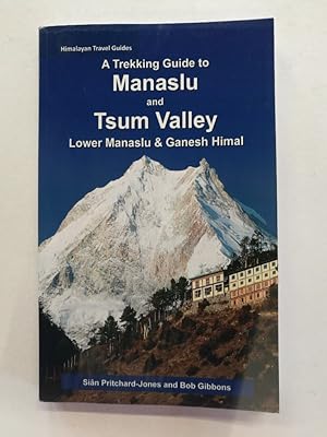
A Trekking Guide to Mustang: Upper and Lower Mustang (Himalayan Travel Guides)
Pritchard-Jones, Sian; Gibbons, Bob; Shakya, Pawan; House, Map; Gurung, Sanjib; Grobel, Paulo; Millen, John
Sprache: Englisch
Verlag: Independently published, 2025
Serie: Himalayan Travel Guides, Buch 47 von 55. Buch 47 von 55 - Himalayan Travel Guides
- Softcover
Anbieter: Ria Christie Collections, Uxbridge, Vereinigtes KönigreichRia Christie Collections
Verkäufer/-in kontaktierenVerkäufer/-in mit 5 SternenZustand: Neu
EUR 26,54
EUR 13,90 VersandVersand von Vereinigtes Königreich nach USAAnzahl: Mehr als 20 verfügbar
Zustand: New. In.
Anbieter: Reuseabook, Gloucester, GLOS, Vereinigtes KönigreichReuseabook
Verkäufer/-in kontaktierenVerkäufer/-in mit 5 SternenZustand: Gebraucht - Befriedigend
EUR 4,67
EUR 11,61 VersandVersand von Vereinigtes Königreich nach USAAnzahl: 1 verfügbar
map. Zustand: Used; Good. Dispatched, from the UK, within 48 hours of ordering. This book is in good condition but will show signs of previous ownership. Please expect some creasing to the spine and/or minor damage to the cover.

Sprache: Englisch
Verlag: CreateSpace Independent Publishing Platform, 2015
Serie: Himalayan Travel Guides, Buch 11 von 55. Buch 11 von 55 - Himalayan Travel Guides
- Softcover
Anbieter: Ria Christie Collections, Uxbridge, Vereinigtes KönigreichRia Christie Collections
Verkäufer/-in kontaktierenVerkäufer/-in mit 5 SternenZustand: Neu
EUR 35,71
EUR 13,90 VersandVersand von Vereinigtes Königreich nach USAAnzahl: Mehr als 20 verfügbar
Zustand: New. In. House, Map (illustrator).

Sprache: Englisch
- Softcover
Anbieter: WorldofBooks, Goring-By-Sea, WS, Vereinigtes KönigreichWorldofBooks
Verkäufer/-in kontaktierenVerkäufer/-in mit 5 SternenZustand: Gebraucht - Gut
EUR 31,94
EUR 6,50 VersandVersand von Vereinigtes Königreich nach USAAnzahl: 1 verfügbar
Paperback. Zustand: Very Good. The book has been read, but is in excellent condition. Pages are intact and not marred by notes or highlighting. The spine remains undamaged.

- Softcover
Anbieter: Anytime Books, London, Vereinigtes KönigreichAnytime Books
Verkäufer/-in kontaktierenVerkäufer/-in mit 4 SternenZustand: Gebraucht - Gut
EUR 23,91
EUR 34,82 VersandVersand von Vereinigtes Königreich nach USAAnzahl: 1 verfügbar
Soft cover. Zustand: Very Good. Zustand des Schutzumschlags: Very Good. NEPA MAPS. P. Gondini. Folding map; 1:250,000.

Sprache: Englisch
Anbieter: medimops, Berlin, Deutschlandmedimops
Verkäufer/-in kontaktierenVerkäufer/-in mit 5 SternenZustand: Gebraucht - Ausreichend
EUR 33,38
EUR 10,00 VersandVersand von Deutschland nach USAAnzahl: 1 verfügbar
Zustand: acceptable. Ausreichend/Acceptable: Exemplar mit vollständigem Text und sämtlichen Abbildungen oder Karten. Schmutztitel oder Vorsatz können fehlen. Einband bzw. Schutzumschlag weisen unter Umständen starke Gebrauchsspuren auf. / Describes a book or dust jacket that has the complete text pages (including those with maps… or plates) but may lack endpapers, half-title, etc. (which must be noted). Binding, dust jacket (if any), etc may also be worn.
Sprache: Englisch
Anbieter: medimops, Berlin, Deutschlandmedimops
Verkäufer/-in kontaktierenVerkäufer/-in mit 5 SternenZustand: Gebraucht - Befriedigend
EUR 33,38
EUR 10,00 VersandVersand von Deutschland nach USAAnzahl: 1 verfügbar
Zustand: good. Befriedigend/Good: Durchschnittlich erhaltenes Buch bzw. Schutzumschlag mit Gebrauchsspuren, aber vollständigen Seiten. / Describes the average WORN book or dust jacket that has all the pages present.
 Weitere Bilder
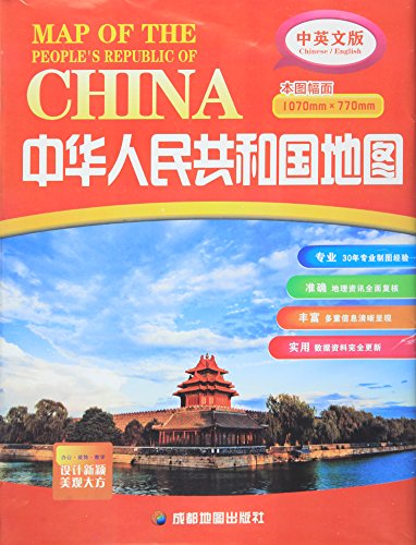
Zhongguo di tu ce : xiu zhen ben [=Atlas of China: Pocket Edition]
Di tu chu ban she bian zhi = Compiled by The Map Publishing House
Sprache: Chinesisch
Verlag: The Map Publishing House, Beijing, 1978
- Softcover
Anbieter: Joseph Burridge Books, Dagenham, Vereinigtes KönigreichJoseph Burridge Books
Verkäufer/-in kontaktierenVerkäufer/-in mit 5 SternenZustand: Gebraucht - Gut
EUR 17,93
EUR 26,69 VersandVersand von Vereinigtes Königreich nach USAAnzahl: 1 verfügbar
Soft cover. Zustand: Very Good. 1 atlas (30 pages) : colour illustrations, colour maps ; 19 cm. Flexible red plastic covers.
Sprache: Englisch
Anbieter: medimops, Berlin, Deutschlandmedimops
Verkäufer/-in kontaktierenVerkäufer/-in mit 5 SternenZustand: Gebraucht - Ausreichend
EUR 43,46
EUR 10,00 VersandVersand von Deutschland nach USAAnzahl: 1 verfügbar
Zustand: acceptable. Ausreichend/Acceptable: Exemplar mit vollständigem Text und sämtlichen Abbildungen oder Karten. Schmutztitel oder Vorsatz können fehlen. Einband bzw. Schutzumschlag weisen unter Umständen starke Gebrauchsspuren auf. / Describes a book or dust jacket that has the complete text pages (including those with maps… or plates) but may lack endpapers, half-title, etc. (which must be noted). Binding, dust jacket (if any), etc may also be worn.
Sprache: Englisch
Anbieter: medimops, Berlin, Deutschlandmedimops
Verkäufer/-in kontaktierenVerkäufer/-in mit 5 SternenZustand: Gebraucht - Befriedigend
EUR 43,46
EUR 10,00 VersandVersand von Deutschland nach USAAnzahl: 1 verfügbar
Zustand: good. Befriedigend/Good: Durchschnittlich erhaltenes Buch bzw. Schutzumschlag mit Gebrauchsspuren, aber vollständigen Seiten. / Describes the average WORN book or dust jacket that has all the pages present.
Sprache: Englisch
Verlag: CreateSpace Independent Publishing Platform 27.03.2013., 2013
Serie: Himalayan Travel Guides, Buch 7 von 55. Buch 7 von 55 - Himalayan Travel Guides
- Softcover
Anbieter: Antiquariat Mäander Quell, Waldshut-Tiengen, DeutschlandAntiquariat Mäander Quell
Verkäufer/-in kontaktierenVerkäufer/-in mit 5 SternenZustand: Gebraucht - Wie neu
EUR 50,70
EUR 105,00 VersandVersand von Deutschland nach USAAnzahl: 1 verfügbar
Zustand: Wie neu. Auflage: 1. 206 Seiten Geschenkqualität. Sehr schönes Exemplar - wie neu. - Wir versenden aus unserem deutschen Lager heraus in plastikfreien oder wiederverwendeten Polstertaschen. Sprache: Englisch Gewicht in Gramm: 284 12,7 x 1,2 x 20,3 cm, Taschenbuch.

Sprache: Englisch
Verlag: CreateSpace Independent Publishing Platform, 2014
- Softcover
Anbieter: BUCHSERVICE / ANTIQUARIAT Lars Lutzer, Wahlstedt, DeutschlandBUCHSERVICE / ANTIQUARIAT Lars Lutzer
Verkäufer/-in kontaktierenVerkäufer/-in mit 5 SternenZustand: Gebraucht - Gut
EUR 419,90
EUR 39,95 VersandVersand von Deutschland nach USAAnzahl: 1 verfügbar
Zustand: gut. A Trekking Guide to Upper & Lower Dolpo (Himalayan Travel Guides) - Pritchard-Jones, Ms Sian In deutscher Sprache. pages.

Verlag: Guandong, Guangdong Sheng Dìtú Chuban Shè [Guangdong Province Map Publishing House], 1981., 1981
- Softcover
- Erstausgabe
Anbieter: Alexanderplatz Books, New York, NY, USAAlexanderplatz Books
Verkäufer/-in kontaktierenVerkäufer/-in mit 5 SternenZustand: Gebraucht
EUR 74,42
EUR 5,69 VersandVersand innerhalb von USAAnzahl: 1 verfügbar
First Edition. Wrappers. Tall 8vo, 190 pp. Complete guide to Chinese fonts, including seal script, cursive forms with standard character equivalents (tremendously helpful), decorative characters for signs, etc. Also pages of decorative elements for borders, musical programs (revolutionary operas, etc.), Roman letters, numerals,…cartoon characters, kaleidoscope patterns, cranes. dragons, etc. No doubt hard to find anywhere. Chinese characters of title available on request. Very good condition with slight signs of use.
 Weitere Bilder
Viet Nam : Forward to a New Stage
anonymous [ Foreign Languages Publishing House (Hanoi) ] [ Nhà xuat ban ngoai van ]
Verlag: Foreign Languages Pub. House, Hanoi, 1977
- Softcover
Anbieter: Expatriate Bookshop of Denmark, Svendborg, DänemarkExpatriate Bookshop of Denmark
Verkäufer/-in kontaktierenVerkäufer/-in mit 5 SternenZustand: Gebraucht
EUR 22,55
EUR 59,00 VersandVersand von Dänemark nach USAAnzahl: 1 verfügbar
orig. wrappers. Zustand: Minor rubbing. VG. 19x13cm, 92,(2) pp. Contents: Introduction to Fourth Party Congress: 20 Months After South Viet Nam's Liberation; South Viet Nam '76; The Socialist Republic of Viet Nam: Main Data. Textual map. (illustrator).
 Weitere Bilder
Verlag: Giai Phong Publishing House March 1968, [Hanoi?], 1968
- Softcover
Anbieter: Expatriate Bookshop of Denmark, Svendborg, DänemarkExpatriate Bookshop of Denmark
Verkäufer/-in kontaktierenVerkäufer/-in mit 5 SternenZustand: Gebraucht
EUR 31,57
EUR 59,00 VersandVersand von Dänemark nach USAAnzahl: 1 verfügbar
orig. wrappers. 19x13cm, 87,(8) pp. An account of the initial phases of the Tet offensive, ca 3 January - 26 February 1968. Large rubberstamp to front cover. Minor rubbing. Good. 8p photoplates; folding map. (illustrator).
 Weitere Bilder
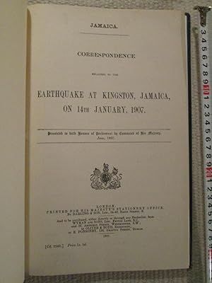
Verlag: H.M.S.O., London, 1907
- Hardcover
Anbieter: Expatriate Bookshop of Denmark, Svendborg, DänemarkExpatriate Bookshop of Denmark
Verkäufer/-in kontaktierenVerkäufer/-in mit 5 SternenZustand: Gebraucht
EUR 58,63
EUR 59,00 VersandVersand von Dänemark nach USAAnzahl: 1 verfügbar
binder's cloth. Zustand: Minor wear. VG. 31x20cm, xvii,119 pages, Later [recent] binder's blind cloth. Folding map. (illustrator).
 Weitere Bilder
Verlag: H.M.S.O. 1883 - 1884, London, 1883
- Hardcover
Anbieter: Expatriate Bookshop of Denmark, Svendborg, DänemarkExpatriate Bookshop of Denmark
Verkäufer/-in kontaktierenVerkäufer/-in mit 5 SternenZustand: Gebraucht
EUR 88,39
EUR 59,00 VersandVersand von Dänemark nach USAAnzahl: 1 verfügbar
binder's cloth. Zustand: Minor wear. VG. 31x20cm, (214) pages., Later [recent] binder's blind cloth. This is a single volume containing three British government documents regarding the Egyptian cholera epidemic ca. 1883-1884, each with separate title-pages and paginations. Includes: 1) "Correspondence Respecting the Cholera Epid…emic in Egypt, 1883" (Commercial ; no. 34) [iv,99 pages]; BOUND TOGETHER WITH: 2) "Further Correspondence Respecting the Cholera Epidemic in Egypt, 1883 : in Continuation of Commercial no. 34 (1883)". [65pages] [Commercial, no. 39 (1883)] BOUND TOGETHER WITH: 3) "Further Reports Respecting the Cholera Epidemic in Egypt and the Proceedings of the German Scientific Commission [46 pages, folding plan (of Alexandria)] [Commercial No. 22 (1884)]. Folding map. (illustrator).

- Karte
Anbieter: Schürmann und Kiewning GbR, Naumburg, DeutschlandSchürmann und Kiewning GbR
Verkäufer/-in kontaktierenVerkäufer/-in mit 5 SternenZustand: Gebraucht - Befriedigend
EUR 37,95
EUR 60,00 VersandVersand von Deutschland nach USAAnzahl: 1 verfügbar
gefaltet: 21x14 cm. Zustand: Befriedigend. 1 Karte : beids. bedr. Sprache: Deutsch Gewicht in Gramm: 66.
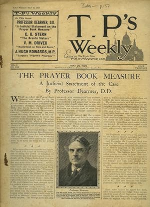
T. P.'s Weekly | Volume X Issue Number 239. | May 26, 1928 | H. E. Bates 'The Parrot'; John Masefield [Drawn by Joseph Simpson].
Thomas Power O'Connor (5 October 1848 - 18 November 1929), known as T. P. O'Connor and occasionally as Tay Pay (mimicking his own pronunciation of the initials T. P.), was a journalist, an Irish nationalist political figure, and a member of parliament (MP) in the House of Commons of the United Kingdom of Great Britain and Ireland for nearly fifty years. O'Connor founded and was the first editor of several newspapers and journals: The Star (1887), the Weekly Sun (1891), The Sun (1893), M.A.P. and T.P.'s Weekly (1902). Includes Articles and Stories by: H. E. Bates; John Masefield [Drawn by Joseph Simpson];
Verlag: Published by The Amalgamated Press Ltd., The Fleetway House, Farringdon Street, London First Edition May 26 1928., 1928
- Erstausgabe
Anbieter: Little Stour Books PBFA Member, Canterbury, Vereinigtes KönigreichLittle Stour Books PBFA Member
Verkäufer/-in kontaktierenVerkäufer/-in mit 5 SternenVerbandsmitglied: PBFA
Zustand: Gebraucht - Befriedigend
EUR 113,57
EUR 34,82 VersandVersand von Vereinigtes Königreich nach USAAnzahl: 1 verfügbar
Zustand: Good. First edition in publisher's white paper printed stapled tabloid 12" x 9½". New short stories and articles by: H. E. Bates 'The Parrot' A Complete Story; John Masefield [Drawn by Joseph Simpson]. Photographs and illustrated advertisements. Extremely rare. Staples weeping and in Good condition. Member of the P.B.F.…A. BATES, H. E. (1906-1974).
 Weitere Bilder
Verlag: ????.[Di tu zhan bao]. September1967., [Beijing]., 1967
Anbieter: Asia Bookroom ANZAAB/ILAB, Canberra, ACT, AustralienAsia Bookroom ANZAAB/ILAB
Verkäufer/-in kontaktierenVerkäufer/-in mit 5 SternenZustand: Gebraucht
EUR 170,71
EUR 18,61 VersandVersand von Australien nach USAAnzahl: 1 verfügbar
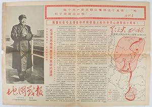
Maps printed in red and black, single sheet printed on both sides, folded, scale not given, photographic image of Mao Zedong. Some light browning at edges with tears and losses on left edge, still good. Text in Chinese. Sheet measures 26.5 x 38.4cm. Includes a map of Autumn Harvest Uprising and also shows the routes of the milit…ary advancing towards Jinggangshan between September and October 1927. On reverse left section, a map shows the route along which Chairman Mao led the Fourth Army of the Chinese Red Army marching towards south of Anhui and Jiangxi Provinces in 1929. On reverse right section, a map titled "The Long March of The Chinese Workers' and Peasants' Red Army (October 1934-October 1935)". Quotations of Chairman Mao about the Long March insert on corners of the map. Issue no. 6 of a series of maps with text issued by the Red Guards organisations in the form of Cultural Revolution tabloid-sized newspaper. This issue is designed to celebrate the 40th anniversary of the Autumn Harvest Uprising which was one of the earliest armed uprisings organised by the Chinese Communist Party.

- Karte
Anbieter: Geographicus Rare Antique Maps, Brooklyn, NY, USAGeographicus Rare Antique Maps
Verkäufer/-in kontaktierenVerkäufer/-in mit 4 SternenZustand: Gebraucht
EUR 454,59
EUR 14,89 VersandVersand innerhalb von USAAnzahl: 1 verfügbar
Very good. Light toning along original centerfold. Verso repairs to margin tears. Blank on verso. Size 31.25 x 22.5 Inches. This is an 1867 John Weyss and Nathaniel Michler map of Appomattox Court House, Virginia, where the American Civil War came to a close. The map depicts the region from Appomattox Station on the South Side R…ailroad to the Jenkins homestead and from the homestead of L. Marshall to Evergreen Station. Beautifully engraved, the area surrounding Appomattox Court House is illustrated in detail, with numerous homesteads noted throughout. Roads traverse the area, along with the South Side Railroad, and rivers and streams are noted. Forests and hills are also included. Troop locations and movements, however, are not depicted. Appomattox Court House and the American Civil War Appomattox Court House is the name of a village in central Virginia. Originally known as Clover Hill, it was renamed Appomattox Court House after its newly built courthouse. The hamlet declined in importance through the 1840s and 1850s, particularly after the rail network bypassed it in favor of nearby Appomattox Station. During the Civil War, Appomattox Court House consisted of about 'five houses, a tavern, and a courthouse' along a single street, which itself was boarded up at one end to keep the cows out.' This sleepy hamlet was nonetheless the site of the final battle of the American Civil War, the Battle of Appomattox Court House, and of the surrender of General Robert E. Lee's Army of Northern Virginia to Union General Ulysses S. Grant. Today, Appomattox Court House is a National Historical Park and is administered by the National Park Service. Census and Publication History This map was surveyed and drawn by Major John E. Weyss under the command of Brevet Brigadier General Nathaniel Michler, engraved by Julius Bien, and published by the War Department in Military Maps illustrating the Operations of the Armies of the Potomac and James in 1869. While this map is well represented in institutional collections, it is rarely on the private market. References: Rumsey 3881.014. Philips (Atlases) P843.
 Weitere Bilder
- Karte
Anbieter: Geographicus Rare Antique Maps, Brooklyn, NY, USAGeographicus Rare Antique Maps
Verkäufer/-in kontaktierenVerkäufer/-in mit 4 SternenZustand: Gebraucht
EUR 808,15
EUR 14,89 VersandVersand innerhalb von USAAnzahl: 1 verfügbar
Very good. Light wear along original folds. Several small tears along borders and fold junctions professionally repaired. Ship with book. Size 22.25 x 15.75 Inches. A scarce 1905 map of Los Angeles by the Commercial Printing House for the Granite Securities Company, with an unusual bird's-eye view of the region on the verso. A C…loser Look Covering Downtown Los Angeles and its environs, this map provides a glimpse of Los Angeles when it was growing at a tremendous pace (the city's population tripled between 1900 and 1910). Streets are labeled and indexed according to a grid surrounding the map. Red lines trace the 'yellow car' streetcar system of the Los Angeles Railway (owned by Henry Huntington), as indicated in the small legend towards the top-right. Additional electric rail lines are also indicated, including the Pacific Electric and three additional lines, most of which Huntington also owned and all of which were absorbed by the Pacific Electric in the following years. The verso displays a bird's-eye view of Greater Los Angeles, including Hollywood, Santa Monica, Long Beach, and Pasadena. Many towns sprang up nearly overnight in this region due to the ongoing oil boom in the early 20th century. Both local (streetcar and interurban electric) and long-distance railways (including the Southern Pacific and Santa Fe) are traced. One quite unusual feature of this map is the location of the port of Los Angeles adjacent to Santa Monica, near today's Pacific Palisades neighborhood. This resulted from an acrimonious disagreement between two influential groups in the city over the placement of the port. The Free Harbor Fight The dispute over the location of the Port of Los Angeles, also known as the Free Harbor Fight, bitterly divided the elites of Los Angeles and California more broadly in the late 19th century and tied into broader struggles over the relative economic might and political power of Northern and Southern California, as well as the influence of the Southern Pacific Railroad over the state's politicians. By the 1880s, it was clear that Los Angeles was on track to becoming a large city and that Santa Monica Bay, to the city's west, could serve as the location of one of the premier ports on the western coast of North America. Two locations were floated for the construction of a large, modern port: one at San Pedro, which provided a very good natural harbor, and one at Santa Monica, which was less naturally suited but already had a rail link with Los Angeles and the rest of California via the Southern Pacific. Though perhaps convenient, this rail link would also give the Southern Pacific and its president, Collis P. Huntington, a monopoly on access to the port, allowing it to charge whatever price it wanted. In anticipation of being chosen as the port's site, in the early 1890s, Southern Pacific built what was then the longest wharf in the world, extending nearly a mile into the bay, at Santa Monica. An intense campaign of lobbying and political pressure played out in the closing years of the century. Local elites in Los Angeles, including the Chamber of Commerce and L.A. Times editor Harrison Gray Otis powerfully advocated for the 'Free Port' at San Pedro. Knowing that federal funding was essential to completing such a large port, both sides lobbied hard in Washington, D.C., for their proposed site. In 1896, Congress established an engineering commission to determine which site would be best. Despite Huntington's vast fortune and powerful influence in the U.S. Congress, the 'Free Port' advocates benefitted from the surprising pluckiness of California Senator Stephen White, who amended the bill establishing the commission to prevent monopolistic practices by Southern Pacific if Santa Monica were chosen. He then spoke at length on the floor of the Senate about Southern Pacific's other monopolistic practices and domineering influence in California's politics. The following year, the engineering commission determined that San.
 Weitere Bilder
- Signiert
- Karte
Anbieter: Geographicus Rare Antique Maps, Brooklyn, NY, USAGeographicus Rare Antique Maps
Verkäufer/-in kontaktierenVerkäufer/-in mit 4 SternenZustand: Gebraucht
EUR 1.919,37
EUR 14,89 VersandVersand innerhalb von USAAnzahl: 1 verfügbar
Very good. Accompanied by original envelope. Map of China on verso. Wear on old fold lines. Size 21.25 x 31 Inches. A scarce March 5, 1932, map of Shanghai, China, issued by Osaka-based Cross-House publishing firm. The map was issued to illustrate the Shanghai Ceasefire Agreement (??????), a peace treaty between China and Japan…that made Shanghai a demilitarized zone. It follows the January 28 Incident, also known as the Shanghai Incident (January 28 - March 3, 1932), a conflict in the Shanghai International Settlement between the Republic of China and the Empire of Japan. A Closer Look The map's focus centers on the concession regions, using color coding to distinguish between the British and American Concessions (red), the Japanese-controlled region (Orange), and the French Concession (Yellow). Along the bottom of the map, there is a dramatic view of the Bund - marking this map as part of a lineage of similar maps by Fusazo Sugie (????), although it is distinct and only stylistically related to the others. The verso (back) features a large map of China, Manchuria, and Korea - a region that would soon be embroiled in war. Shanghai Incident of 1932 The conflict of January 28th, 1932, also known as the Shanghai Incident or Shanghai War, was a precursor to the Second Sino-Japanese War (1937 - 1845), which would begin a few years later. Following several alleged attacks on Japanese nationals, the Japanese launched a blitzkrieg-style attack on Chinese Nationalist forces with the supposed intent of protecting Japanese civilians residing in the Hongkou District, an informal Japanese Concession within the International Settlement. The Chinese Nationalist troops concentrated in Zhabei to protect the strategically important Shanghai Railway Station, through which supplies and reinforcements could be readily delivered. The Chinese resistance proved stubborn, and both sides established perimeters along the Huangpu River. A similar perimeter was established to the south, along the Wusong River, to protect the British and French Concessions. Nonetheless, the Japanese pursued their attack, using gunboats on the Wusong River and Huangpu River to harry the Chinese. Ultimately, the two sides fought to a near standstill. On March 5th, the League of Nations forced the Japanese to sign a ceasefire, the Shanghai Ceasefire Agreement (??????), with China, turning Shanghai into a demilitarized zone. Shanghai International Settlement The Shanghai International Settlement was created in 1863 when the British and American Shanghai enclaves merged. These concessions had been granted to England and the United States as part of the Unequal Treaties that followed the Opium Wars. From about 1854, the settlements were governed by the Shanghai Municipal Council, a British-dominated board of government officials and powerful merchants. The board issued restrictions limiting Chinese habitation on International Settlement territory and oversaw the construction of public services, including trams, a sewage system, highways, and port buildings. The International Settlement expanded several times in the late 19th century and early 20th century. In addition, they constructed and administered Extra-Settlement Roads into the surrounding country, which further allowed for informal expansion. It became an enclave of peace and prosperity when the Japanese invaded Shanghai in 1937, but this abruptly came to an end with the Japanese bombing of Pearl Harbor and the subsequent invasion of the International Settlement in 1941. After the war the International Settlement lands were returned to Chinese sovereignty. The Bund The Bund is a waterfront area in central Shanghai. The name derives from the old German term, 'bund,' meaning embankment or causeway. Many Asian colonial cities supported a Bund, but none became more famous or iconic than the Shanghai Bund. The area centers on the section of Zhongshan Road within the former Shanghai International Settlement, which runs along t. Signed by Author(s).


