Henry mangles denham (17 Ergebnisse)

- Hardcover
- Erstausgabe
Anbieter: MW Books, New York, NY, USAMW Books
Verkäufer/-in kontaktierenVerkäufer/-in mit 5 SternenZustand: Gebraucht
EUR 38,39
Versand nach gratisVersand innerhalb von USAAnzahl: 1 verfügbar
1st Edition. Near fine cloth copy in a very good if slightly edge-nicked and dust-dulled dust wrapper, now mylar-sleeved. Remains particularly well-preserved overall; tight, bright, clean and strong. Physical description: xx, 224 pages, [20]p of plates ill 24cm. Subjects: Sailing Greece Guidebooks. Sailing Turkey Guide-books. Ya…chts and yachting Greece Ionian Islands Greece Ionian Islands. Greece Description and travel 1981- ; Guidebooks. Turkey Description and travel 1960- ; Guidebooks. Ionian Islands (Greece) Description and travel Guidebooks. Aegean Islands (Greece and Turkey) Guidebooks. Genre: Illustrated. 3 Kg.

- Softcover
Anbieter: Ria Christie Collections, Uxbridge, Vereinigtes KönigreichRia Christie Collections
Verkäufer/-in kontaktierenVerkäufer/-in mit 5 SternenZustand: Neu
EUR 25,17
EUR 14,06 VersandVersand von Vereinigtes Königreich nach USAAnzahl: Mehr als 20 verfügbar
Zustand: New. In.

- Hardcover
Anbieter: Ria Christie Collections, Uxbridge, Vereinigtes KönigreichRia Christie Collections
Verkäufer/-in kontaktierenVerkäufer/-in mit 5 SternenZustand: Neu
EUR 34,92
EUR 14,06 VersandVersand von Vereinigtes Königreich nach USAAnzahl: Mehr als 20 verfügbar
Zustand: New. In.
 Weitere Bilder
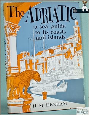
Verlag: London: John Murray, 1967
- Hardcover
- Erstausgabe
Anbieter: BookLovers of Bath, Peasedown St. John, BATH, Vereinigtes KönigreichBookLovers of Bath
Verkäufer/-in kontaktierenVerkäufer/-in mit 5 SternenZustand: Gebraucht - Gut
EUR 15,71
EUR 17,61 VersandVersand von Vereinigtes Königreich nach USAAnzahl: 1 verfügbar
Hardback in Dust Wrapper. Zustand: Very Good. Zustand des Schutzumschlags: Good. Condition Notes: A little rubbing to the edges of the dust wrapper, with several short, closed, tears and the price clipped. Gently bruised at the head, tail and corners of the binding. Previous owners' name to the first blank. Text complete, clean…and tight; First edition (first printing). Hardback. Dust wrapper over red boards with gilt titles to the spine; Measures 9½" x 6¾" (0.9 kg); pp (xiii) 189; Index; Cover art by David Knight; Illustrated by way of: Vignette to the title page; Black & White Photographs; Black & White Drawings; Maps; Plans; || The book is on the shelf, ready to be appropriately packed, and posted from the pastoral paradise of Peasedown St. John, Bath, by a real bookseller in a real book shop - with my personal guarantee and beady eye on the Consumer Contracts Regulations. REMEMBER! Buying my copy means the book shop Jack Russells get their supper! My Book #198428 ||. Madge Denham & Elizabeth Scott (illustrator).

Verlag: London : John Murray, 1967
- Hardcover
- Erstausgabe
Anbieter: MW Books, New York, NY, USAMW Books
Verkäufer/-in kontaktierenVerkäufer/-in mit 5 SternenZustand: Gebraucht
EUR 33,78
Versand nach gratisVersand innerhalb von USAAnzahl: 1 verfügbar
First Edition. Near fine cloth copy in a near-fine, very slightly edge-nicked and dust-dulled dust-wrapper, now mylar-sleeved. Remains particularly well-preserved overall; tight, bright, clean and strong. Physical description: xiii, 189 pages ; (8º). Subjects: Adriatic coast; travel. Genre: Travel. Language: English. 3 Kg.

- Softcover
Anbieter: AHA-BUCH GmbH, Einbeck, DeutschlandAHA-BUCH GmbH
Verkäufer/-in kontaktierenVerkäufer/-in mit 5 SternenZustand: Neu
EUR 33,40
EUR 61,88 VersandVersand von Deutschland nach USAAnzahl: 2 verfügbar
Taschenbuch. Zustand: Neu. Neuware.
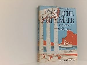
Verlag: Published by Verlag Delius, Klasing & Co., Bielefeld und Berlin, Germany First German Edition . Germany 1968., 1968
- Hardcover
- Erstausgabe
- Signiert
Anbieter: Little Stour Books PBFA Member, Canterbury, Vereinigtes KönigreichLittle Stour Books PBFA Member
Verkäufer/-in kontaktierenVerkäufer/-in mit 5 SternenVerbandsmitglied: PBFA
Zustand: Gebraucht - Gut
EUR 24,18
EUR 35,21 VersandVersand von Vereinigtes Königreich nach USAAnzahl: 1 verfügbar
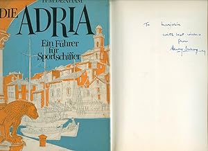
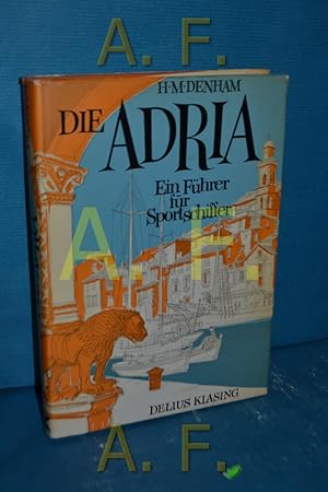
Zustand: Very Good. First German edition hard back binding in publisher's original tan cloth covers, gilt title and author lettering to the spine. 8vo. 9½'' x 7''. Contains 211 printed pages of German text with monochrome maps, illustrations and photographs throughout. Minimal wear to the covers. Very Good condition book in near… Very Good condition dust wrapper with Shallow rubs to the upper spine tips, small chips to the corners, shelf rubs to the panels. SIGNED by the Author to the front free end paper 'To Marjorie with best wishes from Henry Denham, July 1968'. Dust wrapper supplied in archive acetate film protection, it does not adhere to the book or to the dust wrapper. Member of the P.B.F.A. GERMANY [Language, History].
- Softcover
Anbieter: Hübner Einzelunternehmen, Hamburg, HH, DeutschlandHübner Einzelunternehmen
Verkäufer/-in kontaktierenVerkäufer/-in mit 5 SternenZustand: Gebraucht
EUR 10,00
EUR 41,00 VersandVersand von Deutschland nach USAAnzahl: 1 verfügbar
Okst. M.OU. 2., überarb. Aufl. 248 S. : zahlr. Ill. u. Kt.; ; 24 cm 2., überarb. Aufl. Sprache: Deutsch Gewicht in Gramm: 600.

- Hardcover
Anbieter: AHA-BUCH GmbH, Einbeck, DeutschlandAHA-BUCH GmbH
Verkäufer/-in kontaktierenVerkäufer/-in mit 5 SternenZustand: Neu
EUR 49,59
EUR 62,75 VersandVersand von Deutschland nach USAAnzahl: 2 verfügbar
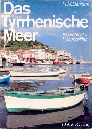
Buch. Zustand: Neu. Neuware - Published in 1856, this nautical guide provides detailed sailing directions for the coast of Wales and the approaches to Liverpool. The text is accompanied by charts and diagrams, making it an indispensable resource for sailors and navigators of the time. For modern readers, it offers a fascinating…glimpse into the technology and knowledge of 19th-century seafaring.This work has been selected by scholars as being culturally important, and is part of the knowledge base of civilization as we know it.This work is in the 'public domain in the United States of America, and possibly other nations. Within the United States, you may freely copy and distribute this work, as no entity (individual or corporate) has a copyright on the body of the work.Scholars believe, and we concur, that this work is important enough to be preserved, reproduced, and made generally available to the public. We appreciate your support of the preservation process, and thank you for being an important part of keeping this knowledge alive and relevant.

- Softcover
Anbieter: Hubert Wilhelm Eichhorn, Möhnesee, DeutschlandHubert Wilhelm Eichhorn
Verkäufer/-in kontaktierenVerkäufer/-in mit 5 SternenZustand: Gebraucht
EUR 3,20
EUR 58,90 VersandVersand von Deutschland nach USAAnzahl: 1 verfügbar
Gebundene Ausgabe. 2. Aufl. 210 S. : zahlr. Ill. u. Kt.; ; 24 cm Gebraucht, gut. T 27006 Sprache: Deutsch Gewicht in Gramm: 596.
- Hardcover
Anbieter: Antiquarische Fundgrube e.U., Wien, ÖsterreichAntiquarische Fundgrube e.U.
Verkäufer/-in kontaktierenVerkäufer/-in mit 5 SternenZustand: Gebraucht
EUR 10,00
EUR 55,00 VersandVersand von Österreich nach USAAnzahl: 1 verfügbar
gebundene Ausgabe. 2. Aufl. 210 S. Schutzumschlag gering berieben u. gering rissig // Adria , Wassersport, a Verkehr, a Turnen, Sport, Spiele SL05 9783768800334 *.* Sprache: Deutsch Gewicht in Gramm: 640.

- Hardcover
Anbieter: Butterfly Books GmbH & Co. KG, Herzebrock-Clarholz, DeutschlandButterfly Books GmbH & Co. KG
Verkäufer/-in kontaktierenVerkäufer/-in mit 5 SternenZustand: Gebraucht - Sehr gut
EUR 8,50
EUR 60,00 VersandVersand von Deutschland nach USAAnzahl: 1 verfügbar
Hardcover mit Schutzumschlag. Zustand: Sehr gut. 268 Seiten Zustand: SEHR GUTER Zustand! HC1-171-6/8-00257509 Sprache: Deutsch Gewicht in Gramm: 719.
Sprache: Deutsch
Verlag: Bielefeld ; Berlin : Delius, Klasing u. Co., 1968
Anbieter: Book Broker, Berlin, DeutschlandBook Broker
Verkäufer/-in kontaktierenVerkäufer/-in mit 5 SternenZustand: Gebraucht - Gut
EUR 15,68
EUR 36,43 VersandVersand von Deutschland nach USAAnzahl: 1 verfügbar
Gebundene Ausgabe. Zustand: Gut. 0 Alle Bücher & Medienartikel von Book Broker sind stets in gutem & sehr gutem gebrauchsfähigen Zustand. Dieser Artikel weist folgende Merkmale auf: Altersentsprechend nachgedunkelte/saubere Seiten in fester Bindung. Schutzumschlag weist Gebrauchsspuren auf. Einband leicht staubfleckig. Sprache:…Deutsch Gewicht in Gramm: 750.
 Weitere Bilder
Verlag: Liverpool: Printed & Published as the Act Directs for H. M. Denham by J. & J. Mawdsley, 1840
- Hardcover
- Erstausgabe
Anbieter: Forest Books, ABA-ILAB, Grantham, LINCS, Vereinigtes KönigreichForest Books, ABA-ILAB
Verkäufer/-in kontaktierenVerkäufer/-in mit 5 SternenZustand: Gebraucht
EUR 816,08
EUR 29,34 VersandVersand von Vereinigtes Königreich nach USAAnzahl: 1 verfügbar
First edition, 8vo, two parts in one, [2], xx, [2], 169, [1]; 26pp., engraved title page, 25 engravings and large folding maps (some coloured), all mounted on linen and hence in very good condition, marbled endpapers, contemporary smooth calf, a little rubbed, spine compartments ruled in gilt, second compartment with red leather… label lettered in gilt, first compartment with the 'Northern Light Board' motif stamped in gilt.

Verlag: Printed and published as the Act directs for H.M. Denham J. & J. Mawdsley, 1840
Anbieter: Blackwell's Rare Books ABA ILAB BA, Oxford, Vereinigtes KönigreichBlackwell's Rare Books ABA ILAB BA
Verkäufer/-in kontaktierenVerkäufer/-in mit 5 SternenZustand: Gebraucht
EUR 602,99
EUR 29,34 VersandVersand von Vereinigtes Königreich nach USAAnzahl: 1 verfügbar
FIRST EDITION. Folding engraved map frontispiece (short closed tear, strengthening repairs to verso), lithograph title with vignette with strengthened fore-margin, 20 lithograph plates, plans and maps (19 folding, one or two with repaired closed tears and two with frayed fore-margins), one lithograph illustration on India paper,… hand-coloured folding plate and two folding maps/plans, various printed note slips added throughout; uniformly a little toned, and browned at some of the untrimmed edges; pp. xx, [2], 169, [1]; 26 8vo; untrimmed and partially unopened in modern half navy morocco gilt; small white mark to upper cover. A smart example of Vice Admiral Sir Henry Mangles Denham's richly illustrated guide to sailing from Point Lynas (on the north-east corner of Anglesey) to Liverpool. The work is the result of Denham's appointment by the Admiralty to survey the coasts of Lancashire and Cumberland. It is not only full of navigational detail, but is beautifully produced, with fine views of sections of coastline, various lighthouses and other coastal infrastructure, and detailed maps. This was an area Denham (1800-87) knew well; in the early 1830s he had been appointed by the Admiralty, following a request from the Liverpool Dock Trustees, to survey the Mersey, the silting of which was hampering the success of trade. His proposal for dredging and other innovations made him a pivotal figure in Liverpool's development into a modern terminal port. He went on to conduct major surveys of Australasia and part of the Southwest Pacific, and served as Commander-in-Chief, Pacific Station. To the rear of the work, as called for, is Denham's 'Remarks and Sailing Directions for Approaching and Navigating the Sea-Reach of Wyre up to Port Fleetwood', with its own title page and individual pagination.
 Weitere Bilder
Verlag: Allan & Wigley, Sydney, 1857
Anbieter: Hordern House Rare Books, Potts Point, NSW, AustralienHordern House Rare Books
Verkäufer/-in kontaktierenVerkäufer/-in mit 4 SternenZustand: Gebraucht
EUR 5.329,29
EUR 13,33 VersandVersand von Australien nach USAAnzahl: 1 verfügbar
Zustand: Laid down on paper. Lithograph by Allan and Wigley; 500 x 610 mm, profiles and landmarks captioned; in a custom made mount. Rare and detailed coastal profiles of Port Jackson drawn in Sydney by James Glen Wilson and lithographed by the local lithographic studio, Allan and Wigley of 23 Bridge Street. The artist, an Irish…man who arrived on the Denham expedition but later chose to settle in Sydney, depicts North and South Heads and the lighthouse, giving detailed illustrations of shipping, bathymetric soundings and a wide record of Sydney buildings. HMS Herald arrived in Sydney in 1853 under the command of Captain Henry Mangles Denham: "the arrival in Sydney on February 19th, 1853 of this scientific officer of long experience was an important event in the progress of the Australian marine surveys. " (Ingleton, Charting A Continent). Denham charted the land masses and suspected shipping hazards in Port Jackson between February and December 1857, with the Admiralty publishing his much better known map "Australia, Port Jackson" in 1859. His close survey of Port Jackson formed a part of the Herald's hydrographic survey throughout the South Pacific which, beginning in 1852, continued to 1861. The Herald also worked in Shark's Bay, Western Australia, the Fijian Islands, New Caledonia and Norfolk Island and was involved in the search for Benjamin Boyd throughout the Pacific, and in the wreck of the Dunbar just off Sydney Heads. Widely celebrated, and knighted for his contribution to hydrographic services, Denham was appointed Commander in Chief of the Pacific Station in 1864. Denham in Western Australia was named for him, and in 1858 his ship was celebrated in Sydney by the publication of a music sheet entitled Herald Waltzes. The profiles are (abbreviated from the captions): The Outer South Head - Light-House bearing West.; Appearance of the Inner South Head when rounding into the Eastern Channel of the Sow and Pigs Bar [and] the new (Eastern) Obelisks.; Inner view of the South Head with Lighthouse.; Elizabeth Bay House in line with Bradley Point.; Craig-end Mill in line with Bradley Point.; St. James's Church its breadth open of Bradley Pt. .

Verlag: Depot de la Marine et des Colonies,, Paris,, 1869
Anbieter: Daniel Crouch Rare Books Ltd, London, Vereinigtes KönigreichDaniel Crouch Rare Books Ltd
Verkäufer/-in kontaktierenVerkäufer/-in mit 4 SternenZustand: Gebraucht
EUR 8.463,08
EUR 23,48 VersandVersand von Vereinigtes Königreich nach USAAnzahl: 1 verfügbar
Sydney Harbour during the Gold Rush Large engraved map, on two sheets joined (618 by 907mm to the neatline, full margins showing the plate mark), with contemporary hand colour to the light-houses. Large scale and detailed chart of Port Jackson, showing the city of Sydney, and all of Sydney Harbour, from about one and a half mile…s out to sea, as far south as Bondi Beach, as far north as Cabbage Tree Bay, and west to beyond Cockatoo Island, to Parramatta and Ironstone. A coastal view runs along the bottom edge of the map, showing the entrance to the harbor from just beyond the Heads. The directions of the currents, and soundings are given throughout. Published by the Depot de la Marine, based on a British Admiralty survey of 1857, with corrections, probably after Willis' map of 1867. The earliest chart, of Sydney Harbour was published in 1791, based on a survey carried out within a few weeks of first European settlement in January of 1788. The survey by Lieutenants John Hunter and William Bradley, which extended from the Harbour entrance to 'The Flats', now Homebush Bay, took only 9 days to complete. The second survey was completed by John Septimus Roe, the assistant surveyor to hydrographer Phillip Parker King from 1818 to 1822. King had been commissioned to survey the Australian coast based on the findings of Mathew Flinders in his circumnavigation. Although King and Roe conducted most of their survey in the western and north-western coast of Australia, they used Sydney as one of his bases. Roe surveyed Sydney Harbour himself, as far west as The Flats and beyond in 1822, but also borrowed from the discoveries of Hunter and Bradley, and also from Freycinet's survey of 1802. "With the discovery of gold in the 1850s and the need to protect the gold shipments, the Royal Navy began to take a greater interest in New South Wales and in 1859 established a new Australian Station, a naval command, separate from the East Indies Station, responsible for waters around Australia. It was initially under the command of a Commodore but upgraded in 1884 to be commanded by a Rear Admiral. This greater naval involvement may explain the more detailed hydrographic surveys which began from about this time. The 1857 British Admiralty survey was carried out by Hutchison et al (1859). "It was under the direction of a Captain Henry Mangles Denham F.R.S. who had been tasked with surveying parts of the south-west Pacific in HMS Herald. The chart of this survey, engraved in 1859, had the high soundings density one would expect with a modern hydrographic survey and it clearly marks a significant departure from earlier mapping efforts of Sydney Harbour. The area covered was from 1.5 miles seawards of the harbour entrance, west to Five Dock Bay. However, sounding densities were relatively sparse west of Cockatoo Island, where a new dry dock, Fitzroy Dry Dock, was opened in late 1857. A long baseline, 2780 feet long was laid out at Rose Bay, from which a triangulation scheme was set up to cover all the harbour as far west as Cockatoo Island. Check baselines were set up at Manly Beach, north of the harbour entrance, Darling Point and South Head. The survey and initial chart production took approximately two months" (Phil Mulhearn 'The 18th and 19th Century Charting of Sydney Harbour / Port Jackson, 2014). This issue not in Tooley.


