
Gesamtpreis (1 Artikel Artikel):
Versandziel:

h f walling (20 Ergebnisse)
Direkt zu den wichtigsten Suchergebnissen
Suchfilter
Produktart
- Alle Product Types
- Bücher (18)
- Magazine & Zeitschriften (Keine weiteren Ergebnisse entsprechen dieser Verfeinerung)
- Comics (Keine weiteren Ergebnisse entsprechen dieser Verfeinerung)
- Noten (Keine weiteren Ergebnisse entsprechen dieser Verfeinerung)
- Kunst, Grafik & Poster (Keine weiteren Ergebnisse entsprechen dieser Verfeinerung)
- Fotografien (Keine weiteren Ergebnisse entsprechen dieser Verfeinerung)
- Karten (2)
- Manuskripte & Papierantiquitäten (Keine weiteren Ergebnisse entsprechen dieser Verfeinerung)
Zustand Mehr dazu
- Neu (5)
- Wie Neu, Sehr Gut oder Gut Bis Sehr Gut (Keine weiteren Ergebnisse entsprechen dieser Verfeinerung)
- Gut oder Befriedigend (6)
- Ausreichend oder Schlecht (Keine weiteren Ergebnisse entsprechen dieser Verfeinerung)
- Wie beschrieben (9)
Einband
Weitere Eigenschaften
- Erstausgabe (4)
- Signiert (Keine weiteren Ergebnisse entsprechen dieser Verfeinerung)
- Schutzumschlag (Keine weiteren Ergebnisse entsprechen dieser Verfeinerung)
- Angebotsfoto (6)
Sprache (2)
Preis
- Beliebiger Preis
- Weniger als EUR 20 (Keine weiteren Ergebnisse entsprechen dieser Verfeinerung)
- EUR 20 bis EUR 45
- Mehr als EUR 45
Gratisversand
Land des Verkäufers
Verkäuferbewertung
-

The Morris and Essex R R, And the Anthracite Coal Regions of Pennsylvania With Sketches of Cities, Villages, Stations, Scenery, and Objects of Interest Along the Route Classic Reprint
Anbieter: PBShop.store US, Wood Dale, IL, USA
Verkäuferbewertung 5 von 5 Sternen

PAP. Zustand: New. New Book. Shipped from UK. Established seller since 2000.
-
The Morris and Essex R R, And the Anthracite Coal Regions of Pennsylvania With Sketches of Cities, Villages, Stations, Scenery, and Objects of Interest Along the Route Classic Reprint
Anbieter: PBShop.store UK, Fairford, GLOS, Vereinigtes Königreich
Verkäuferbewertung 5 von 5 Sternen
EUR 25,04
EUR 3,81 Versand
Versand von Vereinigtes Königreich nach USAAnzahl: 15 verfügbar
In den WarenkorbPAP. Zustand: New. New Book. Shipped from UK. Established seller since 2000.
-

The Morris and Essex R R, And the Anthracite Coal Regions of Pennsylvania With Sketches of Cities, Villages, Stations, Scenery, and Objects of Interest Along the Route Classic Reprint
Anbieter: PBShop.store US, Wood Dale, IL, USA
Verkäuferbewertung 5 von 5 Sternen
HRD. Zustand: New. New Book. Shipped from UK. Established seller since 2000.
-
The Morris and Essex R. R., And the Anthracite Coal Regions of Pennsylvania: With Sketches of Cities, Villages, Stations, Scenery, and Objects of Interest Along the Route (Classic Reprint)
Anbieter: Majestic Books, Hounslow, Vereinigtes Königreich
Verkäuferbewertung 4 von 5 Sternen

EUR 30,41
EUR 7,52 Versand
Versand von Vereinigtes Königreich nach USAAnzahl: 1 verfügbar
In den WarenkorbZustand: New.
-
The Morris and Essex R R, And the Anthracite Coal Regions of Pennsylvania With Sketches of Cities, Villages, Stations, Scenery, and Objects of Interest Along the Route Classic Reprint
Anbieter: PBShop.store UK, Fairford, GLOS, Vereinigtes Königreich
Verkäuferbewertung 5 von 5 Sternen
EUR 33,40
EUR 4,82 Versand
Versand von Vereinigtes Königreich nach USAAnzahl: 15 verfügbar
In den WarenkorbHRD. Zustand: New. New Book. Shipped from UK. Established seller since 2000.
-

MAP OF BOSTON AND THE COUNTRY ADJACENT, FROM ACTUAL SURVEYS
Verlag: A. Williams & Co, Boston, (MA), 1872
Anbieter: Bartleby's Books, ABAA, Chevy Chase, MD, USA
Verbandsmitglied: ABAA ESA ILAB IOBA
Verkäuferbewertung 5 von 5 Sternen
Broadside map, 18 ˝ x 25 Ľ inches (mat line), locating townships, counties, cities, harbor islands, etc., from north of Swampscott to Cohasset north to south and extending to Lexington, Waltham, and Needham Hills to the west; some townships or counties hand-colored green or blue, some borders colored in red. "Shows county boundaries, townships, rural buildings, roads, horse and steam railroads, school houses, cemeteries, etc."; relief shown by hachures, and with a printed note: "the circles indicate the distance in miles from the State house in Boston" (OCLC, locating two copies with the Williams imprint: N. H. Historical Society and Massachusetts Historical Society). Matted, glazed and framed (not examined out of from). Fold lines, but very good, lacking the printed wrappers it was originally folded into.
-
Official topographical atlas of Massachusetts Astronomical Trigonometrical and Various Local Surveys/ Atlas of the state of Massachusetts
Verlag: Stedman Brown Lyon, 1872
Anbieter: Schoen Books, South Deerfield, MA, USA
Verbandsmitglied: SNEAB
Verkäuferbewertung 2 von 5 Sternen

Hardcover. Zustand: Good +. hinges reapired strengthened leather spine marbled endpapers corners of covers rubbed ,tp slight tears 100 Pages 27 maps plus list of patrons.
-
Atlas of the State of Wisconsin 1876
Verlag: Walling Tackabury Boston, 1876
Anbieter: Antique Emporium, Eau Claire, WI, USA
Verkäuferbewertung 5 von 5 Sternen
Erstausgabe
Hardcover. Zustand: Very Good. 1st Edition. Folio hardcover volume with leather spine and tips.Gold embossed title. Small chip to bottom of spine and some rubbing to edges. Quite good for a volume like this. Marbled end papers not marked or split. Boards solid and tight.68 single and 11 double page hand colored maps. A few spots in text but no thumbing.There is a small watermark in the rear pages as shown but not into the map section. It would be hard to find a better copy.
-
Atlas Of The State Of Michigan; Including Statistics And Descriptions Of Its Topography, Hydrography, Climate, Natural And Civil History, Railways, Educational Institutions, Material Resources, Etc.
Verlag: R.M. & S.T. Tackabury, Detroit, 1873
Anbieter: The First Edition Rare Books, LLC, Cincinnati, OH, USA
Verbandsmitglied: ABAA ILAB IOBA MWABA
Verkäuferbewertung 5 von 5 Sternen
Erstausgabe
Cloth. Zustand: Very good. First edition of Atlas of the State of Michigan by H.F. Walling, published in 1873. (illustrator). First Edition. Folio, 162pp, [32pp business patrons]. Publisher's brown cloth, spine in brown morocco, title stamped in gilt, marbled endpapers. Professional repairs to spine, front hinge, inner joints reinforced. Japanese tissue restoration to fore edge of six maps. A complete example, with all 84 maps, 7 of which are double plates. Plates 67-70 beginning to detach. (Phillips Maps of America, p. 427) (LeGear, L1754) A very good example. Maps are drawn by Henry Francis Walling, professor of Civil Engineering at Lafayette College.
-
Atlas Of The State Of Ohio; From Surveys under the Direction of H.F. Walling; To which is added An Atlas Of The United States
Verlag: H.H. Lloyd & Co., for Henry S. Stebbins, New York, 1869
Anbieter: The First Edition Rare Books, LLC, Cincinnati, OH, USA
Verbandsmitglied: ABAA ILAB IOBA MWABA
Verkäuferbewertung 5 von 5 Sternen
Cloth. Zustand: Very good. 1869 Atlas of the State of Ohio by H.F. Walling of H.H. Lloyd & Co. (illustrator). Second Edition. Folio, [102pp], [3pp index]. Publisher's original cloth over boards, new black leather spine, title in gilt on label affixed to spine, title stamped in gilt on front cover. Professional reinforcement with new endpapers, linen reinforced hinges. Dampstain affecting title page and table of contents, finger marks to fore edge of most maps. A complete atlas with all 43 called for maps, including 25 maps of Ohio and 18 "general maps" of the United States. This work followed the first edition, published by H.H. Lloyd & Company in 1868. (Phillips Maps of America, p. 917).
-
ATLAS OF THE STATE OF MICHIGAN.
Verlag: R.M. & S.T. Tackabury: Detroit, MI, 1873
Anbieter: John K King Used & Rare Books, Detroit, MI, USA
Verkäuferbewertung 4 von 5 Sternen
Hardcover. Zustand: Very Good. Colored maps, 18 x 14", recently rebound in black buckram with original front cover affixed, 162pp plus 31pp "Business Cards of Patrons." section, covers a bit worn (esp. original cover), large dark splash stain on foredge that affects foredges of pages to varying degrees (but never onto text or maps), inkstamp of college library on title page, some finger soiling and darkening to edges but still a rather nice, complete Michigan atlas.
-
Atlas of the State of New Hampshire.
Verlag: New York: Comstock & Cline, 1877., 1877
Anbieter: Arader Galleries - AraderNYC, New York, NY, USA
Verkäuferbewertung 5 von 5 Sternen
Erstausgabe
Hardcover. 1st Edition. Folio, (17 5/8 x 14 3/8 inches). Fine folding lithographed map of Coos County, 10 double-page maps, 12 single-page maps, most with original hand-color. Contemporary half straight-grained brown morocco, blue pebbled cloth, gilt (extremities a bit rubbed and worn). First edition. Double-page maps include: Geological Map of New Hampshire, Railroad Map of the United States, New England, New Hampshire and Vermont, Carroll County, Grafton County, Merrimack County, Cheshire County, Hillsborough County, and Rockingham County. "In 1853 [Walling] entered on his life work as a cartographer, and between that date and 1870 did a great work in the preparation of maps. His work extended over a large part of the Northern states. He prepared and published the well-known map of Massachusetts, which was the product in part of Borden's survey and in part the result of his own painstaking labor. About 1870 he became a professor of mathematics in Lafayette college, which office he retained for two years. For some years thereafter he was an assistant in the United States coast survey. Having acquired an interest in geological problems, he then became an officer of the national geological survey" (obituary, Cambridge Tribune, 1888). Hitchcock "served as New Hampshire State Geologist from 1868 to 1878 and taught at Dartmouth College from 1868 to 1908, holding the Hall Professorship of Geology and Mineralogy. Hitchcock's survey produced a three volume work, 'The Geology of New Hampshire' (1874-1878) and the folio, 'Atlas accompanying the report on the geology of New Hampshire.' The maps in the atlas comprise the first detailed, comprehensive map of the bedrock and surfacial geology of the state. Hitchcock used to name the rock units and designated their 'type localities.' Most of these rock formation names are still in use. In addition to geology, he contributed to a wide range of fields including fieldwork in paleontology, bedrock and glaciology, economic geology, and volcanology" (Dartmouth College Special Collections Library online). Phillips 2136.
-
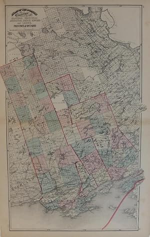
Atlas of the Dominion of Canada with General Descriptions by T.Sterry Hunt LL.D., F.R.S., Etc, ; Robert Bell, C.E., F.G.S., Etc; A.R.C. Selwyn, F.G.S.,Etc: H. Alleyne Nicholson, M.D., D.Sc., F.R.S.E., Etc.; W.H. Ellis, M.A.; H.H. Miles, Ll.D., D.C.L.,J.George Hodgins, L.L.D., Etc; WM. Canniff, M.D., M.R.C.S., (Eng.), Lorin Blodget, Esq; Hugh Fletcher, and Charles Robb, C.E.
Verlag: George N. Tackabury, Montreal,Toronto, London, 1876
Anbieter: Alexandre Antique Prints, Maps & Books, Toronto, ON, Kanada
Verkäuferbewertung 4 von 5 Sternen
Original full calf boards with matching tooled gilt morocco boards., Size : Folio: 445mm x 355mm, Illustrated with maps of which include the following:Map of the Dominion of Canada Colored to show the principal geological formations, Map of the Canadian Pacific Railway Between Manitoba and Lake Nipissing, Map to Illustrate the climatology of the Dominion of Canada, Map of the Dominion of Canada and the British Possessions in North America with a portion of the United States, Atlas of the Dominion Map of British Columbia, Map of the Province of New Brunswick, Map of the Province of Manitoba, Map of the Province of Nova Scotia, Map of Newfoundland, Map of the Western Part of the Province of Quebec Canada, Map of the Central Part of the Province of Quebec Canada, Map of the Eastern Part of the Province of Quebec Canada, Map of the Western Part of the Algoma District of the North Shore of Lake Superior, Map of the Eastern Part of Algoma District of the North Shore of Lake Huron, Map of the Province of Ontario Shewing Counties, Electoral Districts, Township, Railways Et., Discrtict of Nipissing Province of Ontario, Counties of Kent and Essex Provice of Ontario, City of Toronto, Counties of Middlesex, Elgin, Lambton, Counties fof Huron, Wellington, Perth, and Waterloo, City of Montreal, Counties of Oxford, Brant Wentworth, Norfolk and Haldmand Province of Ontario, Counties of Lincoln and Welland Province of Ontario, Counties of Peterboro, Victoria, Northumberland and Durham. Province of Ontario, County of Bruce. Province of Ontario, County of Grey. Province of Ontario, Counties of Hastings, Frontenac, Addington, Prince Edward and Lenox. Province of Ontario, District of Moskoka Province of Ontario, Counties of Joliette, Berthier, Maskinonge, Laval, Montcalm, L?Assomtion, Two Mountains, Terrebonne, Argenteuil, Vaudreuil, Soulanges, Jacque Cartier, Hochelaga, Huntingdon, Beauharnois, Chateauguay, St. John?s, Napierville, Laprairie, Vercheres and Chambly. Province of Quebec, Counties of Halton, Peel, York and Ontario. Province of Ontario, County of Simcoe. Province of Ontario, Counties of St. Maurice, Champlain, Maskinonge, St. Hyacinthe, Richeliu, Iberville, Rouville, Missiquoi, Nicolet, Arthabaska, Yamaska, Drummond, Richmond, Shefford, Bagot, Brome, Stanstead, and Sherbrooke Town. Province of Quebec., County of Refrew. Province of Ontario, Plan of Ottawa. Carlton County Ontario, Counties of Lanark, Leeds, Grenville, and Carelton, Counties of Dundas, Russell, Prescott, Stormont, and Glengary. Province of Ontario, Plan of Hamilton Wehntworth County Ontario, Plan of London Middlesex County Ontario, Counties of Quebecm Monmorency, Portneuf, Lislet, Montmagny, Bellechasse, Dorchester, Levis and Lotvinere. Province of Quebec, County of Pontiac Province of Quebec, County of Ottawa Province of Quebec , County of Chicoutimi and part of Saguenay Province of Quebec, Counties of Wolfe and Compton Province of Quebec, Counties of Beauce and Megantic Province of Quebec, Counties of Temiscouata with parts of Saguenay, Bonaventure and Rimouski. Province of Quebec, Plan of Kingston Frontenac County Ontario; Plan of the City of Quebec; County of Gaspe and parts of Bonaventure and Rimouski, Province of Quebc; Counties of Charlivoix and Kamouaska, Province of Quebec, Map of the United States of America, Map of Europe. Boards and spine are worn but otherwise in good condtion. Maps are clean.
-
Tackabury`s Atlas of the Dominion of Canada with General Descriptions by T.Sterry Hunt LL.D., F.R.S., Etc, ; Robert Bell, C.E., F.G.S., Etc; A.R.C. Selwyn, F.G.S.,Etc: H. Alleyne Nicholson, M.D., D.Sc., F.R.S.E., Etc.; W.H. Ellis, M.A.; H.H. Miles, Ll.D., D.C.L.,J.George Hodgins, L.L.D., Etc; WM. Canniff, M.D., M.R.C.S., (Eng.), Lorin Blodget, Esq; Hugh Fletcher, and Charles Robb, C.E.
Verlag: George N. Tackabury, Montreal,Toronto, London, 1875
Anbieter: Alexandre Antique Prints, Maps & Books, Toronto, ON, Kanada
Verkäuferbewertung 4 von 5 Sternen
Erstausgabe
Edition : 1st Edition , Original full calf boards with matching tooled gilt morocco boards., Size : Folio: 445mm x 355mm, Illustrated with maps of which include the following:Map of the Dominion of Canada Colored to show the principal geological formations, Map of the Canadian Pacific Railway Between Manitoba and Lake Nipissing, Map to Illustrate the climatology of the Dominion of Canada, Map of the Dominion of Canada and the British Possessions in North America with a portion of the United States, Atlas of the Dominion Map of British Columbia, Map of the Province of New Brunswick, Map of the Province of Manitoba, Map of the Province of Nova Scotia, Map of Newfoundland, Map of the Western Part of the Province of Quebec Canada, Map of the Central Part of the Province of Quebec Canada, Map of the Eastern Part of the Province of Quebec Canada, Map of the Western Part of the Algoma District of the North Shore of Lake Superior, Map of the Eastern Part of Algoma District of the North Shore of Lake Huron, Map of the Province of Ontario Shewing Counties, Electoral Districts, Township, Railways Et., Discrtict of Nipissing Province of Ontario, Counties of Kent and Essex Provice of Ontario, City of Toronto, Counties of Middlesex, Elgin, Lambton, Counties of Huron, Wellington, Perth, and Waterloo, City of Montreal, Counties of Oxford, Brant Wentworth, Norfolk and Haldmand Province of Ontario, Counties of Lincoln and Welland Province of Ontario, Counties of Peterboro, Victoria, Northumberland and Durham. Province of Ontario, County of Bruce. Province of Ontario, County of Grey. Province of Ontario, Counties of Hastings, Frontenac, Addington, Prince Edward and Lenox. Province of Ontario, District of Moskoka Province of Ontario, Counties of Joliette, Berthier, Maskinonge, Laval, Montcalm, L?Assomtion, Two Mountains, Terrebonne, Argenteuil, Vaudreuil, Soulanges, Jacque Cartier, Hochelaga, Huntingdon, Beauharnois, Chateauguay, St. John?s, Napierville, Laprairie, Vercheres and Chambly. Province of Quebec, Counties of Halton, Peel, York and Ontario. Province of Ontario, County of Simcoe. Province of Ontario, Counties of St. Maurice, Champlain, Maskinonge, St. Hyacinthe, Richeliu, Iberville, Rouville, Missiquoi, Nicolet, Arthabaska, Yamaska, Drummond, Richmond, Shefford, Bagot, Brome, Stanstead, and Sherbrooke Town. Province of Quebec., County of Refrew. Province of Ontario, Plan of Ottawa. Carlton County Ontario, Counties of Lanark, Leeds, Grenville, and Carelton, Counties of Dundas, Russell, Prescott, Stormont, and Glengary. Province of Ontario, Plan of Hamilton Wehntworth County Ontario, Plan of London Middlesex County Ontario, Counties of Quebecm Monmorency, Portneuf, Lislet, Montmagny, Bellechasse, Dorchester, Levis and Lotvinere. Province of Quebec, County of Pontiac Province of Quebec, County of Ottawa Province of Quebec , County of Chicoutimi and part of Saguenay Province of Quebec, Counties of Wolfe and Compton Province of Quebec, Counties of Beauce and Megantic Province of Quebec, Counties of Temiscouata with parts of Saguenay, Bonaventure and Rimouski. Province of Quebec, Plan of Kingston Frontenac County Ontario; Plan of the City of Quebec; County of Gaspe and parts of Bonaventure and Rimouski, Province of Quebc; Counties of Charlivoix and Kamouaska, Province of Quebec, Map of the United States of America, Map of Europe. Boards and spine are slightly worn but otherwise a very good copy. Maps are clean and crisp.
-
Tackabury?s Atlas of the Dominion of Canada
Verlag: George N. Tackabury, Toronto, Montreal, London, 1877
Anbieter: Alexandre Antique Prints, Maps & Books, Toronto, ON, Kanada
Verkäuferbewertung 4 von 5 Sternen
Zustand: An excellent copy. rebacked expertly, recent cloth preserving the original upper board, title in gilt on upper board within a blind tooled greek key boarder, flat spine. Marbled paste down and free end papers, Size : Folio, Contains many maps of different locals in Canada, title page contains a view of the parliament buildings in Ottawa., P. frontis, title, printer?s imprint, preface 3-6, contents 7-8, 9-223.
-
Counties of Hastings, Frontenac, Addington, Prince Edward and Lenox. Province of Ontario
Verlag: George N. Tackabury, Montreal, 1875
Anbieter: Argosy Book Store, ABAA, ILAB, New York, NY, USA
Verkäuferbewertung 5 von 5 Sternen
unbound. Zustand: very good. Map. Lithograph. 17.5" x 26.5". Shows some toning and small chips at edges. In very good condition. From Tackabury's Atlas of the Dominion of Canada (Montreal, 1875). Verso shows District of Parry Sound, and County of Grey. Professor Henry Francis Walling (1825-1888) was an engineer and surveyor based in Burrillville, Rhode Island.
-

Old Colony Line, Map of Martha's Vineyard and the Summer resorts of Buzzard's Bay and Vineyard Sound
Verlag: Old Colony Line, Boston, 1900
Anbieter: Alexandre Antique Prints, Maps & Books, Toronto, ON, Kanada
Verkäuferbewertung 4 von 5 Sternen
Karte
Zustand: Very Good, originally folded. Size : 355x230 (mm), 14x9 (Inches), Hand Colored.
-
Map of the United Counties of Frontenac, Lennox and Addington Canada West
Verlag: Putman & Walling, Tremaine, Kingston, 1860
Anbieter: Alexandre Antique Prints, Maps & Books, Toronto, ON, Kanada
Verkäuferbewertung 4 von 5 Sternen
Karte
Large scale map of the counties Frontenac, Lennox and Addington in Ontario. The map is surrounded with notable edifices and landscapes of the significant cities of these counties. , Size : 1440x1460 (mm), 56.69x57.48 (Inches), Original Outline Coloring Very Good, with some expert restorations, mounted on acid free canvas for long term preservation.
-
ATLAS OF THE STATE OF MICHIGAN, Including statistics and descriptions of its topography
Anbieter: John K King Used & Rare Books, Detroit, MI, USA
Verkäuferbewertung 4 von 5 Sternen
Tackabury: Detroit 1873. 17.5 x 14", 162pp+business card section, half leather, covers worn, slightly warped & abraded, spine ends torn, front outer hinge cracked, f.f.ep has abrasion, spotted, foxed, creased corners, waterstained, pp. Slightly wavy, offsettin from newsp. Clipping, tears pp103-104 (Wayne Co./Washt. Co.) has a horizontal tear, spotting on foredge, some margins sunned, maps pretty clean.
-
ATLAS OF THE STATE OF MICHIGAN, Including Statistics and Descriptions of its Topography.
Anbieter: John K King Used & Rare Books, Detroit, MI, USA
Verkäuferbewertung 4 von 5 Sternen
Tackabury: Detroit 1873. Illus, 17.5 x 14", half leather w/gilt-stamped cloth, 162+business card section, covers well worn, soiled, stained, cloth torn & worn, leather scuffed & peeling, corners bumped & worn, some of the gilt worn/faded, inner hinges cracked & covers loose, soiling, smudging, spotting, tears, loose pp/signatures, creasing, tears, waterstaining, some wavy pages, offsetting, but all maps present & usable.


