Gesamtpreis (1 Artikel Artikel):
Versandziel:

grynaeus simon (23 Ergebnisse)
Direkt zu den wichtigsten Suchergebnissen
Suchfilter
Produktart
- Alle Product Types
- Bücher (22)
- Magazine & Zeitschriften (Keine weiteren Ergebnisse entsprechen dieser Verfeinerung)
- Comics (Keine weiteren Ergebnisse entsprechen dieser Verfeinerung)
- Noten (Keine weiteren Ergebnisse entsprechen dieser Verfeinerung)
- Kunst, Grafik & Poster (1)
- Fotografien (Keine weiteren Ergebnisse entsprechen dieser Verfeinerung)
- Karten (Keine weiteren Ergebnisse entsprechen dieser Verfeinerung)
- Manuskripte & Papierantiquitäten (Keine weiteren Ergebnisse entsprechen dieser Verfeinerung)
Zustand Mehr dazu
- Neu (2)
- Wie Neu, Sehr Gut oder Gut Bis Sehr Gut (2)
- Gut oder Befriedigend (8)
- Ausreichend oder Schlecht (Keine weiteren Ergebnisse entsprechen dieser Verfeinerung)
- Wie beschrieben (11)
Einband
Weitere Eigenschaften
- Erstausgabe (8)
- Signiert (Keine weiteren Ergebnisse entsprechen dieser Verfeinerung)
- Schutzumschlag (Keine weiteren Ergebnisse entsprechen dieser Verfeinerung)
- Angebotsfoto (18)
Sprache (2)
Gratisversand
Land des Verkäufers
Verkäuferbewertung
-

Tagebuch einer Reise von Basel nach Frankreich 1749
Anbieter: ANTIQUARIAT Franke BRUDDENBOOKS, Lübeck, Deutschland
Verkäuferbewertung 5 von 5 Sternen

Gebundene Ausgabe. Zustand: Gut. 1. 165 S. Buch ist in gutem Zustand, geringe Gebrauchs- Alters- oder Lagerungsspuren. ISBN: 3796522122 Wir senden umgehend mit beiliegender MwSt.Rechnung. Sprache: Deutsch Gewicht in Gramm: 150.
-

Tagebuch einer Reise von Basel nach Frankreich 1749. Hrsg. und kommentiert von Verena Meier-Vetter
Anbieter: Versandantiquariat Nussbaum, Bernkastel-Kues, RP, Deutschland
Verkäuferbewertung 5 von 5 Sternen
gebundene Ausgabe. Zustand: Wie neu. 165 S. : Ill. ; 20 cm tadelloses Exemplar Sprache: Deutsch Gewicht in Gramm: 280.
-

Tagebuch einer Reise von Basel nach Frankreich 1749
Sprache: Deutsch
Verlag: Schwabe Verlag Basel, Basel, 2006
ISBN 10: 3796522122 ISBN 13: 9783796522123
Anbieter: Online-Shop S. Schmidt, Häg-Ehrsberg, BW, Deutschland
Verkäuferbewertung 5 von 5 Sternen
Hardcover. Einband leichte Lagerspuren, ungelesen - Mit seinem Reisetagebuch gibt Simon Grynäus ein vielfältiges Bild sowohl von Frankreich und Paris wie auch von seiner Heimatstadt Basel in der Mitte des 18. Jahrhunderts. Der vierundzwanzigjährige Pfarrer reiste zusammen mit einem gleichaltrigen Freund, der bereits einen Lehrstuhl an der Universität innehatte. Aber trotz dieser beruflichen Stellung fuhren die beiden als Studenten nach Paris. Sie machten also eine Bildungsreise, besuchten Bibliotheken und Kabinette, die Museen ihrer Zeit und suchten den Kontakt mit bedeutenden Männern. Ihr Weg führte sie über Strassburg, das damals sehr eng mit Basel verbunden war, nach Lunéville und Nancy, an den Hof von Stanislas, dem ehemaligen König von Polen. In Toul trafen sie Kameraden und Verwandte aus Basel, die im französischen Dienst standen. Da war wohl nicht viel von Gelehrsamkeit die Rede! Kleine charmante Details über das Leben in Paris bietet das genau geführte Ausgabenbuch, in dem sich immer wieder der Alltag zeigt. In deutscher Sprache. pages. 204x128x20 mm.
-

EUR 30,19
EUR 48,99 Versand
Versand von Deutschland nach USAAnzahl: Mehr als 20 verfügbar
In den WarenkorbZustand: New.
-

Von dem Daseyn und den Vollkommenheiten Gottes. Aus dem Englischen des Johan Abernethy abgekürzt von Simon Grynäus.
Verlag: Basel Johann Jacob Flick, 1781
Anbieter: Antiquariat Heuberger (VDA / ILAB), Köln, Deutschland
Verbandsmitglied: GIAQ ILAB VDA
Verkäuferbewertung 4 von 5 Sternen

333 Seiten, Kl8° (14,9 x 10,1 cm), Lederband d.Zt. mit reicher ornamentaler Rückenvergold. u. vergold. Rückentitel a. dunkelrotem Schildchen. 1. Ausgabe in deutscher Sprache. - Einband vereinzelt leicht berieben, insgesamt gut erhaltenes Exemplar in einem schönen zeitgenöss. Lederband. Sprache: Deutsch.
-

Die Heilige Schrift.
Sprache: Deutsch
Verlag: Creative Media Partners, LLC Aug 2018, 2018
ISBN 10: 0274662019 ISBN 13: 9780274662012
Anbieter: AHA-BUCH GmbH, Einbeck, Deutschland
Verkäuferbewertung 5 von 5 Sternen
Taschenbuch. Zustand: Neu. Neuware - This work has been selected by scholars as being culturally important, and is part of the knowledge base of civilization as we know it. This work was reproduced from the original artifact, and remains as true to the original work as possible. Therefore, you will see the original copyright references, library stamps (as most of these works have been housed in our most important libraries around the world), and other notations in the work.
-
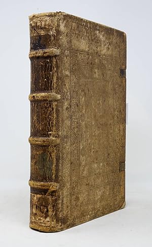
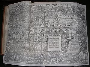
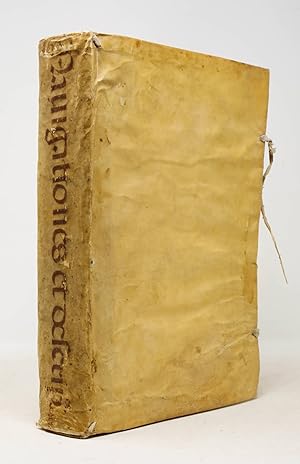
Hardcover. Zustand: Very good. First. THE FIRST MAP TO SHOW THE EARTH REVOLVING ON ITS AXIS. First edition. Basel: Io[hannes] Hervagius, 1532. Pot folio in 6s (11 1/2" x 8", 292mm x 204mm). [Full collation available.] With a folding woodcut map (Harrisse A) of the world excised and framed separately. Bound in contemporary limp vellum with yapp edges and tawed leather ties. On the spine, Navigationes et descrip.es orbis inked vertically in fine humanist script. All edges of the text-block speckled red. Presented in a grey cloth clam-shell box with a morocco spine-label gilt. Some rippling and a little soiling to the vellum. All four ties partly perished. Rear paste-down split at the head. Lacking quire [delta] (between [gamma] and "a": 12 pp. Münster's notes to the map). Map excised and framed. Some very mild tanning throughout the text, with occasional leaves with more pronouned darkening. Some very restrained early ink marginalia. In all, a lovely unsophisticated copy. The clam-shell box split at the front hinge, and the label coming up and partly perished. With the morocco label of Michael Sharpe to the inside of the front of the box. Although the map (rightly) has a nearly electromagnetic pull, being the first to indicate Copernicus' model of the revolving world (predating his 1543 De revolutionibus by 11 years), the book in which it was published is monumental in its own right: the first collection of voyages. The work emerges from the humanistic forge of the German-speaking Protestant world. Johann Huttich (Huttichius, 1490-1544) was part of the embassy that led Charles V to Madrid to announce his election as Holy Roman Emperor. While there he gained access to the accounts of Spanish and Portuguese (or Iberian-funded) explorers of the Americas (Cadamosto (whence the title-label), Columbus, Niño, Pinzón, Vespucci, Peter Martyr d'Anghiera) in addition to a great many voyages elsewhere (including Marco Polo) in Eurasia. While most of these had been printed elsewhere, their union in a single edited work is the first time we can discern the genre of voyages. Simon Grynaeus (Griner, 1493-1541) was a student of Melanchthon's at Pforzheim, and is perhaps best known for finding and editing the first five books of Livy's history of Rome (1531) that would be published by Erasmus. His role, Harrisse and others argue, was principally as prefator. Sebastian Münster (1488-1552), whose principal job was professor of Hebrew, would nevertheless go on in 1544 to publish the Cosmographia, the first description of the world in German. Shirley attributes the map to him, and indeed his twelve-page description of the map and its use suggests at the very least a deep involvement in its production. The final name attached to the work is that of Hans Holbein (The Younger, 1497-1543), who cut the fanciful border of the map with its cannibals and elephant hunt. In short, the Novus Orbus is the collective effort of some of the great humane minds of the Protestant Reformation. The map is Harrisse A ("we are inclined to consider as the genuine map;" Shirley is agnostic about precedence), distinguished by the large "ASIA". As such it is the first visual representation of the revolutionary model of the world: it revolves around a notional axis, and it is that action that accounts for daily and seasonal change. Münster (or Holbein) depicts this with angels at the North and South Poles powering the revolution via crank. Michael Sharpe worked for many years as an antiquarian bookseller. The present item was bought at his sale (Sotheby's New York, 11 December 2008, lot 178). Adams G-1334, Alden & Landis 532/17, Harrisse 171, John Carter Brown Library I, p. 104 (JCB I:101), Sabin 34100, Shirley 67.
-
Hardcover. Zustand: Very good. First. THE FIRST MAP TO SHOW THE EARTH REVOLVING ON ITS AXIS. First edition. Basel: Io[hannes] Hervagius, 1532. Pot folio in 6s (11 5/16" x 7 11/16", 288mm x 195mm). [Full collation available.] With a folding woodcut map (Harrisse A) of the world (inserted before Münster's notes to the map). Bound in (later) stiff vellum. On the spine, a red diced-morocco label with title and date gilt. At the head of the spine, title, date and place manuscript. At the foot, a circular paper label with the date manuscript. Presented in a modern quarter green morocco slip-case, with a chemise. Wear to the fore-corners, with some scuffs and gouges to the boards. Small areas of worming or wear. Front pastedown partly perished. Very mild tanning throughout, with the odd leaf or two mildly tanned, and very infrequent foxing. Map with some repaired tears or reinforced hinges, and some little splits -- unusually good margins. With scattered early ink marginalia to the index and to the text. French auction description pasted to the front paste-down, with manuscript at the bottom translating to "bought from Fred Muller Amst. 1886 [price]." Morocco labels of Marvyn Carton and ex-libris B[ernardo] Mendel to the front paste-down. On the verso of Cc6 (final printed leaf), ink duplicate stamp of the Lilly Library at Indiana university, released (pencil) 8 Nov. 1962. French auction description pasted to the rear paste-down. Although the map (rightly) has a nearly electromagnetic pull, being the first to indicate Copernicus' model of the revolving world (predating his 1543 De revolutionibus by 11 years), the book in which it was published is monumental in its own right: the first collection of voyages. Johann Huttich (Huttichius, 1490-1544) gained access to the accounts of Spanish and Portuguese (or Iberian-funded) explorers of the Americas in addition to a great many voyages elsewhere (including Marco Polo) in Eurasia. Their union in a single edited work is the first time we can discern the genre of voyages. Simon Grynaeus (Griner, 1493-1541) was principally a prefator. To Sebastian Münster (1488-1552) Shirley attributes the map. Hans Holbein (The Younger, 1497-1543) cut the fanciful border of the map with its cannibals and elephant hunt. In short, the Novus Orbus is the collective effort of some of the great humane minds of the Protestant Reformation. The map is Harrisse A ("we are inclined to consider as the genuine map;" Shirley is agnostic about precedence), distinguished by the large "ASIA". Münster (or Holbein) indicates the revolving world with angels at the North and South Poles powering the revolution via crank. Frederik Muller (1817-1881) was an Amsterdam bookseller specializing in maps. He gained great renown (and some infamy) as a bibliographer; the Frederik Muller Akademie was established as a school of book history (and now part of the Hogeschool van Amsterdam). Bernardo Mendel (1895-1967) was a decorated Viennese WWI soldier who, luckily, moved to Colombia in 1928 and remained there until 1952. He began collecting material principally related to the Americas, and eventually ran the Harper bookshop in New York. His collection eventually was given to the Lilly Library at the University of Indiana at Bloomington beginning in 1961, and it is from this collection that the present item was released as a duplicate. It then was owned by Marvyn Carton (1917-2004), an investment banker and trustee of Brown University. He endowed the Kapstein chair in literary arts at Brown. Adams G-1334, Alden & Landis 532/17, Harrisse 171, John Carter Brown Library I, p. 104 (JCB I:101), Sabin 34100, Shirley 67.
-
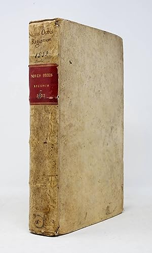
Hardcover. Zustand: Very good. First. THE NEBENZAHL COPY, CONTAINING THE FIRST MAP TO SHOW THE EARTH REVOLVING ON ITS AXIS. First edition, map state A. Basel: Io[hannes] Hervagius, 1532. Folio in 6s (11 5/8" x 8 1/16", 296mm x 205mm). [Full collation available.] With a folding woodcut map (Harrisse A) of the world (inserted at pp. 11-12). Bound in (1581, per the front board) calf over beveled wooden boards with clasps. On the front, a silver (in all instances oxidized to black) Crucifixion within blind borders within a silver repeating allegorical border with the figures of the four Virtues within a blind border, with silver corner-fleurons within a blind border. On the rear, an Annunciation at the center, otherwise identical. On the spine, four raised bands with blind fillets. In the panels, blind borders. Paper label manuscript to the first panel. Brass catches with clasp (one lacking) incised with hatching, rays and concentric circles. All edges of the text-block dotted in red and blue. Lacking one clasp. Staining to the boards. Fore-corners (except the lower rear) worn. Head- and tail-pieces perished. Front board split, but binding cords firm. The map has some small repaired tears at the folds, but is altogether very good. Scattered worming to the boards, and one discreet wormhole from 2b2 through to the rear board (with a patch of worming to the rear paste-down and free end-paper. Scattered tanning. In a sixteenth-century hand, some ink marginalia and underlining throughout but concentrations of intense comment from pp. 298-363 and 2318-323 (mis-numbered 327). In all, a volume that has been used and perused, but still robust and solid. With the bookplate of Kenneth Nebenzahl (Christie's New York, 9 April 2012, lot 65). Although the map (rightly) has a nearly electromagnetic pull, being the first to indicate Copernicus' model of the revolving world (predating his 1543 De revolutionibus by 11 years), the book in which it was published is monumental in its own right: the first collection of voyages. Johann Huttich (Huttichius, 1490-1544) gained access to the accounts of Spanish and Portuguese (or Iberian-funded) explorers of the Americas in addition to a great many voyages elsewhere (including Marco Polo) in Eurasia. Their union in a single edited work is the first time we can discern the genre of voyages. Simon Grynaeus (Griner, 1493-1541) was principally a prefator. To Sebastian Münster (1488-1552) Shirley attributes the map. Hans Holbein (The Younger, 1497-1543) cut the fanciful border of the map with its cannibals and elephant hunt. In short, the Novus Orbus is the collective effort of some of the great humane minds of the Protestant Reformation. The map is Harrisse A ("we are inclined to consider as the genuine map;" Shirley is agnostic about precedence), distinguished by the large "ASIA". Münster (or Holbein) indicates the revolving world with angels at the North and South Poles powering the revolution via crank. Widukind of Corvey's (ca. 925-973) chronicle of the Saxons up through the Xc, known as the Res gestae saxonicae, is published here for the first time by Martin Frecht (1494-1556). Often the only account of crucial portions of Saxon history, it also takes as its basis local and oral traditions rather than Roman (or southern) accounts, which are often biased and inaccurate. The present volume comes from the distinguished collection of Kenneth Nebenzahl Jr. (1927-2020), whose 2012 Christie's sale fetched some $11.6M. He was a dealer of the highest order, specializing in maps. Indeed, the Nebenzahl Lectures in the History of Cartography at the Newberry Library in Chicago (the first speaker was the great authority R.A. Skelton) are among the most important landmarks in the field. It is difficult to imagine a superior provenance for such a vital volume. Novus orbis: Adams G-1334, Alden & Landis 532/17, Harrisse 171, John Carter Brown Library I, p. 104 (JCB I:101), Sabin 34100, Shirley 67. Res gestae: Adams W-215.
-
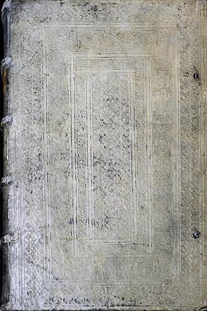
Hardcover. Zustand: Very good. First. THE FIRST MAP TO SHOW THE EARTH REVOLVING ON ITS AXIS, IN AN EXCEPTIONAL CONTEMPORARY BINDING. First edition. Basel: Io[hannes] Hervagius, 1532. Pot folio in 6s (11 7/8" x 8 3/16", 302mm x 208mm). [Full collation available.] With a folding woodcut map (Harrisse A) of the world (inserted before p. 1). Bound in contemporary clasped tooled pigskin over beveled wood boards. On the boards, a central panel of opening buds, surrounded by a roll of heads in roundels, surrounded by a roll of rosettes, surrounded by a roll of allegorical figures (Venus, Lucretia, Prudentia) dated 1532 within a border of opening buds left-and-right, and acanthus and guilloche top-and-bottom. On the spine, four raised bands. Paper labels in the first, fourth) and fifth panels. On the first-panel label, "Grynaeus" in ink manuscript. On the upper edge of the textblock "Novus orbis. Item(?) no 68" in ink manuscript. Presented in quarter morocco slipcase with chemise. Rubbing and wear to the extremities, especially at the fore-corners. Some tarnish and discoloration to the clasps. On the rear covering, an extant (i.e., present before binding) hole in the pigskin has a patch underneath. Some scattered worming to the boards A small stain to the upper fore-corner (not affecting text) o5-s6. Some marginal foxing and overall mild toning, with the odd leaf more uniformly darkened. Ownership inscription of Johannes Craesselius (twice), gift inscription from him, inscription of the Jesuit College in Graz with a catalog indication (dated to 1633) and then another catalog indication of (transfer to?) the mathematical library, dated 1674. With a few marginal comments (by Craesselius?), i.a. p. 392. Although the map (rightly) has a nearly electromagnetic pull, being the first to indicate Copernicus' model of the revolving world (predating his 1543 De revolutionibus by 11 years), the book in which it was published is monumental in its own right: the first collection of voyages. Johann Huttich (Huttichius, 1490-1544) gathered the accounts of Spanish and Portuguese explorers of the Americas in addition to a great many voyages elsewhere (including Marco Polo) in Eurasia. Their union in a single edited work is the first time we can discern the genre of voyages. Simon Grynaeus (Griner, 1493-1541) was principally a prefator. To Sebastian Münster (1488-1552) Shirley attributes the map. Hans Holbein (The Younger, 1497-1543) cut the fanciful border of the map with its cannibals and elephant hunt. In short, the Novus Orbus is the collective effort of some of the great humane minds of the Protestant Reformation. The map is Harrisse A ("we are inclined to consider as the genuine map;" Shirley is agnostic about precedence), distinguished by the large "ASIA". Münster (or Holbein) indicates the revolving world with angels at the North and South Poles powering the revolution via crank. This exceptional intact binding enjoys the additional distinction of being dated to the year of publication, although of course that only dates the roll itself, which may well have been used for many years. This roll appears identical to one attributed to Caspar Angler (made master in 1526, died ca. 1565) who worked at the court of Albert, first Duke of Prussia. Johann Craesselius (Johannes Krösel, ca. 1555-1633) was a theologian, poet and librarian, first at Ingolsadt and then at Graz. In Graz, he was chaplain and librarian of Archduke Ferdinand II. Some 222 of his books are now in the collection of the University of Graz. Purchased at the 2007 Christie's New York sale of Frank S. Streeter (16 April, lot 273), who died in 2006. Son of the legendary Americana collector Thomas Streeter, his own collecting interest was navigation and voyages, and so the present volume must, as the first collection of accounts of voyages, have enjoyed pride of place among Streeter's shelves. Adams G-1334, Alden & Landis 532/17, Harrisse 171, John Carter Brown Library I, p. 104 (JCB I:101), Sabin 34100, Shirley 67.
-
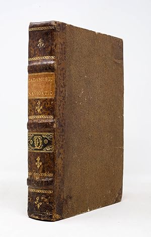
Hardcover. Zustand: Very good. First. THE FIRST MAP TO SHOW THE EARTH REVOLVING ON ITS AXIS. First edition, map state A (Harrisse). Basel: Io[hannes] Hervagius, 1532. Pot folio in 6s (11 1/16" x 7 7/16", 231mm x 189mm). [Full collation available.] With a folding woodcut map (Harrisse A) of the world (inserted before p. 1). Bound in somewhat later half speckled calf over sprinkled boards. On the spine, three raised bands. In the panels, gilt floral central ornaments. Title (CADAMUSTI NAVIGATIO) gilt to a beige morocco label in the upper portion of the second panel. In the second panel, a gilt cipher (L O) in acanthus scrolls to a green morocco label. Marbled end-papers. All edges of the text-block stained red. Worming to the lower quarter of the spine, wrapping around to the front board. Some wear to the boards overall. Map with a repaired closed tear and with some small tears at the folds and margins. Internally, as so often, certain quires have tanned, but most are lovely and bright; generally quite good, with occasional foxing. Small round ex-libris label of "a.r.s." on the front paste-down. Violet inkstamps of the Collegio S. Carlo library and of "M.D" on the title-page. Although the map (rightly) has a nearly electromagnetic pull, being the first to indicate Copernicus' model of the revolving world (predating his 1543 De revolutionibus by 11 years), the book in which it was published is monumental in its own right: the first collection of voyages. The work -- indeed, both works contained in the present volume -- emerges from the humanistic forge of the German-speaking Protestant world. Johann Huttich (Huttichius, 1490-1544) was part of the embassy that led Charles V to Madrid to announce his election as Holy Roman Emperor. While there he gained access to the accounts of Spanish and Portuguese (or Iberian-funded) explorers of the Americas (Cadamosto (whence the title-label), Columbus, Niño, Pinzón, Vespucci, Peter Martyr d'Anghiera) in addition to a great many voyages elsewhere (including Marco Polo) in Eurasia. While most of these had been printed elsewhere, their union in a single edited work is the first time we can discern the genre of voyages. Simon Grynaeus (Griner, 1493-1541) was a student of Melanchthon's at Pforzheim, and is perhaps best known for finding and editing the first five books of Livy's history of Rome (1531) that would be published by Erasmus. His role, Harrisse and others argue, was principally as prefator. Sebastian Münster (1488-1552), whose principal job was professor of Hebrew, would nevertheless go on in 1544 to publish the Cosmographia, the first description of the world in German. Shirley attributes the map to him, and indeed his twelve-page description of the map and its use suggests at the very least a deep involvement in its production. The final name attached to the work is that of Hans Holbein (The Younger, 1497-1543), who cut the fanciful border of the map with its cannibals and elephant hunt. In short, the Novus Orbus is the collective effort of some of the great humane minds of the Protestant Reformation. The map is Harrisse A ("we are inclined to consider as the genuine map;" Shirley is agnostic about precedence), distinguished by the large "ASIA". As such it is the first visual representation of the revolutionary model of the world: it revolves around a notional axis, and it is that action that accounts for daily and seasonal change. Münster (or Holbein) depicts this with angels at the North and South Poles powering the revolution via crank. The Collegio S. Carlo (Milan? Modena) library stamp and the mysterious M.D within a beveled rectangle (as well as the "ex libris a.r.s.") do not yield much by way of ownership; they must nevertheless have taken rather good care of it for it to have survived so well to the present. Adams G-1334, Alden & Landis 532/17, Harrisse 171, John Carter Brown Library I, p. 104 (JCB I:101), Sabin 34100, Shirley 67.
-
Novus orbis regionum ac insularum veteribus incognitarum una cum tabula cosmographica. Basel: Johannes Hervagius, 1555
Verlag: Basel: Johannes Hervagius, 1555., 1555
Anbieter: Arader Galleries - AraderNYC, New York, NY, USA
Verkäuferbewertung 5 von 5 Sternen
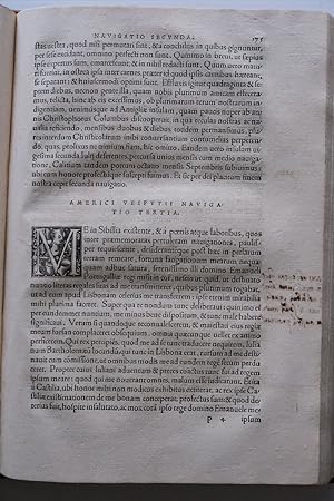
Folio (12 1/2 X 8 in.; 31.8 x 20.3 cm). Woodcut printer's device on title-page and last leaf, large woodcut folding map, two small woodcut text illustrations (pp. 21 and 93), woodcut initials. BINDING/CONDITION: Contemporary pigskin over wooden boards, each cover decorated in blind with panels of floral and saints roll tools, the spine in five compartments with four raised bands; remains of two pairs of ties, some soiling, rubbed, a few worm trails on front pastedown and free endpaper. Tiny worm holes in margins of title-page and ?2, some browning on perpendicular centerfolds of map, faint marginal dampstaining in quires I-N, ink redactions affecting title-page and a few words on *1v. (64V1H) FOURTH AND MOST COMPLETE EDITION, AUGMENTED WITH MORE ACCOUNTS OF THE NEW WORLD THAN PREVIOUSLY PUBLISHED, WITH DISTINGUISHED PROVENANCE. Additions to the present edition include the second and third Cortez letters, the epistle of the Bishop of Temixtitan in "Huketan," and the summary of Herborn's discourse on the conversion of the Indians. The map is called for in all Basel editions (the Paris edition used a map by Oronce Fine). It is the issue with "Asia" printed at an almost even level with "Mare Caspia," and "Tropicus Capricorni" appears below the tropic line. The redactions, which affect the imprint on the title-page and colophon, as well as the list of contents ("Praefatio Simonis Grynaei ad Collimitium" in line 1 and "per Sebastianum Munsterum" in line 2 of ?1v and "per Sebastianum Munsterum" on Münster's introduction on *1r) make plain a deep-rooted aversion-most likely by the monks of Baumburg Abbey-for the Protestant Reformation. Grynaeus was a theologian of the Reformation; Münster had joined the Franciscans in 1505 but became an apostate in 1529 in order to assume an appointment at the University of Basel, which was dominated by the Reformed Church. Subsequently Basel had become an important center of the Protestant Reformation in the sixteenth century, with many of its printers, including Hervagius, producing Protestant works. PROVENANCE: Contemporary ownership inscription with Latin motto; later shelf-mark on the front paste-down; Augustinian Canons Regular, Baumburg Abbey, Bavaria ("Monasterij Baumburg" inscribed at head of title-page); American Antiquarian Society (its gift bookplate inscribed with the donor's name, Isaac Davis, on the front pastedown, blind-embossed stamp on title-page, deaccession stamp on bookplate and on lower pastedown) REFERENCES: Adams G-1338, Alden-Landis 555/42; Brown, The World Encompassed 65; Brunet IV:132 (".la plus complète [édition]"); JCB 1:202; Sabin 34104; Shirley 67 (world map).
-
Novus orbis regionum ac insularum veteribus incognitarum una cum tabula cosmographica.
Verlag: Basel: Johannes Hervagius, 1555., 1555
Anbieter: Arader Galleries - AraderNYC, New York, NY, USA
Verkäuferbewertung 5 von 5 Sternen
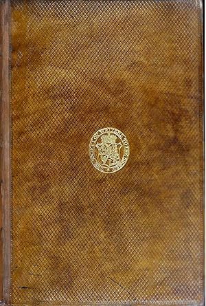
Folio (12 x 7 1/4 in.; 30.4 x 18.6 cm). Woodcut printer's device on title-page and last leaf, large woodcut folding map, two small woodcut text illustrations (pp. 21 and 93), woodcut initials. BINDING/CONDITION: Light marginal staining, a trifle more pronounced on leaves X5-6, F6, G1-2, and quire Bb at the end, small internal tear or flaw on gamma2, touching about 2-3 index entries, light discoloration to map along central perpendicular folds. Nineteenth-century diced calf with gilt supralibros of the Society of Writers to the Signet, edges stained red; expertly rebacked with original spine laid down. (64V1H) FOURTH AND MOST COMPLETE EDITION, AUGMENTED WITH MORE ACCOUNTS OF THE NEW WORLD THAN PREVIOUSLY PUBLISHED, WITH DISTINGUISHED PROVENANCE. Additions to the present edition include the second and third Cortez letters, the epistle of the Bishop of Temixtitan in "Huketan," and the summary of Herborn's discourse on the conversion of the Indians. The map is called for in all Basel editions (the Paris edition used a map by Oronce Fine). It is the issue with "Asia" printed at an almost even level with "Mare Caspia," and "Tropicus Capricorni" appears below the tropic line. PROVENANCE: George Lockhart of Carnwath (1673-1731), Scottish writer and politician (armorial bookplate on title-page); Society of Writers to the Signet (gilt supralibros, shelfmark on front pastedown and inscription on front flyleaf: "Ex Lib:|Bibl: Scribar | Sig: Reg:|1812"); Kenneth Nebenzahl (ticket on front pastedown and his sale, Christie's New York, 10 April 2012, lot 66) REFERENCES: Adams G-1338, Alden-Landis 555/42; Brown, The World Encompassed 65; Brunet IV:132 (".la plus complète [édition]"); JCB 1:202; Sabin 34104; Shirley 67 (world map).
-
Novus orbis regionum ac insularum veteribus incognitarum.
Verlag: Basel: Johannes Hervagius, 1555., 1555
Anbieter: Arader Galleries - AraderNYC, New York, NY, USA
Verkäuferbewertung 5 von 5 Sternen
Erstausgabe
Folio (13 4/8 x 8 inches). Woodcut printer's device on title-page and last leaf, LARGE WOODCUT FOLDING MAP (washed and folds and one or two closed tears restored on verso), wood-engravings in the text (last leaves spotted and wormed). 18th-century tan panelled sheep (worn with loss at the extremities). Provenance: with the near contemporary ownership inscription of Paul v. Vallis on the title-page; the early ownership inscription of Godofridus Gilkens, dated the 16th of August 1596 also on the title-page; with the printed book label of Sergei Sobolewski (1803-1870) on the front paste-down, and his extensive notes on the front endpapers, his sale List & Francke, 1873, lot 4004; with the printed library label of the celebrated Chilean historian Diego Barros Arana (1830-1907) also on the front paste-down; and the leather library label of G.J. Avanitidi below. Fourth and most complete edition containing more accounts of the New World than previous editions (first published Basel, 1532). With the celebrated world map "Typus cosmographicus universalis", with an ANGEL AT EACH POLE WITH A CRANK TO TURN THE WORLD ON ITS AXIS which at the time of the first edition was a visual representation of Copernican theory predating by 11 years publication of his "De revolutionibus orbium coelestium". The map is identical to that in the first edition of 1532, except for slight variations in type and text, this the issue with "Tropicus Capricorni" printed above the tropical line. Shirley attributes the cartography of this map to Münster and the border decoration to Holbein, who was working with several Basel publishers at the time. It is of particular interest especially for its "richness of artistic decoration" (Shirley). The work contains accounts of the voyages of Cadamosto, the three voyages of Columbus, Nino, Pinzon, Vespucius, Cabral, and part of the Fourth Decade of Peter Martyr, "also many other pieces which do not relate to America" (Sabin). Beginning with Madrignano's latin version of the "Paesi novamente retrovati", and followed by ten accounts, all of which had been previously published except the second, they include Vespucci's letter to Piero Soderinin Gonfalonier of Florence, recording his four voyages which was first published in 1507 as an appendix to Waldseemuller's "Cosmographiae Introductio"; the first publication of a letter from King Manuel of Portugal to Leo X relating the conquest of Malacca and the relief of Goa by Albuquerque; Madrignano's Latin translation of the "Itinerario" of Ludovico di Varthema, printed Rome 1510; Brocardus's description of the Holy Land; the travels of Marco Polo; the travels of Hayton the Armenian; a description of Russia by Matthias of Miechow first published in Cracow in 1517; another description of Russia by Paolo Giovio, first published in Rome 1525; Peter the Martyr's Fourth Decade, fist published in Basel in 1521; and an account of the antiquities of Prussia by Erasmuns Stella, also Basel 1510 (Modern Language Review, volume II, 1907). Additions to the present edition include the second and third Cortez letters, letters on propagation of the Gospel among Indians, epistle of Bishop of Temixtitan in "Huketan," and the summary of Herborn's discourse on the conversion of the Indians. (6.4V.1F). REFERENCES: Adams G-1338; Brunet IV, 132: ".la plus complete [edition]"; Sabin 34104; Shirley 67n. Catalogued by Kate Hunter.
-
NOVUS ORBIS REGIONUM AC INSULARUM VETERIBUS INCOGNITARUM UNA CUM TABULA COSMOGRAPHICA.
Verlag: Basil. Hervagius. November, 1536
Anbieter: Charles Russell, ABA, ILAB, est 1978, Cirencester, Vereinigtes Königreich
Verbandsmitglied: ABA ILAB PBFA
Verkäuferbewertung 5 von 5 Sternen
EUR 1.431,28
EUR 4,75 Versand
Versand von Vereinigtes Königreich nach USAAnzahl: 1 verfügbar
In den WarenkorbSmall folio 29x20 cms, calf over original marbled boards, a little worn. Pages 1- 504 and 517-600 plus colophon leaf. (Thus wanting title, prelims, map and pages 505-516 De Saraminta Asiana/Europea). Illustrated with woodcuts on pages 30 and 129 plus numerous woodcut initials. Some marginal annotation in an old hand. Although defective- otherwise a very good, clean and crisp copy of the majority of the text in a more or less contemporary binding. - Christopher Columbus, Amerigo Vespucci etc. Ref- Sabin 34103.
-
Lexicon Graecum.
Verlag: J. Walder c. 1539, Basle, 1539
Anbieter: Alexandre Antique Prints, Maps & Books, Toronto, ON, Kanada
Verkäuferbewertung 5 von 5 Sternen
18th-century brown ¼ calf with marbled boards, spine in four compartments of raised bands and gilt tooling, gilt text on two. , This is a rare edition of the Greek dictionary by Simon Grynaeus (1493-1541), distinguished Protestant theologian and friend of Melanchthon and Erasmus. He was professor of Greek at Heidelberg and later, in 1536, moved to Basle where the dictionary was published., Size : 4to, Fine woodcut title-border with central woodcut printer?s device., References : Cordell STC 77., P. 1148 pp. A few stains and some light thumbstaining at the beginning, otherwise a very good copy.
-

Porträt. Kopfdarstellung im Profil nach links. Kupferstich (anonym), aufgekllebt, ca. 5 x 5 cm, o. J.
Anbieter: Antiquariat Michael Eschmann, Groß-Gerau, Deutschland
Verkäuferbewertung 5 von 5 Sternen
Kunst / Grafik / Poster
0. Sprache: Deutschu.
-
Novus orbis regionum ac insularum veteribus incognitarum una cum tabula cosmographica, et aliquot consimilis argumenti libellis, nec non navigationibus auctus,
Verlag: Basileae (Basel), Apud Io. Hervagium Anno M.D.LV. Mense Septembri/Johannes Hervagius/Herwagen 1555., 1555
Anbieter: NORDDEUTSCHES ANTIQUARIAT, Rostock, Deutschland
Verkäuferbewertung 5 von 5 Sternen
EUR 38.000,00
EUR 42,00 Versand
Versand von Deutschland nach USAAnzahl: 1 verfügbar
In den Warenkorb2° (ca. 32 x 20 cm). [26] Blätter, 677 S. (richtig 577 Seiten, Pag. springt von 99 auf 200), mit zahlr. Holzschnitt-Initialen, zwei kleinen Text-Abbildungen auf den S. 21 u. 93 und mehrfach gefalteter Weltkarte in Holzschnitt. Pergament der Zeit mit handgeschr. Rückentitel "Cosmographia". Einige Bll. leicht fleckig, Titelblatt angeschmutzt u. gestempelt. Karte mit Einrissen am Falz u. an anderen Stellen gebräunt. Ein kleiner Wurmgang im Block. Einband lichtrandig u. angestaubt, Kopfschnitt stärker nachgedunkelt. - VD16 G 3829 - Enthält ins Lateinische übersetzte Texte über die außereuropäische Welt, u.a. von Christoph Columbus, Hernan/Fernando Cortez und Amerigo Vespucci. - Provenienz: 1. St. Petri-Kirchen-Bibliothek Berlin. Mit Anschreiben zur Übergabe "der Cosmographia, Basel 1555" an die "Cölnische Schulbibliothek", Cöln, d. 24 November 1820, nachdem die Petrikirche am 20. September 1809 abgebrannt war. Unterzeichnet von den drei Geistlichen Dr. Hanstein? [.] - 2. Köllnisches Gymnasium, Berlin: Titelblatt gestempelt "Coeln. Real-Gymnasium", gegenüber elfzeiliger handschriftlicher Eintrag zur Übernahme des Bandes "Dies ist das einzige von den Flammen unberührt gebliebene Buch [.] untergegangenen Bibliothek der Petri-Kirche in Berlin, unterzeichnet "Valentin Heinr. Schmidt, Prof." - Valentin Heinrich Schmidt (17561838), war Mitdirektor 18241827.
-
De recta ingenuorum adolescentum ac puellarum institution, libelli duo / Ad veram sapientiam introductio. / Aristotelis De virtutibus libellum (.) a Simone Grynaeo latinitate donatum
Verlag: Basel, Robert Winter, 1539. 181, (11) pp. Text mostly in Latin, but the Aristotle text ('Peri Areton') in Greek, with Latin translation and commentary. First Latin translation of 'Peri Areton' ., 1539
Anbieter: Antiquariaat Hortus Conclusus, Bergambacht, Niederlande
Verkäuferbewertung 5 von 5 Sternen
EUR 1.350,00
EUR 14,50 Versand
Versand von Niederlande nach USAAnzahl: 1 verfügbar
In den WarenkorbContemporary full limp vellum. Old owner's entry on top of title page, faint, mostly marginal, stain in upper inner corner, slightly browned, still a very good copy. Please see description or ask for photos.
-
NOVUS ORBIS REGIONUM AC INSULARUM VETERIBUS INCOGNITARUM UNA CUM TABULA COSMOGRAPHICA, & ALIQUOT ALLIS CONSIMILIS ARGUMENTI LIBELLIS, QUORUM OMNIUM CATALOGUS SEQUENTI PATEBIT PAGINA. HIS ACCESSIT COPIOSUS RERUM MEMORABILIUM INDEX - ATA UIAM INUENIENT
Verlag: Basileae Apud Io. Hervagium, Mense Martio, Basel, 1532
Anbieter: Aardvark Rare Books, EUGENE, OR, USA
Verkäuferbewertung 5 von 5 Sternen
Erstausgabe
Leather-bound (Vellum). Zustand: Good Plus. First Edition. Folio.IN LATIN. No Map. Vellum.Text 30.5 x 20 cm. Manuscript title to spine. Vellum stained (as per usual) and apart from a very small tear near top of spine, is in lovely and solid condition. Lacks the (rarely seen) woodcut map of the world ("Typus Cosmographicus Universalis"), and lacks Jehan Petit's printer's device to title page, but this device (bust on a pedestal) is present on verso of last leaf. Very light toning throughout, and darkening and tidelines to first 170 or so pages, but restricted to very wide margins (not text). Additional tidelines at bottom to final 30 pages, and again, with no effect upon the clarity of the text. Pages are supple with a nice, easy-to-read typeface. Simon Grynaeus wrote the preface ("Declaratio") but John Huttich alone compiled this massive and invaluable historical work. (Later editions dropped this preface because it contained text critical of The Inquisition. One title page variant noted in WorldCat). Index complete. Collates complete, but as usual skips 578- 581 and 584, 585, 584. Final leaf "Index Ternionum" and on the verso Jehan Petit's printer's device of a bust on a pedestal. In-text woodcuts (DropCaps). FIRST EDITION of one of the earliest accounts of exploration in the Americas -- a very early compendium of travels and explorations. The most complete edition of this important and rare collection of 15th and 16th century voyages. The work contains accounts of the voyages of Cadamosto, the three voyages of Columbus, Nino, Pinzon, Vespucius, Cabral, Marco Polo, and part of the Fourth Decade (i.s., Chapter) of Peter Martyr d'Anghiera, an Italian historian in the employ of Spain, who wrote the first accounts of explorations in Central and South America. (Sabin 34100). As for the absence of the map in this copy, Harrisse (in his Bibliotheca Americana Vetustissima) wrote: ".Notwithstanding the statement in Mr. Grenville's Catalogue respecting the frequent absence of the map, "there is no doubt but that a map does belong to the work.Mr. Muller has reproduced ten copies in exact facsimile" Harrisse remarks: "Whether they were the maps really belonging to the work, and described by Munster, we are unable to say, as no two copies of this edition had the same.".
-
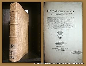
Graecorum Romanorumque illustrium vitae etc.
Verlag: Johann Bebel, Basel, 1535
Anbieter: ANTIQUARIAT.WIEN Fine Books & Prints, Wien, Österreich
Verkäuferbewertung 5 von 5 Sternen
De viris clarissimis , Schweinsleder der Zeit über Holzdeckeln auf 4 Bünden mit abgeschrägten Kanten, mit Schliessen, Folio, 22, 401 recte 392 Blatt, mit 2 Druckermarken, und Initialne im Holzstich, Zustand eine Schliesse fehlt, Titelblatt mit altem Vorbesitzervermerk Caspar Pansa vgl. unten, guter Zustand PROVENIENZ 1 : Mit handschriftl. Bezeichnung auf dem Titelblatt //Caspary Pansa // das ist CASPAR PANSA von Rangenburg aus Themar (Grafschaft Henneberg); Studium in Altdorf, Basel und Straßburg; Advokat in Nürnberg; 1592 Jena; 20.10.1603 Altdorf; in Basel: 1609 stud. phil.; 13.09.1609 b. a. (privatim); 1609 m. a.; 29.03.1610 dr. iur. utr.; von 1608 an Reisebegleiter von Paul Pfintzing (1589-1631 aus Nürnberg); Rat des Erzherzogs Maximilian in Innsbruck, 05.01.1633 Wien Adelsbestätigung und Wappenbesserung Quellen: Int. Biogr. Index, Basler Matrikel, III, 107, 44, Frank: Standeserhebungen IV, 32 // PROVENIENZ 2 Spiegel mit Exlibris von Hieronymus Panzoldi [d.i. vermutlich Hieronymus Joseph Ritter von PANZOLDI ZU MONTE OLIVO (ca. 1769-1846) vgl. Kögl: Gen. Her. Adelslex. II, 750, [Lebensdaten: sterbebilder[Punk]schwemberger[Punkt]] Zweite Auflage der schon 1531 zunächst erschienenen Ausgabe, VD16 P 3759, Adams, P 1615, Graesse: V, 361 la 3100 Buch.
-
Novus orbis regionum ac insularum verteribus incognitarum.
Verlag: Paris: Antoine Augerelle for Jean Petit, 8 November 1532, 1532
Anbieter: Arader Galleries - AraderNYC, New York, NY, USA
Verkäuferbewertung 5 von 5 Sternen
Erstausgabe
Novus orbis regionum ac insularum verteribus incognitarum. Paris: Antoine Augerelle for Jean Petit, 8 November 1532 Folio (12 x 8 in.; 30.5 x 20. 3 cm). Petit's woodcut device on title-page, woodcut folding map in the first state ("Nova, Et Integra Universi Orbis Descriptio" with Fine's imprint "Orontius F. Delph.1531 Mense Julio") decorated with a finely detailed border of flowers and bunches of grapes, two putti, two mermaids, and the French royal coat of arms below the title banner, woodcut initials. BINDING/CONDITION: Map shaved along bottom margin with tiny mend to verso of left margin not affecting image, title-page stained, occasional light toning and foxing, more prevalent in latter half of text, Sebastian Münster's name redacted in ink on [alpha]1v and [delta]4r. Later stiff vellum, manuscript title on spine, edges sprinkled red. Quarter brown morocco folding case. (64V1F) A SUPERB COPY OF THE FIRST PARIS EDITION WITH THE FIRST STATE OF THE RARE DOUBLE-CORDIFORM MAP BY ORONCE FINE. Widely regarded as the first general history of travels, this fine collection of voyages was published in Basel a few months earlier with a world map attributed to Sebastian Münster. Fine's map is "a rendering considerably in advance of any others printed earlier.a detailed woodcut, geographically much superior to the large oval map.in the Basle editions" (Shirley). This new form of projection showing both the north and south poles was used by Mercator in his 1538 world map and by Lafreri in 1560; it is a marked departure from the speculative geography of Waldseemüller and Ruysch. A good portion of the right-hand (or southern) cordum is occupied by the newly discovered but still unexplored Antarctic land mass ("Terra Australis") and given the lack of any knowledge of the region, it is surprisingly accurate. Fine names the lower Pacific "Mare magellanicum," one of the first uses of the navigator's name on a map. The definition of the west coast of Mexico is one of the earliest to show the discoveries of Cortés. The text contains the first three voyages of Columbus, the four voyages of Vespucci, an extract of the Fourth Decade of Peter Martyr, as well as the voyages of Cadamosto, Nino, Pinzon, and Cabral. Other accounts deal with the travels of Marco Polo and voyages to Africa, Russia, Palestine, the Moluccas, and elsewhere. PROVENANCE: Carolus Bartolomeus Ranasius Cremonensis (contemporary inscription at foot of title-page); Christie's London, 16 November 2005, lot 180 REFERENCES: Adams G-1335; Alden/European Americana 532/19; Sabin 34102; Shirley 66.
-
Die new welt, der landschaften unnd Insulen, so . jungst aber von den Portugalesern unnd Hispaniern im Nidergenglichen Meer . herfunden.
Anbieter: Antiquariat Kainbacher, Baden bei Wien, Österreich
Verkäuferbewertung 5 von 5 Sternen
EUR 28.000,00
EUR 14,50 Versand
Versand von Österreich nach USAAnzahl: 1 verfügbar
In den WarenkorbStraßburg, G. Ulricher 1534. Folio. 32 : 21 cm. 6 Bll. (Vorwort von M. Herr), 242 (recte 248) num. Bll. Mit 2 Holzschnitt-Druckermarken auf Titel und letztem Bl. verso, großer Wappen-Holzschnitt-Initiale und zahlr. Holzschnitt-Schmuckinitialen. Schweinslederband der Zeit über Holzdeckeln mit reicher Blind- und Rollenprägung und 2 Metallschließen mit Monogramm "IWS". - Foliierung springt von 145 auf 150, letztes Bl. ebenfalls falsch numeriert. Leicht gebräunt und fleckig, Titel und die 5 Bll. Vorwort mit Restaurierungen und im Rand ergänzt, erste Textbll. in der oberen rechten Ecke moulliert, ca. 10 Bll. im Rand mit kl. teils hinterlegter Läsur durch entfernte Blattweiser, Innengelenke ausgebessert. Einband fleckig, Ecken bestoßen, Leder der Schließen erneuert. Gutes Exemplar. Erste deutsche Ausgabe der Sammlung von Reiseberichten über die frühen Entdeckungsreisen des 15. und 16. Jahrhunderts. Die Übersetzung der lateinischen AusgabeNovus orbis regionum(Basel 1532) besorgte der Straßburger Arzt und Gelehrte Michael Herr. "It is less known and much rarer than the original. The version is somewhat broad, and is distinguished by a certain originality in expression. Although it has no map, it has, on the other hand, the merit of being augmented in the text. It contains a full translation of Peter Martyr'sDecades,folios 174-229, and also his three booksDe Legatione Babylonica,folios 235-248, both wanting in all the different Latin editions. Besides, it contains all the pieces of the first Latin edition of 1532, except Münster'sIntroductio in tabulam geograph., to which the map belongs, and would, therefore, have been superfluous in this edition. The preface by Grynaeus is omitted." (Sabin). Enthält fernerPaese Novamente retrovativon Montalboddo, die vier Reisen des Vespucci, VarthemasLobwertige Rays(deren erste deutsche Übersetzung 1515 ebenso von Michael Herr stammt), Marco Polos Reisen u. a. - Zweispaltiger Druck, eine der letzten Erzeugnisse der nur sechs Jahre bis 1536 bestehenden Straßburger Offizin von Georg Ulricher. PROVENIENZ: Hs. Besitzvermerk "Conradus Bolhuis me possidet" auf Titel, Stempel der Hamburger Commerzbibliothek (Dubl.), Stempel derVollbehr-Sammlung Americana(Dubl, verkauft in Metuchen, NY, 1932), Bibl.-Schild derCollection Robert Williams(1933); mont. Katalogbeschreibung von Swann Auction Galleries (Auktion 1955). Zuletzt niederländische Privatsammlung. LITERATUR: VD 16, G 3830. - Muller II, 330, 22. - Ritter 2205. - Alden/L. 543/20. - Sabin 34106. - Harissee 188. First German translation of "Novus orbis regionum" (Latin ed. Basel 1532), an important collection of travel accounts about the early discoveries of the 15th and 16th century. With 2 woodcut printer's devices and numerous woodcut initials. Contemp. pigskin over wooden boards with 2 brass clasps (with monogr. "IWS"). - Foliation jumping from 145 to 150, last leaf also with wrong number. Slightly tanned and stained, title and first leaves (foreword by M. Herr) with restaurations and partly remargined, the first text leaves with small defects by mould in upper corner, ca. 10 leaves with small marginal defects, inner hinges repaired. Binding stained, corners bumped, calf of clasps renewed. Good copy. - Provenance: Ms. ownership entry "Conradus Bolhuis me possidet" on title. - Commerzbibliothek Hamburg (stamp, doubl.). - Vollbehr Americana collection (stamp, doub., sold in Metuchen, NY, 1932). - Collection Robert Williams (1933). - Mounted catalogue description of Swann Auction Galleries (sale in 1955). Dutch private collection.


![Bild des Verkäufers für Novus orbis regionum ac insularum veteribus incognitarum, unà cum tabula cosmographica, & aliquot alijs consimilis argumenti libellis, quorum omnium catalogus sequenti patebit pagina. His accessit copiosus rerum memorabilium index WITH Witichindi Saxonis rerum ab Henrico et Ottone I Impp. Gestarum Libri III, unà cum alijs quibusdam raris & antehac non lectis diversorum autorum historijs, ab Anno salutis D.CCC. usq[ue] ad præsentem ætatem: quorum catalogus proxima patebit pagina. Huc accesit rerum scitu dignarum copiosus index zum Verkauf von Arader Books](https://pictures.abebooks.com/inventory/md/md30871863248.jpg)