
Gesamtpreis (1 Artikel Artikel):
Versandziel:

f j salmon (29 Ergebnisse)
Direkt zu den wichtigsten Suchergebnissen
Suchfilter
Produktart
- Alle Product Types
- Bücher (26)
- Magazine & Zeitschriften (Keine weiteren Ergebnisse entsprechen dieser Verfeinerung)
- Comics (Keine weiteren Ergebnisse entsprechen dieser Verfeinerung)
- Noten (Keine weiteren Ergebnisse entsprechen dieser Verfeinerung)
- Kunst, Grafik & Poster (Keine weiteren Ergebnisse entsprechen dieser Verfeinerung)
- Fotografien (Keine weiteren Ergebnisse entsprechen dieser Verfeinerung)
- Karten (3)
- Manuskripte & Papierantiquitäten (Keine weiteren Ergebnisse entsprechen dieser Verfeinerung)
Zustand Mehr dazu
- Neu (6)
- Wie Neu, Sehr Gut oder Gut Bis Sehr Gut (3)
- Gut oder Befriedigend (16)
- Ausreichend oder Schlecht (Keine weiteren Ergebnisse entsprechen dieser Verfeinerung)
- Wie beschrieben (4)
Einband
Weitere Eigenschaften
- Erstausgabe (2)
- Signiert (1)
- Schutzumschlag (Keine weiteren Ergebnisse entsprechen dieser Verfeinerung)
- Angebotsfoto (14)
Sprache (4)
Gratisversand
Land des Verkäufers
Verkäuferbewertung
-
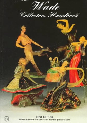
The Wade Collectors Handbook
Sprache: Englisch
Verlag: Wallace-Homestead Book Co (edition ), 1998
ISBN 10: 1870703618 ISBN 13: 9781870703611
Paperback. Zustand: Very Good. It's a well-cared-for item that has seen limited use. The item may show minor signs of wear. All the text is legible, with all pages included. It may have slight markings and/or highlighting.
-

How to Build a Beowulf: A Guide to the Implementation and Application of PC Clusters
Buch 14 von 27: Scientific and Engineering ComputationAnbieter: ThriftBooks-Atlanta, AUSTELL, GA, USA
Verkäuferbewertung 5 von 5 Sternen

Paperback. Zustand: Very Good. No Jacket. May have limited writing in cover pages. Pages are unmarked. ~ ThriftBooks: Read More, Spend Less.
-
The Wade Collectors Handbook
Sprache: Englisch
Verlag: Wallace-Homestead Book Co, 1998
ISBN 10: 1870703618 ISBN 13: 9781870703611
Anbieter: ThriftBooks-Dallas, Dallas, TX, USA
Verkäuferbewertung 5 von 5 Sternen
Paperback. Zustand: Good. No Jacket. Pages can have notes/highlighting. Spine may show signs of wear. ~ ThriftBooks: Read More, Spend Less.
-

Collecting Clarice Cliff
Sprache: Englisch
Verlag: Francis Joseph Publications, 2003
ISBN 10: 1870703782 ISBN 13: 9781870703789
Anbieter: WeBuyBooks, Rossendale, LANCS, Vereinigtes Königreich
Verkäuferbewertung 5 von 5 Sternen
EUR 5,07
EUR 7,14 Versand
Versand von Vereinigtes Königreich nach USAAnzahl: 1 verfügbar
In den WarenkorbZustand: Very Good. Most items will be dispatched the same or the next working day. A copy that has been read, but is in excellent condition. Pages are intact and not marred by notes or highlighting. The spine remains undamaged.
-
Collecting Clarice Cliff
Anbieter: WorldofBooks, Goring-By-Sea, WS, Vereinigtes Königreich
Verkäuferbewertung 5 von 5 Sternen
EUR 8,02
EUR 6,49 Versand
Versand von Vereinigtes Königreich nach USAAnzahl: 10 verfügbar
In den WarenkorbPaperback. Zustand: Very Good. The book has been read, but is in excellent condition. Pages are intact and not marred by notes or highlighting. The spine remains undamaged.
-
The Wade Collectors Handbook
Sprache: Englisch
Verlag: Francis Joseph Publication, London, 1997
ISBN 10: 1870703618 ISBN 13: 9781870703611
Anbieter: Victoria Bookshop, BERE ALSTON, DEVON, Vereinigtes Königreich
Verkäuferbewertung 4 von 5 Sternen

Erstausgabe
EUR 3,20
EUR 11,41 Versand
Versand von Vereinigtes Königreich nach USAAnzahl: 1 verfügbar
In den WarenkorbPaperback. Zustand: Good. First Edition. ex library. Book.
-
Softcover. Zustand: Trčs bon. Ancien livre de bibliothčque avec équipements. Edition 1999. Ammareal reverse jusqu'ŕ 15% du prix net de cet article ŕ des organisations caritatives. ENGLISH DESCRIPTION Book Condition: Used, Very good. Former library book. Edition 1999. Ammareal gives back up to 15% of this item's net price to charity organizations.
-

Chiffres, revue de l'Association Française de Calcul, 5čme année, N° 4 décembre 1962
Verlag: 1962, 1962
Anbieter: Sylvain Paré, Montolieu, Frankreich
Verkäuferbewertung 5 von 5 Sternen
Imprimerie Allier, Grenoble, 1962, plaquette 16x24 cm, broché, 78 pages, table des matičres sur la photo Bon état - Pour les envois hors de France, la tafication «livre & brochure» pour les frais de port a disparue.Les frais de port annoncés correspondent ŕ une moyenne. Ils seront calculés au plus juste en fonction du poids de votre article.
-

The Ice Scream Man
Anbieter: Revaluation Books, Exeter, Vereinigtes Königreich
Verkäuferbewertung 5 von 5 Sternen
EUR 25,29
EUR 14,48 Versand
Versand von Vereinigtes Königreich nach USAAnzahl: 1 verfügbar
In den WarenkorbPaperback. Zustand: Brand New. 1st edition. 402 pages. 9.00x6.00x1.01 inches. In Stock.
-
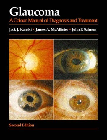
Glaucoma: A Colour Manual Of Diagnosis And Treatment
Anbieter: Romtrade Corp., STERLING HEIGHTS, MI, USA
Verkäuferbewertung 5 von 5 Sternen
Zustand: New. This is a Brand-new US Edition. This Item may be shipped from US or any other country as we have multiple locations worldwide.
-

Introduction to the Philosophy of Science
Anbieter: Revaluation Books, Exeter, Vereinigtes Königreich
Verkäuferbewertung 5 von 5 Sternen
EUR 59,45
EUR 14,48 Versand
Versand von Vereinigtes Königreich nach USAAnzahl: 1 verfügbar
In den WarenkorbPaperback. Zustand: Brand New. 1st edition. 464 pages. 9.50x7.50x1.50 inches. In Stock.
-
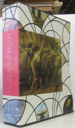
De Thomas Couture a M. Denis - musée départemental 2 tomes
Anbieter: crealivres, La fontennelle, Frankreich
Verkäuferbewertung 5 von 5 Sternen
Zustand: Good. Envoi rapide Bon Etat de l'ensemble emboîtage un peu défraîchie intérieur frais. 28x24x6cm. 1996. Broché + emboîtage cartonné. 350 pages. abondante iconographie noir et blanc et couleurs. Good.
-
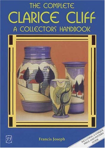
The Complete Clarice Cliff A C
Anbieter: World of Books (was SecondSale), Montgomery, IL, USA
Verkäuferbewertung 5 von 5 Sternen
Zustand: Good. Item in good condition. Textbooks may not include supplemental items i.e. CDs, access codes etc.
-
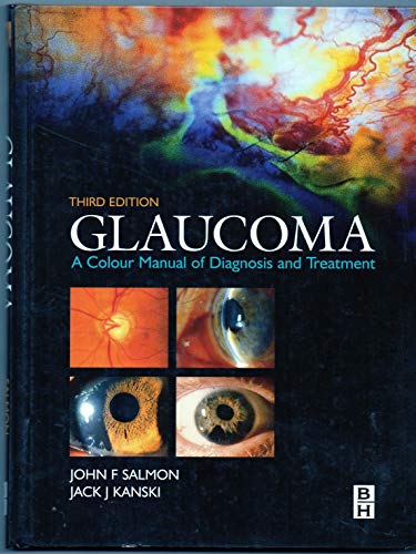
Glaucoma. A Colour Manual of Diagnosis and Treatment. Third Edition.
Sprache: Englisch
Verlag: Butterworth-Heinemann, Edinburgh - London - New York - Oxford,, 2004
ISBN 10: 0750655283 ISBN 13: 9780750655286
Anbieter: Antiquariat Christoph Wilde, Düsseldorf, Deutschland
Verkäuferbewertung 5 von 5 Sternen
VII, 168 S. Ill. Orig.-Pappband. - Sehr guter Zustand innen und außen.
-

THE RUINS OF CARTHAGE, AFRICA - an Original Hand-Coloured Print, Printed in 1839
Sprache: Englisch
Erscheinungsdatum: 1839
Anbieter: K Books Ltd ABA ILAB, York, YORKS, Vereinigtes Königreich
Verbandsmitglied: ABA ILAB PBFA
Verkäuferbewertung 5 von 5 Sternen
EUR 29,83
EUR 22,59 Versand
Versand von Vereinigtes Königreich nach USAAnzahl: 1 verfügbar
In den WarenkorbNo Binding. Zustand: Very Good. J SALMON (illustrator). A splendid original antique hand-coloured print, colouring not contemporary but delicately and expertly executed, mounted (matted) and ready to frame. Shows the ruins 'drawn from Nature by Sir Grenville T Temple, Bart'.
-
TOWN AND HARBOUR OF BONA, AFRICA - an Original Hand-Coloured Print, Printed in 1839
Sprache: Englisch
Erscheinungsdatum: 1839
Anbieter: K Books Ltd ABA ILAB, York, YORKS, Vereinigtes Königreich
Verbandsmitglied: ABA ILAB PBFA
Verkäuferbewertung 5 von 5 Sternen
EUR 29,83
EUR 22,59 Versand
Versand von Vereinigtes Königreich nach USAAnzahl: 1 verfügbar
In den WarenkorbNo Binding. Zustand: Very Good. J SALMON (illustrator). A splendid original antique hand-coloured print, colouring not contemporary but delicately and expertly executed, mounted (matted) and ready to frame. Shows a group of boats with the town in the background 'drawn from Nature by Sir Grenville T Temple, Bart'.
-
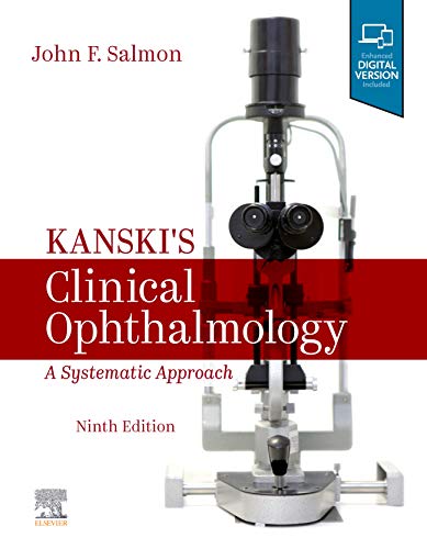
Kanski's Clinical Ophthalmology: A Systematic Approach
Anbieter: Anybook.com, Lincoln, Vereinigtes Königreich
Verkäuferbewertung 5 von 5 Sternen
EUR 103,15
EUR 44,51 Versand
Versand von Vereinigtes Königreich nach USAAnzahl: 1 verfügbar
In den WarenkorbZustand: Good. This is an ex-library book and may have the usual library/used-book markings inside.This book has hardback covers. In good all round condition. No dust jacket. Please note the Image in this listing is a stock photo and may not match the covers of the actual item,2950grams, ISBN:9780702077111.
-

Critical Care Cases
Buch 78 von 208: Oxford Medical PublicationsAnbieter: Revaluation Books, Exeter, Vereinigtes Königreich
Verkäuferbewertung 5 von 5 Sternen
EUR 219,04
EUR 11,58 Versand
Versand von Vereinigtes Königreich nach USAAnzahl: 1 verfügbar
In den WarenkorbPaperback. Zustand: Brand New. 1st edition. 230 pages. 9.25x5.75x0.75 inches. In Stock.
-

Expositio super aphorismo hippocratis "in morbis minus": Repetitio super aphorismo hippocratis "vita brevis"
Anbieter: Agapea Libros, Malaga, MA, Spanien
Verkäuferbewertung 5 von 5 Sternen
Zustand: New. Aquest volum presenta edicions dels dos comentaris hipocrŕtics coneguts d'Arnau. Estudiats conjuntament, ens ofereixen la mostra més autčntica de la valoració real que Arnau féu dels mčrits d'Hipňcrates, de la seva (tal com ell mateix expressŕ en el comentari sobre l'aforisme "In morbis minus") "Perspicacia et plenitudo sententie". A més, quan els llegim segons l'ordre de composició, ens informen sobre el desenvolupament intel lectual d'Arnau quan ensenyava a Montpeller. En el primer comentari, el de l'aforisme II. 34, sembla encara creure que la medicina pot arribar a establir regles terapčutiques que tinguin validesa general, mentre que en el segon, relatiu a l'aforisme "Vita brevis [. . . ]" ha esdevingut menys confiat, més conscient de la contingčncia de la prŕctica mčdica. En la dčcada del 1290 Arnau sembla haver estat madurant com a metge prŕctic. *** Nota: Los envíos a Espańa peninsular, Baleares y Canarias se realizan a través de mensajería urgente. No aceptamos pedidos con destino a Ceuta y Melilla.
-

Traité de chimie organique X: Diacides et polyacydes-Matičres grasses-Dérivés Sulfurés ou séléniés de la fonction acide
Verlag: Masson et Cie, Paris, 1939
Hardcover. Zustand: Good. pp. 807 French.
-
La Société des Aqua-Fortistes français. [ Salon de 1886 - Société des Aquafortistes français ]
Sprache: Französisch
Verlag: La Société des Aqua-Fortistes français, 1886
Anbieter: Librairie du Cardinal, GRADIGNAN, Frankreich
Verkäuferbewertung 5 von 5 Sternen
Erstausgabe Signiert
rigide. Zustand: Bon. 1 vol. in-4 reliure demi-vélin blanc, dos lisse orné en long, reliure signée de Henry Mériot, relieur d'art ŕ Rochefort, La Société des Aqua-Fortistes français, s.d. [ 1886 ], frontispice, 4 pp., 33 ff. n. ch. et 31 planches hors texte sous serpentes Bel exemplaire bien relié (qq. rouss.). Trčs beau recueil bien complet des 32 eaux-fortes par Gustave Greux, L. Ruet, Ch. Courtry, F. Penet, Emile Salmon, Henri Lefort, Mme Louveau-Rouveyre, Albert Duvivier, Laguillermie, Albert Ardail, C. Faivre, Oudart, Beauvais, Léopold Flameng, L. Boulian, L. Margelidon, E. Daumont, Jules Sévrette, J.-E. Buland, P. Huet, Vion, Gaujean, Hélčne Formstecher, L.-F. Penet, Paul Avril, L. Desbrosses, De Billy, Ch. Waltner. Langue: Français.
-
![Bild des Verkäufers für [SALMON'S MAP OF CYPRUS] Survey of Cyprus administration map. Scale of 4 miles to one inch = 1/253440. zum Verkauf von Khalkedon Rare Books ABA, ILAB, IOBA, ESA](https://pictures.abebooks.com/inventory/md/md30943975906.jpg)
[SALMON'S MAP OF CYPRUS] Survey of Cyprus administration map. Scale of 4 miles to one inch = 1/253440.
Verlag: Ordnance Survey, Southampton, 1958
Anbieter: Khalkedon Rare Books ABA, ILAB, IOBA, ESA, Istanbul, Türkei
Verbandsmitglied: ABA ESA ILAB IOBA
Verkäuferbewertung 5 von 5 Sternen
Karte
Soft cover. Zustand: Very Good. 3rd Edition. Revised Third Edition of this rare map of Cyprus, made by Salmon, who was the director of Cypriot land registration and surveys. "Shows grid, district boundaries, heights in feet, railways, roads (2 categories), antiquities, ancient sites.". / "Shows district boundaries, towns and cities, roads (2 categories), railroads, ancient sites and antiquities, and dry streams. Relief is shown by contours, gradient tints, and spot heights. Earlier Edition: 1952.". (OCLC). "In December 1926, in a memorandum to the Colonial Office on vacant surveying positions in the colonies, Palestine and Cyprus were mentioned at the end of a group of Mediterranean colonies; that is there was a group of Mediterranean colonies, and also Cyprus and Palestine [.] Only in 1929 was an Imperial project involving Palestine and Transjordan, brought up at the committee (Colonial Survey Committee). This was the experimental aerial survey for determining the route of the Haifa - Damascus railway, which was presented as a model for mapping from aerial photographs [.] Among the important things reported to the Colonial Survey Committee was the reconnaissance conducted by Colonial Winterbotham, the Chief of the GSGS, in the survey departments of the colonies in 1929, a trip that had been encouraged in the first Conference of Empire Survey Officers in 1928 [.] . how much Salmon [F. J.] expected from Winterbotham's visit to Ceylon a short time before he was to take over the directorship of the small survey department of Cyprus.". (Source: The Survey of Palestine Under the British Mandate, 1920-1948). Original color map. Folded in original wrappers. Fine. Elephant folio. (58 x 89 cm). In English. Survey of Cyprus administration map. Scale of 4 miles to one inch = 1/253440. Compiled and drawn under the direction of F. J. SALMON, (Director of Land Registration and Surveys, Cyprus, 1932). Revised Third Edition. Second in 1950.
-

-
8 Vols Our Beautiful Homeland
Verlag: The Gresham Publishing Company Ltd., London, 1921
Anbieter: Rooke Books PBFA, Bath, Vereinigtes Königreich
Verbandsmitglied: PBFA
Verkäuferbewertung 5 von 5 Sternen
EUR 298,29
EUR 23,16 Versand
Versand von Vereinigtes Königreich nach USAAnzahl: 1 verfügbar
In den WarenkorbCloth. Zustand: Very Good. Ernest W. Haslehust (illustrator). A beautiful illustrated ten volume collection of works from the Our Beautiful Homeland Series. In the publisher's original pictorial cloth bindings.These copies are undated. Dated here using Jisc, from copies held at the National Library of Scotland and the University of Birmingham Libraries.This is a eight-volume set of this charming early 20th-century travel series showcasing the historic towns, rural landscapes, and iconic landmarks of Britain.Each copy of Our Beautiful Homeland features 48 full-page colour plates of watercolours, painted by Ernest W. Haslehust, R.B.A.This set includes volumes exploring: Norwich: Shakespeare Land: The Peak District: The Dukeries, described by Walter Jerrold & R. Murray Gilchrist Exeter: Heart of Wessex: Dartmoor: Bath and Wells, described by Sidney Heath & Arthur L. Salmon Hereford: Chester: Oxford: Warwick & Leamington, described by Charles Edwards, F. D. How & George Morley Canterbury: Winchester: The Isle of Wight: Swanage, described by Edward Thomas, Sidney Heath & Canon Danks York: Ripon and Harrogate: The English Lakes: Scarborough, described by George Benson, A. G. Bradley & R. Murray Gilchrist The Thames: Windsor Castle: Hampton Court: Dickens Land, described by G. E. Mitton, Edward Thomas, Walter Jerrold & J. A. Nicklin Edinburgh: The Scott Country: The Shores of Fife: Loch Lomond: Loch Katrine & The Trossachs, described by John Geddie & George Eyre Todd The Heart of London: Through London"s Highways: In London"s By-Ways: Rambles in Greater London, described by Walter Jerrold In original publisher's cloth bindings. Externally, smart. Slight rubbing and bumping to extremities. Slight age toning to cloth, more so to spines, particularly "Norwich". The odd minor handling mark to boards. slight soiling to cloth. The odd hinge strained, but firm. Internally, generally firmly bound, aside from pages 13-16 in "Oxford", which are fully disbound. Pages bright and clean, if slightly age toned. The odd spot, heavier to first and last few leaves and fore edge. Very Good. book.
-
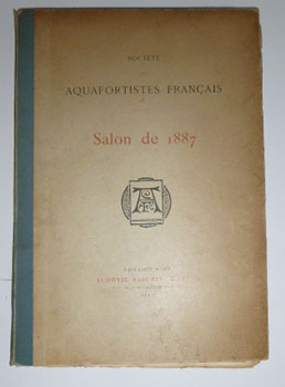
Société des aquafortistes français. Salon de 1887.
Verlag: Paris: Ludovic Baschet, 1887
Anbieter: Wittenborn Art Books, San Francisco, CA, USA
Verkäuferbewertung 5 von 5 Sternen
Zustand: Good. Original qtr. cloth boards. 23 x 33 cm. Sheets loose. 31etchings with a separate text for each work.graveur / peintre / počte : Charles Courtry ; Benjamin Constant ; E. Haraucourt - De Billy ; Ev. Carpentier ; Fernand Icres - L. Penet ; Maignan ; Léonce Larnac - E. Abot ; S. Kuelh ; Armand Silvestre - S. Desbrosses ; Nozal ; Ant. Bunand - J. Sevrette ; R. Gilbert ; Gaston Sevrette - E. Salmon ; Aimé Morot ; E. Pontvoisin - R. Paul Huet ; P. Beaudouin ; Jean Aicard - F. Oudart ; P. Sain ; Clovis Hugues - Manchon ; Haquette ; Paul Guigou - Mathey-Doret ; W. Bouguereau ; Jean Richepin - Decisy ; Marcel Capy ; L. Descaves - Léop. Flameng ; Léop. Flameng ; Henri Lefort - Fornet ; Girardot ; Félix Jeantet - F. Desmoulin ; Carričre ; C. Morice .[1 leaf, 6 pages, 31 leaves, 1 pages, 1] leaf, 62 plates ; 46 cm.OCLC Number: 51422673.Portrait de Charles Courtry gravé par Albert Duvivier.
-
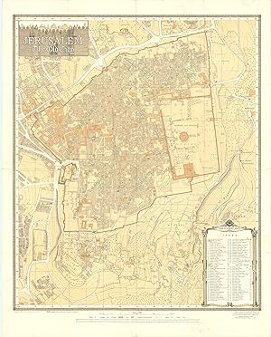
[Map] Palestine of the Old Testament
Verlag: Palestine Survey, (Jaffa), 1944
Anbieter: Dendera, London, Vereinigtes Königreich
Verkäuferbewertung 5 von 5 Sternen
Karte
EUR 387,78
EUR 28,96 Versand
Versand von Vereinigtes Königreich nach USAAnzahl: 1 verfügbar
In den WarenkorbSoft cover. Zustand: Very Good. Colour map backed on to linen, 38 x 61cm, folding down into illustrated tan wraps 12 x 20cm. Map very good with some wear at the folds, and pinholes to corners. Wraps about very good with creasing to the edges and previous owner's contemporary details to the front ("N Pearson(?) / 1944 / Jerusalem"). Compiled, drawn and printed under the direction of F.J. Salmon, Commissioner for Lands & Surveys Palestine 1938; Photo-zincography by Survey of Palestine Jaffa 1938; Reprinted with minor changes, May 1944. Collaborators in compilation include Pere Abel of the Ecole biblique et archeologique francaise, Dr Glueck of the American School of Oriental Research, Prof Klein of the Hebrew University Dept of Antiquities, and the British School of Archaeology. There is the qualification "Some of the identifications are controversial". The map is on a scale of 1:500,000, with an inset continuation on the same scale for Southern Palestine. Features include remains of interest, cities of refuge, and altitude colouring. The ornately decorative border is based on ivories found in the ruins of Ahab's Palace at Samaria, with a different seal identified for each of the corners. The front wrap features an illustration of Abraham's oak at Hebron. Worldcat and Jisc record editions during 1938-72, of which this is a scarce early, possibly 2nd, edition.
-

ARCHIPEL 18 / 1979 COMMERCES et NAVIRES dans les MERS du SUD
Sprache: Französisch
Anbieter: LA FRANCE GALANTE, Saint MARTIN sur LAVEZON, Frankreich
Verkäuferbewertung 5 von 5 Sternen
Couverture souple. Zustand: Comme neuf. Paris . Centre National de la Recherche Scientifique, 1979. Broché 16 x 21 cm , de 318 pages + planches . Sommaire : L'isthme de la Péninsule malaise dans les navigations au long cours. Nouvelles données archéologiques; Les jonques chinoises de haute mer sous les Song et les Yuan; Un vaisseau du XIIIčme . retrourvé avec sa cargaison dans la rade de "Zaitun"; Navigators in Insulinde about A.D>1500; Note sur l'origine nautique du mot jam; Les Portugais dans les mers de l'Archipel au XVIe sičcle; Les premiers voyages portugais ŕ Pasai et ŕ Pégou; Un rčglement de comptes entre Portugais et Javanais dans les mers d l'Indonésie en 1580; Miguel Roxo de Brito's Narrative of his voyage to the Raja Empat (may 1581 - 1582); Chinese trade to Batavia during the days of the V.O.C.; Le rôle des orang laut dans l'histoire du Riau; The Sulu Zone: Commerce and the evolution of a multi-ethnic polity, 1768-1898; Regard nouveau sur les "pirates malais" (lčre moitié du XIXčme sičcle; The Merchant Fleet of Java (1820-1850); A Bugis manuscript about praus; Notes sur l'histoire et la navire long-courrier, odi, aujourd'hui disparu, des Maldives; La mer de Chine méridionale, quelques éléments de géostratégie . Etat proche du neuf .
-

The Old City of Jerusalem.
Verlag: JerusalemCompiled Drawn & Printed under the direction of F.J. Salmon Commissionaer for Lands & Surveys Palestine May ., 1947
Anbieter: Robert Frew Ltd. ABA ILAB, London, Vereinigtes Königreich
Verbandsmitglied: ABA ILAB PBFA
Verkäuferbewertung 5 von 5 Sternen
Karte
EUR 596,58
EUR 11,58 Versand
Versand von Vereinigtes Königreich nach USAAnzahl: 1 verfügbar
In den WarenkorbOriginal lithograph plan of Jerusalem (75 x 60 cm) printed in black, grey and red, surrounded by decorative greek key border, vignette title, and index, folding between publisher's original pale-blue card covers. In excellent condition. This map was compiled, drawn, and printed in Palestine under the direction of Frederick John Salmon, the Commissioner for Lands and Surveys. First published in 1936 with two later editions issued in 1945, a first edition created by Salmon and a second edition with new information supplied by the Department of Antiquities. This is the third edition which is a 'modified reprint,' published in May 1947. Notable sites are identified, with particular emphasis on Temple Mount. The Dome of the Rock, the Al Aqsa Mosque, and Solomon's Stables (now the El-Marwani Mosque), are labelled, among other sites. Sixty-three sites throughout are numerically labelled and correspond with an index in the lower right. Outside the Old City, King David's Tomb and the Church of the Dormition appear on Mt. Zion. Several hospitals, schools, and cemeteries are also identified. Frederick John Salmon (1882 - July 8, 1964) was a British surveyor, foreign service officer, and soldier. He served in the Ceylon Survey from 1908 through 1930, with the exception of serving on the Western Front during World War I. During the war, he made a name for himself by promoting cooperation between surveying and artillery. He was also particularly enthusiastic about printing and distributing updated maps and using aerial photography to update tactical maps. He became a Fellow of the Royal Geographical Society in December 1918. Between 1930 and 1933, Salmon directed the Lands and Survey Departments in Cyprus, but was named Director of the Palestine Survey at the end of 1932. He began work at the Survey of Palestine on March 27, 1933, and began an initiative to begin a modern topographical mapping of Palestine. He was appointed Commissioner for Lands and Surveys of Palestine and as a member of the Advisory Council to the Government of Palestine in 1935. After a thirty-year career surveying sites around the Empire, Salmon retired on July 13, 1938. His cartographic work is part of the collection at the Royal Geographical Society. In 1937, then Commissioner of Lands and Surveys, Lieutenant Colonel F. J. Salmon, described the importance of the department's work with respect to allowing land purchases: "In the Ottoman days, a title to a piece of land in Palestine was a very vague document. There was no survey, recording shape, area or position; the description was usually, to say the least of it, ambiguous, and the extent which was the gauge for taxation, was almost invariably falsified to save the pocket of the owner. Big blocks were, and in areas where there has been no land settlement, still are, shared by large numbers of owners who have no defined boundaries and who often alter the position of their plots from year to year To purchase land from a title owner, or worse still, from an occupier who had no title, was a very uncertain business, and often still is. The difficulty, however, is now being solved, though very slowly, by Land Settlement The claims are recorded and examined by Palestinian Assistant Settlement Officers, while cases of dispute are heard by British Land Settlement Officers Even in areas that are not under Settlement, a land-owner can apply for an authoritative registration of title on a modern survey, but if there is a dispute, this has to be settled by the Land Court, a much slower, more expensive and laborious proceeding than an investigation and judgment by a Settlement Officer". Salmon, F.J. (1937). "The Modern Geography of Palestine". Palestine Exploration Quarterly. 69 (1): 3342.
-
Jerusalem. The Old City.
Verlag: [Tel-Aviv], Survey of Israel, 1967., 1967
Anbieter: Antiquariat INLIBRIS Gilhofer Nfg. GmbH, Vienna, A, Österreich
Verbandsmitglied: ILAB PADA VDA VDAO
Verkäuferbewertung 5 von 5 Sternen
Sepia toned pictographic folding map, 800 x 630 mm. Scale 1:2,500. A finely drawn, detailed plan of Jerusalem's Old City, originally produced by the British surveyor F. J. Salmon and here re-issued by the Survey of Israel, in the wake of the 1967 Six-Day War, when East Jerusalem including the Old City came under Israeli occupation. - Notable sites are identified, with particular emphasis on the Temple Mount. The Dome of the Rock and Solomon's Stables (now the El-Marwani Mosque) are labeled, among other sites. 63 sites throughout are numerically labeled and correspond with an index at lower right. Outside the Old City, King David's Tomb and the Church of the Dormition appear on Mount Zion. Several hospitals, schools, and cemeteries are also identified. - This map was originally compiled, drawn, and printed in British Mandate Palestine under the direction of F. J. Salmon (1882-1964), the Commissioner for Lands and Surveys, in 1936. Further editions were published in 1945 and 1947, including revisions with new information supplied by the government's Department of Antiquities. After Israel captured East Jerusalem in the Six-Day War in 1967, the Survey of Israel republished the map in both English and Hebrew in 1967 and 1970. These later editions are quite rare in either language. - Occasional very slight foxing, but generally in fine condition.

![Bild des Verkäufers für La Société des Aqua-Fortistes français. [ Salon de 1886 - Société des Aquafortistes français ] zum Verkauf von Librairie du Cardinal](https://pictures.abebooks.com/inventory/md/md31071161784.jpg)

![Bild des Verkäufers für [Map] Palestine of the Old Testament zum Verkauf von Dendera](https://pictures.abebooks.com/inventory/md/md31041886078.jpg)