
Gesamtpreis (1 Artikel Artikel):
Versandziel:

edited jacobus (24 Ergebnisse)
Direkt zu den wichtigsten Suchergebnissen
Suchfilter
Produktart
- Alle Product Types
- Bücher (11)
- Magazine & Zeitschriften (Keine weiteren Ergebnisse entsprechen dieser Verfeinerung)
- Comics (Keine weiteren Ergebnisse entsprechen dieser Verfeinerung)
- Noten (Keine weiteren Ergebnisse entsprechen dieser Verfeinerung)
- Kunst, Grafik & Poster (Keine weiteren Ergebnisse entsprechen dieser Verfeinerung)
- Fotografien (Keine weiteren Ergebnisse entsprechen dieser Verfeinerung)
- Karten (13)
- Manuskripte & Papierantiquitäten (Keine weiteren Ergebnisse entsprechen dieser Verfeinerung)
Zustand Mehr dazu
- Neu (6)
- Wie Neu, Sehr Gut oder Gut Bis Sehr Gut (2)
- Gut oder Befriedigend (3)
- Ausreichend oder Schlecht (Keine weiteren Ergebnisse entsprechen dieser Verfeinerung)
- Wie beschrieben (13)
Einband
Weitere Eigenschaften
- Erstausgabe (2)
- Signiert (Keine weiteren Ergebnisse entsprechen dieser Verfeinerung)
- Schutzumschlag (1)
- Angebotsfoto (15)
Sprache (3)
Preis
- Beliebiger Preis
- Weniger als EUR 20 (Keine weiteren Ergebnisse entsprechen dieser Verfeinerung)
- EUR 20 bis EUR 45
- Mehr als EUR 45
Gratisversand
- Kostenloser Versand nach USA (Keine weiteren Ergebnisse entsprechen dieser Verfeinerung)
Land des Verkäufers
Verkäuferbewertung
-

The Familiar Letters of James Howell, Historiogropher Royal to Charles II
Verlag: David Nutt, 1892
Anbieter: siop lyfrau'r hen bost, Blaenau Ffestiniog, Vereinigtes Königreich
Verkäuferbewertung 5 von 5 Sternen

EUR 29,83
EUR 11,58 Versand
Versand von Vereinigtes Königreich nach USAAnzahl: 1 verfügbar
In den WarenkorbHardcover. Zustand: Good.
-

Revolutionary War Records of Fairfield, Connecticut
Anbieter: Janaway Publishing Inc., Santa Maria, CA, USA
Verkäuferbewertung 2 von 5 Sternen

Hardcover. Zustand: New. No Jacket. Covering hundreds of Revolutionary War veterans of Fairfield, Connecticut, this book contains abstracts of pension records that were originally on file at the old Pension Bureau in Washington, D.C., including soldiersż and widowsż applications, bounty land warrants, and rejected pension applications. Packed with information--much of it deriving from affidavits provided by friends and relatives in support of the veteranżs application for a pension--the abstracts include some or all of the following data: name of pension applicant, place and date of birth, age, dates of enlistment and discharge, service record (sometimes very detailed but always interesting), place of residence before and after service, distinguishing characteristics, name of spouse, date of marriage, names of children, and names of parents and other family members. Technological advances notwithstanding, nowhere else can the researcher find so much information so quickly on Fairfieldżs Revolutionary War pensioners. In addition to the pension abstracts, this work also contains an exhaustive collection of muster rolls of Fairfield soldiers in the militia and Continental Army. Roll by roll, Fairfield men are identified by name, rank, and dates of enlistment and discharge, and occasionally by other details such as company, regiment, engagements, injuries, and pay. With references to about 7,500 individuals, the muster rolls and pension abstracts give a comprehensive picture of Fairfieldżs contribution to the war effort. Both sections of the book are completely indexed, with soldiers set off in a separate index. Readers may be surprised to learn that this work was originally published in 1932 as Volume III of Donald Lines Jacobusż History and Genealogy of the Families of Old Fairfield. Unlike the first two volumes of that famous compendium, however, it has never been reprinted. Not a compendium of family histories but a collection of source records, it stands completely independent of the first two volumes and is available now as a separate and distinct contribution to Revolutionary War genealogy. 533 pp. indexed. (1932) repr. 2004. [G-2984].
-

The Arrangement of Atoms in Space
Sprache: Englisch
Verlag: Cambridge University Press, 2014
ISBN 10: 1108080294 ISBN 13: 9781108080293
Anbieter: Revaluation Books, Exeter, Vereinigtes Königreich
Verkäuferbewertung 5 von 5 Sternen
EUR 60,60
EUR 11,58 Versand
Versand von Vereinigtes Königreich nach USAAnzahl: 2 verfügbar
In den WarenkorbPaperback. Zustand: Brand New. 228 pages. 8.50x5.50x0.58 inches. In Stock.
-

Jacobus Voorda. Dictata ad ius hodiernum. Lectures on the contemporary law given by Jacobus Voorda 1698-1768 at the University of Utrecht (2 volumes)
Sprache: Englisch
Verlag: Amsterdam : Royal Netherlands Academy of Art and Sciences, 2005
ISBN 10: 9069844435 ISBN 13: 9789069844435
Zustand: Good. 2 uniform gilt lettered red cloths, facsimiles of old letters, some photographs, 8vo.
-

Leading in a VUCA World: Integrating Leadership, Discernment and Spirituality
Buch 122 von 214: Contributions to Management ScienceAnbieter: Revaluation Books, Exeter, Vereinigtes Königreich
Verkäuferbewertung 5 von 5 Sternen
EUR 87,03
EUR 11,58 Versand
Versand von Vereinigtes Königreich nach USAAnzahl: 2 verfügbar
In den WarenkorbHardcover. Zustand: Brand New. 228 pages. 9.25x6.10x0.71 inches. In Stock.
-

Body/Politics: Women and the Discourses of Science
Anbieter: Revaluation Books, Exeter, Vereinigtes Königreich
Verkäuferbewertung 5 von 5 Sternen
EUR 88,12
EUR 11,58 Versand
Versand von Vereinigtes Königreich nach USAAnzahl: 2 verfügbar
In den WarenkorbPaperback. Zustand: Brand New. 1st edition. 206 pages. 9.25x6.25x0.50 inches. In Stock.
-

Neuropsychological Conditions Across the Lifespan
Sprache: Englisch
Verlag: Cambridge University Press, 2018
ISBN 10: 1107190010 ISBN 13: 9781107190016
Anbieter: Kennys Bookstore, Olney, MD, USA
Verkäuferbewertung 5 von 5 Sternen
EUR 215,69
EUR 9,07 Versand
Versand innerhalb von USAAnzahl: Mehr als 20 verfügbar
In den WarenkorbZustand: New. 2018. Illustrated. hardcover. . . . . . Books ship from the US and Ireland.
-

Pediatric Neuropsychological Intervention: A Critical Review of Science & Practice
Sprache: Englisch
Verlag: Cambridge University Press, 2007
ISBN 10: 0521875501 ISBN 13: 9780521875509
Anbieter: Kennys Bookstore, Olney, MD, USA
Verkäuferbewertung 5 von 5 Sternen
EUR 245,51
EUR 9,07 Versand
Versand innerhalb von USAAnzahl: Mehr als 20 verfügbar
In den WarenkorbZustand: New. This 2007 volume provides an overview of evidence-based treatments for common pediatric brain-behavior disorders. Editor(s): Hunter, Scott J.; Donders, Jacobus. Num Pages: 524 pages, 6 b/w illus. 14 colour illus. 14 tables. BIC Classification: MJN; MJW. Category: (P) Professional & Vocational. Dimension: 247 x 174 x 29. Weight in Grams: 1120. . 2007. Illustrated. hardcover. . . . . Books ship from the US and Ireland.
-

Armed Forces And Society | Sociological Essays
Verlag: Published by Mouton Publishers, The Hague, First Edition . 1968., 1968
Anbieter: Little Stour Books PBFA Member, Canterbury, Vereinigtes Königreich
Verbandsmitglied: PBFA
Verkäuferbewertung 5 von 5 Sternen
Erstausgabe
EUR 53,69
EUR 34,75 Versand
Versand von Vereinigtes Königreich nach USAAnzahl: 1 verfügbar
In den WarenkorbZustand: Very Good. First edition hard back binding in publisher's original black cloth covers, gilt title and author lettering to the spine. 8vo. 10'' x 6˝''. Contains 386 printed pages of English text. Two ink names inside. Near Fine condition book in Very Good condition dust wrapper with small tear across the top edge. Dust wrapper supplied in archive acetate film protection, it does not adhere to the book or to the dust wrapper. Member of the P.B.F.A. MILITARY (Armed Warfare).
-
![Beispielbild für Juden und Christen unter römischer Herrschaft: Selbstwahrnehmung und Fremdwahrnehmung in den ersten beiden Jahrhunderten n.Chr. [Schriften des Institutum Judaicum Delitzschianum, Band 10] zum Verkauf von ERIC CHAIM KLINE, BOOKSELLER (ABAA ILAB)](https://pictures.abebooks.com/isbn/9783525542095-de-300.jpg)
Juden und Christen unter römischer Herrschaft: Selbstwahrnehmung und Fremdwahrnehmung in den ersten beiden Jahrhunderten n.Chr. [Schriften des Institutum Judaicum Delitzschianum, Band 10]
Sprache: Deutsch
Verlag: Vandenhoeck & Ruprecht, Göttingen, 2015
ISBN 10: 3525542097 ISBN 13: 9783525542095
Anbieter: ERIC CHAIM KLINE, BOOKSELLER (ABAA ILAB), Santa Monica, CA, USA
Verkäuferbewertung 3 von 5 Sternen

Erstausgabe
Hardcover. Zustand: Like new. First edition. Quarto (9 5/8 x 6 3/4"). 224pp. Original printed paper covered boards. "Socio-religious communities obtain their identity by the interplay of self-perception and the perception of others. Surrounding convictions as well as cultural and social practices are assumed by such communities; other convictions and practices are strictly repudiated. They can evolve into the external boundary markers of in-groups and, thus, into exemption criteria for members of out-groups. This also applies to Judaism and nascent Christianity in the first and early second centuries C.E. In this volume, ten renowned scholars discuss internal and external forms of religious identity processing through analysis of early Jewish and early Christian sources." (From the Publishers). Text in German. Binding and interior in like new condition.
-
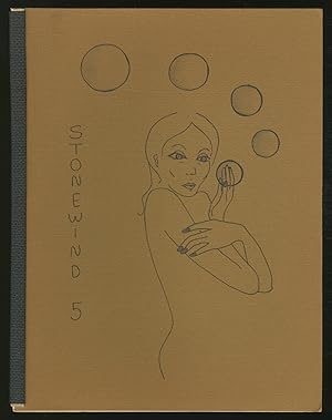
Stone Wind 5
Verlag: Stone Wind Press, Northeastern Illinois Univeristy, 1973
Anbieter: Between the Covers-Rare Books, Inc. ABAA, Gloucester City, NJ, USA
Verbandsmitglied: ABAA ESA ILAB IOBA
Verkäuferbewertung 5 von 5 Sternen
Softcover. Zustand: Near Fine. Magazine. Cover by Carla Evonne. Quarto. Stiff illustrate wraps. Fine. Contributors include Kanabus, Ted Berrigan, Clark Coolidge, Alice Notley, Anselm Hollo, Andrei Codrescu, Al Simmons, Dick Gallup, Lorenzo Thomas, Donald Cameron, Dave Morice, Neil Hackman, Gilbert Bike, Sue Lytle, John Paul, Art Lange, Allan Kornblum, Terry Jacobus and shabazz. *OCLC* locates four copies.
-
![Bild des Verkäufers für [Germany] Quarta Europe Tabula zum Verkauf von Daniel Crouch Rare Books Ltd](https://pictures.abebooks.com/inventory/md/md31456530913.jpg)
[Germany] Quarta Europe Tabula
Verlag: Lienhart Holle, 16 July 1482., Ulm,, 1482
Anbieter: Daniel Crouch Rare Books Ltd, London, Vereinigtes Königreich
Verbandsmitglied: ABA ILAB PBFA
Verkäuferbewertung 4 von 5 Sternen

Karte
EUR 14.317,98
EUR 23,17 Versand
Versand von Vereinigtes Königreich nach USAAnzahl: 1 verfügbar
In den WarenkorbA striking map of Germany from the 1482 Ulm Ptolemy Woodcut map, fine original hand-colour, minor losses to lower gutter and edges skilfully repaired. The map was published in the first atlas printed outside Italy and the first atlas illustrated with woodcut maps. In 1482 Lienhart Holle in Ulm published a revised edition of Ptolemy's Geographia with the reworking of the Ptolemaic corpus by the cartographer Nicolaus Germanus Donis. The atlas included five additional "modern" maps: Italy, Spain, France, Scandinavia, and the Holy Land. The atlas would be the first book printed by Lienhart Holle, however, it would appear that the venture proved ruinously expensive and his business would go bankrupt shortly after publication. The remaining sheets, the woodblocks and the types passed to Johann Reger in Ulm, who reissued the work in 1486. As well as the modern maps the atlas bears some other notable first. It was the first time that maps were signed by the artist responsible for the woodcutting; in this case Johannes of Armsheim, who signed the world map, and incorporated a backwards N into the woodcut text on each map. It is also the first to print the accompanying text on the verso of the map to which it refers. Another important feature of the Ulm editions is the introduction of the publisher's colouring upon the maps. Maps from 1482 usually have a rich blue colour in the sea which was replaced with a soft brown colour in 1486. Campbell, T., 'Earliest Printed Maps', p. 179-210; Schreiber 5032; Skelton, R.A., Bibliographical note prefixed to the facsimile of the 1482 Ulm Ptolemy.
-
[Africa] Quarta et Ultima Affrice Tabula.
Verlag: Lienhart Holle, 16 July 1482., Ulm,, 1482
Anbieter: Daniel Crouch Rare Books Ltd, London, Vereinigtes Königreich
Verbandsmitglied: ABA ILAB PBFA
Verkäuferbewertung 4 von 5 Sternen
Karte
EUR 35.794,95
EUR 23,17 Versand
Versand von Vereinigtes Königreich nach USAAnzahl: 1 verfügbar
In den WarenkorbA striking map of Africa from the 1482 Ulm Ptolemy Woodcut map, fine original hand-colour, minor losses to gutters skilfully repaired. The map was published in the first atlas printed outside Italy and the first atlas illustrated with woodcut maps. In 1482 Lienhart Holle in Ulm published a revised edition of Ptolemy's Geographia with the reworking of the Ptolemaic corpus by the cartographer Nicolaus Germanus Donis. The atlas included five additional "modern" maps: Italy, Spain, France, Scandinavia, and the Holy Land. The atlas would be the first book printed by Lienhart Holle, however, it would appear that the venture proved ruinously expensive and his business would go bankrupt shortly after publication. The remaining sheets, the woodblocks and the types passed to Johann Reger in Ulm, who reissued the work in 1486. As well as the modern maps the atlas bears some other notable first. It was the first time that maps were signed by the artist responsible for the woodcutting; in this case Johannes of Armsheim, who signed the world map, and incorporated a backwards N into the woodcut text on each map. It is also the first to print the accompanying text on the verso of the map to which it refers. Another important feature of the Ulm editions is the introduction of the publisher's colouring upon the maps. Maps from 1482 usually have a rich blue colour in the sea which was replaced with a soft brown colour in 1486. Campbell, T., 'Earliest Printed Maps', p. 179-210; Schreiber 5032; Skelton, R.A., Bibliographical note prefixed to the facsimile of the 1482 Ulm Ptolemy.
-
[North Africa, Sardinia and Sicily] Secunda Affrice Tabula.
Verlag: Lienhart Holle, 16 July 1482., Ulm,, 1482
Anbieter: Daniel Crouch Rare Books Ltd, London, Vereinigtes Königreich
Verbandsmitglied: ABA ILAB PBFA
Verkäuferbewertung 4 von 5 Sternen
Karte
EUR 8.948,74
EUR 23,17 Versand
Versand von Vereinigtes Königreich nach USAAnzahl: 1 verfügbar
In den WarenkorbA striking map of North Africa, Sardinia and Sicily from the 1482 Ulm Ptolemy Woodcut map, fine original hand-colour, minor losses to top and bottom margins skilfully repaired. The map was published in the first atlas printed outside Italy and the first atlas illustrated with woodcut maps. In 1482 Lienhart Holle in Ulm published a revised edition of Ptolemy's Geographia with the reworking of the Ptolemaic corpus by the cartographer Nicolaus Germanus Donis. The atlas included five additional "modern" maps: Italy, Spain, France, Scandinavia, and the Holy Land. The atlas would be the first book printed by Lienhart Holle, however, it would appear that the venture proved ruinously expensive and his business would go bankrupt shortly after publication. The remaining sheets, the woodblocks and the types passed to Johann Reger in Ulm, who reissued the work in 1486. As well as the modern maps the atlas bears some other notable first. It was the first time that maps were signed by the artist responsible for the woodcutting; in this case Johannes of Armsheim, who signed the world map, and incorporated a backwards N into the woodcut text on each map. It is also the first to print the accompanying text on the verso of the map to which it refers. Another important feature of the Ulm editions is the introduction of the publisher's colouring upon the maps. Maps from 1482 usually have a rich blue colour in the sea which was replaced with a soft brown colour in 1486. Campbell, T., 'Earliest Printed Maps', p. 179-210; Schreiber 5032; Skelton, R.A., Bibliographical note prefixed to the facsimile of the 1482 Ulm Ptolemy.
-
[Modern Holy Land]
Verlag: Lienhart Holle, 16 July 1482., Ulm,, 1482
Anbieter: Daniel Crouch Rare Books Ltd, London, Vereinigtes Königreich
Verbandsmitglied: ABA ILAB PBFA
Verkäuferbewertung 4 von 5 Sternen
Karte
EUR 44.743,69
EUR 23,17 Versand
Versand von Vereinigtes Königreich nach USAAnzahl: 1 verfügbar
In den WarenkorbA striking map of the modern Holy Land from the 1482 Ulm Ptolemy Woodcut map, fine original hand-colour, old repairs to lower margins. The map was published in the first atlas printed outside Italy and the first atlas illustrated with woodcut maps. In 1482 Lienhart Holle in Ulm published a revised edition of Ptolemy's Geographia with the reworking of the Ptolemaic corpus by the cartographer Nicolaus Germanus Donis. The atlas included five additional "modern" maps: Italy, Spain, France, Scandinavia, and the Holy Land. The atlas would be the first book printed by Lienhart Holle, however, it would appear that the venture proved ruinously expensive and his business would go bankrupt shortly after publication. The remaining sheets, the woodblocks and the types passed to Johann Reger in Ulm, who reissued the work in 1486. As well as the modern maps the atlas bears some other notable first. It was the first time that maps were signed by the artist responsible for the woodcutting; in this case Johannes of Armsheim, who signed the world map, and incorporated a backwards N into the woodcut text on each map. It is also the first to print the accompanying text on the verso of the map to which it refers. Another important feature of the Ulm editions is the introduction of the publisher's colouring upon the maps. Maps from 1482 usually have a rich blue colour in the sea which was replaced with a soft brown colour in 1486. ?The Map One of the "modern maps" included in the Ulm edition shows the Holy Land oriented to the southeast, as shown by the sloping lines of latitude above the image, stretching from Gaza in the south to Sidon in the north and extending into the Trans-Jordananian region. The territories of the Twelve Tribes of Israel are delineated, and a few small vignettes represent scenes from scripture, such as Jacob pitching his tent his tent in Salem (Genesis 33:18) and King David's relocation to Hebron on the direct orders of God (II Samuel 2:1). It is based on a manuscript map, originally drafted by Pietro Vesconte and published by Marino Sanunto around 1320, and later updated by Germanus in 1482; it appeared in printed form in the Rome Ptolemy of 1478 and then both Ulm editions. In the water to the south of Carmel, the island of Atlit is labelled the "Castle of the Pilgrims", after the Crusader fortress built there in 1218, and to the north of Jaffa, the smaller island of Assur appears. Although this version displays notable improvements from the original map, there are nonetheless many errors, such as the size and shape of the mountains, and the scale of the River Jordan. Campbell, T., 'Earliest Printed Maps', p. 179-210; Schreiber 5032; Skelton, R.A., Bibliographical note prefixed to the facsimile of the 1482 Ulm Ptolemy.
-
![Bild des Verkäufers für [India] Decima Asie tabula. zum Verkauf von Daniel Crouch Rare Books Ltd](https://pictures.abebooks.com/inventory/md/md31456520356.jpg)
[India] Decima Asie tabula.
Verlag: Lienhart Holle, 16 July 1482., Ulm,, 1482
Anbieter: Daniel Crouch Rare Books Ltd, London, Vereinigtes Königreich
Verbandsmitglied: ABA ILAB PBFA
Verkäuferbewertung 4 von 5 Sternen
Karte
EUR 44.743,69
EUR 23,17 Versand
Versand von Vereinigtes Königreich nach USAAnzahl: 1 verfügbar
In den WarenkorbA striking map of India from the 1482 Ulm Ptolemy Woodcut map, fine original hand-colour, a few minor worm holes. The map was published in the first atlas printed outside Italy and the first atlas illustrated with woodcut maps. In 1482 Lienhart Holle in Ulm published a revised edition of Ptolemy's Geographia with the reworking of the Ptolemaic corpus by the cartographer Nicolaus Germanus Donis. The atlas included five additional "modern" maps: Italy, Spain, France, Scandinavia, and the Holy Land. The atlas would be the first book printed by Lienhart Holle, however, it would appear that the venture proved ruinously expensive and his business would go bankrupt shortly after publication. The remaining sheets, the woodblocks and the types passed to Johann Reger in Ulm, who reissued the work in 1486. As well as the modern maps the atlas bears some other notable first. It was the first time that maps were signed by the artist responsible for the woodcutting; in this case Johannes of Armsheim, who signed the world map, and incorporated a backwards N into the woodcut text on each map. It is also the first to print the accompanying text on the verso of the map to which it refers. Another important feature of the Ulm editions is the introduction of the publisher's colouring upon the maps. Maps from 1482 usually have a rich blue colour in the sea which was replaced with a soft brown colour in 1486. Campbell, T., 'Earliest Printed Maps', p. 179-210; Schreiber 5032; Skelton, R.A., Bibliographical note prefixed to the facsimile of the 1482 Ulm Ptolemy.
-
![Bild des Verkäufers für [Balkans] Nona Europe tabula. zum Verkauf von Daniel Crouch Rare Books Ltd](https://pictures.abebooks.com/inventory/md/md31456521245.jpg)
[Balkans] Nona Europe tabula.
Verlag: Lienhart Holle, 16 July 1482., Ulm,, 1482
Anbieter: Daniel Crouch Rare Books Ltd, London, Vereinigtes Königreich
Verbandsmitglied: ABA ILAB PBFA
Verkäuferbewertung 4 von 5 Sternen
Karte
EUR 14.317,98
EUR 23,17 Versand
Versand von Vereinigtes Königreich nach USAAnzahl: 1 verfügbar
In den WarenkorbA striking map of Balkans from the 1482 Ulm Ptolemy Woodcut map, fine original hand-colour. The map was published in the first atlas printed outside Italy and the first atlas illustrated with woodcut maps. In 1482 Lienhart Holle in Ulm published a revised edition of Ptolemy's Geographia with the reworking of the Ptolemaic corpus by the cartographer Nicolaus Germanus Donis. The atlas included five additional "modern" maps: Italy, Spain, France, Scandinavia, and the Holy Land. The atlas would be the first book printed by Lienhart Holle, however, it would appear that the venture proved ruinously expensive and his business would go bankrupt shortly after publication. The remaining sheets, the woodblocks and the types passed to Johann Reger in Ulm, who reissued the work in 1486. As well as the modern maps the atlas bears some other notable first. It was the first time that maps were signed by the artist responsible for the woodcutting; in this case Johannes of Armsheim, who signed the world map, and incorporated a backwards N into the woodcut text on each map. It is also the first to print the accompanying text on the verso of the map to which it refers. Another important feature of the Ulm editions is the introduction of the publisher's colouring upon the maps. Maps from 1482 usually have a rich blue colour in the sea which was replaced with a soft brown colour in 1486. Campbell, T., 'Earliest Printed Maps', p. 179-210; Schreiber 5032; Skelton, R.A., Bibliographical note prefixed to the facsimile of the 1482 Ulm Ptolemy.
-
[Balkans] Nona Europe tabula.
Verlag: Lienhart Holle, 16 July 1482., Ulm,, 1482
Anbieter: Daniel Crouch Rare Books Ltd, London, Vereinigtes Königreich
Verbandsmitglied: ABA ILAB PBFA
Verkäuferbewertung 4 von 5 Sternen
Karte
EUR 17.897,48
EUR 23,17 Versand
Versand von Vereinigtes Königreich nach USAAnzahl: 1 verfügbar
In den WarenkorbA striking map of Balkans from the 1482 Ulm Ptolemy Woodcut map, fine original hand-colour, minor losses to higher and lower gutters skilfully repaired The map was published in the first atlas printed outside Italy and the first atlas illustrated with woodcut maps. In 1482 Lienhart Holle in Ulm published a revised edition of Ptolemy's Geographia with the reworking of the Ptolemaic corpus by the cartographer Nicolaus Germanus Donis. The atlas included five additional "modern" maps: Italy, Spain, France, Scandinavia, and the Holy Land. The atlas would be the first book printed by Lienhart Holle, however, it would appear that the venture proved ruinously expensive and his business would go bankrupt shortly after publication. The remaining sheets, the woodblocks and the types passed to Johann Reger in Ulm, who reissued the work in 1486. As well as the modern maps the atlas bears some other notable first. It was the first time that maps were signed by the artist responsible for the woodcutting; in this case Johannes of Armsheim, who signed the world map, and incorporated a backwards N into the woodcut text on each map. It is also the first to print the accompanying text on the verso of the map to which it refers. Another important feature of the Ulm editions is the introduction of the publisher's colouring upon the maps. Maps from 1482 usually have a rich blue colour in the sea which was replaced with a soft brown colour in 1486. Campbell, T., 'Earliest Printed Maps', p. 179-210; Schreiber 5032; Skelton, R.A., Bibliographical note prefixed to the facsimile of the 1482 Ulm Ptolemy.
-
[Himilayas and Central Asia] Octava Asie tabula.
Verlag: Lienhart Holle, 16 July 1482., Ulm,, 1482
Anbieter: Daniel Crouch Rare Books Ltd, London, Vereinigtes Königreich
Verbandsmitglied: ABA ILAB PBFA
Verkäuferbewertung 4 von 5 Sternen
Karte
EUR 10.738,49
EUR 23,17 Versand
Versand von Vereinigtes Königreich nach USAAnzahl: 1 verfügbar
In den WarenkorbA striking map of the Himilayas and Central Asia and China from the 1482 Ulm Ptolemy Woodcut map, fine original hand-colour, a few worm holes to gutters skilfully repaired. The map was published in the first atlas printed outside Italy and the first atlas illustrated with woodcut maps. In 1482 Lienhart Holle in Ulm published a revised edition of Ptolemy's Geographia with the reworking of the Ptolemaic corpus by the cartographer Nicolaus Germanus Donis. The atlas included five additional "modern" maps: Italy, Spain, France, Scandinavia, and the Holy Land. The atlas would be the first book printed by Lienhart Holle, however, it would appear that the venture proved ruinously expensive and his business would go bankrupt shortly after publication. The remaining sheets, the woodblocks and the types passed to Johann Reger in Ulm, who reissued the work in 1486. As well as the modern maps the atlas bears some other notable first. It was the first time that maps were signed by the artist responsible for the woodcutting; in this case Johannes of Armsheim, who signed the world map, and incorporated a backwards N into the woodcut text on each map. It is also the first to print the accompanying text on the verso of the map to which it refers. Another important feature of the Ulm editions is the introduction of the publisher's colouring upon the maps. Maps from 1482 usually have a rich blue colour in the sea which was replaced with a soft brown colour in 1486. Campbell, T., 'Earliest Printed Maps', p. 179-210; Schreiber 5032; Skelton, R.A., Bibliographical note prefixed to the facsimile of the 1482 Ulm Ptolemy.
-
[Central Asia and China] Septima Asie tabula.
Verlag: Lienhart Holle, 16 July 1482., Ulm,, 1482
Anbieter: Daniel Crouch Rare Books Ltd, London, Vereinigtes Königreich
Verbandsmitglied: ABA ILAB PBFA
Verkäuferbewertung 4 von 5 Sternen
Karte
EUR 14.317,98
EUR 23,17 Versand
Versand von Vereinigtes Königreich nach USAAnzahl: 1 verfügbar
In den WarenkorbA striking map of Central Asia and China from the 1482 Ulm Ptolemy Woodcut map, fine original hand-colour, old repair to bottom of gutter, minor losses to top gutter skilfully repaired. The map was published in the first atlas printed outside Italy and the first atlas illustrated with woodcut maps. In 1482 Lienhart Holle in Ulm published a revised edition of Ptolemy's Geographia with the reworking of the Ptolemaic corpus by the cartographer Nicolaus Germanus Donis. The atlas included five additional "modern" maps: Italy, Spain, France, Scandinavia, and the Holy Land. The atlas would be the first book printed by Lienhart Holle, however, it would appear that the venture proved ruinously expensive and his business would go bankrupt shortly after publication. The remaining sheets, the woodblocks and the types passed to Johann Reger in Ulm, who reissued the work in 1486. As well as the modern maps the atlas bears some other notable first. It was the first time that maps were signed by the artist responsible for the woodcutting; in this case Johannes of Armsheim, who signed the world map, and incorporated a backwards N into the woodcut text on each map. It is also the first to print the accompanying text on the verso of the map to which it refers. Another important feature of the Ulm editions is the introduction of the publisher's colouring upon the maps. Maps from 1482 usually have a rich blue colour in the sea which was replaced with a soft brown colour in 1486. Campbell, T., 'Earliest Printed Maps', p. 179-210; Schreiber 5032; Skelton, R.A., Bibliographical note prefixed to the facsimile of the 1482 Ulm Ptolemy.
-
[Arabia] Sexta Asie Tabula.
Verlag: Lienhart Holle, 16 July 1482., Ulm,, 1482
Anbieter: Daniel Crouch Rare Books Ltd, London, Vereinigtes Königreich
Verbandsmitglied: ABA ILAB PBFA
Verkäuferbewertung 4 von 5 Sternen
Karte
EUR 178.974,77
EUR 23,17 Versand
Versand von Vereinigtes Königreich nach USAAnzahl: 1 verfügbar
In den WarenkorbA striking map of Arabia from the 1482 Ulm Ptolemy Woodcut map, fine original hand-colour, old repair to bottom of gutter, minor losses to top gutter skilfully repaired. The map was published in the first atlas printed outside Italy and the first atlas illustrated with woodcut maps. In 1482 Lienhart Holle in Ulm published a revised edition of Ptolemy's Geographia with the reworking of the Ptolemaic corpus by the cartographer Nicolaus Germanus Donis. The atlas included five additional "modern" maps: Italy, Spain, France, Scandinavia, and the Holy Land. The atlas would be the first book printed by Lienhart Holle, however, it would appear that the venture proved ruinously expensive and his business would go bankrupt shortly after publication. The remaining sheets, the woodblocks and the types passed to Johann Reger in Ulm, who reissued the work in 1486. As well as the modern maps the atlas bears some other notable first. It was the first time that maps were signed by the artist responsible for the woodcutting; in this case Johannes of Armsheim, who signed the world map, and incorporated a backwards N into the woodcut text on each map. It is also the first to print the accompanying text on the verso of the map to which it refers. Another important feature of the Ulm editions is the introduction of the publisher's colouring upon the maps. Maps from 1482 usually have a rich blue colour in the sea which was replaced with a soft brown colour in 1486. Campbell, T., 'Earliest Printed Maps', p. 179-210; Schreiber 5032; Skelton, R.A., Bibliographical note prefixed to the facsimile of the 1482 Ulm Ptolemy.
-
![Bild des Verkäufers für [Pakistan] Nona Asie tabula. zum Verkauf von Daniel Crouch Rare Books Ltd](https://pictures.abebooks.com/inventory/md/md31456528943.jpg)
[Pakistan] Nona Asie tabula.
Verlag: Lienhart Holle, 16 July 1482., Ulm,, 1482
Anbieter: Daniel Crouch Rare Books Ltd, London, Vereinigtes Königreich
Verbandsmitglied: ABA ILAB PBFA
Verkäuferbewertung 4 von 5 Sternen
Karte
EUR 14.317,98
EUR 23,17 Versand
Versand von Vereinigtes Königreich nach USAAnzahl: 1 verfügbar
In den WarenkorbA striking map of Pakistan from the 1482 Ulm Ptolemy Woodcut map, fine original hand-colour, a few minor worm holes. The map was published in the first atlas printed outside Italy and the first atlas illustrated with woodcut maps. In 1482 Lienhart Holle in Ulm published a revised edition of Ptolemy's Geographia with the reworking of the Ptolemaic corpus by the cartographer Nicolaus Germanus Donis. The atlas included five additional "modern" maps: Italy, Spain, France, Scandinavia, and the Holy Land. The atlas would be the first book printed by Lienhart Holle, however, it would appear that the venture proved ruinously expensive and his business would go bankrupt shortly after publication. The remaining sheets, the woodblocks and the types passed to Johann Reger in Ulm, who reissued the work in 1486. As well as the modern maps the atlas bears some other notable first. It was the first time that maps were signed by the artist responsible for the woodcutting; in this case Johannes of Armsheim, who signed the world map, and incorporated a backwards N into the woodcut text on each map. It is also the first to print the accompanying text on the verso of the map to which it refers. Another important feature of the Ulm editions is the introduction of the publisher's colouring upon the maps. Maps from 1482 usually have a rich blue colour in the sea which was replaced with a soft brown colour in 1486. Campbell, T., 'Earliest Printed Maps', p. 179-210; Schreiber 5032; Skelton, R.A., Bibliographical note prefixed to the facsimile of the 1482 Ulm Ptolemy.
-
[Southeast Asia] Undecima Asie tabula.
Verlag: Lienhart Holle, 16 July 1482., Ulm,, 1482
Anbieter: Daniel Crouch Rare Books Ltd, London, Vereinigtes Königreich
Verbandsmitglied: ABA ILAB PBFA
Verkäuferbewertung 4 von 5 Sternen
Karte
EUR 44.743,69
EUR 23,17 Versand
Versand von Vereinigtes Königreich nach USAAnzahl: 1 verfügbar
In den WarenkorbA striking map of Southeast Asia from the 1482 Ulm Ptolemy Woodcut map, fine original hand-colour, a few minor worm holes. The map was published in the first atlas printed outside Italy and the first atlas illustrated with woodcut maps. In 1482 Lienhart Holle in Ulm published a revised edition of Ptolemy's Geographia with the reworking of the Ptolemaic corpus by the cartographer Nicolaus Germanus Donis. The atlas included five additional "modern" maps: Italy, Spain, France, Scandinavia, and the Holy Land. The atlas would be the first book printed by Lienhart Holle, however, it would appear that the venture proved ruinously expensive and his business would go bankrupt shortly after publication. The remaining sheets, the woodblocks and the types passed to Johann Reger in Ulm, who reissued the work in 1486. As well as the modern maps the atlas bears some other notable first. It was the first time that maps were signed by the artist responsible for the woodcutting; in this case Johannes of Armsheim, who signed the world map, and incorporated a backwards N into the woodcut text on each map. It is also the first to print the accompanying text on the verso of the map to which it refers. Another important feature of the Ulm editions is the introduction of the publisher's colouring upon the maps. Maps from 1482 usually have a rich blue colour in the sea which was replaced with a soft brown colour in 1486. Campbell, T., 'Earliest Printed Maps', p. 179-210; Schreiber 5032; Skelton, R.A., Bibliographical note prefixed to the facsimile of the 1482 Ulm Ptolemy.
-
[Sri Lanka] Duodecima et ultima Asie tabula.
Verlag: Lienhart Holle, 16 July 1482., Ulm,, 1482
Anbieter: Daniel Crouch Rare Books Ltd, London, Vereinigtes Königreich
Verbandsmitglied: ABA ILAB PBFA
Verkäuferbewertung 4 von 5 Sternen
Karte
EUR 17.897,48
EUR 23,17 Versand
Versand von Vereinigtes Königreich nach USAAnzahl: 1 verfügbar
In den WarenkorbA striking map of Sri Lanka from the 1482 Ulm Ptolemy Woodcut map, fine original hand-colour, a few minor worm holes. The map was published in the first atlas printed outside Italy and the first atlas illustrated with woodcut maps. In 1482 Lienhart Holle in Ulm published a revised edition of Ptolemy's Geographia with the reworking of the Ptolemaic corpus by the cartographer Nicolaus Germanus Donis. The atlas included five additional "modern" maps: Italy, Spain, France, Scandinavia, and the Holy Land. The atlas would be the first book printed by Lienhart Holle, however, it would appear that the venture proved ruinously expensive and his business would go bankrupt shortly after publication. The remaining sheets, the woodblocks and the types passed to Johann Reger in Ulm, who reissued the work in 1486. As well as the modern maps the atlas bears some other notable first. It was the first time that maps were signed by the artist responsible for the woodcutting; in this case Johannes of Armsheim, who signed the world map, and incorporated a backwards N into the woodcut text on each map. It is also the first to print the accompanying text on the verso of the map to which it refers. Another important feature of the Ulm editions is the introduction of the publisher's colouring upon the maps. Maps from 1482 usually have a rich blue colour in the sea which was replaced with a soft brown colour in 1486. Campbell, T., 'Earliest Printed Maps', p. 179-210; Schreiber 5032; Skelton, R.A., Bibliographical note prefixed to the facsimile of the 1482 Ulm Ptolemy.

![Bild des Verkäufers für [Africa] Quarta et Ultima Affrice Tabula. zum Verkauf von Daniel Crouch Rare Books Ltd](https://pictures.abebooks.com/inventory/md/md31456527928.jpg)
![Bild des Verkäufers für [North Africa, Sardinia and Sicily] Secunda Affrice Tabula. zum Verkauf von Daniel Crouch Rare Books Ltd](https://pictures.abebooks.com/inventory/md/md31456527927.jpg)
![Bild des Verkäufers für [Balkans] Nona Europe tabula. zum Verkauf von Daniel Crouch Rare Books Ltd](https://pictures.abebooks.com/inventory/md/md31456520355.jpg)
![Bild des Verkäufers für [Himilayas and Central Asia] Octava Asie tabula. zum Verkauf von Daniel Crouch Rare Books Ltd](https://pictures.abebooks.com/inventory/md/md31456521242.jpg)
![Bild des Verkäufers für [Central Asia and China] Septima Asie tabula. zum Verkauf von Daniel Crouch Rare Books Ltd](https://pictures.abebooks.com/inventory/md/md31456525067.jpg)
![Bild des Verkäufers für [Arabia] Sexta Asie Tabula. zum Verkauf von Daniel Crouch Rare Books Ltd](https://pictures.abebooks.com/inventory/md/md31456521241.jpg)
![Bild des Verkäufers für [Southeast Asia] Undecima Asie tabula. zum Verkauf von Daniel Crouch Rare Books Ltd](https://pictures.abebooks.com/inventory/md/md31456526981.jpg)
![Bild des Verkäufers für [Sri Lanka] Duodecima et ultima Asie tabula. zum Verkauf von Daniel Crouch Rare Books Ltd](https://pictures.abebooks.com/inventory/md/md31456524165.jpg)