
Chinese manuscript map (3 Ergebnisse)
Verlag: (Mid - Late 20th Century)., [China].
Anbieter: Asia Bookroom ANZAAB/ILAB, Canberra, ACT, AustralienAsia Bookroom ANZAAB/ILAB
Verkäufer/-in kontaktierenVerkäufer/-in mit 5 SternenZustand: Gebraucht
EUR 157,24
EUR 18,60 VersandVersand von Australien nach USAAnzahl: 1 verfügbar
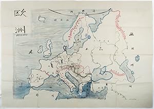
In den WarenkorbLarge handpainted folding political map of Europe including some geographical features, surrounding seas painted in blue, labelled in manuscript simplified Chinese characters, 78.5 x 109cm. Some small holes at fold points, small paper repair on reverse at lower margin, in very good condition. Appears to have been painted by a te…acher in China for use as a large classroom map illustrating the political situation and borders in Europe after the Second World War. Major geographical features, including mountain ranges, are used to demarcate a number of countries, and the Danube and Volga rivers are shown. An interesting example of mid - late twentieth-century Chinese classroom teaching material.

Verlag: [Henan].
Anbieter: Asia Bookroom ANZAAB/ILAB, Canberra, ACT, AustralienAsia Bookroom ANZAAB/ILAB
Verkäufer/-in kontaktierenVerkäufer/-in mit 5 SternenZustand: Gebraucht
EUR 248,44
EUR 18,60 VersandVersand von Australien nach USAAnzahl: 1 verfügbar
In den WarenkorbColour manuscript map of Korea, made in Puyang Middle School in 1954, 109 x 78cm, text in traditional Chinese characters, the map which was originally folded has been laid down on heavy gauge paper. Chipped in a number of areas at folds some recent colouring has modified the impact of this loss. While showing signs of use this m…ap is an interesting example of classroom teaching material relating to Korea in 1950s China. The map depicts the principal geographical areas of Korea, Japan, and the People?s Republic of China. The 38th parallel is clearly marked, along with a number of important Korean cities, including Hanseong (Seoul), Kaesong, Busan, Jinju, Incheon, and Pyongyang, here written as ?? Korea is labelled as Chaoxian (??), the term commonly used in China at the time. Taken together with the naïve style of calligraphy and the note that it was produced at a middle school, Puyang Zhongxue (????) in Henan Province, shortly after the Korean War, it is likely that the map was made by a student, possibly named Guo Renwen (???), whose name appears at the lower right. The faint yellow numbers 1?5 painted on the map may refer to a legend or explanatory key that is no longer present.

- Karte
Anbieter: Geographicus Rare Antique Maps, Brooklyn, NY, USAGeographicus Rare Antique Maps
Verkäufer/-in kontaktierenVerkäufer/-in mit 4 SternenZustand: Gebraucht
EUR 757,14
EUR 14,88 VersandVersand innerhalb von USAAnzahl: 1 verfügbar
In den WarenkorbGood. Hand-colored. Scattered dampstaining and foxing. Size 10.5 x 16 Inches. A unique c. 1932 manuscript map of Jilin Province, Manchuria, China, issued just after the establishment of the Japanese puppet state of Manchukuo. It highlights the critical rail infrastructure, the backbone of Japanese influence in Manchuria even bef…ore the establishment of Manchukuo. A Closer Look Adorned with a decorate border, this manuscript map depicts Jilin Province in the early days of Japanese imperial control. The area covered is considerably larger than modern day Jilin Province, here incorporating much of Heilongjiang Province as far as the confluence of the Amur (Heilongjiang) River and Ussuri (Wusuli) River, at top-right, and taking in Harbin (abbreviated here as ?), towards left-center. A legend at bottom-right indicates symbols used for lakes, rivers, mountain ranges, and administrative information. However, the most important features indicated are the railways, the foundation of Japan's control of Manchuria. Though not labelled, at bottom-left is the growing city of Changchun, soon afterwards rechristened as Xinjing ('new capital'), when it became the political center of the entire puppet state. Changchun's prominence originated from its being the break of gauge point between the standard gauge used on most of the South Manchuria Railway network and Russian gauge, used on the China Eastern Railway and the portion of the South Manchuria Railway between Harbin and Changchun. As the junction point between the two railway systems, Changchun was designated as the headquarters of the South Manchuria Railway Company (Mantetsu), which no doubt played a role in its later being chosen as the capital city of Manchukuo. Yongji (??), noted here as the provincial capital, is used synonymously with the former county seat of Jilin, known in contemporary Western and Japanese sources as Kirin. Aside from the Amur (Heilongjiang), several other rivers are labelled, most importantly the Songhua, whose two branches formed, respectively, the northern border of the province and cut through it in a northwest / southeast direction, including straight through Yongji. Japanese Influence in Manchuria The Treaty of Portsmouth that ended the Russo-Japanese War (1904 - 1905) granted to Japan, among other rights, the southern section of the China Eastern Railway, from Changchun to Port Arthur (Lüshunkou), which became known as the South Manchuria Railway. The company created to manage this section, the South Manchuria Railway Company (?????????), soon developed into a mega-conglomerate, akin to the chartered corporations of early modern Europe. The company oversaw hotels, mines, mills, power plants, publishing, and much more that expanded Japanese influence in Manchuria to the point that it became a virtual colony. By the 1930s, Mantetsu was the largest company in Japan and by itself formed a significant portion of the Japanese economy. Although Japan already exercised an informal empire in much of Manchuria, the territory was still under the control of a group of Chinese warlords known as the Fengtian Clique led by Zhang Zuolin. Meanwhile, a sizable Japanese garrison occupied the southern portion of Liaodong Peninsula, known as the Kwantung Army (or Kant?-gun in Japanese). The Kwantung Army was a hotbed of ultranationalism, militarism, and anti-democratic secret societies, and produced several of Japan's future wartime leaders, including T?j? Hideki. Although the Kwantung Army had initially supported Zhang Zuolin as a bulwark against Chiang Kai-Shek, who was seen as pro-Communist, he was assassinated in 1928 when a bomb exploded under his private train while it was traveling on the South Manchuria Railway in a plot hatched by junior Kwantung officers. Zhang was succeeded by his son, Zhang Xueliang, initially seen as a playboy and feckless military commander, but who later became a national hero for his opposition to Japanese imperialism. Three years later, on Se.


