

Gesamtpreis (1 Artikel Artikel):
Versandziel:

cassini thury (48 Ergebnisse)
Direkt zu den wichtigsten Suchergebnissen
Suchfilter
Produktart
- Alle Product Types
- Bücher (37)
- Magazine & Zeitschriften (Keine weiteren Ergebnisse entsprechen dieser Verfeinerung)
- Comics (Keine weiteren Ergebnisse entsprechen dieser Verfeinerung)
- Noten (Keine weiteren Ergebnisse entsprechen dieser Verfeinerung)
- Kunst, Grafik & Poster (8)
- Fotografien (Keine weiteren Ergebnisse entsprechen dieser Verfeinerung)
- Karten (2)
- Manuskripte & Papierantiquitäten (1)
Zustand Mehr dazu
- Neu (14)
- Wie Neu, Sehr Gut oder Gut Bis Sehr Gut (3)
- Gut oder Befriedigend (12)
- Ausreichend oder Schlecht (Keine weiteren Ergebnisse entsprechen dieser Verfeinerung)
- Wie beschrieben (19)
Weitere Eigenschaften
- Erstausgabe (4)
- Signiert (2)
- Schutzumschlag (Keine weiteren Ergebnisse entsprechen dieser Verfeinerung)
- Angebotsfoto (38)
Sprache (3)
Gratisversand
Land des Verkäufers
Verkäuferbewertung
-

Explication de la Table Pour Trouver Les Distances Réciproques de Différents Lieux (Sciences) (French Edition)
Anbieter: Ria Christie Collections, Uxbridge, Vereinigtes Königreich
Verkäuferbewertung 5 von 5 Sternen

EUR 13,70
EUR 14,07 Versand
Versand von Vereinigtes Königreich nach USAAnzahl: Mehr als 20 verfügbar
In den WarenkorbZustand: New. In.
-

Introduction À La Seconde Feuille Occidentale de la Carte de la France (Histoire) (French Edition)
Anbieter: Ria Christie Collections, Uxbridge, Vereinigtes Königreich
Verkäuferbewertung 5 von 5 Sternen
EUR 13,70
EUR 14,07 Versand
Versand von Vereinigtes Königreich nach USAAnzahl: Mehr als 20 verfügbar
In den WarenkorbZustand: New. In.
-

Addition Aux Tables Astronomiques De M. Cassini (French Edition)
Anbieter: Ria Christie Collections, Uxbridge, Vereinigtes Königreich
Verkäuferbewertung 5 von 5 Sternen
EUR 28,44
EUR 14,07 Versand
Versand von Vereinigtes Königreich nach USAAnzahl: Mehr als 20 verfügbar
In den WarenkorbZustand: New. In.
-

Addition Aux Tables Astronomiques De M. Cassini (French Edition)
Anbieter: Ria Christie Collections, Uxbridge, Vereinigtes Königreich
Verkäuferbewertung 5 von 5 Sternen
EUR 38,18
EUR 14,07 Versand
Versand von Vereinigtes Königreich nach USAAnzahl: Mehr als 20 verfügbar
In den WarenkorbZustand: New. In.
-

EUR 19,88
EUR 48,99 Versand
Versand von Deutschland nach USAAnzahl: Mehr als 20 verfügbar
In den WarenkorbZustand: New.
-

EUR 19,88
EUR 48,99 Versand
Versand von Deutschland nach USAAnzahl: Mehr als 20 verfügbar
In den WarenkorbZustand: New.
-

Description Geometrique De La France (1783)
Sprache: Französisch
Verlag: Kessinger Publishing, LLC, 2009
ISBN 10: 1104730405 ISBN 13: 9781104730406
EUR 33,31
EUR 48,99 Versand
Versand von Deutschland nach USAAnzahl: Mehr als 20 verfügbar
In den WarenkorbZustand: New. KlappentextrnrnThis scarce antiquarian book is a facsimile reprint of the original. Due to its age, it may contain imperfections such as marks, notations, marginalia and flawed pages. Because we believe this work is culturally important, we have.
-

Relation Des Deux Voyages Faits En Allemagne Par Ordre Du Roi
Sprache: Französisch
Verlag: Kessinger Publishing, LLC, 2009
ISBN 10: 1120024609 ISBN 13: 9781120024602
EUR 34,18
EUR 48,99 Versand
Versand von Deutschland nach USAAnzahl: Mehr als 20 verfügbar
In den WarenkorbZustand: New. KlappentextrnrnThis scarce antiquarian book is a facsimile reprint of the original. Due to its age, it may contain imperfections such as marks, notations, marginalia and flawed pages. Because we believe this work is culturally important, we have.
-

La Meridienne De L\ Observatoire Royal De Paris
Sprache: Französisch
Verlag: Kessinger Publishing, LLC, 2009
ISBN 10: 1104879301 ISBN 13: 9781104879303
EUR 50,05
EUR 48,99 Versand
Versand von Deutschland nach USAAnzahl: Mehr als 20 verfügbar
In den WarenkorbZustand: New. KlappentextrnrnThis scarce antiquarian book is a facsimile reprint of the original. Due to its age, it may contain imperfections such as marks, notations, marginalia and flawed pages. Because we believe this work is culturally important, we have.
-

Addition Aux Tables Astronomiques De M. Cassini
Sprache: Französisch
Verlag: Creative Media Partners, LLC Jul 2023, 2023
ISBN 10: 1021685925 ISBN 13: 9781021685926
Anbieter: AHA-BUCH GmbH, Einbeck, Deutschland
Verkäuferbewertung 5 von 5 Sternen
Taschenbuch. Zustand: Neu. Neuware - Ce livre traite des tables astronomiques utilisées pour calculer les positions des corps célestes. Il comprend des influences théoriques pour différents corps planétaires et est donc idéal pour les astronomes.This work has been selected by scholars as being culturally important, and is part of the knowledge base of civilization as we know it.This work is in the 'public domain in the United States of America, and possibly other nations. Within the United States, you may freely copy and distribute this work, as no entity (individual or corporate) has a copyright on the body of the work.Scholars believe, and we concur, that this work is important enough to be preserved, reproduced, and made generally available to the public. We appreciate your support of the preservation process, and thank you for being an important part of keeping this knowledge alive and relevant.
-

Description Geometrique De La France (1783)
Sprache: Französisch
Verlag: Kessinger Publishing, LLC Jul 2009, 2009
ISBN 10: 1104730405 ISBN 13: 9781104730406
Anbieter: AHA-BUCH GmbH, Einbeck, Deutschland
Verkäuferbewertung 5 von 5 Sternen
Taschenbuch. Zustand: Neu. Neuware - This scarce antiquarian book is a facsimile reprint of the original. Due to its age, it may contain imperfections such as marks, notations, marginalia and flawed pages. Because we believe this work is culturally important, we have made it available as part of our commitment for protecting, preserving, and promoting the world's literature in affordable, high quality, modern editions that are true to the original work.
-

De Thury, C: FRE-RELATION DES DEUX VOYAGES
Anbieter: AHA-BUCH GmbH, Einbeck, Deutschland
Verkäuferbewertung 5 von 5 Sternen
Taschenbuch. Zustand: Neu. Neuware - This is an EXACT reproduction of a book published before 1923. This IS NOT an OCR'd book with strange characters, introduced typographical errors, and jumbled words. This book may have occasional imperfections such as missing or blurred pages, poor pictures, errant marks, etc. that were either part of the original artifact, or were introduced by the scanning process. We believe this work is culturally important, and despite the imperfections, have elected to bring it back into print as part of our continuing commitment to the preservation of printed works worldwide. We appreciate your understanding of the imperfections in the preservation process, and hope you enjoy this valuable book.
-

Addition Aux Tables Astronomiques De M. Cassini
Sprache: Französisch
Verlag: Creative Media Partners, LLC Jul 2023, 2023
ISBN 10: 1020324740 ISBN 13: 9781020324741
Anbieter: AHA-BUCH GmbH, Einbeck, Deutschland
Verkäuferbewertung 5 von 5 Sternen
Buch. Zustand: Neu. Neuware - Ce livre traite des tables astronomiques utilisées pour calculer les positions des corps célestes. Il comprend des influences théoriques pour différents corps planétaires et est donc idéal pour les astronomes.
-

La Meridienne De L'Observatoire Royal De Paris : Verifiee Dans Toute L'Etendue Du Royaume Par De Nouvelles Observations (1744)
Sprache: Französisch
Verlag: Kessinger Publishing, LLC Aug 2009, 2009
ISBN 10: 1104879301 ISBN 13: 9781104879303
Anbieter: AHA-BUCH GmbH, Einbeck, Deutschland
Verkäuferbewertung 5 von 5 Sternen
Taschenbuch. Zustand: Neu. Neuware - This scarce antiquarian book is a facsimile reprint of the original. Due to its age, it may contain imperfections such as marks, notations, marginalia and flawed pages. Because we believe this work is culturally important, we have made it available as part of our commitment for protecting, preserving, and promoting the world's literature in affordable, high quality, modern editions that are true to the original work.
-

Zustand: Hervorragend. Zustand: Hervorragend | Seiten: 448 | Sprache: Französisch | Produktart: Bücher | Keine Beschreibung verfügbar.
-

Femmes, vulgarisation et pratique des sciences au siècle des Lumières. Les Dialogues sur l'astronomie et la Lettre sur la figure de la Terre de César-François Cassini de Thury
Verlag: , Brepols, 2020, 2020
Anbieter: BOOKSELLER - ERIK TONEN BOOKS, Antwerpen, Belgien
Verbandsmitglied: ILAB
Verkäuferbewertung 5 von 5 Sternen
Hardback, vi + 310 pages, Size:156 x 234 mm, Illustrations:58 col., Language: French. ISBN 9782503586038. Summary Vers 1740, c'est la guerre à l'Académie royale des sciences. Le conflit s'est cristallisé autour de la figure de la Terre. Attaqués par les partisans de la physique de Newton, qui pensait que la Terre devait être aplatie aux pôles, les Cassini de l'Observatoire de Paris après avoir d'abord confirmé par leurs mesures de terrain leur ancienne opinion d'une Terre oblongue doivent admettre leur défaite. Les manuscrits inédits que nous publions aujourd'hui leur redonnent voix. Pièce manquante dans l'histoire de ces vifs débats, ce livre dévoile un visage inattendu de l'astronomie du 18e siècle?: on y découvre un personnage de femme étonnamment moderne, qui nous aidera à appréhender les pratiques d'observation et les techniques de calcul qui fondent la précision astronomique de cette époque. C'est aussi l'occasion d'une profonde réflexion sur les différentes façons dont on peut vulgariser les sciences. TABLE OF CONTENTS Introduction générale par David Aubin La précision dans la querelle de la figure de la Terre Les Dialogues sur l'astronomie : vulgariser la précision ? Une femme dans un observatoire : histoire littéraire et sociale La « thèse » avortée de Victoire Pigeon Dialogues sur l'astronomie par César-François Cassini de Thury Sur la présente édition Préface de l'auteur Premier entretien Deuxième entretien Troisième entretien Quatrième entretien Cinquième entretien Sixième entretien Septième entretien Huitième entretien Neuvième entretien Dixième entretien Sur l'astrologie Solution de quelques problèmes d'astronomie Principes ou règles établies par les géomètres et astronomes Formules de géométrie Des raisons Sur la figure de la Terre par César-François Cassini de Thury Sur la présente édition Lettre sur la figure de la Terre Épilogue : Femmes et amamteurs au siècle des Lumières par David Aubin La mystérieuse lettre de Google Livres L'astronomie « mise à la portée de tout le monde » Les rôles de l'amateur selon Cassini III L'astronomie à la portée de toutes (sauf des marquises) Conclusion générale Chronologie Bibliographie Index Table de figures Table des matières 0 g.
-

Femmes, vulgarisation et pratique des sciences au siècle des Lumières. Les Dialogues sur l'astronomie et la Lettre sur la figure de la Terre de César-François Cassini de Thury César-François Cassini de Thury
Anbieter: BUCHSERVICE / ANTIQUARIAT Lars Lutzer, Wahlstedt, Deutschland
Verkäuferbewertung 5 von 5 Sternen
Zustand: gut. Femmes, vulgarisation et pratique des sciences au siècle des Lumières. Les Dialogues sur l'astronomie et la Lettre sur la figure de la Terre de César-François Cassini de Thury In deutscher Sprache. pages.
-
Atlas Géographique et Militaire de la France, divisé en deux Parties [ Première Partie ]
Sprache: Französisch
Verlag: Chez R. Julien, 1751
Anbieter: Librairie du Cardinal, GRADIGNAN, Frankreich
Verkäuferbewertung 5 von 5 Sternen
Erstausgabe
rigide. Zustand: Assez bon. 1 vol. in-4 (31,5 x 26 cm en marges) cartonnage ancien, dos à 3 nerfs, Chez R. Julien, à l'Hôtel de Soubise, Paris, 1751, 1 f. double (titre gravé à double page), 24 planches doubles de cartes, frontières rehaussées en couleurs, 3 ff. doubles (tables) Première partie seule de cet atlas, recueillant la "Carte de France et des Etats limitrophes, divisé par Provinces et Gouvernemens Militaires, dressée tant sur les meilleures Cartes particulières qui ont paru jusqu'ici, que sur les Observations de l'Académie Royale des Sciences raportées dans les Cartes des Triangles, Levées par ordre du Roi, et mises au jour par Mr. Cassini de Thury, de l'Académie Royale des Sciences". Les carte et le texte sont montés sur onglet. Etat très satisfaisant (qq. mouill. marginales ou sur le pli central, qq. ff. partiellement débrochés de leur onglet, petites usures au cartonnage, bon état par ailleurs). L'exemplaire provient de la bibliothèque du secrétaire et exécuteur testamentaire des frères Goncourt et de Paul de Saint-Victor, Alidor Delzant (1848-1905), avec son ex-libris manuscrit en garde Langue: Français.
-
Carte de Cassini N°150 Barraux / feuille 137
Verlag: .
Anbieter: Librairie Lis Tes Ratures, Nantes, Frankreich
Verbandsmitglied: ILAB
Verkäuferbewertung 4 von 5 Sternen

Chez Picquet, géographe ordinaire du roi Paris, vers 1790, une feuille (69x102cm la feuille) de la carte «générale et particulière de la France» de Cassini. La feuille est repliée en 24 sections marouflées sur toile. Cette feuille est en noir. Cette carte fut publiée entre 1756 et 1815 dont le tirage était de 200 à 500 exemplaires selon les feuilles. La carte de Cassini (des Cassini devrait-on dire puisque plusieurs générations de géographes du même nom se sont succédées dans cette entreprise.) est la première carte française réalisée par triangulations primaires et secondaires à partir de relevés géodésiques ce qui lui confère la plus grande précision possible techniquement pour l'époque. Superbe, en parfaite condition. Chaque feuille rectangulaire couvre 40 000 toises sur 25 000 (une toise pour 1,94 904 mètres et une ligne pour 100 toises soit 80 kilomètres sur 50 environ) à léchelle du 1/86 400 e.
-
![Bild des Verkäufers für Carte générale de la France. N°113, [Langres]. N°113. [établie sous la direction de César-François Cassini de Thury] zum Verkauf von Librairie de l'Avenue - Henri Veyrier](https://pictures.abebooks.com/inventory/md/md32314798295.jpg)
Carte générale de la France. N°113, [Langres]. N°113. [établie sous la direction de César-François Cassini de Thury]
Verlag: [Sn] F.A. Aveline sculp.[sit], 1760
Anbieter: Librairie de l'Avenue - Henri Veyrier, Saint-Ouen, FR, Frankreich
Verkäuferbewertung 5 von 5 Sternen
Couverture souple. Zustand: Très bon état. Carte d'époque entoilée, repliée format 31,5 x 24,5 cm, format déplié : 60 x 94 cm, gravée en noir. Échelles : [1:86400] ou 1 ligne pour 100 toises. La carte de Cassini ou carte de l'Académie est la première carte topographique et géométrique établie à l'échelle du royaume de France dans son ensemble. in-plano.
-
Histoire de l'Académie royale des sciences. Année 1736
Verlag: Chez Pierre Mortier, 1740
Anbieter: Librairie Le Feu Follet, Paris, Frankreich
Verbandsmitglied: ILAB
Verkäuferbewertung 5 von 5 Sternen
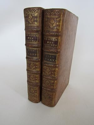
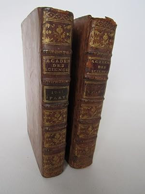
Couverture rigide. Chez Pierre Mortier | A Amsterdam 1740 | 10 x 17 cm | 2 volumes reliés | Edition illustrée de 10 planches pour le tome 1, 23 pour le tome 2, la plupart dépliantes, soit 33 planches. Pages de titre en rouge et noir. Un frontispice allégorique et une vignette de titre dans le tome 1. Reliure en plein veau brun marbré d'époque. Dos à nerfs orné. Pièces de titre en maroquin rouge, et de tomaison à la cire noire. Frottements. 2 coins émoussés. Le premier feuillet de la dédicace semble manquant ; le texte de la dédicace est complet, mais sans page d'épitre. Bel exemplaire. On retiendra dans chacune des sections mentionnées les articles remarquables suivants : Solution pour quelques problèmes de dynamique, par M. Clairaut. Méthode de trouver la hauteur du pole, & la déclinaison des étoiles qui n'est pas sujette à la réfraction, par M. Maraldi. Des précautions que l'on doit prendre pour observer le plus exactement possible, les hauteurs des étoiles, par M. Cassini de Thury. De la manière de concilier dans l'hypothèse des tourbillons les deux règles de Kepler, par M. Cassini. Résolution d'une question astronomique, utile à la navigation, par M. Pitot. Sur la figure de la terre, par M. de Maupertuis. Sur la perpendiculaire à la méridienne de l'observatoire à la distance de 60000 toises vers le nord, par M. Cassini de Thury. Méthode pour trouver la déclinaison des étoiles, par M. de Maupertuis. De la manière de déterminer la figure de la terre par la mesure des degrés de latitude et de longitude, par M. Bouguer. | [ENGLISH DESCRIPTION FOLLOWS] Illustrated edition with 10 plates for volume 1, 23 for volume 2, most folding, totaling 33 plates. Title pages in red and black. An allegorical frontispiece and a title vignette in volume 1. Contemporary full marbled brown calf binding. Spine with raised bands, decorated. Red morocco title-label, and volume label in black wax. Rubbing. 2 corners slightly bumped. The first leaf of the dedication appears to be lacking; the text of the dedication is complete, but without the epistle page. Handsome copy. The following remarkable articles will be noted in each of the mentioned sections: Solution for some problems of dynamics, by M. Clairaut. Method of finding the height of the pole, & the declination of stars that is not subject to refraction, by M. Maraldi. Precautions that must be taken to observe as exactly as possible, the heights of stars, by M. Cassini de Thury. On the manner of reconciling in the hypothesis of vortices the two rules of Kepler, by M. Cassini. Resolution of an astronomical question, useful to navigation, by M. Pitot. On the figure of the earth, by M. de Maupertuis. On the perpendicular to the meridian of the observatory at a distance of 60000 toises towards the north, by M. Cassini de Thury. Method for finding the declination of stars, by M. de Maupertuis. On the manner of determining the figure of the earth by measuring degrees of latitude and longitude, by M. Bouguer. * (18) 166pp. et 260pp. et (2) 266-658p. (2).
-
Histoire de l'Académie royale des sciences. Année 1741
Verlag: Chez Pierre Mortier, 1747
Anbieter: Librairie Le Feu Follet, Paris, Frankreich
Verbandsmitglied: ILAB
Verkäuferbewertung 5 von 5 Sternen
Couverture rigide. Chez Pierre Mortier | A Amsterdam 1747 | 10 x 17 cm | 2 volumes reliés | Edition illustrée de 5 planches pour le tome 1, 13 pour le tome 2, la plupart dépliantes, soit 18 planches. Pages de titre en rouge et noir. Reliure en plein veau brun marbré d'époque. Dos à nerfs orné. Pièces de titre en maroquin rouge, et de tomaison à la cire noire.Un manque en tête du tome 2, un en tête du tome 1. Frottements On retiendra dans chacune des sections mentionnées les articles remarquables suivants : Réflexions sur la théorie du troisième satellite de Jupiter, par M. Maraldi. Sur la cas irréductible du troisième degré, par M. Nicole. Démonstration de la règle de Descartes, pour connaître le nombre de racines positives & négatives dans les équations qui n'ont point de racines imaginaires, par M. l'abbé de Gua. Sur la détermination des solstices, par M. Cassini de Thury. Observations par lesquelles on tâche de découvrir la partie du cerveau où l'âme exerce ses fonctions, par M. de la Peyronie. Problèmes de dynamique par M. de Montigny. De la formation de la voix de l'homme, par M. Ferrein. Recherche du nombre des racines réelles ou imaginaires, réelles positives ou réelles négatives, qui peuvent se trouver dans les équations de tous les degrés, par M. l'abbé de Gua. | [ENGLISH DESCRIPTION FOLLOWS] Illustrated edition with 5 plates for volume 1, 13 for volume 2, most folding, totaling 18 plates. Title pages in red and black. Contemporary full marbled brown calf binding. Decorated spine with raised bands. Red morocco title label and black wax volume label. One lack to head of volume 2, one to head of volume 1. Rubbing Notable among the articles mentioned in each section are the following remarkable pieces: Reflections on the theory of Jupiter's third satellite, by M. Maraldi. On the irreducible case of the third degree, by M. Nicole. Demonstration of Descartes' rule, for determining the number of positive & negative roots in equations that have no imaginary roots, by M. l'abbé de Gua. On the determination of solstices, by M. Cassini de Thury. Observations attempting to discover the part of the brain where the soul exercises its functions, by M. de la Peyronie. Problems of dynamics by M. de Montigny. On the formation of the human voice, by M. Ferrein. Research on the number of real or imaginary roots, real positive or real negative, that can be found in equations of all degrees, by M. l'abbé de Gua. * (12) 274pp. ; 199pp. (2) 203-559p. (8).
-
Relation d'un voyage en Allemagne qui comprend les opérations relatives à la figure de la terre et à la géographie particulière du Palatinat, du duché de Wurtenberg, du Cercle de Souabe, de la Bavière et de l'Autriche, fait par ordre du Roi, suivie de la description des conquêtes de Louis XV depuis 1745 jusqu'en 1748.
Verlag: Imp. royale, 1775
Anbieter: Librairie de l'Avenue - Henri Veyrier, Saint-Ouen, FR, Frankreich
Verkäuferbewertung 5 von 5 Sternen
Couverture rigide. Zustand: Bon état. In-4 demi-basane, dos à nerfs rel. moderne, XXVIII- 194- 5 pp. 12 plans in-fine 11 repliées. Bon exemplaire frais. Géodesien et cartographe de talent, Cassini III (1714-1784) effectua ce voyage en 1664 pour établir une triangulation de l'Allemagne et dresser une nouvelle carte topographique. Sa relation traite surtout de la méthode cartographique mise en oeuvre. in-4°.
-
Almanach perpétuel, pour trouver l'Heure par tous degrés de hauteur du Soleil
Verlag: J. Th. Herissant, 1770
Anbieter: Librairie Le Feu Follet, Paris, Frankreich
Verbandsmitglied: ILAB
Verkäuferbewertung 5 von 5 Sternen
Erstausgabe
Couverture rigide. J. Th. Herissant | Paris 1770 | 18 x 24 cm | Relié | Édition originale ornée de 11 planches dont 10 dépliantes. Reliure à la bradel en plein cartonnage recouvert de papier à la cuve, dos lisse, étiquette de titre encollée en long. "Ce sont les tables des hauteurs du soleil à toutes les heures" [Lalande]. Rare et agréable exemplaire. | [ENGLISH DESCRIPTION FOLLOWS] First edition illustrated with 11 plates, 10 of which are folding.Bradel binding in full marbled paper boards, smooth spine, vertical paper title label."Ce sont les tables des hauteurs du soleil à toutes les heures" [Lalande]. A rare and appealing copy. * in-4 ; Titre, 6 ff.n.ch., 11 ff.n.ch. de tables (dont 10 dépliants), 24 pp., 12 pp. Lalande p. 518.
-

Description Geometrique de la France
Verlag: Paris: J. Ch. Desaint, 1783., 1783
Anbieter: Arader Galleries - AraderNYC, New York, NY, USA
Verkäuferbewertung 5 von 5 Sternen
Erstausgabe
Soft cover. 1st Edition. 4to., (10 5/8 x 8 4/8 inches). Large folding engraved map "Nouvelle carte qui comprend les principaux triangles qui servent de fondement A la description geometrique de la France". Paris, Delisle, 1744 (22 x 24 4/8 inches to the eat line) (some separations at folds, margins spotted and stained througout). Original orange paper wrappers over thin paste-board (back strip largely worn away, modern manuscript title on front cover. Provenance: with the ink library stamps of the Library of the Royal College of Surgeons in Ireland on the title-page First edition. Cassini, was a French astronomer and geodesist, who continued the surveying work initially undertaken by his father, Jacques Cassini, and in the process created a monumental map of France. "one of the best-known artifacts of the eighteenth century.". Cassini succeeded his father as director of the Paris Observatory in 1771, but his achievements as an astronomer were less distinguished then those as a geodesist and cartographer. From the 1740s "until his death, Cassini de Thury directed work on a general topographic map of France. Published in 1789, this "Carte géométrique de la France" ("Geometric Map of France"), or "Carte de Cassini," was the first map of an entire country drawn up on the basis of extensive triangulation and topographic surveys" (Encyclopedia Britannia online). The map included here corresponds to the key map for the eventual megalith which consisted of 180 sheets measuring about 11 metres square. "By 1760, 50 maps of the 180 projected were finished, all in the north-central part of France. Between 1760 and 1770, 38 were published, covering all of eastern France, central France north of Lyon, and western France east of Rennes and north of Poitiers. Forty-five more were available by 1780, covering Anjou, Poitou, the Dauphin, and Provence. The Limousin, the Pyrenees frontier, and the region of Nice appeared between 1780 and 1789. All fieldwork but not all engraving was completed by 1789." (Konvitz, Cartography in France 1660-1848. Chicago, 1987, pp. 21-25). Catalogued by Kate Hunter.
-
CARTE ORIGINALE GRAVÈE en 21 PARTIES de J. SEGUIN INGr GÈOGhe du ROY 1759 [ Jean-Dominique SEGUIN Ingénieur Géographe du ROY , de l'ACADÈMIE ROYALE des SCIENCES , sous la Direction de CASSINI - 1759 ] CARTE ENTOILÈE de 59,5 x 92,5 cm en 21 PANNEAUX - N° 111 COMMERCY , BAR-LE-DUC , TOUL , THIANCOURT , FLEURY en ARGONNE , ANCERVILLE .
Sprache: Französisch
Anbieter: LA FRANCE GALANTE, Saint MARTIN sur LAVEZON, Frankreich
Verkäuferbewertung 5 von 5 Sternen
Couverture souple. Zustand: Très bon. Paris . Académie Royale des Sciences . 1759 . UNE CARTE ORIGINALE GRAVÈE en 21 PARTIES de J. SEGUIN INGr GÈOGhe du ROY 1759 [ Jean-Dominique SEGUIN Ingénieur Géographe du ROY , de l'ACADÈMIE ROYALE des SCIENCES , sous la Direction de CASSINI - 1759 ] CARTE ENTOILÈE de 59,5 x 92,5 cm en 21 PANNEAUX - N° 111 COMMERCY , BAR-LE-DUC , TOUL , THIANCOURT , FLEURY en ARGONNE , ANCERVILLE .
-
Suite des memoires de mathematique et de physique, tires des registres de l`academie royale des sciences de l`année M. DCC.XL.III
Sprache: Französisch
Verlag: Amsterdam, Chez Pierre Mortier 1748,, 1748
Anbieter: Antiquariat an der Uni Muenchen, München, Deutschland
Verkäuferbewertung 4 von 5 Sternen
8° , Ledereinband. 154-584 Seiten. Ganzleder mit vergold. Buchrücken. Mit einigen mehrfach gefalteten Kupferstichen. Gutes Exemplar. Sprache: Französisch Gewicht in Gramm: 550.
-
ÉLÉMENTS D'ASTRONOMIE [.].
Sprache: Italienisch
Verlag: DE L'IMPRIMERIE ROYAL, A PARIS, 1740
Anbieter: Il Cartiglio di Roberto Cena srlu, TORINO, TO, Italien
Verkäuferbewertung 5 von 5 Sternen
Piena Pelle. Zustand: Buone. Legatura coeva in piena pelle color avana maculata; ai piatti, riquadro di duplice filetto impresso a secco; dorso a cinque nervi rilevati, evidenziati da fregi trasversali a rotella, recante titolo e numero di tomo, decorato alle caselle con fiorone a losanga tra piccoli fregi, entro riquadro di filetto e denti di topo; dentelle esterne decorate a rotella, il tutto impresso in oro; risguardi policromi marmorizzati. XVI - (12) - 643 pagine numerate, compreso il frontespizio con arma del re di Francia tra strumenti scientifici, a silografia. Testo in lingua francese; fregi tipografici (con bella testatina a p. 1) e alcune piccole illustrazioni scientifiche nel testo, il tutto a silografia. 20 tavole fuori testo, incise su matrice di rame e impresse su foglio più volte ripiegato, con 85 figure astronomiche e geometriche. Al frontespizio, timbro ottocentesco alle armi di un ecclesiastico. Il volume, in edizione originale, è un trattato in cui vengono esposti gli elementi dell'astronomia, ad opera di Giacomo Cassini, membro di una dinastia di scienziati di origine italiana ma operosa in Francia. Il testo, da considerare come a sé stante, è il primo dei tre tomi che costituiscono (a quanto scrive Graesse) la nona parte della silloge Histoire et Mémoires de l'Académie Royale des Sciences. Questa collezione di volumi, comprendente le relazioni scientifiche della prestigiosa accademia reale francese fondata nel 1666, si articola in 19 sezioni per un totale di ben 164 tomi in-4°, pubblicati a Parigi fra il 1701 e il 1793. Esemplare in buono strato conservativo; usura al dorso della legatura, con parziale apertura alle cerniere del piatto anteriore; varie pagine di testo brunite; tavole fuori testo assai fresche.
-
De la Situation la plus avantageuse des Planetes pour Découvrir les Irrégularités de leurs Mouvemens. (+ Kies:) Sur les Eclipses des Etoileas fixes par la Lune. (+ Cassini de Thury:) Memoire, dans lequel on examiné, si l'on peut esperer la meme Pre.
Anbieter: Herman H. J. Lynge & Søn ILAB-ABF, Copenhagen, Dänemark
Verkäuferbewertung 4 von 5 Sternen
(Berlin, Haude et Spener, 1751). 4to. No wrappers, as issued in "Mémoires de l'Academie Royale des Sciences et Belles-Lettres", tome V, Année 1749, pp. 339-372, 1 folded geometrical plate (to the first paper) and 3 fine double-page folded engraved plates showing the quadrant. Kies was one of the first to propagate Newton's discoveries in Germany, and dedicated two of his works to the Englishman. The crater Kies on the Moon is named after him.The paper on the instrument describes and depicts the large quadrant in the Berlin observatory invented by Hadley (described in Transactions of the Royal Society in 1732)."From 1742 to 1754, at the recommendation of the mathematician Leonhard Euler, he (Kies) was made professor of mathematics at Berlin's Academy of Sciences and astronomer at its observatory. His reports from this time include De la Situation la plus avantageuse des planètes pour découvrir les irrégularités de leurs mouvemens, Sur les Éclipses des étoiles fixes par la lune, and Description d'un instrument qui se trouve .".
-

Carte de France levée par ordre du Roy. No. 42 - Cambrai, 1759) . Modern printing
Verlag: Paris: circa 1759, 1759
Anbieter: Wittenborn Art Books, San Francisco, CA, USA
Verkäuferbewertung 5 von 5 Sternen
Kunst / Grafik / Poster
Zustand: Good. Engraving on thick Arches paper. 73 x 104cm. sheet size. .Echelle de dix Mille Toises ; vingt mille mètres ; 20 000 T à la M.References: Konvitz, J. Cartography in France 1660-1848, p. 21-31; Pelletier, M. Les cartes des Cassini; Rumsey, 5694.062 .The base of the triangulation was the verified meridian of Paris; along it, at intervals of 60,000 toises (rather more than 1° of latitude), perpendiculars were carried to east and west, from which the positions of towns and other landmarks were fixed. The project faced immense difficulties which were ultimately overcome. In 1756 the French Government withdrew its financial support, but Cassini formed a company which sought to recover its expenses from the sale of the maps. Later several provinces provided financial support. Cassini lived long enough to see the work practically completed before he died of smallpox on September 4, 1784. Publication was undertaken by his son, Jacques Dominique. The atlas appeared in 182 sheets in October 1789 . It soon won universal acclaim and stands as model for all later map-making by triangulation' (NMM).

![Bild des Verkäufers für Atlas Géographique et Militaire de la France, divisé en deux Parties [ Première Partie ] zum Verkauf von Librairie du Cardinal](https://pictures.abebooks.com/inventory/md/md31885701078.jpg)




![Bild des Verkäufers für CARTE ORIGINALE GRAVÈE en 21 PARTIES de J. SEGUIN INGr GÈOGhe du ROY 1759 [ Jean-Dominique SEGUIN Ingénieur Géographe du ROY , de l'ACADÈMIE ROYALE des SCIENCES , sous la Direction de CASSINI - 1759 ] CARTE ENTOILÈE de 59,5 x 92,5 cm en 21 PANNEAUX - N° 111 COMMERCY , BAR-LE-DUC , TOUL , THIANCOURT , FLEURY en ARGONNE , ANCERVILLE . zum Verkauf von LA FRANCE GALANTE](https://pictures.abebooks.com/inventory/md/md22279255957.jpg)
![Bild des Verkäufers für ÉLÉMENTS D'ASTRONOMIE [.]. zum Verkauf von Il Cartiglio di Roberto Cena srlu](https://pictures.abebooks.com/inventory/md/md30000379273.jpg)
