Gesamtpreis (1 Artikel Artikel):
Versandziel:

bowen emanuel thomas (12 Ergebnisse)
Direkt zu den wichtigsten Suchergebnissen
Suchfilter
Produktart
- Alle Product Types
- Bücher (7)
- Magazine & Zeitschriften (Keine weiteren Ergebnisse entsprechen dieser Verfeinerung)
- Comics (Keine weiteren Ergebnisse entsprechen dieser Verfeinerung)
- Noten (Keine weiteren Ergebnisse entsprechen dieser Verfeinerung)
- Kunst, Grafik & Poster (Keine weiteren Ergebnisse entsprechen dieser Verfeinerung)
- Fotografien (Keine weiteren Ergebnisse entsprechen dieser Verfeinerung)
- Karten (5)
- Manuskripte & Papierantiquitäten (Keine weiteren Ergebnisse entsprechen dieser Verfeinerung)
Zustand Mehr dazu
- Neu (Keine weiteren Ergebnisse entsprechen dieser Verfeinerung)
- Wie Neu, Sehr Gut oder Gut Bis Sehr Gut (Keine weiteren Ergebnisse entsprechen dieser Verfeinerung)
- Gut oder Befriedigend (1)
- Ausreichend oder Schlecht (2)
- Wie beschrieben (9)
Einband
Weitere Eigenschaften
- Erstausgabe (2)
- Signiert (Keine weiteren Ergebnisse entsprechen dieser Verfeinerung)
- Schutzumschlag (1)
- Angebotsfoto (9)
Sprache (1)
Preis
- Beliebiger Preis
- Weniger als EUR 20 (Keine weiteren Ergebnisse entsprechen dieser Verfeinerung)
- EUR 20 bis EUR 45 (Keine weiteren Ergebnisse entsprechen dieser Verfeinerung)
- Mehr als EUR 45
Gratisversand
Land des Verkäufers
Verkäuferbewertung
-
THE ROYAL ENGLISH ATLAS Eighteenth Century County Maps of England and Wales
Verlag: David & Charles Reprints, 1971, 1971
Anbieter: Rothwell & Dunworth (ABA, ILAB), Dulverton, Vereinigtes Königreich
Verkäuferbewertung 5 von 5 Sternen

EUR 95,07
EUR 14,42 Versand
Versand von Vereinigtes Königreich nach USAAnzahl: 1 verfügbar
In den WarenkorbFacsimile edn. Folio (17¾ x 11½ ins). Original gilt lettered maroon cloth (near Fine), dustwrapper (small tears at edges, not price clipped). Pp. 14 thereafter unpaginated, illus with 44 b&w maps (no inscriptions).
-

An Improved Map of the County of Stafford Divided into its Hundreds
Verlag: John Hinton at the Kings Arms in St. Pauls Churchyard, London, 1749
Anbieter: Clive A. Burden Ltd., Chalfont St. Giles, BUCKS, Vereinigtes Königreich
Verkäuferbewertung 5 von 5 Sternen
Karte
EUR 350,57
EUR 25,56 Versand
Versand von Vereinigtes Königreich nach USAAnzahl: 1 verfügbar
In den WarenkorbNo binding. Zustand: Fair. SEPARATELY PUBLISHED FIRST STATE. 710 x 540 mm., early outline colour, with very wide margins, some margin tears, repaired and light brown tone across the bottom, otherwise in good condition. The first state, separately published, of Bowen and Kitchin's map of the county of Staffordshire. The maps from Emanuel Bowen (1693?-1767) and Thomas Kitchin's (1719-84) beautiful 'Large English Atlas' were first issued separately. The project began at the hands of the publisher John Hinton in 1748 before he ran into financial difficulties. They are superb, clear and concise engravings. In the history of English county atlases it is hard to think of one with finer quality. Wardington praised the book saying that 'the size of the plate presented the publishers, the engravers and the printers with as formidable a task as any posed by the finest productions of Louis XIV or XV, the best of the Dutch engravings fifty years earlier, or the Ordnance Survey sheets fifty years later'. Demand for folio maps of the English Counties in the early eighteenth century was mostly met by the old maps of Christopher Saxton, John Speed, and various other seventeenth century maps. Individual large-scale surveys were beginning to be published providing a ready source for more accurate information. In the case of Staffordshire it was no doubt based on the very rare large-scale map by Samuel Parsons from Newcastle-under-Lyme published in 1747. Hinton clearly saw a market for a fresh set of folio maps. In about 1748 Hinton employed the engravers Emanuel Bowen and Thomas Kitchin to produce the copper plates. Hinton had already employed Bowen for the maps in the 'Universal Magazine' from 1747. In May 1749 Hinton announced the publication of the map of Sussex and stated that the balance would be published at the rate of one a month. By 1752 or 1753 he sold his interest and the twenty-eight maps produced to date, to the printseller John Tinney. By May 1756 he too felt the financial strains of the project and brought in the most successful printseller's of the time, Thomas Bowles, John Bowles and Son, and Robert Sayer. Hodson 221 provides a thorough account of the complex history of this atlas, which was finally completed and issued with a title-page in c.1762. Because of the long publication history of the atlas the maps all appear with several different imprints. That of Staffordshire is found in seven states. This example is in Hodson's state H, the first state. Provenance: Clive A. Burden Ltd. (2008). Hodson (1984-97) II 221 & p. 135; King 'Staffordshire' no. 30; Shirley 'Atlases in the BL' T-Bow 3a; Worms & Baynton-Williams (2011).
-

Hampshire
Verlag: London, 1760
Anbieter: Clive A. Burden Ltd., Chalfont St. Giles, BUCKS, Vereinigtes Königreich
Verkäuferbewertung 5 von 5 Sternen
Karte
EUR 469,41
EUR 25,56 Versand
Versand von Vereinigtes Königreich nach USAAnzahl: 1 verfügbar
In den WarenkorbNo binding. Zustand: Good. 540 x 700 mm., in early outline colour, folded and laid on contemporary linen, imprint below trimmed, in attractive marbled board slipcase, complete with the printed label of the map seller Robert Sayer, otherwise in good condition. A beautifully engraved large scaled map of the county of Hampshire from Emanuel Bowen (1693?-1767) and Thomas Kitchin's (1718-84) beautiful 'Large English Atlas' were first issued separately. The project began at the hands of the publisher John Hinton (1716-81) in 1748 before he ran into financial difficulties. They are superb, clear and concise engravings. In the history of English county atlases it is hard to think of one with finer quality. Wardington praised the book saying that 'the size of the plate presented the publishers, the engravers and the printers with as formidable a task as any posed by the finest productions of Louis XIV or XV, the best of the Dutch engravings fifty years earlier, or the Ordnance Survey sheets fifty years later'. Demand for folio maps of the English Counties in the early eighteenth century was mostly met by the old maps of Christopher Saxton, John Speed, and various other seventeenth century maps. Individual large scale surveys were beginning to be published providing a ready source for accurate information. Hinton clearly saw a market for a fresh set of folio maps. In about 1748 Hinton employed the engravers Emanuel Bowen and Thomas Kitchin to engrave the maps. Hinton had already employed Bowen for the maps in the 'Universal Magazine' from 1747. In May 1749 Hinton announced the publication of the map of Sussex and stated that the balance would be published at the rate of one a month. By 1752 or 1753 he sold his interest and the twenty-eight maps produced to date to the printseller John Tinney. By May 1756 he too felt the financial strains of the project and brought in the most successful printsellers of the time, Thomas Bowles, John Bowles and Son and Robert Sayer. Hodson 221 provides a thorough account of the complex history of this atlas, which was finally completed and issued with a title-page in c.1762. The exact issue of this example is unclear as the imprint was trimmed when mounted onto linen. Hodson (1984-97) II 221.
-
Bowles's New Medium English Atlas; or, Complete Set of Maps of the Counties of England and Wales
Verlag: Carington Bowles at his Map and Print Warehouse, No. 69, in St. Paul's Church Yard, London, 1785
Anbieter: Clive A. Burden Ltd., Chalfont St. Giles, BUCKS, Vereinigtes Königreich
Verkäuferbewertung 5 von 5 Sternen
EUR 4.456,43
EUR 25,56 Versand
Versand von Vereinigtes Königreich nach USAAnzahl: 1 verfügbar
In den WarenkorbNo binding. Quarto (260 x 210 mm.), full contemporary quarter mottled calf, gilt ruled, rebacked with gilt ruled compartments, original calf gilt title label preserved. With typographic title and 44 copper engraved maps in early outline colour and yellow wash border, the general map in early wash colour, lower right corner of final map with some minor dirt, otherwise in good condition. This atlas was first published in 1767 as the 'Atlas Anglicanus' in response to Ellis' popular 'English Atlas' first published in 1765. The 'Atlas Anglicanus' like many projects at the time began life by being published in monthly numbers. Each contained three maps with, apart from the first, the part numbers being engraved on them. Until recently no example of the parts issue had been located and the only evidence we had for its issue came from a contemporary account of Gough and two located adverts. Shortly after production began, Emanuel Bowen (c.1693-1767) died; his death on 8 May 1767 was reported in the 'London Magazine'. The project was continued by his son Thomas (c.1733-90) although the issues were becoming somewhat irregular towards the end. Near completion, Thomas Kitchin (1718-84) stepped in and bought the rights to the atlas, the last part is issued with a title page indicating Kitchin as sole publisher. Kitchin was originally apprenticed to Emanuel Bowen in 1732 and would marry his master's daughter Sarah, in 1739. Quite soon the pupil's output became prolific, including several high-quality English county atlases. Bowen was successful too and despite the death of Sarah in 1761 the ties between Bowen and Kitchin would remain close. But whilst Bowen's wealth declined over the years Kitchin remarried in to a wealthy Baptist family. The maps are reductions of those published in the 'Royal English Atlas', themselves reductions of the 'Large English Atlas', both great atlases. Carington Bowles acquired the plates sometime before 1785 and immediately set about revising them. The titles are all changed, the imprints brought up to date and all now are numbered upper right to 44. The general map of the roads is omitted from this edition as is the leaf with a list of contents which is now situated on the title page. The compass roses are now more uniform in style throughout and distances have been erased being replaced by those from London to the major cities. The atlas faced stiff competition from the continued presence of the Ellis atlas and the introduction of the hugely popular 'New and Correct English Atlas' by John Cary in 1787. Bowles priced his atlas at £1 16s, whilst the Ellis was 10s 6d and even the new Cary atlas was £1 10s. This atlas is therefore considerably rarer than that of the Cary. Provenance: Bonhams, Oxford, 16 September 2014 lot 147; private English collection. Chubb (1927) 232; ESTC T301089; Hodson (1984-97) 256; Shirley (2004) T.Bow 5d; Worms & Baynton-Williams (2011).
-
Atlas Anglicanus or a Complete Sett of Maps of the Counties of South Britain
Verlag: London, 1767
Anbieter: Clive A. Burden Ltd., Chalfont St. Giles, BUCKS, Vereinigtes Königreich
Verkäuferbewertung 5 von 5 Sternen
Erstausgabe
EUR 7.724,49
EUR 25,56 Versand
Versand von Vereinigtes Königreich nach USAAnzahl: 1 verfügbar
In den WarenkorbNo binding. Zustand: Fair. VERY RARE FIRST EDITION, FIRST ISSUE. Folio (370 x 240 mm.), modern quarter calf by Temple Bindery, marbled paper boards, gilt ruled, gilt ruled ribbed spine with red calf gilt title label. With engraved title page frayed and laid down, pp. 4 'Subscribers Names' and 45 copper engraved maps in early outline colour, with two further maps of new Jersey and France inserted at the end. An example of the VERY RARE FIRST EDITION, FIRST ISSUE. This atlas was first published in 1767 as the 'Atlas Anglicanus' in response to Ellis' popular 'English Atlas' first published in 1765. The 'Atlas Anglicanus' like many projects at the time began life by being published in monthly numbers. Each contained three maps, the part numbers being engraved on them. Only one example of the parts issue has been located and the only evidence we had for its issue came from a contemporary account of Gough and two located adverts. The presence of the same number on three maps caused some confusion for earlier carto-bibliographers. Notably Chubb who surmised that they represented pigeon holes in the printing office! The first part was issued on 1 January 1767 and shortly after production began Emanuel Bowen died on 8 May 1767, his death was reported in the 'London Magazine'. Only four parts had been issued. The project was continued by his son Thomas although the issues were becoming somewhat irregular towards the end. Near completion Thomas Kitchin (1718-84) stepped in and appears to buy the rights to the atlas, the last part was issued on 29 July 1768 and included a title page indicating Kitchin as sole publisher. Kitchin was originally apprenticed to Emanuel Bowen in 1732 and would marry his master's daughter, Sarah, in 1739. Quite soon, the pupil's output became prolific including several high quality English county atlases. Bowen was successful too and despite the death of Sarah in 1761, the ties between Bowen and Kitchin would remain close. But whilst Bowen's wealth declined over the years, Kitchin remarried into a wealthy Baptist family. The maps are reductions of those published in the 'Royal English Atlas', themselves reductions of the 'Large English Atlas', both great works. After acquiring the 'Atlas Anglicanus', Kitchin immediately undertook the task of adding his imprint to all the maps. Examples of the atlas usually contain some maps with his imprint, this example however appears to bear none and is therefore a true first issue. Very few examples survive in this state and include the subscribers list. In all my years I have only located four examples. I have handled two of them, the remaining are in the Bodleian Library and Cambridge University Library. Provenance: private English collection. Chubb (1927) 232; Hodson (1984-97) no. 254; Shirley (2004) BL T.Bow 5a.
-

Dorset Shire Divided into Hundreds
Verlag: London, 1767
Anbieter: Clive A. Burden Ltd., Chalfont St. Giles, BUCKS, Vereinigtes Königreich
Verkäuferbewertung 5 von 5 Sternen
Karte
EUR 130,72
EUR 25,56 Versand
Versand von Vereinigtes Königreich nach USAAnzahl: 1 verfügbar
In den WarenkorbNo binding. 230 x 325 mm., in good condition. The 'Atlas Anglicanus' was first issued in parts which is exceedingly rare and then as an atlas in 1767 republished in 1777. Emanuel Bowen (fl.1714 d.1767) was a very active engraver whose style is often noted by the extensive use of legends. Emanuel died during the issue of the parts and the work was continued by his son Thomas. However before it was completed Thomas Kitchin would take control of it. This example is in its more usual second state. Not in Beaton; Hodson 254.
-

Cambridgeshire Divided into Hundreds
Verlag: London, 1767
Anbieter: Clive A. Burden Ltd., Chalfont St. Giles, BUCKS, Vereinigtes Königreich
Verkäuferbewertung 5 von 5 Sternen
Karte
EUR 172,32
EUR 25,56 Versand
Versand von Vereinigtes Königreich nach USAAnzahl: 1 verfügbar
In den WarenkorbNo binding. 325 x 230 mm., early outline colour, good condition. The 'Atlas Anglicanus' was first issued in parts which is exceedingly rare and then as an atlas in 1767 republished in 1777. Emanuel Bowen (fl.1714 d.1767) was a very active engraver whose style is often noted by the extensive use of legends. Emanuel died during the issue of the parts and the work was continued by his son Thomas. However before it was completed Thomas Kitchin would take control of it. This rare example is in its first state. Hodson 254.
-

Royal English Atlas: Collection of 28 Maps
Verlag: John Bowles; Carington [Corington] Bowles; Robert Sayer; John Bennett. C. 1777-1778, London, 1777
Anbieter: Alexandre Antique Prints, Maps & Books, Toronto, ON, Kanada
Verkäuferbewertung 5 von 5 Sternen
Loose., A very good example of this collection of maps, which are most often sold individually and are becoming increasingly rare and scarce. Emanuel Bowen (1694?1767) was a Welsh map engraver who served as Royal Mapmaker to both King George II of Great Britain and Louis XV of France. Bowen was highly regarded by his contemporaries for producing some of the largest, most detailed, and most accurate maps of his era. Despite this, Bowen would die in poverty, a similar fate that would be met by his son, Thomas Bowen, who took up his father?s cartographic business following his death.List of maps (number indicated if stated):1. #16. E. Bowen, 1777. An Accurate Map of HARTFORD SHIRE Divided into Hundreds? 2. E. Bowen, 1777. An Accurate Map of DORSET SHIRE Divided into Hundreds? 3. #7. E. Bowen, 1777. An Accurate Map of CORNWALL Divided into Hundreds?4. E. Bowen, 1777. An Accurate Map of the County of HUNTINGDON, Divided into its Hundreds?5. E. Bowen, 1777. An Accurate Map of CAMBRIDGE SHIRE, Divided into Hundreds?6. #6. E. Bowen, 1777. An Accurate Map of the COUNTY PALATINE OF CHESTER. Divided into Hundreds?7. E. Bowen, 1777. An Accurate Map of the County of MONMOUTH, Divided into Hundreds?8. E. Bowen, 1777. An Accurate Map of the County of GLOUCESTER, Divided into Hundreds?9. #9. E. Bowen, 1777. An Accurate Map of DERBY SHIRE, Divided into its Hundreds?10. E. Bowen, 1777. An Accurate Map of HAMP SHIRE Divided into its Hundreds?11. E. Bowen, 1777. A Corrected Map of the County of STAFFORD Divided into Hundreds?12. #26. E. Bowen, 1777. An Accurate Map of the County of NORTHAMPTON, Divided into its Hundreds?13. #12. E. Bowen, 1777. An Accurate Map of the COUNTY PALATINE OF DURHAM, divided into its Wards?14. #29. E. Bowen, 1777. An Accurate Map of OXFORD SHIRE, Drawn from the Best Authorities, Divided into Hundreds?15. E. Bowen, 1777. An Accurate Map of the County of NORTHUMBERLAND, laid down from the Best Authorities and Divided into its Wards?16. E. Bowen, 1777. An Accurate Map of LINCOLN SHIRE DIVDED INTO WAPONTAKES? 17. #33. E. Bowen, 1777. An Accurate map of the County of SUFFOLK Divided into its Hundreds? 18. E. Bowen, 1777. An Accurate Map of BERK SHIRE Divided into Hundreds?19. Bowen, 1777. An Accurate Map of the COUNTY OF KENT DIVIDED INTO ITS LATHES, and Subdivided into Hundreds? 20. #34. T. Bowen; revised, corrected and improved by E. Bowen, 1777. An Accurate Map of the County of SURREY Divided into Hundreds?21. #20. J. Gibson; revised, corrected and improved by E. Bowen, 1777. An Accurate Map of the County of LANCASTER, Divided into Hundreds?22. #13. J. Gibson; revised, corrected, and improved by E. Bowen, 1778. An Accurate Map of the COUNTY OF ESSEX Divided into Hundreds? (John Bowles and Carington Bowles, ? ?)23. #38. E. Bowen, 1778. An Accurate Map of WORCESTER SHIRE Divided into Hundreds?24. E. Bowen, 1778. An Accurate Map of the COUNTY OF HEREFORD Drawn from Surveys?25. E. Bowen, 1778. An Accurate Map of the COUNTIES OF LEICESTER & RUTLAND, Divided into their Respective Hundreds?26. T. Kitchin, 1777. An Accurate Map of SUSSEX Drawn from the Best Surveys & Intelligences Divided into its Hundreds?27. T. Kitchin, 1777. A NEW MAP OF SOUTH WALES, containing the counties of Radnor, Brecknock, Glamorgan, Carmarthen, Pembroke & Cardigan?28. T. Kitchin, 1777. An Accurate Map of the COUNTY OF SALOP Divided into its Hundreds?, A collection of 28 copper-engraved maps from Bowen?s Royal English Atlas, which was a smaller-scale version of the Large English Atlas issued circa 1767. 3 maps drawn by Kitchin, remainder drawn by or corrected by E. Bowen. Maps illustrating various British counties (list below), with later handcolouring, often with pictorial cartouches, often featuring inset engravings of cathedrals and churches, plus extracts commenting on counties? trade and economy, geographical details, history and formation, and more. Some maps numbered.Maps of Hartfordshire, Dorsetshire, Cornwall, Huntingdon, Cambridgeshire, Chester, Monmouth, Gloucester, Derbyshire, Hampshire, Stafford, Northampton, Durham, Oxfordshire, Northumberland, Lincoln Shire, Suffolk, Berkshire, Kent, Surrey, Lancaster, Essex, Worcestershire, Hereford, Leicester & Rutland, Sussex, South Wales, Salop (details in list below). Some toning, edgewear, occasional spotting, some small holes, minor worming, or wear at folds, small dampstains most often affecting map verso or margins and print edges, occasional tape repair, occasional marks, some maps rebacked.
-
A New and Accurate Map of the World: drawn from the best Authorities and regulated by astronomical observations: describing the course of each of the following circum-navigators vizt. Ferdinand Magellan Sr. Francis Drake, and Commodore Anson.
Verlag: T. Woodward, A. Ward, S. Birt,
Anbieter: Daniel Crouch Rare Books Ltd, London, Vereinigtes Königreich
Verbandsmitglied: ABA ILAB PBFA
Verkäuferbewertung 4 von 5 Sternen

Karte
EUR 1.188,38
EUR 23,08 Versand
Versand von Vereinigtes Königreich nach USAAnzahl: 1 verfügbar
In den WarenkorbControversial contention on circumnavigation Double-page engraved map. Published in the second edition of John Harris's 'Navigantium atque Itinerantium Bibliotheca. Or, a Complete Collection of Voyages and Travels', first published without Bowen's maps in 1705. The map shows the known world, but assumes an uninterrupted eastern coastline of Australia. A note beneath the map states: "The Reader is desired to observe that Sir Francis Drake was the First Navigator who made the Circuit of the Globe: For tho' Magellan was First in that Design yet as he was unfortunately Killed at one of the Ladrone Islands, he cannot properly be intitled [sic] a Circumnavigator". The mapmakers Amongst Emanuel Bowen's first work were maps for George Willdey's 'Atlas of the World' (1717). There followed a period during which he engraved charts for some of the leading hydrographers of his day: Joseph Avery, Samuel Fearon and John Eyes, Nicholas Dobrée, and Murdoch Mackenzie. He also produced a prodigious number of maps for British periodicals. Significant maps that he subsequently published under his own name, include: 'A new and accurate map of South Wales delineated from an actual survey and admeasurement by Eman. Bowen', (1729), a large six-sheet map, sold by subscription, mostly to local wealthy landowners. In the early 1730s, Bowen took on two apprentices, Thomas Kitchin and Thomas Jefferys, both of whom would become pre-eminent map makers in their own right. There followed some large-scale maps of Norfolk and Huntingdonshire, 'A new and accurate map of England and Wales' (1734), maps for John Harris's 'Navigantium atque itinerantium bibliotheca' (17448), as well as numerous atlases, including Bowen's 'Complete System of Geography' (17447), and 'Complete Atlas' (1752).
-
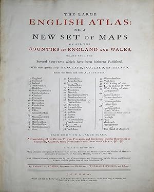
The Large English Atlas, or, a New Set of Maps of all the Counties in England and Wales, Drawn from the Several Surveys which have been hitherto Published. With three general Maps of England, Scotland, and Ireland.
Verlag: London: Printed and Sold by T. Bowles, in St. Paul's Church-Yard; John Bowles, at the Black Horse, in Cornhill; and Robert Sayer, at the Buck, in Fleet-Street, [1763], 1763
Anbieter: Arader Galleries - AraderNYC, New York, NY, USA
Verkäuferbewertung 5 von 5 Sternen
Folio (22 1/2 x 15 1/4 in.; 57.2 x 38.7 cm). Title printed in red and black incorporating general index, 50 engraved maps on 47 double-folding sheets, hand-colored in outline, with cartouches, vignettes, and inset plans, mounted on guards. BINDING/CONDITION: Map of Kent with centerfold split, England & Wales, Suffolk, Oxfordshire and Surrey with shorter splits. Contemporary calf, red morocco spine label, extremities worn with some tears, joints split, upper cover nearly detached. (64F5C) Emanuel Bowen's contribution to eighteenth-century British atlases is substantial. Using contemporary sources, he published and drew maps the county maps in his "Large English Atlas," the first to cover England and Wales on a large scale, which were subsequently reduced by Bowen and Kitchin for their "Royal English Atlas" and then by Emanuel and Thomas Bowen for "Atlas Anglicanus," published after Emanuel Bowen's death by Kitchin. "All three works are characterized by detailed texts in the spaces surrounding the maps and by elegant rococo decoration, which became the hallmark of his engraving" (DNB). PROVENANCE: Bonham's London, 7 March 2019, lot 59. REFERENCE: Chubb CXCVII.
-
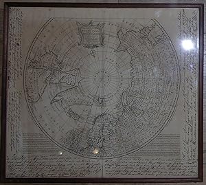
A New & Accurate Map of the North Pole
Verlag: London: William Innys,. 1747]., 1747
Anbieter: Arader Galleries - AraderNYC, New York, NY, USA
Verkäuferbewertung 5 von 5 Sternen
A new & accurate map of the North Pole, with all the countries hitherto discovered situated near or adjacent to it, as well as some others more remote. Drawn from the latest and best authorities and regulated by astronoml. observatns. By Eman. Bowen. [London: Printed for William Innys, Richard Ware, Aaron Ward, J. and P. Knapton, John Clarke, T. Longman and T. Shewell, Thomas Osborne, Henry Whitridge . M.DCC.XLVII]. Double-page engraved map (17 4/8 x 19 4/8 inches, full margins, showing the plate mark). Fine map of the North Pole and surrounding hemisphere on a polar projection, the title within a fine rococo cartouche top centre, and showing northern Europe, Greenland and northern North America, with explanatory text in the margins both sides of the of the hemisphere (a bit browned). Provenance: with copies 19th-century manuscript notes in the margins, including extracts from Sir John Ross' "Narrative of a Second Voyage in Search of a North-West Passage and of a Residence in the Arctic Regions during the years 1829, 1830, 1831, 1832, 1833". A fine map of the North Pole from Bowen's "A complete system of geography", London: Printed for William Innys, 1757, the margins filled with notes from Ross's voyage in search of a North-West Passage regarding the great cold and impenetrable ice of Prince Regents Inlet, not very far from where Sir John Franklin went missing about 15 years later, and where one of his ships has just been found. Emanuel Bowen's contribution to eighteenth-century world and British atlases is substantial. Using contemporary sources, he published and drew maps for the "Complete System of Geography" (2 vols., 1744-47), "The Maps and Charts to the Modern Part of the Universal History" (published in 1766 under Thomas Kitchin's name), the celebrated maps for John Harris's "Navigantium atque itinerantium bibliotheca" (1744-48), and all twenty-two new plates in the final edition (1754) of Patrick Gordon's "Geography Anatomized", the county maps in his "Large English Atlas" (1760) the first to cover England and Wales on a large scale, and subsequently reduced by Bowen and Kitchin for their "Royal English Atlas" (ca.1763) and then by Emanuel and Thomas Bowen for "Atlas Anglicanus" (1767-8), published after Emanuel Bowen's death by Kitchin. "All three works are characterized by detailed texts in the spaces surrounding the maps and by elegant rococo decoration, which became the hallmark of his engraving" (Iolo Roberts and Menai Roberts for DNB). P-Maps, p. 117 (1752 ed.); NMM p.356; M&B p 166.
-
Atlas Anglicanus, Or a Complete Sett of Maps of the Counties of South Britain . To which is added a Correct Map of the Roads of England, with the Distances agreable to the Mile Stones and other exact Admensurations, between the Principal Towns.
Verlag: [London:] Printed for Thomas Kitchin, [1767]., 1767
Anbieter: Arader Galleries - AraderNYC, New York, NY, USA
Verkäuferbewertung 5 von 5 Sternen
Erstausgabe
1st Edition. Small folio (9 4/8 x 8 2/8 inches). Double-page engraved title-page, 2 leaves of letterpress subscribers, 41 (of 45) full-sheet engraved maps, all partially handcolored in outline (lacking Hereford, Kent, Sussex, and North Wales, title-page and a few maps with short separations at central folds, a few manuscript titles shaved). Early calf, rear cover with overlapping fore-edge (rubbed, recased with renewed endpapers). Provenance: Early manuscript index, all maps numbered and titled in manuscript on the verso. First edition. Emanuel Bowen's contribution to eighteenth-century world and British atlases is substantial. Using contemporary sources, he published and drew maps for the "Complete System of Geography" (2 vols., 1744-7), "The Maps and Charts to the Modern Part of the Universal History" (published in 1766 under Thomas Kitchin's name), the celebrated maps for John Harris's "Navigantium atque itinerantium bibliotheca" (1744-8), and all twenty-two new plates in the final edition (1754) of Patrick Gordon's "Geography Anatomized", the county maps in his "Large English Atlas" (1760) the first to cover England and Wales on a large scale, and subsequently reduced by Bowen and Kitchin for their "Royal English Atlas" (ca.1763) and then by Emanuel and Thomas Bowen for "Atlas Anglicanus" (1767-8), published after Emanuel Bowen's death by Kitchin. "All three works are characterized by detailed texts in the spaces surrounding the maps and by elegant rococo decoration, which became the hallmark of his engraving" (Iolo Roberts and Menai Roberts for DNB). Chubb, Printed Maps in the Atlases of Great Britain CCXXXII.