Bongars (23 Ergebnisse)

- Softcover
Anbieter: medimops, Berlin, Deutschlandmedimops
Verkäufer/-in kontaktierenVerkäufer/-in mit 5 SternenZustand: Gebraucht - Befriedigend
EUR 17,31
EUR 10,00 VersandVersand von Deutschland nach USAAnzahl: 1 verfügbar
Zustand: good. Befriedigend/Good: Durchschnittlich erhaltenes Buch bzw. Schutzumschlag mit Gebrauchsspuren, aber vollständigen Seiten. / Describes the average WORN book or dust jacket that has all the pages present. Mathou (illustrator).

- Softcover
Anbieter: PBShop.store US, Wood Dale, IL, USAPBShop.store US
Verkäufer/-in kontaktierenVerkäufer/-in mit 5 SternenZustand: Neu
EUR 36,06
Versand nach gratisVersand innerhalb von USAAnzahl: 15 verfügbar
PAP. Zustand: New. New Book. Shipped from UK. Established seller since 2000.
- Softcover
Anbieter: PBShop.store UK, Fairford, GLOS, Vereinigtes KönigreichPBShop.store UK
Verkäufer/-in kontaktierenVerkäufer/-in mit 5 SternenZustand: Neu
EUR 31,99
EUR 6,87 VersandVersand von Vereinigtes Königreich nach USAAnzahl: 15 verfügbar
PAP. Zustand: New. New Book. Shipped from UK. Established seller since 2000.

- Hardcover
Anbieter: PBShop.store US, Wood Dale, IL, USAPBShop.store US
Verkäufer/-in kontaktierenVerkäufer/-in mit 5 SternenZustand: Neu
EUR 46,29
Versand nach gratisVersand innerhalb von USAAnzahl: 15 verfügbar
HRD. Zustand: New. New Book. Shipped from UK. Established seller since 2000.
- Hardcover
Anbieter: PBShop.store UK, Fairford, GLOS, Vereinigtes KönigreichPBShop.store UK
Verkäufer/-in kontaktierenVerkäufer/-in mit 5 SternenZustand: Neu
EUR 40,42
EUR 6,87 VersandVersand von Vereinigtes Königreich nach USAAnzahl: 15 verfügbar
HRD. Zustand: New. New Book. Shipped from UK. Established seller since 2000.
 Weitere Bilder
Verlag: Essener Verlagsanstalt
- Hardcover
Anbieter: Stadion Books, Amsterdam, NiederlandeStadion Books
Verkäufer/-in kontaktierenVerkäufer/-in mit 2 SternenZustand: Gebraucht
EUR 35,00
EUR 17,55 VersandVersand von Niederlande nach USAAnzahl: 1 verfügbar
1941, 262pp, hardcover, rug wat minder, gebruikssporen, zonder kaart.

- Softcover
Anbieter: moluna, Greven, Deutschlandmoluna
Verkäufer/-in kontaktierenVerkäufer/-in mit 5 SternenZustand: Neu
EUR 30,60
EUR 48,99 VersandVersand von Deutschland nach USAAnzahl: Mehr als 20 verfügbar
Zustand: New.
- Softcover
Anbieter: LiLi - La Liberté des Livres, CANEJAN, FrankreichLiLi - La Liberté des Livres
Verkäufer/-in kontaktierenVerkäufer/-in mit 5 SternenZustand: Gebraucht - Sehr gut
EUR 17,91
EUR 65,00 VersandVersand von Frankreich nach USAAnzahl: 1 verfügbar
Zustand: fine. vendeur professionnel. envoi soigne en 24/48h. le livre peut presenter de tres legers signes d'usure, petites rayures ou imperfections esthetiques. Mathou (illustrator).

- Softcover
Anbieter: moluna, Greven, Deutschlandmoluna
Verkäufer/-in kontaktierenVerkäufer/-in mit 5 SternenZustand: Neu
EUR 42,12
EUR 48,99 VersandVersand von Deutschland nach USAAnzahl: Mehr als 20 verfügbar
Zustand: New. KlappentextrnrnThis scarce antiquarian book is a facsimile reprint of the original. Due to its age, it may contain imperfections such as marks, notations, marginalia and flawed pages. Because we believe this work is culturally important, we have.

- Softcover
Anbieter: AHA-BUCH GmbH, Einbeck, DeutschlandAHA-BUCH GmbH
Verkäufer/-in kontaktierenVerkäufer/-in mit 5 SternenZustand: Neu
EUR 54,65
EUR 63,02 VersandVersand von Deutschland nach USAAnzahl: 1 verfügbar
Taschenbuch. Zustand: Neu. Neuware - This scarce antiquarian book is a facsimile reprint of the original. Due to its age, it may contain imperfections such as marks, notations, marginalia and flawed pages. Because we believe this work is culturally important, we have made it available as part of our commitment for protecting, pr…eserving, and promoting the world's literature in affordable, high quality, modern editions that are true to the original work.

- Softcover
Anbieter: Buchpark, Trebbin, DeutschlandBuchpark
Verkäufer/-in kontaktierenVerkäufer/-in mit 5 SternenZustand: Gebraucht - Sehr gut
EUR 12,78
EUR 105,00 VersandVersand von Deutschland nach USAAnzahl: 1 verfügbar
Zustand: Sehr gut. Zustand: Sehr gut | Sprache: Französisch | Produktart: Bücher | Keine Beschreibung verfügbar. Ally, Clara (illustrator).

Verlag: Hachette, Paris, 1887
- Softcover
Anbieter: Bonnefoi Livres Anciens, Paris, FrankreichBonnefoi Livres Anciens
Verkäufer/-in kontaktierenVerkäufer/-in mit 4 SternenVerbandsmitglied: ILAB
Zustand: Gebraucht
EUR 63,00
EUR 40,00 VersandVersand von Frankreich nach USAAnzahl: 1 verfügbar
In-8 broché de LXXVI-224 pp. couverture imprimée. Édition Léonce Anquez. Le calviniste Jacques Bongars seigneur de Bauldry et de La Chesnaye (1554-1612) fut l'agent d'Henri IV auprès du Saint-Empire. Historien et philologue, il est l'auteur d'ouvrages d'histoire romaine et d'histoire des croisades. Hauser 2704.
Sprache: Französisch
Verlag: Arnout Leers & Adrian Moetjens, La Haye, 1681
- Hardcover
Anbieter: Librairie Rouchaleou, Saint-André-de-Sangonis, FR, FrankreichLibrairie Rouchaleou
Verkäufer/-in kontaktierenVerkäufer/-in mit 5 SternenZustand: Gebraucht - Sehr gut
EUR 250,00
EUR 54,00 VersandVersand von Frankreich nach USAAnzahl: 1 verfügbar
Couverture rigide. Zustand: Très bon. 1 volume reliure plein veau fauve ancienne, dos lisse très orné, pièce de titre de cuir beige, tranches teintées rouge, 15 faux-feullets non chiffrés et 497 pages. Bel exemplaire ( Photographies sur demande / We can send pictures of this book on simple request ).

Verlag: CHEZ CH.ANT. JOMBERT PERE, 1772
- Hardcover
Anbieter: Le-Livre, SABLONS, FrankreichLe-Livre
Verkäufer/-in kontaktierenVerkäufer/-in mit 5 SternenVerbandsmitglied: ILAB
Zustand: Gebraucht - Gut bis sehr gut
EUR 255,00
EUR 42,00 VersandVersand von Frankreich nach USAAnzahl: 1 verfügbar
Couverture rigide. Zustand: bon. R300122904: 1772. In-12. Relié plein cuir. Etat d'usage, Coins frottés, Dos abîmé, Intérieur frais. XVI + 482 pages - contre plats jaspés - coiffe en tête absente - coiffe en pied abîmée - manque de cuir sur le dos - tranches dorées - 2 photos disponibles . . . . Classification Dewey : 840.05-XVI…II ème siècle.
 Weitere Bilder
Verlag: Hanau, typis Wechelianis, apud heredes Joan. Aubry, 1611., 1611
- Softcover
Anbieter: Antiquariat INLIBRIS Gilhofer Nfg. GmbH, Vienna, A, ÖsterreichAntiquariat INLIBRIS Gilhofer Nfg. GmbH
Verkäufer/-in kontaktierenVerkäufer/-in mit 5 SternenZustand: Gebraucht
EUR 25.000,00
EUR 30,00 VersandVersand von Österreich nach USAAnzahl: 1 verfügbar
Folio (240 x 352 mm). (56), 1203 (instead of 1207, properly 1205), (1) pp. (p. 623f. blank, wants pp. 231f. & 237f.). - (Includes, as part 2:) Sanudo, Marino. Liber secretorum fidelium crucis super Terrae Sanctae recuperatione et conservatione [.] Orientalis historiae tomus secundus. Ibid., 1611. (12), 361, (3) pp. (283f. printe…d as a double-page-sized folding table). Both parts with engraved printer's device to title-page. With 3 double-page-sized folding engraved maps and 2 engraved plans as well as a woodcut printer's device at the end. Slightly later full calf, spine elaborately gilt. Only edition of this early, important source book for the history of the crusades and the Kingdom of Jerusalem and its vassal states. The second parts contains the first printing of the much sought-after 14th century maps and plans by the Genoese cartographer Pietro Vesconte, previously available in manuscript copies only. "Four of the maps from Marino Sanudo's early fourteenth-century manuscript atlas were reprinted by Johann Bongars in 1611. Sanudo's planisphere [.] is one of the few examples of medieval maps based on portolano sources in printed form. It is a circular map centered on Jerusalem with the Mediterranean relatively well defined. The ocean surrounds the whole of the known world, the outer parts of which are represented by conjecture. The authorship of Marino Sanudo is not definitely established and the original manuscript has also been attributed to Pietro Vesconte" (Shirley). - One of two title variants differing only in slight changes in the typesetting (here: "Expeditionum" begins between the "O" and the "R" of "Orientalium"). Binding somewhat rubbed, hinges starting. Rather severely browned throughout due to paper stock, some waterstaining to margins, more pronounced near the end, sometimes reaching into the printed text. Stains to first title-page; the second title and its counter-leaf *6 are printed on different paper stock. Some light worming, mainly confined to margins but also touching the text near the end; occasional edge defects. A copy in modern half vellum (severely browned, with some worming, but otherwise complete) commanded 13,000 Euros at Reiss's spring 2009 auction. - VD 17, 1:069728C. Atabey 127. Ioannou 49 (variant). Potthast I, 105. Tooley I, 162. Cf. Tobler 12. For the maps: Shirley 276 (with plate 217); Nordenskiöld 51 (with fig. 28); Laor 783 & 1145f. as well as Lex. Kart. 576 & 860f.
Verlag: Elzevier/Elsevier, Ex Officina Elzeviriorum, Lugdunum Batavorum (Leiden), 1647
- Hardcover
- Erstausgabe
Anbieter: Antiquariat Clement, Bonn, DeutschlandAntiquariat Clement
Verkäufer/-in kontaktierenVerkäufer/-in mit 4 SternenZustand: Gebraucht
EUR 950,00
EUR 51,00 VersandVersand von Deutschland nach USAAnzahl: 1 verfügbar
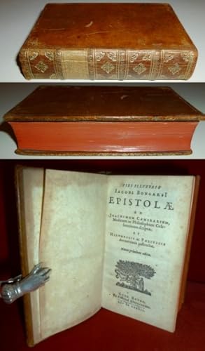
Erstausgabe Leder Sehr gut. Text Lateinisch. Ganzledereinband mit ornamental gestaltetem, goldgeprägtem Rückentitel, 4 Bünde, Einband mit angenehmster Patina, Kapital/Kapitalband intakt, Goldprägung auch an den Buchkanten, minimalste Schieflage, Schnitt rundum rot eingefärbt, Titelblatt mit Elzevir-Markenzeichen, mit Titelvignet…ten, Vorwort 10 Seiten, 444 Seiten mit Schlußvignette, perfekt gedruckt, stockfleckenfrei, sauber, ein Kleinod! Die Briefe des berühmten Jacobus Bongarz (vermutlich oder Bongart) geschrieben an Joachim Camerarius, den hochberühmten Arzt und Philosophen, durch historische und politische Zeugnisse ergänzt. Joachim Camerarius der Jüngere (1534 - 1598), deutscher Arzt, Botaniker und Naturforscher. +++ An exquisite and first edition of Jacob Bongarz, letters to Joachim Camerarius jr., excellent condition.+++ 7,3 x 12,5 Cm. 0,17 Kg. +++ Stichwörter: Alte Drucke Elseviriana Rarität Rara Briefwechsel Bibliophilie Gewicht in Gramm: 170.
 Weitere Bilder
Q. Curtius Rufus De rebus gestis Alexandri Magni:cum commentariis Raderi, Bongarsii, Popmae, Salmaaii, Gronovii, Loccenii & Freinshemii : hujusque & vetustioribus supplementis, nec non locorum difficiliorum interpretatione, & indice philologico locupletissimo rerum & verborum : accedunt figurae aeneae ad historiam Alexandri Magni apud curtium illustrandam necessariae. First edition.
Rufus, Q. Curtius ; Curtius Rufus, Quintus; Alexander the Great, 356 B.C.-323 B.C; Schoonebeek, Adriaan 1657 or 8-1705., Saumaise, Claude 1588-1653., Rader, Mattha?us 1561-1634., Popma, Titus d. 1620., Loccenius, Johan 1598-1677., Gronovius, Jacobus 1645-1716., Bongars, Jacques 1554-1612., Freinsheim, Johann 1608-1660.
Sprache: Latein
Verlag: Lugduni Batavorvm [Leiden] : Excudit Petrus vander Aa, bibliop., 1696
- Hardcover
Anbieter: Wittenborn Art Books, San Francisco, CA, USAWittenborn Art Books
Verkäufer/-in kontaktierenVerkäufer/-in mit 5 SternenZustand: Gebraucht - Befriedigend
EUR 451,71
EUR 8,77 VersandVersand innerhalb von USAAnzahl: 1 verfügbar
Zustand: Good. Contemporary calf, gilt spine. 11 x 19 cm.36 plates, some folding including a map of Alexander the Great's route. Manuscirpt annotatations in an ancient hand with added engraving.Manuscript notation in Getty Research Institute copy attributes the engravings to Adriaan Schoonebeeck.Illustrated with an added engrave…d title-page, frontispiece, and plates.Signatures: *?(-*1) 2* (-2* ) A-3E? 3F a-h? i (-i2) k.QUINTII CURTII D. REBUS GESTIS ALEXANDRI MAGNI. Commentarris. Lug. Batavorrum. P. Vander Aa. 1696. 36 planches hors texte, rel. de l'époque, veau moucheté, dos ornéExpertise by Roger ROQUES - 06.12.15.30.68 - - 2 rue du Périgord - 31000 TOULOUSE.
 Weitere Bilder
Sprache: Latein
Verlag: Typis Wechelianis apud Claudium Marnium & haeredes Ioan. Aubrii, Hannau, 1611
- Hardcover
- Erstausgabe
Anbieter: Librairie Voyage et Exploration, Cerny, FrankreichLibrairie Voyage et Exploration
Verkäufer/-in kontaktierenVerkäufer/-in mit 3 SternenZustand: Gebraucht - Gut bis sehr gut
EUR 10.000,00
EUR 45,00 VersandVersand von Frankreich nach USAAnzahl: 1 verfügbar
Couverture rigide. Zustand: Bon. Edition originale. Hanau, Typis Wechelianis apud Claudium Marnium & haeredes Ioan. Aubrii, 1611. In-folio, [16]-1196-[76] pp. + [4]-285-[3] pp., 5 cartes gravées sur cuivre dont 3 grandes dépliantes. Plein veau, dos à nerfs aux armes de la famille de Montholon, restauration à la reliure, brunissu…res importantes par endroits, légères rousseurs aux cartes, léger pli au titre. Exemplaire complet. Provenance : reliure aux armes de la famille de Montholon ; étiquette de la librairie Dorbon-Ainé. En deux parties avec chacune son titre propre. Diplomate, érudit et collectionneur de manuscrits, Jacques Bongars (1554-1612) consacra une grande partie de sa vie à rassembler les sources de l'épopée des croisades. Le résultat de ce travail monumental parut en 1611, l'année avant sa mort : une anthologie de toutes les grandes chroniques latines de la guerre sainte, Guillaume de Tyr, Albert d'Aix, Foucher de Chartres, Jacques de Vitry, accompagnées de listes des princes, prélats et chefs militaires, et de passages relatifs aux origines et à la discipline des Templiers. La seconde partie, paginée séparément, reproduit le Liber Secretorum Fidelium Crucis du patricien vénitien Marino Sanudo Torsello (v. 1270-1343), traité rédigé pour convaincre les puissances chrétiennes de reprendre les armes pour la Terre sainte, et qui constitue l'une des analyses les plus fouillées du commerce, de la politique et de l'histoire de l'Orient latin au tournant du XIVe siècle. C'est dans cette seconde partie que se trouvent les cinq cartes gravées. La plus remarquable est une mappemonde circulaire de type portulan, centrée sur Jérusalem, que Shirley qualifie de « rare exemple de carte médiévale imprimée issue de sources portulanes » (Mapping of the World, n° 276) : il s'agit de la première reproduction imprimée connue de cette carte, jusqu'alors uniquement connue par des copies manuscrites. Son attribution fait débat, tantôt donnée à Pietro Vesconte, tantôt à Marino Sanudo lui-même, le manuscrit original ayant circulé sous les deux noms, mais sa valeur cartographique et sa rareté en font l'un des artefacts les plus recherchés de la cartographie médiévale. Les quatre autres cartes complètent un ensemble géographique d'une cohérence remarquable : une carte de la Terre Sainte divisée selon les douze tribus d'Israël, un plan de Jérusalem figurant ses édifices religieux, un plan d'Acre, dernier bastion des croisés en Orient, et une carte maritime de la Méditerranée orientale d'après les portulans italiens. First edition. One of the two title-page variants recorded by Ioannou. The world map is described by Shirley as one of the few examples of medieval cartography based on portolan sources to survive in printed form, making this volume not only the essential reference on the Crusades but one of the landmarks of the history of cartography. Atabey 127, Ioannou 49, Shirley 276. Pietro Vesconte, Marino Sanudo (illustrator).
 Weitere Bilder
Verlag: Johann Bongars, Hanao, Germany, 1611
Anbieter: Argosy Book Store, ABAA, ILAB, New York, NY, USAArgosy Book Store, ABAA, ILAB
Verkäufer/-in kontaktierenVerkäufer/-in mit 5 SternenZustand: Gebraucht
EUR 3.478,13
EUR 5,26 VersandVersand innerhalb von USAAnzahl: 1 verfügbar
Map. Engraving in Eli Wilner gilt frame 14 3/8 by 18". This outstanding rare engraved map of the Levant, including Cyprus, the Nile River, and Mesopotamia, is a remarkable historical artifact based on a 14th-century medieval portolan by Pietro Vesconte. The map is oriented with East at the top, following the traditional medieval… cartographic convention. In very good condition with some toning. Pietro Vesconte, (1310-1330) a Genoese cartographer, was among the earliest and most influential creators of portolan charts. His work represents some of the first attempts at accurate, empirical nautical mapping in the Mediterranean world. This map was engraved as part of a series by Jacques Bongars, (1554-1612), a notable French diplomat, classical scholar, and historian. Bongars is best remembered for his compilation "Gesta Dei per Francos," a collection of primary source documents chronicling the Crusades. His contribution to historical scholarship and cartography is reflected in these engraved maps, which merge medieval geographic knowledge with early modern engraving techniques. Bongars' adaptation of Vesconte's charts for print represents a significant moment in the transmission of medieval geographic knowledge into the early modern period. The inclusion of Cyprus, the Nile, and Mesopotamia demonstrates the wide geographical scope of medieval interest in the Eastern Mediterranean, especially in the context of Crusader routes and pilgrimage destinations. Its survival offers a fascinating glimpse into the intellectual and artistic currents that bridged the medieval and Renaissance worlds.
Verlag: Leiden, Elzevier, 1647; Paris, 1650., 1650
Anbieter: Biblion Antiquariat, Zürich, ZH, SchweizBiblion Antiquariat
Verkäufer/-in kontaktierenVerkäufer/-in mit 5 SternenZustand: Gebraucht
EUR 1.200,00
EUR 25,00 VersandVersand von Schweiz nach USAAnzahl: 1 verfügbar
13,5x7,5 cm. (6) Bl., 444 S.; 160 S. Roter Maroquin-Bd. mi reicher goldgepr. Rückenverzierung, mehrfacher Deckel-, Innenkanten- und Spiegel-Fileteriung (sign. P. Lefebvre). Mit dem gestoch. Exlibris Holland-House auf dem Innendeckel. - (Seitenränder wasserrandig, dekorativer Einband). Sprache: lateinisch.
 Weitere Bilder
- Signiert
Anbieter: Librairie du Levant, Bayonne, FrankreichLibrairie du Levant
Verkäufer/-in kontaktierenVerkäufer/-in mit 1 SternenZustand: Gebraucht
EUR 231,00
EUR 6,00 VersandVersand von Frankreich nach USAAnzahl: 1 verfügbar
Chez Carles Osmont, à l'Ecu de France. 1681. Avec Privilège du Roi. In-12° sous reliure d'époque en cuir solide. XXII + 391pp. Avec dédicace au M. Le Daufin. Français Etat général correcte pour un exemplaire tricentenaire. Intérieur complet, bien préservé, lisible et agréable. Reliure présente, malgré quelques déchirures et marq…ues d'âge considérables.

- Karte
Anbieter: Geographicus Rare Antique Maps, Brooklyn, NY, USAGeographicus Rare Antique Maps
Verkäufer/-in kontaktierenVerkäufer/-in mit 4 SternenZustand: Gebraucht
EUR 3.035,46
EUR 14,91 VersandVersand innerhalb von USAAnzahl: 1 verfügbar
Excellent. Deckled right margin, close at lower right but margins complete. A fine example with a bold strike. Size 10.25 x 7.75 Inches. This rare plan of Jerusalem is the earliest printed iteration of Pietro Vesconte's manuscript plan of the city. While not committed to print until this 1611 edition by Jacques Bongars, the map…is the work of the 14th-century Venetian cartographer Vesconte, who produced it c. 1320 to promote Marino Sanudo's proposed crusade to recapture the city. As such, it is one of the earliest surviving plans to support a specific military effort. Reading the Plan As it was bound into Bongars' work, the plan is oriented to the south (as indicated by the plate number at the upper left corner). Bongars has, however, rotated the composition ninety degrees to fit the sheet. The manuscript original is oriented to the east, and this is reflected in the orientation of Bongars' engraved text. (We have pictured the plan with its proper eastern orientation.) The plan includes not only the walled city of Jerusalem but also embraces the surrounding region as far as the village of Bethany to the east. Towns, forts, and towers are shown pictorially, and fig palms are pictured. All are rendered in the manner of Vesconte's original, 14th-century manuscript. The Basis of the Plan Vesconte's 14th-century manuscript has no clear precursor. Its sources include both the ancient descriptions of Josephus (c. 37 - c. 100) and the firsthand medieval reports of Burchard of Mount Sion (fl. late 13th century). The latter was one of the last Westerners to write about a visit to Jerusalem prior to its fall to Sultan al-Ashraf Khalil in 1291. His reports would have been of particular interest to Sanudo: Burchard, in his own turn, also proposed a new Crusade. Like Sanudo's, Burchard's plan called for a preliminary conquest to form a jumping-off point for the retaking of Jerusalem - although his initial target was not Sanudo's Egypt but the Orthodox lands of Serbia and Constantinople. A Practical Plan of Jerusalem Sanudo, Vesconte, and Burchard were all Western Christians, and their primary interest in Jerusalem and the Holy Land was its carried weight of Biblical history. Consequently, the plan includes the holy sites the proposed crusade was intended to seize. For instance, near the village of Bethany is the fig tree cursed by Jesus. At the center of the plan is the Palace and Temple of Solomon. The plan also includes the Church of the Holy Sepulchre. Medieval features, such as the Church of the Ascension on the Mount of Olives, appear as well. Significantly, the plan also offers a practical focus: it details the city's walls and, emphatically, its water supply, here dramatically exaggerated. The Kidron is depicted as a huge river, nearly enclosing Jerusalem like a moat. While not based on any sort of systematic survey, the depiction of the city emphasizes a physically real city with its fortifications and neighboring villages with their own forts. Promoting a New Crusade This plan of Jerusalem was not intended for the religious edification of the armchair pilgrim, but rather as part of a practical set of suggestions in anticipation of an actual attempt to seize the city. While it would not have been of use to actual soldiers in the field, its purpose, and that of the portolan maps accompanying it, was to convince the leaders of Western Europe - Pope John XXII and King Charles IV of France - of the practicality of a new crusade. It appeared in the Venetian diplomat Marino Sanudo's Liber secretorum fidelium crucis (Book of Secrets for True Crusaders), which detailed his proposed effort to take the Holy Land for the Christian West. Publication History and Census This printed edition of the plan appeared in Jacques Bongars' 1611 Gesta Dei per Francos, sive Orientalium expeditionum, et regni Francorum Hierosolimitani historia which collected in one volume the surviving medieval texts pertaining to France's role in the crusades. As such, it.

- Karte
Anbieter: Geographicus Rare Antique Maps, Brooklyn, NY, USAGeographicus Rare Antique Maps
Verkäufer/-in kontaktierenVerkäufer/-in mit 4 SternenZustand: Gebraucht
EUR 2.782,51
EUR 14,91 VersandVersand innerhalb von USAAnzahl: 1 verfügbar
Excellent. Some creasing at folds, else a fine example with a bold strike. Size 10.25 x 12.5 Inches. This is the earliest printed iteration of Pietro Vesconte's 1611 portolan map of the Eastern Mediterranean, the Lower Nile, the Arabian Peninsula, and Mesopotamia. While not committed to print until this 1611 edition by Jacques B…ongars, the map is the work of the 14th-century Venetian cartographer Vesconte, who produced it c. 1320 to promote Marino Sanudo's proposed crusade. As such, it is one of the earliest surviving maps to support a specific military effort. Reading the Map This printed map is a faithful copy of a 14th-century manuscript and thus pre-dates the European rediscovery of Ptolemy's Geographia . Consequently, the map lacks Ptolemy's precision, systematic scale, or conventions of orientation. The map is oriented to the east with the eastern Mediterranean, indicated with hachured waves, at the bottom just left of center. The eastern tip of the Crete appears at the base along with the archipelago, including Scarpanto and Rhodes. The map follows the coast of Asia Minor, listing the locations in the manner of a Portolan. A very large Cyprus is depicted south of Asia Minor. Note the orientation of the place names on the island, suggesting a direction of travel from east to west, as distinct from the place names elsewhere leading towards the Holy Land. Beyond Cyprus, place names along the coasts of Lebanon and Palestine are also rotated to facilitate travel. Both within the Holy Land and on the Egyptian coastlines, major cities and fortifications are shown pictorially. The Mediterranean commands the lower left corner, which abandons scale in order to place the region in a broader scope. The lower right depicts Egypt. The Nile Delta and the Mediterranean coast approaching Alexandria share the portolan-esque quality of the rest of the Mediterranean chart, but points south depict details in a much more schematic, mappamundi-like manner, showing Egypt's western fortifications as well as its castles along the Nile. The upper left describes Mesopotamia: the Tigris and Euphrates Rivers, the city of Babylon, and the distant lands of Assyria and Persia. The rivers reach southwards towards the Persian Gulf. The Red Sea is named, revealing a drastically minimized Arabian Peninsula featuring the Church of Saint Catherine upon Mount Sinai, a short distance from Mecca. The waters beyond - a drastically foreshortened Indian Ocean - show an array of islands whose names (Nebile, Celtales, and so on) are drawn from the Travels of Marco Polo. One of the Earliest Military Maps Despite the wild distortions of the southern and eastern portions of the map, the Mediterranean areas were, firstly, based on the best techniques of charting available in the 14th century. The purpose of the map was to convince the leaders of Western Europe - Pope John XXII and King Charles IV of France in particular - of the practicality of a new crusade to Capture the Holy Land. It appeared in the Venetian diplomat Marino Sanudo's Liber secretorum fidelium crucis (Book of Secrets for True Crusaders), which detailed his proposed effort to take the Holy Land for the Christian West. Publication History and Census This printed edition of the map appeared in Jacques Bongars' 1611 Gesta Dei per Francos, sive Orientalium expeditionum, et regni Francorum Hierosolimitani historia which collected in one volume the surviving medieval texts pertaining to France's role in the crusades. As such, it presented in print for the first time the full complement of Vesconte's maps. (The map specifically of the Holy Land, dubbed the Sanuto-Vesconte map, found its way into several of the printed editions of Ptolemy's Geographia , but the other maps such as this remained neglected.) The book, while well-represented in institutional collections, was printed in a single edition, and its maps are rare on the market. One example of the separate map is listed in OCLC. References: OCLC 87504062.


