
Gesamtpreis (1 Artikel Artikel):
Versandziel:

bligh capt william (5 Ergebnisse)
Direkt zu den wichtigsten Suchergebnissen
Suchfilter
Produktart
- Alle Product Types
- Bücher (5)
- Magazine & Zeitschriften (Keine weiteren Ergebnisse entsprechen dieser Verfeinerung)
- Comics (Keine weiteren Ergebnisse entsprechen dieser Verfeinerung)
- Noten (Keine weiteren Ergebnisse entsprechen dieser Verfeinerung)
- Kunst, Grafik & Poster (Keine weiteren Ergebnisse entsprechen dieser Verfeinerung)
- Fotografien (Keine weiteren Ergebnisse entsprechen dieser Verfeinerung)
- Karten (Keine weiteren Ergebnisse entsprechen dieser Verfeinerung)
- Manuskripte & Papierantiquitäten (Keine weiteren Ergebnisse entsprechen dieser Verfeinerung)
Zustand Mehr dazu
- Neu (Keine weiteren Ergebnisse entsprechen dieser Verfeinerung)
- Wie Neu, Sehr Gut oder Gut Bis Sehr Gut (Keine weiteren Ergebnisse entsprechen dieser Verfeinerung)
- Gut oder Befriedigend (2)
- Ausreichend oder Schlecht (Keine weiteren Ergebnisse entsprechen dieser Verfeinerung)
- Wie beschrieben (3)
Einband
Weitere Eigenschaften
- Erstausgabe (Keine weiteren Ergebnisse entsprechen dieser Verfeinerung)
- Signiert (1)
- Schutzumschlag (Keine weiteren Ergebnisse entsprechen dieser Verfeinerung)
- Angebotsfoto (3)
Sprache (1)
Preis
- Beliebiger Preis
- Weniger als EUR 20 (Keine weiteren Ergebnisse entsprechen dieser Verfeinerung)
- EUR 20 bis EUR 45
- Mehr als EUR 45
Gratisversand
Land des Verkäufers
Verkäuferbewertung
-

Voyage to the South Sea: Undertaken By Command of His Majesty for the Purpose of Conveying the Bread-Fruit Tree to the West indies, in His Majesty's Ship the Bounty.
Verlag: Rare Books, Honolulu, HI, USA, 1967
Anbieter: Munster & Company LLC, ABAA/ILAB, Corvallis, OR, USA
Verbandsmitglied: ABAA CBA ILAB
Verkäuferbewertung 5 von 5 Sternen

Zustand: Good. Honolulu, HI, USA: Rare Books, 1967. Facsimile; cover very barely sunned/rubbed/bumped; top edge very barely soiled; binding tight; cover, edges, and interior intact and clean except where noted; due to the size of this item, additional shipping charges may apply. hardcover. Good. 4to - over 9ľ" - 12" tall.
-
![Bild des Verkäufers für Colonies and Trade [Offprint] zum Verkauf von Besleys Books PBFA](https://pictures.abebooks.com/inventory/md/md32249806734.jpg)
Colonies and Trade [Offprint]
Erscheinungsdatum: 1793
Anbieter: Besleys Books PBFA, Diss, Vereinigtes Königreich
Verbandsmitglied: PBFA
Verkäuferbewertung 5 von 5 Sternen
EUR 29,79
EUR 20,82 Versand
Versand von Vereinigtes Königreich nach USAAnzahl: 1 verfügbar
In den WarenkorbSoft Cover. Zustand: Good. Booklet, page 305 detached. Pp. 305-317. Scarce. (ar23).
-
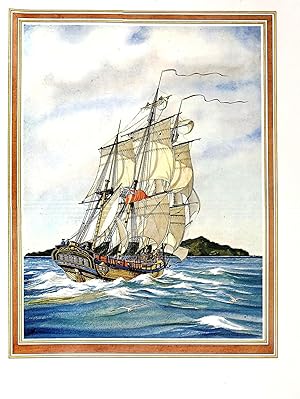
A VOYAGE TO THE SOUTH SEAS UNDERTAKEN BY COMMAND OF HIS MAJESTY FOR THE PURPOSE OF CONVEYING THE BREAD-FRUIT TREE TO THE WEST INDIES IN HIS MAJESTY'S SHIP BOUNTY COMMANDED BY LIEUTENANT WILLIAM BLIGH INCLUDING AN ACCOUNT OF THE MUTINY ON BOARD THE SAID SHIP AND THE SUBSEQUENT VOYAGE OF PART OF THE CREW IN THE SHIP'S BOAT FROM TOFAO, ONE OF THE FRIENDLY ISLANDS, TO TIMOR, A DUTCH SETTLEMENT IN THE EAST INDIES
Verlag: Limited Editions Club, Adelaide, South Australia, 1975
Anbieter: Charles Agvent, est. 1987, ABAA, ILAB, Fleetwood, PA, USA
Verkäuferbewertung 5 von 5 Sternen
Signiert
Hardcover. Geoffrey Ingleton (illustrator). Tall folio (9-5/8" x 14") bound in full tan homespun linen with the covers printed in terra cotta with nautical silhouettes by Geoffrey Ingleton; 176 pages. Printed at the Griffin Press; introduction by Alan Villiers. One of 2000 copies, this one not numbered, designed by Douglas Dunstan and illustrated by Geoffrey Ingleton with 3 full-page color plates and 22 in-text line drawings. He also drew a map of the southwest Pacific for the front endpapers and a plan of the Bounty's main rigging for the rear endpapers. The frontispiece reproduces the portrait of Admiral Bligh painted by John Smart in 1797. SIGNED by the artist and by the designer on the colophon page. Monthly Letter laid in. Fine in lightly worn glassine and a Fine slipcase.
-
A Chart of Van Diemen's Land
Verlag: London: Alexander Hogg, [ca 1785]., 1785
Anbieter: Arader Galleries - AraderNYC, New York, NY, USA
Verkäuferbewertung 5 von 5 Sternen
"Single sheet (8 6/8 x 14 inches to the neat line). A fine engraved map showing the coast of Van Diemen's Land (now Tasmania) from S.W. Cape to Cape Frederick Henry, and three coastal profiles by Thomas Bowen after Bligh (lower edge torn with loss encroaching on the plate mark but not the image, one or two marks). A fine view of Van Diemen's Land, showing Cook's tracks in the 'Resolution', and originally published in Cook's third voyage: "A Voyage to the Pacific Ocean; undertaken by Command of his Majesty, for making Discoveries in the Northern Hemisphere: to determine the Position and Extent of the West Side of North America; its distance from Asia; and the Practicality of a Northern Passage to Europe" first published in 1784. Thomas Bowen followed in the footsteps of his more famous father Emanuel Bowen as bookseller and cartographer. In 1767 he issued the 'Atlas Anglicannus' and a world map in 1777 showing the discoveries of Captain Cook. He fell into financial difficulties and died in a Clerkenwell workhouse in 1790.".
-

Bligh's Voyage in the Resource
Erscheinungsdatum: 1937
Anbieter: Maggs Bros. Ltd ABA, ILAB, PBFA, London, Vereinigtes Königreich
Verbandsmitglied: ABA ILAB PBFA
Verkäuferbewertung 5 von 5 Sternen
EUR 813,18
EUR 31,23 Versand
Versand von Vereinigtes Königreich nach USAAnzahl: 1 verfügbar
In den WarenkorbFrom Coupang to Batavia, together with the Log of his subsequent passage to England in the Dutch Packet Vlydt and his remarks on Morrison's journal. No. 54 of an edition limited to 350 numbered copies. Woodcuts by Peter Barker-Mill. Folio. Original two-toned cloth. Pages unopened. A few spots, otherwise very good. 159pp. London, the Golden Cockerel Press,
