Gesamtpreis (1 Artikel Artikel):
Versandziel:

blaeu joannes (34 Ergebnisse)
Direkt zu den wichtigsten Suchergebnissen
Suchfilter
Produktart
- Alle Product Types
- Bücher (30)
- Magazine & Zeitschriften (Keine weiteren Ergebnisse entsprechen dieser Verfeinerung)
- Comics (Keine weiteren Ergebnisse entsprechen dieser Verfeinerung)
- Noten (Keine weiteren Ergebnisse entsprechen dieser Verfeinerung)
- Kunst, Grafik & Poster (1)
- Fotografien (Keine weiteren Ergebnisse entsprechen dieser Verfeinerung)
- Karten (3)
- Manuskripte & Papierantiquitäten (Keine weiteren Ergebnisse entsprechen dieser Verfeinerung)
Zustand Mehr dazu
- Neu (Keine weiteren Ergebnisse entsprechen dieser Verfeinerung)
- Wie Neu, Sehr Gut oder Gut Bis Sehr Gut (5)
- Gut oder Befriedigend (2)
- Ausreichend oder Schlecht (Keine weiteren Ergebnisse entsprechen dieser Verfeinerung)
- Wie beschrieben (27)
Einband
- alle Einbände
- Hardcover (4)
- Softcover (Keine weiteren Ergebnisse entsprechen dieser Verfeinerung)
Weitere Eigenschaften
- Erstausgabe (3)
- Signiert (Keine weiteren Ergebnisse entsprechen dieser Verfeinerung)
- Schutzumschlag (Keine weiteren Ergebnisse entsprechen dieser Verfeinerung)
- Angebotsfoto (20)
Sprache (3)
Gratisversand
Land des Verkäufers
Verkäuferbewertung
-
Nouveau théâtre d'Italie, ou description exacte de ses villes, palais, églises, principaux édifices
Verlag: The Hague, R.Chr. Alberts,, 1724
Anbieter: Libreria Pontes, Madrid, M, Spanien
Verkäuferbewertung 5 von 5 Sternen

Encuadernación de tapa dura. Zustand: Excelente. 4 parts in 3 vol., large folio: engr. title-letterpress title-[56] pp.; 79 maps, engr. title-letterpress title-[4]-xxxviii-[4]-1042]-14 pp.; 75 maps, engr. title-letterpress title-lxii-[2]-12 pp., 40 maps, engr. title-letterpress title-[4]-xl-[2]-14-[2] pp.; 87 maps, all pl. mounted on guards (vol. 1: large brown stripe on map of Venice, heavy cracks in the pl. 55 Cataro and 66 Trajan, pl. 57 e.v.: sl. toned; vol. 2: fol. *1r-*2v bound after K while bifolium X is bound before (2)A, condition of maps: Rome foldings and tears in lower part; vol. 3: sm. hole on page number 7; maps 85 bound before 81-83, 86-87, 84, several plates sl. cracked). Uniformly bound in full red straight-grain morocco, richly tooled in gilt on the covers and spine, with 8 raised bands (sl. traces of use, but very nice copies). A very neat copy of Rutgert Alberts' French edition of the new town atlases of Italy by P. Mortier (Amsterdam: 1704/5). Mortier's work was in turn a re-issue of Blaeu's town atlases with corrections and retouchings of Blaeu's maps. Similarly, Alberts made changes and inserted his imprint on many maps. Although several plates were damaged or showed repairs (e.g. Cataro and Trajan in vol. 1), this is a very neat copy with 281 engravings., including large panoramic views of Genoa, Venice, and Naples, with many other detailed plates depicting charming Italian towns. Volume I covers Lombardy; volume II the Papal States; volume III Naples and Sicily in the 1st part and Ancient and Modern Rome in the 2nd. Ref. Koeman I, Bl 88-102. - Phillips 8945. - Van der Krogt 43:23. Prov. Le Vaillant de Jollain (ex libris and handwritten).
-

Theatrum orbis terrarum, sive atlas novus. Pars secunda.
Verlag: Blaeu, Amsterdam, 1655
Anbieter: Arader Galleries - AraderNYC, New York, NY, USA
Verkäuferbewertung 5 von 5 Sternen
Hardcover. Part II "Americas" of volume II (of 6) only, folio (20 4/8 x 13 6/8 inches). Text in Latin. Engraved title with letterpress title overslip, 15 engraved double-page maps ALL FINELY COLORED IN A CONTEMPORARY HAND, woodcut tail-pieces and initials (some light browning and spotting, a few marginal tears). Contemporary Dutch paneled vellum (remboitage), each cover elaborately decorated in gilt in two panels with fillets of broad floral roll tools, large floral inner corner-pieces and central floral medallion, yapp edges, all edges gilt (rebacked, lacking two pairs of ties, front cover with small split in fore-edge, one or two small stains). Provenance: Richard Green Library of Important Scientific Books, his sale, Christie's New York, 3rd December 2007, lot 256. A FINE TALL COPY WITH EXCEPTIONAL HAND-COLORING. An important part of the Latin edition of Blaeu's "Theatrum orbis terrarium." Containing fine large maps of "Americae," "Insulae Americanae," "Nova Belgica et Anglia Nova," "Barmudas," "Nova Virginiae," "Virginiae . et Floridae," "Nova Hispania et Nova Galicia," ".Novum Regnum Granatense et Popayan," "Venezuela, cum. Novae Andalusiae," "Guiana sive Amazonum Regio," "Brasilia," "Paraguay, o Prov. De Rio de la Plata cum. Tucuman et S.ta Cruz de la Sierrra," "Magellanica," "Chili," and "Peru." Of particular interest is the map of "Nova Belgica et Anglia Nova": "It's primary source is the first manuscript figurative map of Adrien Block, 1614. Indeed it is the first full representation of it in print. It is one of the earliest to name "Nieu Amsterdam" (Burden). Publication of this New World Atlas, or "Atlas Novus" was originally begun by Joannes's father Willem Blaeu with the publication in 1635 of two volumes (consisting of The World, Europe, Arctic, Scandinavia, Russia, Eastern Europe, Germany and the Low Countries; and France, Spain, Asia, Africa and America), and published in four languages (German, Dutch, Latin and French). After succeeding his father, Joannes Blaeu progressively expanded the "Atlas Novus" to six volumes by 1655, and this formed the first half the "Atlas Maior," extending to 11 or 12 volumes by 1662. Burden 241 and 242; Koeman I, Bl 24C.
-
Novus Atlas Sinensis. From Nieue Atlas oft Toonneel des Aerdrijcx.
Verlag: [Amsterdam: Joannes and Willem Blaeu, 1655]., 1655
Anbieter: Arader Galleries - AraderNYC, New York, NY, USA
Verkäuferbewertung 5 von 5 Sternen
Erstausgabe
Hardcover. Zustand: Very Good. 1st Edition. Complete title: Novus atlas sinensis a Martino Martinio Soc. Iesu descriptus et serenessimo archidvci Leopoldo Gvilielmo Avstriaco Dedicatvs. Cum privilegio S.C. Maj. et Ordd. Foed. Belg. Folio (21 x 14 inches). Engraved allegorical title-page with original hand-colour HEIGHTENED IN GOLD (creased, edges a bit frayed), 17 fine double-page engraved maps of Asia with original hand-colour in outline (2x1 with long tear crossing the text repaired in the margin at an early date, map of Japan a bit spotted as are some text leaves, one map with short closed tear, some lower margins with pale waterstains). Contemporary Dutch gilt panelled vellum over thin paste-board with yap fore-edges, all edges gilt (lacking two pairs of ties, lightly soiled but ATTRACTIVE). FIRST AND ONLY DUTCH EDITION OF VOL. VI OF BLAEU'S SIX-VOLUME NIEUE ATLAS DEPICTING THE CHINESE EMPIRE, ITS 15 PROVINCES, AND JAPAN. The Novus Atlas Sinensis was compiled by the Italian Jesuit Martino Martini (1614-1661), and it is the first atlas of China produced in the western world, the first comprehensive visually descriptive work on China with accompanying historical texts, perhaps the first true Sino-European publications, based as it was on Chinese land surveys, and was the first of very many illustrated works and translations of works about China in the 17th and 18th centuries. "The seventeen maps are noteworthy not only for their accuracy, remarkable for the time, but also for their highly decorative cartouches featuring vignettes depicting regional Chinese dress, activities and animals. Along with the maps, the volume contains 171 pages of Latin text by Martini comprising a preface on the Far East and descriptions of each province in China as well as the Liaodong and Korean peninsulas and Japan. Also included in the volume are two separately paginated works: Jacobus Golius's De Regno Catayo Additamentum ("An Addition on the Chinese Reign") and Martini's De Bello Tartarico Historia ("History Concerning the Tartar War," 1654), both of which were also published as separate titles" (Reed and Dematte, p. 188). Martini set out for Asia in March 1640, "traveling initially to India, reaching Goa later that year, and then to China, reaching Hangzhou in 1643. After impressive missionary works--baptizing hundreds of converts in Hangzhou--Martini was called back to Rome in 1650 to represent both the accomplishments of the Jesuit mission in China and its needs. En route to Rome, he landed in Amsterdam in 1654, where he met Blaeu, and they worked together to create the Novus Atlas Sinensis. Martini had brought with him copies of Chinese atlases, among them Luo Hongxian's Guangyu tu ("Englarged Terrestrial Atlas," 1579), a Ming-dynasty atlas (based on the monumental Yuan-dynasty map compiled by Zhu Siben between 1311 and 1320) that included, apart from the general map of China, maps of the various provinces and border regions. Martini finally reached Rome at the end of 1655 but set out for China in 1657. He died in Hangzhou in 1661" (ibid.). The Blaeu family firm was founded by Willem Janzoon Blaeu (1571-1638) in 1596. He was eventually joined by his sons, Cornelius (1616-1648) and Joannes (1596-1673). The firm became the most productive cartographic establishment in the Netherlands until it was destroyed by fire in 1672. The elder Blaeu initiated the great series of atlases that culminated in the Atlas Maior, in which Joannes Blaeu incorporated much of the geographical knowledge bequeathed him by his father. REFERENCES: Koeman 2:521A; Marcia Reed and Paola Dematte, "China on Paper," Getty Research Institute, 2007. Catalogued by Kate Hunter. Atlas.
-
Novvus Atlas, Das ist, Weltbeschreibung.
Verlag: Amsterdam: Joannes and Willem Blaeu, 1649 - 1647 - 1648 - 1654 - 1656., 1656
Anbieter: Arader Galleries - AraderNYC, New York, NY, USA
Verkäuferbewertung 5 von 5 Sternen
Hardcover. Zustand: Near Fine. 6 volumes. Folio. 8 engraved allegorical title-pages, all but the first with printed overslips for the title and or imprint, all with EXCEPTIONAL ORIGINAL HAND-COLOUR HEIGHTENED IN GOLD, PROBABLY BY FRANS KOERTEN AND HIS STUDIO. 404 engraved maps, the majority double-page, seven folding, and some full-page, all with original hand-colour in outline, and all mounted on guards (map of Lithuania in volume one with expert repairs to folds, minor marginal tears to three maps, not affecting the images, pale marginal waterstains to the first third of volume one, volume V - Scotland - very browned, and volume VI - Asia - quite browned). Contemporary Dutch vellum over paste-board, elaborately decorated in gilt, with remains of 12 pairs of silk ties (small chip in backstrip of volume V, extremities a bit scuffed, spines lightly soiled, early bookplate removed from each paste-down). Provenance: 20th-century manuscript ex-libris on front paste-down of each volume. A FINE LARGE PAPER DELUXE COPY PROBABLY COLOURED BY FRANS KOERTEN AND HIS STUDIO. The German edition of Joannes and Willem Blaeu's "Novvus atlas", first published as three-volumes in 1641-1642 (world, the continents including fifteen maps of the Americas, northern and eastern Europe, Italy and Greece); they enlarged it to four volumes in 1646 (England); published a new edition with four volumes in 1647; and then enlarged that to five and six volumes in 1654 (Scotland) and 1655 (China) respectively. The Blaeu family firm was founded by Willem Janzoon Blaeu (1571-1638) in 1596. He was eventually joined by his sons, Cornelius (1616-1648) and Joannes (1596-1673). The firm became the most productive cartographic establishment in the Netherlands until it was destroyed by fire in 1672. The elder Blaeu initiated the great series of atlases that culminated in the "Atlas Maior". Truusje Goedings, renowned expert in Dutch colourists of the 17th-century writes of this copy: "Contemporary colour in a style very characteristic for the Blaeu atlases before the 'Atlas Maior', ie between ca. 1635-1656, and initiated by Willem Blaeu I. Archival documents reveal that colored copies could be ordered at the Blaeu firm, and were made according Blaeu's instructions from the very start. The underlying principles were the same throughout (including the 'Atlas Maior'): a lavishly coloured title-page, often more or less heightened with gold; a functional colouring of the maps and a contrasting, more extensive treatment of the map decorations. Comparison shows that except for the title-pages, and independent of their degree of luxury, the maps of early copies were coloured more soberly and have a much more open and plain style. "This large paper copy in typical Dutch gilt vellum atlas bindings has extensively and expertly coloured title-pages, each lavishly heightened with gold especially in the first and fourth volumes, with a lively variety of colours and a careful handling of details such as fruitguirlandes and clothing of figures. The cartography of the maps is executed carefully but soberly, keeping the overall view rather white: the dividing or surrounding borderlines are in general drawn in single lines, in very pale hues of rosa, yellow and green; the detailed engraved mountain- or wooded regions are not worked out but indicated in the same way as the border lines with one very light and transparant (broader) stroke of pale green or umber. Small embellishments such as boats, waves, heraldry were given their special colours, places in the regions have red dots - signs that this colouring had a somewhat more than regular character. The larger decorations, such as legends and cartouches are often remarkably worked out. With a large variety of colours in bright and vivid combinations (see especially the Italy-volume, they produce a lively contrast with the dominant white of the regions). Comparison with one volume (5) of a coloured dedication copy (to Ferdinand of Liechtenstein, to which this edition al.
-
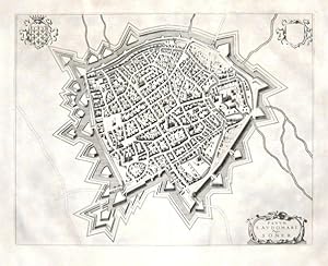
Fanum S. Audomari Vulgo S. Omer
Verlag: Joan Blaeu, Amsterdam, 1649
Anbieter: Antikvariat Krenek, Prag, Tschechien
Verbandsmitglied: ILAB
Verkäuferbewertung 5 von 5 Sternen
Karte
Kein Einband. Zustand: Gut bis sehr gut. Saint-Omer. "Fanum S. Audomari Vulgo S. Omer". Orig. copperplate engraving, J. Blaeu, 1649. With ornamental title cartouche and 2 coats of arms (one blank). 38,5:49,5 cm (15 1/4 x 19 1/2 inch.). Printed on paper with wide margins sized 52:63 cm. Koeman IV, map 4150, ed. 43:113 (1652 Lat.). 1. state. - A birds-eye-view and fortification plan of the city of St-Omer in northern France from Blaeu's Theatrum Urbium Belgicae.
-
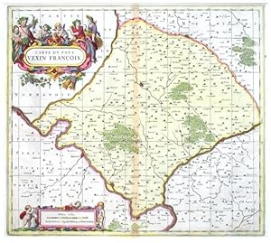
Carte dv Pays Vexin Francois
Verlag: Valck, Gerard - Schenk, Peter, Amsterdam, 1690
Anbieter: Antikvariat Krenek, Prag, Tschechien
Verbandsmitglied: ILAB
Verkäuferbewertung 5 von 5 Sternen
"Carte du Pays Vexin Francois". Orig. copperplate engraving. Published by P. Schenk and G. Valk in Amsterdam, ca. 1690. Orig. old colouring. With great figure title-cartouche and ornamnetal chartouche with the scale of map ("Milliaria Gallica") and 3 cherubs. 44:49,5 cm (17 1/2 x 19 1/2 inch.). A very decorative map of the region north of Paris. Centered on the city of Chaumont-en-Vexin. With the cities of Vernon, Mantes-la-Jolie, Meulan, Poissy, Pontoise, Beaumont-sur-Oise and Beauvais. - Price includes the passe-partout (61:66 cm; 24 x 26 inch.).
-
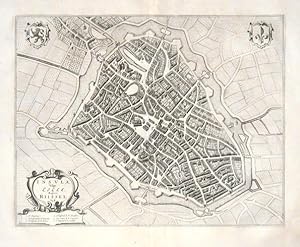
Insula, Vulgo Lille, Belgice Riisel
Verlag: Joan Blaeu, Amsterdam, 1649
Anbieter: Antikvariat Krenek, Prag, Tschechien
Verbandsmitglied: ILAB
Verkäuferbewertung 5 von 5 Sternen
Karte
Kein Einband. Zustand: Sehr gut. Lille. "Insula, Vulgo Lille, Belgice Riissel". Orig. copperplate engraving, J. Blaeu, 1649. With ornamental title cartouche with explanatory notes (1.-6.) and 2 coats of arms. 38:49 cm (15 x 19 1/4 inch.). Printed on paper with wide margins sized 52:63 cm. Koeman IV, map 2346, ed. 43:113 (1652 Lat.). - A birds-eye-view and fortification plan of the city of Lille in northern France from Blaeu's Theatrum Urbium Belgicae.
-
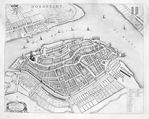
Dordrecht
Verlag: Blaeu, Johann, Amsterdam, 1649
Anbieter: Antikvariat Krenek, Prag, Tschechien
Verbandsmitglied: ILAB
Verkäuferbewertung 5 von 5 Sternen
Dordrecht. "Dordrecht". Orig. copperplate engraving, J. Blaeu, 1652. With ornemental title cartouche, 2 coats-of-arms and explanatory notes (1-31). 42:53 cm (16 1/2 x 20 3/4 inch). Koeman IV, map 1116, ed. 43:113 (Lat.). - A birds eye view of the city of Dordrecht from Blaeu's Theatrum urbim Belgicae.
-
Ducatus Chablasius et Lacus Lemanus, cum Regionibus adjacentibus
Verlag: Lago di Ginevra
Anbieter: Sergio Trippini, Gavirate, VA, Italien
Verkäuferbewertung 5 von 5 Sternen
Carta geografica del lago e delle regioni adiacenti. Titolo entro drappo sostenuto da putti. Piega centrale.
-
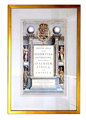
Title-Page: Achtste Stuck der Aerdrycks-Beschryving welck vervat Spaenjen, Africa, en America
Verlag: In de Druckery van Joan Blaeu, Amsterdam, 1665
Anbieter: James Cummins Bookseller, ABAA, New York, NY, USA
Verkäuferbewertung 5 von 5 Sternen
Image 10 x 16 inches. Zustand: Framed and glazed. Image 10 x 16 inches.
-

Angleterre, Qui Est Le XI. Livre De L'Europe.
Verlag: Amsterdam; 1662. 410 x 240mm (16¼ x 9½ inches)., 1662
Anbieter: Tooley, Adams & Co., Wallingford, OXON, Vereinigtes Königreich
Verkäuferbewertung 3 von 5 Sternen

Erstausgabe
EUR 427,85
EUR 42,87 Versand
Versand von Vereinigtes Königreich nach USAAnzahl: 1 verfügbar
In den WarenkorbSuperb original colour, with gold highlights; some very minor age-toning and light spotting to the margins, overall a fine example. A superb example of the titlepage from the Blaeu atlas of England and Wales, with gold highlights and fine original colour. Although it has the printed date of 1662, it is from the first French Edition of the 'Atlas Major' published 1663. KOEMAN: Bl 58.
-
Guiana sive Amazonum Regio
Verlag: Amsterdam: Blaeu, 1655., 1655
Anbieter: Arader Galleries - AraderNYC, New York, NY, USA
Verkäuferbewertung 5 von 5 Sternen
Single sheet (20 x 23 4/8 inches; 14 4/8 x 19 inches). Fine engraved map of Guyana, the title, scale and imprint within fine mannerist and allegorical cartouches, the ocean decorated with a large compass rose and three galleons, all with original hand-colour in outline. A fine and attractive map of Guyana, showing Lake Parime, a very small El Dorado, and a long Amazon River. Although Columbus sighted Guayan on his third voyage it was settled by the Dutch rather than the Spanish. Tales of the mythical city of gold, El Dorado, led Sir Walter Raleigh to modern Venezuela. Although the city was not found, Raleigh argued that Guiana had the potential to yield many riches, and be an advantageous English stronghold against the Spanish: "Guiana is a Country that hath yet her Maydenhead, never sackt, turned, nor wrought, the face of the earth hath not beene torne, not the virtue and salt of the soyule spent by manurance, the graves have not beene opened for gold, the mines not broken with sledges, nor their Images puld down out of their temples. It hath never been entered by any armie of strength, and never conquered or possessed by any Chrisitian Prince. It is besides so defensible, that if two fortes be builded in one of the provinces which I have seen, the flood setteth in so neere the banke, where the channel also lyeth, that no shippe can passé up, but with Pikes length of the Artillerie, first of the one, and afterwards of the other." (Raleigh pages 96-97). Shakespeare is believed to have obtained his knowledge of the "still vexed Bermoothes" for "The Tempest" from Raleigh's account of Guyana. Publication of Blaeu's New World Atlas, or "Atlas Novus" was originally begun by Joannes's father Willem Blaeu with the publication in 1635 of two volumes (consisting of The World, Europe, Arctic, Scandinavia, Russia, Eastern Europe, Germany and the Low Countries; and France, Spain, Asia, Africa and America), and published in four languages (German, Dutch, Latin and French). After succeeding his father, Joannes Blaeu progressively expanded the "Atlas Novus" to six volumes by 1655, and this formed the first half the "Atlas Maior," extending to 11 or 12 volumes by 1662.
-
March. Brandenburgici Pars, quae Marchia Media vulgo Mittelmarck audit (Altkolorierter Kupferstich aus Atlas Major bei J. Blaeu, Amsterdam)
Verlag: Blaeu, Amsterdam, 1662
Anbieter: ANTIQUARIAT H. EPPLER, Karlsruhe, Deutschland
Verkäuferbewertung 5 von 5 Sternen
40x52cm Karte gerahmt, leicht sichtbare Mittelfalte, sonst gutes Ex. Sprache: Latein, Mit figürlicher Titelkartusche mit Wildschwein, Hund und Hirsch sowie Meilenzeiger mit Putte und Geometer, ferner ein nicht ausgefülltes Wappenschild in der oberen rechten Ecke. Dekorative, breitrandige Karte der Mittelmark mit Berlin im Zentrum.
-
Terra Firma et Novum Regum Grantense et Popayan
Verlag: Amsterdam: Blaeu, 1655., 1655
Anbieter: Arader Galleries - AraderNYC, New York, NY, USA
Verkäuferbewertung 5 von 5 Sternen
Single sheet (20 x 23 4/8 inches; 15 x 19 inches to the neat line). Fine engraved map of north-west South America, the title and scale within a fine mannerist cartouches, the ocean decorated with two compass roses, all with original hand-colour in outline and in part. A fine and attractive map of modern Panama and Columbia. During the Spanish colonial era the Isthmus of Panama was known as Tierra Firma (firm ground), a small stretch of land dividing the Atlantic and Pacific Oceans. The first European to explore the Isthmus was the Spanish explorer Rodrigo de Galván Bastidas in 1501. The following year Christopher Columbus also landed on the northern coast. Publication of Blaeu's New World Atlas, or "Atlas Novus" was originally begun by Joannes's father Willem Blaeu with the publication in 1635 of two volumes (consisting of The World, Europe, Arctic, Scandinavia, Russia, Eastern Europe, Germany and the Low Countries; and France, Spain, Asia, Africa and America), and published in four languages (German, Dutch, Latin and French). After succeeding his father, Joannes Blaeu progressively expanded the "Atlas Novus" to six volumes by 1655, and this formed the first half the "Atlas Maior," extending to 11 or 12 volumes by 1662.
-
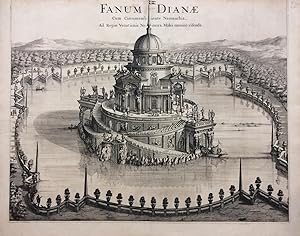
Fanum Dianae; Cum Circumambiente Naumachia, Ad Regiae Venationis Nemora, Moles omnino visenda
Verlag: Joannes Blaeu, Amsterdam, 1680
Anbieter: Argosy Book Store, ABAA, ILAB, New York, NY, USA
Verkäuferbewertung 5 von 5 Sternen
unbound. Print. Uncolored engraving. Image measures 19.25 x 24 inches, sheet measure 20.5 x 26 inches. Shows some light foxing, as well as a repaired ~2 inch tear at left margin. Top edge trimmed to neat line. In very good condition. Outstanding view of a baroque pleasure palaces and garden from 'Theatrum Statuum Regiae Sabaudiae'. The series features maps, topographic views of Turin and cities and towns of Piedmont and Savoy. One of the most prolific Dutch mapmakers of his time, Willem Blaeu (1571-1638) started one of the most famous map publishing firms of the 17th century. It was at this time that the Dutch controlled the map trade, and their ornate and beautiful maps had immense popularity. Blaeu and his family worked out of Amsterdam and was instrumental in driving this dominance in his lifetime, and this legacy was continued by his sons. "Theatrum Statuum Regiae Sabaudiae" was published by his son Johannes (c. 1599-1673), who took over the business upon his father's death.
-
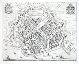
Emda
Verlag: Blaeu, Johann, 1649
Anbieter: Antikvariat Krenek, Prag, Tschechien
Verbandsmitglied: ILAB
Verkäuferbewertung 5 von 5 Sternen
"Emda". Vogelschauansicht. Kupf. (von J. Blaeu aus dem Städtebuch, 1649). Mit 2 Wappen. 42,5:53 cm. Zeigt Emden.
-
Nova et Accurata Brasiliae totius tabula.
Verlag: Schenk Amsterdam, Amstelædami, 1720
Anbieter: George Jeffery Books, HERTFORDSHIRE, Vereinigtes Königreich
Verbandsmitglied: PBFA
Verkäuferbewertung 5 von 5 Sternen
EUR 683,38
EUR 28,85 Versand
Versand von Vereinigtes Königreich nach USAAnzahl: 1 verfügbar
In den WarenkorbZustand: Very Good. Large hand coloured map. Map, engraved area measures 58.5x50.cm, plus margin. Some light wear, short closed tear to margins. Map in good clean condition.
-
Tabula Magellanica, qua Tierrae del fuego, cum celeberrimis fretis a F. Magellano et I. Le Maire detectis novissima et accuratissima deseriptio exhibertur.
Verlag: Amsterdam: Blaeu, 1655., 1655
Anbieter: Arader Galleries - AraderNYC, New York, NY, USA
Verkäuferbewertung 5 von 5 Sternen
Single sheet (20 x 23 4/8 inches; 16 x 21 inches). Fine engraved map of Tierra del Fuego. The title, key, and description of latitude and longitude within fine elaborate mannerist and allegorical cartouches, decorated with an elaborate dedication to 3 small compass roses and a fleet of seven galleons, all with original hand-colour in outline. A fine and attractive map of the southernmost tip of South America and the archipelago Tierra del Fuego, named land of fires by Ferdinand Magellan in 1520 as he circumnavigated the globe for the first time. For the next 350 years the island and the Straits of Magellan remained mostly unexplored until the British Admiralty undertook a thorough survey of the entire archipelago between 1826 and 1836. It was on the second voyage of 1836 that Charles Darwin famously joined the expedition aboard the Beagle as the official naturalist. Publication of Blaeu's New World Atlas, or "Atlas Novus" was originally begun by Joannes's father Willem Blaeu with the publication in 1635 of two volumes (consisting of The World, Europe, Arctic, Scandinavia, Russia, Eastern Europe, Germany and the Low Countries; and France, Spain, Asia, Africa and America), and published in four languages (German, Dutch, Latin and French). After succeeding his father, Joannes Blaeu progressively expanded the "Atlas Novus" to six volumes by 1655, and this formed the first half the "Atlas Maior," extending to 11 or 12 volumes by 1662.
-
Peru
Verlag: Amsterdam: Blaeu, 1655., 1655
Anbieter: Arader Galleries - AraderNYC, New York, NY, USA
Verkäuferbewertung 5 von 5 Sternen
Single sheet (20 x 23 4/8 inches; 14 4/8 x 19 inches). Fine engraved map of Peru. The title and scale within a fine elaborate mannerist strapwork cartouche, decorated with a compass rose, four galleons, and three sea monsters, all with original hand-colour in outline. A fine and attractive map of Peru, oriented to the east, showing lake Titicaca, the Andes, more than 100 places, and extending from Ecuador in the north to the Atacama desert in northern Chile. Publication of Blaeu's New World Atlas, or "Atlas Novus" was originally begun by Joannes's father Willem Blaeu with the publication in 1635 of two volumes (consisting of The World, Europe, Arctic, Scandinavia, Russia, Eastern Europe, Germany and the Low Countries; and France, Spain, Asia, Africa and America), and published in four languages (German, Dutch, Latin and French). After succeeding his father, Joannes Blaeu progressively expanded the "Atlas Novus" to six volumes by 1655, and this formed the first half the "Atlas Maior," extending to 11 or 12 volumes by 1662.
-
Brasilia
Verlag: Amsterdam: Blaeu, 1655., 1655
Anbieter: Arader Galleries - AraderNYC, New York, NY, USA
Verkäuferbewertung 5 von 5 Sternen
Single sheet (20 x 23 4/8 inches; 15 x 19 inches). Fine engraved map of Brasil, oriented to the west, the title, scale within fine elaborate mannerist and allegorical cartouches, the ocean decorated with two compass roses and three galleons, all with original hand-colour in outline. A fine and attractive map of Brasil, first discovered by Pedro Álvares Cabral in 1500, while en route to India via the Cape of Good Hope, who claimed it for Portugal. The map includes the region from the mouth of the Amazon river to the La Plata. Publication of Blaeu's New World Atlas, or "Atlas Novus" was originally begun by Joannes's father Willem Blaeu with the publication in 1635 of two volumes (consisting of The World, Europe, Arctic, Scandinavia, Russia, Eastern Europe, Germany and the Low Countries; and France, Spain, Asia, Africa and America), and published in four languages (German, Dutch, Latin and French). After succeeding his father, Joannes Blaeu progressively expanded the "Atlas Novus" to six volumes by 1655, and this formed the first half the "Atlas Maior," extending to 11 or 12 volumes by 1662.
-
Venezuela.
Verlag: Amsterdam: Blaeu, 1655., 1655
Anbieter: Arader Galleries - AraderNYC, New York, NY, USA
Verkäuferbewertung 5 von 5 Sternen
Single sheet (20 x 23 4/8 inches; 14 4/8 x 19 inches). Fine engraved map of Venezuela the title and scale with fine mannerist and allegorical cartouches, the ocean decorated with two compass roses and a galleon, the land with birds and animals, all with original hand-colour in outline. It was on his third voyage in 1498 that Columbus discovered mainland America, exploring the coastline of what is now known as Venezuela: "Great signs are these of the Terrestrial Paradise, for the site conforms to the opinion of the holy and wise theologians whom I have mentioned. And likewise, the [other] signs conform very well, for I have never read or heard of such a large quantity of fresh water being inside and in such close proximity to salt water; the very mild temperateness also corroborates this; and if the water of which I speak does not proceed from Paradise then it is an even greater marvel, because I do not believe such a large and deep river has ever been known to exist in this world" (recorded by Zamora, Margarita (1993). Reading Columbus. University of California Press. pp. Voyage to Paradise, page 141). Publication of Blaeu's New World Atlas, or "Atlas Novus" was originally begun by Joannes's father Willem Blaeu with the publication in 1635 of two volumes (consisting of The World, Europe, Arctic, Scandinavia, Russia, Eastern Europe, Germany and the Low Countries; and France, Spain, Asia, Africa and America), and published in four languages (German, Dutch, Latin and French). After succeeding his father, Joannes Blaeu progressively expanded the "Atlas Novus" to six volumes by 1655, and this formed the first half the "Atlas Maior," extending to 11 or 12 volumes by 1662.
-
Chili
Verlag: Amsterdam: Blaeu, 1655., 1655
Anbieter: Arader Galleries - AraderNYC, New York, NY, USA
Verkäuferbewertung 5 von 5 Sternen
Single sheet (20 x 23 4/8 inches; 14 x 19 inches to the neat line). Fine engraved map of Chile, the title, imprint, and scale with elaborate rococo cartouches, the key within a scroll, and decorated with two compass roses, ships and sea monsters, Latin text on verso (a little toned, one or two marginal spots). A beautiful map of Chili from Blaeu's "Theatrum orbis terrarum, sive atlas novus. Pars secunda". Publication of Blaeu's New World Atlas, or "Atlas Novus" was originally begun by Joannes's father Willem Blaeu with the publication in 1635 of two volumes (consisting of The World, Europe, Arctic, Scandinavia, Russia, Eastern Europe, Germany and the Low Countries; and France, Spain, Asia, Africa and America), and published in four languages (German, Dutch, Latin and French). After succeeding his father, Joannes Blaeu progressively expanded the "Atlas Novus" to six volumes by 1655, and this formed the first half the "Atlas Maior," extending to 11 or 12 volumes by 1662.
-
Nova Belgica et Anglia Nova
Verlag: Amsterdam: Blaeu, 1655, 1655
Anbieter: Arader Galleries - AraderNYC, New York, NY, USA
Verkäuferbewertung 5 von 5 Sternen
Single sheet (20 x 23 4/8 inches; 15 3/8 x 19 4/8 inches to the neat line). Fine engraved map of the east cost of North America unusually oriented to the south, showing the area from Chesapeake Bay in Virginia to Penscabot Bay in New France, the title and scale within fine allegorical cartouches, decorated with images of Native American villages, Native Americans in their canoes, European ships, two compass roses, numerous rhumb lines, wild animals, lakes and forests, all with fine original hand-colouring in part and in outline, Latin text on verso (a little browned). "This important map was one of the most attractive of the Americas at the time" (Burden) A fine map from Blaeu's "Theatrum orbis terrarum, sive atlas novus. Pars secunda", the "Nova Belgica et Anglia Nova"'s "primary source is the first manuscript figurative map of Adrien Block, 1614. Indeed it is the first full representation of it in print. It is one of the earliest to name "Nieu Amsterdam" (Burden). Publication of this New World Atlas, or "Atlas Novus" was originally begun by Joannes's father Willem Blaeu with the publication in 1635 of two volumes (consisting of The World, Europe, Arctic, Scandinavia, Russia, Eastern Europe, Germany and the Low Countries; and France, Spain, Asia, Africa and America), and published in four languages (German, Dutch, Latin and French). After succeeding his father, Joannes Blaeu progressively expanded the "Atlas Novus" to six volumes by 1655, and this formed the first half the "Atlas Maior," extending to 11 or 12 volumes by 1662. Burden 241.
-
Virginiae partis australis, et Floridae partis orientalis, interjacentiumq regionum Nova Descriptio
Verlag: Amsterdam: Blaeu, 1655., 1655
Anbieter: Arader Galleries - AraderNYC, New York, NY, USA
Verkäuferbewertung 5 von 5 Sternen
Single sheet (20 x 23 4/8 inches; 15 x 19 4/8 inches to the neat line). Fine engraved map of Virginia and Florida, the title and scale with elaborate allegorical cartouches, decorated with the Royal arms of France and Britain, ships and two compass roses, all with fine original hand-colour in part or in outline, Latin text on verso (margins a bit browned). A beautiful map of Virginia and Florida from Blaeu's "Theatrum orbis terrarum, sive atlas novus. Pars secunda" of 1655. "Cartographically it forms a marked improvement on the Jodocus Hondius map of 1606, from which this was largely derived. It also amply illustrates the direction that engraving styles had moved, being more open and florid. The map depicts two nations' interests, both marked by their own coat of arms. The French claim, being largely present day Georgia, rests on the abortive colony attempts of the 1560s. The greatest improvemen occurs in the northern half of the map north of 'Porto Royal'. Whereas on the Hondius the coastline towards C. de Ste. Romano (present day Cape Fear) veered directly east, Blaeu more correctly takes it north-east, placing the cape closer to its true position of 34 degrees" (Burden 253). Publication of Blaeu's New World Atlas, or "Atlas Novus" was originally begun by Joannes's father Willem Blaeu with the publication in 1635 of two volumes (consisting of The World, Europe, Arctic, Scandinavia, Russia, Eastern Europe, Germany and the Low Countries; and France, Spain, Asia, Africa and America), and published in four languages (German, Dutch, Latin and French). After succeeding his father, Joannes Blaeu progressively expanded the "Atlas Novus" to six volumes by 1655, and this formed the first half the "Atlas Maior," extending to 11 or 12 volumes by 1662.
-
Mappa aestivarum insularum, alias Barmudas.
Verlag: Amsterdam: Blaeu, 1655., 1655
Anbieter: Arader Galleries - AraderNYC, New York, NY, USA
Verkäuferbewertung 5 von 5 Sternen
Single sheet (20 x 23 4/8 inches; 15 6/8 x 20 4/8 inches to the neat line). Fine engraved map of Bermuda, the title and scales with elaborate allegorical cartouches, decorated with a fine compass rose and numerous rhumb lines, a detailed key to property holdings below the map decorated with the Royal arms and arms of Bermuda, all with original hand-colour in part and in outline, Latin text on verso (margins a bit browned). A beautiful map of Bermuda transposed over a map of the Atlantic Ocean showing the position of Bermuda and the partial coastlines of Florida, Virginia and New England. Based on the original survey of Bermuda by John Norwood of the Bermuda Company in 1618, the map clearly shows the division of the islands into the original Tribes and landowners, with their names in a table below the map. From Blaeu's "Theatrum orbis terrarum, sive atlas novus. Pars secunda". Publication of this New World Atlas, or "Atlas Novus" was originally begun by Joannes's father Willem Blaeu with the publication in 1635 of two volumes (consisting of The World, Europe, Arctic, Scandinavia, Russia, Eastern Europe, Germany and the Low Countries; and France, Spain, Asia, Africa and America), and published in four languages (German, Dutch, Latin and French). After succeeding his father, Joannes Blaeu progressively expanded the "Atlas Novus" to six volumes by 1655, and this formed the first half the "Atlas Maior," extending to 11 or 12 volumes by 1662.
-
Insulae Americanae in Oceano Septentrionali cum Terris Adiacentibus
Verlag: Amsterdam: Blaeu, 1655., 1655
Anbieter: Arader Galleries - AraderNYC, New York, NY, USA
Verkäuferbewertung 5 von 5 Sternen
Single sheet (20 x 23 4/8 inches; 14 6/8 x 20 4/8 inches to the neat line). Fine engraved map of Central America and the West Indies, the title, dedication and scale within fine allegorical cartouches, the ocean decorated with ships, three compass roses and numerous rhumb lines, hand-coloured in part and in outline, Latin text on verso (one or two insignificant marginal spots). A beautiful map of the West Indies showing the eastern coast of North America from Chesapeake Bay to the Gulf of Mexico, Central America and the northern coast of South America. From Blaeu's "Theatrum orbis terrarum, sive atlas novus. Pars secunda". Publication of this New World Atlas, or "Atlas Novus" was originally begun by Joannes's father Willem Blaeu with the publication in 1635 of two volumes (consisting of The World, Europe, Arctic, Scandinavia, Russia, Eastern Europe, Germany and the Low Countries; and France, Spain, Asia, Africa and America), and published in four languages (German, Dutch, Latin and French). After succeeding his father, Joannes Blaeu progressively expanded the "Atlas Novus" to six volumes by 1655, and this formed the first half the "Atlas Maior," extending to 11 or 12 volumes by 1662.
-
Nova Virginia, Tabula
Verlag: Amsterdam: Blaeu, 1655., 1655
Anbieter: Arader Galleries - AraderNYC, New York, NY, USA
Verkäuferbewertung 5 von 5 Sternen
Single sheet (20 x 23 4/8 inches; 14 4/8 x 18 4/8 inches). Fine engraved map of Virginia, the title, "Notarum explicato" and scale within mannerist strapwork cartouches, decorated with a vignette of Powhatan's Council upper left and a portrait of a Sasquesahanough Indian middle right after the drawings of John White, also with the Royal arms without motto, Latin text on verso (short marginal tear lower left, not affecting the image). Blaeu's issue of the "first and most important" (Burden) derivative of John Smith's map of Virginia originally published in 1612. The original plate was engraved for Jodocus Hondius Jr, and purchased by Willem Blaeu in 1629 whereafter it was published by his firm many times over the next forty-two years. This issue is from from Blaeu's "Theatrum orbis terrarum, sive atlas novus. Pars secunda" of 1655 (Burden 193). The Smith/Hondius/Blaeu map of Virginia is one of the most important printed maps of America ever produced and one of the greatest influence. "it became the prototype for the area for half a century until Augustine Herrman's map of 1673, it was seen widely and inspired much interest in the fledgling Virginia colony, influencing considerably its eventual success. Consequently the east coast of North America became dominated by the English. To this day the maps is still used by archeologists to locate native Indian villages. It records 166 of them, and is remarkably detailed" (Burden 164). Publication of Blaeu's New World Atlas, or "Atlas Novus" was originally begun by Joannes's father Willem Blaeu with the publication in 1635 of two volumes (consisting of The World, Europe, Arctic, Scandinavia, Russia, Eastern Europe, Germany and the Low Countries; and France, Spain, Asia, Africa and America), and published in four languages (German, Dutch, Latin and French). After succeeding his father, Joannes Blaeu progressively expanded the "Atlas Novus" to six volumes by 1655, and this formed the first half the "Atlas Maior," extending to 11 or 12 volumes by 1662.
-
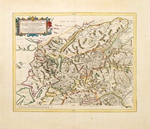
Braid-Allaban, Atholia, Marria Superior, Badenochia, Strath-Spea, Lochharbia. A description of the inland provinces of Scotland lying between the Tay River and Murray Firth.
Verlag: Amsterdam: [1654], 1654
Anbieter: Peter Harrington. ABA/ ILAB., London, Vereinigtes Königreich
Verbandsmitglied: ABA ILAB PBFA
Verkäuferbewertung 5 von 5 Sternen
EUR 891,36
EUR 25,39 Versand
Versand von Vereinigtes Königreich nach USAAnzahl: 1 verfügbar
In den WarenkorbDutch edition. A glorious, highly detailed map of north eastern Scotland by Blaeu, based on the earlier surveys of Robert Gordon. Map is orientated to the north. One of the central features of the map is the River Spey, the second longest and the fastest-flowing river in Scotland. It is important for salmon fishing and whisky production. A decorative, rococo style title cartouche dominates the upper left corner of the map. Size: 540 x 640 mm. Copperplate engraving with hand colour. Map has been cleaned and strengthened. Good condition.
-

Istria olim Iapidia.
Verlag: Amsterdam: 1648, 1648
Anbieter: Peter Harrington. ABA/ ILAB., London, Vereinigtes Königreich
Verbandsmitglied: ABA ILAB PBFA
Verkäuferbewertung 5 von 5 Sternen
EUR 1.129,06
EUR 25,39 Versand
Versand von Vereinigtes Königreich nach USAAnzahl: 1 verfügbar
In den WarenkorbA wonderfully decorative and visually striking map by Joan Blaeu of the peninsular of Istria, situated on the Adriatic Sea, bordering Italy, Croatia and Slovenia. Blaeu's attractive map is embellished by a gorgeous title cartouche; featuring the winged Lion of Venice, together with a pair of armoured soldiers and a pair of winged mermaids either side of the pretty mileage scale in the lower right corner. All major coastal towns are highlighted in red, rivers, mountains, forests and hills are well defined, a ship is seen sailing within the Gulf of Venice. Over the centuries, Istria has been a part of the Republic of Venice; The Austrian Empire (twice); been under Napoleonic Rule and then finally a part of modern day Italy. Published in Blaeu's "Theatrum Orbis Terrarum" or "Novus Atlas". Size: 530 x 640 mm. Copperplate engraving with wonderful early hand colour. Dutch text on verso. A few minor rust marks, and some slight discolouration to the central fold, otherwise in very good condition.
-
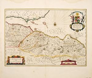
Lothian and Linlitquo.
Verlag: Amsterdam: 1664, 1664
Anbieter: Peter Harrington. ABA/ ILAB., London, Vereinigtes Königreich
Verbandsmitglied: ABA ILAB PBFA
Verkäuferbewertung 5 von 5 Sternen
Erstausgabe
EUR 1.069,63
EUR 25,39 Versand
Versand von Vereinigtes Königreich nach USAAnzahl: 1 verfügbar
In den WarenkorbA splendidly decorative and striking map of the areas of Lothian and Linlithgow in Scotland by premier seventeenth century Dutch cartographer Joan Blaeu, from his wonderful multi-volume work entiled "Theatrum Orbis Terrarum" or "Novus Atlas". The map centres on Edinburgh, and takes in the outlying towns of Rosslyn, North Berwick, Haddington, Linlithgow and Dunbar. The map is enhanced by a number of decorative features; a compass rose in The Firth of Forth, scrolled title cartouche and mileage scale and a most attractive dedication. The Blaeu maps of Scotland are uncommon, as they were only produced between 1654, the date of their first printing, and 1672, the year of the fire that destroyed the Blaeu printing house. This is a much shorter period of time than for most of the other Blaeu maps. Size: 530 x 625 mm. Copperplate engraving with beautiful early hand colour. Dutch text on verso. Some water staining and mild damp stains to margins, small repaired tear to lower central margin, otherwise in very good condition.