

Gesamtpreis (1 Artikel Artikel):
Versandziel:

barres manuel (9 Ergebnisse)
Direkt zu den wichtigsten Suchergebnissen
Suchfilter
Produktart
- Alle Product Types
- Bücher (9)
- Magazine & Zeitschriften (Keine weiteren Ergebnisse entsprechen dieser Verfeinerung)
- Comics (Keine weiteren Ergebnisse entsprechen dieser Verfeinerung)
- Noten (Keine weiteren Ergebnisse entsprechen dieser Verfeinerung)
- Kunst, Grafik & Poster (Keine weiteren Ergebnisse entsprechen dieser Verfeinerung)
- Fotografien (Keine weiteren Ergebnisse entsprechen dieser Verfeinerung)
- Karten (Keine weiteren Ergebnisse entsprechen dieser Verfeinerung)
- Manuskripte & Papierantiquitäten (Keine weiteren Ergebnisse entsprechen dieser Verfeinerung)
Zustand Mehr dazu
- Neu (1)
- Wie Neu, Sehr Gut oder Gut Bis Sehr Gut (Keine weiteren Ergebnisse entsprechen dieser Verfeinerung)
- Gut oder Befriedigend (3)
- Ausreichend oder Schlecht (Keine weiteren Ergebnisse entsprechen dieser Verfeinerung)
- Wie beschrieben (5)
Einband
Weitere Eigenschaften
- Erstausgabe (1)
- Signiert (Keine weiteren Ergebnisse entsprechen dieser Verfeinerung)
- Schutzumschlag (Keine weiteren Ergebnisse entsprechen dieser Verfeinerung)
- Angebotsfoto (3)
Sprache (2)
Gratisversand
- Kostenloser Versand nach USA (Keine weiteren Ergebnisse entsprechen dieser Verfeinerung)
Land des Verkäufers
Verkäuferbewertung
-

Zustand: good. Befriedigend/Good: Durchschnittlich erhaltenes Buch bzw. Schutzumschlag mit Gebrauchsspuren, aber vollständigen Seiten. / Describes the average WORN book or dust jacket that has all the pages present.
-

Fotografiar es facil
Anbieter: Libros Ramban, Santander, S, Spanien
Verkäuferbewertung 4 von 5 Sternen

Encuadernación de tapa blanda. Zustand: Aceptable. 157 p\u00E1ginas.Plastificado.
-

Tapa blanda. Zustand: Nuevo.
-
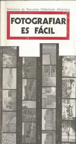
Fotografiar es fácil
Anbieter: Librería Torres-Espinosa, CERCEDILLA, M, Spanien
Verkäuferbewertung 5 von 5 Sternen

Erstausgabe
1. ed. 150 p. Ilustrado. 22*12 cm. Rústica editorial. (84-205-1724-0) Fecha Impresión- 02/1992. Cubierta ligeramente deslucida.Buen estado. IMPORTANTE. Lea Nuestras Condiciones de Venta y Gastos de Envío. Contrareembolso 6 eur.
-

Recherches sur la priorité de la découverte des pays situés sur la cote occidentale d'Afrique, au-dela du Cap Bojador, et sur les progrès de la science géographique, après les navigations des Portugais, au XVe siècle.
Verlag: Libraire Orientale de Dondey-Dupré, Paris, 1842
Anbieter: studio bibliografico pera s.a.s., LUCCA, LU, Italien
Verkäuferbewertung 4 von 5 Sternen
Copertina rigida. Zustand: Buono. Testo francese. Cm.21,2x12,8. Pg.CXVI, 336. Legatura in mz.pelle con impressioni a rilievo e tassello con titoli in oro al dorso. Fogli di guardia marmorizzati. Non è presente l'Atlante allegato. Il volume contiene anche "Démonstration des droits qu'a la couronne de Portugal sur les territoires situés sur la côte occidentale d'Afrique entre le 5e degré et 12 minutes et le 8e de latitude méridionale et par conséquent sur les territoires de Molembo, de Cabinda et d'Ambriz, par le Vicomte de Santarem" (Lisbonne, Imprimerie Nationale, 1855; pg.40); "Faits et considérations relatives aux droits du Portugal sur les territoires de Molembo, de Cabinda et d'Ambriz et autres Lieux de la côte occidentale d'Afrique entre le 5e degré, 12 minutes et le 8e de latitude australe, par le Vicomte de Santarem" (Lisbonne, Imprimerie Nationale, 1855; pg.72); "Mémoire et pièces justificatives sur le réclamation des sujets portugais contre la France" (Paris, Casimir, 1837; pg.52). Tra il terzo e quarto testo sono inserite cinque carte in grande formato, ripiegate, raffiguranti la costa dell'Angola, la pianta del Forte di Cabinde, la carta dei paesi di Mossullo e Bombe, la pianta del Forte di Nazareth e St.Jean du Loge, i porti di Ambriz e Ambrizette. Importante studio sulle colonie portoghesi in Africa, opera dello storico Manuel Francisco de Barros e Sousa de Macedo Leitão Moschea e Carvalhosa, visconte di Santarem (Lisbona, 18 novembre 1791 - Paris, 17 gennaio 1856). > Gay, "Bibliographie des ouvrages relatifs a l'Afrique et a l'Arabie", 208. Brunet, V, 134. 800 gr.
-

Atlas de Santarem. Facsimile of the final edition 1849. With explanatory text by Dr. Helen Wallis and Drs. A.H.Sijmons.
Anbieter: Antiquariaat A. Kok & Zn. B.V., Amsterdam, Niederlande
Verkäuferbewertung 5 von 5 Sternen
Paris, E.Thunot et Cie, 1849-53. [Reprint Amsterdam, Rudolf Muller, 1985]. 78 loose plts. Elephant folio. - Complete with the textbook (80 pp., softcover 4to.) with explanatory text in English by Helen Wallis and A.H.Sijmons.COPY WITHOUT THE ORIGINAL BOX ! - - The 'Atlas do Visconde de Santarém' in English sometimes known as the Viscount of Santarém's World atlas is an important compendium lithographic reproductions of medieval European maps and navigation charts. There were three editions, all published in Paris: 1841, 1842-1844 with far fewer plates, and in 1849, the third edition and considered to be the best. This edition contains 145 maps on 77 plates, arranged in 4 parts.Viscount the Santarém example was followed by such distinguished authors as Jomard, Nordenskiöld, Miller, Kretschmer and Wieder. - This facsimile of the third edition of Santarém's atlas is published, like the original, in a limited edition of 300 copies. The facsimile contains all plates as specified by Dr. Jordão de Freitas in his index of the copy of the Museu de Marinha, Lisbon. [for more information please read the article "Atlas do Visconde de Santarém" on Wikipedia].
-
Recherches sur la priorité de la découverte des pays au dela du Cap Bojador et essai sur l'histoire de la cosmographie et de la cartographie pendant le Moyen-Age.
Anbieter: Antiquariaat A. Kok & Zn. B.V., Amsterdam, Niederlande
Verkäuferbewertung 5 von 5 Sternen
Lisboa, 1989. 5 parts in 1 vol. (consisting of introd, and 4 facs. reprints), [4],54 (introd.); CXIV,[2],527,[1]; [4],LXXXVII,[1,518; [2],XCV,[1],592,[2]; LXXVI,646,[7] pp. Blind stamped rexine,gilt title. 8vo.Printed in a limited edition of 1500 numbered copies (nr. 327). ,
-
Atlas de Santarem. Facsimile of the final edition 1849. With explanatory text by Dr. Helen Wallis and Drs. A.H.Sijmons.
Anbieter: Antiquariaat A. Kok & Zn. B.V., Amsterdam, Niederlande
Verkäuferbewertung 5 von 5 Sternen
Paris, E.Thunot et Cie, 1849-53. [Reprint Amsterdam, Rudolf Muller, 1985]. 78 loose plts. In gray cloth box. Elephant folio. - Complete with the textbook (80 pp.) with explanatory text in English by Helen Wallis and A.H.Sijmons. - Box with some shelfwear.The 'Atlas do Visconde de Santarém' known sometimes in English as the Viscount of Santarém's world atlas is an important compendium lithographic reproductions of medieval European maps and navigation charts. There were three editions, all published in Paris: 1841, 1842-1844 with far fewer plates, and in 1849, the third edition and considered to be the best. This edition contains 145 maps on 77 plates, arranged in 4 parts.Viscount the Santarém example was followed by such distinguished authors as Jomard, Nordenskiöld, Miller, Kretschmer and Wieder. - This facsimile of the third edition of Santarém's atlas is published, like the original, in a limited edition of 300 copies. The facsimile contains all plates as specified by Dr. Jordão de Freitas in his index of the copy of the Museu de Marinha, Lisbon. [for more information pleas read the article "Atlas do Visconde de Santarém" on Wikipedia].
-
Atlas du Vicomte de Santarem. Edition fac-simileé des cartes définitives, organisée et avec un préface par Martim de Albuquerque.
Anbieter: Antiquariaat A. Kok & Zn. B.V., Amsterdam, Niederlande
Verkäuferbewertung 5 von 5 Sternen
Lisbon, Administracao do Porto de Lisboa, 1989, 7,[5] (introd.) textpages, (13 facs.)pages & 95 facs. (some in col.) double-page maps. Orig. blindst. giltlettered rexine. Elephant folio. [75 x 56 cm.]Printed in a limited edition of 1500 numbered copies (nr. 327). - Attractive facsimile reprint of 1849 edition of E. Thunot, Paris. - Preface in English, French and Portuguese. In this edition the three avertissements published by the Viscount of Santarem are also reproduced ( the 1841 Atlas, the 1842 Atlas and the 1844 Livraison).


