
Gesamtpreis (1 Artikel Artikel):
Versandziel:

ashworth mick (21 Ergebnisse)
Direkt zu den wichtigsten Suchergebnissen
Suchfilter
Produktart
- Alle Product Types
- Bücher (21)
- Magazine & Zeitschriften (Keine weiteren Ergebnisse entsprechen dieser Verfeinerung)
- Comics (Keine weiteren Ergebnisse entsprechen dieser Verfeinerung)
- Noten (Keine weiteren Ergebnisse entsprechen dieser Verfeinerung)
- Kunst, Grafik & Poster (Keine weiteren Ergebnisse entsprechen dieser Verfeinerung)
- Fotografien (Keine weiteren Ergebnisse entsprechen dieser Verfeinerung)
- Karten (Keine weiteren Ergebnisse entsprechen dieser Verfeinerung)
- Manuskripte & Papierantiquitäten (Keine weiteren Ergebnisse entsprechen dieser Verfeinerung)
Zustand Mehr dazu
- Neu (10)
- Wie Neu, Sehr Gut oder Gut Bis Sehr Gut (4)
- Gut oder Befriedigend (6)
- Ausreichend oder Schlecht (Keine weiteren Ergebnisse entsprechen dieser Verfeinerung)
- Wie beschrieben (1)
Einband
Weitere Eigenschaften
- Erstausgabe (Keine weiteren Ergebnisse entsprechen dieser Verfeinerung)
- Signiert (Keine weiteren Ergebnisse entsprechen dieser Verfeinerung)
- Schutzumschlag (2)
- Angebotsfoto (8)
Sprache (3)
Gratisversand
Land des Verkäufers
Verkäuferbewertung
-

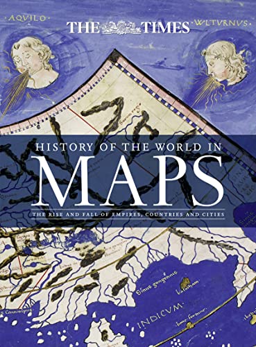
History of the World in Maps: The rise and fall of Empires, Countries and Cities
Anbieter: WeBuyBooks, Rossendale, LANCS, Vereinigtes Königreich
Verkäuferbewertung 5 von 5 Sternen

EUR 7,40
EUR 11,53 Versand
Versand von Vereinigtes Königreich nach USAAnzahl: 1 verfügbar
In den WarenkorbZustand: Like New. Most items will be dispatched the same or the next working day. An apparently unread copy in perfect condition. Dust cover is intact with no nicks or tears. Spine has no signs of creasing. Pages are clean and not marred by notes or folds of any kind.
-
History of the World in Maps: The rise and fall of Empires, Countries and Cities
Sprache: Englisch
Verlag: HarperCollins Publishers, United Kingdom, London, 2015
ISBN 10: 0008147795 ISBN 13: 9780008147792
Anbieter: WorldofBooks, Goring-By-Sea, WS, Vereinigtes Königreich
Verkäuferbewertung 5 von 5 Sternen
EUR 13,09
EUR 6,46 Versand
Versand von Vereinigtes Königreich nach USAAnzahl: 5 verfügbar
In den WarenkorbPaperback. Zustand: Very Good. From Babylonian tablets to Google Maps, the world has evolved rapidly, along with the ways in which we see it. In this time, cartography has not only kept pace with these changes, but has often driven them. In this beautiful book, over 70 maps give a visual representation of the history of the world. Every map tells a story and this book tells the incredible history of our world through maps, and includes many famous examples of cartography, along with some that deserve to be better known. See countries and cities come and go, empires rise and fall, significant geographical discoveries, and key historical events unfold. Key maps shown include: Babylonian clay tablets, c.2300 BC and c.600 BC some of the worlds oldest surviving maps. Waldseemuller World Map, 1507 the first map to use the name America for the New World. Waghenaer chart, 1584 a forerunner to modern nautical charts. Abel Buell map of North America, 1782 the first map of the newly independent United States that was produced in America by an American. The Scramble for Africa, 1852/1898 maps of new colonies being created. Ypres, 1918 map of the aftermath of the First World War. Cuban Missile Crisis, 1962 map used by President John F. Kennedy during the crisis. The book has been read, but is in excellent condition. Pages are intact and not marred by notes or highlighting. The spine remains undamaged.
-
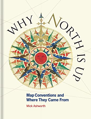
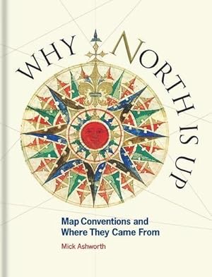
Why North is Up: Map Conventions and Where They Came From
Sprache: Englisch
Verlag: The Bodleian Library 16/08/2019, 2019
ISBN 10: 1851245197 ISBN 13: 9781851245192
Anbieter: Bahamut Media, Reading, Vereinigtes Königreich
Verkäuferbewertung 5 von 5 Sternen
EUR 11,85
EUR 8,05 Versand
Versand von Vereinigtes Königreich nach USAAnzahl: 1 verfügbar
In den WarenkorbZustand: Very Good. Shipped within 24 hours from our UK warehouse. Clean, undamaged book with no damage to pages and minimal wear to the cover. Spine still tight, in very good condition. Remember if you are not happy, you are covered by our 100% money back guarantee.
-

History of the World in Maps: The rise and fall of Empires, Countries and Cities
Anbieter: WeBuyBooks, Rossendale, LANCS, Vereinigtes Königreich
Verkäuferbewertung 5 von 5 Sternen
EUR 3,86
EUR 15,96 Versand
Versand von Vereinigtes Königreich nach USAAnzahl: 1 verfügbar
In den WarenkorbZustand: Like New. Most items will be dispatched the same or the next working day. An apparently unread copy in perfect condition. Dust cover is intact with no nicks or tears. Spine has no signs of creasing. Pages are clean and not marred by notes or folds of any kind.
-
Why North is Up â" Map Conventions and Where They Came From
Sprache: Englisch
Verlag: Bodleian Library, University of Oxford, 2019
ISBN 10: 1851245197 ISBN 13: 9781851245192
Anbieter: WorldofBooks, Goring-By-Sea, WS, Vereinigtes Königreich
Verkäuferbewertung 5 von 5 Sternen
EUR 17,48
EUR 6,46 Versand
Versand von Vereinigtes Königreich nach USAAnzahl: 5 verfügbar
In den WarenkorbPaperback. Zustand: Very Good. The book has been read, but is in excellent condition. Pages are intact and not marred by notes or highlighting. The spine remains undamaged.
-
Why North is Up
Anbieter: PBShop.store UK, Fairford, GLOS, Vereinigtes Königreich
Verkäuferbewertung 5 von 5 Sternen
EUR 21,16
EUR 6,77 Versand
Versand von Vereinigtes Königreich nach USAAnzahl: 15 verfügbar
In den WarenkorbHRD. Zustand: New. New Book. Shipped from UK. Established seller since 2000.
-

History of the World in Maps: The rise and fall of Empires, Countries and Cities
Sprache: Englisch
Verlag: HarperCollins Publishers, United Kingdom, London, 2014
ISBN 10: 0007588240 ISBN 13: 9780007588244
Anbieter: WorldofBooks, Goring-By-Sea, WS, Vereinigtes Königreich
Verkäuferbewertung 5 von 5 Sternen
EUR 23,64
EUR 6,46 Versand
Versand von Vereinigtes Königreich nach USAAnzahl: 3 verfügbar
In den WarenkorbPaperback. Zustand: Very Good. From Babylonian tablets to Google Maps, the world has evolved rapidly, along with the ways in which we see it. In this time, cartography has not only kept pace with these changes, but has often driven them. In this beautiful book, over 70 maps give a visual representation of the history of the world. Every map tells a story and this book tells the incredible history of our world through maps, and includes many famous examples of cartography, along with some that deserve to be better known. See countries and cities come and go, empires rise and fall, significant geographical discoveries, and key historical events unfold. Key maps shown include: Babylonian clay tablets, c.2300 BC and c.600 BC some of the worlds oldest surviving maps. Waldseemuller World Map, 1507 the first map to use the name America for the New World. Waghenaer chart, 1584 a forerunner to modern nautical charts. Abel Buell map of North America, 1782 the first map of the newly independent United States that was produced in America by an American. The Scramble for Africa, 1852/1898 maps of new colonies being created. Ypres, 1918 map of the aftermath of the First World War. Cuban Missile Crisis, 1962 map used by President John F. Kennedy during the crisis. The book has been read, but is in excellent condition. Pages are intact and not marred by notes or highlighting. The spine remains undamaged.
-
Why North Is Up: Map Conventions and Where They Came From
Sprache: Englisch
Verlag: Bodleian Library, University of Oxford, 2019
ISBN 10: 1851245197 ISBN 13: 9781851245192
Anbieter: Majestic Books, Hounslow, Vereinigtes Königreich
Verkäuferbewertung 4 von 5 Sternen

EUR 26,21
EUR 7,49 Versand
Versand von Vereinigtes Königreich nach USAAnzahl: 3 verfügbar
In den WarenkorbZustand: New.
-
Why North is Up: Map Conventions and Where They Came From
Anbieter: Kennys Bookstore, Olney, MD, USA
Verkäuferbewertung 5 von 5 Sternen
Zustand: New. 2019. Edition, Published UK July 2019 ed. Hardcover. . . . . . Books ship from the US and Ireland.
-
Why North Is Up: Map Conventions and Where They Came From
Sprache: Englisch
Verlag: Bodleian Library, University of Oxford, 2019
ISBN 10: 1851245197 ISBN 13: 9781851245192
Anbieter: Ria Christie Collections, Uxbridge, Vereinigtes Königreich
Verkäuferbewertung 5 von 5 Sternen
EUR 25,38
EUR 13,81 Versand
Versand von Vereinigtes Königreich nach USAAnzahl: 2 verfügbar
In den WarenkorbZustand: New. In.
-
Why North is Up Map Conventions and Where They Came From
Anbieter: Revaluation Books, Exeter, Vereinigtes Königreich
Verkäuferbewertung 5 von 5 Sternen
EUR 25,40
EUR 14,41 Versand
Versand von Vereinigtes Königreich nach USAAnzahl: 2 verfügbar
In den WarenkorbHardcover. Zustand: Brand New. 144 pages. 9.00x7.25x1.00 inches. In Stock.
-

Zustand: Good. Original pictorial boards, dust jacket, map on endpapers, illustrated with numerous (double page) maps in colour, folio.
-
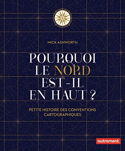
Pourquoi le Nord est-il en haut ?: Petite histoire des conventions cartographiques
Anbieter: Gallix, Gif sur Yvette, Frankreich
Verkäuferbewertung 5 von 5 Sternen
Zustand: Neuf.
-
WHY NORTH IS UP
Sprache: Englisch
Verlag: Bodleian Library, University of Oxford, 2019
ISBN 10: 1851245197 ISBN 13: 9781851245192
Anbieter: Speedyhen, Hertfordshire, Vereinigtes Königreich
Verkäuferbewertung 5 von 5 Sternen
EUR 19,97
EUR 47,28 Versand
Versand von Vereinigtes Königreich nach USAAnzahl: 2 verfügbar
In den WarenkorbZustand: NEW.
-

Zustand: New. Many people have a love of maps. But what lies behind the process of map-making? Here is an accessible and enlightening guide to the sometimes hidden techniques of map-making through the centuries.KlappentextrnrnMany people have a love of ma.
-
The Times History of the World in Maps The Rise and Fall of Empires, Countries and Cities
Sprache: Englisch
Verlag: HarperCollins Publishers Limited, 2014
ISBN 10: 0007588240 ISBN 13: 9780007588244
Anbieter: Mooney's bookstore, Den Helder, Niederlande
Verkäuferbewertung 4 von 5 Sternen
Zustand: Very good.
-
Why North Is Up : Map Conventions and Where They Came from
Sprache: Englisch
Verlag: Bodleian Library Nov 2019, 2019
ISBN 10: 1851245197 ISBN 13: 9781851245192
Anbieter: AHA-BUCH GmbH, Einbeck, Deutschland
Verkäuferbewertung 5 von 5 Sternen
Buch. Zustand: Neu. Neuware - Many people have a love of maps. But what lies behind the process of map-making How have cartographers through the centuries developed their craft and established a language of maps which helps them to better represent our world and help users to understand it.
-

Buch. Zustand: Neu. Why North is Up | Map Conventions and Where They Came From | Mick Ashworth | Buch | Einband - fest (Hardcover) | Englisch | 2019 | Bodleian Library | EAN 9781851245192 | Verantwortliche Person für die EU: Libri GmbH, Europaallee 1, 36244 Bad Hersfeld, gpsr[at]libri[dot]de | Anbieter: preigu.
-

Hardcover. Zustand: Fine. 4to (34 cm), 256 pp. Publisher's laminated boards with dust jacket (minor shelf wear). From Babylonian tablets to Google Maps, the world has evolved rapidly, along with the ways in which we see it. In this time, cartography has not only kept pace with these changes but has often driven them. Every map tells a story, and this book recounts the remarkable history of our world through maps, showcasing many famous examples of cartography alongside others that deserve wider recognition. Key maps featured include Babylonian clay tablets, c.2300 BC and c.600 BC (among the world's oldest surviving maps); Waldseemüller World Map, 1507 (the first to use the name 'America' for the New World); Waghenaer chart, 1584 (a precursor to modern nautical charts); Abel Buell map of North America, 1782 (the first map of the newly independent United States produced in America by an American); the Scramble for Africa, 1852/1898 (maps depicting the creation of new colonies); Ypres, 1918 (map of the aftermath of World War I); and the Cuban Missile Crisis, 1962 (map used by President John F. Kennedy during the crisis).
-
Pourquoi le nord est-il en haut ? petite histoire des conventions cartographiques
Anbieter: LiLi - La Liberté des Livres, CANEJAN, Frankreich
Verkäuferbewertung 5 von 5 Sternen
Zustand: fine. l'article peut presenter de tres legers signes d'usure, petites rayures ou imperfections esthetiques. vendeur professionnel; envoi soigne en 24/48h.
-

Reprint. Fine cloth copy in an equally fine dust wrapper. Particularly well-preserved overall; tight, bright, clean and especially sharp-cornered. Physical description: 256 pages: illustrations (colour), maps (black and white, and colour); 34 cm. Subjects: World history; Maps. Historical geography; Maps. World History 2014; Atlases. 4 Kg.