
Gesamtpreis (1 Artikel Artikel):
Versandziel:

army map service (77 Ergebnisse)
Feedback
Direkt zu den wichtigsten Suchergebnissen
Suchfilter
Produktart
- Alle Product Types
- Bücher (39)
- Magazine & Zeitschriften (Keine weiteren Ergebnisse entsprechen dieser Verfeinerung)
- Comics (Keine weiteren Ergebnisse entsprechen dieser Verfeinerung)
- Noten (Keine weiteren Ergebnisse entsprechen dieser Verfeinerung)
- Kunst, Grafik & Poster (Keine weiteren Ergebnisse entsprechen dieser Verfeinerung)
- Fotografien (Keine weiteren Ergebnisse entsprechen dieser Verfeinerung)
- Karten (38)
- Manuskripte & Papierantiquitäten (Keine weiteren Ergebnisse entsprechen dieser Verfeinerung)
Zustand Mehr dazu
- Neu (Keine weiteren Ergebnisse entsprechen dieser Verfeinerung)
- Wie Neu, Sehr Gut oder Gut Bis Sehr Gut (14)
- Gut oder Befriedigend (21)
- Ausreichend oder Schlecht (2)
- Wie beschrieben (40)
Einband
Weitere Eigenschaften
- Erstausgabe (12)
- Signiert (Keine weiteren Ergebnisse entsprechen dieser Verfeinerung)
- Schutzumschlag (Keine weiteren Ergebnisse entsprechen dieser Verfeinerung)
- Angebotsfoto (48)
Sprache (2)
Gratisversand
Land des Verkäufers
Verkäuferbewertung
-

Bethel, United States ( Alaska Topographic Map, 1:1,000,000).
Verlag: U. S. Army Map Service, Corps of Engineers, Folded Sheet.
Anbieter: Eryops Books, Stephenville, TX, USA
Verkäuferbewertung 5 von 5 Sternen

Karte
EUR 2,20
Währung umrechnenEUR 5,11 für den Versand innerhalb von/der USAAnzahl: 1 verfügbar
In den WarenkorbFolded topographic map; ex-corporate library; minor shelfwear; o/w in very good condition. Map.
-
Barrow, United States ( Alaska Topographic Map, 1:1,000,000).
Verlag: U. S. Army Map Service, Corps of Engineers, Folded Sheet.
Anbieter: Eryops Books, Stephenville, TX, USA
Verkäuferbewertung 5 von 5 Sternen
Karte
EUR 2,20
Währung umrechnenEUR 5,11 für den Versand innerhalb von/der USAAnzahl: 1 verfügbar
In den WarenkorbFolded topographic map; ex-corporate library; minor shelfwear; o/w in very good condition. Map.
-
Umiat, North America ( Alaska Topographic Map, 1:1,000,000).
Verlag: U. S. Army Map Service, Corps of Engineers, Folded Sheet.
Anbieter: Eryops Books, Stephenville, TX, USA
Verkäuferbewertung 5 von 5 Sternen
Karte
EUR 3,08
Währung umrechnenEUR 5,11 für den Versand innerhalb von/der USAAnzahl: 1 verfügbar
In den WarenkorbFolded topographic map; ex-corporate library; minor shelfwear; o/w in very good condition. Map.
-
White Lake, World (North America). Scale 1:1,000,000. (United States / U. S. Army Map Service, Map NH 15).
Verlag: U. S. Army Map Service., 1958
Anbieter: Eryops Books, Stephenville, TX, USA
Verkäuferbewertung 5 von 5 Sternen
EUR 3,49
Währung umrechnenEUR 5,11 für den Versand innerhalb von/der USAAnzahl: 1 verfügbar
In den WarenkorbNo Binding. Zustand: Good. Large Folded Map; ex-corporate library; light creasing of edges, o/w in good condition. Map.
-
Florida Keys, Sheet NG 17, Series 1301, World (North America). Scale 1:1,000,000. (United States / U. S. Army Map Service, Map NG 17).
Verlag: U. S. Army Map Service., 1959
Anbieter: Eryops Books, Stephenville, TX, USA
Verkäuferbewertung 5 von 5 Sternen
EUR 3,49
Währung umrechnenEUR 5,11 für den Versand innerhalb von/der USAAnzahl: 1 verfügbar
In den WarenkorbNo Binding. Zustand: Very Good. Large Folded Map; ex-corporate library; in very good condition. Map.
-

Objective Methods for Food Evaluation: Proceedings of a Symposium, November 7-8, 1974, Newton, Massachusetts
Verlag: National Academy of Sciences, Washington, D.C., 1976
ISBN 10: 0309025206 ISBN 13: 9780309025201
Sprache: Englisch
Anbieter: Doss-Haus Books, Redondo Beach, CA, USA
Verkäuferbewertung 5 von 5 Sternen
EUR 19,74
Währung umrechnenEUR 4,69 für den Versand innerhalb von/der USAAnzahl: 1 verfügbar
In den WarenkorbHardcover. Zustand: Very Good. Hardcover 1976 library binding edition. Ex-library book with stamps and labels attached. Binding firm. Pages unmarked and clean. Covers in plain cardboard with library tape binding. [299 pages].
-
Glossary of terms used on maps of Japan May 1944 [Paperback] United States. Army Map Service.
Verlag: Army Map Service, 1944
Anbieter: GridFreed, North Las Vegas, NV, USA
Verkäuferbewertung 5 von 5 Sternen
EUR 17,51
Währung umrechnenEUR 4,65 für den Versand innerhalb von/der USAAnzahl: 1 verfügbar
In den WarenkorbPaperback. Zustand: Good. Good condition with wear and markings, ex-library.
-
Glossary of terms used on maps of Japan May 1944
Verlag: Army Map Service, Washington, D.C., 1944
Anbieter: Carothers and Carothers, Albany, CA, USA
Verkäuferbewertung 5 von 5 Sternen
EUR 21,07
Währung umrechnenEUR 6,39 für den Versand innerhalb von/der USAAnzahl: 1 verfügbar
In den WarenkorbSoft cover. Zustand: Good. viii, 95 p. Original paper wrappers moderately rubbed and worn, previous owner's signature (Clarence Glacken) to head of upper wrapper, five-line property stamp to foot of rear wrapper; check-marks in pencil throughout, with a few notes in pencil, else contents very good. 200 grams.
-
Gazetteer to maps of Japan, map series AMS L561, L571, L591 [and] W511
Verlag: Army Map Service, Washington, D.C., 1944
Anbieter: Carothers and Carothers, Albany, CA, USA
Verkäuferbewertung 5 von 5 Sternen
Erstausgabe
EUR 21,95
Währung umrechnenEUR 6,39 für den Versand innerhalb von/der USAAnzahl: 1 verfügbar
In den WarenkorbSoft cover. Zustand: Good. 1st Edition. xvi, 462 p., 2 col. maps (1 fold.). First edition, November 1944. Original paper wrappers worn and rubbed, backstrip peeling, exposing stitching; contents age-toned but clean, open tear to rear endpaper, with loss of ca 2 sq. in., folding map laid in at rear endpaper. 860 grams.
-
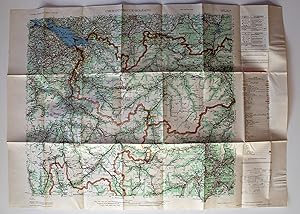
Central Europe Road Maps 1:300,000: Chur - Innsbruck - Bolzano. Sheet No. 26. AMS Series M405.
Verlag: Washington D. C., 1952
Anbieter: Versandantiquariat Hösl, Neuried, Deutschland
Verkäuferbewertung 5 von 5 Sternen
Karte
EUR 17,00
Währung umrechnenEUR 9,50 für den Versand von Deutschland nach USAAnzahl: 1 verfügbar
In den WarenkorbZustand: Sehr gut. The Army Map Service (AMS) was the military cartographic agency of the United States Department of Defense from 1941 to 1968, subordinated to the United States Army Corps of Engineers.The major task of the Army Map Service was the compilation, publication and distribution of military topographic maps and related products required by the Armed Forces of the United States.Between 1941 and 1945, the Army Map Service prepared 40,000 maps of all types, covering 400,000 square miles of the earth's surface. (WIkipedia) Große farbige Straßenkarte der Zentralschweiz und Teilen der Nachbarländer Franreich, Deutschland und Italien, vielfach gefaltet, praktisch ohne Gebrauchsspuren und wie neu. Legende in Englisch, Französisch und Deutsch. Gefaltet ist die Größe ca. 21,4 x 12,5 cm. AMS M405. First Edition - AMS. Copied in 1952 from kartogr. Anstalt Freytag-Berndt u. Artaria, Wien, 1:300,000, Auto-Strassenkarten, cartes routičres, 1951. Sprache / Language: en 1 Seiten. ca. 62,6 x 88 cm.
-
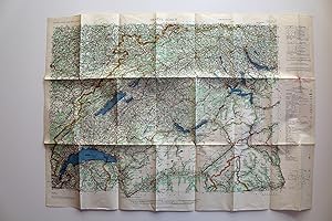
Central Europe Road Maps 1:300,000: Genčve - Zürich. Sheet No. 39. AMS Series M405.
Verlag: Washington D.C., 1952
Anbieter: Versandantiquariat Hösl, Neuried, Deutschland
Verkäuferbewertung 5 von 5 Sternen
Karte Erstausgabe
EUR 17,00
Währung umrechnenEUR 9,50 für den Versand von Deutschland nach USAAnzahl: 1 verfügbar
In den WarenkorbZustand: Sehr gut. 1. Auflage. The Army Map Service (AMS) was the military cartographic agency of the United States Department of Defense from 1941 to 1968, subordinated to the United States Army Corps of Engineers.The major task of the Army Map Service was the compilation, publication and distribution of military topographic maps and related products required by the Armed Forces of the United States.Between 1941 and 1945, the Army Map Service prepared 40,000 maps of all types, covering 400,000 square miles of the earth's surface. (WIkipedia) Große farbige Straßenkarte der Zentralschweiz und Teilen der Nachbarländer Franreich, Deutschland und Italien, vielfach gefaltet, praktisch ohne Gebrauchsspuren und wie neu. Legende in Englisch, Französisch und Deutsch. Gefaltet ist die Größe ca. 21,4 x 12,5 cm. AMS M405. First Edition - AMS. Copied in 1952 from kartogr. Anstalt Freytag-Berndt u. Artaria, Wien, 1:300,000, Auto-Strassenkarten, cartes routičres, 1951. Sprache / Language: en 1 Seiten. ca. 62,6 x 88 cm.
-
Double-sided AAF Escape Charts: Eastern Asia Series AMS 5301 - NI53 Osaka, Japan (2nd Edition, 1943) / NI54 Tokyo, Japan (2nd edition, 1943)
Verlag: US Army American Air Force (AAF), Washington DC, 1943
Sprache: Englisch
Anbieter: Dendera, London, Vereinigtes Königreich
Verkäuferbewertung 5 von 5 Sternen
Karte
EUR 17,69
Währung umrechnenEUR 28,63 für den Versand von Vereinigtes Königreich nach USAAnzahl: 1 verfügbar
In den WarenkorbNo Binding. Zustand: Poor. Two WW2 era American Air Force escape maps / evasion charts, 1/1M, colour printed on each side of a sheet of balloon cloth, rayon, or silk, 65x62cm. The cloth is fine, but the printing is unfortunately poor: legible but faint on the Osaka side, and faint with large illegible areas on the Tokyo side.
-

Hai-Nan Tao. AMS Series 1301 NE 49
Verlag: Army Map Service, Washington DC, 1962
Anbieter: Rulon-Miller Books (ABAA / ILAB), St. Paul, MN, USA
Verbandsmitglied: ABAA ILAB RMABA
Verkäuferbewertung 5 von 5 Sternen
EUR 32,93
Währung umrechnenEUR 10,23 für den Versand innerhalb von/der USAAnzahl: 1 verfügbar
In den WarenkorbSeveth edition, broadside map; 26 x 28 in., 1:1,000,000 scale; showing roadways, settlements, and elevation light creasing at lower border, else fine. Published under the schema for the International Map of the World. The IMW was the cartographical brain child of Albrecht Penck, who in the late 19th century conceived of a series of maps uniformly produced that would cover the whole of the Earth's land mass. To accomplish this, the planet was divided into 2,500 segments, and each segment was to be produced independently by various governments and NGOs. The project was envisioned to be strictly apolitical, but this meant that buy-in was slow for governmental bodies, and the lack of thematic information frustrated potential contributors in industry and led to University of Wisconsin cartographer Arthur Robinson declaring the resulting maps "cartographic wallpaper." When government agencies did contribute, they did so as here, in service to a baldly political interest in a given region.
-
[Mapa de] CHOISEUL ISLAND, Melanesia
Verlag: Army Map Service, 1944
Anbieter: Librería Miguel Miranda, Lope de Vega n.ş XIX, Madrid, M, Spanien
Verkäuferbewertung 4 von 5 Sternen

Karte
EUR 45,00
Währung umrechnenEUR 14,95 für den Versand von Spanien nach USAAnzahl: 1 verfügbar
In den WarenkorbZustand: Good / Bien. Washington: Army Map Service, [ca. 1959?].- Mapa en colores plegado de 64,5 x 55 cm, Scale 1: 500.000; Refer to this map as: SHEET SB 57-4 Series X401; Texto en inglés. Tan solo tiene los nombres de algunos pueblos o zonas costeras manuscritos a bolígrafo azul. Por lo demás en perfecto estado. Book in english GEOGRAFÍA, GUÍAS Y ATLAS DEL EXTRANJERO.
-
Djibouti (series 2201 sheet 21)
Verlag: Army Map Service, 1968
Anbieter: Acanthophyllum Books, Holywell, FLINT, Vereinigtes Königreich
Verbandsmitglied: PBFA
Verkäuferbewertung 2 von 5 Sternen

Karte
EUR 23,59
Währung umrechnenEUR 25,14 für den Versand von Vereinigtes Königreich nach USAAnzahl: 1 verfügbar
In den WarenkorbFolded map. Zustand: V.g. Covers northern Somalia, eastern Ethiopia and Socotra. Scale 1:2m. Weight: 1 Language: English.
-
Mogadiscio (series 2201 sheet 25)
Verlag: Army Map Service, 1967
Anbieter: Acanthophyllum Books, Holywell, FLINT, Vereinigtes Königreich
Verbandsmitglied: PBFA
Verkäuferbewertung 2 von 5 Sternen
Karte
EUR 23,59
Währung umrechnenEUR 25,14 für den Versand von Vereinigtes Königreich nach USAAnzahl: 1 verfügbar
In den WarenkorbFolded map. Zustand: V.g. Covers southern Somalia and the Seychelles, Amirante, Farquar and Aldabra islands. Weight: 1 Language: English.
-

Belvoir (VA. ; MD. Fort Belvoir and vicinity). Refer to this map as: Sheet 5561 II NW
Verlag: Army Map Service, 1956
Anbieter: Librería Miguel Miranda, Lope de Vega n.ş XIX, Madrid, M, Spanien
Verkäuferbewertung 4 von 5 Sternen
Karte
EUR 50,00
Währung umrechnenEUR 14,95 für den Versand von Spanien nach USAAnzahl: 1 verfügbar
In den WarenkorbZustand: Good / Bien. Washington: Army Map Service, [ca. 1956].- Es un mapa a escala 1 : 25.000 en colores y plegado, de 71 x 54,4 cm; Texto en inglés.- Al verso tiene la totografía aérea del área cartografiada en el mapa. Excelente estado. Book in english GEOGRAFÍA, GUÍAS Y ATLAS DEL EXTRANJERO.
-
[Mapa de] MAUI, Hawiian Islands
Verlag: Army Map Service, 1952
Anbieter: Librería Miguel Miranda, Lope de Vega n.ş XIX, Madrid, M, Spanien
Verkäuferbewertung 4 von 5 Sternen
Karte
EUR 50,00
Währung umrechnenEUR 14,95 für den Versand von Spanien nach USAAnzahl: 1 verfügbar
In den WarenkorbZustand: Good / Bien. Washington: Army Map Service, [ca. 1952].- Mapa en colores plegado de 54,5 x 68,2 cm, Scale 1: 250.000, Location diagram for NF 4-16; Texto en inglés. Excelente estado. Book in english GEOGRAFÍA, GUÍAS Y ATLAS DEL EXTRANJERO.
-
Double-sided AAF Escape Charts: Eastern Asia Series AMS 5301 - NJ 53 Kanazawa, Japan (1st edition, 1943) / NJ 54 Sendai, Japan (2nd edition, 1943)
Verlag: US Army American Air Force (AAF), Washington DC, 1943
Sprache: Englisch
Anbieter: Dendera, London, Vereinigtes Königreich
Verkäuferbewertung 5 von 5 Sternen
Karte
EUR 53,08
Währung umrechnenEUR 28,63 für den Versand von Vereinigtes Königreich nach USAAnzahl: 1 verfügbar
In den WarenkorbNo Binding. Zustand: Very Good. Two WW2 era American Air Force escape maps / evasion charts, 1/1M, colour printed on each side of a sheet of balloon cloth, rayon, or silk, 61x62cm. Very good.
-
Double-sided AAF Escape Charts: Eastern Asia Series AMS 5301 - NK53 Vladimiro-Aleksandrovskoye, USSR (2nd edition, 1943) / NL54 Otomari, Japan (2nd edition, 1944)
Verlag: US Army American Air Force (AAF), Washington DC, 1943
Sprache: Englisch
Anbieter: Dendera, London, Vereinigtes Königreich
Verkäuferbewertung 5 von 5 Sternen
Karte
EUR 53,08
Währung umrechnenEUR 28,63 für den Versand von Vereinigtes Königreich nach USAAnzahl: 1 verfügbar
In den WarenkorbNo Binding. Zustand: Good. Two WW2 era American Air Force escape maps / evasion charts, 1/1M, colour printed on each side of a sheet of balloon cloth, rayon, or silk, 59x62cm. Cloth fine. Printing clear and quite sharp, with a little fading especially to the foot of Otomari.
-
Double-sided AAF Escape Charts: Eastern Asia Series AMS 5301 - NH 52 Kagoshima, Japan (2nd edition, 1943) / NI 52 Nagasaki, Japan (2nd edition, 1944)
Verlag: US Army American Air Force (AAF), Washington DC, 1943
Sprache: Englisch
Anbieter: Dendera, London, Vereinigtes Königreich
Verkäuferbewertung 5 von 5 Sternen
Karte
EUR 53,08
Währung umrechnenEUR 28,63 für den Versand von Vereinigtes Königreich nach USAAnzahl: 1 verfügbar
In den WarenkorbNo Binding. Zustand: Good. Two WW2 era American Air Force escape maps / evasion charts, 1/1M, colour printed on each side of a sheet of balloon cloth, rayon, or silk, 64x60cm. Cloth near fine, a little crumpled, the printing clear if a little faded in places.
-
Gazetteer to Maps of Central Honshu [Japan]. Map Series AMS L774, 1:50,000
Verlag: Washington, D. C. War Department. Army Map Service, Corps of Engineers., 1945
Anbieter: Erik Hanson Books and Ephemera, San Diego, CA, USA
Verkäuferbewertung 5 von 5 Sternen
Erstausgabe
EUR 65,85
Währung umrechnenEUR 3,41 für den Versand innerhalb von/der USAAnzahl: 1 verfügbar
In den WarenkorbHardcover. Zustand: Good. 1st Edition. April, 1945 printing. 535 double-column pages. Former paperbound now in library laminate hardcover binding. Ex-library stamps. A sound copy with no marks on the interior pages. Thousands of named villages, mountains, islands, reefs, swamps, etc. with latitudes and longitudes given in English language orthography. One small folding color index map, mostly just written material.
-

Sheet X - 5 Weilheim. For use by War and Navy Department Agencies only. Not for sale or distribution.
Verlag: Washington: Selbstverlag, 1943
Sprache: Englisch
Anbieter: Antiquariat im Kloster, Weilheim, BY, Deutschland
Verkäuferbewertung 5 von 5 Sternen
Karte Erstausgabe
EUR 45,00
Währung umrechnenEUR 45,00 für den Versand von Deutschland nach USAAnzahl: 1 verfügbar
In den WarenkorbFaltmaß 34x24 cm. Zustand: Gut. First Edition. AMS 2. Mehrfarb. Faltkarte im Maßstab: 1:100.000. 99x91 cm. Karte 55x71 cm. - Karte etw. angeschmutzt, mit Randknicken u. Randläsuren u. einzelnen Eintragungen. - Aufgrund der Größe der Karte konnte diese nicht vollständig gescannt werden. Zahlungen mit PayPal möglich. Sprache: Englisch Gewicht in Gramm: 200.
-
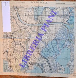
Porto Tolle. Sheet 77.
Erscheinungsdatum: 1944
Anbieter: Libreria Piani, Monte San Pietro, BO, Italien
Verkäuferbewertung 5 von 5 Sternen
EUR 20,00
Währung umrechnenEUR 20,00 für den Versand von Italien nach USAAnzahl: 1 verfügbar
In den WarenkorbWashington, 1944, cm. 41 x 41, scala 1 : 50.000 a colori.
-
[Mapa de] OAHU = HONOLULU , Hawaiian Islands
Verlag: Army Map Service, 1952
Anbieter: Librería Miguel Miranda, Lope de Vega n.ş XIX, Madrid, M, Spanien
Verkäuferbewertung 4 von 5 Sternen
Karte
EUR 60,00
Währung umrechnenEUR 14,95 für den Versand von Spanien nach USAAnzahl: 1 verfügbar
In den WarenkorbZustand: Good / Bien. Washington: Army Map Service, [ca. 1952].- Mapa en colores plegado de 55,5 x 72,5 cm, Scale 1: 250.000, Location diagram for NF 4-11; Texto en inglés. Excelente estado. Book in english GEOGRAFÍA, GUÍAS Y ATLAS DEL EXTRANJERO.
-
Double-sided AAF Escape Charts: Eastern Asia Series AMS 5301 - NL50 Buir Nor, Mongolia (1st edition, 1944) / NL51 Tsitsihar (Lung-Chiang), China, 1943 (1st edition, 1943)
Verlag: US Army American Air Force (AAF), Washington DC, 1943
Sprache: Englisch
Anbieter: Dendera, London, Vereinigtes Königreich
Verkäuferbewertung 5 von 5 Sternen
Karte
EUR 70,78
Währung umrechnenEUR 28,63 für den Versand von Vereinigtes Königreich nach USAAnzahl: 1 verfügbar
In den WarenkorbNo Binding. Zustand: Fine. Two WW2 era American Air Force escape maps / evasion charts, 1/1M, colour printed on each side of a sheet of balloon cloth, rayon, or silk, 54x61cm. Cloth fine with clear, sharp printing.
-
India and Pakistan. Leh. Sheet NI 43-8,
Verlag: Washington,, 1962
Sprache: Englisch
Anbieter: Books and Beaches, Anna Bechteler, Icking, Deutschland
Verkäuferbewertung 5 von 5 Sternen
Erstausgabe
EUR 18,00
Währung umrechnenEUR 85,00 für den Versand von Deutschland nach USAAnzahl: 1 verfügbar
In den WarenkorbZustand: Sehr gut. Folding Map 1: 250.000. Very good condition. Uncommon. Showing the area of Leh/Ladakh. Sprache: Englisch Gewicht in Gramm: 50.
-
India and Pakistan. Palampur. Sheet NI 43-16,
Verlag: Washington, n.d. (ca. 1960)., 1960
Sprache: Englisch
Anbieter: Books and Beaches, Anna Bechteler, Icking, Deutschland
Verkäuferbewertung 5 von 5 Sternen
EUR 18,00
Währung umrechnenEUR 85,00 für den Versand von Deutschland nach USAAnzahl: 1 verfügbar
In den WarenkorbZustand: Sehr gut. Folding Map 1: 250.000. As new condition (may be later printing, but not noted as such). Uncommon. Showing the area of Palampur in Kangra Valley/Himachal Pradesh. Sprache: Englisch Gewicht in Gramm: 50.
-
India and Pakistan. Shyok. Sheet NH 44-5,
Verlag: Washington, n.d. (ca. 1960)., 1960
Sprache: Englisch
Anbieter: Books and Beaches, Anna Bechteler, Icking, Deutschland
Verkäuferbewertung 5 von 5 Sternen
EUR 18,00
Währung umrechnenEUR 85,00 für den Versand von Deutschland nach USAAnzahl: 1 verfügbar
In den WarenkorbZustand: Sehr gut. Folding Map 1: 250.000. As new condition (may be later printing, but not noted as such). Uncommon. Showing the area of Shyok in Ladakh, with Lingzi Tang, Changlung La, Panglung. Sprache: Englisch Gewicht in Gramm: 50.
-
India and Pakistan. Mastuj. Sheet NJ 43-13,
Verlag: Washington, n.d. (ca. 1960)., 1960
Sprache: Englisch
Anbieter: Books and Beaches, Anna Bechteler, Icking, Deutschland
Verkäuferbewertung 5 von 5 Sternen
EUR 18,00
Währung umrechnenEUR 85,00 für den Versand von Deutschland nach USAAnzahl: 1 verfügbar
In den WarenkorbZustand: Sehr gut. Folding Map 1: 250.000. As new condition (may be later printing, but not noted as such). Uncommon. Showing the area of Mastuj on the border to Afghanistan. Sprache: Englisch Gewicht in Gramm: 50.


![Bild des Verkäufers für [Mapa de] CHOISEUL ISLAND, Melanesia zum Verkauf von Librería Miguel Miranda](https://pictures.abebooks.com/inventory/md/md31942268035.jpg)
![Bild des Verkäufers für [Mapa de] MAUI, Hawiian Islands zum Verkauf von Librería Miguel Miranda](https://pictures.abebooks.com/inventory/md/md31942264458.jpg)


![Bild des Verkäufers für [Mapa de] OAHU = HONOLULU , Hawaiian Islands zum Verkauf von Librería Miguel Miranda](https://pictures.abebooks.com/inventory/md/md31942258737.jpg)
