
Gesamtpreis (1 Artikel Artikel):
Versandziel:

a k johnston ltd (13 Ergebnisse)
Direkt zu den wichtigsten Suchergebnissen
Suchfilter
Produktart
- Alle Product Types
- Bücher (13)
- Magazine & Zeitschriften (Keine weiteren Ergebnisse entsprechen dieser Verfeinerung)
- Comics (Keine weiteren Ergebnisse entsprechen dieser Verfeinerung)
- Noten (Keine weiteren Ergebnisse entsprechen dieser Verfeinerung)
- Kunst, Grafik & Poster (Keine weiteren Ergebnisse entsprechen dieser Verfeinerung)
- Fotografien (Keine weiteren Ergebnisse entsprechen dieser Verfeinerung)
- Karten (Keine weiteren Ergebnisse entsprechen dieser Verfeinerung)
- Manuskripte & Papierantiquitäten (Keine weiteren Ergebnisse entsprechen dieser Verfeinerung)
Zustand Mehr dazu
Einband
Weitere Eigenschaften
- Erstausgabe (1)
- Signiert (Keine weiteren Ergebnisse entsprechen dieser Verfeinerung)
- Schutzumschlag (Keine weiteren Ergebnisse entsprechen dieser Verfeinerung)
- Angebotsfoto (6)
Sprache (2)
Gratisversand
Land des Verkäufers
Verkäuferbewertung
-

The Scottish Tartans
Anbieter: PBShop.store US, Wood Dale, IL, USA
Verkäuferbewertung 5 von 5 Sternen

PAP. Zustand: New. New Book. Shipped from UK. Established seller since 2000.
-
The Scottish Tartans
Anbieter: PBShop.store UK, Fairford, GLOS, Vereinigtes Königreich
Verkäuferbewertung 5 von 5 Sternen
EUR 25,36
EUR 3,81 Versand
Versand von Vereinigtes Königreich nach USAAnzahl: 15 verfügbar
In den WarenkorbPAP. Zustand: New. New Book. Shipped from UK. Established seller since 2000.
-

The Scottish Tartans: With Historical Sketches of the Clans and Families of Scotland; The Badges and Arms of the Chiefs of the Clans and Families (Classic Reprint)
Anbieter: PBShop.store US, Wood Dale, IL, USA
Verkäuferbewertung 5 von 5 Sternen
HRD. Zustand: New. New Book. Shipped from UK. Established seller since 2000.
-

My Second Atlas: 64 pages in colour containing 61 maps and insets: 190 illustrations with questions: index to place-names
Verlag: Edinburgh & London: W. & A. K. Johnston & G. W. Bacon Ltd., 1961
Enlarged Edition. Good copy bound in quarter cloth over decorated paper boards. So slight wear and tear as with age. Remains well preserved overall; bright and clean. Includes previous owner's inscriptions. Physical description; 64 pages. Notes; No clear publication date given. Subjects; Atlas. Children's Atlas. 3 Kg.
-
The Scottish Tartans: With Historical Sketches of the Clans and Families of Scotland; The Badges and Arms of the Chiefs of the Clans and Families (Classic Reprint)
Anbieter: PBShop.store UK, Fairford, GLOS, Vereinigtes Königreich
Verkäuferbewertung 5 von 5 Sternen
EUR 33,70
EUR 4,81 Versand
Versand von Vereinigtes Königreich nach USAAnzahl: 15 verfügbar
In den WarenkorbHRD. Zustand: New. New Book. Shipped from UK. Established seller since 2000.
-

Clan Maclean: Their Septs & Dependents (Clan Tartan Series, No. 23)
Verlag: W. & A. K. Johnston, Ltd.
Anbieter: Wonder Book, Frederick, MD, USA
Verkäuferbewertung 5 von 5 Sternen
Zustand: Fair. Acceptable condition. Clan Tartan Series, No. 23. A sample of Maclean tartan laid in. (Scotland, Clans, Tartans) A readable, intact copy that may have noticeable tears and wear to the spine. All pages of text are present, but they may include extensive notes and highlighting or be heavily stained. Includes reading copy only books.
-

Johnston's Motoring and Touring Map of Ireland.
Verlag: W and A K Johnston and G W Bacon ltd.
Anbieter: High Street Books, New Mills, Vereinigtes Königreich
Verkäuferbewertung 5 von 5 Sternen
EUR 9,53
EUR 23,13 Versand
Versand von Vereinigtes Königreich nach USAAnzahl: 1 verfügbar
In den WarenkorbMap. Zustand: Good. Covers marked and worn with short tears to the edges, cloth backed map undated.
-
Bacon's Large Scale Map of the Isle of Wight
Verlag: W. & A.K. Johnston & G.W. Bacon Ltd, London and Edinburgh, 1955
Anbieter: beckfarmbooks, HOLT, Norfolk, Vereinigtes Königreich
Verkäuferbewertung 3 von 5 Sternen

EUR 11,91
EUR 26,02 Versand
Versand von Vereinigtes Königreich nach USAAnzahl: 1 verfügbar
In den WarenkorbCard Covers. Zustand: Good Plus. Zustand des Schutzumschlags: None. Fold-out map of the Isle of Wight with large index to place names. Map fully coloured (roads in red, woods and parks in green) on a scale of 1 inch to 1 mile. Yellow and green card covers 6.5 x 3.75 inches. Map in 21 sections of the same size. Originally published at 2/- (two shillings).
-

Road Atlas: 3 Miles to Inch (Map of Great Britain Showing Areas and Numbers of the Map Sections and the Main Throug Routes)
Verlag: W. & A. K. Johnston, 1938
Anbieter: Librería Miguel Miranda, Lope de Vega n.ş XIX, Madrid, M, Spanien
Verkäuferbewertung 5 von 5 Sternen
Zustand: Good / Bien. London: W. & A. K. Johnston, [ca. 1938].- 324 p. de mapas; 4ş menor (21,2 x 14,7 cm); Texto en inglés; Tela Ed. Minimos roces en las esquinas. Book in english GEOGRAFÍA, GUÍAS Y ATLAS DEL EXTRANJERO.
-
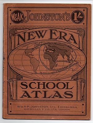
Johnston's New Era School Atlas
Verlag: W. & A. K. Johnston, Ltd nd. ca. 1900s, Edinburgh, 1900
Anbieter: Attic Books (ABAC, ILAB), London, ON, Kanada
Verkäuferbewertung 5 von 5 Sternen
Card covers. Zustand: Very good. 40 p. 25 cm. 40 colour maps. Brown card covers with black print. Ink stains to spine and rear.
-
Zustand: Sehr gut. Zustand: Sehr gut | Sprache: Englisch | Produktart: Bücher | Keine Beschreibung verfügbar.
-
The reference atlas of the world, political and physical : containing one hundred and twenty-eight plates and complete index
Verlag: Glasgow ; Edinburgh : R.W. Forsyth Ltd, 1920
Anbieter: Joseph Burridge Books, Dagenham, Vereinigtes Königreich
Verkäuferbewertung 5 von 5 Sternen
EUR 71,48
EUR 26,60 Versand
Versand von Vereinigtes Königreich nach USAAnzahl: 1 verfügbar
In den WarenkorbHardcover. Zustand: Very Good. 10 unnumbered pages, 128 (that is 136) color maps, 99 pages 2 colour plates : 32 cm. "Treaties of Versailles, June 1919. Eight additional maps have been added . showing new frontiers, boundaries, and ceded territories.".
-

The Cambridge Medieval History: Map Volumes: II-VII
Verlag: Cambridge: Cambridge University Press
Erstausgabe
First Edition. Near fine collection of folding maps in the original paper board protective cases. Remains well preserved overall; tight, bright, clean and sharp-cornered. Physical description; 6 volumes (II-VII). Notes; No clear publication date given. Subjects; Cambridge Medieval History. Maps. Medieval Maps. Map Volumes. 4 Kg.

