Verwandte Artikel zu East Anglia A-Z Road Atlas
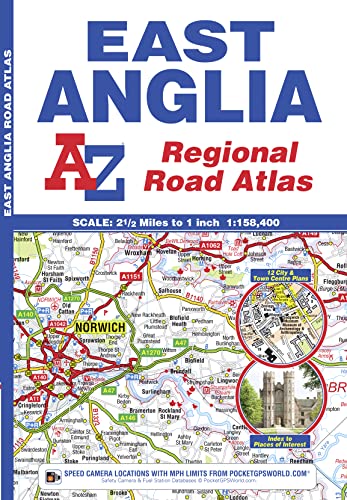
A-Z Maps East Anglia A-Z Road Atlas ISBN 13: 9781843487951

East Anglia A-Z Road Atlas - Softcover

 
9781843487951: East Anglia A-Z Road Atlas
Alle Exemplare der Ausgabe mit dieser ISBN anzeigen:
 
 
Reseña del editor:
This A-Z map of East Anglia is a full colour atlas featuring 39 pages of continuous road mapping extending from Grantham and Milton Keynes in the west to Lowestoft on the east coast, and from St Albans and Chelmsford in the south to Cromer on the north coast. A-Z road mapping is instantly recognizable and easy to use - published at a clear 2.5 miles to 1 inch, it includes the following features: Motorways with full junction detail, primary routes and destinations, A & B roads, under construction and proposed roads, service areas, tolls, mileages, county and unitary authority boundaries. Selected safety camera locations with speed limits. Selected fuel stations. The Norfolk Broads National Park boundary. Selected places of interest and tourist information centres. Also included are 14 city, town, airport and port plans for: Bedford, Bury St. Edmunds, Cambridge, Chelmsford, Colchester, Ely, Great Yarmouth, Ipswich, King's Lynn, Norwich, Luton, Peterborough, Harwich Port and London Stansted Airport. There are 2 separate indexes: An index to cities, towns, villages, hamlets and locations and a places of interest index with corresponding map symbols alongside each entry for easy identification.

„Über diesen Titel“ kann sich auf eine andere Ausgabe dieses Titels beziehen.

Versand: EUR 5,25
Von Vereinigtes Königreich nach USA

Versandziele, Kosten & Dauer

In den Warenkorb

Weitere beliebte Ausgaben desselben Titels

9781843485704: East Anglia (A-Z Regional Road Atlas)

Vorgestellte Ausgabe

ISBN 10:  1843485702 ISBN 13:  9781843485704
Verlag: Geographers' A-Z Map Co Ltd, 2008
Softcover

  • 9781843482420: East Anglia Regional Road Atlas

    Geogra..., 2004
    Softcover

  • 9781843481201: East Anglia Regional Road Atlas

    Geogra..., 2003
    Softcover

Beste Suchergebnisse beim ZVAB

Beispielbild für diese ISBN

A-Z Maps
ISBN 10: 1843487950 ISBN 13: 9781843487951
Neu paperback Anzahl: > 20
Anbieter:
Blackwell's
(London, Vereinigtes Königreich)
Bewertung

Buchbeschreibung paperback. Zustand: New. Language: ENG. Artikel-Nr. 9781843487951

Weitere Informationen zu diesem Verkäufer | Verkäufer kontaktieren

Neu kaufen
EUR 9,61
Währung umrechnen

In den Warenkorb

Versand: EUR 5,25
Von Vereinigtes Königreich nach USA
Versandziele, Kosten & Dauer
Beispielbild für diese ISBN

Geographers' A-Z Map Company
ISBN 10: 1843487950 ISBN 13: 9781843487951
Neu Paperback Anzahl: 2
Anbieter:
Monster Bookshop
(Fleckney, Vereinigtes Königreich)
Bewertung

Buchbeschreibung Paperback. Zustand: New. BRAND NEW ** SUPER FAST SHIPPING FROM UK WAREHOUSE ** 30 DAY MONEY BACK GUARANTEE. Artikel-Nr. 9781843487951-GDR

Weitere Informationen zu diesem Verkäufer | Verkäufer kontaktieren

Neu kaufen
EUR 9,70
Währung umrechnen

In den Warenkorb

Versand: EUR 10,50
Von Vereinigtes Königreich nach USA
Versandziele, Kosten & Dauer
Foto des Verkäufers

Geographers' A-Z Map Company
ISBN 10: 1843487950 ISBN 13: 9781843487951
Neu Taschenbuch Anzahl: 4
Anbieter:
Smartbuy
(Einbeck, Deutschland)
Bewertung

Buchbeschreibung Taschenbuch. Zustand: Neu. Neuware - A full colour regional road atlas of East Anglia featuring 39 pages of continuous road mapping that covers an area extending to: Grantham, Sleaford, Boston, King's Lynn, Cromer, Great Yarmouth, Felixstowe, Clacton-on-Sea, Colchester, Chelmsford, Harlow, Hemel Hempstead, Leighton Buzzard and Stamford. 60 pp. Englisch. Artikel-Nr. 9781843487951

Weitere Informationen zu diesem Verkäufer | Verkäufer kontaktieren

Neu kaufen
EUR 8,99
Währung umrechnen

In den Warenkorb

Versand: EUR 32,99
Von Deutschland nach USA
Versandziele, Kosten & Dauer