
Gesamtpreis (1 Artikel Artikel):
Versandziel:

9781843487951 - East Anglia A-Z Road Atlas von A-Z Maps (8 Ergebnisse)
Direkt zu den wichtigsten Suchergebnissen
Produktart
- Alle Product Types
- Bücher (8)
- Magazine & Zeitschriften
- Comics
- Noten
- Kunst, Grafik & Poster
- Fotografien
- Karten
- Manuskripte & Papierantiquitäten
Zustand
Einband
- alle Einbände
- Hardcover
- Softcover (8)
Weitere Eigenschaften
- Erstausgabe
- Signiert
- Schutzumschlag
- Angebotsfoto (3)
Gratisversand
- Versand nach USA gratis
Land des Verkäufers
Verkäuferbewertung
-

East Anglia Regional Road Atlas
Verlag: Geographers' A-Z Map Co Ltd, 2018
ISBN 10: 1843487950ISBN 13: 9781843487951
Buch
Paperback. Zustand: Very Good. The book has been read, but is in excellent condition. Pages are intact and not marred by notes or highlighting. The spine remains undamaged.
-
East Anglia Regional Road Atlas
Verlag: Geographers' A-Z Map Co Ltd, 2018
ISBN 10: 1843487950ISBN 13: 9781843487951
Buch
Paperback. Zustand: Fair. A readable copy of the book which may include some defects such as highlighting and notes. Cover and pages may be creased and show discolouration.
-

East Anglia Regional Road Atlas
Verlag: Geographers' A-Z Map Co Ltd, 2018
ISBN 10: 1843487950ISBN 13: 9781843487951
Buch
Zustand: VeryGood. Most items will be dispatched the same or the next working day.
-

East Anglia Regional Road Atlas
Verlag: Geographers' A-Z Map Co Ltd, 2018
ISBN 10: 1843487950ISBN 13: 9781843487951
Buch
Zustand: Good. Most items will be dispatched the same or the next working day.
-
East Anglia Regional Road Atlas
Verlag: HarperCollins Publishers, United Kingdom, 2018
ISBN 10: 1843487950ISBN 13: 9781843487951
Buch
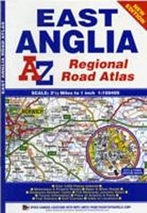
Paperback. Zustand: Good. A full colour regional road atlas of East Anglia featuring 39 pages of continuous road mapping that covers an area extending to: Grantham, Sleaford, Boston, King's Lynn, Cromer, Great Yarmouth, Felixstowe, Clacton-on-Sea, Colchester, Chelmsford, Harlow, Hemel Hempstead, Leighton Buzzard and Stamford. Mapping is shown at a clear 2.5 miles to 1 inch scale (1.58 km to 1 cm) and includes the following features: Motorways open with full junction detail, motorways under construction and proposed, service areas, primary routes and destinations, A & B roads, selected minor roads, gradients 1:5 and steeper, tolls, mileages, county boundaries, spot heights and hill shading Selected safety camera locations with their maximum speed limits Selected fuel stations National Park boundaries Selected places of interest, tourist information centres and golf courses Also included are 14 city, town, airport or port plans for: Bedford, Bury St. Edmunds, Cambridge, Chelmsford, Colchester, Ely, Great Yarmouth, Ipswich, King's Lynn, Norwich, Luton, Peterborough, Harwich Port and London Stansted Airport. The index section lists cities, towns, villages, hamlets and locations covered by this atlas. The book has been read but remains in clean condition. All pages are intact and the cover is intact. Some minor wear to the spine.
-
East Anglia A-Z Road Atlas
Verlag: HarperCollins Publishers 2018-11-29, London, 2018
ISBN 10: 1843487950ISBN 13: 9781843487951
Buch
paperback. Zustand: New. Language: ENG.
-
East Anglia Regional Road Atlas
Verlag: Geographers' A-Z Map Co Ltd, 2011
ISBN 10: 1843487950ISBN 13: 9781843487951
Buch
Paperback. Zustand: New. BRAND NEW ** SUPER FAST SHIPPING FROM UK WAREHOUSE ** 30 DAY MONEY BACK GUARANTEE.
-
East Anglia Regional Road Atlas
Verlag: Harpercollins Publishers Nov 2018, 2018
ISBN 10: 1843487950ISBN 13: 9781843487951
Buch
Taschenbuch. Zustand: Neu. Neuware - A full colour regional road atlas of East Anglia featuring 39 pages of continuous road mapping that covers an area extending to: Grantham, Sleaford, Boston, King's Lynn, Cromer, Great Yarmouth, Felixstowe, Clacton-on-Sea, Colchester, Chelmsford, Harlow, Hemel Hempstead, Leighton Buzzard and Stamford. 60 pp. Englisch.