
Verwandte Artikel zu Touristische Karte Namibia 1:1 200 000: waterproof,...
Touristische Karte Namibia 1:1 200 000: waterproof, tear-resistant Travel Map (National Geographic Adventure Map, Band 3209)
Inhaltsangabe
- Waterproof - Tear-Resistant - Travel Map
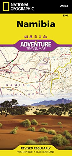
National Geographic's Namibia Adventure Map is designed to meet the needs of adventure travelers with its detailed and accurate information. This map includes the locations of cities and towns with a user-friendly index, a clearly marked road network complete with distances and designations for roads/highways, plus secondary routes for those seeking to explore off the beaten path.
- The Namibia map also includes hundreds of marked private guest lodges, camps and, state-owned rest camps.
- Adventure Maps differ from a traditional road map because of the specialty content they include.
- Each map contains hundreds of diverse and unique recreational, ecological, cultural, and historic destinations -- outside of the major tourist hubs.
- National Geographic Adventure Maps are the perfect companion to a guidebook.
- Namibia is located on the south east shore of Africa.
- The climate is dry, even on the Atlantic coast where the dunes of the Namib Desert provide a spectacular sight.
- The eastern border of Namibia with Botswana, is defined by the Kalahari Desert.
- Despite the dry environment the protected areas of Namibia include almost 15 percent of the land area with virtually the entire Namib Desert coastal strip under protection.
- These protected areas are home to cheetahs, lions, zebras, giraffes, and even elephants.
- The northern part of the map includes the famous Skeleton Coast National Park.
The the capital city of Windhoek falls in the generous overlap area of the printed map. The south side of the map includes Namib-Naukluft National Park as well as the Tsau//Khaeb (Sperrgebiet) National Park and, the long border with South Africa.
Every Adventure map is printed on "Travel-Tough" waterproof, tear-resistant paper.
- Map Scale = 1:1,200,000
- Sheet Size = 25.5" x 37.75"
- Folded Size = 4.25" x 9.25"
Die Inhaltsangabe kann sich auf eine andere Ausgabe dieses Titels beziehen.
Über die Autorin bzw. den Autor
Founded in 1915 as the Cartographic Group, the first division of National Geographic, National Geographic Maps has been responsible for illustrating the world around us through the art and science of mapmaking.Today, National Geographic Maps continues this mission by creating the world's best wall maps, recreation maps, atlases, and globes which inspire people to care about and explore their world.
„Über diesen Titel“ kann sich auf eine andere Ausgabe dieses Titels beziehen.
Suchergebnisse für Touristische Karte Namibia 1:1 200 000: waterproof,...

Beispielbild für diese ISBN
Namibia Map
Anbieter: PBShop.store UK, Fairford, GLOS, Vereinigtes Königreich
Verkäuferbewertung 5 von 5 Sternen

UNK. Zustand: New. New Book. Shipped from UK. Established seller since 2000. Artikel-Nr. EA-9781597756198
Neu kaufen
EUR 19,95
EUR 3,92 Versand
Versand von Vereinigtes Königreich nach USA
Versand von Vereinigtes Königreich nach USA
Anzahl: 15 verfügbar
Beispielbild für diese ISBN
National Geographic Adventure Travel Map Namibia Africa
Anbieter: Revaluation Books, Exeter, Vereinigtes Königreich
Verkäuferbewertung 5 von 5 Sternen
Map. Zustand: Brand New. fol map edition. 2 pages. 8.90x4.40x0.20 inches. In Stock. Artikel-Nr. xr1597756199
Neu kaufen
EUR 13,75
EUR 11,92 Versand
Versand von Vereinigtes Königreich nach USA
Versand von Vereinigtes Königreich nach USA
Anzahl: 2 verfügbar
Beispielbild für diese ISBN
National Geographic Adventure Travel Map Namibia Africa
Anbieter: Revaluation Books, Exeter, Vereinigtes Königreich
Verkäuferbewertung 5 von 5 Sternen
Map. Zustand: Brand New. fol map edition. 2 pages. 8.90x4.40x0.20 inches. In Stock. Artikel-Nr. 1597756199
Neu kaufen
EUR 28,44
EUR 11,92 Versand
Versand von Vereinigtes Königreich nach USA
Versand von Vereinigtes Königreich nach USA
Anzahl: 1 verfügbar
Foto des Verkäufers
Touristische Karte Namibia 1:1 200 000 : waterproof, tear-resistant Travel Map
Anbieter: AHA-BUCH GmbH, Einbeck, Deutschland
Verkäuferbewertung 5 von 5 Sternen
Karte. Zustand: Neu. Neuware - - Waterproof - Tear-Resistant - Travel MapNational Geographic's Namibia Adventure Map is designed to meet the needs of adventure travelers with its detailed and accurate information. This map includes the locations of cities and towns with a user-friendly index, a clearly marked road network complete with distances and designations for roads/highways, plus secondary routes for those seeking to explore off the beaten path.- The Namibia map also includes hundreds of marked private guest lodges, camps and, state-owned rest camps.- Adventure Maps differ from a traditional road map because of the specialty content they include.- Each map contains hundreds of diverse and unique recreational, ecological, cultural, and historic destinations -- outside of the major tourist hubs.- National Geographic Adventure Maps are the perfect companion to a guidebook.- Namibia is located on the south east shore of Africa.- The climate is dry, even on the Atlantic coast where the dunes of the Namib Desert provide a spectacular sight.- The eastern border of Namibia with Botswana, is defined by the Kalahari Desert.- Despite the dry environment the protected areas of Namibia include almost 15 percent of the land area with virtually the entire Namib Desert coastal strip under protection.- These protected areas are home to cheetahs, lions, zebras, giraffes, and even elephants.- The northern part of the map includes the famous Skeleton Coast National Park.The the capital city of Windhoek falls in the generous overlap area of the printed map. The south side of the map includes Namib-Naukluft National Park as well as the Tsau//Khaeb (Sperrgebiet) National Park and, the long border with South Africa.Every Adventure map is printed on 'Travel-Tough' waterproof, tear-resistant paper.- Map Scale = 1:1,200,000- Sheet Size = 25.5' x 37.75'- Folded Size = 4.25' x 9.25'. Artikel-Nr. 9781597756198
Neu kaufen
EUR 19,53
EUR 35,00 Versand
Versand von Deutschland nach USA
Versand von Deutschland nach USA
Anzahl: 1 verfügbar
Beispielbild für diese ISBN
Namibia Map (National Geographic Adventure Map, 3209)
Anbieter: Turor Books, Hückelhoven, Deutschland
Verkäuferbewertung 5 von 5 Sternen
map. Zustand: New. Artikel-Nr. 01M3N6Z50GKCPYJ
Neu kaufen
EUR 17,95
EUR 48,49 Versand
Versand von Deutschland nach USA
Versand von Deutschland nach USA
Anzahl: 1 verfügbar
Foto des Verkäufers
Touristische Karte Namibia 1:1 200 000
Anbieter: moluna, Greven, Deutschland
Verkäuferbewertung 5 von 5 Sternen
Zustand: New. Klappentext- Waterproof - Tear-Resistant - Travel MapNational Geographic s Namibia Adventure Map is designed to meet the needs of adventure travelers with its detailed and accurate information. This map includes the loca. Artikel-Nr. 244624519
Neu kaufen
EUR 17,87
EUR 48,99 Versand
Versand von Deutschland nach USA
Versand von Deutschland nach USA
Anzahl: 1 verfügbar
Foto des Verkäufers
Touristische Karte Namibia 1:1 200 000
Anbieter: buchversandmimpf2000, Emtmannsberg, BAYE, Deutschland
Verkäuferbewertung 5 von 5 Sternen
Karte. Zustand: Neu. Neuware -- Waterproof - Tear-Resistant - Travel MapNational Geographic's Namibia Adventure Map is designed to meet the needs of adventure travelers with its detailed and accurate information. This map includes the locations of cities and towns with a user-friendly index, a clearly marked road network complete with distances and designations for roads/highways, plus secondary routes for those seeking to explore off the beaten path.- The Namibia map also includes hundreds of marked private guest lodges, camps and, state-owned rest camps.- Adventure Maps differ from a traditional road map because of the specialty content they include.- Each map contains hundreds of diverse and unique recreational, ecological, cultural, and historic destinations -- outside of the major tourist hubs.- National Geographic Adventure Maps are the perfect companion to a guidebook.- Namibia is located on the south east shore of Africa.- The climate is dry, even on the Atlantic coast where the dunes of the Namib Desert provide a spectacular sight.- The eastern border of Namibia with Botswana, is defined by the Kalahari Desert.- Despite the dry environment the protected areas of Namibia include almost 15 percent of the land area with virtually the entire Namib Desert coastal strip under protection.- These protected areas are home to cheetahs, lions, zebras, giraffes, and even elephants.- The northern part of the map includes the famous Skeleton Coast National Park.The the capital city of Windhoek falls in the generous overlap area of the printed map. The south side of the map includes Namib-Naukluft National Park as well as the Tsau//Khaeb (Sperrgebiet) National Park and, the long border with South Africa.Every Adventure map is printed on 'Travel-Tough' waterproof, tear-resistant paper.- Map Scale = 1:1,200,000- Sheet Size = 25.5' x 37.75'- Folded Size = 4.25' x 9.25'GeoCenter TMS, Kurze Str. 40, 70794 Filderstadt Englisch. Artikel-Nr. 9781597756198
Neu kaufen
EUR 17,95
EUR 60,00 Versand
Versand von Deutschland nach USA
Versand von Deutschland nach USA
Anzahl: 1 verfügbar
Foto des Verkäufers
Touristische Karte Namibia 1:1 200 000 | waterproof, tear-resistant Travel Map
Anbieter: preigu, Osnabrück, Deutschland
Verkäuferbewertung 5 von 5 Sternen
(Land-)Karte. Zustand: Neu. Touristische Karte Namibia 1:1 200 000 | waterproof, tear-resistant Travel Map | Geographic National | (Land-)Karte | National Geographic Adventure | Karte/Landkarte | Englisch | 2015 | National Geographic Maps | EAN 9781597756198 | Verantwortliche Person für die EU: Geocenter TMS, Anja Pfister, Kurze Str. 40, 70794 Filderstadt, gpsr[at]geocenter[dot]de | Anbieter: preigu. Artikel-Nr. 104193469
Neu kaufen
EUR 16,55
EUR 70,00 Versand
Versand von Deutschland nach USA
Versand von Deutschland nach USA
Anzahl: 1 verfügbar
Foto des Verkäufers
Touristische Karte Namibia 1:1 200 000
Anbieter: Books-by-Floh, Paderborn, Deutschland
Verkäuferbewertung 5 von 5 Sternen
Karte. Zustand: Neu. Neuware -- Waterproof - Tear-Resistant - Travel MapNational Geographic's Namibia Adventure Map is designed to meet the needs of adventure travelers with its detailed and accurate information. This map includes the locations of cities and towns with a user-friendly index, a clearly marked road network complete with distances and designations for roads/highways, plus secondary routes for those seeking to explore off the beaten path. The Namibia map also includes hundreds of marked private guest lodges, camps and, state-owned rest camps. Adventure Maps differ from a traditional road map because of the specialty content they include. Each map contains hundreds of diverse and unique recreational, ecological, cultural, and historic destinations -- outside of the major tourist hubs. National Geographic Adventure Maps are the perfect companion to a guidebook.Namibia is located on the south east shore of Africa. The climate is dry, even on the Atlantic coast where the dunes of the Namib Desert provide a spectacular sight. The eastern border of Namibia with Botswana, is defined by the Kalahari Desert. Despite the dry environment the protected areas of Namibia include almost 15 percent of the land area with virtually the entire Namib Desert coastal strip under protection. These protected areas are home to cheetahs, lions, zebras, giraffes, and even elephants.The northern part of the map includes the famous Skeleton Coast National Park. The the capital city of Windhoek falls in the generous overlap area of the printed map. The south side of the map includes Namib-Naukluft National Park as well as the Tsau//Khaeb (Sperrgebiet) National Park and, the long border with South Africa.Every Adventure Map is printed on durable synthetic paper, making them waterproof, tear-resistant and tough -- capable of withstanding the rigors of international travel.- Map Scale = 1:1,200,000- Sheet Size = 25.5' x 37.75'- Folded Size = 4.25' x 9.25' Englisch. Artikel-Nr. 9781597756198
Neu kaufen
EUR 23,51
EUR 105,00 Versand
Versand von Deutschland nach USA
Versand von Deutschland nach USA
Anzahl: 2 verfügbar