
Gesamtpreis (1 Artikel Artikel):
Versandziel:

national geographic maps (Mehr als 1.700 Ergebnisse)
Feedback
Direkt zu den wichtigsten Suchergebnissen
Suchfilter
Produktart
- Alle Product Types
- Bücher (1.586)
- Magazine & Zeitschriften (Keine weiteren Ergebnisse entsprechen dieser Verfeinerung)
- Comics (Keine weiteren Ergebnisse entsprechen dieser Verfeinerung)
- Noten (Keine weiteren Ergebnisse entsprechen dieser Verfeinerung)
- Kunst, Grafik & Poster (Keine weiteren Ergebnisse entsprechen dieser Verfeinerung)
- Fotografien (Keine weiteren Ergebnisse entsprechen dieser Verfeinerung)
- Karten (162)
- Manuskripte & Papierantiquitäten (Keine weiteren Ergebnisse entsprechen dieser Verfeinerung)
Zustand Mehr dazu
Einband
- alle Einbände
- Hardcover (Keine weiteren Ergebnisse entsprechen dieser Verfeinerung)
- Softcover (124)
Weitere Eigenschaften
- Erstausgabe (1)
- Signiert (Keine weiteren Ergebnisse entsprechen dieser Verfeinerung)
- Schutzumschlag (Keine weiteren Ergebnisse entsprechen dieser Verfeinerung)
- Angebotsfoto (335)
Sprache (2)
Gratisversand
Land des Verkäufers
Verkäuferbewertung
-

Wyoming Benchmark Road & Recreation Atlas
Anbieter: ThriftBooks-Dallas, Dallas, TX, USA
Verkäuferbewertung 5 von 5 Sternen

EUR 8,75
Währung umrechnenKostenlos für den Versand innerhalb von/der USAAnzahl: 1 verfügbar
In den WarenkorbPaperback. Zustand: Fair. No Jacket. Readable copy. Pages may have considerable notes/highlighting. ~ ThriftBooks: Read More, Spend Less 1.
-
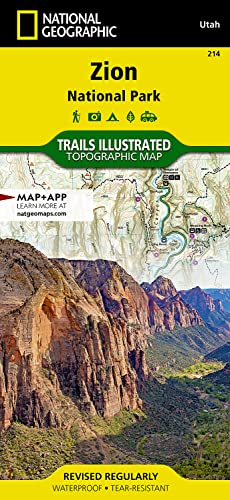
Zion National Park Map (National Geographic Trails Illustrated Map, 214)
Verlag: National Geographic Maps (edition 2022), 2022
ISBN 10: 1566952972 ISBN 13: 9781566952972
Sprache: Englisch
EUR 5,46
Währung umrechnenKostenlos für den Versand innerhalb von/der USAAnzahl: 1 verfügbar
In den WarenkorbMap. Zustand: Good. 2022. It's a preowned item in good condition and includes all the pages. It may have some general signs of wear and tear, such as markings, highlighting, slight damage to the cover, minimal wear to the binding, etc., but they will not affect the overall reading experience.
-
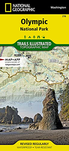
Olympic National Park Map (National Geographic Trails Illustrated Map, 216)
Verlag: National Geographic Maps (edition 2024), 2024
ISBN 10: 1566954029 ISBN 13: 9781566954020
Sprache: Englisch
EUR 6,86
Währung umrechnenKostenlos für den Versand innerhalb von/der USAAnzahl: 1 verfügbar
In den WarenkorbMap. Zustand: Good. 2024. It's a preowned item in good condition and includes all the pages. It may have some general signs of wear and tear, such as markings, highlighting, slight damage to the cover, minimal wear to the binding, etc., but they will not affect the overall reading experience.
-
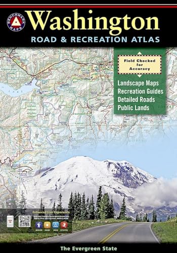
Washington Road and Recreation Atlas 2013
Anbieter: Better World Books: West, Reno, NV, USA
Verkäuferbewertung 5 von 5 Sternen
EUR 12,25
Währung umrechnenKostenlos für den Versand innerhalb von/der USAAnzahl: 1 verfügbar
In den WarenkorbZustand: Good. Former library book; may include library markings. Used book that is in clean, average condition without any missing pages.
-

Prague (National Geographic Destination City Map)
Anbieter: Wonder Book, Frederick, MD, USA
Verkäuferbewertung 5 von 5 Sternen
EUR 8,16
Währung umrechnenKostenlos für den Versand innerhalb von/der USAAnzahl: 1 verfügbar
In den WarenkorbZustand: Very Good. Very Good condition. Map. A copy that may have a few cosmetic defects. May also contain light spine creasing or a few markings such as an owner's name, short gifter's inscription or light stamp.
-
Washington Benchmark Road & Recreation Atlas
Anbieter: Roundabout Books, Greenfield, MA, USA
Verbandsmitglied: SNEAB
Verkäuferbewertung 4 von 5 Sternen

EUR 13,11
Währung umrechnenKostenlos für den Versand innerhalb von/der USAAnzahl: 1 verfügbar
In den Warenkorbpaperback. Zustand: Very Good. Clean, unmarked copy with some edge wear. Good binding. Dust jacket included if issued with one. We ship in recyclable American-made mailers. 100% money-back guarantee on all orders.
-
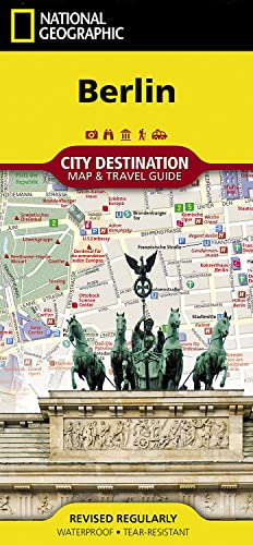
Berlin (National Geographic Destination City Map)
Anbieter: WorldofBooks, Goring-By-Sea, WS, Vereinigtes Königreich
Verkäuferbewertung 5 von 5 Sternen
EUR 6,56
Währung umrechnenEUR 6,41 für den Versand von Vereinigtes Königreich nach USAAnzahl: 1 verfügbar
In den WarenkorbPaperback. Zustand: Very Good. The book has been read, but is in excellent condition. Pages are intact and not marred by notes or highlighting. The spine remains undamaged.
-
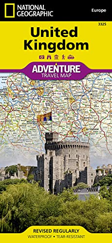
United Kingdom Map (National Geographic Adventure Map, 3325)
Verlag: National Geographic Maps (edition 2022), 2022
ISBN 10: 1566956447 ISBN 13: 9781566956444
Sprache: Englisch
EUR 8,60
Währung umrechnenKostenlos für den Versand innerhalb von/der USAAnzahl: 1 verfügbar
In den WarenkorbMap. Zustand: Good. 2022. It's a preowned item in good condition and includes all the pages. It may have some general signs of wear and tear, such as markings, highlighting, slight damage to the cover, minimal wear to the binding, etc., but they will not affect the overall reading experience.
-

Road Atlas 2023: Scenic Drives: Scenic Drives Edition; United States, Canada, Mexico (National Geographic Recreation Atlas)
Anbieter: WorldofBooks, Goring-By-Sea, WS, Vereinigtes Königreich
Verkäuferbewertung 5 von 5 Sternen
EUR 7,57
Währung umrechnenEUR 6,41 für den Versand von Vereinigtes Königreich nach USAAnzahl: 1 verfügbar
In den WarenkorbPaperback. Zustand: Good. The book has been read but remains in clean condition. All pages are intact and the cover is intact. Some minor wear to the spine.
-

New Mexico Road and Recreation Atlas 2012
Anbieter: Better World Books: West, Reno, NV, USA
Verkäuferbewertung 5 von 5 Sternen
EUR 14,90
Währung umrechnenKostenlos für den Versand innerhalb von/der USAAnzahl: 1 verfügbar
In den WarenkorbZustand: Very Good. Used book that is in excellent condition. May show signs of wear or have minor defects.
-
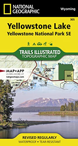
Yellowstone National Park SE Map: Trails Illustrated National Parks (National Geographic Trails Illustrated Map)
Anbieter: WorldofBooks, Goring-By-Sea, WS, Vereinigtes Königreich
Verkäuferbewertung 5 von 5 Sternen
EUR 8,57
Währung umrechnenEUR 6,41 für den Versand von Vereinigtes Königreich nach USAAnzahl: 1 verfügbar
In den WarenkorbPaperback. Zustand: Very Good. The book has been read, but is in excellent condition. Pages are intact and not marred by notes or highlighting. The spine remains undamaged.
-

Dar Es Salaam (Zanzibar and Pemba) (City Destination Maps S.)
Anbieter: WeBuyBooks, Rossendale, LANCS, Vereinigtes Königreich
Verkäuferbewertung 5 von 5 Sternen
EUR 5,59
Währung umrechnenEUR 4,93 für den Versand von Vereinigtes Königreich nach USAAnzahl: 1 verfügbar
In den WarenkorbZustand: Very Good. Most items will be dispatched the same or the next working day. A copy that has been read, but is in excellent condition. Pages are intact and not marred by notes or highlighting. The spine remains undamaged.
-
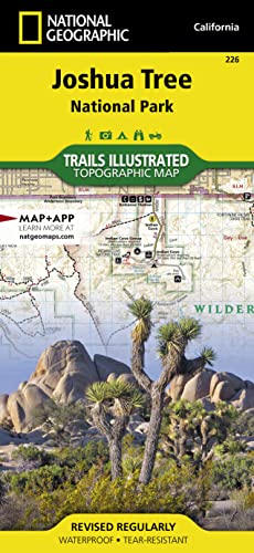
Joshua Tree National Park (National Geographic Trails Illustrated Map) (National Geographic Trails Illustrated Map, 226)
Anbieter: Goodwill Industries of VSB, Oxnard, CA, USA
Verkäuferbewertung 5 von 5 Sternen
EUR 7,62
Währung umrechnenEUR 3,40 für den Versand innerhalb von/der USAAnzahl: 1 verfügbar
In den WarenkorbZustand: Good. The book is nice and 100% readable, but the book has visible wear which may include stains, scuffs, scratches, folded edges, sticker glue, torn on front page,highlighting, notes, and worn corners.
-
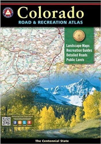
Colorado Road and Recreation Atlas 2015
Anbieter: Better World Books, Mishawaka, IN, USA
Verkäuferbewertung 5 von 5 Sternen
EUR 16,45
Währung umrechnenKostenlos für den Versand innerhalb von/der USAAnzahl: 1 verfügbar
In den WarenkorbZustand: Good. Used book that is in clean, average condition without any missing pages.
-
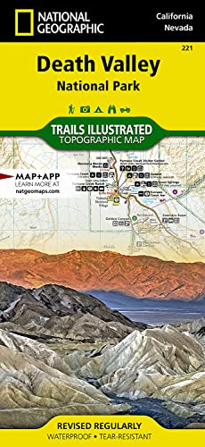
Death Valley National Park Map (National Geographic Trails Illustrated Map, 221)
Verlag: National Geographic Maps (edition 2025), 2025
ISBN 10: 1566953219 ISBN 13: 9781566953214
Sprache: Englisch
EUR 11,58
Währung umrechnenKostenlos für den Versand innerhalb von/der USAAnzahl: 1 verfügbar
In den WarenkorbMap. Zustand: Good. 2025. It's a preowned item in good condition and includes all the pages. It may have some general signs of wear and tear, such as markings, highlighting, slight damage to the cover, minimal wear to the binding, etc., but they will not affect the overall reading experience.
-
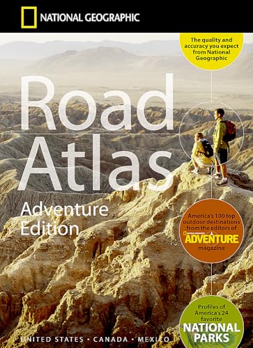
National Geographic Road Atlas 2026
Anbieter: Better World Books: West, Reno, NV, USA
Verkäuferbewertung 5 von 5 Sternen
EUR 17,85
Währung umrechnenKostenlos für den Versand innerhalb von/der USAAnzahl: 1 verfügbar
In den WarenkorbZustand: Good. Used book that is in clean, average condition without any missing pages.
-
National Geographic Road Atlas 2026
Anbieter: Better World Books: West, Reno, NV, USA
Verkäuferbewertung 5 von 5 Sternen
EUR 17,85
Währung umrechnenKostenlos für den Versand innerhalb von/der USAAnzahl: 1 verfügbar
In den WarenkorbZustand: Very Good. Used book that is in excellent condition. May show signs of wear or have minor defects.
-
National Geographic Road Atlas 2026
Anbieter: Better World Books, Mishawaka, IN, USA
Verkäuferbewertung 5 von 5 Sternen
EUR 17,85
Währung umrechnenKostenlos für den Versand innerhalb von/der USAAnzahl: 3 verfügbar
In den WarenkorbZustand: Very Good. Used book that is in excellent condition. May show signs of wear or have minor defects.
-

Channel Islands National Park, CA - Trails Illustrated Map # 252
Anbieter: Better World Books: West, Reno, NV, USA
Verkäuferbewertung 5 von 5 Sternen
EUR 13,11
Währung umrechnenKostenlos für den Versand innerhalb von/der USAAnzahl: 1 verfügbar
In den WarenkorbZustand: Very Good. Former library book; may include library markings. Used book that is in excellent condition. May show signs of wear or have minor defects.
-
![Beispielbild für Black Hills South Map [Black Hills National Forest] (National Geographic Trails Illustrated Map, 238) zum Verkauf von Wonder Book](https://pictures.abebooks.com/isbn/9781566953474-de-300.jpg)
Black Hills South Map [Black Hills National Forest] (National Geographic Trails Illustrated Map, 238)
Anbieter: Wonder Book, Frederick, MD, USA
Verkäuferbewertung 5 von 5 Sternen
EUR 13,14
Währung umrechnenKostenlos für den Versand innerhalb von/der USAAnzahl: 1 verfügbar
In den WarenkorbZustand: Very Good. Very Good condition. A copy that may have a few cosmetic defects. May also contain light spine creasing or a few markings such as an owner's name, short gifter's inscription or light stamp.
-
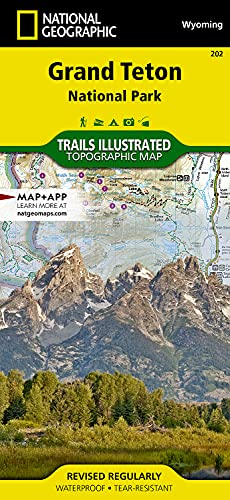
Grand Teton National Park Map (National Geographic Trails Illustrated Map, 202)
Verlag: National Geographic Maps (edition 2023), 2023
ISBN 10: 1566954371 ISBN 13: 9781566954372
Sprache: Englisch
EUR 13,74
Währung umrechnenKostenlos für den Versand innerhalb von/der USAAnzahl: 1 verfügbar
In den WarenkorbMap. Zustand: Good. 2023. It's a preowned item in good condition and includes all the pages. It may have some general signs of wear and tear, such as markings, highlighting, slight damage to the cover, minimal wear to the binding, etc., but they will not affect the overall reading experience.
-

Montreal Map: Destination City Maps (National Geographic Destination City Map)
Anbieter: WeBuyBooks, Rossendale, LANCS, Vereinigtes Königreich
Verkäuferbewertung 5 von 5 Sternen
EUR 8,96
Währung umrechnenEUR 4,87 für den Versand von Vereinigtes Königreich nach USAAnzahl: 1 verfügbar
In den WarenkorbZustand: Very Good. Most items will be dispatched the same or the next working day. A copy that has been read, but is in excellent condition. Pages are intact and not marred by notes or highlighting. The spine remains undamaged.
-
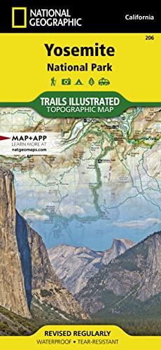
Yosemite National Park (National Geographic Trails Illustrated Map)
Anbieter: Wonder Book, Frederick, MD, USA
Verkäuferbewertung 5 von 5 Sternen
EUR 14,02
Währung umrechnenKostenlos für den Versand innerhalb von/der USAAnzahl: 1 verfügbar
In den WarenkorbZustand: Very Good. Very Good condition. A copy that may have a few cosmetic defects. May also contain light spine creasing or a few markings such as an owner's name, short gifter's inscription or light stamp.
-
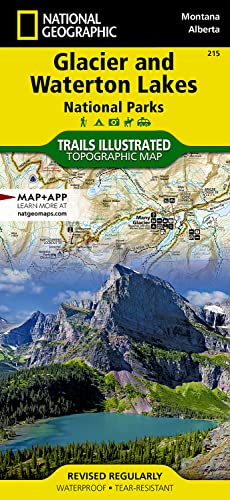
Glacier and Waterton Lakes National Parks (National Geographic Trails Illustrated Map)
Anbieter: Wonder Book, Frederick, MD, USA
Verkäuferbewertung 5 von 5 Sternen
EUR 14,89
Währung umrechnenKostenlos für den Versand innerhalb von/der USAAnzahl: 1 verfügbar
In den WarenkorbZustand: Very Good. Very Good condition. A copy that may have a few cosmetic defects. May also contain light spine creasing or a few markings such as an owner's name, short gifter's inscription or light stamp.
-
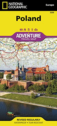
Poland Map (National Geographic Adventure Map, 3330)
Verlag: National Geographic Maps (edition 2022), 2022
ISBN 10: 1566957613 ISBN 13: 9781566957618
Sprache: Englisch
EUR 15,36
Währung umrechnenKostenlos für den Versand innerhalb von/der USAAnzahl: 1 verfügbar
In den WarenkorbMap. Zustand: Good. 2022. It's a preowned item in good condition and includes all the pages. It may have some general signs of wear and tear, such as markings, highlighting, slight damage to the cover, minimal wear to the binding, etc., but they will not affect the overall reading experience.
-

Canyonlands National Park (National Geographic Trails Illustrated Map) (National Geographic Trails Illustrated Map, 210)
Verlag: National Geographic Maps (edition 2023), 2023
ISBN 10: 156695326X ISBN 13: 9781566953269
Sprache: Englisch
EUR 15,44
Währung umrechnenKostenlos für den Versand innerhalb von/der USAAnzahl: 1 verfügbar
In den WarenkorbMap. Zustand: Good. 2023. It's a preowned item in good condition and includes all the pages. It may have some general signs of wear and tear, such as markings, highlighting, slight damage to the cover, minimal wear to the binding, etc., but they will not affect the overall reading experience.
-
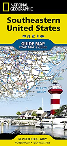
Southeastern USA Guide Map
Verlag: National Geographic Maps Division, 2018
ISBN 10: 1566957966 ISBN 13: 9781566957960
Sprache: Englisch
Anbieter: PBShop.store UK, Fairford, GLOS, Vereinigtes Königreich
Verkäuferbewertung 5 von 5 Sternen
EUR 11,89
Währung umrechnenEUR 3,77 für den Versand von Vereinigtes Königreich nach USAAnzahl: 4 verfügbar
In den WarenkorbUNK. Zustand: New. New Book. Shipped from UK. Established seller since 2000.
-

Colorado
Verlag: National Geographic Maps Division, 2018
ISBN 10: 156695777X ISBN 13: 9781566957779
Sprache: Englisch
Anbieter: PBShop.store UK, Fairford, GLOS, Vereinigtes Königreich
Verkäuferbewertung 5 von 5 Sternen
EUR 11,97
Währung umrechnenEUR 3,77 für den Versand von Vereinigtes Königreich nach USAAnzahl: 4 verfügbar
In den WarenkorbUNK. Zustand: New. New Book. Shipped from UK. Established seller since 2000.
-
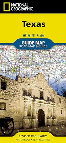
Texas
Verlag: National Geographic Maps Division, 2017
ISBN 10: 156695729X ISBN 13: 9781566957298
Sprache: Englisch
Anbieter: PBShop.store UK, Fairford, GLOS, Vereinigtes Königreich
Verkäuferbewertung 5 von 5 Sternen
EUR 12,02
Währung umrechnenEUR 3,77 für den Versand von Vereinigtes Königreich nach USAAnzahl: 5 verfügbar
In den WarenkorbUNK. Zustand: New. New Book. Shipped from UK. Established seller since 2000.
-
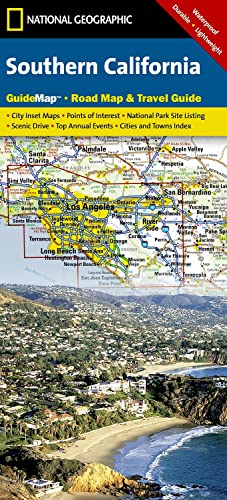
Southern California
Verlag: National Geographic Maps Division, 2012
ISBN 10: 1597750158 ISBN 13: 9781597750158
Sprache: Englisch
Anbieter: PBShop.store UK, Fairford, GLOS, Vereinigtes Königreich
Verkäuferbewertung 5 von 5 Sternen
EUR 11,96
Währung umrechnenEUR 3,77 für den Versand von Vereinigtes Königreich nach USAAnzahl: 15 verfügbar
In den WarenkorbUNK. Zustand: New. New Book. Shipped from UK. Established seller since 2000.