Verwandte Artikel zu St Cuthbert's Way (Trail Map XT40)
Zu dieser ISBN ist aktuell kein Angebot verf�gbar.
Alle Exemplare der Ausgabe mit dieser ISBN anzeigen:
Rese�a del editor:
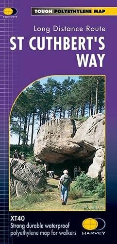
The Way links places associated with the life of the 7th century saint, Cuthbert. From Melrose Abbey to Holy Island (Lindisfarne). 100km (62 miles). Tough, light and 100% waterproof. Compact and light - the map itself weighs just 60 gms - a third of the weight of a laminated map, and much less bulky. And you can fold or refold it time and again, or put it in your back pocket and it wont fall to pieces. Shows the entire route on one sheet. Information on finding accommodation, camping and food. Directions to the start. Also Ranger Service contact numbers and enlargements of towns/villages showing facilities available and tips on weather and clothing.
Biograf�a del autor:
Since 1977, HARVEY has gained a reputation for high quality maps for adventurous recreation. These award winning maps are compiled from original aerial surveys and field checked by our experienced surveyors, themselves hill-walkers
��ber diesen Titel� kann sich auf eine andere Ausgabe dieses Titels beziehen.
- VerlagHarvey Map Services Ltd
- Erscheinungsdatum2019
- ISBN 10 1851374744
- ISBN 13 9781851374748
- EinbandMapa
- Auflage2
- Anzahl der Seiten1
Neu kaufen
Mehr zu diesem Angebot erfahren
EUR 17,93
Versand:
EUR 5,24
Von Vereinigtes K�nigreich nach USA
Beste Suchergebnisse beim ZVAB
Beispielbild f�r diese ISBN
St Cuthbert's Way
Verlag:
Harvey Map Services Ltd 2019-06-28
(2019)
ISBN 10: 1851374744
ISBN 13: 9781851374748
Neu
Anzahl: 5
Anbieter:
Bewertung
Buchbeschreibung sheet map (folded). Zustand: New. Artikel-Nr. 9781851374748
Weitere Informationen zu diesem Verk�ufer | Verk�ufer kontaktieren
Neu kaufen
EUR 17,93
W�hrung umrechnen