Verwandte Artikel zu Dorset County Atlas (A-Z County Atlas)
Zu dieser ISBN ist aktuell kein Angebot verf�gbar.
Alle Exemplare der Ausgabe mit dieser ISBN anzeigen:
Rese�a del editor:
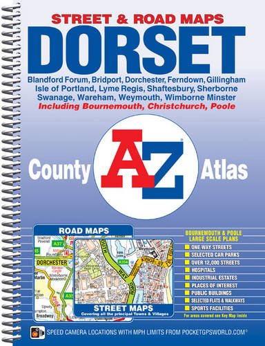
This A-Z map of Dorset is a spiral bound County Atlas containing 118 pages of coloured street mapping featuring all the major towns and villages, and 9 pages of road mapping covering the whole county.
The street mapping includes coverage of:
- Bournemouth
- Christchurch
- Poole
- Weymouth
- Dorchester
- Wareham
- Swanage
- Wimborne Minster
- Ferndown
- Blandford Forum
- Shaftesbury
- Gillingham
- Sherborne
- Isle of Portland
- Bridport
- Lyme Regis
Also included are large scale town centre maps of Bournemouth and Poole.
Postcode districts, one-way streets and safety camera locations with their maximum speed are featured on the street mapping.
The index section lists streets, selected flats, walkways and places of interest, place, area and station names. There is a separate list of hospitals and hospices covered by this atlas.
��ber diesen Titel� kann sich auf eine andere Ausgabe dieses Titels beziehen.
- VerlagGeographers' A-Z Map Co Ltd
- Erscheinungsdatum2011
- ISBN 10 1843487772
- ISBN 13 9781843487777
- EinbandEncuadernaci�n en espiral
- Auflage2
- Anzahl der Seiten168
Gebraucht kaufen
Zustand: BefriedigendThe book has been read but remains... Mehr zu diesem Angebot erfahren

EUR 5,11
Versand:
EUR 5,59
Von Vereinigtes K�nigreich nach USA
Beste Suchergebnisse beim ZVAB
Beispielbild f�r diese ISBN
Dorset County Atlas (A-Z County Atlas)
Verlag:
Geographers' A-Z Map Company Ltd.
(2011)
ISBN 10: 1843487772
ISBN 13: 9781843487777
Gebraucht
Paperback
Anzahl: 2
Anbieter:
Bewertung
Buchbeschreibung Paperback. Zustand: Good. The book has been read but remains in clean condition. All pages are intact and the cover is intact. Some minor wear to the spine. Artikel-Nr. GOR005477011
Weitere Informationen zu diesem Verk�ufer | Verk�ufer kontaktieren
Gebraucht kaufen
EUR 5,11
W�hrung umrechnen
Beispielbild f�r diese ISBN
Dorset County Atlas (A-Z County Atlas)
Verlag:
Geographers' A-Z Map Company Ltd.
(2011)
ISBN 10: 1843487772
ISBN 13: 9781843487777
Gebraucht
Paperback
Anzahl: 1
Anbieter:
Bewertung
Buchbeschreibung Paperback. Zustand: Fair. A readable copy of the book which may include some defects such as highlighting and notes. Cover and pages may be creased and show discolouration. Artikel-Nr. GOR009644903
Weitere Informationen zu diesem Verk�ufer | Verk�ufer kontaktieren
Gebraucht kaufen
EUR 5,11
W�hrung umrechnen
Beispielbild f�r diese ISBN
Dorset County Atlas (A-Z County Atlas)
Verlag:
HarperCollins Publishers, United Kingdom
(2011)
ISBN 10: 1843487772
ISBN 13: 9781843487777
Gebraucht
Paperback
Anzahl: 4
Anbieter:
Bewertung
Buchbeschreibung Paperback. Zustand: Very Good. The book has been read, but is in excellent condition. Pages are intact and not marred by notes or highlighting. The spine remains undamaged. Artikel-Nr. GOR005224729
Weitere Informationen zu diesem Verk�ufer | Verk�ufer kontaktieren
Gebraucht kaufen
EUR 123,95
W�hrung umrechnen