Verwandte Artikel zu Insight Travel Map: Germany (Insight Travel Maps)

Zu dieser ISBN ist aktuell kein Angebot verfügbar.
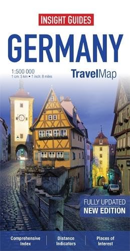
Alle Exemplare der Ausgabe mit dieser ISBN anzeigen:Travel Map Germany is an indexed, road map now available at the more detailed scale of 1:500 000. Also included is a map of the Ruhr at 1:300 000.
Places of interest, including museums, monuments and religious sites are listed and accompanied by a wide range of pictorial symbols for instant recognition, these symbols have been colour coded by category.
In addition to the road and rail networks, ferry routes and airports, this map provides an overview of the topography through the use of relief shading. National parks, nature reserves and restricted areas are clearly shown.
Handy distance indicators, located in the margin, give distances to the nearest town, major locations and motorway junction, if applicable. Intermediate driving distances are shown on main roads.
The extensive legend is shown in 4 languages.
„Über diesen Titel“ kann sich auf eine andere Ausgabe dieses Titels beziehen.
- VerlagInsight Maps
- Erscheinungsdatum2013
- ISBN 10 1780054785
- ISBN 13 9781780054780
- EinbandMapa
- Auflage4
- Anzahl der Seiten2
Versand:
EUR 5,59
Von Vereinigtes Königreich nach USA
Beste Suchergebnisse beim ZVAB
Insight Guides Travel Maps Germany (Insight Travel Maps)
Buchbeschreibung Paperback. Zustand: Very Good. Travel Map Germany is an indexed, road map now available at the more detailed scale of 1:500 000. Also included is a map of the Ruhr at 1:300 000. Places of interest, including museums, monuments and religious sites are listed and accompanied by a wide range of pictorial symbols for instant recognition, these symbols have been colour coded by category. In addition to the road and rail networks, ferry routes and airports, this map provides an overview of the topography through the use of relief shading. National parks, nature reserves and restricted areas are clearly shown. Handy distance indicators, located in the margin, give distances to the nearest town, major locations and motorway junction, if applicable. Intermediate driving distances are shown on main roads. The extensive legend is shown in 4 languages. The book has been read, but is in excellent condition. Pages are intact and not marred by notes or highlighting. The spine remains undamaged. Artikel-Nr. GOR008541255
Weitere Informationen zu diesem Verkäufer | Verkäufer kontaktieren
Insight Guides Travel Maps Germany (Insight Travel Maps)
Buchbeschreibung Gut/Very good: Buch bzw. Schutzumschlag mit wenigen Gebrauchsspuren an Einband, Schutzumschlag oder Seiten. / Describes a book or dust jacket that does show some signs of wear on either the binding, dust jacket or pages. Artikel-Nr. M01780054785-V
Weitere Informationen zu diesem Verkäufer | Verkäufer kontaktieren

