Beschreibung
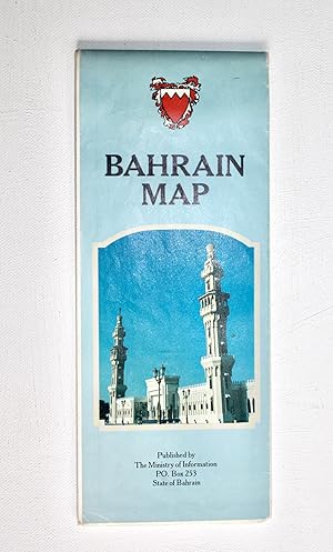
Highly detailed maps, colour printed to both sides of a single sheet 70x100cm, folding down into colour illustrated panels 10x25cm. Produced and printed by Cook Hammond & Kell Ltd, UK. Good or better, neatly folded with closed fold tears and small perforations at intersections. One side presents the main map of Bahrain 1:60,000, with two insets for the State of Bahrain, and Bahrain's position in the Arabian Gulf. It shows several road types, boundaries, pipelines, aerial cableway, wadis and their spread, built up areas, cultivation, sabkha, sand, burial mounds, colour shaded heights, escarpments, shoals and sandbanks, coral, beaches, places of interest / importance, petrol station, police station, the Qanat System, and springs. The other side is dominated by a 1:9000 plan of Manama with index, showing road types, undercover and open car parks, petrol stations, mosques, Matam, church, built up areas, public parks and gardens, cemetery, important buildings, schools, police station, post office, clinic, and cinema. There are are also insets with index for Isa Town 1:25,000 and Muharraq 1:27,500, and for the King Fahad Causeway connecting Saudi Arabia 1:200,000. Both sides feature a description of the State of Bahrain, covering geography, history, culture, economy, tourism, leisure etc.
Bestandsnummer des Verkäufers 4894
Verkäufer kontaktieren
Diesen Artikel melden


