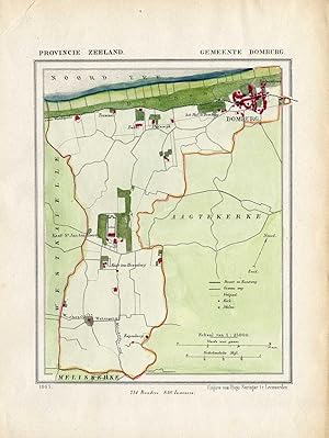
Antique Map-NETHERLANDS-TOWN PLAN-DOMBURG-ZEELAND-Kuyper-Kuijper-1865
Verkauft von ThePrintsCollector, Zeeland, Niederlande
AbeBooks-Verkäufer seit 3. April 2017
Gebraucht
Anzahl: 1 verfügbar
In den Warenkorb legenVerkauft von ThePrintsCollector, Zeeland, Niederlande
AbeBooks-Verkäufer seit 3. April 2017
Anzahl: 1 verfügbar
In den Warenkorb legenZeeland: Gemeente Domburg, Kasteel St. Jans en Heere. Original handcoloured lithograph on a velin type paper. Description: These scarse detailed maps of Dutch Towns originate from the 'Gemeente-atlas' of Jacob Kuyper. This atlas of all towns in the Netherlands was published from 1865-1870 and included all towns in the Dutch province of Zeeland. These maps are also known as a Kuyperkaart or Kuyperkaartjes. We carry multiple versions of these prints - coloured, outline coloured and not coloured. Please inquire, also if you are looking for a place currently not listed.Artists and Engravers: Author: Jacob Kuyper. Kuyper was one of the most important of the Dutch atlas editors of the second half of the 19th century. He is particularly known for the "Gemeente Atlas", with 1210 plans of all the towns and villages in the Netherlands. Condition: Fine; occasional foxing. Small tear in the top margin. Sheet irregularly cut, not affecting image. Please study scan carefully. Storage location: C222-23 The overall size is ca. 7.7 x 10.2 inch. The image size is ca. 5.9 x 7.3 inch. The overall size is ca. 19.5 x 26 cm. The image size is ca. 15 x 18.5 cm.
Bestandsnummer des Verkäufers 33026