
Gesamtpreis (1 Artikel Artikel):
Versandziel:

rucksack readers united kingdom dunblane (4 Ergebnisse)
Direkt zu den wichtigsten Suchergebnissen
Produktart
- Alle Product Types
- Bücher (4)
- Magazine & Zeitschriften
- Comics
- Noten
- Kunst, Grafik & Poster
- Fotografien
- Karten
- Manuskripte & Papierantiquitäten
Zustand
- Alle
- Neu
- Antiquarisch (4)
Einband
- alle Einbände
- Hardcover
- Softcover (4)
Weitere Eigenschaften
- Erstausgabe
- Signiert
- Schutzumschlag
- Angebotsfoto
Gratisversand
- Versand nach USA gratis
Land des Verkäufers
Verkäuferbewertung
-
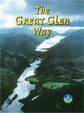
Great Glen Way (Rucksack Readers): Walk or cycle the Great Glen Way
Verlag: Rucksack Readers, United Kingdom, Dunblane, 2005
ISBN 10: 1898481245ISBN 13: 9781898481249
Buch
Paperback. Zustand: Very Good. This guidebook (fully updated in 2024) contains all you need to plan and enjoy a holiday walking or cycling along Scotland's historic Great Glen (77 miles/124 km). The Way runs between Fort William and Inverness, passing beside Scotland's highest mountain, along its historic Caledonian Canal and alongside beautiful lochs, including Loch Ness with its famous monster legend and Urquhart Castle. This seventh edition covers all route options including the newly opened Abriachan section of High Route as well as details of the route changes that apply during 2024 and 2025 because of the closure of Loch Oichside and the High Route beyond Fort Augustus. Here is all you need to plan and enjoy the Great Glen Way on foot or on a bike: detailed mapping on 13 pages at 1:38,000 withrelief contours and colouring hill and mountain side-trips including Ben Nevis background on canal heritage, clan history and wildlife detailed description for each section with points of interest and mileage references summaries showing distance, terrain, food/drink stops and altitude profile planning information for walkers and cyclists, with travel to/from the route town plans of Fort William and Inverness in full colour, with 100+ photos rucksack-friendly and on rainproof paper throughout. The book has been read, but is in excellent condition. Pages are intact and not marred by notes or highlighting. The spine remains undamaged.
-
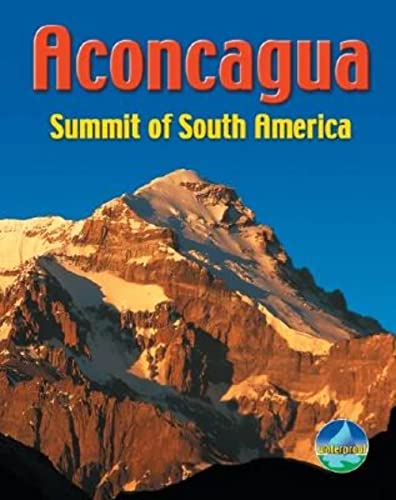
Aconcagua: Summit of South America (Rucksack Pocket Summits)
Verlag: Rucksack Readers, United Kingdom, Dunblane, 2005
ISBN 10: 1898481512ISBN 13: 9781898481515
Buch
Paperback. Zustand: Very Good. Of the seven continental summits, Aconcagua (at 6962 m/22,840 ft) lies second only to Everest. Yet it is surprisingly free of snow and ice, and experienced hikers can reach the roof of the Americas without technical expertise. However, it is one of the world's highest and toughest treks. The author has summated twice, and explains in detail how to tackle the main trekking routes (Normal and Polish Traverse), as well as giving a useful summary on the technical Polish Glacier route. This pocket-sized book weighs only 112 g (4 oz), yet it contains all you need to plan and enjoy your summit attempt: concise advice from an expert about preparation, planning and choosing your gear detailed information about altitude effects and sickness, and how to monitor and prevent them fold-out map showing the routes, also enlargement of summit area 96 waterproof pages with open-flat binding in full colour, with 60 photographs. The book has been read, but is in excellent condition. Pages are intact and not marred by notes or highlighting. The spine remains undamaged.
-
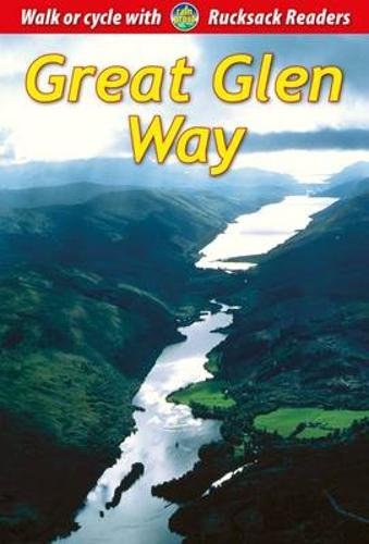
Great Glen Way: Walk or Cycle the Great Glen Way
Verlag: Rucksack Readers, United Kingdom, Dunblane, 2014
ISBN 10: 1898481636ISBN 13: 9781898481638
Buch
Paperback. Zustand: Very Good. This guidebook (fully updated in 2024) contains all you need to plan and enjoy a holiday walking or cycling along Scotland's historic Great Glen (77 miles/124 km). The Way runs between Fort William and Inverness, passing beside Scotland's highest mountain, along its historic Caledonian Canal and alongside beautiful lochs, including Loch Ness with its famous monster legend and Urquhart Castle. This seventh edition covers all route options including the newly opened Abriachan section of High Route as well as details of the route changes that apply during 2024 and 2025 because of the closure of Loch Oichside and the High Route beyond Fort Augustus. Here is all you need to plan and enjoy the Great Glen Way on foot or on a bike: detailed mapping on 13 pages at 1:38,000 withrelief contours and colouring hill and mountain side-trips including Ben Nevis background on canal heritage, clan history and wildlife detailed description for each section with points of interest and mileage references summaries showing distance, terrain, food/drink stops and altitude profile planning information for walkers and cyclists, with travel to/from the route town plans of Fort William and Inverness in full colour, with 100+ photos rucksack-friendly and on rainproof paper throughout. The book has been read, but is in excellent condition. Pages are intact and not marred by notes or highlighting. The spine remains undamaged.
-
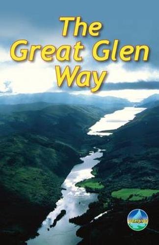
The Great Glen Way: Walk or cycle the Great Glen Way
Verlag: Rucksack Readers, United Kingdom, Dunblane, 2010
ISBN 10: 1898481393ISBN 13: 9781898481393
Buch
Paperback. Zustand: Very Good. This guidebook (fully updated in 2020) contains all you need to plan and enjoy a holiday walking or cycling along Scotland's historic Great Glen (77 miles/124 km). The Way runs between Fort William and Inverness, passing beside Scotland's highest mountain, along its historic Caledonian Canal and alongside beautiful lochs, including Loch Ness with its famous monster legend and Urquhart Castle. This sixth edition has fresh mapping at 1:38,000 on 13 pages, with detailed relief contours and colouring; on rainproof paper throughout; in full colour, with 100+ photos; visitor attractions and hills to climb including Ben Nevis; town plans of Fort William and Inverness; background on local geology, history and wildlife; summary of each section showing distance, terrain, altitude profile and food/drink stops; planning information for travel by car, train, bus or plane. This guidebook contains all you need to plan and enjoy the Great Glen Way - on foot or on a bike: detailed mapping on 13 pages at 1:38,000 hill and mountain side-trips including Ben Nevis background on canal heritage, clan history and wildlife detailed description for each section walked from Fort William to Inverness summaries showing distance, terrain, food/drink stops and altitude profile planning information for walkers and cyclists town plans of Fort William and Inverness in full colour, with 100+ photos, many of them new rucksack-friendly and on rainproof paper. The book has been read, but is in excellent condition. Pages are intact and not marred by notes or highlighting. The spine remains undamaged.