
Gesamtpreis (1 Artikel Artikel):
Versandziel:

map one (19 Ergebnisse)
Direkt zu den wichtigsten Suchergebnissen
Suchfilter
Produktart
- Alle Product Types
- Bücher (15)
- Magazine & Zeitschriften (Keine weiteren Ergebnisse entsprechen dieser Verfeinerung)
- Comics (Keine weiteren Ergebnisse entsprechen dieser Verfeinerung)
- Noten (Keine weiteren Ergebnisse entsprechen dieser Verfeinerung)
- Kunst, Grafik & Poster (Keine weiteren Ergebnisse entsprechen dieser Verfeinerung)
- Fotografien (Keine weiteren Ergebnisse entsprechen dieser Verfeinerung)
- Karten (4)
- Manuskripte & Papierantiquitäten (Keine weiteren Ergebnisse entsprechen dieser Verfeinerung)
Zustand Mehr dazu
- Neu (Keine weiteren Ergebnisse entsprechen dieser Verfeinerung)
- Wie Neu, Sehr Gut oder Gut Bis Sehr Gut (2)
- Gut oder Befriedigend (5)
- Ausreichend oder Schlecht (Keine weiteren Ergebnisse entsprechen dieser Verfeinerung)
- Wie beschrieben (12)
Einband
Weitere Eigenschaften
- Erstausgabe (1)
- Signiert (Keine weiteren Ergebnisse entsprechen dieser Verfeinerung)
- Schutzumschlag (3)
- Angebotsfoto (9)
Sprache (2)
Gratisversand
- Kostenloser Versand nach USA (Keine weiteren Ergebnisse entsprechen dieser Verfeinerung)
Land des Verkäufers
Verkäuferbewertung
-

Family and Kinship / A Study of the Pandits of Rural Kashmir.
Sprache: Englisch
Verlag: Oxford University Press, India, 1989. Second enlarged Edition. xxvi, 325 pp. Text in English. With photographs and figures and one fold-out map in black and white., 1990
ISBN 10: 0195621387 ISBN 13: 9780195621389
Anbieter: Antiquariaat Hortus Conclusus, Bergambacht, Niederlande
Verkäuferbewertung 5 von 5 Sternen

Oiginal cloth with dustjacket, edges of the dustjacket slightly worn, small label on the spine, else in (very) good condition. Please see description or ask for photos.
-

Poems to Siva. The Hymns of the Tamil Saints.
Sprache: Englisch
Verlag: Motilal Banarsidass Publishers, Delhi, 1991. xvi, 382pp. With 15 plates and one map in black and white., 1991
ISBN 10: 8120807847 ISBN 13: 9788120807846
Anbieter: Antiquariaat Hortus Conclusus, Bergambacht, Niederlande
Verkäuferbewertung 5 von 5 Sternen
Original cloth with dustjacket. Spine of the dustjacket discolored, edges a bit worn, minor traces of use, else a good copy. Text in English. Please see description or ask for photos.
-
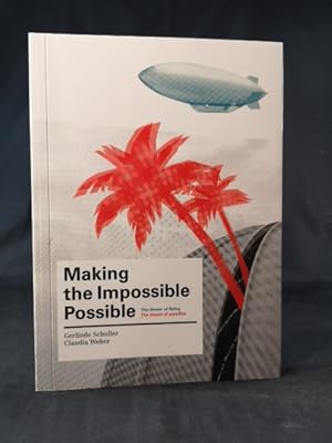
Making the Impossible Possible: The Dream of Flying. The Dream of Paradise.
Anbieter: ANTIQUARIAT Franke BRUDDENBOOKS, Lübeck, Deutschland
Verkäuferbewertung 5 von 5 Sternen
Broschur, Gr.8°. Zustand: Wie neu. 76 S. Das Buch ist in exzellentem, sauberen Zustand. ISBN: 9789081092715 Wir senden umgehend mit beiliegender MwSt.Rechnung. Sprache: Englisch Gewicht in Gramm: 299.
-

Geologie de la Region de Venaco (Corse)
Verlag: Van Gorcum & Comp. - G.A. Hak & Dr. H.J. Prakke, Assen, 1955. 124 pp. Academisch Proefschrift Universiteit van Amsterdam. With illustrations in black and white and one geological map of the region in colour in the back (fold-out)., 1955
Anbieter: Antiquariaat Hortus Conclusus, Bergambacht, Niederlande
Verkäuferbewertung 5 von 5 Sternen
Paperback, spine discolored, some discoloration and traces of tape on the cover, stamps in front, else in good condition. Text in French. Met los blad Stellingen in het Nederlands. Please see description or ask for photos.
-
Wirtschaft und Materielle Kultur der Buschneger Surinames Ein Beitrag zur Erforschung afroamerikanischer Probleme.
Verlag: Akademie-Verlag, Berlin, 1967. vii, 181pp text in German, 28 Abbildungen + one fold-out map in black and white. Series: Abhandlungen und Berichte Des Staatlichen Museums Für Völkerkunde Dresden, Band 26., 1967
Anbieter: Antiquariaat Hortus Conclusus, Bergambacht, Niederlande
Verkäuferbewertung 5 von 5 Sternen
Original wrappers, spine and edge of the wrappers a bit discolored, minor traces of use, else in good condition. Please see description or ask for photos.
-
PORT ALBERNI GATEWAY TO THE PACIFIC [BRITISH COLUMBIA]
Verlag: Port Alberni, B.C. Alberni Valley Chamber of Commerce [Printed by the Albernia Valley Times] (no date listed, ca. 1960s, as one map lists "New Access Road Opening Sept.'68), 1960
Anbieter: Live Oak Booksellers, Langley, WA, USA
Verkäuferbewertung 5 von 5 Sternen
Soft cover. Zustand: Fine. 19 x 17" color pictorial brochure printed both sides and folded in half lengthwise and then in fourths. Two maps, one of Port Alberni's location on Victoria Island, the other of downtown Port Alberni and immediate environs. 62 business ads plus 6 driving tours in and around Port Alberni, as well as other general information about Port Alberni. Very lightly soiled, all folds intact, colors vivid and bright/ n/a.
-
Temples of Tamilnad
Verlag: Bharatiya Vidya Bhavan, Bombay. Second edition 1991. 275 pp. Text in English. XVI plates and one fold-out map in black and white., 1991
Anbieter: Antiquariaat Hortus Conclusus, Bergambacht, Niederlande
Verkäuferbewertung 5 von 5 Sternen
Softcover with dustjacket attached. Edges of the dustjacket a bit worn, minor traces of use, still a good copy. Please see description or ask for photos.
-

Chester sheet 109
Verlag: Ordnance Survey one-inch map, 1963
Anbieter: Acanthophyllum Books, Holywell, FLINT, Vereinigtes Königreich
Verbandsmitglied: PBFA
Verkäuferbewertung 3 von 5 Sternen

Karte
EUR 5,96
EUR 25,39 Versand
Versand von Vereinigtes Königreich nach USAAnzahl: 1 verfügbar
In den WarenkorbFolded map. Zustand: V.g. Scale 1:63,360. Little used. Weight: 1.0 Language: English.
-

Penrith sheet 83
Verlag: Ordnance Survey one-inch map, 1955
Anbieter: Acanthophyllum Books, Holywell, FLINT, Vereinigtes Königreich
Verbandsmitglied: PBFA
Verkäuferbewertung 3 von 5 Sternen
Karte
EUR 5,96
EUR 25,39 Versand
Versand von Vereinigtes Königreich nach USAAnzahl: 1 verfügbar
In den WarenkorbFolded map. Zustand: V.g. Scale 1:63,360. Little used. Weight: 1.0 Language: English.
-

Stoke-on-Trent sheet 110
Verlag: Ordnance Survey one-inch map, 1962
Anbieter: Acanthophyllum Books, Holywell, FLINT, Vereinigtes Königreich
Verbandsmitglied: PBFA
Verkäuferbewertung 3 von 5 Sternen
Karte
EUR 5,96
EUR 25,39 Versand
Versand von Vereinigtes Königreich nach USAAnzahl: 1 verfügbar
In den WarenkorbFolded map. Zustand: V.g. Scale 1:63,360. Little used. Weight: 1.0 Language: English.
-

Germany.
Verlag: N.pl.; 194. Small sized guide, that has nothing to do with military operations, but deals only with civilian life in Germany and with the way one should behave to the German civilian population; softcover, stapled; map in b&w; 10,5x13,5 cm.; 64 pp. Loosely added, a folding leaflet on veneral disease. Staples rusted. [#2387
Anbieter: Antiquariaat De Boekenbeurs, Middelburg, Niederlande
Verkäuferbewertung 5 von 5 Sternen
N.pl.; 194. Small sized guide, that has nothing to do with military operations, but deals only with civilian life in Germany and with the way one should behave to the German civilian population; softcover, stapled; map in b&w; 10,5x13,5 cm.; 64 pp. Loosely added, a folding leaflet on veneral disease. Staples rusted.
-

Barrow-in-Furness sheet 88
Verlag: Ordnance Survey one-inch map, 1955
Anbieter: Acanthophyllum Books, Holywell, FLINT, Vereinigtes Königreich
Verbandsmitglied: PBFA
Verkäuferbewertung 3 von 5 Sternen
Karte
EUR 14,30
EUR 25,39 Versand
Versand von Vereinigtes Königreich nach USAAnzahl: 1 verfügbar
In den WarenkorbFolded map, linen-backed. Zustand: V.g. Scale 1:63,360. Little used. Weight: 1.0 Language: English.
-
Zwei Jahre bei den Indianern Nordwest-Brasiliens
Verlag: Strecker und Schröder Verlag in Stuttgart, 1923. Viertes und fünftes Tausend. xii, 416 pp. With plates, illustrations in the text and one fold-out map in black and white., 1923
Anbieter: Antiquariaat Hortus Conclusus, Bergambacht, Niederlande
Verkäuferbewertung 5 von 5 Sternen
Original decorated halfcloth, ends of the spine damaged, corners bumped, minor traces of use, else contents in (very) good condition. Text in German (Roman type font). Please see description or ask for photos.
-
Corpus Cultus Iovis Sabazii II: The other monuments and literary evidence + III: Conclusions
Verlag: Leiden, Brill 1985/1989 frontispiece, one figure, 40 plates and a map, 1989
Anbieter: Antiquarian Bookshop Klikspaan, Leiden, Niederlande
Verkäuferbewertung 5 von 5 Sternen
Erstausgabe
1st ed. - 2 volumes. - 61 + 68 pages. - With index. - (Études préliminaires aux religions orientales dans l'empire romain ; tome centičme). - Softcover.
-
Connaissance des temps ou des mouvements celestes, a l' usage des astronomes et des navigateurs, pour l' an 1895 - 1897.
Verlag: Paris, Gauthier-Villars, 1893 -1895. 3 vols., with some folding maps of projected trajectory of eclipses (one map with tear without loss)., 1895
Anbieter: Antiquariaat Hortus Conclusus, Bergambacht, Niederlande
Verkäuferbewertung 5 von 5 Sternen
Contemporary halfleather bindings with green title labels and red volume labels, uniformly bound. Spines mostly with 'Observatoire de Bordeaux' on spine end. Bindings slightly chafed / worn (1897 vol. more), but a (very) good set. Text in French. Please see description or ask for photos.
-
Voyages of the Companions of Columbus.
Verlag: In one volume, with a map. Paris, Galignani, 1831,, Paris, 1831
Anbieter: Libreria Antiquaria Pregliasco, Torino, TO, Italien
Verkäuferbewertung 4 von 5 Sternen

Zustand: Good. in-16, pp. XVI, 360, broch. edit. Resoconto dei viaggi compiuti in America da Alonzo de Ojeda, A. Vespucci, Diego de Nicuesa, Vasco Nunez de Balboa, Juan Ponce de Leon. Narrazione di viaggi, traversate oceaniche, ecc. Probabile ediz. originale. Adorno di una tavola geografica f.t. piů volte ripiegata con i dettagli dei territori raggiunti dai viaggiatori colombiani nei primi decenni del XV sec. Raro. Buon esemplare, in barbe, qualche fioritura. Manca al Sabin, Books relating to America. Book.
-
Von Roroima zum Orinoco. Ergebnisse einer Reise in Nordbrasilien und Venezuela in den jahren 1911 - 1913. Band I: Schilderung der Reise.
Verlag: Verlag Dietrich Reimen (Ernst Vohsen), Berlin, 1917. x, 406 pp. Mit 6 Voltafeln und Abbildungen in Lichtdruck. And one large fold-out map in black and white in the back., 1917
Anbieter: Antiquariaat Hortus Conclusus, Bergambacht, Niederlande
Verkäuferbewertung 5 von 5 Sternen
Original decorated cardboard, ends and edge of the spine damaged, edge worn, binding a bit weak, else in good condition. Text in German (Roman type font) Please see description or ask for photos.
-
![Bild des Verkäufers für North East [London]. Sheets 3, 4, 8 and 9. zum Verkauf von Peter Harrington. ABA/ ILAB.](https://pictures.abebooks.com/inventory/md/md2717928279.jpg)
North East [London]. Sheets 3, 4, 8 and 9.
Verlag: STANFORD'S NEW MAP OF THE COUNTY OF LONDON ON THE SCALE OF FOUR INCHES TO ONE MILE. Edward Stanford. c.1900, 1900
Anbieter: Peter Harrington. ABA/ ILAB., London, Vereinigtes Königreich
Verbandsmitglied: ABA ILAB PBFA
Verkäuferbewertung 5 von 5 Sternen
EUR 595,63
EUR 25,44 Versand
Versand von Vereinigtes Königreich nach USAAnzahl: 1 verfügbar
In den WarenkorbThese four sheets, from Stanford's beautifully detailed 20 part folding map, are joined together to show North East London. Extends from Walthamstow in the north to Rotherhithe in the south, and from Holloway in the west to West Ham in the east. As explained in the map's title page: "The parks and open spaces under the control of the London County Council are coloured red blue-green. Other parks and open spaces are coloured yellow-green. The Main Roads, Omnibus and Tramway routes are coloured brown." Two keys to adjoining sheets and two scales on bottom margin, scale is 4 inches to 1 mile. Steel engraving. Very good condition, despite some minor discolouration in places. Original colour. Size: 79.5 x 65 cm. (31˝ x 25˝ inches).
-
![Bild des Verkäufers für North West [London]. Sheets 1, 2, 6 and 7. zum Verkauf von Peter Harrington. ABA/ ILAB.](https://pictures.abebooks.com/inventory/md/md2717930373.jpg)
North West [London]. Sheets 1, 2, 6 and 7.
Verlag: STANFORD'S NEW MAP OF THE COUNTY OF LONDON ON THE SCALE OF FOUR INCHES TO ONE MILE. Edward Stanford. c.1900, 1900
Anbieter: Peter Harrington. ABA/ ILAB., London, Vereinigtes Königreich
Verbandsmitglied: ABA ILAB PBFA
Verkäuferbewertung 5 von 5 Sternen
EUR 714,76
EUR 25,44 Versand
Versand von Vereinigtes Königreich nach USAAnzahl: 1 verfügbar
In den WarenkorbThese four sheets, from Stanford's beautifully detailed 20 part folding map, are joined together to show north west London. Extends from Golders Green in the north to Kensington in the south, and from Sudbury, Middlesex in the west to Camden in the east. As explained in the map's title page: "The parks and open spaces under the control of the London County Council are coloured red blue-green. Other parks and open spaces are coloured yellow-green. The Main Roads, Omnibus and Tramway routes are coloured brown." Two keys to adjoining sheets and two scales on bottom margin, scale is 4 inches to 1 mile. Steel engraving. Very good condition. Original colour. Size: 80 x 65 cm. (31˝ x 25˝ inches).

